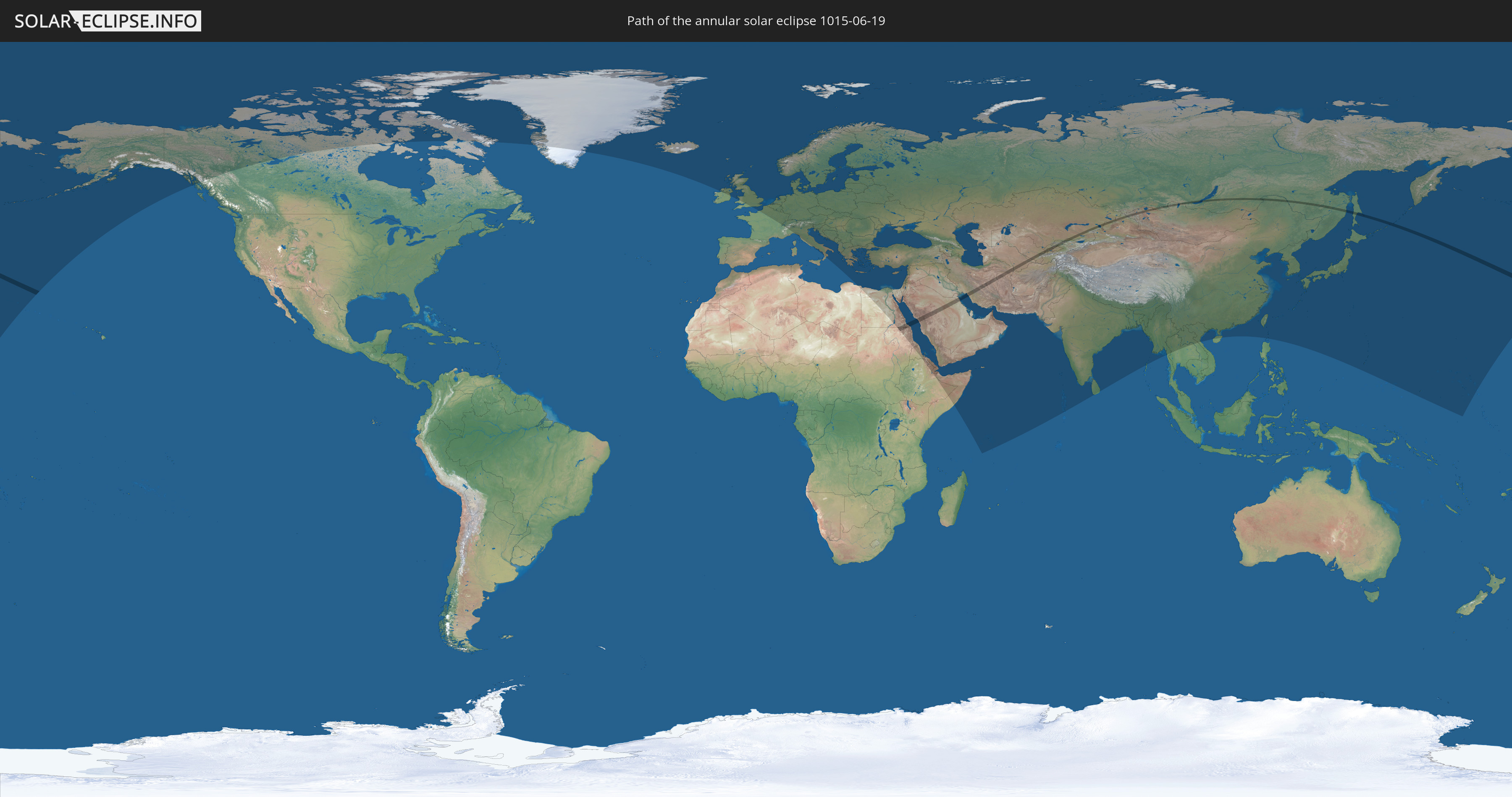
Annular solar eclipse of 06/19/1015
| Day of week: | Monday |
| Maximum duration of eclipse: | 00m57s |
| Maximum width of eclipse path: | 43 km |
| Saros cycle: | 111 |
| Coverage: | 98.9% |
| Magnitude: | 0.9894 |
| Gamma: | 0.4748 |
Wo kann man die Sonnenfinsternis vom 06/19/1015 sehen?
Die Sonnenfinsternis am 06/19/1015 kann man in 103 Ländern als partielle Sonnenfinsternis beobachten.
Der Finsternispfad verläuft durch 14 Länder. Nur in diesen Ländern ist sie als annular Sonnenfinsternis zu sehen.
In den folgenden Ländern ist die Sonnenfinsternis annular zu sehen
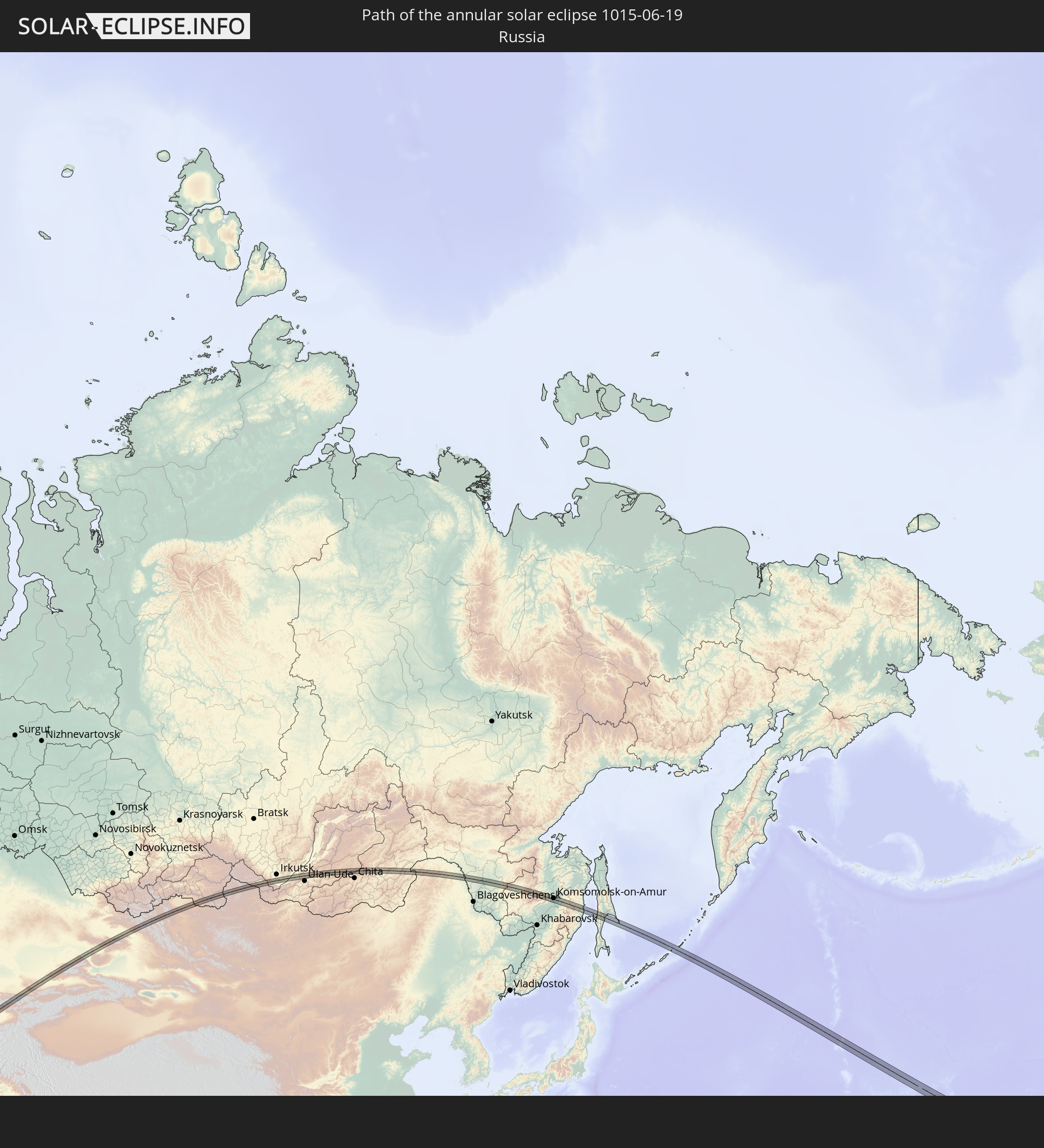 Russia
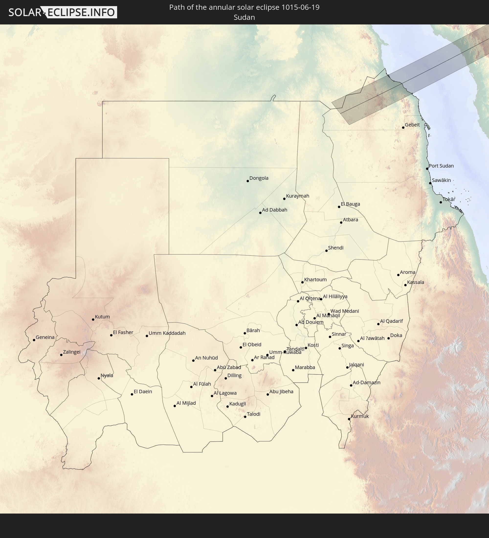 Sudan
Sudan
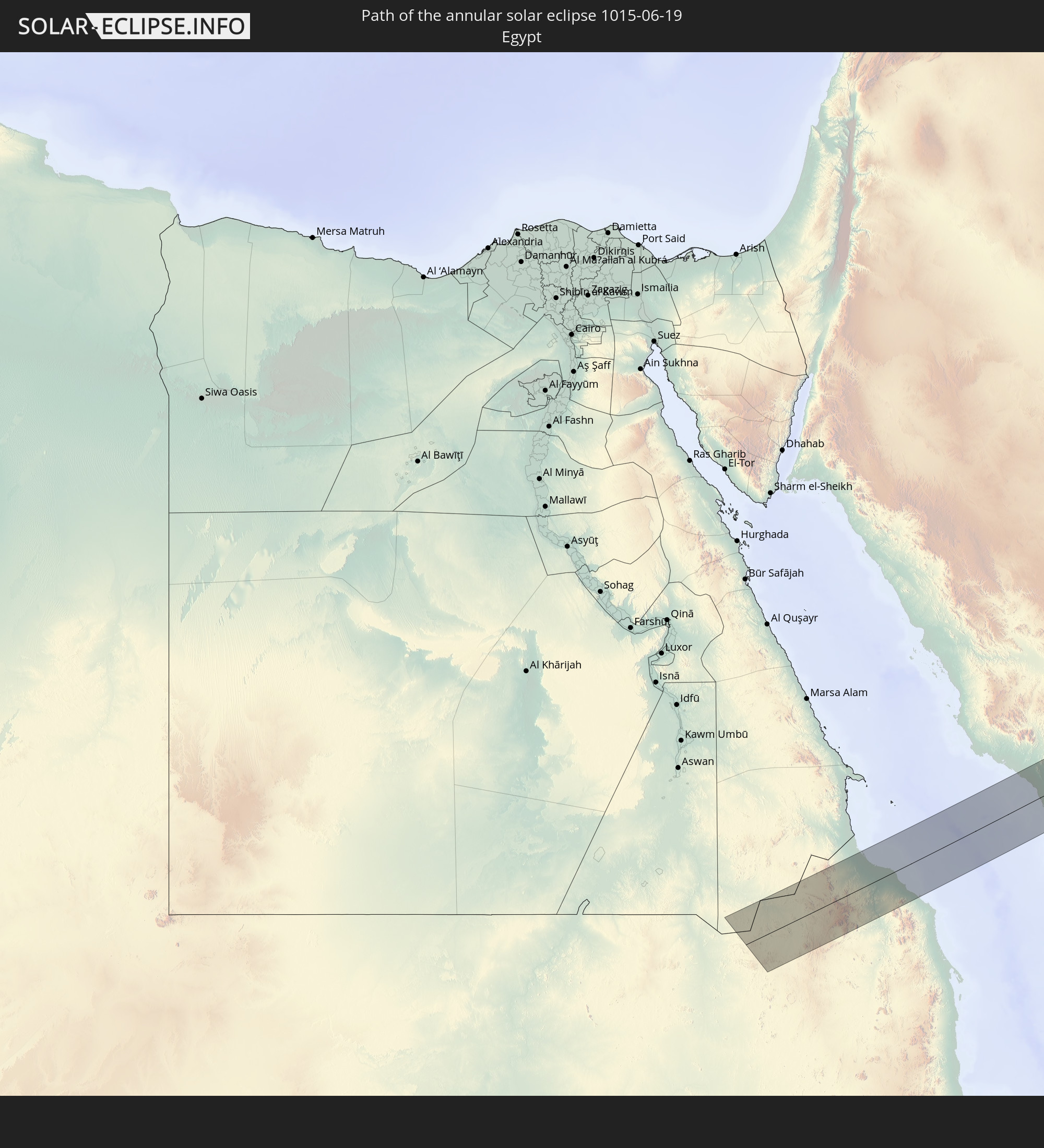 Egypt
Egypt
 Saudi Arabia
 Iran
Iran
 Kazakhstan
 Kuwait
 Turkmenistan
 Uzbekistan
 Afghanistan
 Tajikistan
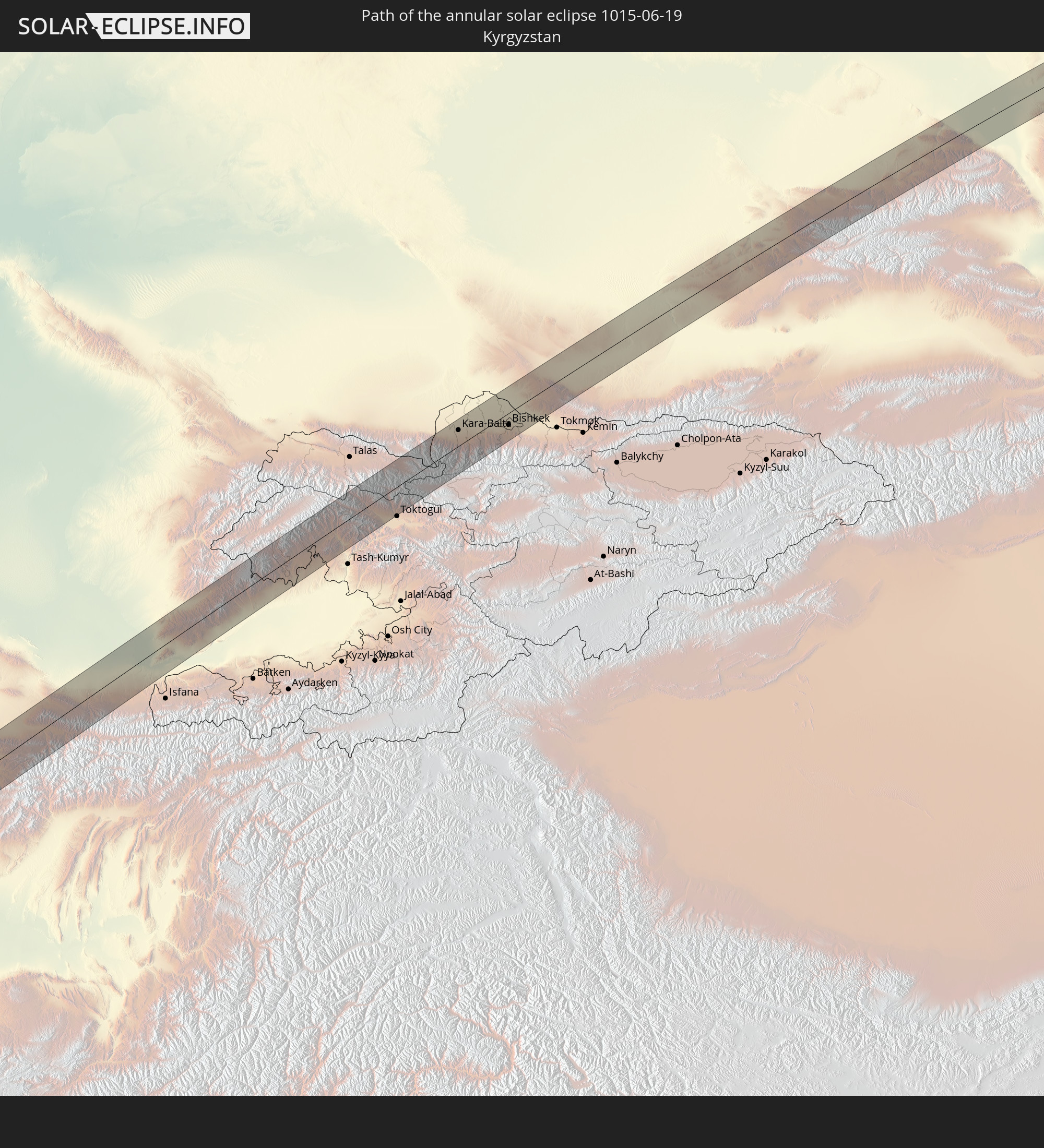 Kyrgyzstan
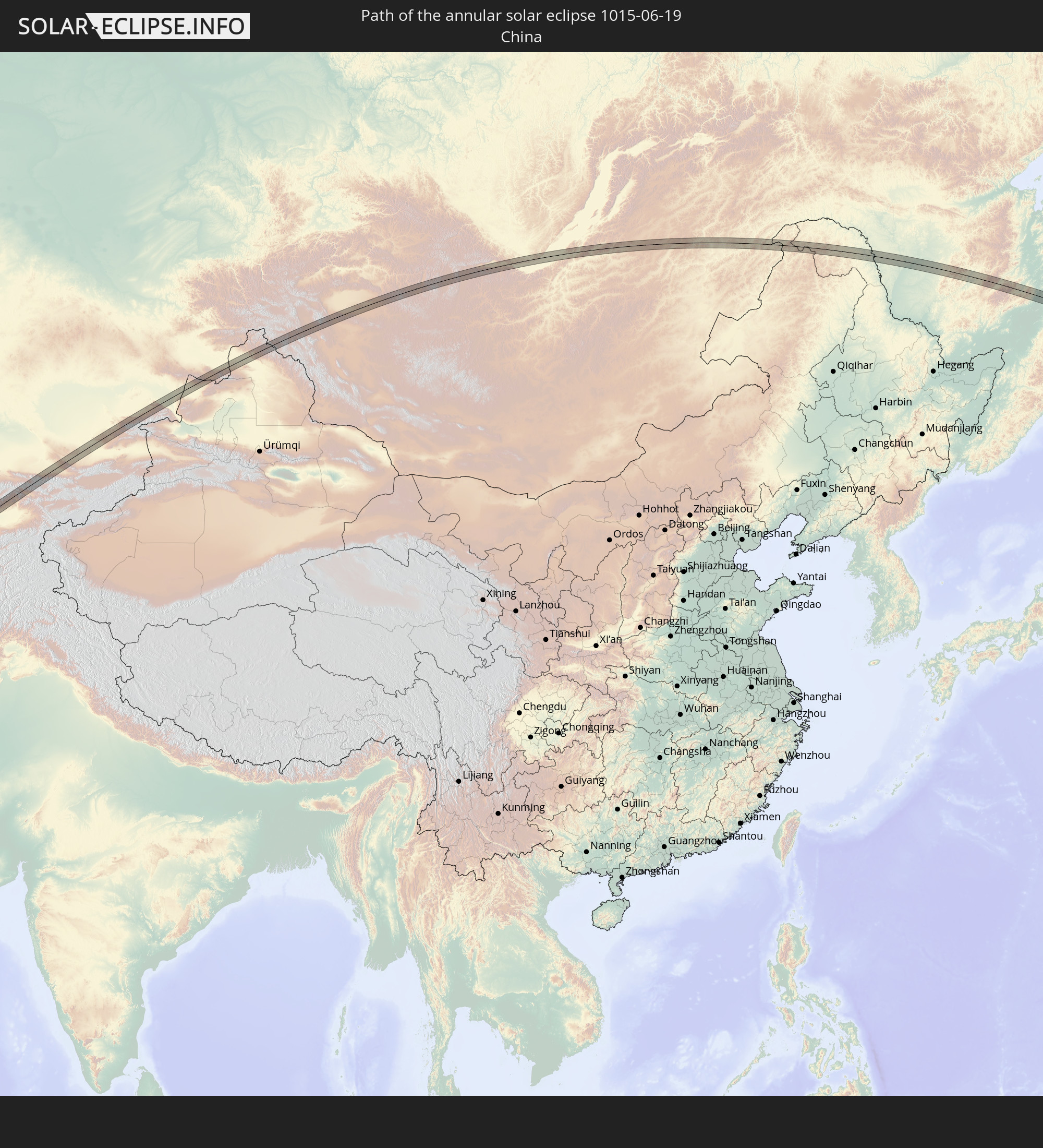 China
China
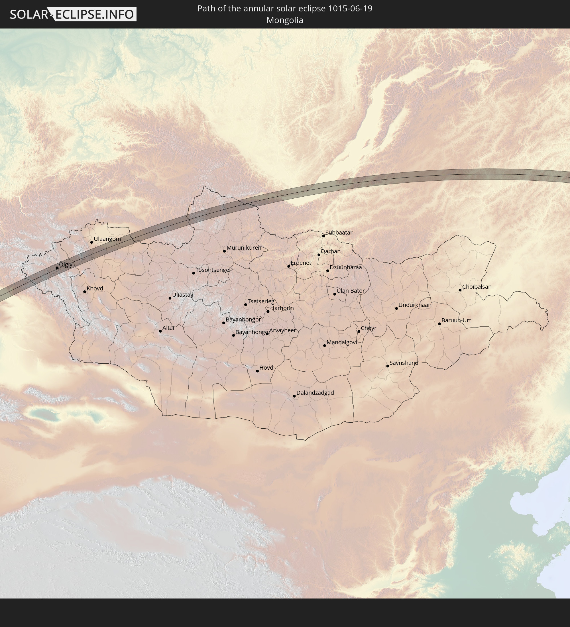 Mongolia
In den folgenden Ländern ist die Sonnenfinsternis partiell zu sehen
 Russia
 United States
 United States Minor Outlying Islands
 Canada
 Greenland
 Iceland
 Republic of Ireland
 Svalbard and Jan Mayen
 United Kingdom
 Faroe Islands
 France
 Isle of Man
 Belgium
 Netherlands
 Norway
 Luxembourg
 Germany
 Switzerland
 Italy
Italy
 Denmark
 Libya
Libya
 Liechtenstein
 Austria
 Sweden
 Czechia
 San Marino
 Slovenia
 Croatia
 Poland
 Bosnia and Herzegovina
 Hungary
 Slovakia
 Montenegro
 Serbia
 Albania
 Åland Islands
 Greece
 Romania
 Republic of Macedonia
 Finland
 Lithuania
 Latvia
 Estonia
 Sudan
Sudan
 Ukraine
 Bulgaria
 Belarus
 Egypt
Egypt
 Turkey
 Moldova
 Cyprus
 Ethiopia
 State of Palestine
 Israel
 Saudi Arabia
 Jordan
 Lebanon
 Syria
Syria
 Eritrea
 Iraq
Iraq
 Georgia
 Somalia
 Djibouti
 Yemen
Yemen
 Armenia
 Iran
Iran
 Azerbaijan
 Seychelles
 Kazakhstan
 Kuwait
 Bahrain
 Qatar
Qatar
 United Arab Emirates
 Oman
Oman
 Turkmenistan
 Uzbekistan
 Afghanistan
 Pakistan
 Tajikistan
 India
India
 Kyrgyzstan
 Maldives
 China
China
 Sri Lanka
 Nepal
Nepal
 Mongolia
 Bangladesh
 Bhutan
 Myanmar
 Thailand
 Laos
Laos
 Vietnam
 Macau
Macau
 Hong Kong
 Taiwan
 Philippines
 Japan
Japan
 North Korea
 South Korea
 Federated States of Micronesia
 Guam
Guam
 Northern Mariana Islands
 Marshall Islands
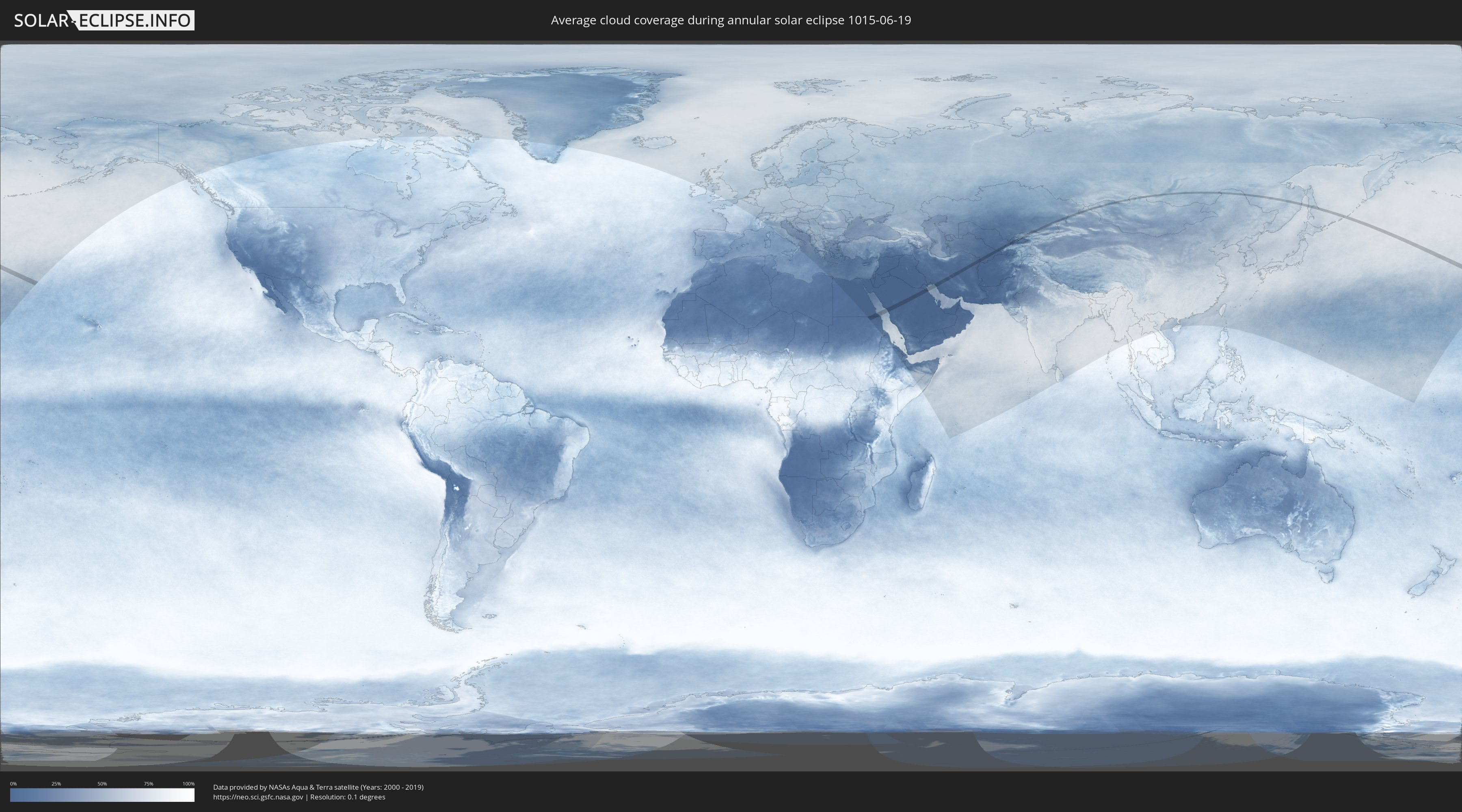
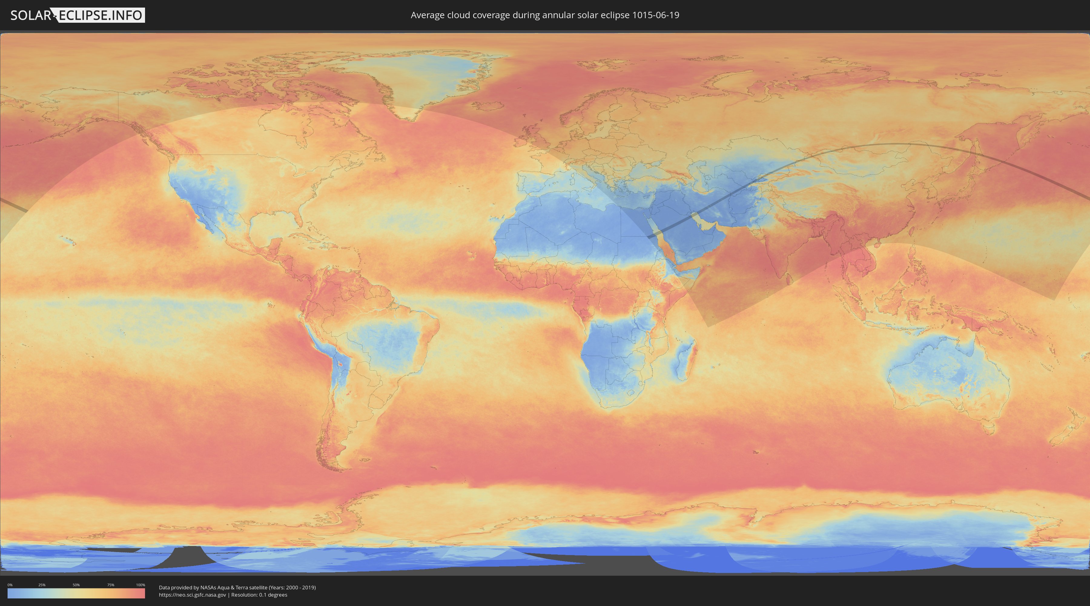
How will be the weather during the annular solar eclipse on 06/19/1015?
Where is the best place to see the annular solar eclipse of 06/19/1015?
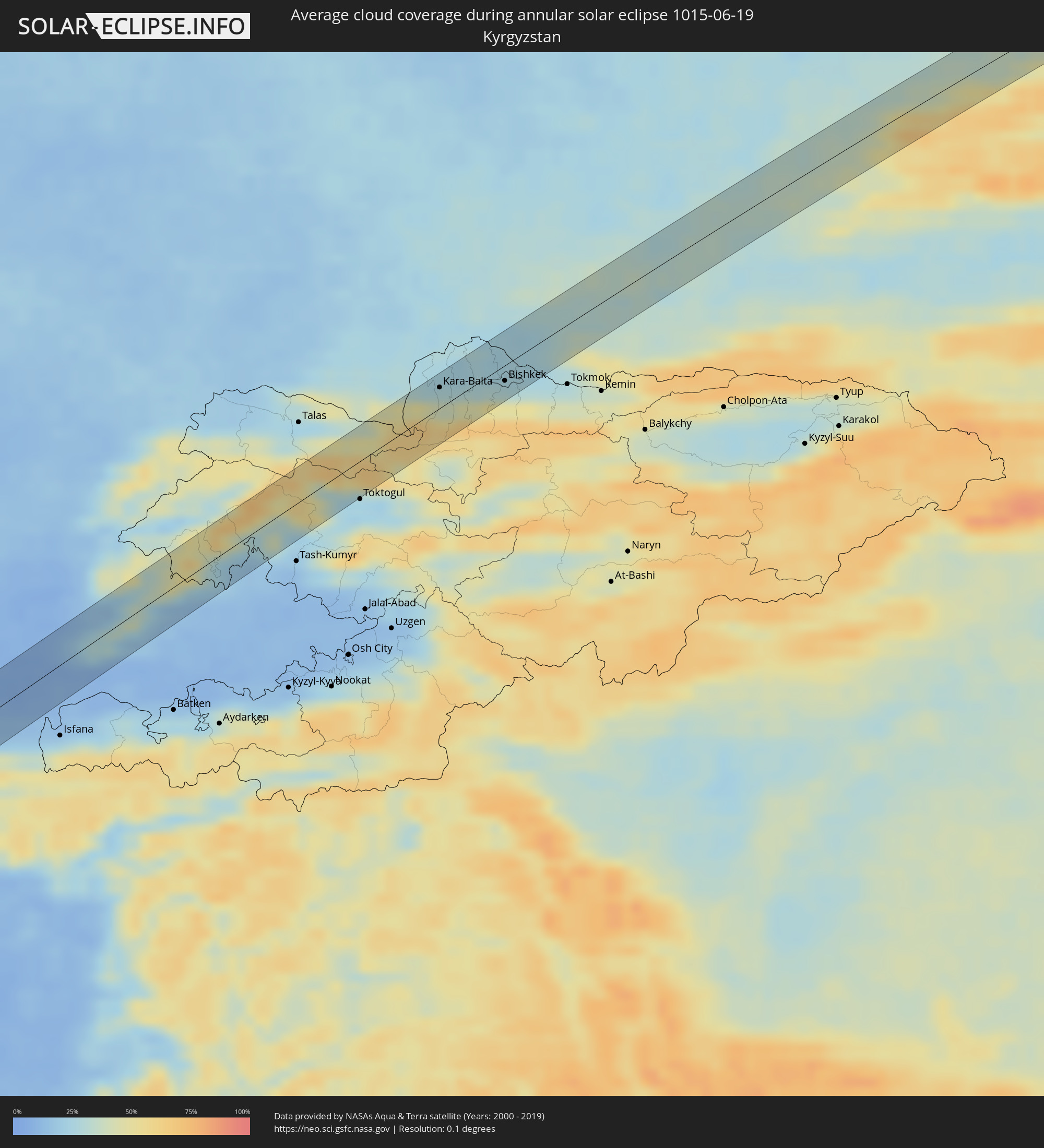
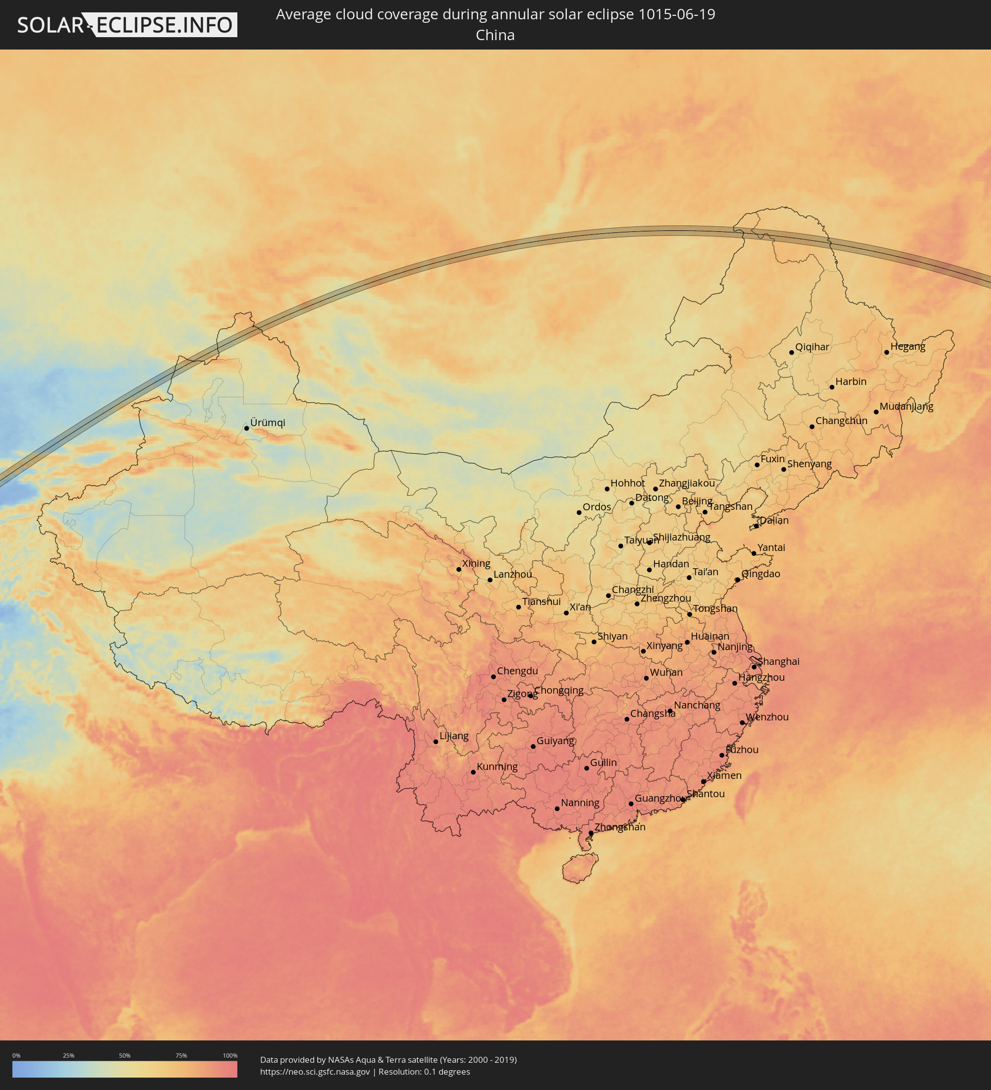
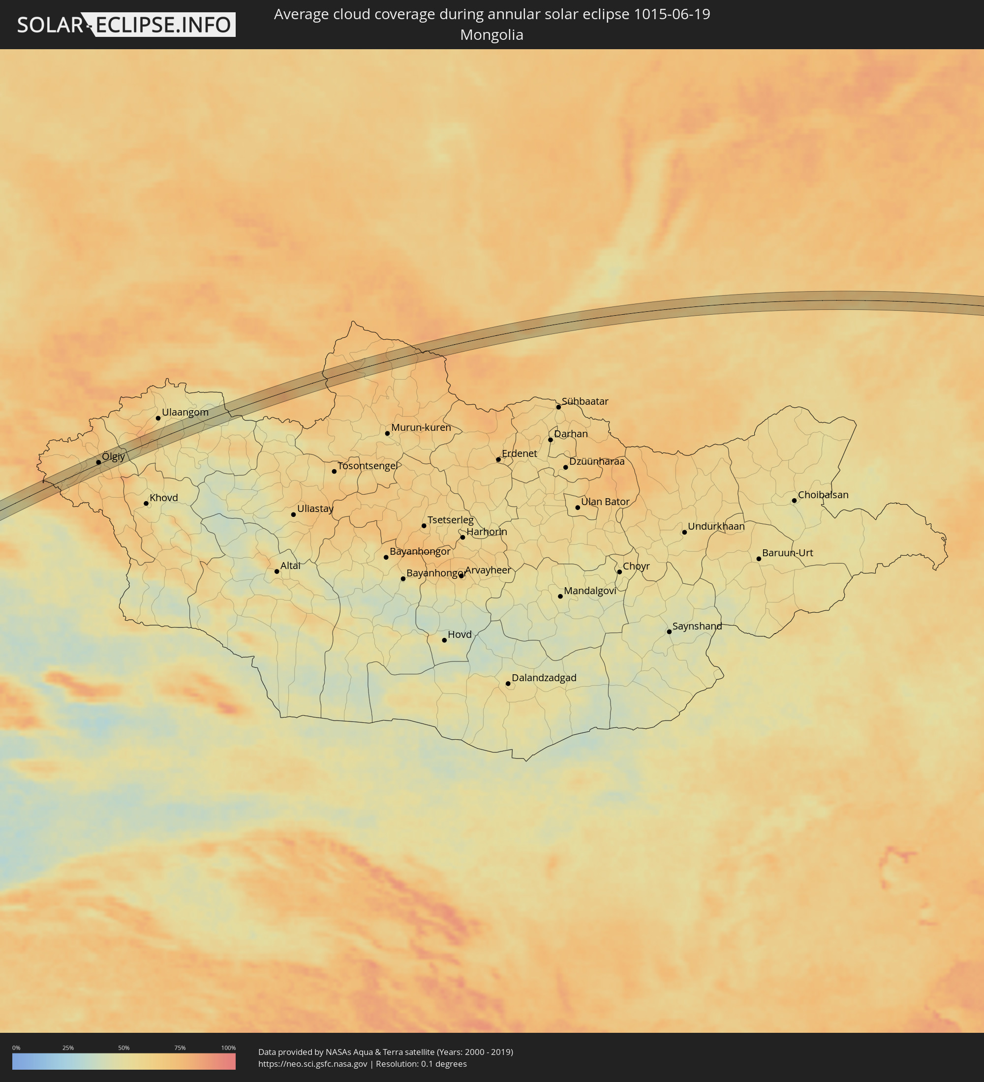
The following maps show the average cloud coverage for the day of the annular solar eclipse.
With the help of these maps, it is possible to find the place along the eclipse path, which has the best
chance of a cloudless sky.
Nevertheless, you should consider local circumstances and inform about the weather of your chosen
observation site.
The data is provided by NASAs satellites
AQUA and TERRA.
The cloud maps are averaged over a period of 19 years (2000 - 2019).
Detailed country maps
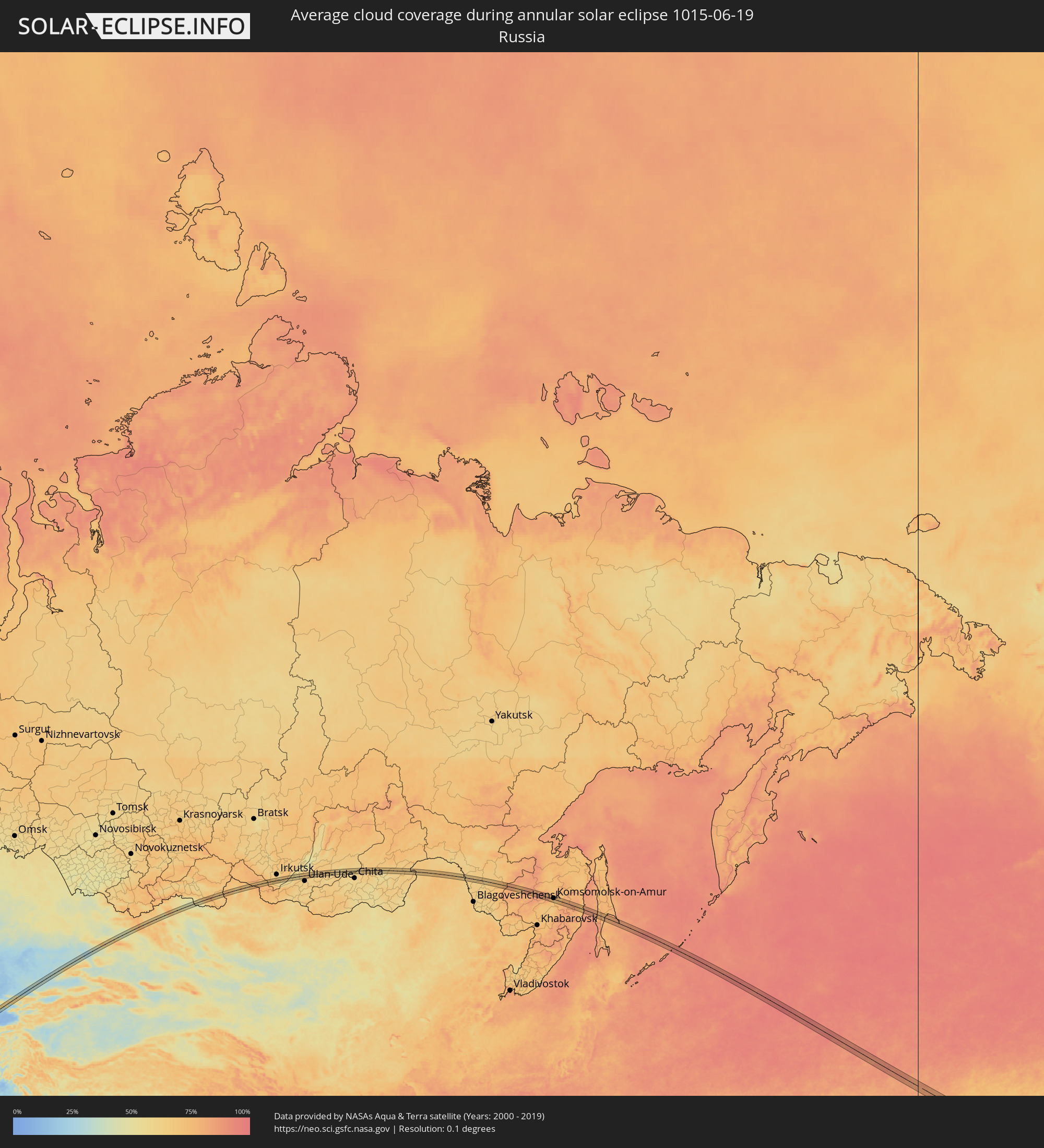 Russia
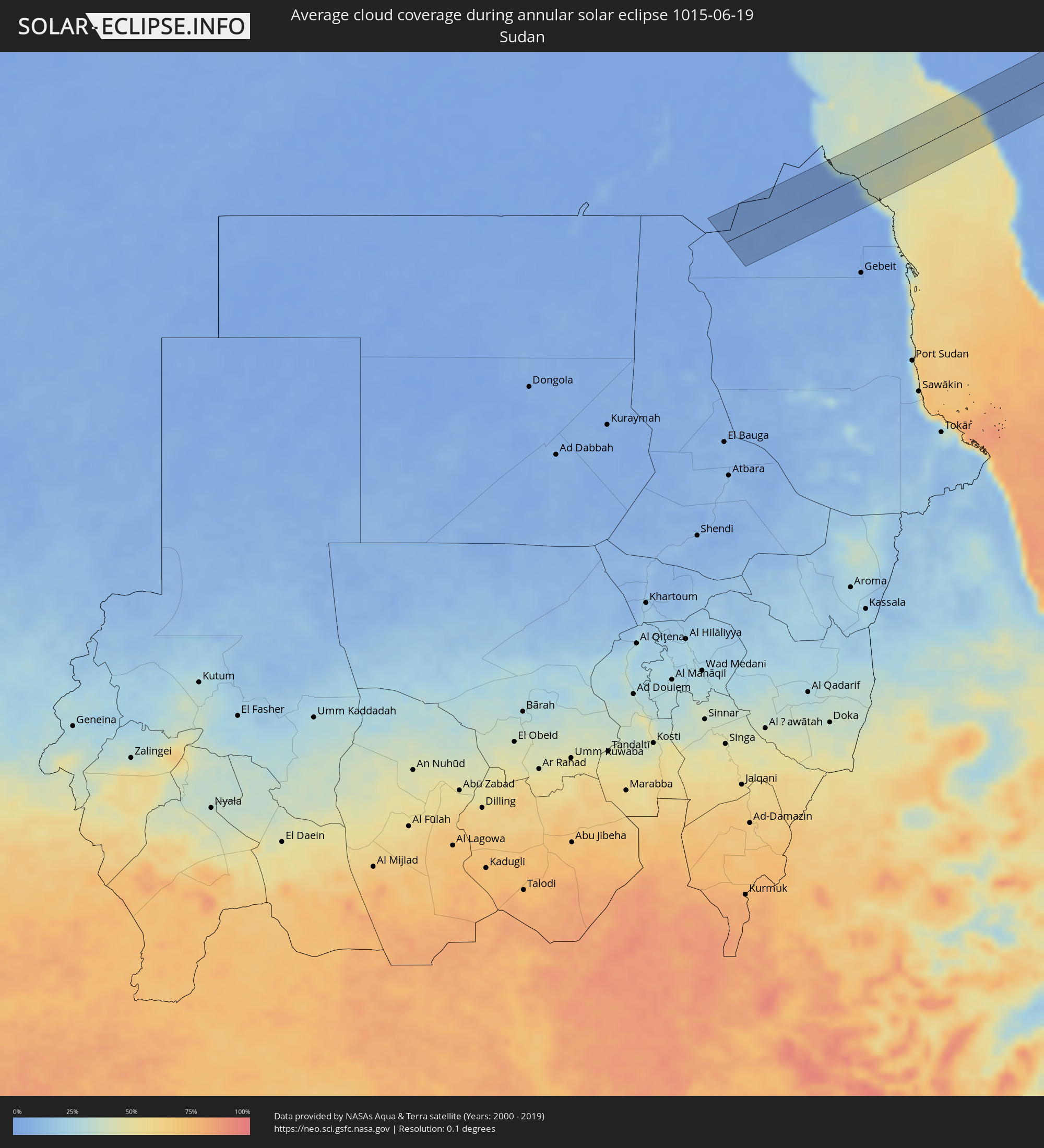 Sudan
Sudan
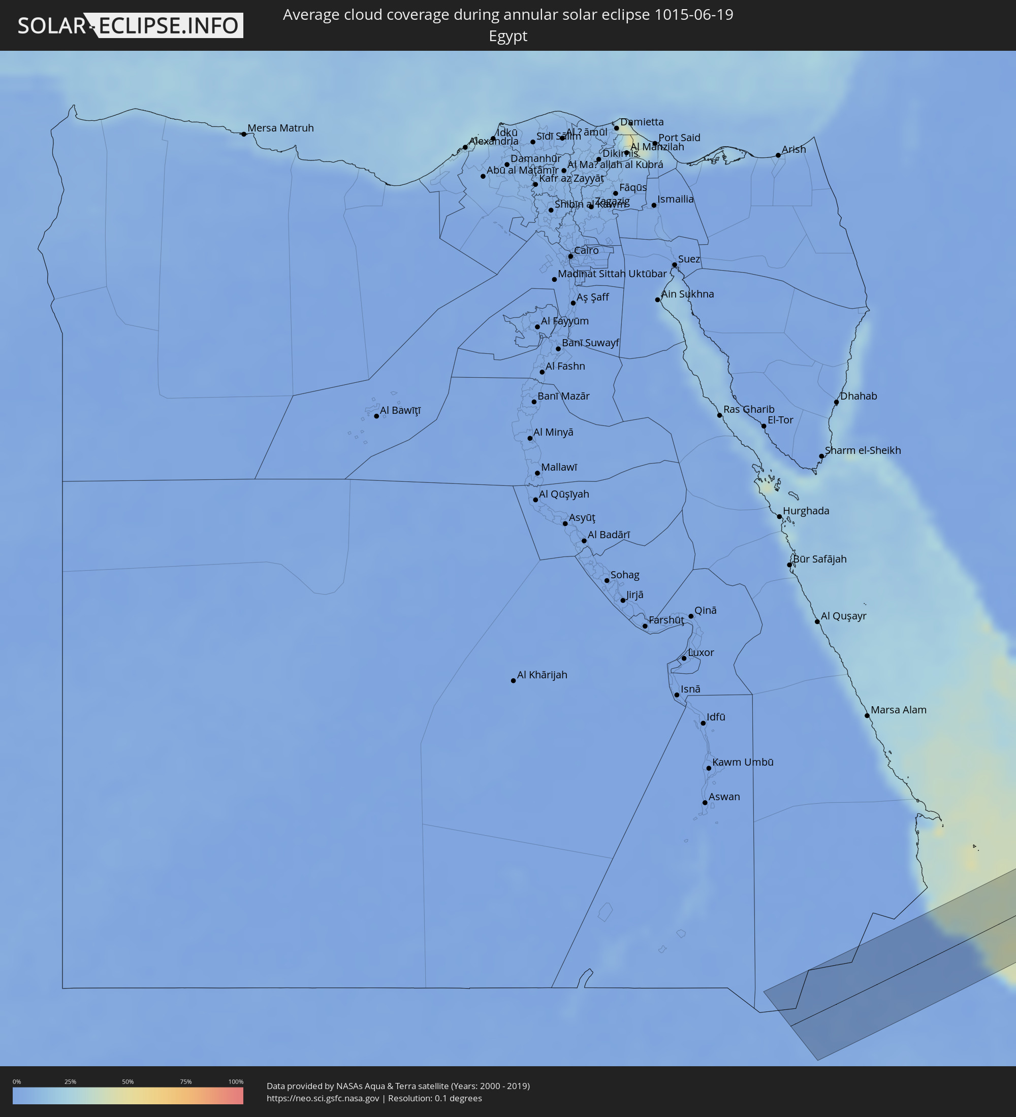 Egypt
Egypt
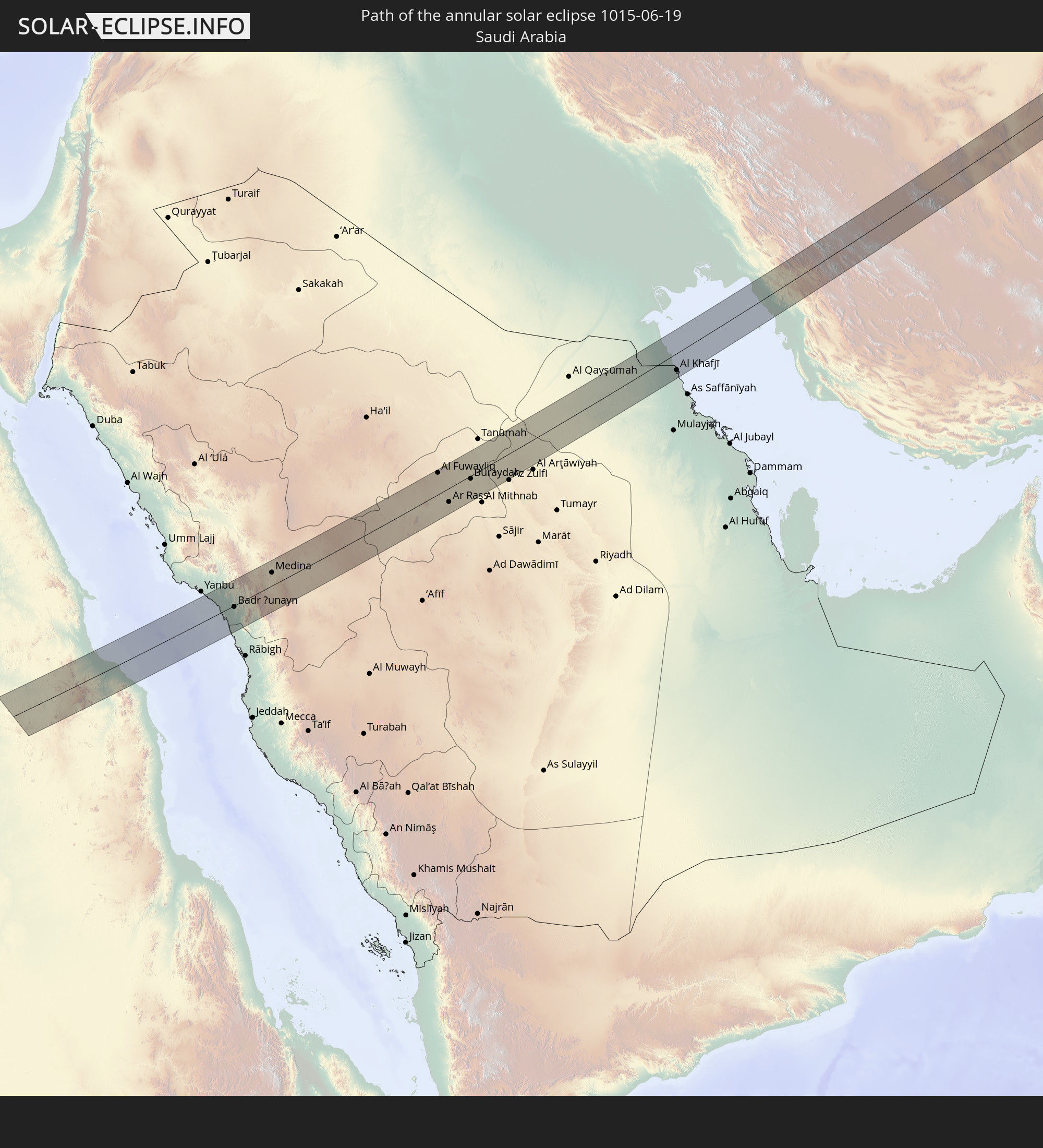
 Saudi Arabia
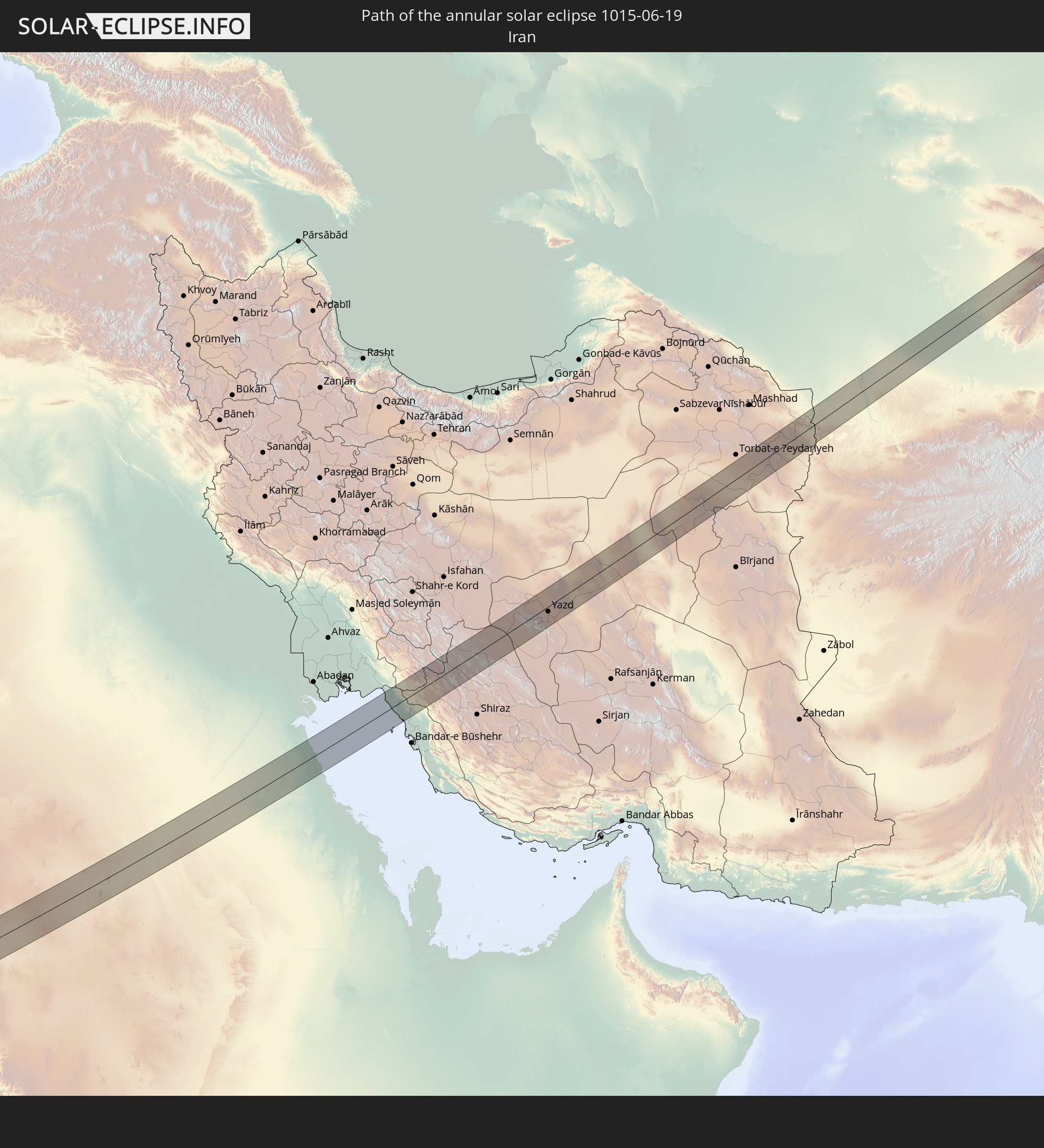
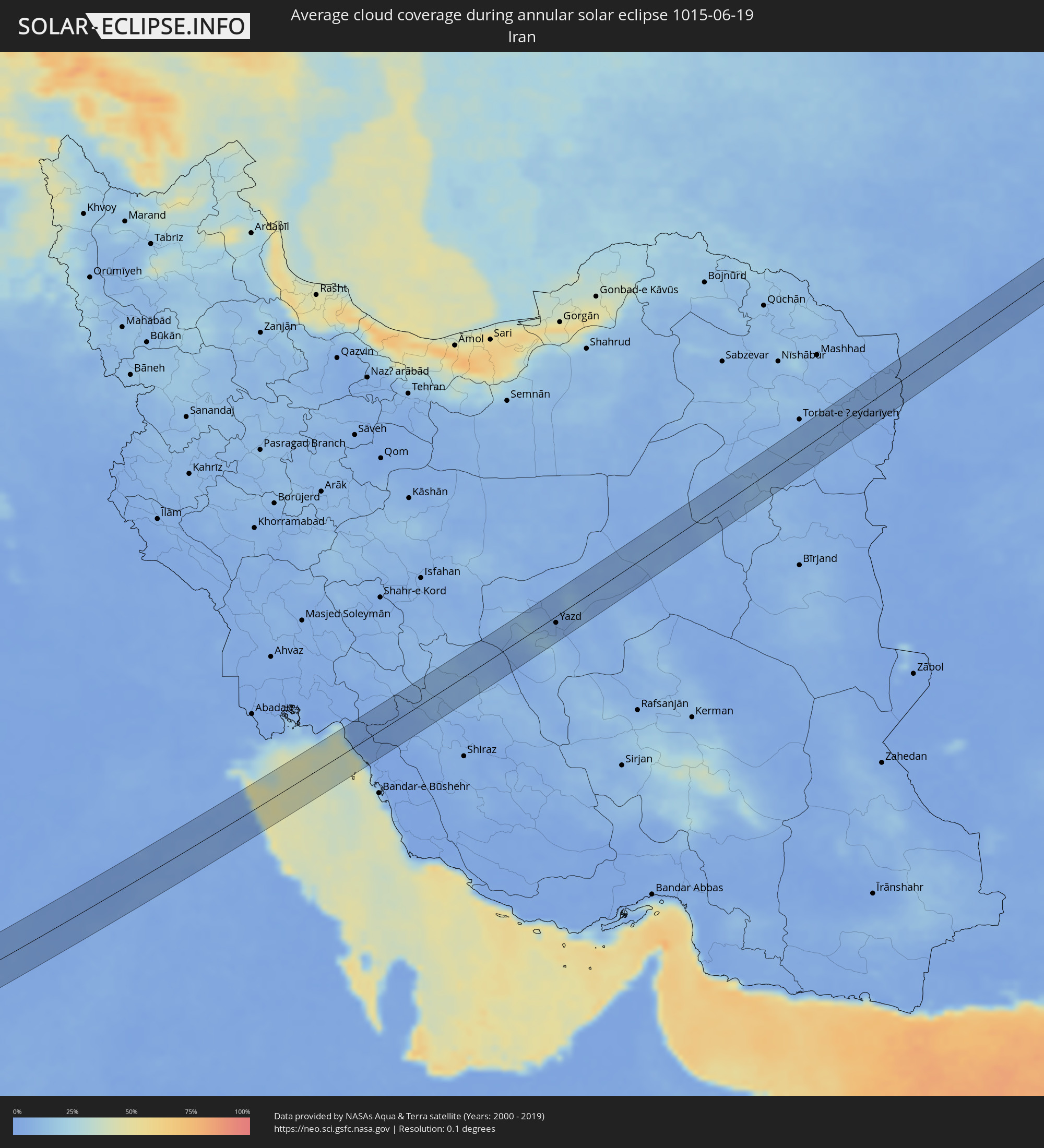 Iran
Iran
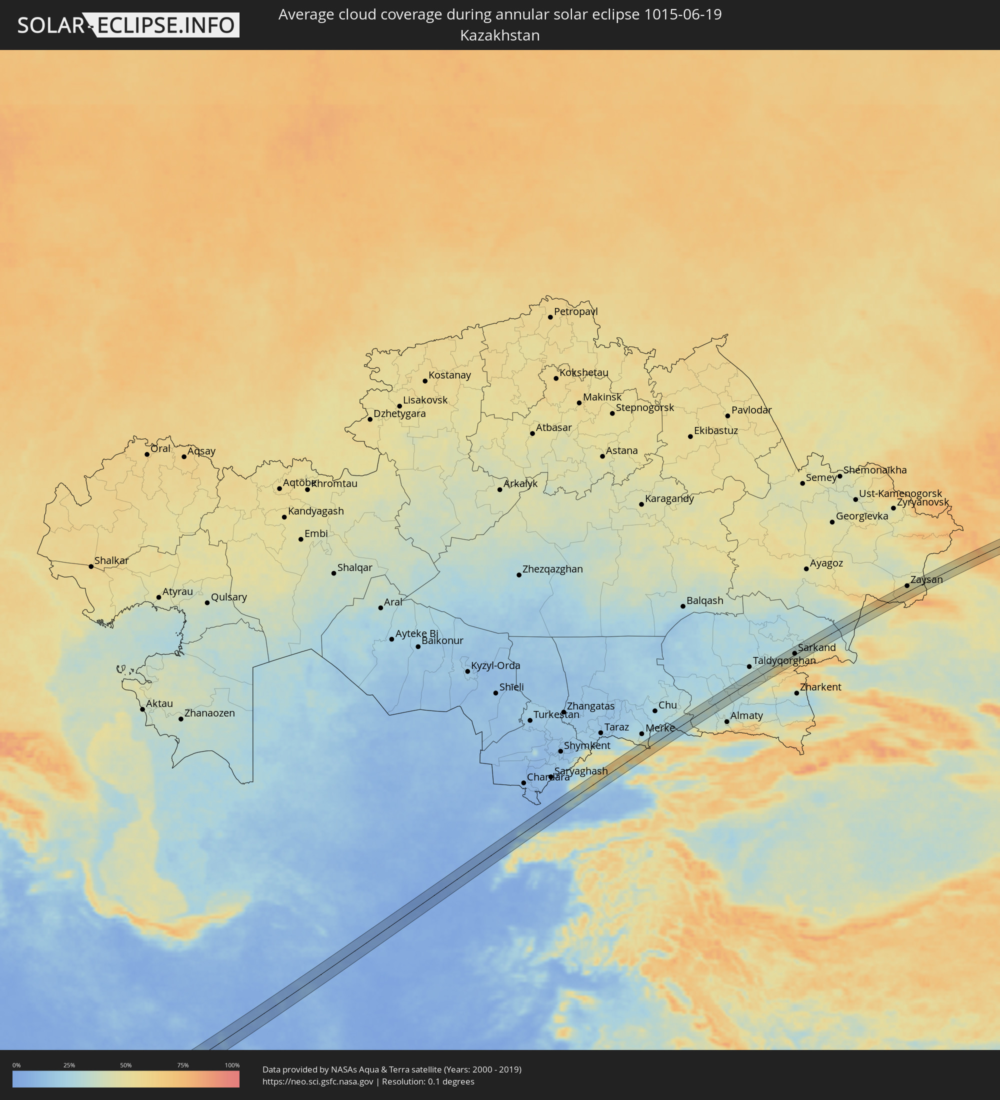 Kazakhstan
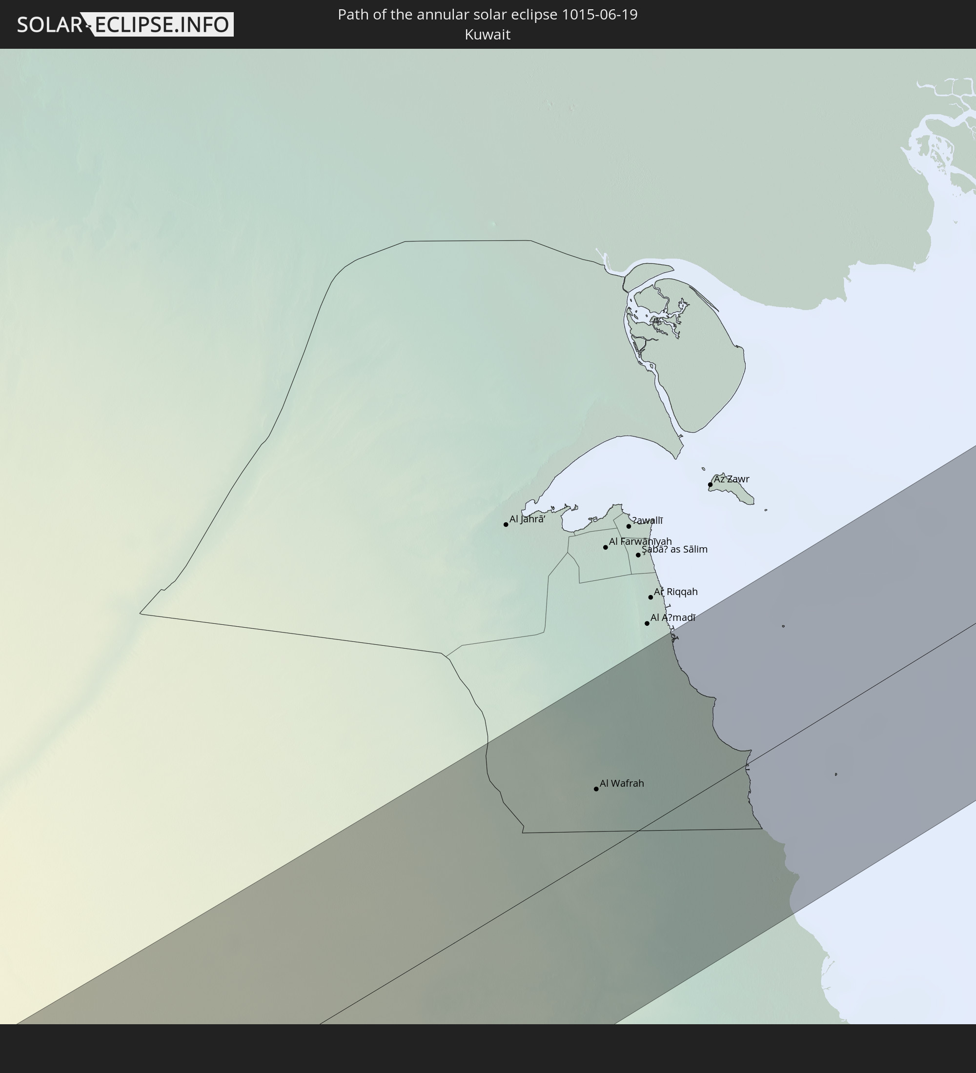
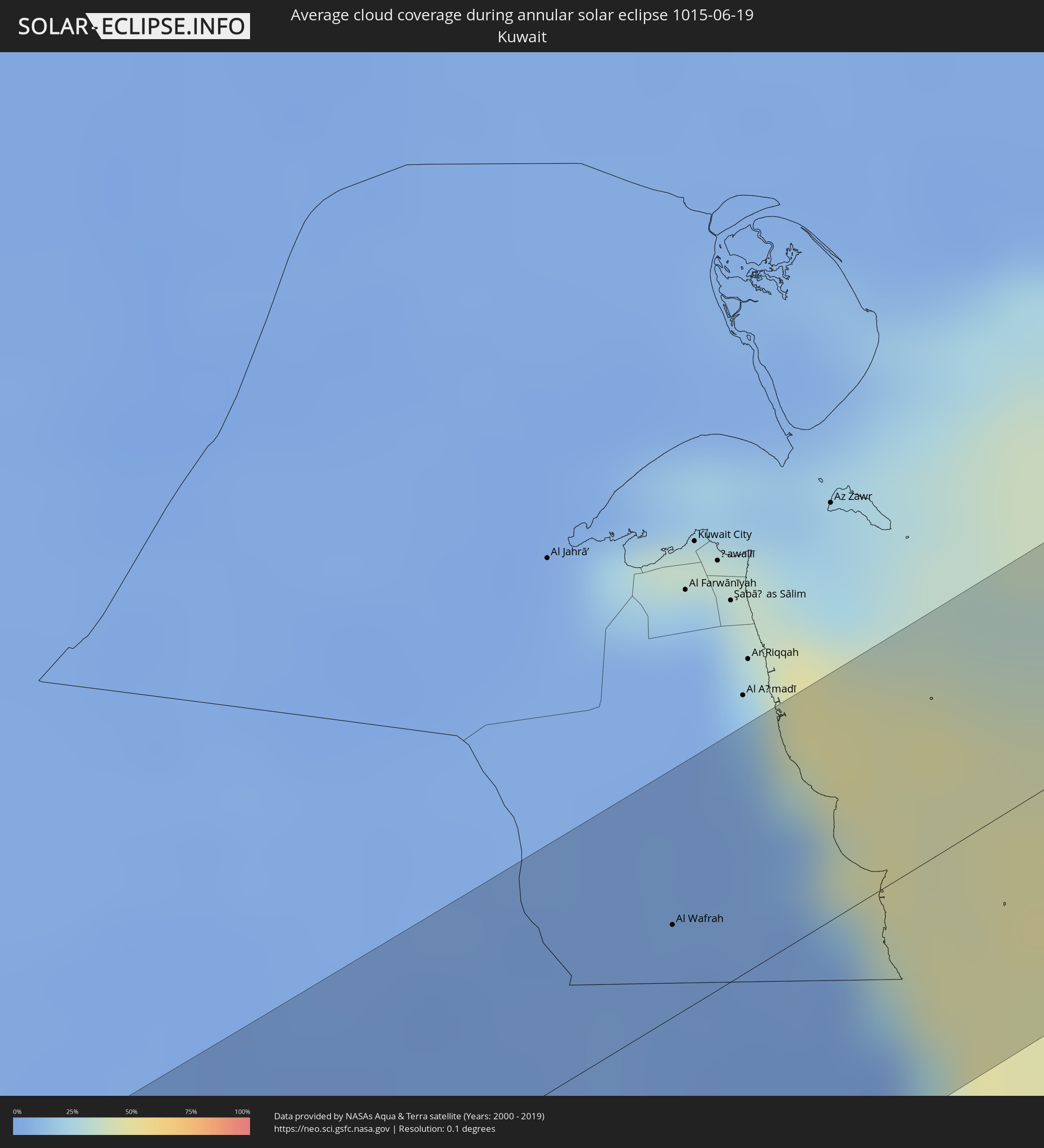 Kuwait
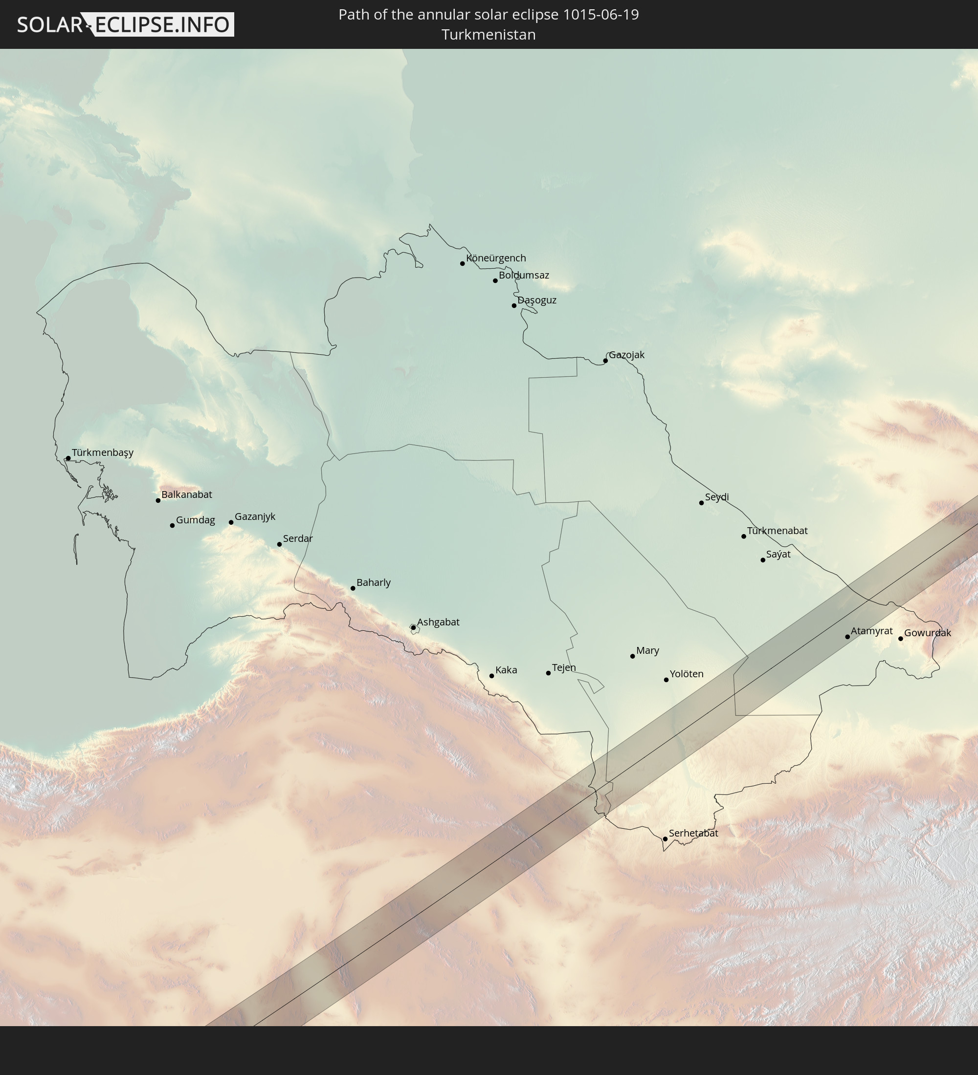
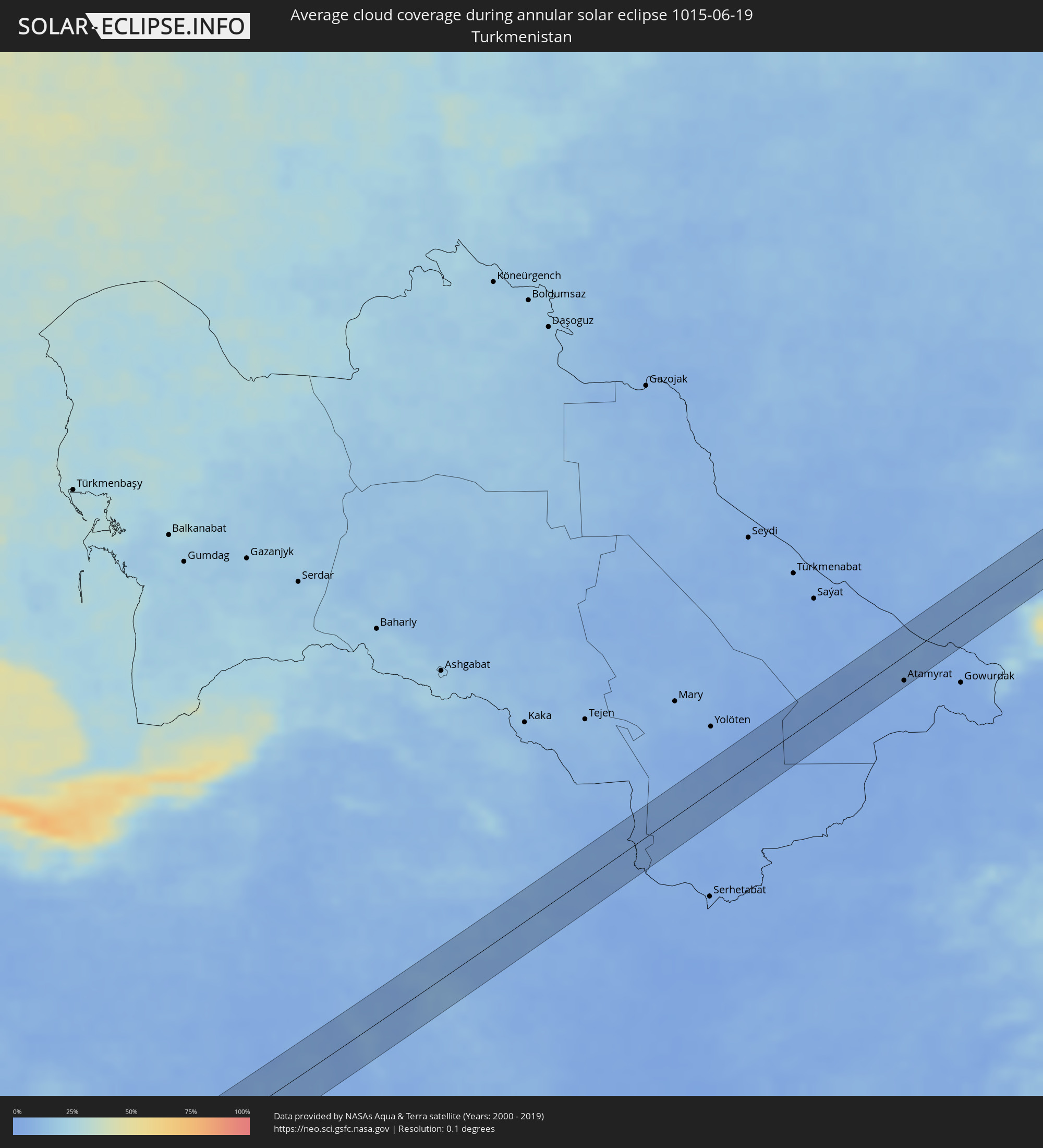 Turkmenistan
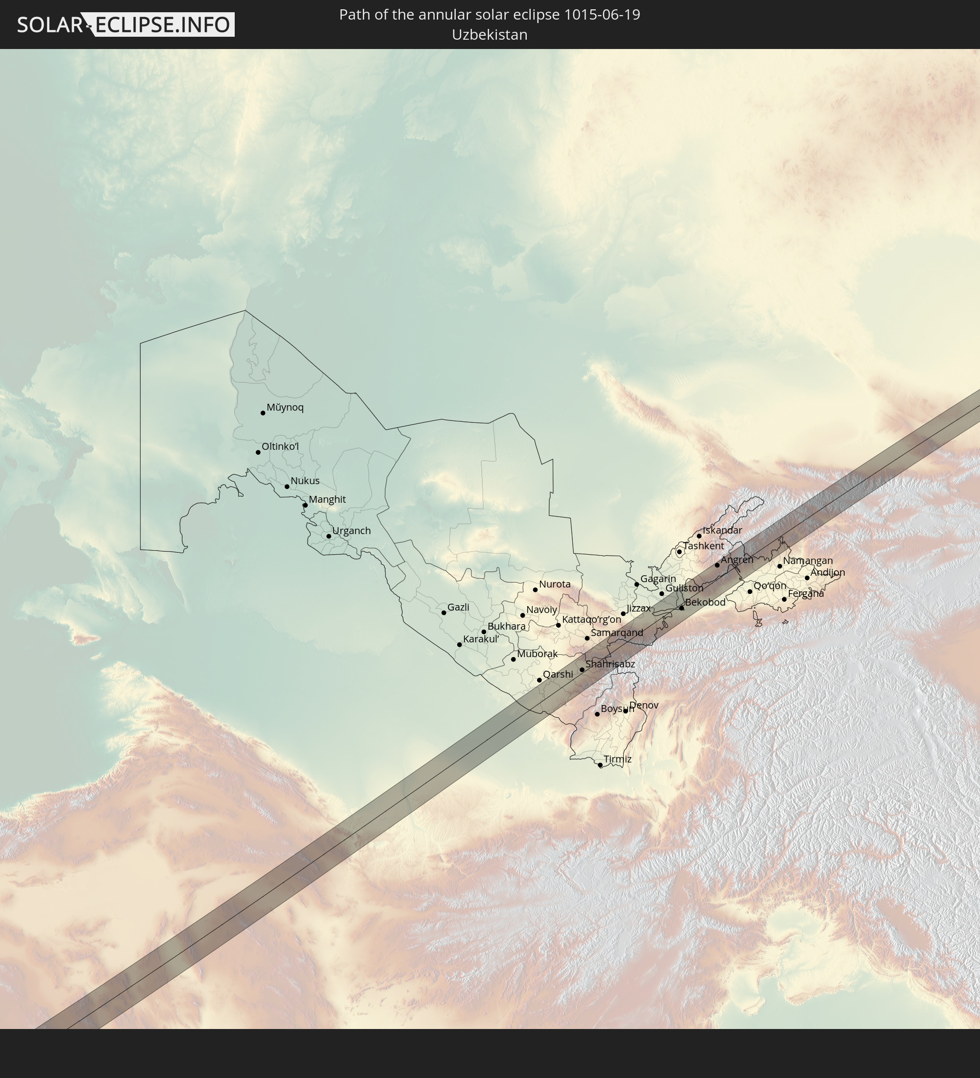
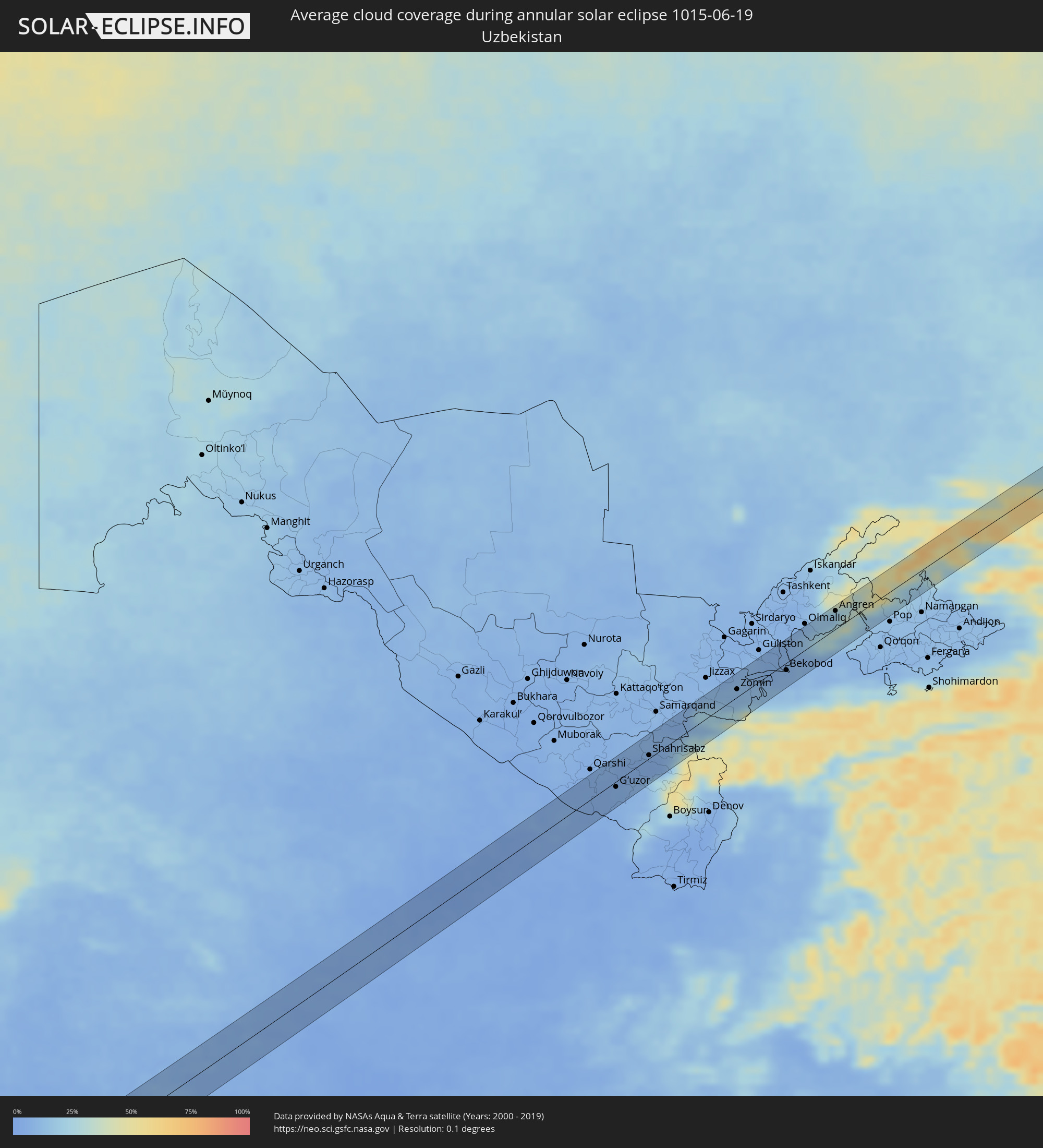 Uzbekistan
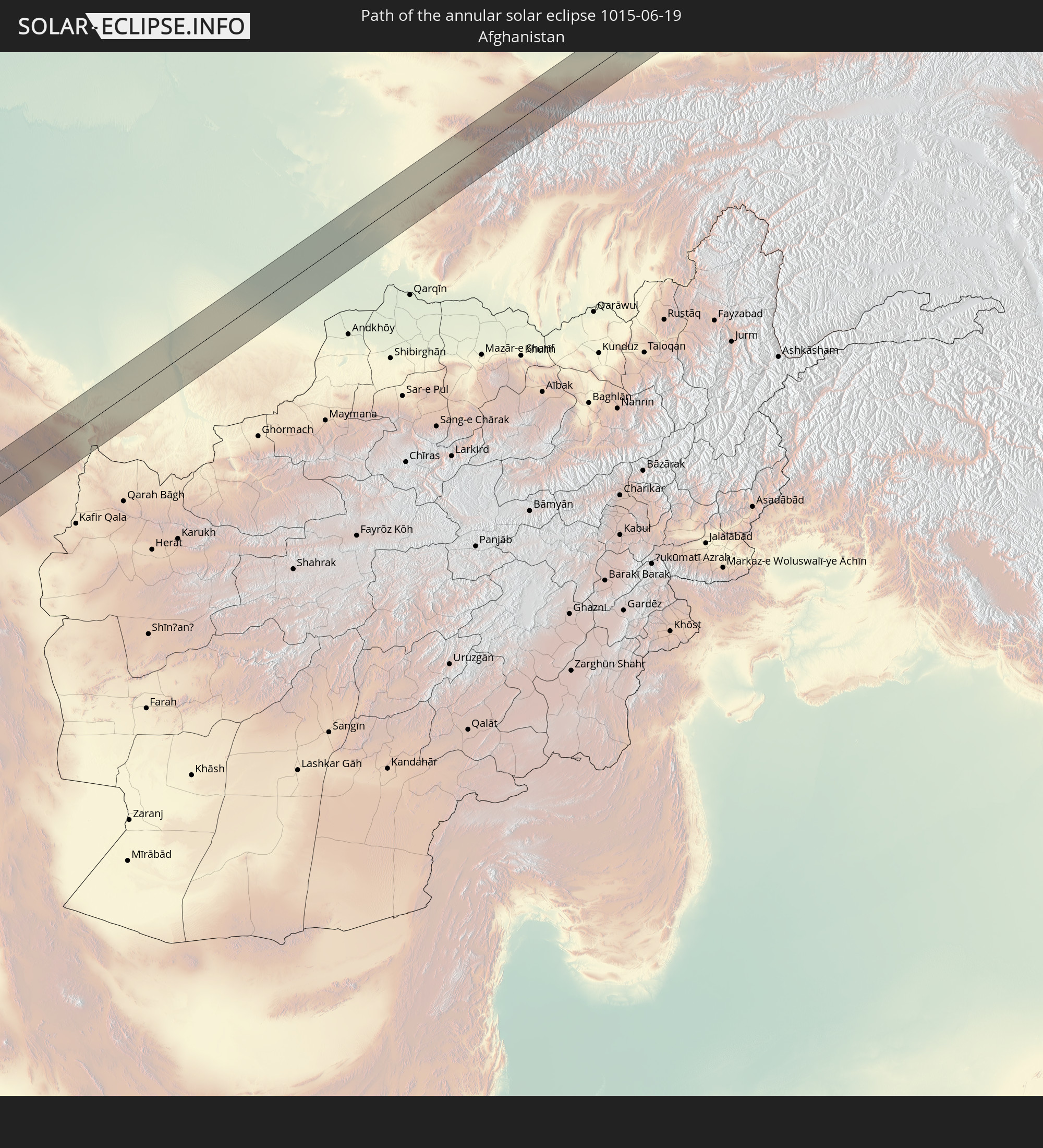
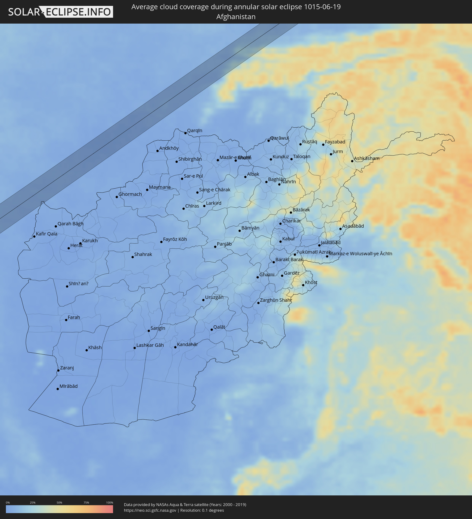 Afghanistan
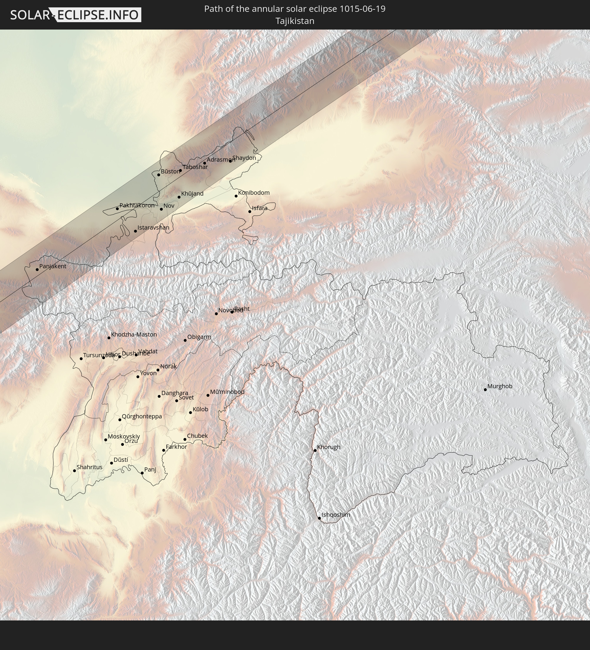
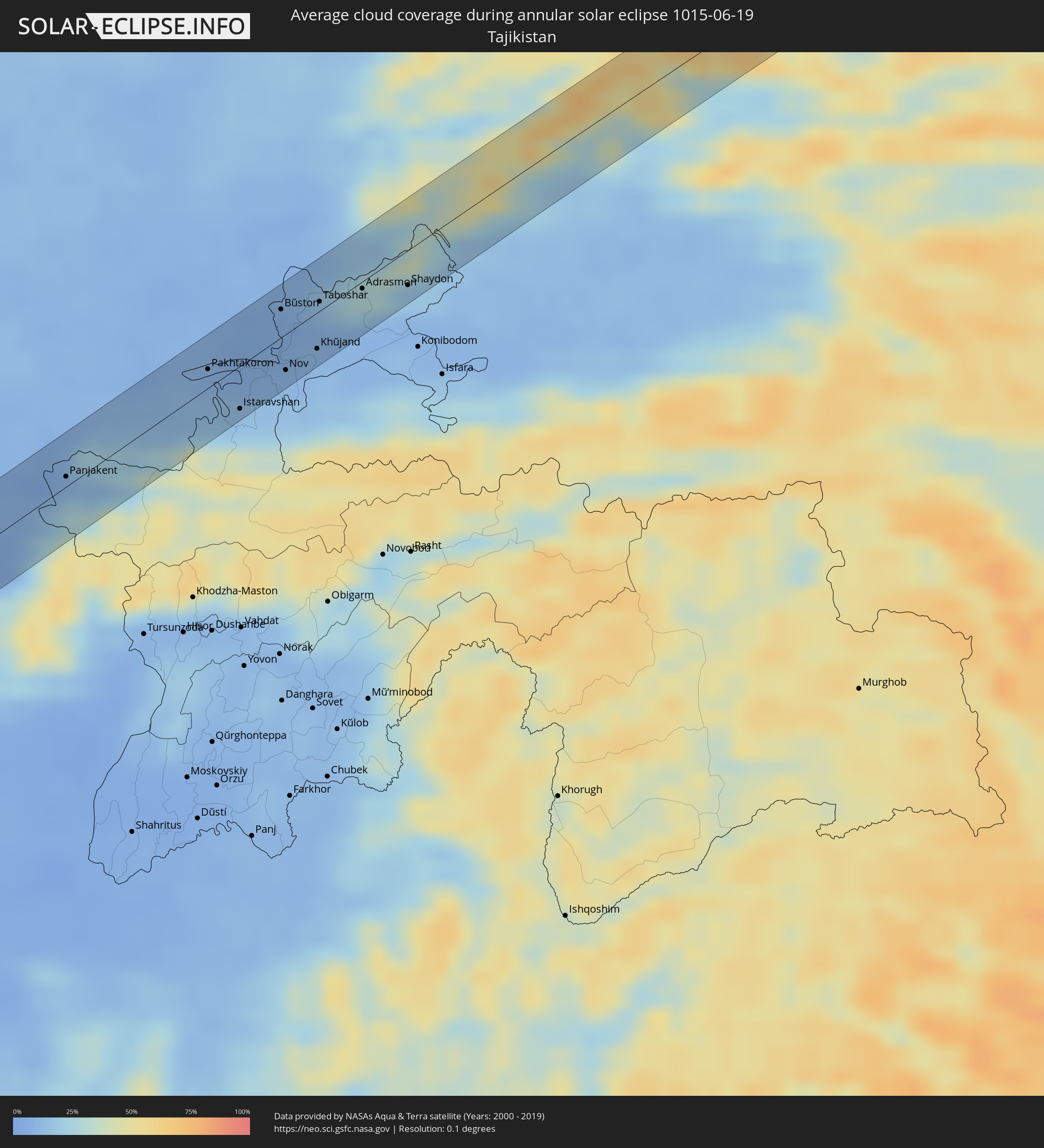 Tajikistan
 Kyrgyzstan
 China
China
 Mongolia
Cities inside the path of the eclipse
The following table shows all locations with a population of more than 5,000 inside the eclipse path. Cities which have more than 100,000 inhabitants are marked bold. A click at the locations opens a detailed map.
| City | Type | Eclipse duration | Local time of max. eclipse | Distance to central line | Ø Cloud coverage |
|
Badr Ḩunayn, Al Madīnah al Munawwarah
|
annular | - | 06:11:52 UTC+03:06 | 26 km | 1% |
|
Sulţānah, Al Madīnah al Munawwarah
|
annular | - | 06:12:25 UTC+03:06 | 39 km | 1% |
|
Medina, Al Madīnah al Munawwarah
|
annular | - | 06:12:22 UTC+03:06 | 37 km | 1% |
|
Al Fuwayliq, Al-Qassim
|
annular | - | 06:13:51 UTC+03:06 | 42 km | 1% |
|
Ar Rass, Al-Qassim
|
annular | - | 06:13:07 UTC+03:06 | 30 km | 2% |
|
Al Bukayrīyah, Al-Qassim
|
annular | - | 06:13:25 UTC+03:06 | 16 km | 2% |
|
Buraydah, Al-Qassim
|
annular | - | 06:13:35 UTC+03:06 | 8 km | 1% |
|
Unaizah, Al-Qassim
|
annular | - | 06:13:17 UTC+03:06 | 35 km | 0% |
|
Al Wafrah, Al Aḩmadī
|
annular | - | 06:16:11 UTC+03:06 | 17 km | 2% |
|
Al Khafjī, Eastern Province
|
annular | - | 06:15:54 UTC+03:06 | 37 km | 21% |
|
Bandar-e Ganāveh, Bushehr
|
annular | - | 06:36:22 UTC+03:25 | 31 km | 23% |
|
Dogonbadan, Kohgīlūyeh va Būyer Aḩmad
|
annular | - | 06:37:29 UTC+03:25 | 32 km | 3% |
|
Nūrābād, Fars
|
annular | - | 06:37:12 UTC+03:25 | 33 km | 4% |
|
Yasuj, Kohgīlūyeh va Būyer Aḩmad
|
annular | - | 06:38:00 UTC+03:25 | 30 km | 7% |
|
Ābādeh, Fars
|
annular | - | 06:38:51 UTC+03:25 | 26 km | 5% |
|
Taft, Yazd
|
annular | - | 06:39:58 UTC+03:25 | 20 km | 14% |
|
Yazd, Yazd
|
annular | - | 06:40:14 UTC+03:25 | 24 km | 4% |
|
Tabas, Yazd
|
annular | - | 06:43:29 UTC+03:25 | 13 km | 3% |
|
Gonābād, Razavi Khorasan
|
annular | - | 06:45:17 UTC+03:25 | 17 km | 8% |
|
Torbat-e Jām, Razavi Khorasan
|
annular | - | 06:47:32 UTC+03:25 | 29 km | 4% |
|
Atamyrat, Lebap
|
annular | - | 07:22:14 UTC+03:53 | 27 km | 3% |
|
Nishon Tumani, Qashqadaryo
|
annular | - | 07:58:22 UTC+04:27 | 32 km | 4% |
|
G’uzor, Qashqadaryo
|
annular | - | 07:58:38 UTC+04:27 | 23 km | 6% |
|
Chiroqchi, Qashqadaryo
|
annular | - | 07:59:35 UTC+04:27 | 23 km | 5% |
|
Kitob, Qashqadaryo
|
annular | - | 07:59:51 UTC+04:27 | 15 km | 6% |
|
Shahrisabz, Qashqadaryo
|
annular | - | 07:59:49 UTC+04:27 | 15 km | 6% |
|
Urgut, Samarqand
|
annular | - | 08:00:43 UTC+04:27 | 22 km | 8% |
|
Panjakent, Viloyati Sughd
|
annular | - | 08:08:28 UTC+04:35 | 16 km | 10% |
|
Zomin, Jizzax
|
annular | - | 08:02:34 UTC+04:27 | 11 km | 11% |
|
Dashtobod, Jizzax
|
annular | - | 08:02:56 UTC+04:27 | 24 km | 11% |
|
Pakhtakoron, Viloyati Sughd
|
annular | - | 08:10:31 UTC+04:35 | 22 km | 8% |
|
Yangiyer, Sirdaryo
|
annular | - | 08:03:28 UTC+04:27 | 19 km | 8% |
|
Istaravshan, Viloyati Sughd
|
annular | - | 08:10:17 UTC+04:35 | 29 km | 15% |
|
Bekobod, Toshkent
|
annular | - | 08:03:44 UTC+04:27 | 23 km | 9% |
|
Bŭston, Viloyati Sughd
|
annular | - | 08:11:38 UTC+04:35 | 17 km | 7% |
|
Nov, Viloyati Sughd
|
annular | - | 08:11:00 UTC+04:35 | 32 km | 10% |
|
Proletar, Viloyati Sughd
|
annular | - | 08:11:08 UTC+04:35 | 30 km | 10% |
|
Khŭjand, Viloyati Sughd
|
annular | - | 08:11:27 UTC+04:35 | 20 km | 9% |
|
Taboshar, Viloyati Sughd
|
annular | - | 08:11:58 UTC+04:35 | 19 km | 12% |
|
Chkalov, Viloyati Sughd
|
annular | - | 08:11:25 UTC+04:35 | 28 km | 11% |
|
Konsoy, Viloyati Sughd
|
annular | - | 08:11:53 UTC+04:35 | 18 km | 10% |
|
Adrasmon, Viloyati Sughd
|
annular | - | 08:12:24 UTC+04:35 | 6 km | 19% |
|
Angren, Toshkent
|
annular | - | 08:05:52 UTC+04:27 | 31 km | 16% |
|
Shaydon, Viloyati Sughd
|
annular | - | 08:12:45 UTC+04:35 | 30 km | 16% |
|
Kosonsoy, Namangan
|
annular | - | 08:07:33 UTC+04:27 | 25 km | 17% |
|
Kaindy, Chüy
|
annular | - | 08:42:53 UTC+04:58 | 29 km | 31% |
|
Kara-Balta, Chüy
|
annular | - | 08:43:02 UTC+04:58 | 17 km | 30% |
|
Sosnovka, Chüy
|
annular | - | 08:42:46 UTC+04:58 | 12 km | 52% |
|
Bishkek, Bishkek
|
annular | - | 08:43:54 UTC+04:58 | 12 km | 27% |
|
Georgiyevka, Zhambyl
|
annular | - | 08:07:47 UTC+04:21 | 2 km | 26% |
|
Kant, Chüy
|
annular | - | 08:44:12 UTC+04:58 | 22 km | 27% |
|
Saryozek, Almaty Oblysy
|
annular | - | 08:13:43 UTC+04:21 | 18 km | 37% |
|
Balpyk Bī, Almaty Oblysy
|
annular | - | 08:14:57 UTC+04:21 | 22 km | 34% |
|
Tekeli, Almaty Oblysy
|
annular | - | 08:15:32 UTC+04:21 | 9 km | 47% |
|
Sarkand, Almaty Oblysy
|
annular | - | 08:17:51 UTC+04:21 | 2 km | 43% |
|
Zaysan, East Kazakhstan
|
annular | - | 08:27:43 UTC+04:21 | 16 km | 51% |
|
Ölgiy, Bayan-Ölgiy
|
annular | - | 10:22:04 UTC+06:06 | 3 km | 58% |
|
Kyren, Respublika Buryatiya
|
annular | - | 11:35:14 UTC+06:57 | 16 km | 67% |
|
Slyudyanka, Irkutsk
|
annular | - | 11:37:54 UTC+06:57 | 19 km | 69% |
|
Kabansk, Respublika Buryatiya
|
annular | - | 11:43:09 UTC+06:57 | 13 km | 62% |
|
Turuntayevo, Respublika Buryatiya
|
annular | - | 11:44:54 UTC+06:57 | 10 km | 65% |
|
Sosnovo-Ozerskoye, Respublika Buryatiya
|
annular | - | 11:51:38 UTC+06:57 | 4 km | 57% |
|
Chernyshevsk, Transbaikal Territory
|
annular | - | 13:42:46 UTC+08:38 | 8 km | 58% |
|
Tahe, Heilongjiang
|
annular | - | 13:16:19 UTC+08:00 | 18 km | 67% |
|
Shimanovsk, Amur
|
annular | - | 14:00:01 UTC+08:38 | 13 km | 64% |
|
Novyy Urgal, Khabarovsk Krai
|
annular | - | 14:16:35 UTC+08:47 | 23 km | 71% |
|
Chegdomyn, Khabarovsk Krai
|
annular | - | 14:17:05 UTC+08:47 | 10 km | 74% |
|
Solnechnyy, Khabarovsk Krai
|
annular | - | 14:22:20 UTC+08:47 | 18 km | 77% |
|
Khurba, Khabarovsk Krai
|
annular | - | 14:23:03 UTC+08:47 | 12 km | 67% |
|
Komsomolsk-on-Amur, Khabarovsk Krai
|
annular | - | 14:23:01 UTC+08:47 | 7 km | 71% |
|
Solnechnyy, Khabarovsk Krai
|
annular | - | 14:23:01 UTC+08:47 | 11 km | 71% |
|
Uglegorsk, Sakhalin
|
annular | - | 15:58:22 UTC+10:14 | 30 km | 75% |
|
Shakhtersk, Sakhalin
|
annular | - | 15:58:18 UTC+10:14 | 22 km | 77% |
|
Poronaysk, Sakhalin
|
annular | - | 15:59:16 UTC+10:14 | 16 km | 79% |