Total solar eclipse of 11/17/1286
| Day of week: | Sunday |
| Maximum duration of eclipse: | 04m17s |
| Maximum width of eclipse path: | 168 km |
| Saros cycle: | 121 |
| Coverage: | 100% |
| Magnitude: | 1.0441 |
| Gamma: | 0.4865 |
Wo kann man die Sonnenfinsternis vom 11/17/1286 sehen?
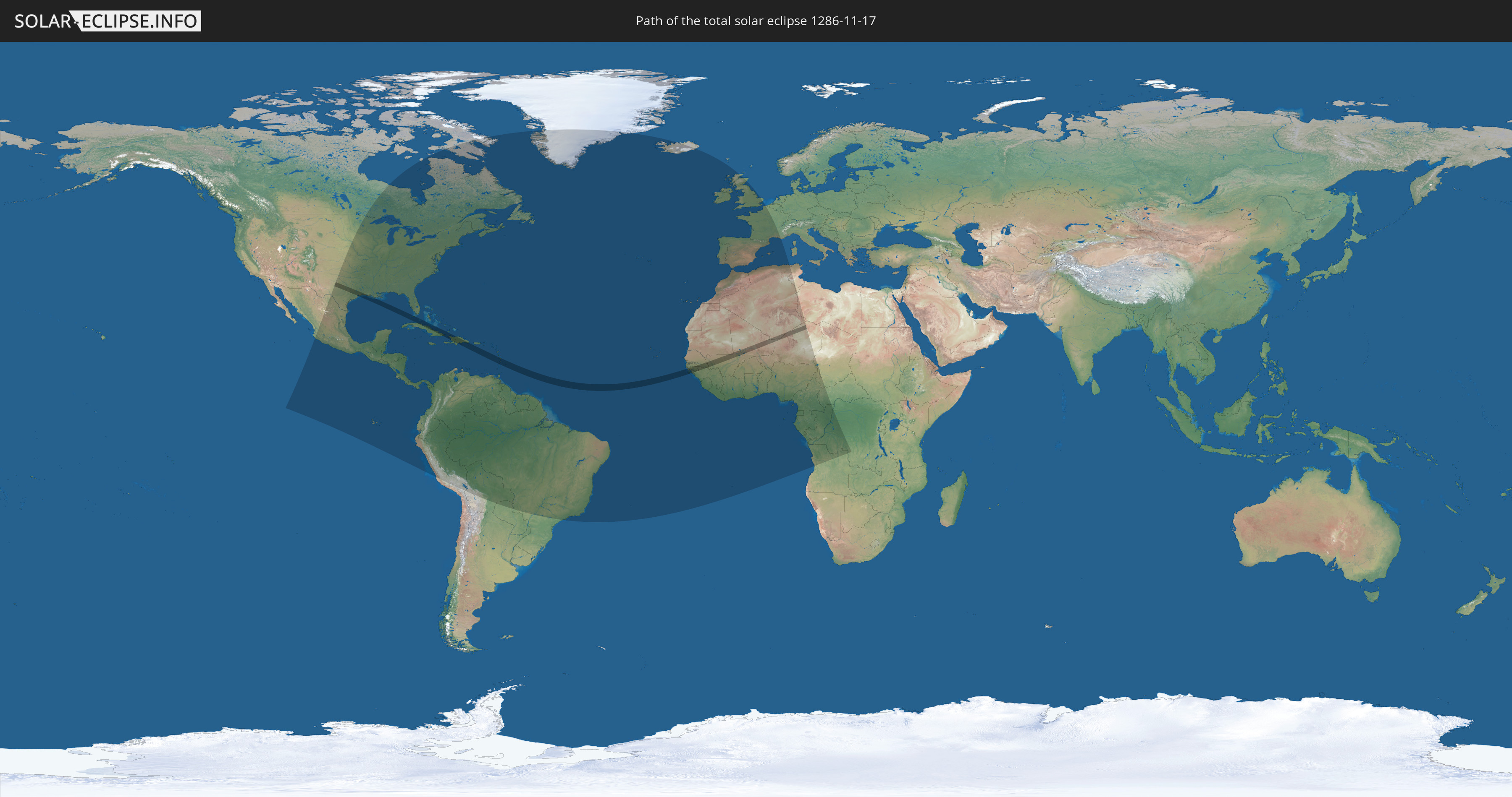
Die Sonnenfinsternis am 11/17/1286 kann man in 90 Ländern als partielle Sonnenfinsternis beobachten.
Der Finsternispfad verläuft durch 16 Länder. Nur in diesen Ländern ist sie als total Sonnenfinsternis zu sehen.
In den folgenden Ländern ist die Sonnenfinsternis total zu sehen
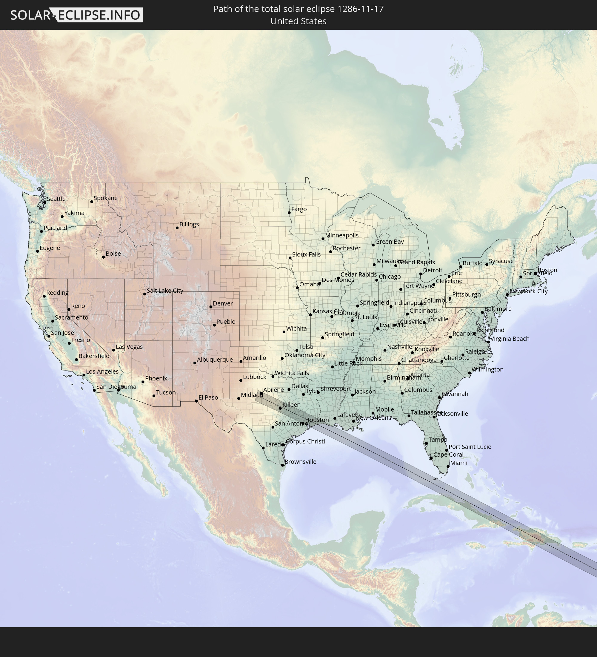 United States
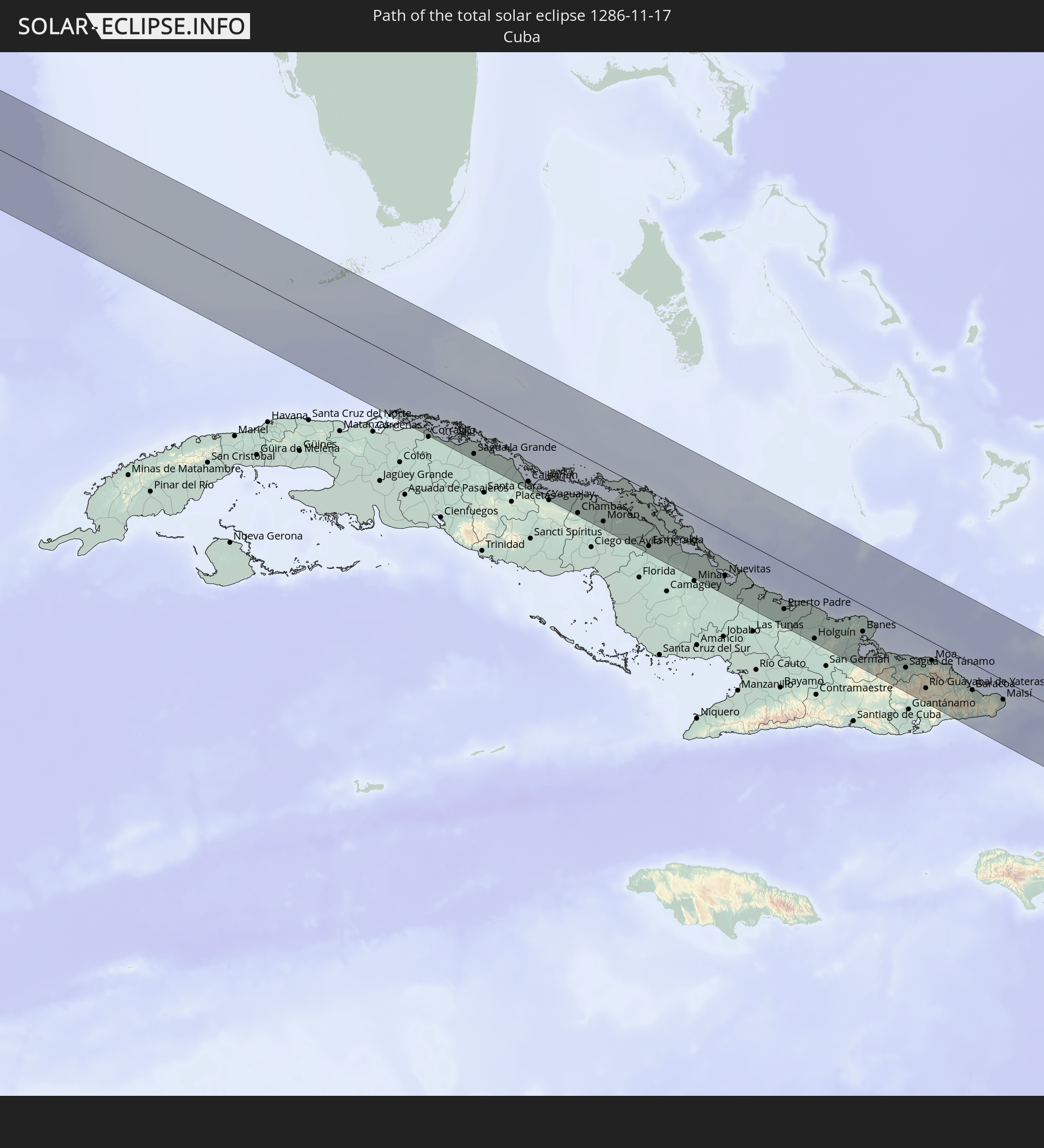 Cuba
Cuba
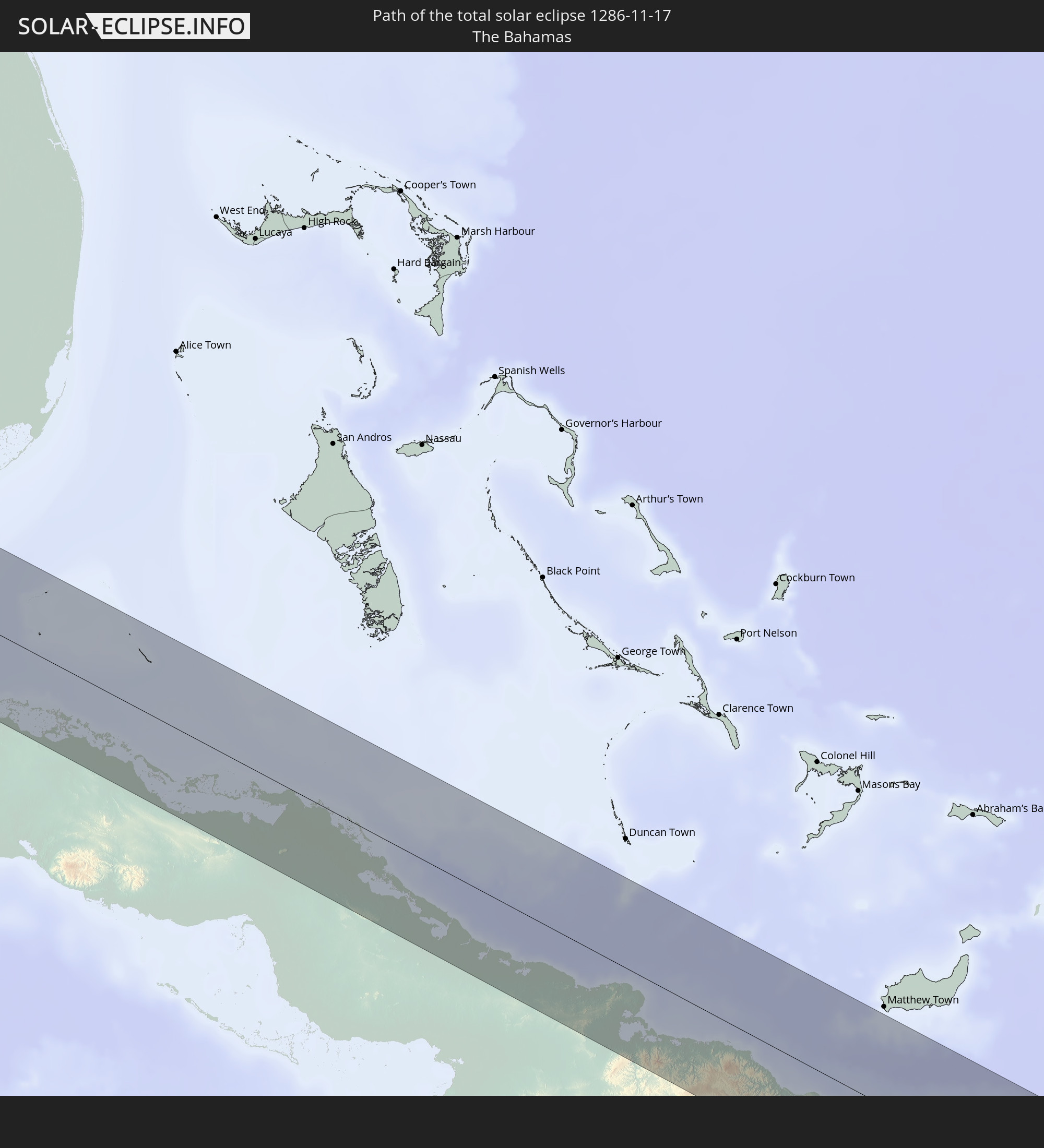 The Bahamas
 Haiti
Haiti
 Dominican Republic
 Saint Vincent and the Grenadines
 Martinique
 Saint Lucia
 Barbados
 Senegal
 Mauritania
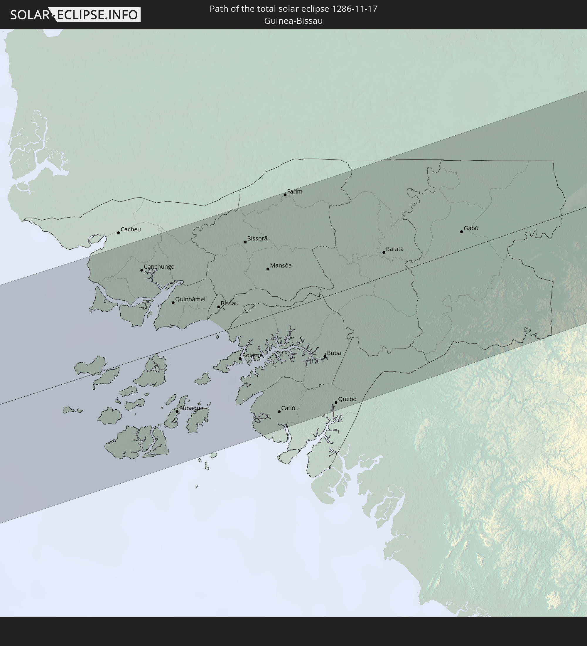 Guinea-Bissau
 Guinea
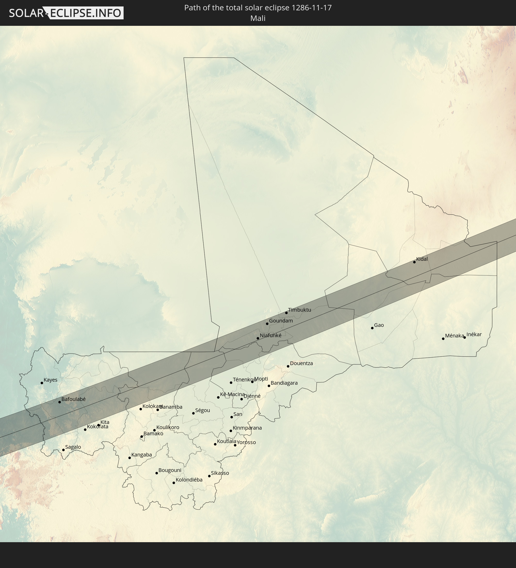 Mali
Mali
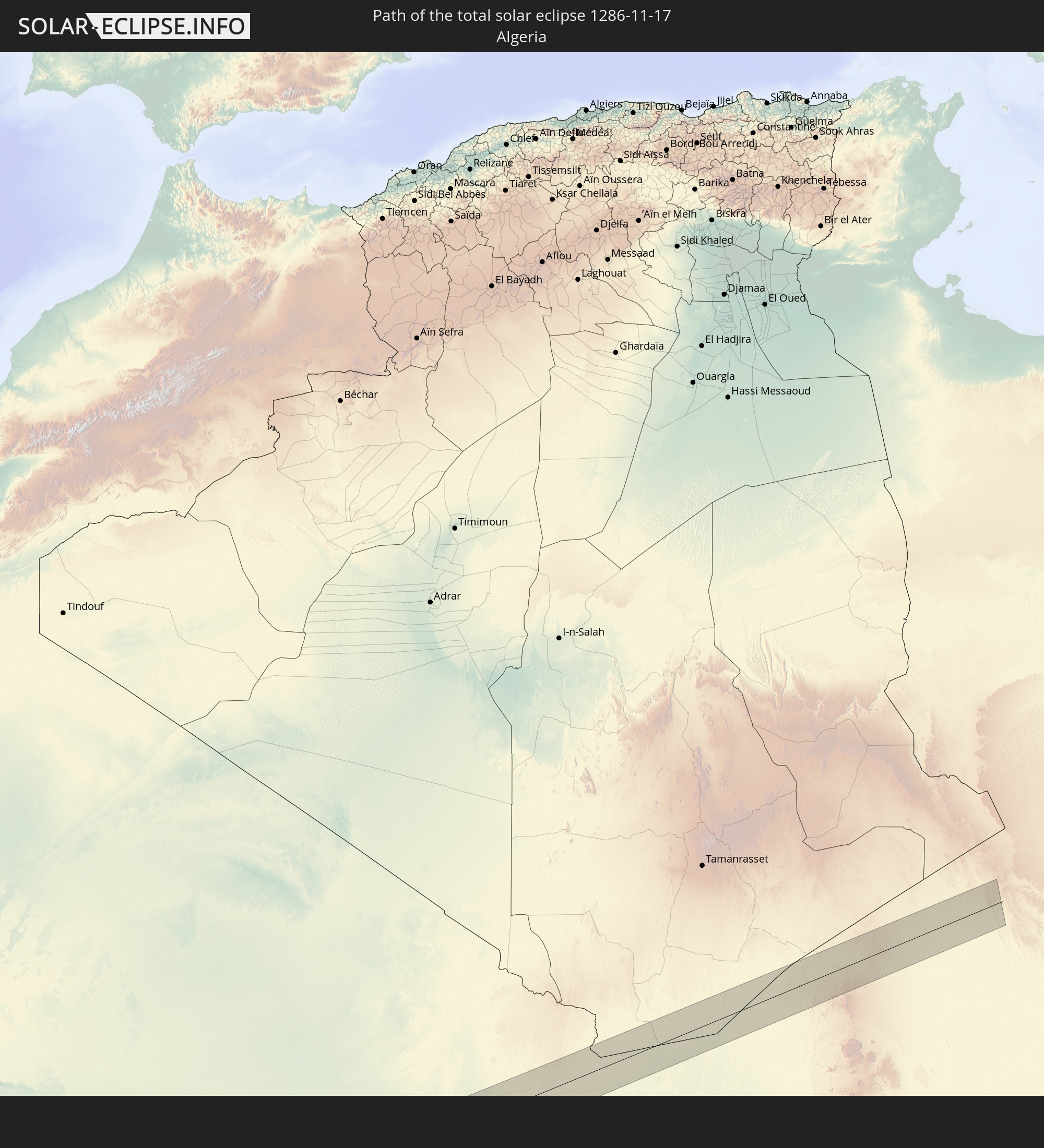 Algeria
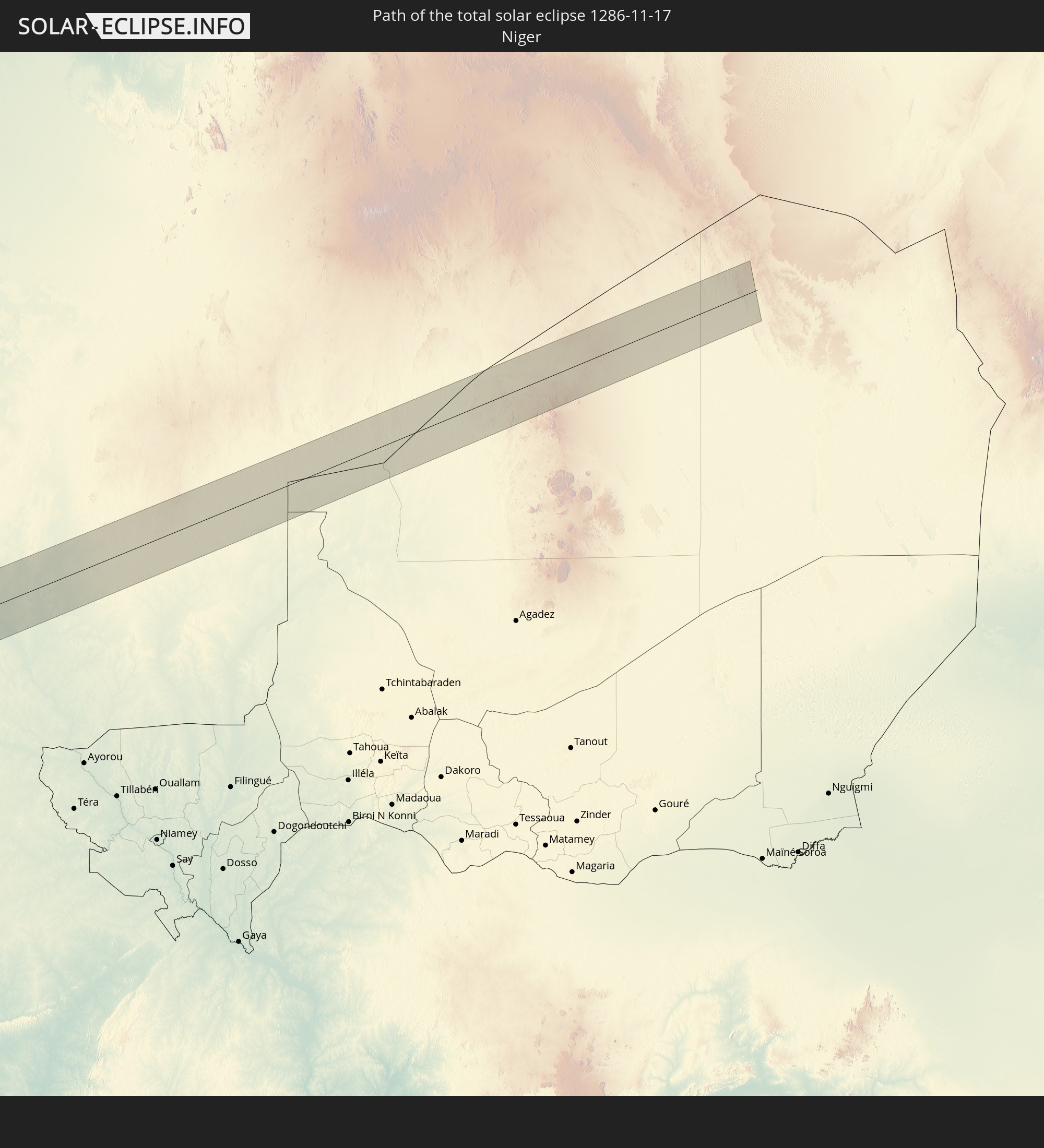 Niger
Niger
In den folgenden Ländern ist die Sonnenfinsternis partiell zu sehen
 United States
 United States Minor Outlying Islands
 Canada
 Mexico
 Greenland
 Guatemala
 Ecuador
 El Salvador
 Honduras
 Belize
 Nicaragua
 Costa Rica
 Cuba
Cuba
 Panama
 Colombia
 Cayman Islands
 Peru
Peru
 The Bahamas
 Jamaica
 Haiti
Haiti
 Brazil
 Venezuela
 Turks and Caicos Islands
 Dominican Republic
 Aruba
Aruba
 Bolivia
 Puerto Rico
 United States Virgin Islands
 Bermuda
 British Virgin Islands
 Anguilla
 Collectivity of Saint Martin
 Saint Barthélemy
 Saint Kitts and Nevis
 Paraguay
 Antigua and Barbuda
 Montserrat
 Trinidad and Tobago
 Guadeloupe
 Grenada
 Dominica
 Saint Vincent and the Grenadines
 Guyana
 Martinique
 Saint Lucia
 Barbados
 Suriname
 Saint Pierre and Miquelon
 French Guiana
 Portugal
 Cabo Verde
 Iceland
 Spain
Spain
 Senegal
 Mauritania
 The Gambia
 Guinea-Bissau
 Guinea
 Saint Helena, Ascension and Tristan da Cunha
 Sierra Leone
 Morocco
 Mali
Mali
 Liberia
 Republic of Ireland
 Algeria
 United Kingdom
 Ivory Coast
 Burkina Faso
 Gibraltar
 France
 Isle of Man
 Ghana
Ghana
 Guernsey
 Jersey
 Togo
Togo
 Niger
Niger
 Benin
Benin
 Andorra
 Nigeria
 Equatorial Guinea
 São Tomé and Príncipe
 Tunisia
 Cameroon
 Gabon
Gabon
 Libya
Libya
 Republic of the Congo
 Angola
 Democratic Republic of the Congo
 Chad
Chad
 Central African Republic
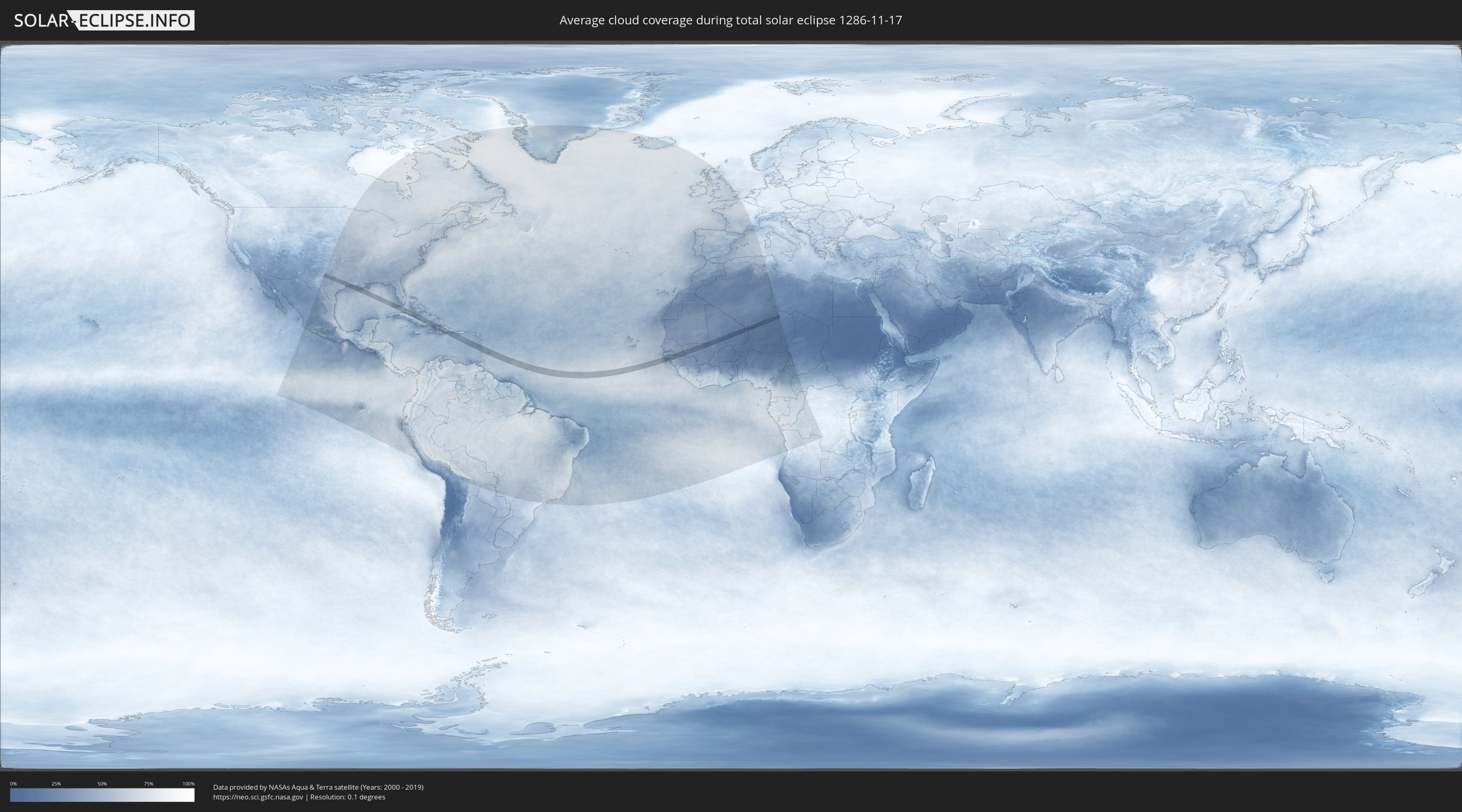
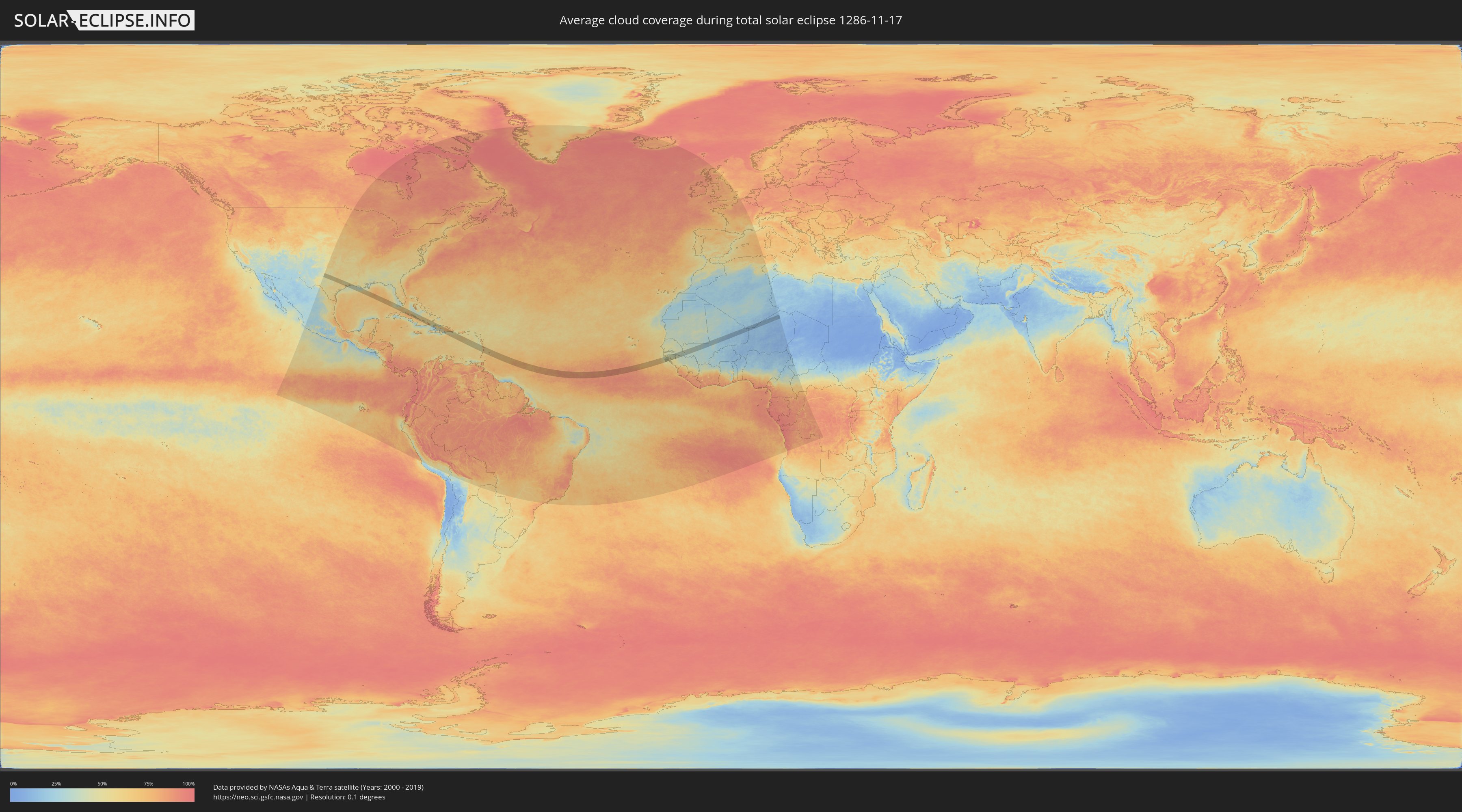
How will be the weather during the total solar eclipse on 11/17/1286?
Where is the best place to see the total solar eclipse of 11/17/1286?
The following maps show the average cloud coverage for the day of the total solar eclipse.
With the help of these maps, it is possible to find the place along the eclipse path, which has the best
chance of a cloudless sky.
Nevertheless, you should consider local circumstances and inform about the weather of your chosen
observation site.
The data is provided by NASAs satellites
AQUA and TERRA.
The cloud maps are averaged over a period of 19 years (2000 - 2019).
Detailed country maps
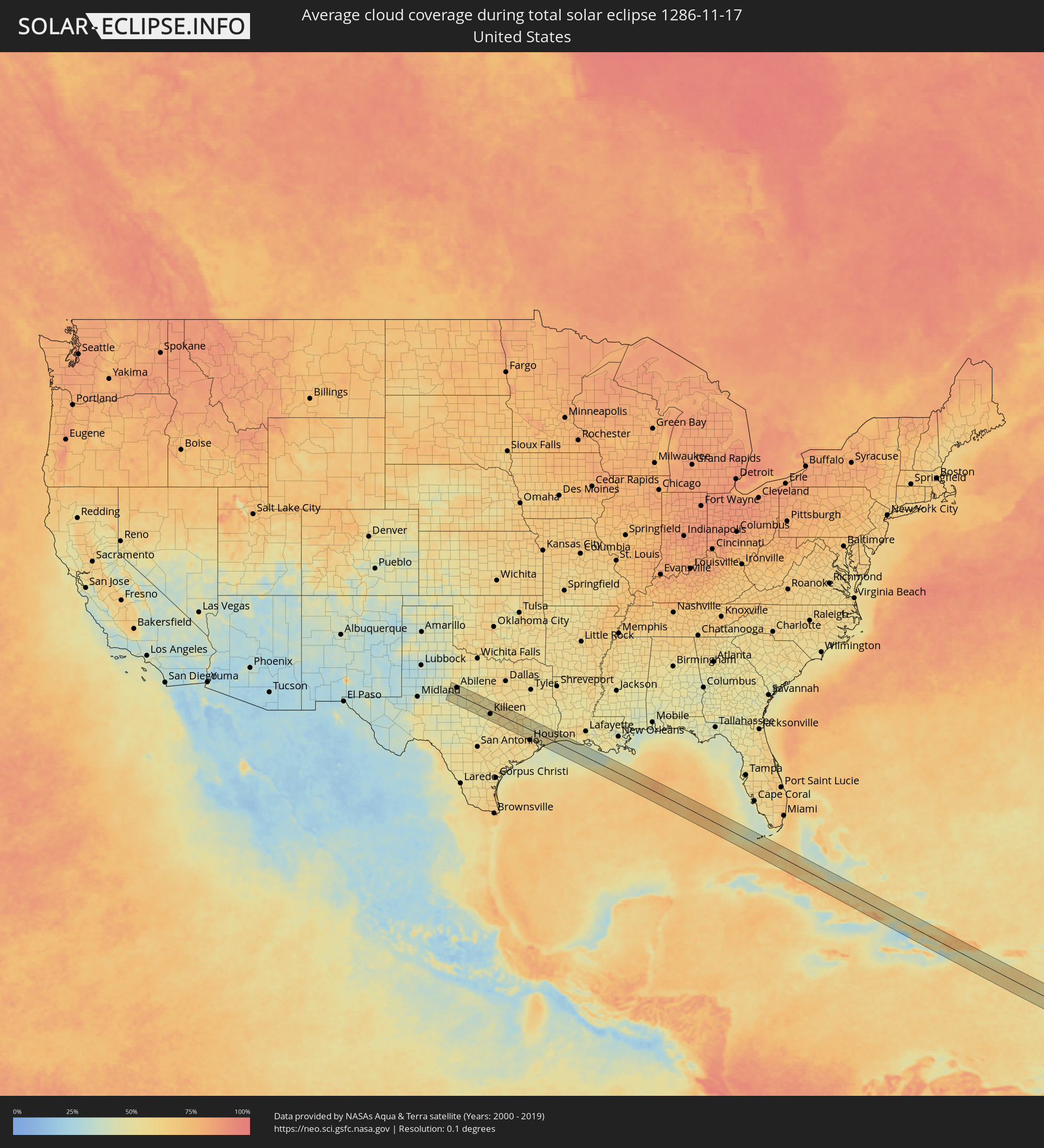 United States
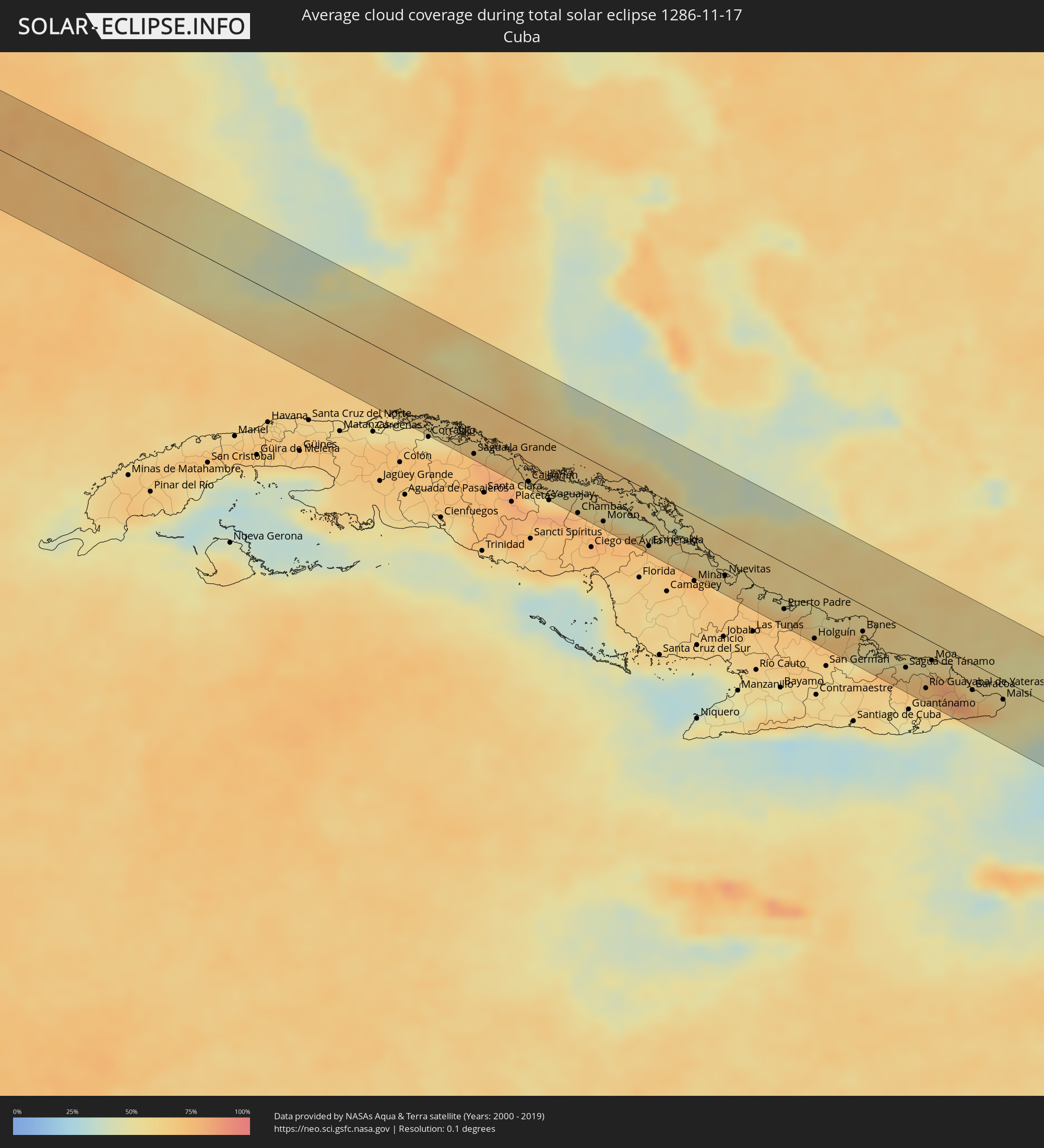 Cuba
Cuba
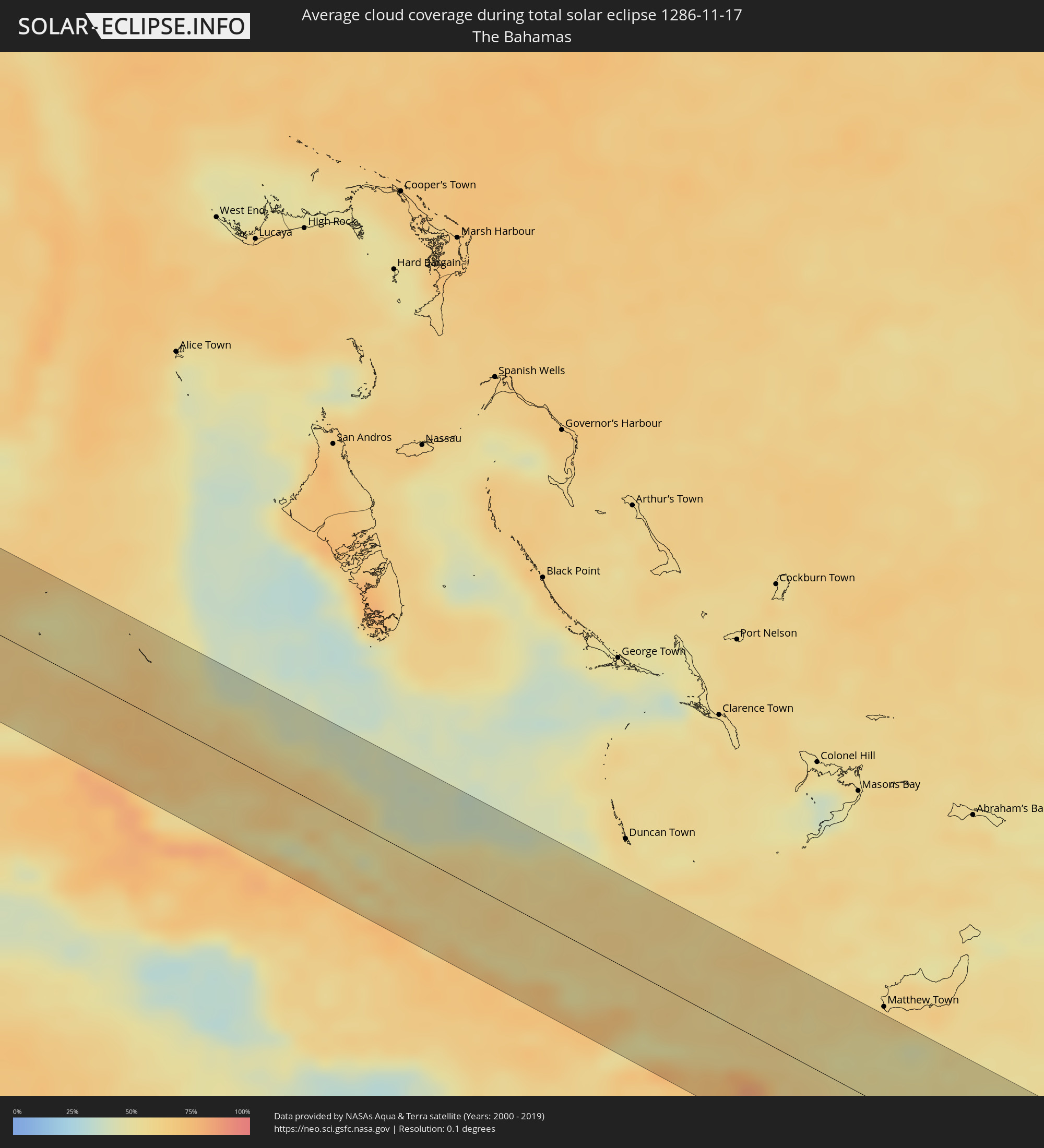 The Bahamas
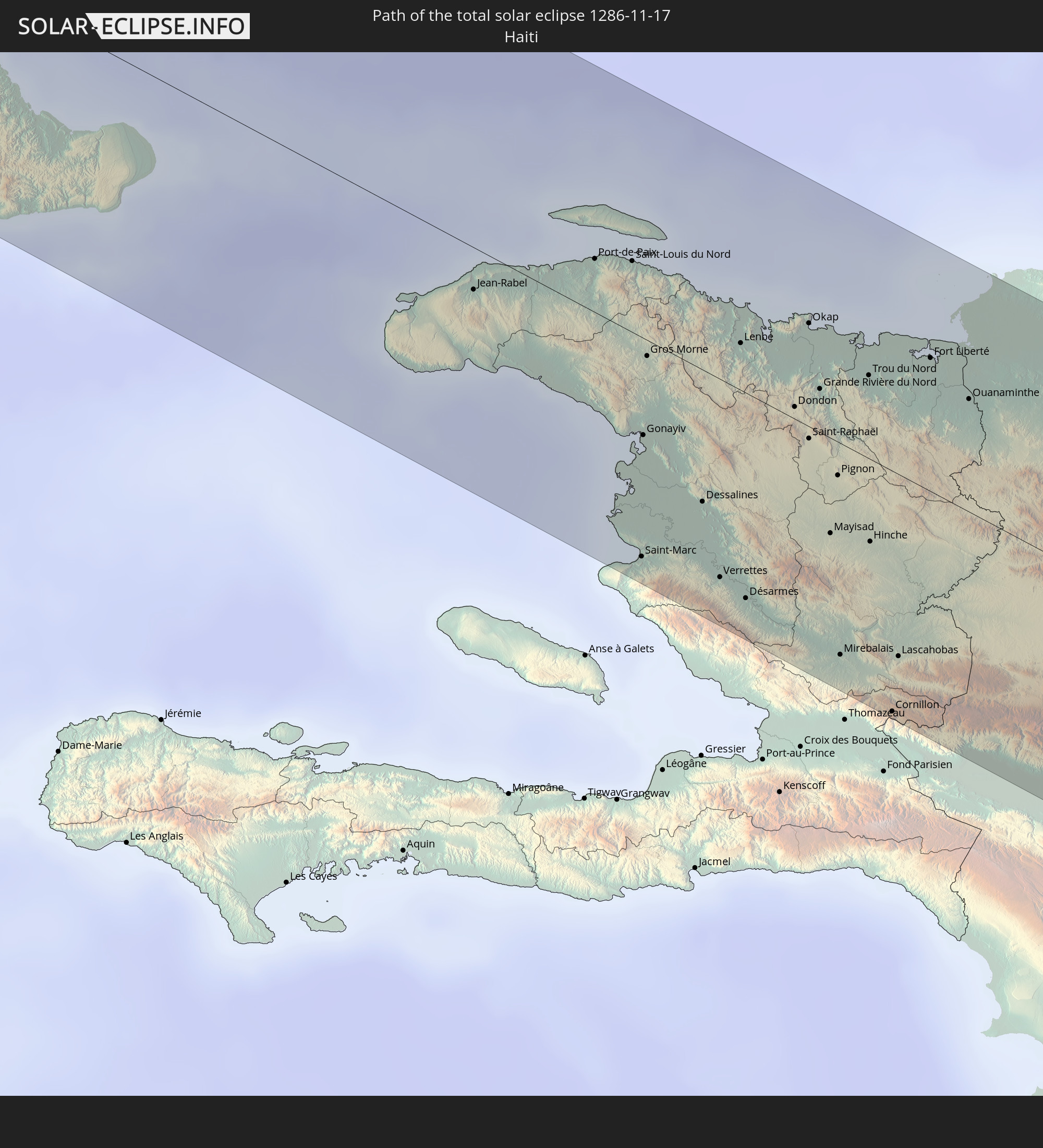
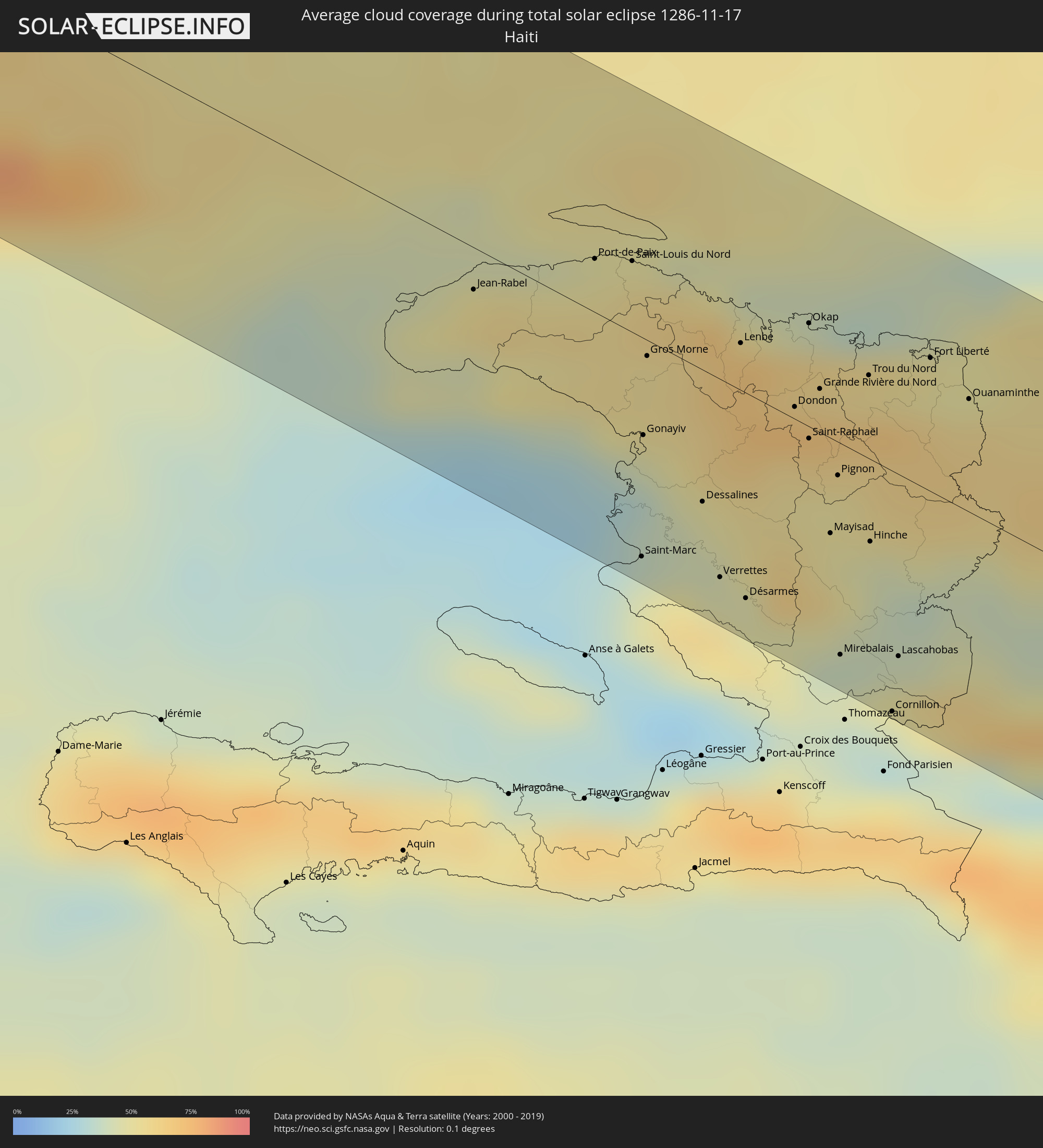 Haiti
Haiti
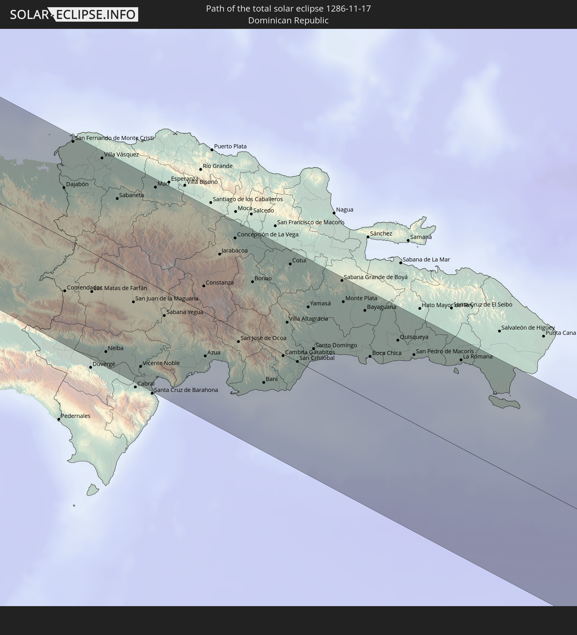
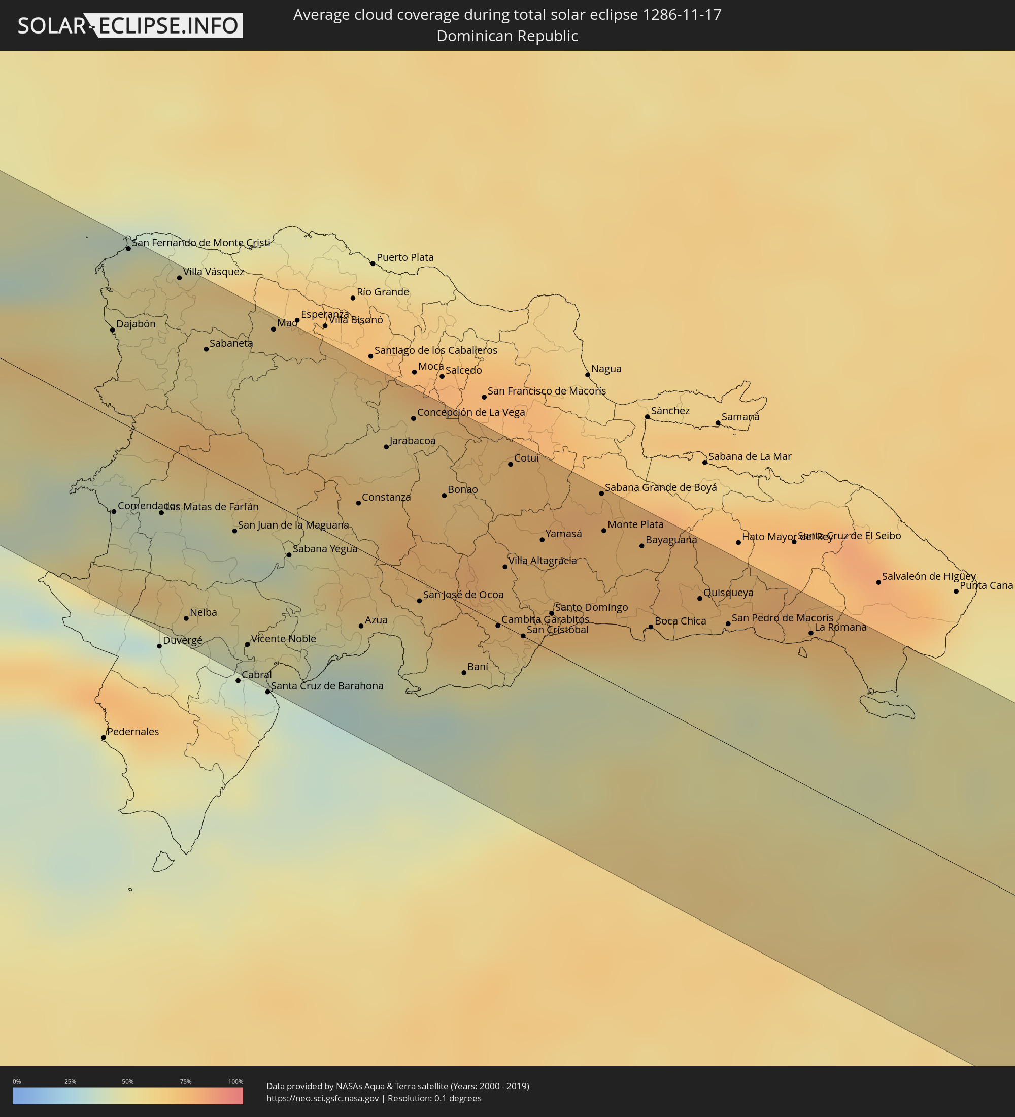 Dominican Republic
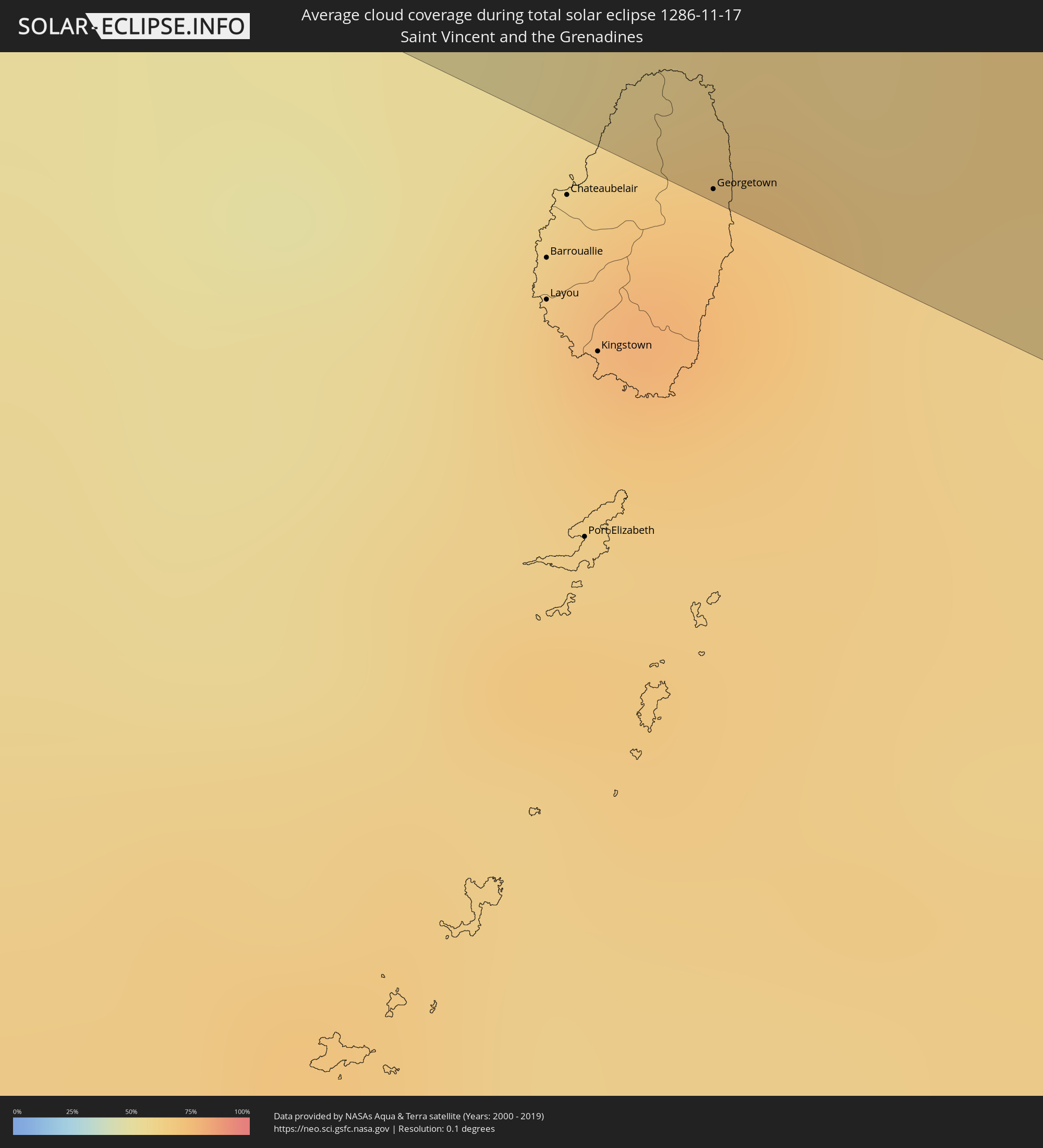 Saint Vincent and the Grenadines
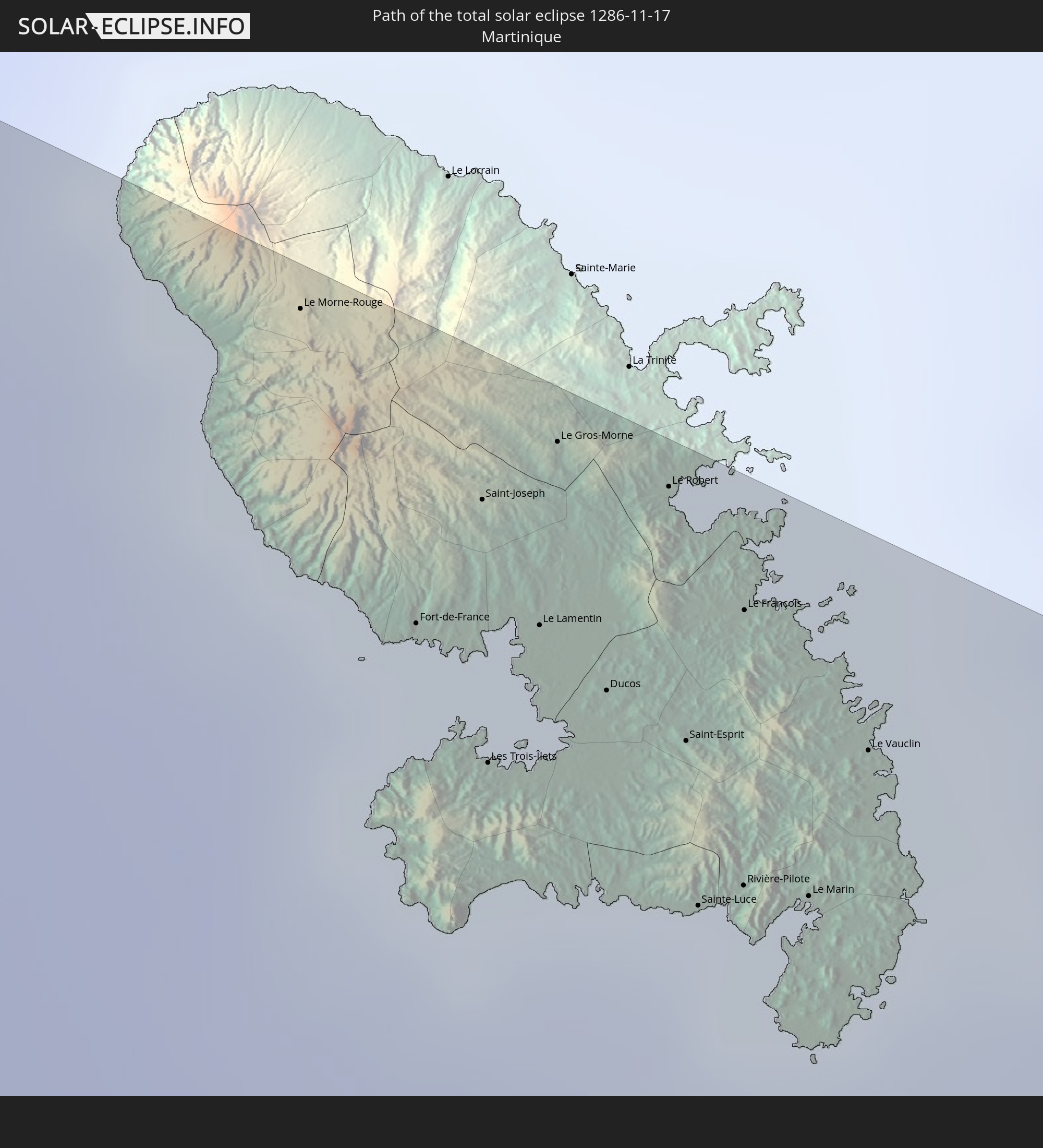
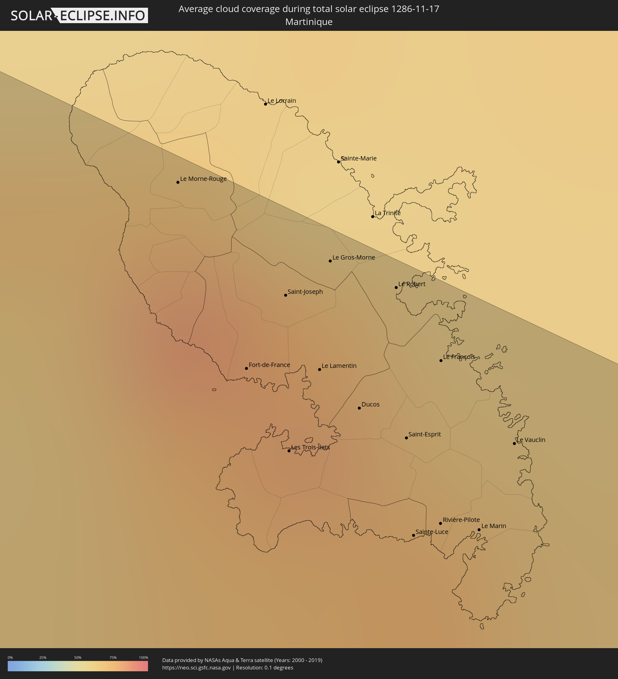 Martinique
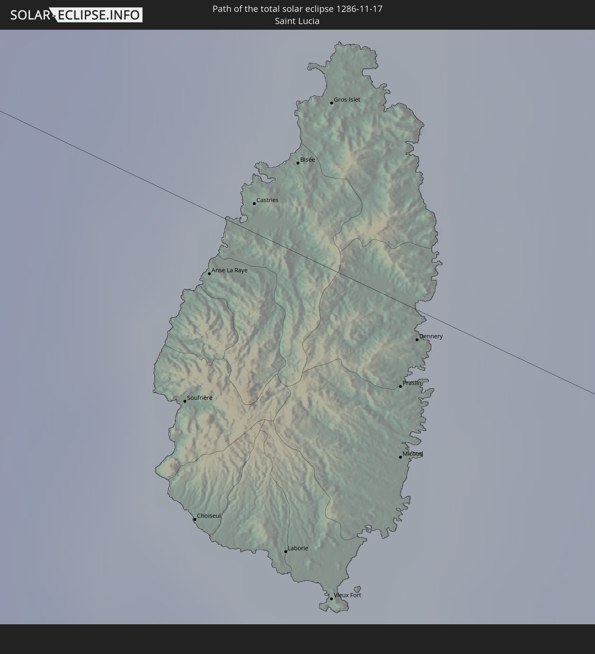
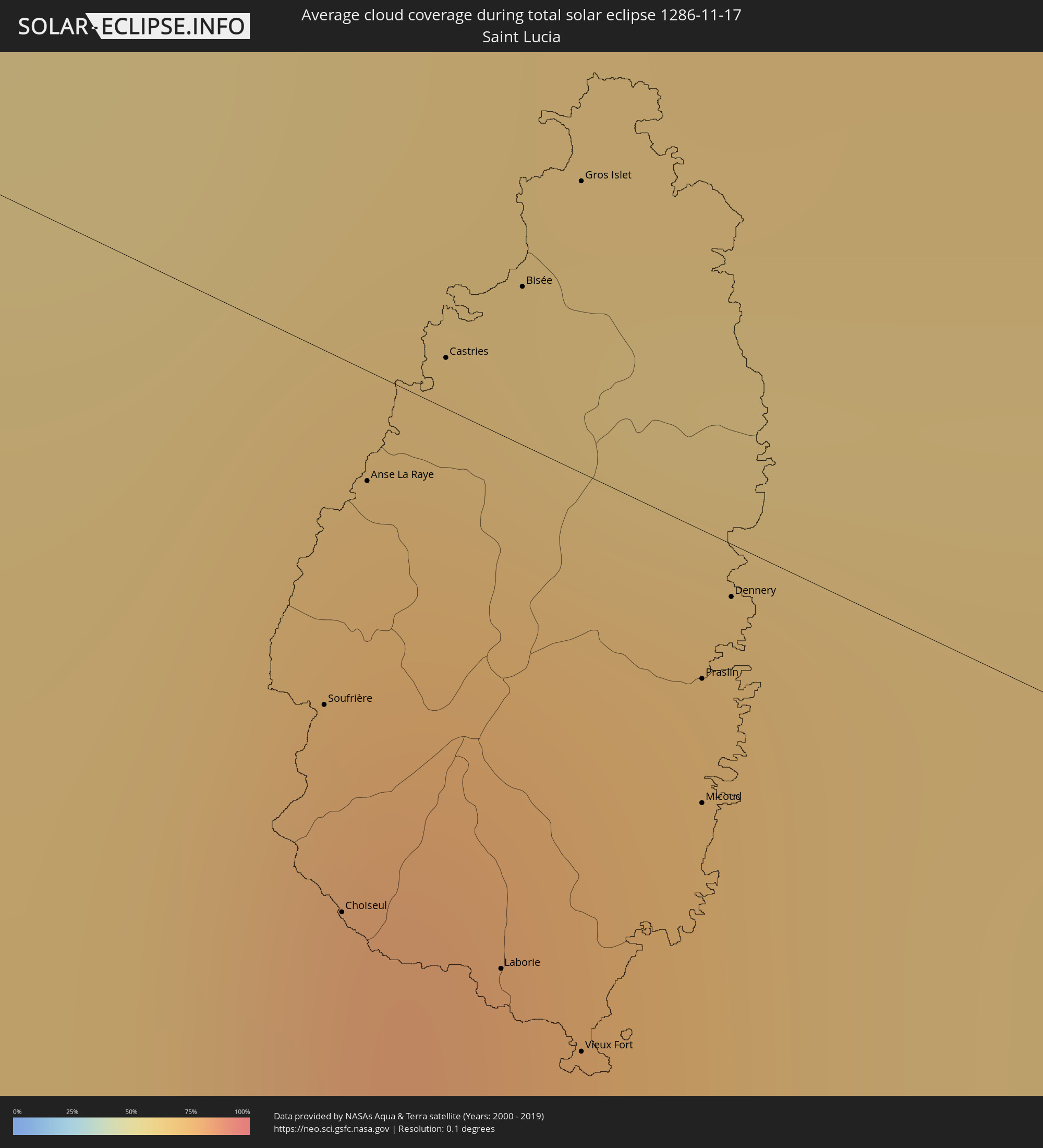 Saint Lucia
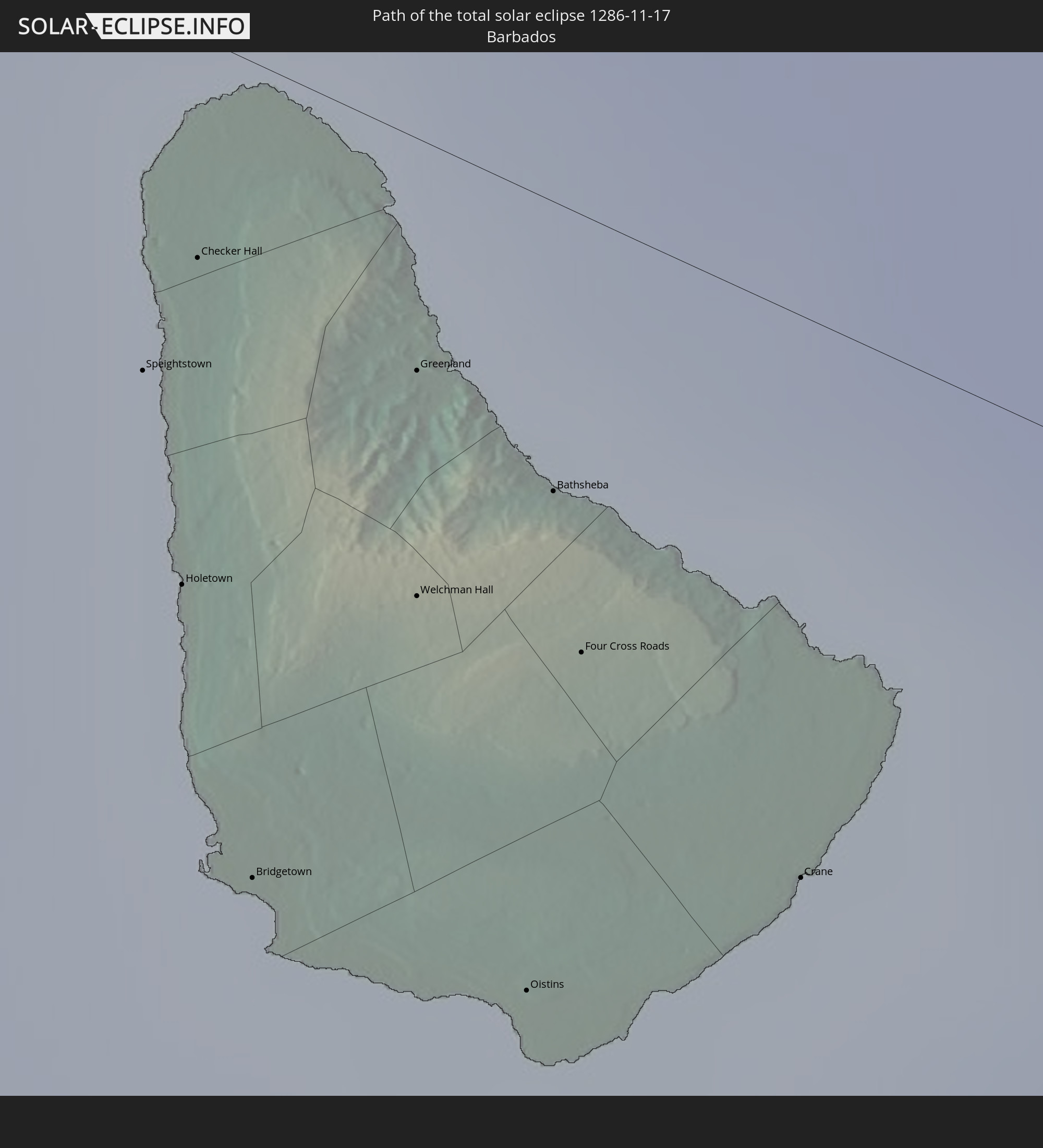
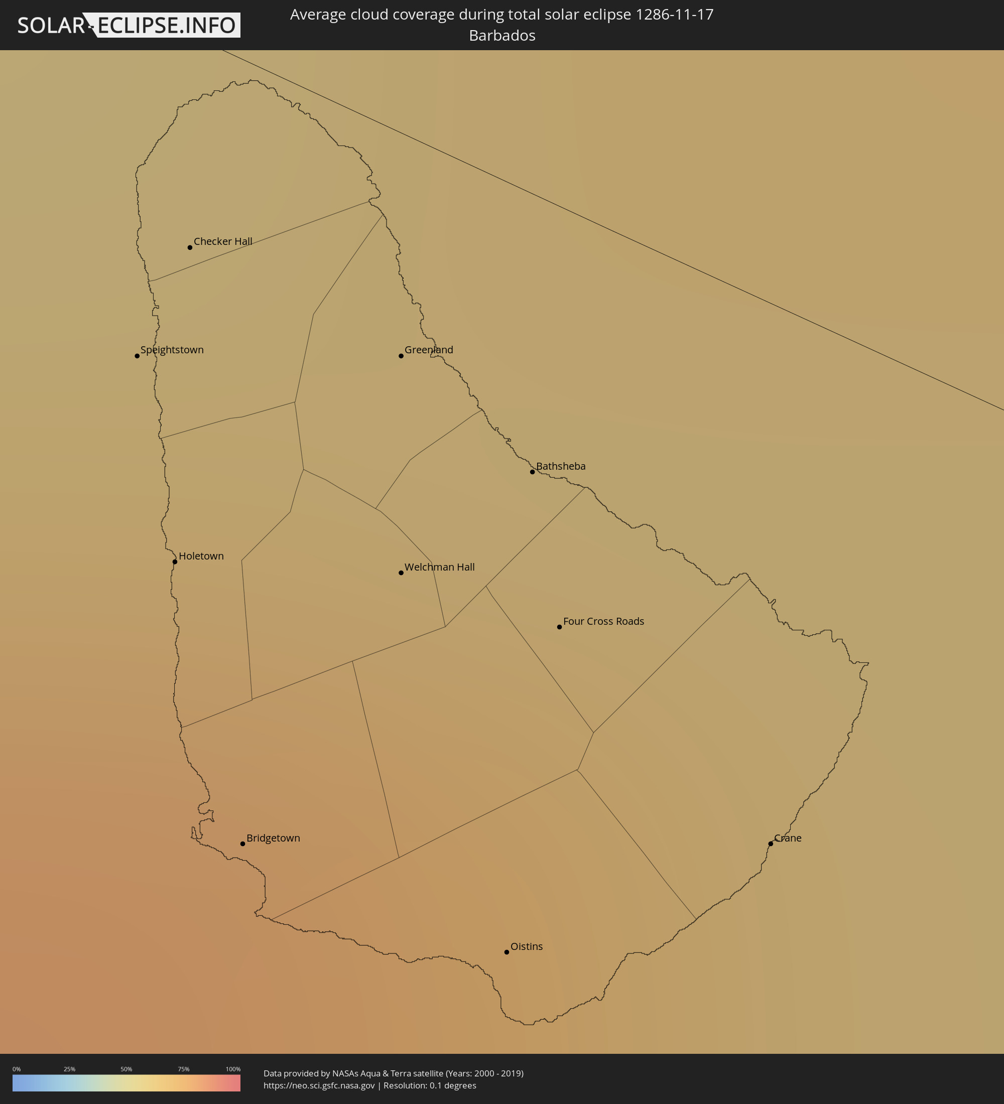 Barbados
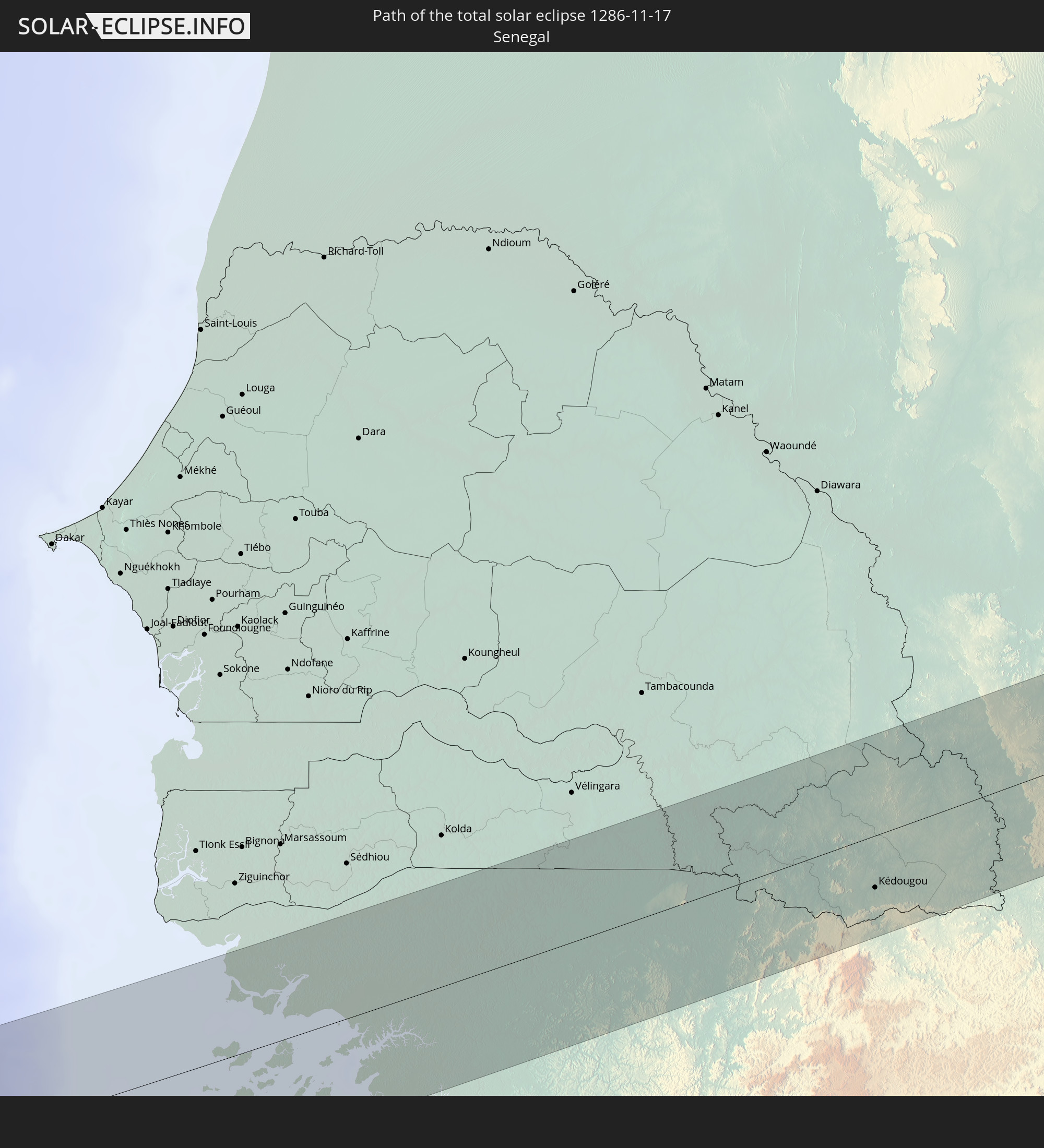
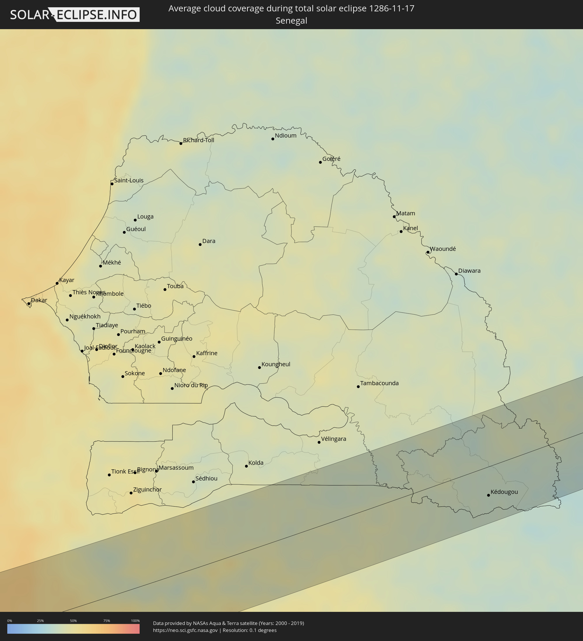 Senegal
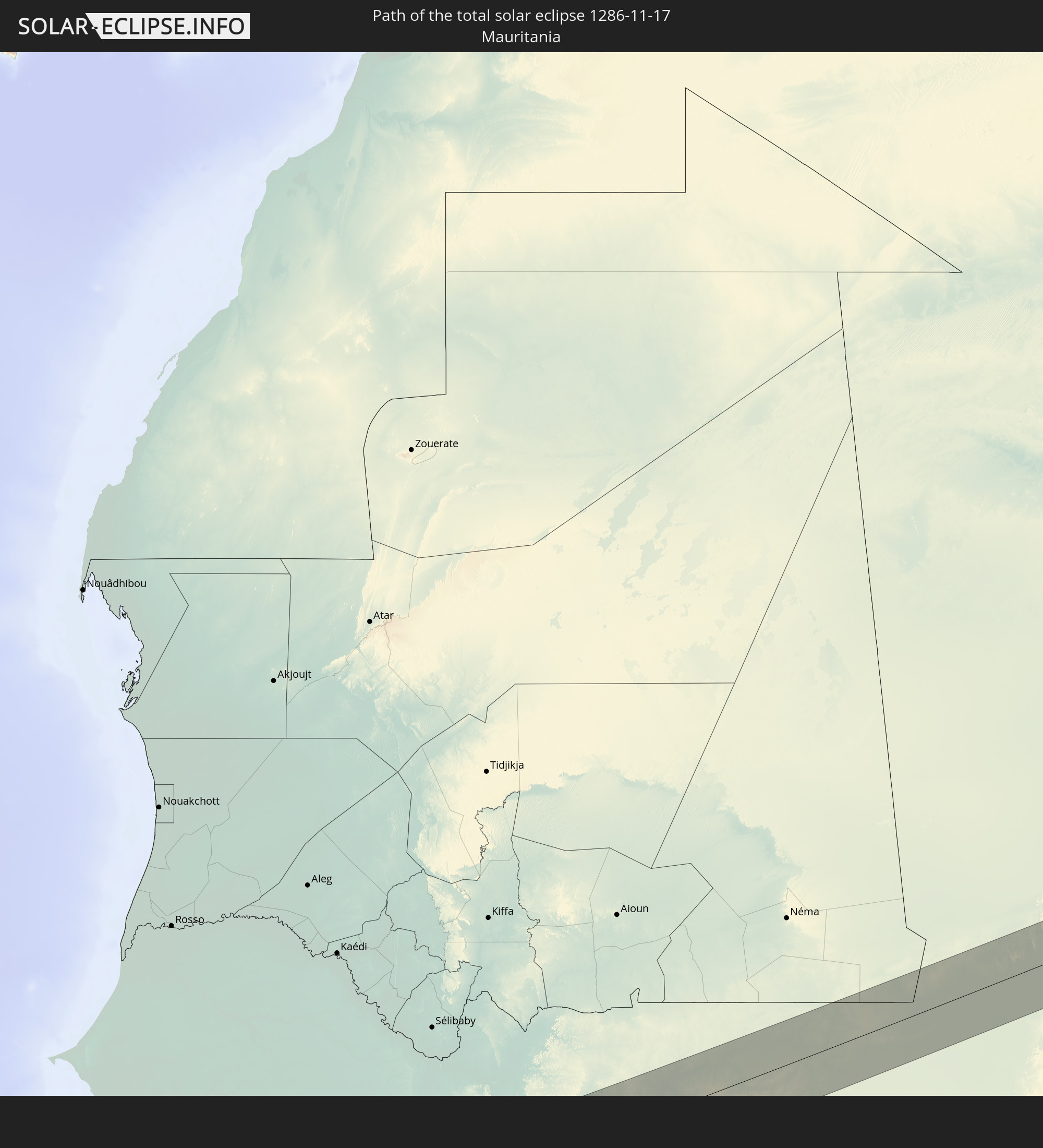
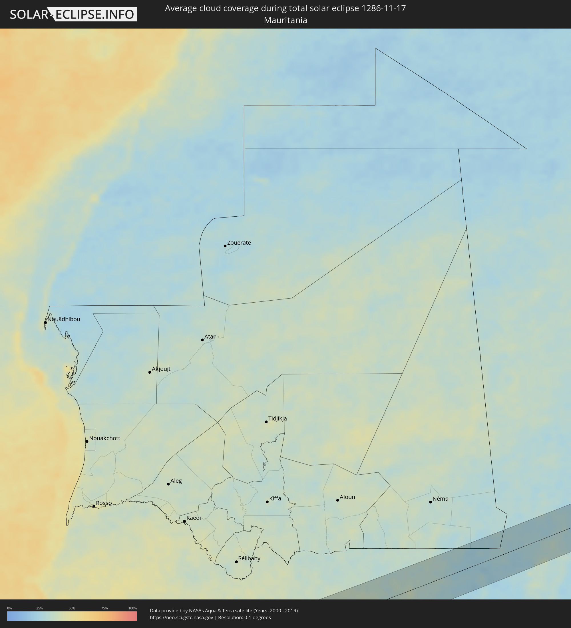 Mauritania
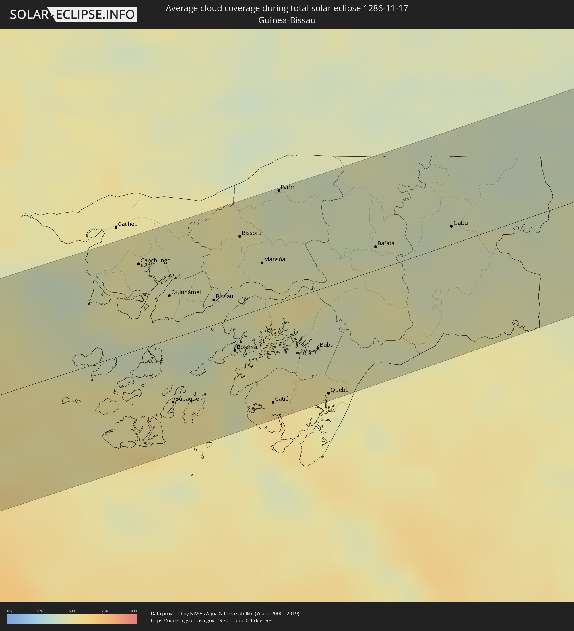 Guinea-Bissau
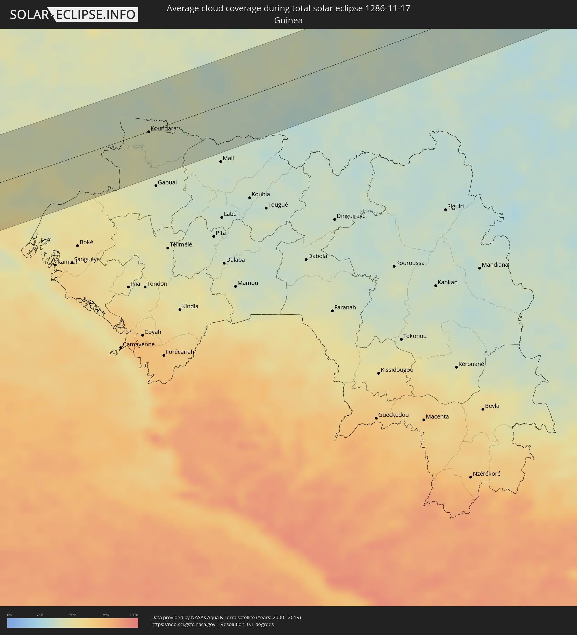 Guinea
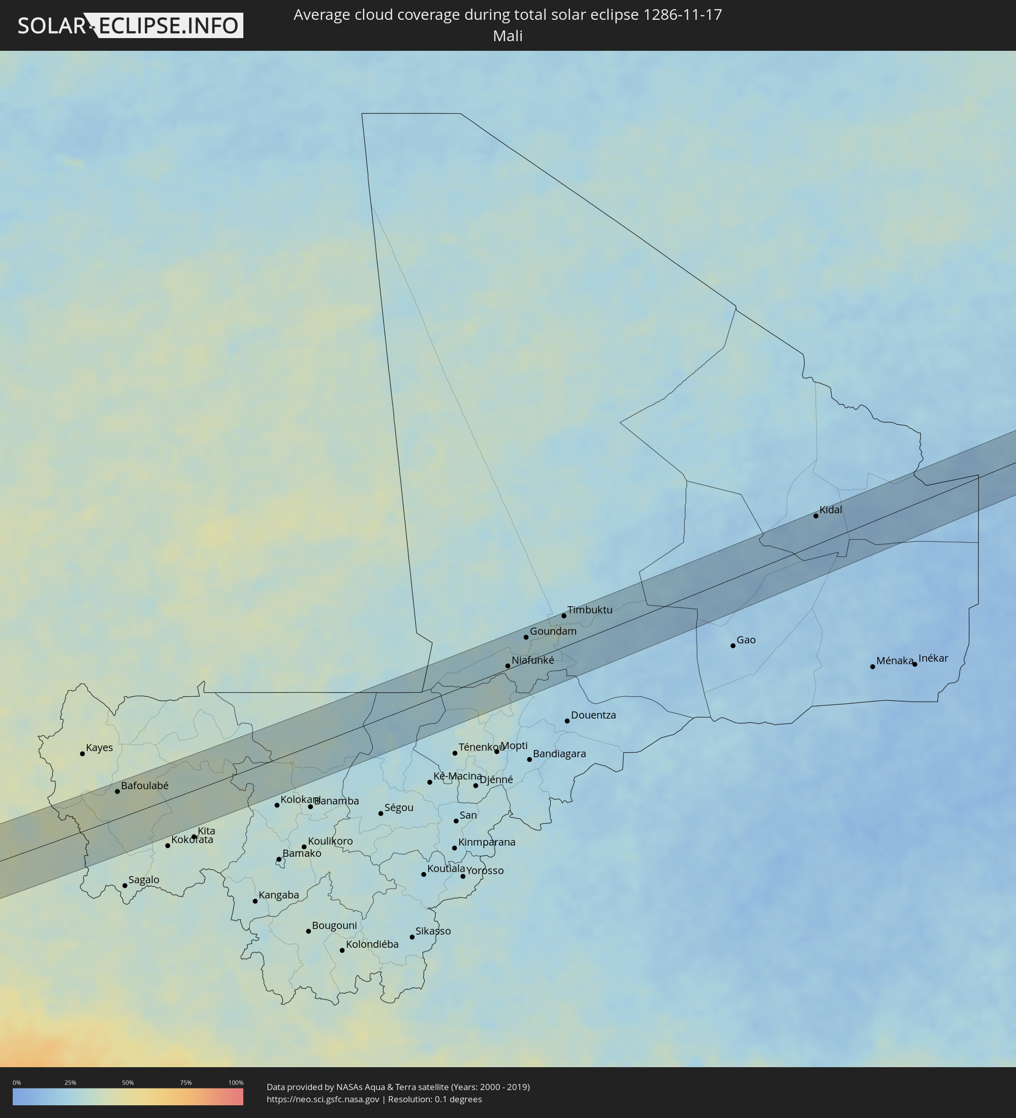 Mali
Mali
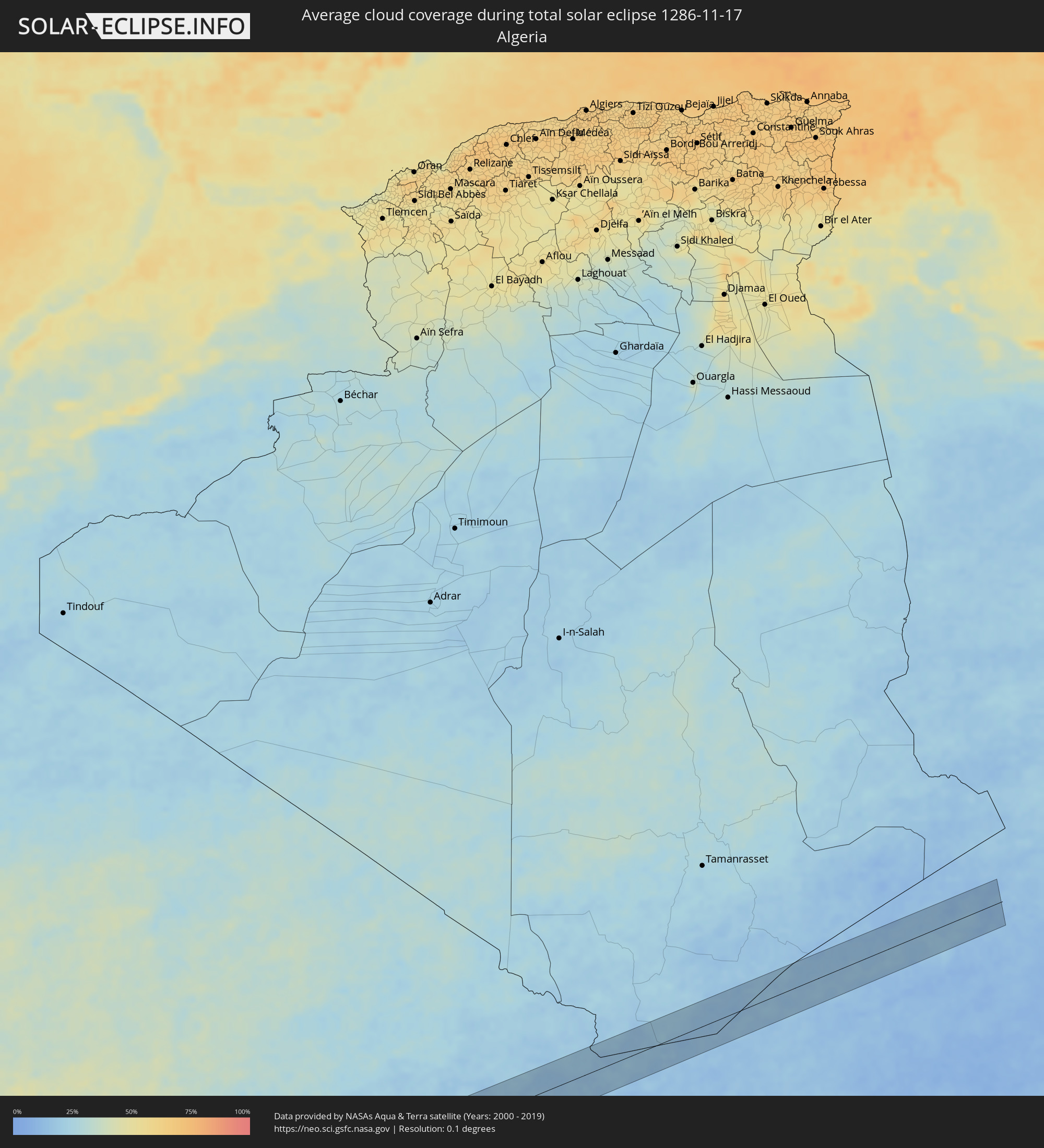 Algeria
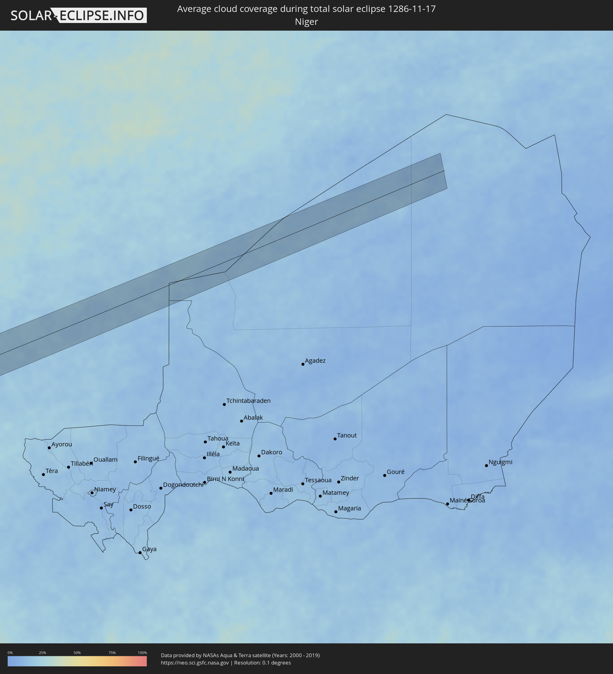 Niger
Niger
Cities inside the path of the eclipse
The following table shows all locations with a population of more than 5,000 inside the eclipse path. Cities which have more than 100,000 inhabitants are marked bold. A click at the locations opens a detailed map.
| City | Type | Eclipse duration | Local time of max. eclipse | Distance to central line | Ø Cloud coverage |
|
Abilene, Texas
|
total | - | 07:24:59 UTC-06:00 | 37 km | 52% |
|
Brownwood, Texas
|
total | - | 07:24:43 UTC-06:00 | 10 km | 52% |
|
Copperas Cove, Texas
|
total | - | 07:24:42 UTC-06:00 | 24 km | 53% |
|
Killeen, Texas
|
total | - | 07:24:45 UTC-06:00 | 18 km | 56% |
|
Temple, Texas
|
total | - | 07:24:52 UTC-06:00 | 4 km | 59% |
|
Waco, Texas
|
total | - | 07:25:12 UTC-06:00 | 49 km | 59% |
|
College Station, Texas
|
total | - | 07:24:57 UTC-06:00 | 10 km | 57% |
|
Cypress, Texas
|
total | - | 07:24:50 UTC-06:00 | 49 km | 65% |
|
Huntsville, Texas
|
total | - | 07:25:18 UTC-06:00 | 32 km | 52% |
|
The Woodlands, Texas
|
total | - | 07:25:01 UTC-06:00 | 22 km | 56% |
|
Conroe, Texas
|
total | - | 07:25:07 UTC-06:00 | 5 km | 51% |
|
Atascocita, Texas
|
total | - | 07:25:03 UTC-06:00 | 24 km | 57% |
|
Cloverleaf, Texas
|
total | - | 07:24:56 UTC-06:00 | 46 km | 64% |
|
Baytown, Texas
|
total | - | 07:25:00 UTC-06:00 | 42 km | 57% |
|
Beaumont, Texas
|
total | - | 07:25:33 UTC-06:00 | 30 km | 59% |
|
Port Arthur, Texas
|
total | - | 07:25:31 UTC-06:00 | 16 km | 52% |
|
Key West, Florida
|
total | - | 08:31:37 UTC-05:00 | 35 km | 46% |
|
Sagua la Grande, Villa Clara
|
total | - | 08:03:18 UTC-05:29 | 56 km | 74% |
|
Remedios, Villa Clara
|
total | - | 08:03:48 UTC-05:29 | 62 km | 73% |
|
Caibarién, Villa Clara
|
total | - | 08:03:53 UTC-05:29 | 55 km | 73% |
|
Chambas, Ciego de Ávila
|
total | - | 08:04:26 UTC-05:29 | 61 km | 77% |
|
Morón, Ciego de Ávila
|
total | - | 08:04:44 UTC-05:29 | 56 km | 77% |
|
Esmeralda, Camagüey
|
total | - | 08:05:16 UTC-05:29 | 56 km | 73% |
|
Nuevitas, Camagüey
|
total | - | 08:06:13 UTC-05:29 | 45 km | 60% |
|
Puerto Padre, Las Tunas
|
total | - | 08:06:59 UTC-05:29 | 47 km | 66% |
|
Jesús Menéndez, Las Tunas
|
total | - | 08:07:07 UTC-05:29 | 44 km | 67% |
|
Holguín, Holguín
|
total | - | 08:07:22 UTC-05:29 | 61 km | 68% |
|
Gibara, Holguín
|
total | - | 08:07:33 UTC-05:29 | 32 km | 61% |
|
Banes, Holguín
|
total | - | 08:08:03 UTC-05:29 | 27 km | 64% |
|
Sagua de Tánamo, Holguín
|
total | - | 08:08:39 UTC-05:29 | 41 km | 67% |
|
Río Guayabal de Yateras, Guantánamo
|
total | - | 08:08:55 UTC-05:29 | 51 km | 68% |
|
Moa, Holguín
|
total | - | 08:09:02 UTC-05:29 | 19 km | 57% |
|
Baracoa, Guantánamo
|
total | - | 08:09:37 UTC-05:29 | 27 km | 81% |
|
Maisí, Guantánamo
|
total | - | 08:10:05 UTC-05:29 | 20 km | 67% |
|
Port-de-Paix, Nord-Ouest
|
total | - | 08:52:31 UTC-04:49 | 15 km | 53% |
|
Saint-Louis du Nord, Nord-Ouest
|
total | - | 08:52:41 UTC-04:49 | 19 km | 56% |
|
Saint-Marc, Artibonite
|
total | - | 08:52:43 UTC-04:49 | 60 km | 44% |
|
Gonayiv, Artibonite
|
total | - | 08:52:43 UTC-04:49 | 27 km | 34% |
|
Dessalines, Artibonite
|
total | - | 08:52:59 UTC-04:49 | 36 km | 47% |
|
Verrettes, Artibonite
|
total | - | 08:53:04 UTC-04:49 | 54 km | 45% |
|
Lenbe, Nord
|
total | - | 08:53:09 UTC-04:49 | 13 km | 67% |
|
Désarmes, Artibonite
|
total | - | 08:53:11 UTC-04:49 | 56 km | 47% |
|
Okap, Nord
|
total | - | 08:53:27 UTC-04:49 | 28 km | 41% |
|
Saint-Raphaël, Nord
|
total | - | 08:53:27 UTC-04:49 | 3 km | 51% |
|
Grande Rivière du Nord, Nord
|
total | - | 08:53:30 UTC-04:49 | 12 km | 68% |
|
Mirebalais, Centre
|
total | - | 08:53:36 UTC-04:49 | 58 km | 43% |
|
Trou du Nord, Nord-Est
|
total | - | 08:53:43 UTC-04:49 | 23 km | 66% |
|
Hinche, Centre
|
total | - | 08:53:43 UTC-04:49 | 23 km | 44% |
|
Lascahobas, Centre
|
total | - | 08:53:51 UTC-04:49 | 50 km | 54% |
|
Fort Liberté, Nord-Est
|
total | - | 08:53:59 UTC-04:49 | 37 km | 49% |
|
Ouanaminthe, Nord-Est
|
total | - | 08:54:09 UTC-04:49 | 31 km | 59% |
|
Las Matas de Farfán, San Juan
|
total | - | 09:03:29 UTC-04:40 | 25 km | 41% |
|
San Juan de la Maguana, San Juan
|
total | - | 09:03:56 UTC-04:40 | 18 km | 39% |
|
Mao, Valverde
|
total | - | 09:04:09 UTC-04:40 | 63 km | 53% |
|
Constanza, La Vega
|
total | - | 09:04:41 UTC-04:40 | 17 km | 63% |
|
Azua, Azua
|
total | - | 09:04:43 UTC-04:40 | 28 km | 47% |
|
Jarabacoa, La Vega
|
total | - | 09:04:51 UTC-04:40 | 42 km | 65% |
|
Concepción de La Vega, La Vega
|
total | - | 09:05:01 UTC-04:40 | 58 km | 63% |
|
San José de Ocoa, San José de Ocoa
|
total | - | 09:05:05 UTC-04:40 | 7 km | 56% |
|
Bonao, Monseñor Nouel
|
total | - | 09:05:13 UTC-04:40 | 36 km | 71% |
|
Baní, Peravia
|
total | - | 09:05:23 UTC-04:40 | 25 km | 48% |
|
Villa Altagracia, San Cristóbal
|
total | - | 09:05:37 UTC-04:40 | 22 km | 72% |
|
Cotuí, Sánchez Ramírez
|
total | - | 09:05:37 UTC-04:40 | 60 km | 74% |
|
Santo Domingo, Nacional
|
total | - | 09:05:55 UTC-04:40 | 14 km | 70% |
|
Bayaguana, Monte Plata
|
total | - | 09:06:29 UTC-04:40 | 56 km | 72% |
|
Boca Chica, Santo Domingo
|
total | - | 09:06:33 UTC-04:40 | 28 km | 67% |
|
San Pedro de Macorís, San Pedro de Macorís
|
total | - | 09:07:03 UTC-04:40 | 44 km | 65% |
|
La Romana, La Romana
|
total | - | 09:07:36 UTC-04:40 | 57 km | 59% |
|
Le Morne-Rouge, Martinique
|
total | - | 09:59:24 UTC-04:04 | 73 km | 83% |
|
Georgetown, Charlotte
|
total | - | 09:58:09 UTC-04:06 | 75 km | 72% |
|
Fort-de-France, Martinique
|
total | - | 09:59:35 UTC-04:04 | 60 km | 71% |
|
Soufrière, Soufrière
|
total | - | 09:58:07 UTC-04:06 | 14 km | 67% |
|
Choiseul, Choiseul Quarter
|
total | - | 09:58:10 UTC-04:06 | 22 km | 71% |
|
Saint-Joseph, Martinique
|
total | - | 09:59:38 UTC-04:04 | 68 km | 79% |
|
Anse La Raye, Anse-la-Raye
|
total | - | 09:58:08 UTC-04:06 | 4 km | 81% |
|
Les Trois-Îlets, Martinique
|
total | - | 09:59:41 UTC-04:04 | 55 km | 65% |
|
Le Lamentin, Martinique
|
total | - | 09:59:43 UTC-04:04 | 63 km | 74% |
|
Castries, Castries Quarter
|
total | - | 09:58:12 UTC-04:06 | 2 km | 75% |
|
Le Gros-Morne, Martinique
|
total | - | 09:59:43 UTC-04:04 | 73 km | 79% |
|
Laborie, Laborie Quarter
|
total | - | 09:58:20 UTC-04:06 | 22 km | 71% |
|
Ducos, Martinique
|
total | - | 09:59:49 UTC-04:04 | 62 km | 74% |
|
Bisée, Castries Quarter
|
total | - | 09:58:15 UTC-04:06 | 6 km | 75% |
|
Gros Islet, Gros-Islet
|
total | - | 09:58:18 UTC-04:06 | 12 km | 67% |
|
Vieux Fort, Vieux-Fort
|
total | - | 09:58:25 UTC-04:06 | 23 km | 63% |
|
Le Robert, Martinique
|
total | - | 09:59:51 UTC-04:04 | 73 km | 68% |
|
Saint-Esprit, Martinique
|
total | - | 09:59:55 UTC-04:04 | 61 km | 75% |
|
Sainte-Luce, Martinique
|
total | - | 09:59:57 UTC-04:04 | 53 km | 72% |
|
Rivière-Pilote, Martinique
|
total | - | 10:00:00 UTC-04:04 | 55 km | 72% |
|
Le François, Martinique
|
total | - | 09:59:58 UTC-04:04 | 69 km | 75% |
|
Micoud, Micoud Quarter
|
total | - | 09:58:30 UTC-04:06 | 11 km | 66% |
|
Praslin, Praslin
|
total | - | 09:58:29 UTC-04:06 | 6 km | 74% |
|
Dennery, Dennery Quarter
|
total | - | 09:58:30 UTC-04:06 | 2 km | 74% |
|
Le Marin, Martinique
|
total | - | 10:00:05 UTC-04:04 | 56 km | 72% |
|
Le Vauclin, Martinique
|
total | - | 10:00:08 UTC-04:04 | 65 km | 65% |
|
Speightstown, Saint Peter
|
total | - | 10:09:11 UTC-03:58 | 11 km | 68% |
|
Holetown, Saint James
|
total | - | 10:09:14 UTC-03:58 | 17 km | 78% |
|
Checker Hall, Saint Lucy
|
total | - | 10:09:13 UTC-03:58 | 7 km | 64% |
|
Bridgetown, Saint Michael
|
total | - | 10:09:19 UTC-03:58 | 24 km | 70% |
|
Welchman Hall, Saint Thomas
|
total | - | 10:09:24 UTC-03:58 | 14 km | 78% |
|
Greenland, Saint Andrew
|
total | - | 10:09:23 UTC-03:58 | 7 km | 64% |
|
Oistins, Christ Church
|
total | - | 10:09:32 UTC-03:58 | 24 km | 70% |
|
Bathsheba, Saint Joseph
|
total | - | 10:09:30 UTC-03:58 | 9 km | 72% |
|
Four Cross Roads, Saint John
|
total | - | 10:09:32 UTC-03:58 | 13 km | 72% |
|
Crane, Saint Philip
|
total | - | 10:09:43 UTC-03:58 | 17 km | 70% |
|
Canchungo, Cacheu
|
total | - | 15:03:25 UTC-01:02 | 51 km | 45% |
|
Quinhámel, Biombo
|
total | - | 15:03:46 UTC-01:02 | 26 km | 45% |
|
Bubaque, Bolama and Bijagos
|
total | - | 15:03:59 UTC-01:02 | 38 km | 52% |
|
Bissau, Bissau
|
total | - | 15:04:11 UTC-01:02 | 15 km | 46% |
|
Bolama, Bolama and Bijagos
|
total | - | 15:04:29 UTC-01:02 | 20 km | 49% |
|
Bissorã, Oio
|
total | - | 15:04:19 UTC-01:02 | 47 km | 45% |
|
Mansôa, Oio
|
total | - | 15:04:34 UTC-01:02 | 27 km | 46% |
|
Catió, Tombali
|
total | - | 15:04:55 UTC-01:02 | 58 km | 55% |
|
Farim, Oio
|
total | - | 15:04:35 UTC-01:02 | 67 km | 41% |
|
Buba, Quinara
|
total | - | 15:05:14 UTC-01:02 | 35 km | 46% |
|
Quebo, Tombali
|
total | - | 15:05:25 UTC-01:02 | 64 km | 45% |
|
Bafatá, Bafatá
|
total | - | 15:05:34 UTC-01:02 | 14 km | 45% |
|
Gabú, Gabú
|
total | - | 15:06:13 UTC-01:02 | 11 km | 42% |
|
Koundara, Boke
|
total | - | 15:53:43 UTC-00:16 | 1 km | 43% |
|
Youkounkoun, Boke
|
total | - | 15:53:58 UTC-00:16 | 2 km | 41% |
|
Kédougou, Kédougou
|
total | - | 15:55:18 UTC-00:16 | 34 km | 37% |
|
Bafoulabé, Kayes
|
total | - | 15:56:39 UTC-00:16 | 47 km | 37% |
|
Niafunké, Tombouctou
|
total | - | 16:03:18 UTC-00:16 | 4 km | 30% |
|
Goundam, Tombouctou
|
total | - | 16:03:23 UTC-00:16 | 42 km | 28% |
|
Timbuktu, Tombouctou
|
total | - | 16:03:47 UTC-00:16 | 52 km | 27% |
|
Kidal, Kidal
|
total | - | 16:06:17 UTC-00:16 | 48 km | 19% |