Total solar eclipse of 07/16/1311
| Day of week: | Thursday |
| Maximum duration of eclipse: | 06m20s |
| Maximum width of eclipse path: | 228 km |
| Saros cycle: | 115 |
| Coverage: | 100% |
| Magnitude: | 1.07 |
| Gamma: | 0.0216 |
Wo kann man die Sonnenfinsternis vom 07/16/1311 sehen?
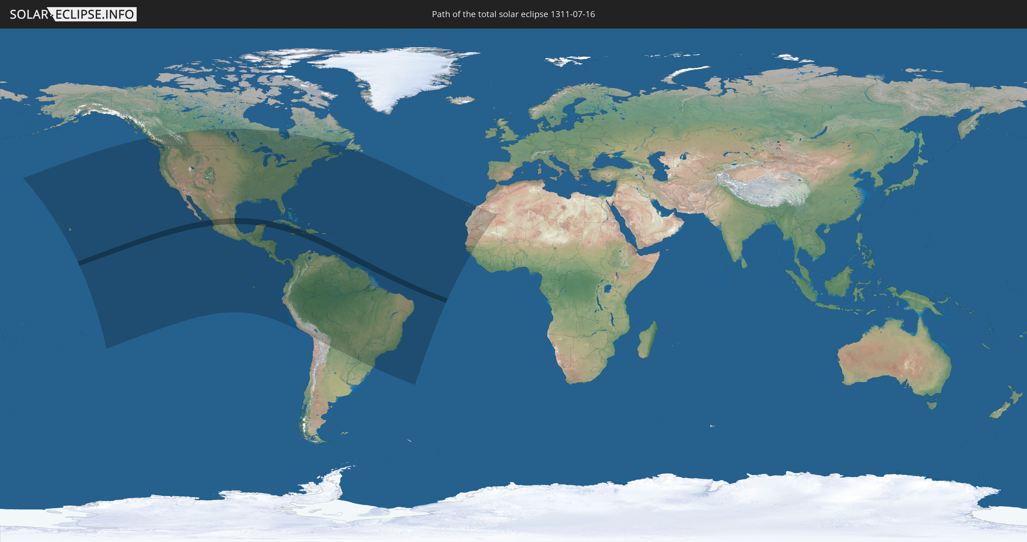
Die Sonnenfinsternis am 07/16/1311 kann man in 61 Ländern als partielle Sonnenfinsternis beobachten.
Der Finsternispfad verläuft durch 10 Länder. Nur in diesen Ländern ist sie als total Sonnenfinsternis zu sehen.
In den folgenden Ländern ist die Sonnenfinsternis total zu sehen
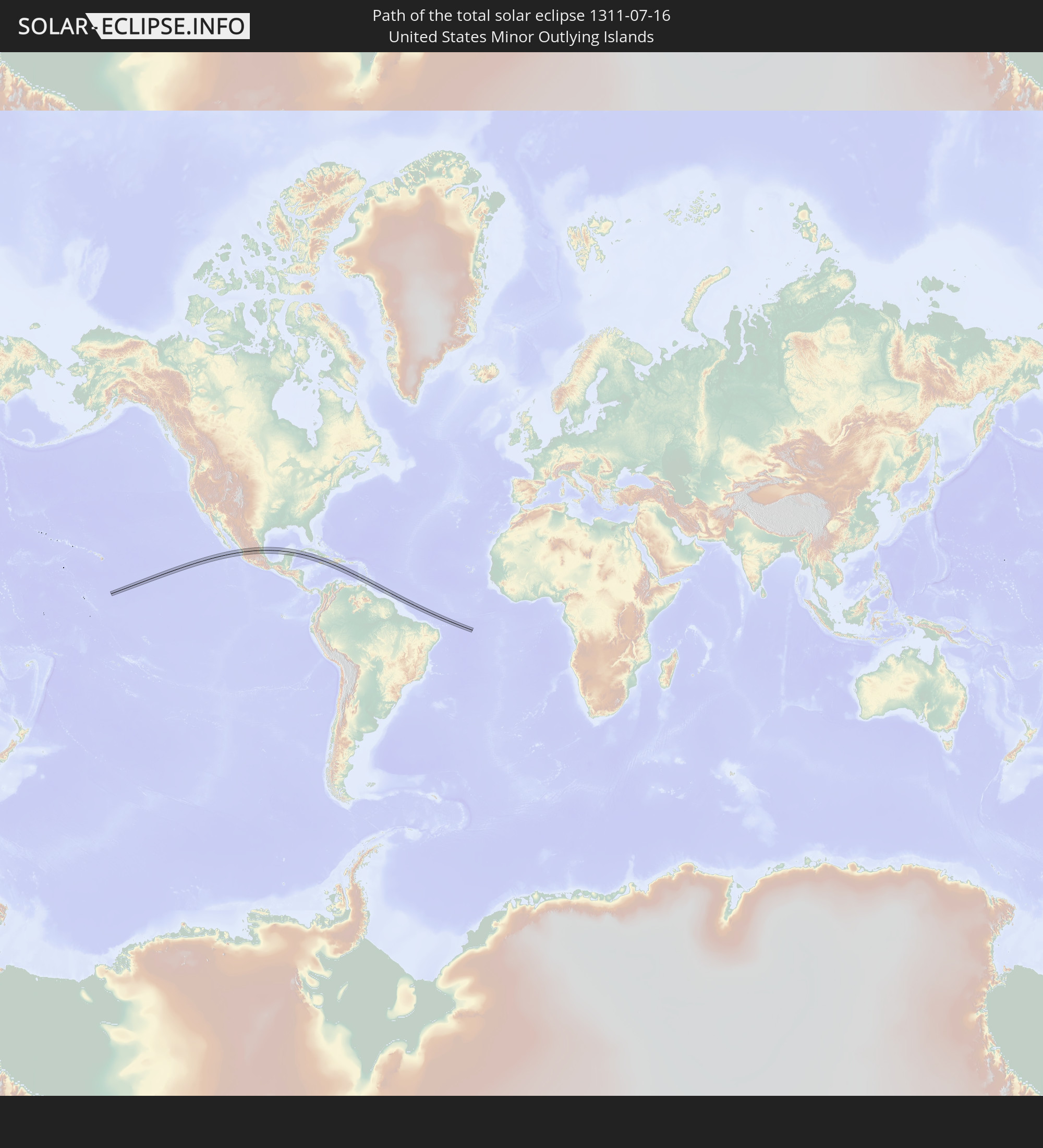 United States Minor Outlying Islands
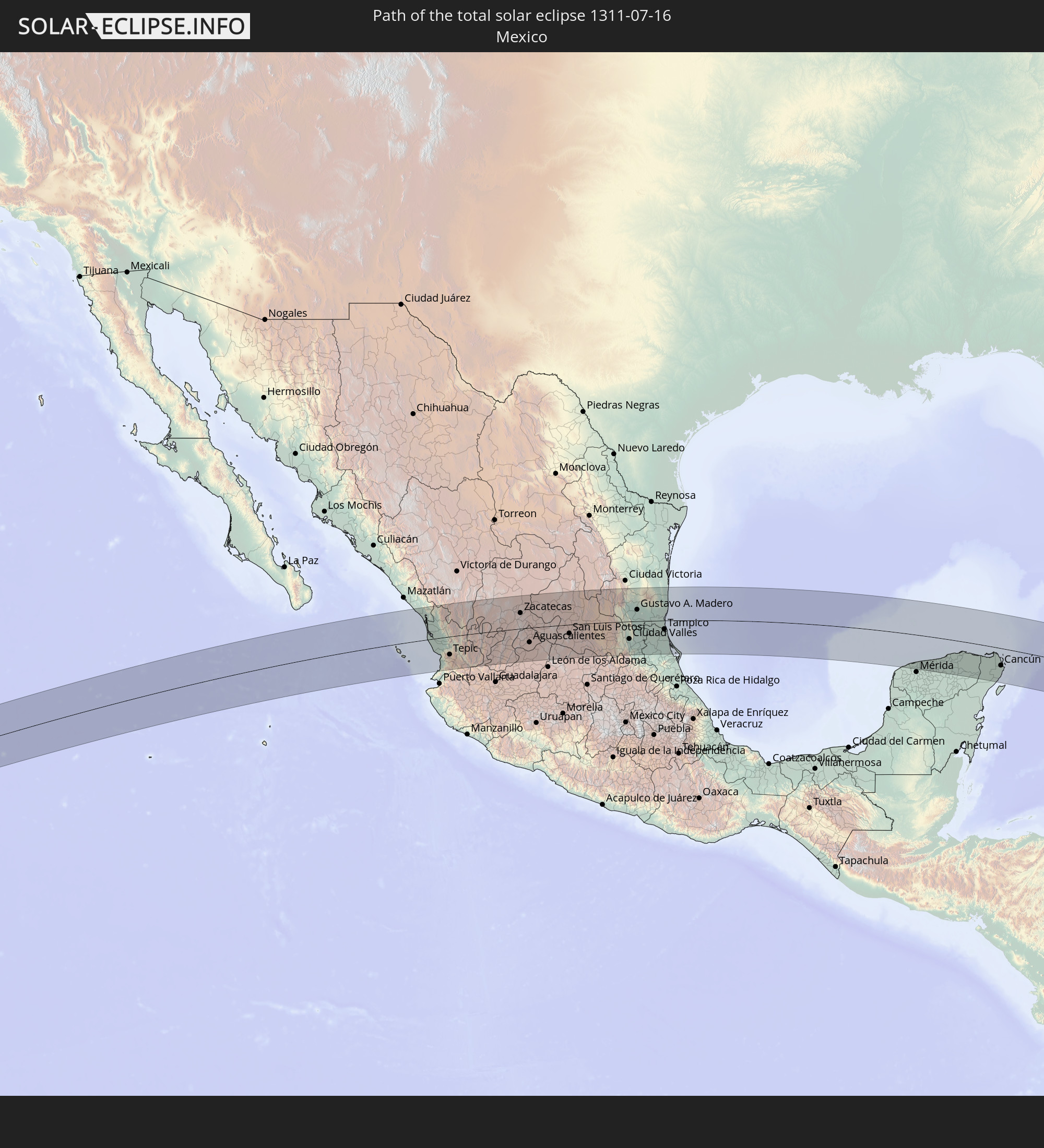 Mexico
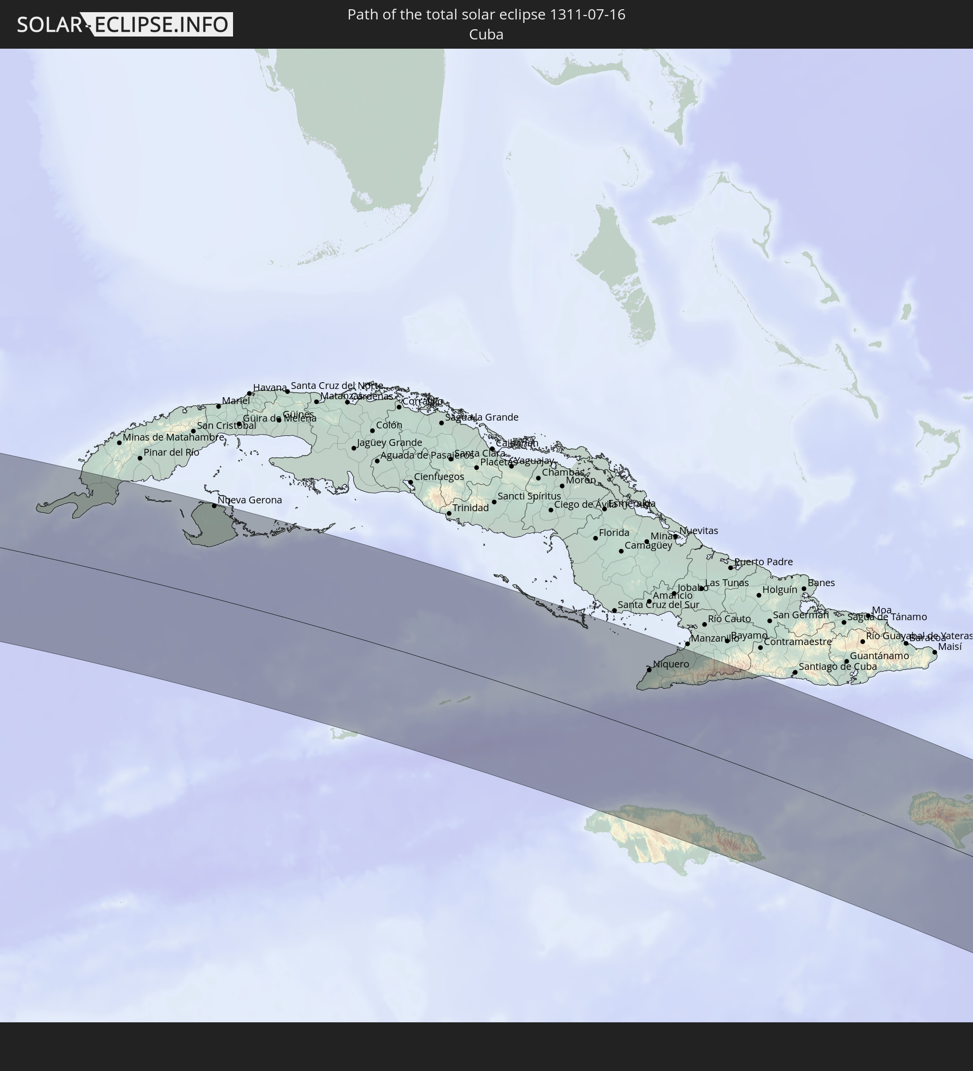 Cuba
Cuba
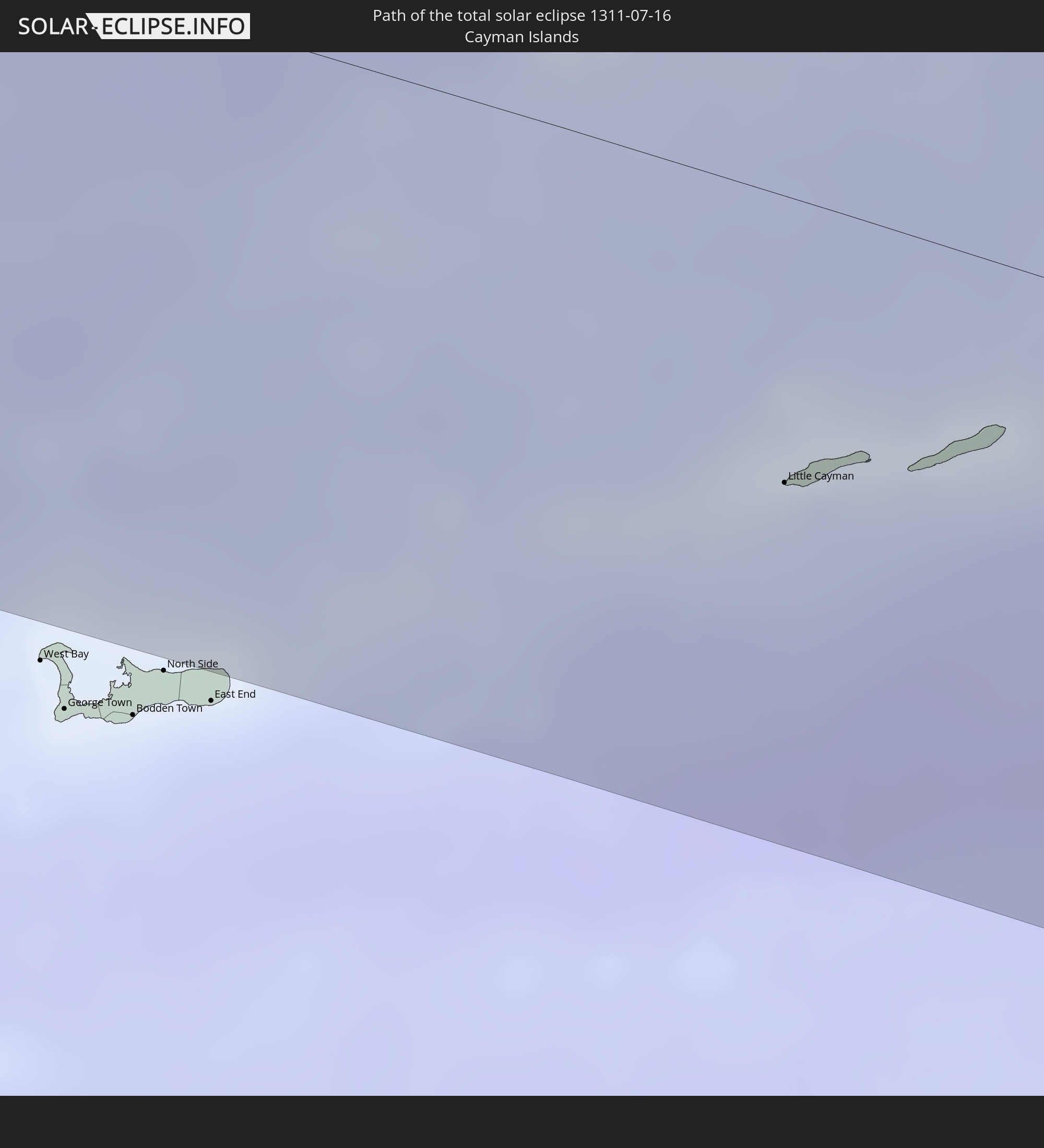 Cayman Islands
 Jamaica
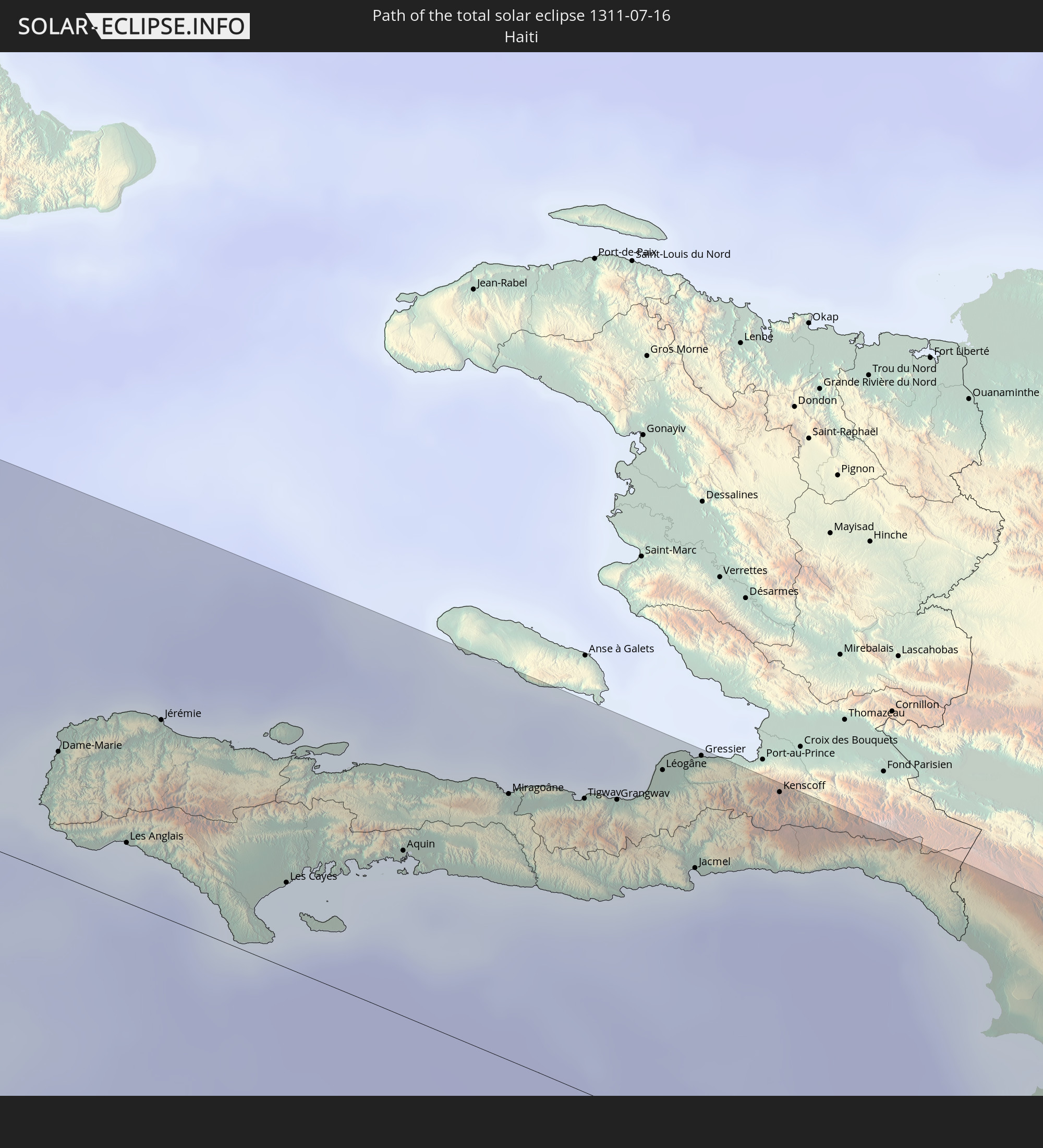 Haiti
Haiti
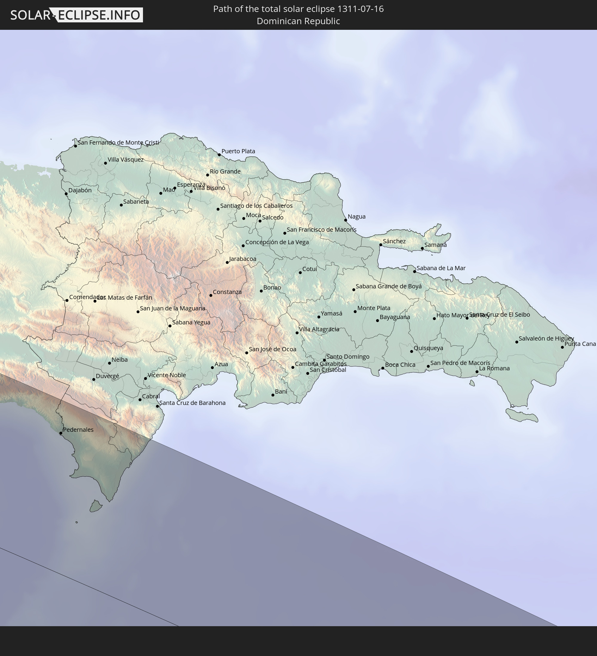 Dominican Republic
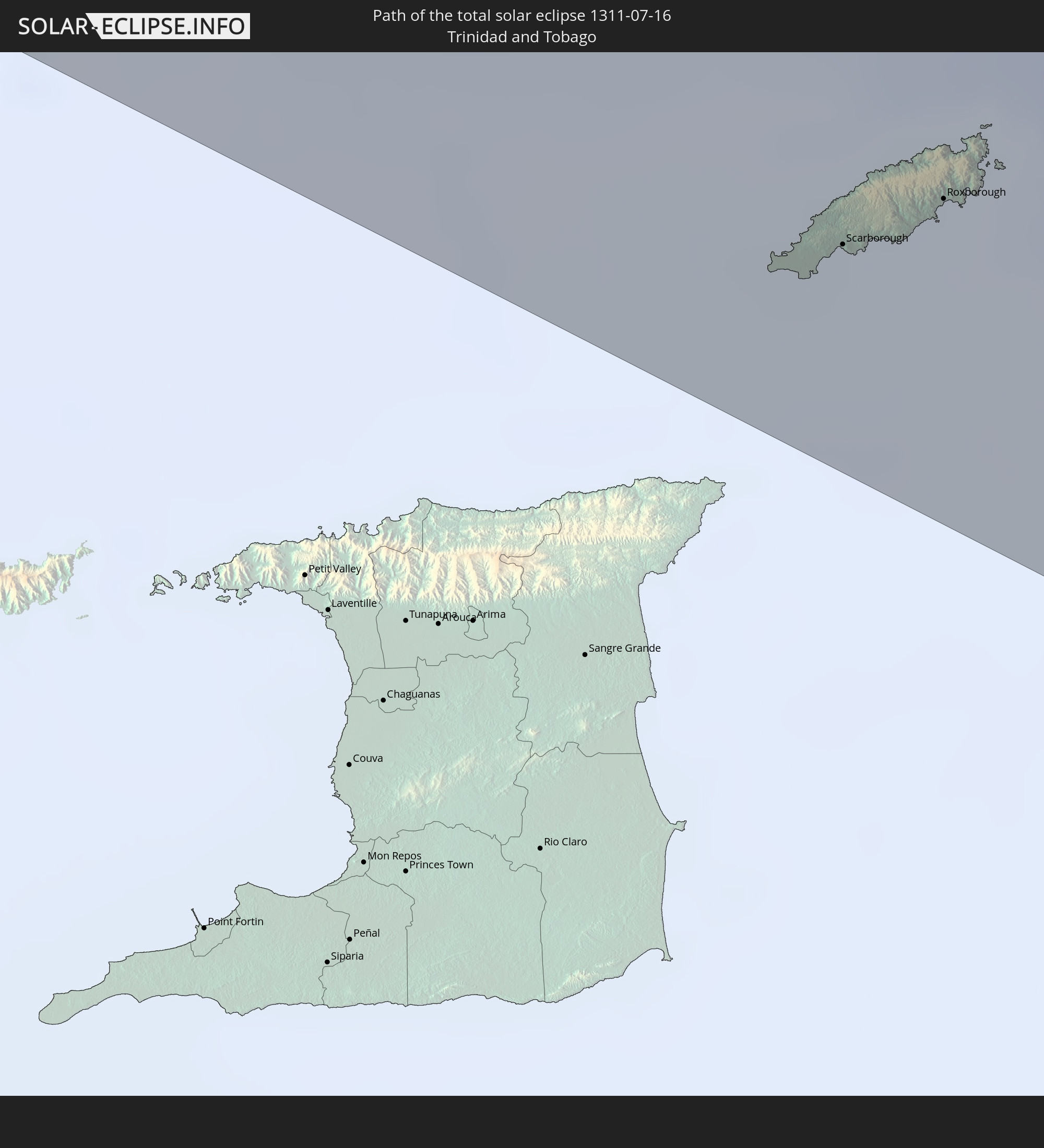 Trinidad and Tobago
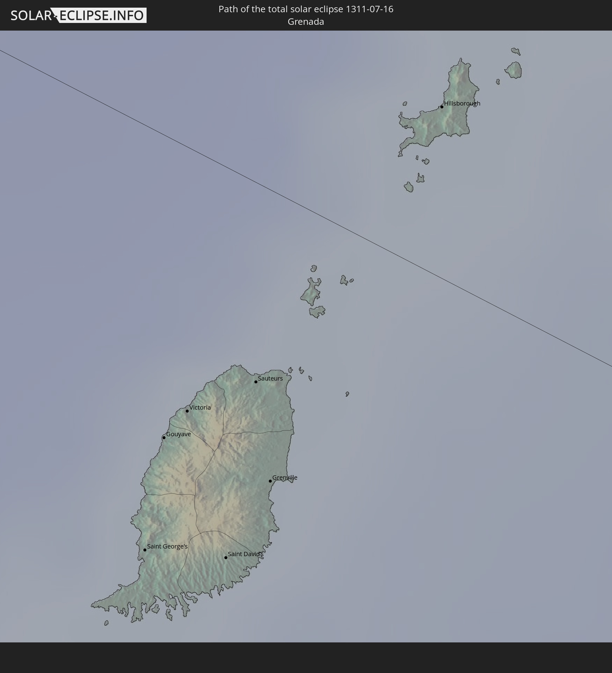 Grenada
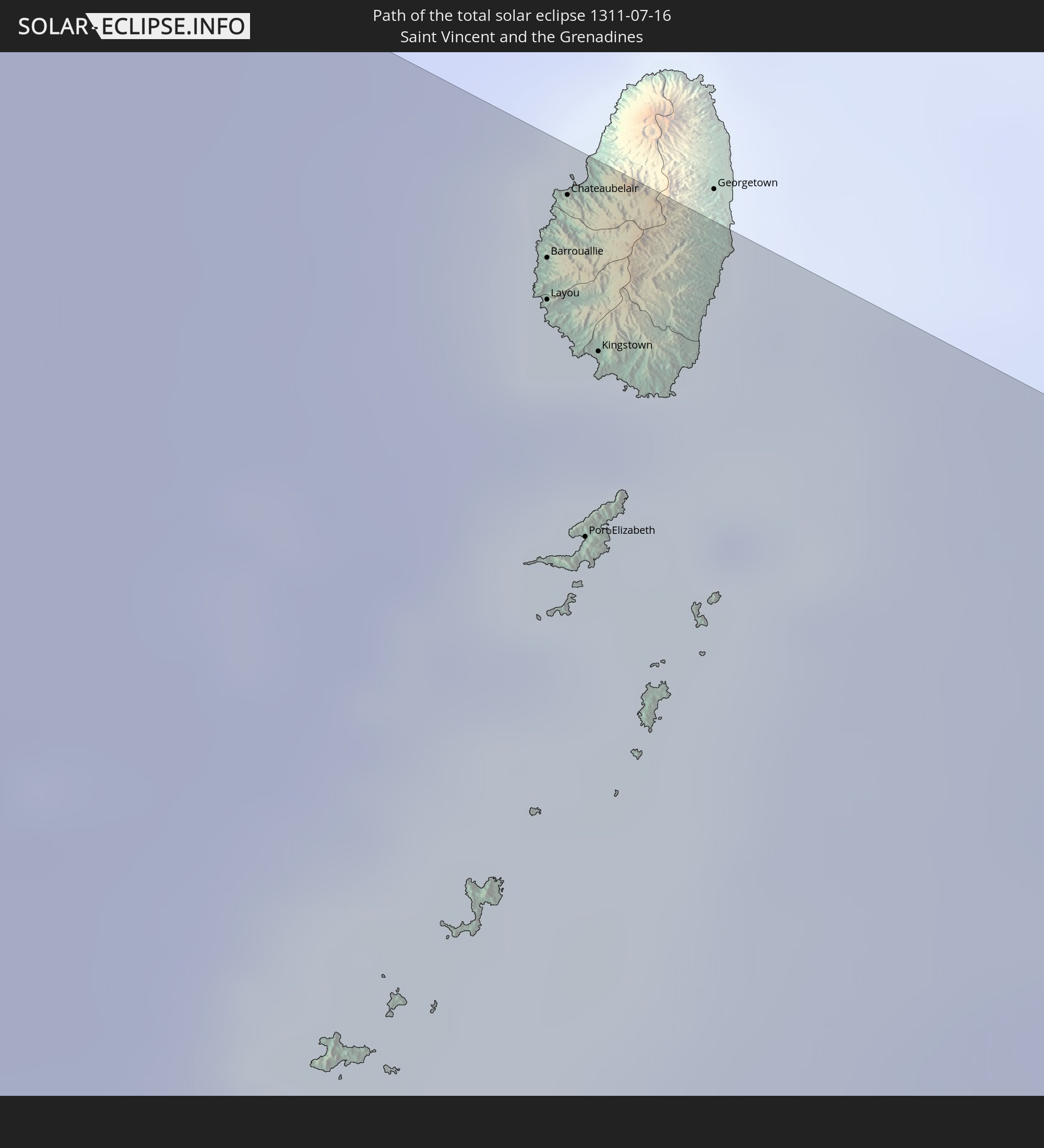 Saint Vincent and the Grenadines
In den folgenden Ländern ist die Sonnenfinsternis partiell zu sehen
 United States
 United States Minor Outlying Islands
 Kiribati
 French Polynesia
 Canada
 Mexico
 Chile
Chile
 Guatemala
 Ecuador
 El Salvador
 Honduras
 Belize
 Nicaragua
 Costa Rica
 Cuba
Cuba
 Panama
 Colombia
 Cayman Islands
 Peru
Peru
 The Bahamas
 Jamaica
 Haiti
Haiti
 Brazil
 Argentina
 Venezuela
 Turks and Caicos Islands
 Dominican Republic
 Aruba
Aruba
 Bolivia
 Puerto Rico
 United States Virgin Islands
 Bermuda
 British Virgin Islands
 Anguilla
 Collectivity of Saint Martin
 Saint Barthélemy
 Saint Kitts and Nevis
 Paraguay
 Antigua and Barbuda
 Montserrat
 Trinidad and Tobago
 Guadeloupe
 Grenada
 Dominica
 Saint Vincent and the Grenadines
 Guyana
 Martinique
 Saint Lucia
 Barbados
 Suriname
 Saint Pierre and Miquelon
 French Guiana
 Cabo Verde
 Spain
Spain
 Senegal
 Mauritania
 The Gambia
 Guinea-Bissau
 Guinea
 Morocco
 Mali
Mali
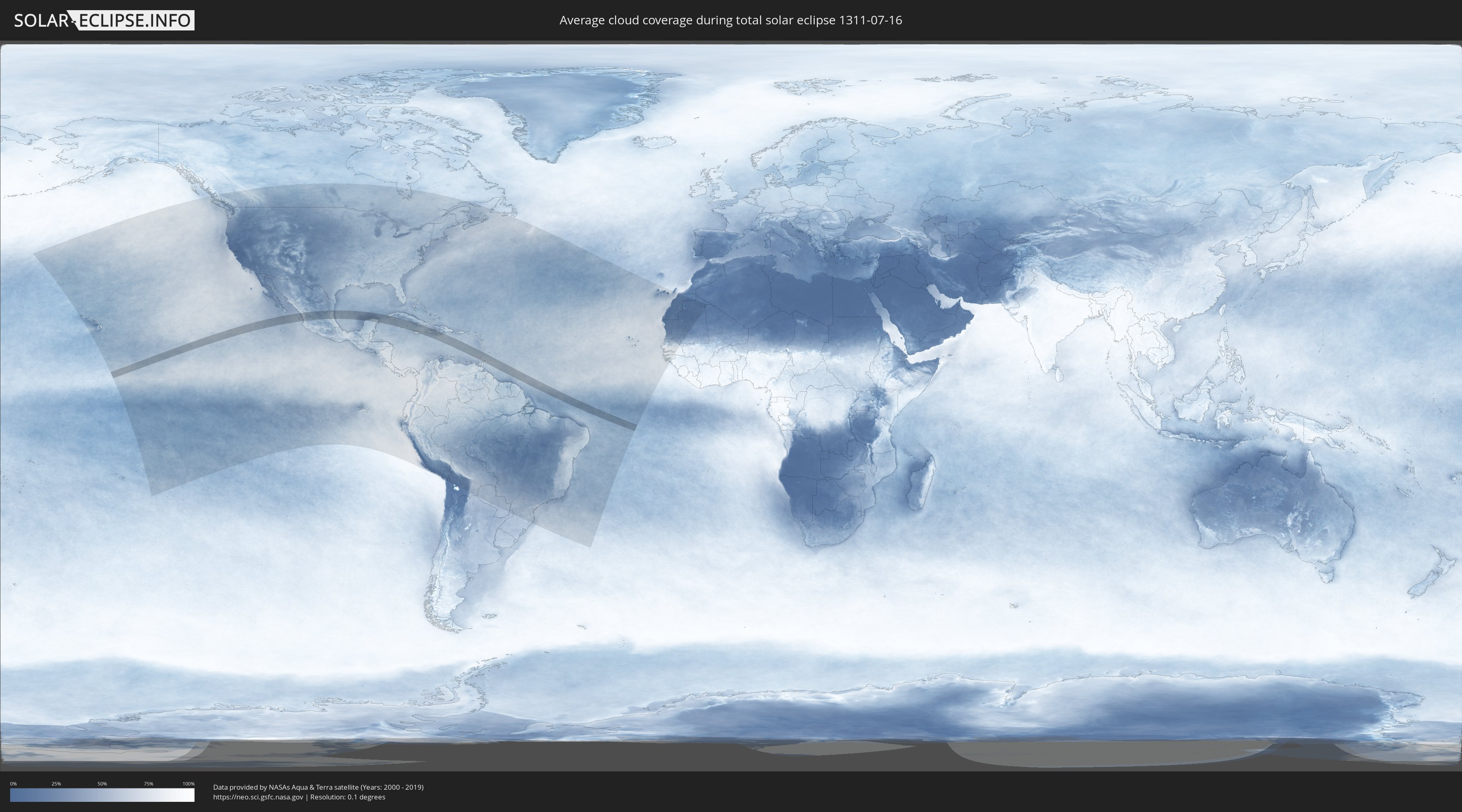
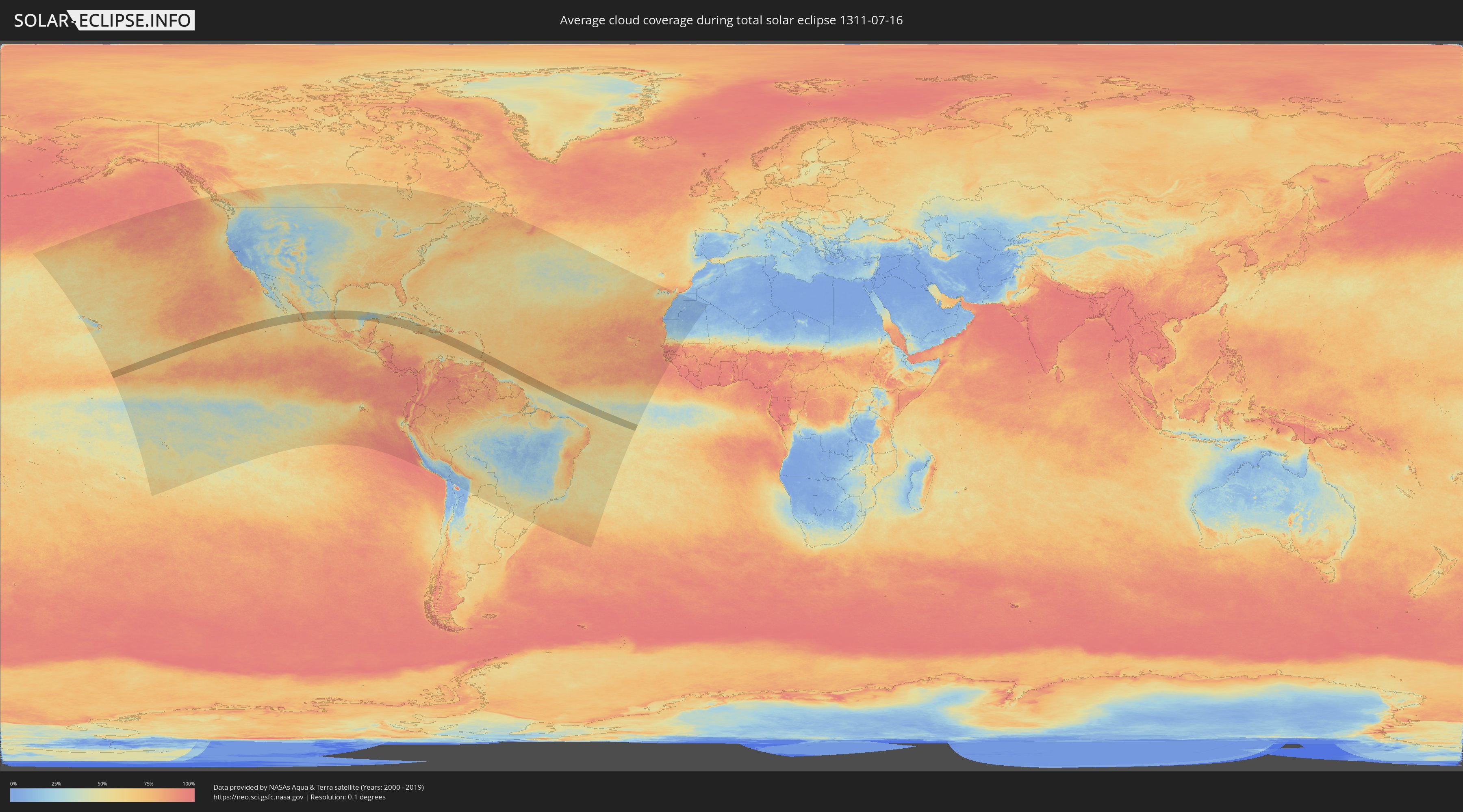
How will be the weather during the total solar eclipse on 07/16/1311?
Where is the best place to see the total solar eclipse of 07/16/1311?
The following maps show the average cloud coverage for the day of the total solar eclipse.
With the help of these maps, it is possible to find the place along the eclipse path, which has the best
chance of a cloudless sky.
Nevertheless, you should consider local circumstances and inform about the weather of your chosen
observation site.
The data is provided by NASAs satellites
AQUA and TERRA.
The cloud maps are averaged over a period of 19 years (2000 - 2019).
Detailed country maps
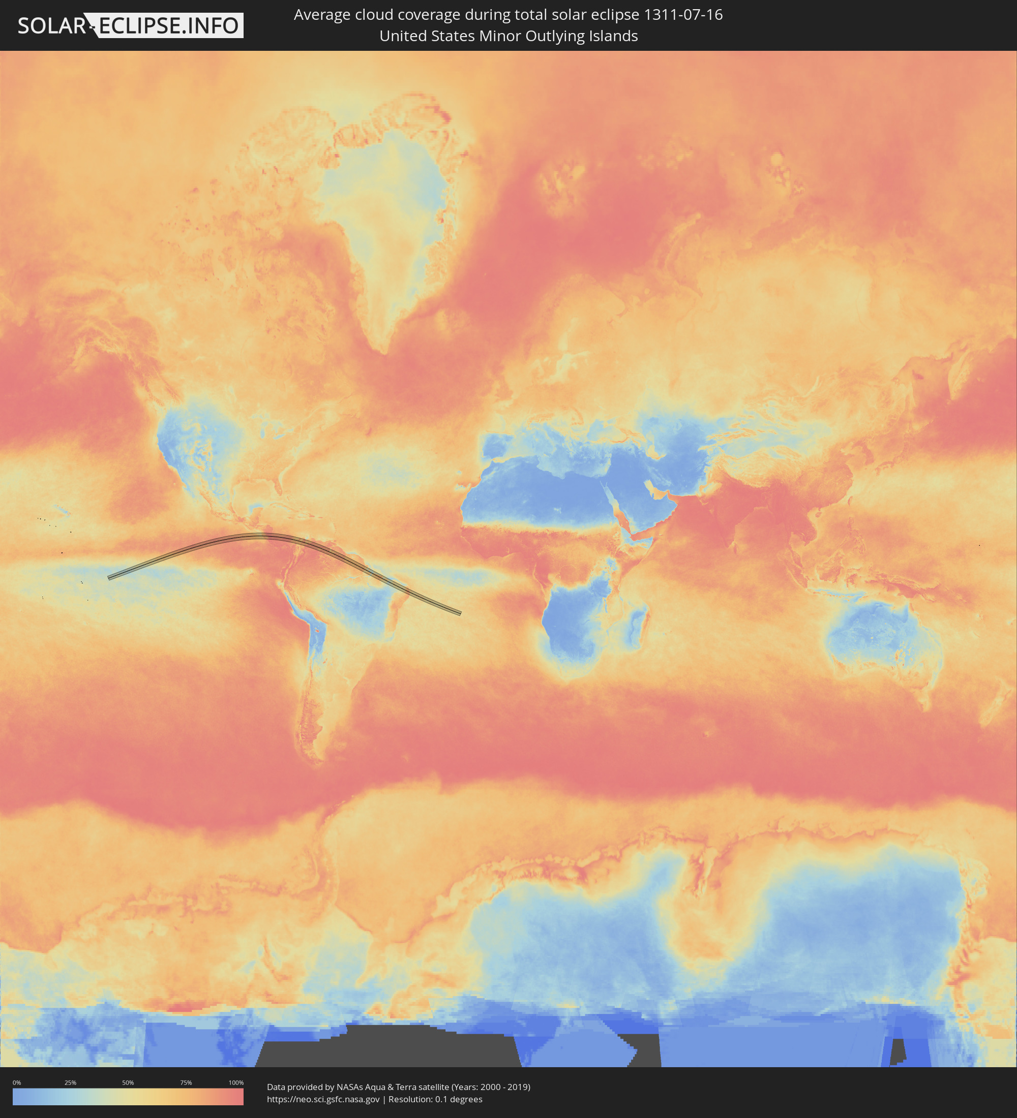 United States Minor Outlying Islands
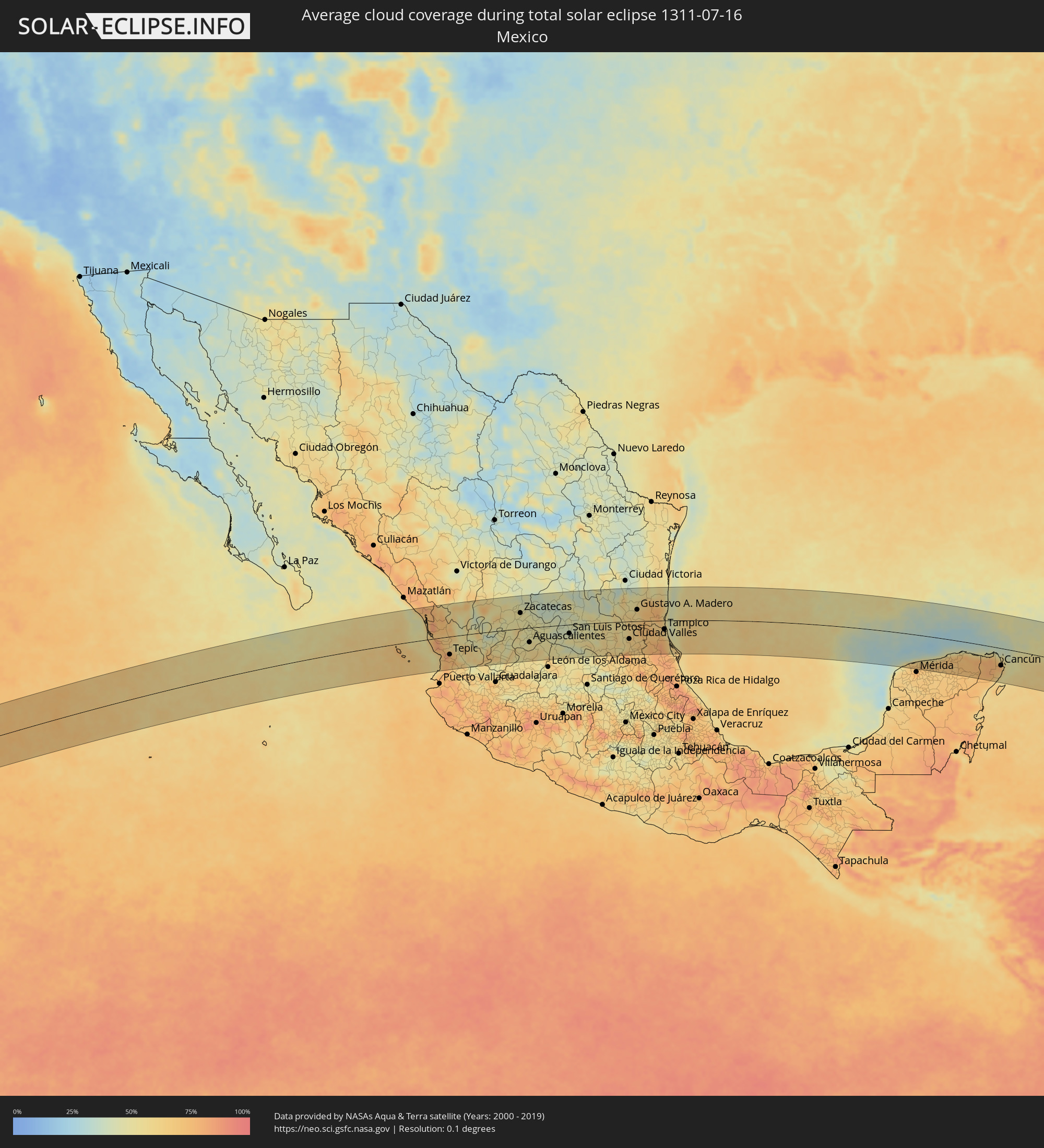 Mexico
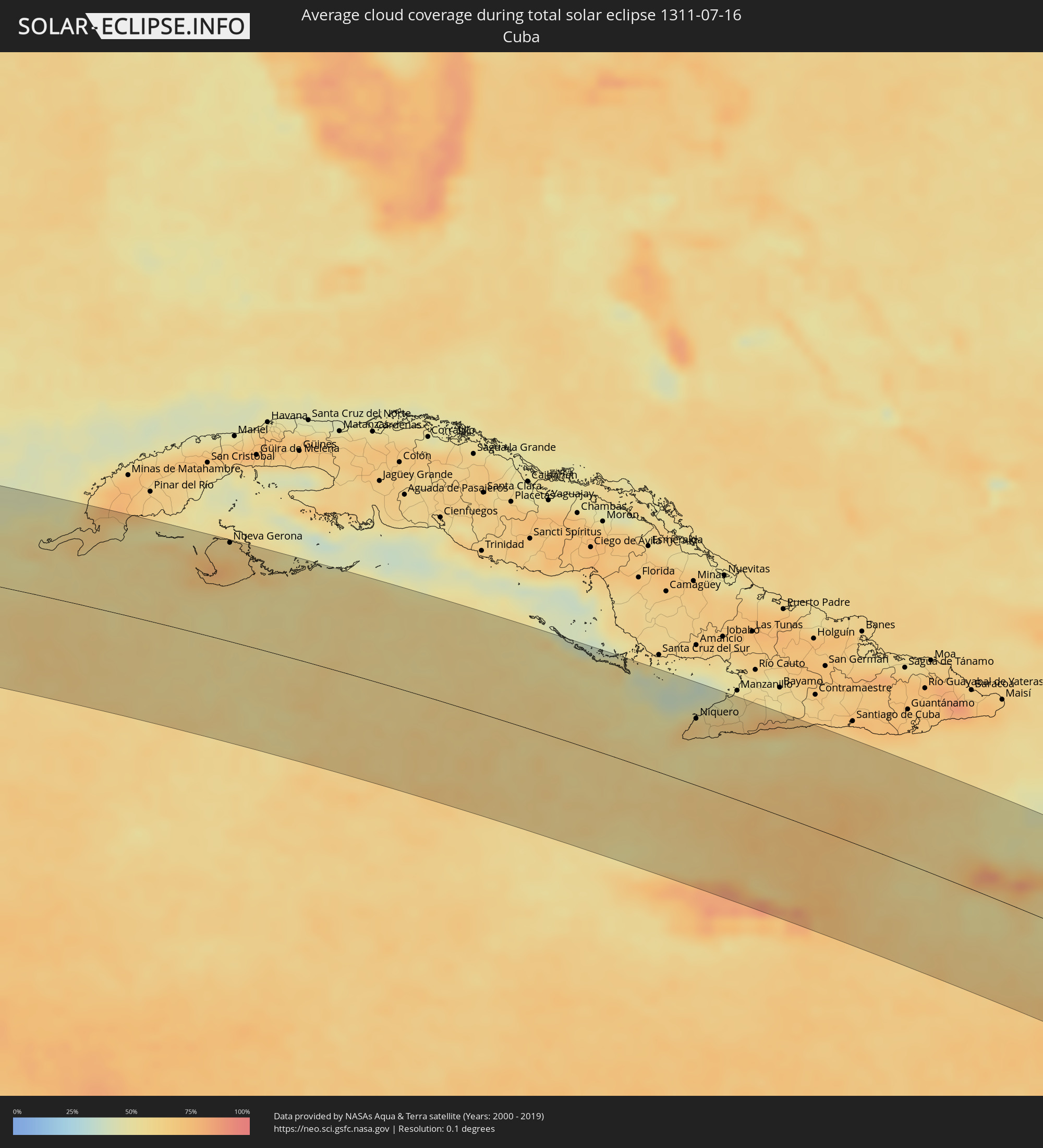 Cuba
Cuba
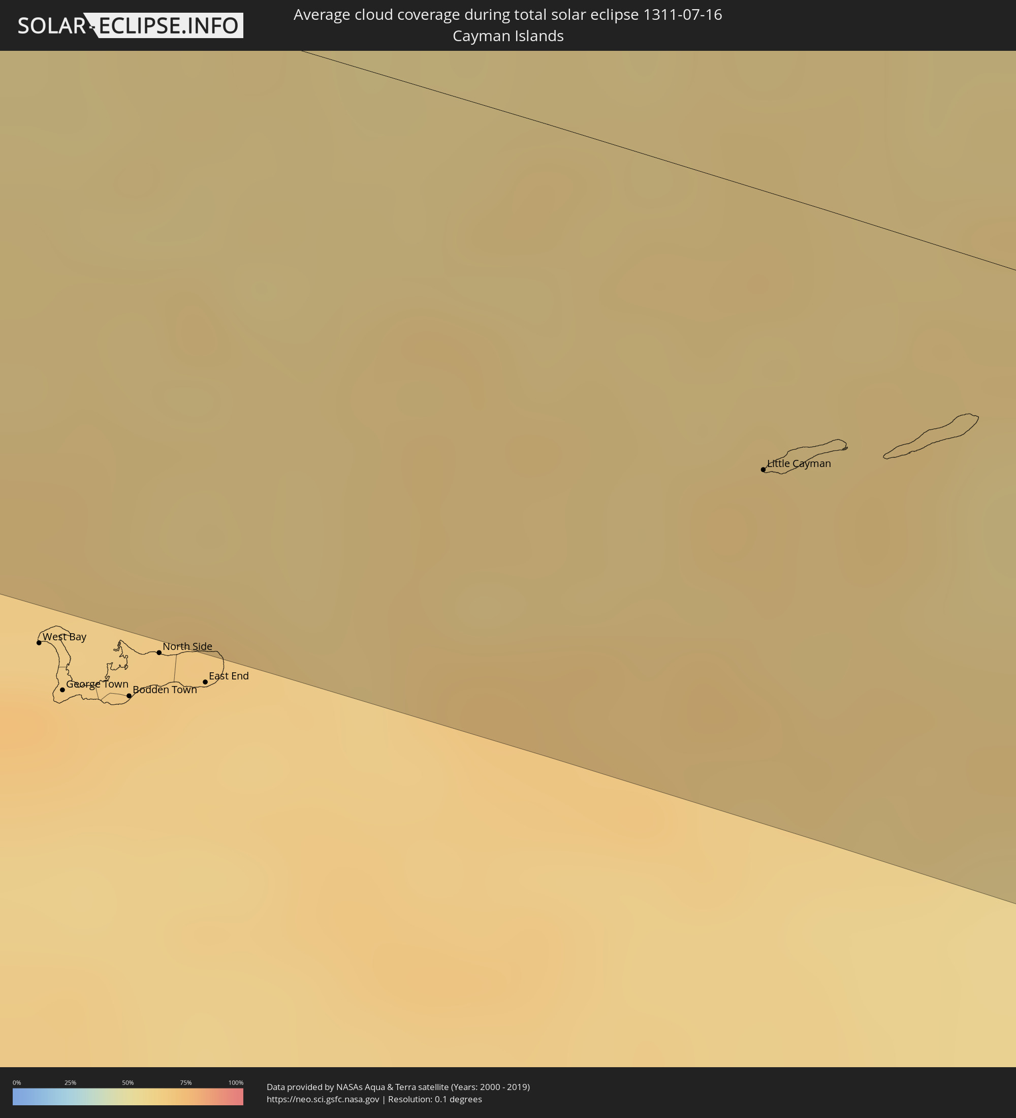 Cayman Islands
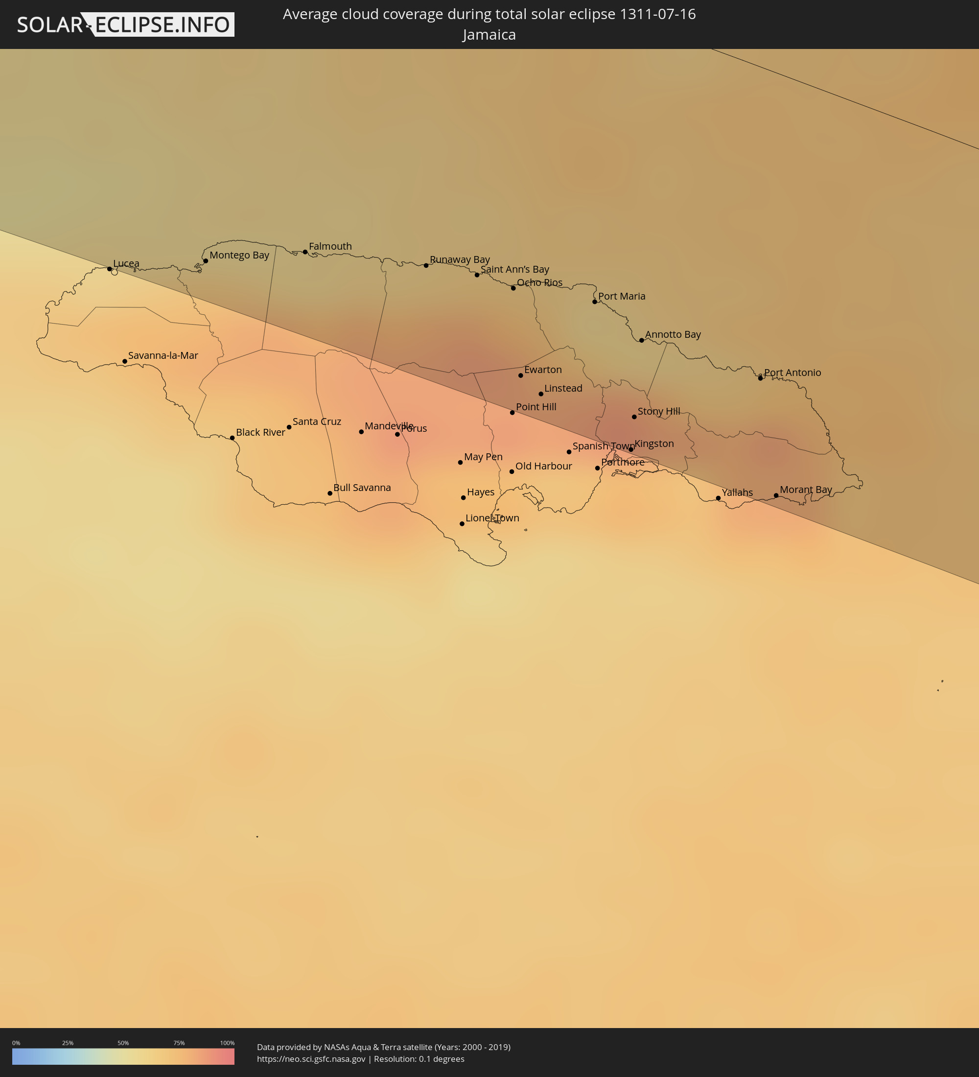 Jamaica
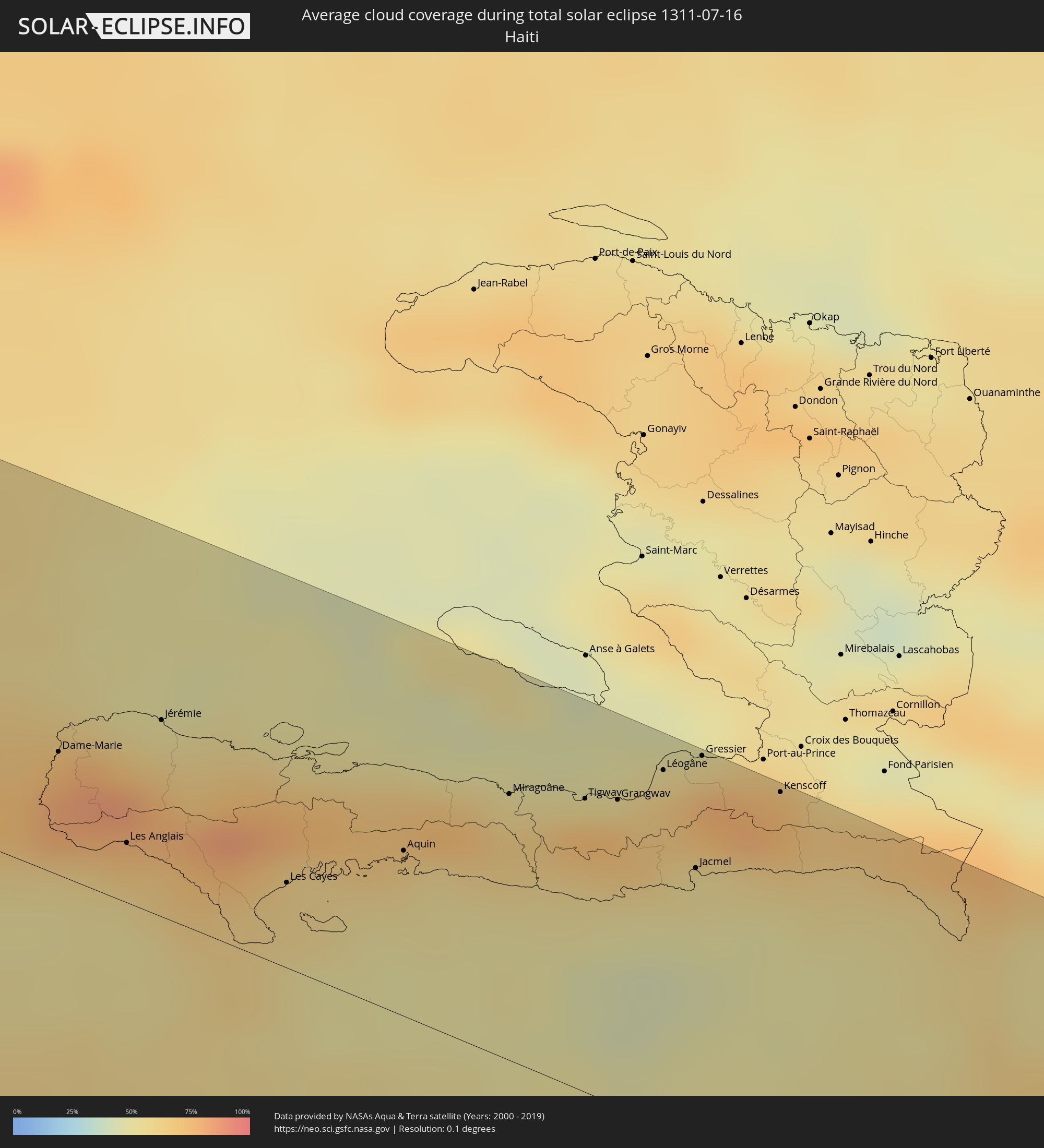 Haiti
Haiti
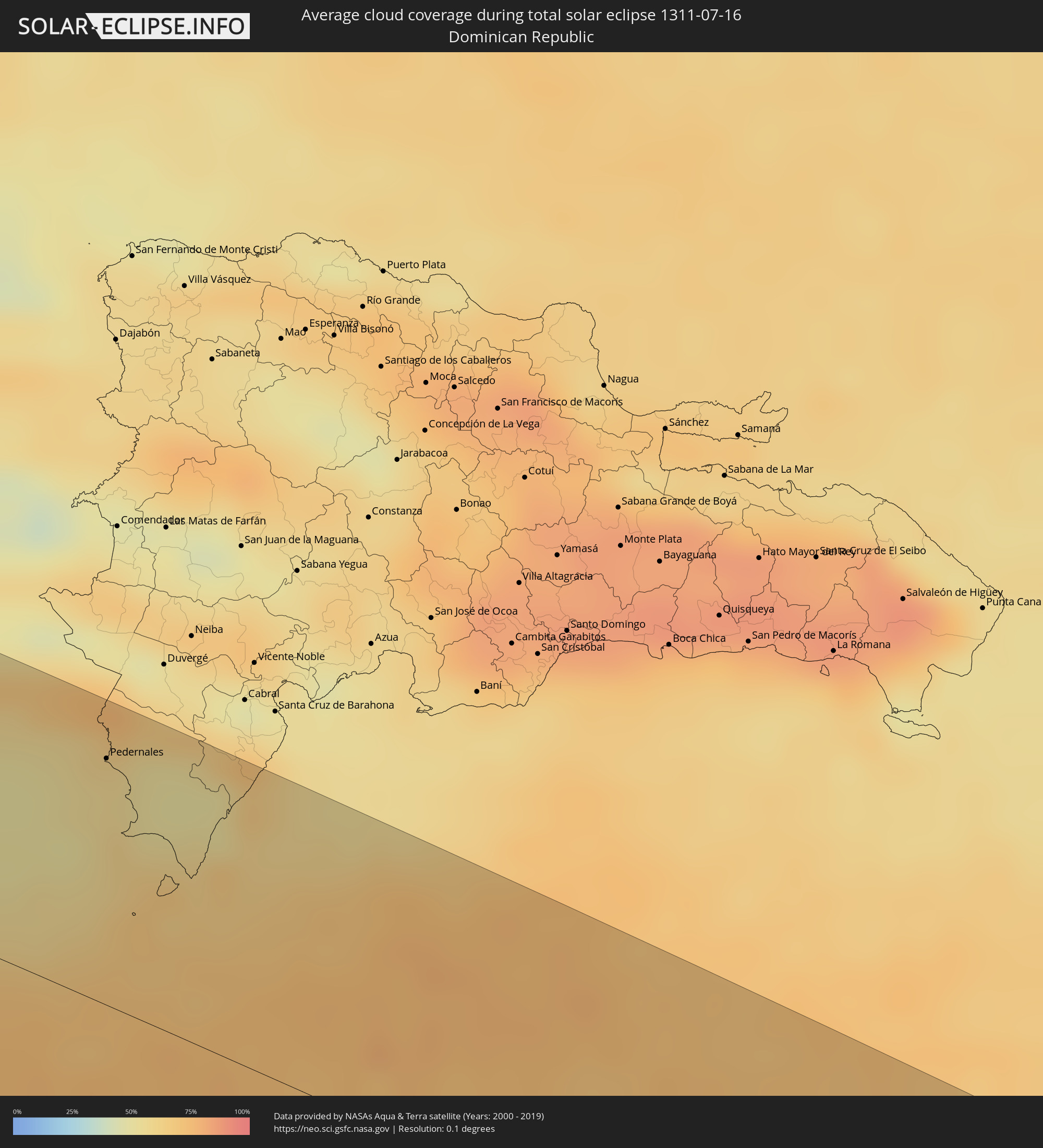 Dominican Republic
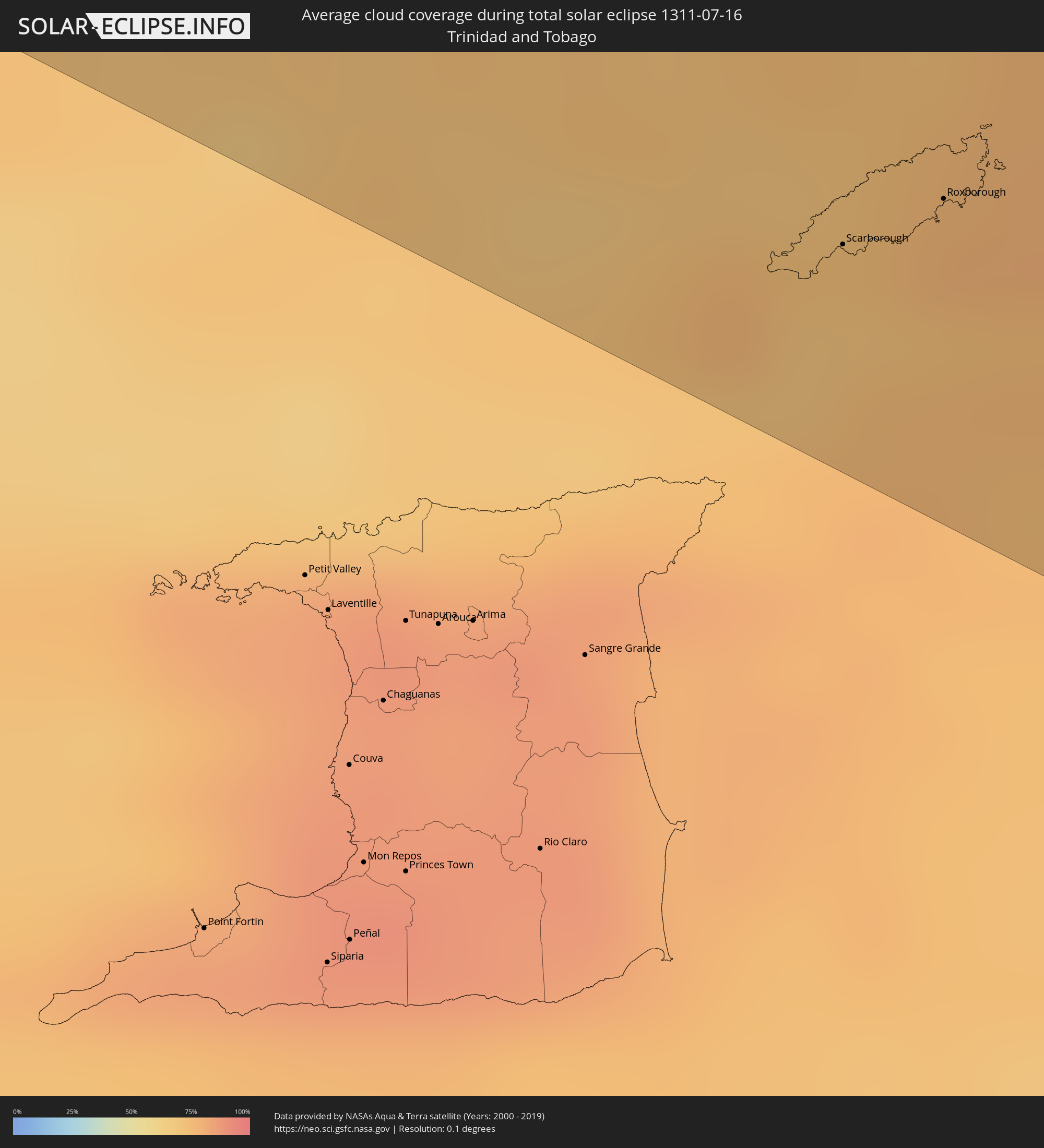 Trinidad and Tobago
 Grenada
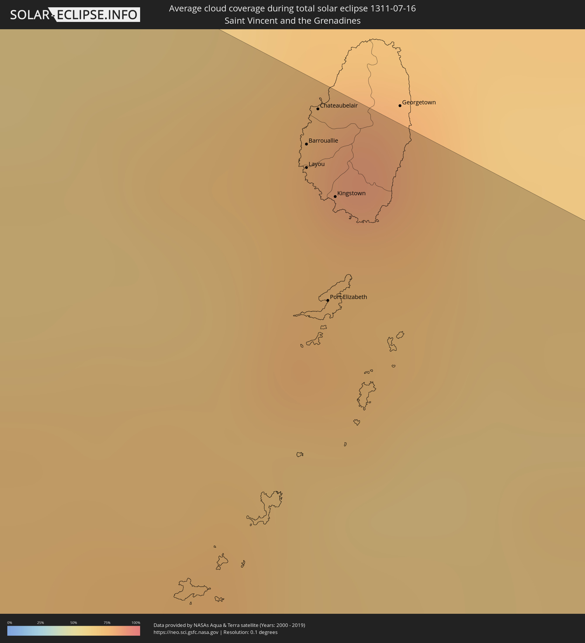 Saint Vincent and the Grenadines
Cities inside the path of the eclipse
The following table shows all locations with a population of more than 5,000 inside the eclipse path. Cities which have more than 100,000 inhabitants are marked bold. A click at the locations opens a detailed map.
| City | Type | Eclipse duration | Local time of max. eclipse | Distance to central line | Ø Cloud coverage |
|
Escuinapa de Hidalgo, Sinaloa
|
total | - | 09:48:01 UTC-07:05 | 98 km | 73% |
|
Tepic, Nayarit
|
total | - | 09:49:26 UTC-07:05 | 60 km | 74% |
|
Jerez de García Salinas, Zacatecas
|
total | - | 10:23:17 UTC-06:36 | 43 km | 50% |
|
Fresnillo, Zacatecas
|
total | - | 10:23:43 UTC-06:36 | 101 km | 46% |
|
Víctor Rosales, Zacatecas
|
total | - | 10:24:02 UTC-06:36 | 74 km | 51% |
|
Zacatecas, Zacatecas
|
total | - | 10:24:16 UTC-06:36 | 52 km | 50% |
|
Teocaltiche, Jalisco
|
total | - | 10:23:54 UTC-06:36 | 96 km | 50% |
|
Rincón de Romos, Aguascalientes
|
total | - | 10:24:44 UTC-06:36 | 10 km | 48% |
|
Aguascalientes, Aguascalientes
|
total | - | 10:24:44 UTC-06:36 | 49 km | 52% |
|
Encarnación de Díaz, Jalisco
|
total | - | 10:24:44 UTC-06:36 | 88 km | 62% |
|
Lagos de Moreno, Jalisco
|
total | - | 10:25:25 UTC-06:36 | 110 km | 54% |
|
San Felipe, Guanajuato
|
total | - | 10:27:14 UTC-06:36 | 102 km | 56% |
|
San Luis Potosí, San Luis Potosí
|
total | - | 10:27:58 UTC-06:36 | 30 km | 48% |
|
Río Verde, San Luis Potosí
|
total | - | 10:30:23 UTC-06:36 | 60 km | 51% |
|
Ciudad Valles, San Luis Potosí
|
total | - | 10:32:53 UTC-06:36 | 59 km | 64% |
|
Ciudad Mante, Tamaulipas
|
total | - | 10:33:05 UTC-06:36 | 25 km | 61% |
|
Gustavo A. Madero, Tamaulipas
|
total | - | 10:33:39 UTC-06:36 | 39 km | 59% |
|
Pánuco, Veracruz
|
total | - | 10:35:02 UTC-06:36 | 54 km | 69% |
|
Tampico, Tamaulipas
|
total | - | 10:35:53 UTC-06:36 | 29 km | 65% |
|
Progreso de Castro, Yucatán
|
total | - | 10:58:46 UTC-06:36 | 91 km | 64% |
|
Motul, Yucatán
|
total | - | 10:59:53 UTC-06:36 | 107 km | 67% |
|
Tizimín, Yucatán
|
total | - | 11:03:07 UTC-06:36 | 84 km | 70% |
|
Cancún, Quintana Roo
|
total | - | 11:56:22 UTC-05:47 | 58 km | 66% |
|
Guane, Pinar del Río
|
total | - | 12:20:57 UTC-05:29 | 113 km | 60% |
|
Nueva Gerona, Isla de la Juventud
|
total | - | 12:24:41 UTC-05:29 | 111 km | 63% |
|
Little Cayman, Sister Island
|
total | - | 12:43:55 UTC-05:19 | 50 km | 64% |
|
Montego Bay, St. James
|
total | - | 13:03:24 UTC-05:07 | 104 km | 68% |
|
Falmouth, Trelawny
|
total | - | 13:04:04 UTC-05:07 | 92 km | 62% |
|
Niquero, Granma
|
total | - | 12:40:17 UTC-05:29 | 74 km | 66% |
|
Media Luna, Granma
|
total | - | 12:40:33 UTC-05:29 | 89 km | 61% |
|
Runaway Bay, St Ann
|
total | - | 13:04:57 UTC-05:07 | 84 km | 65% |
|
Campechuela, Granma
|
total | - | 12:40:52 UTC-05:29 | 104 km | 57% |
|
Saint Ann’s Bay, St Ann
|
total | - | 13:05:20 UTC-05:07 | 82 km | 79% |
|
Ocho Rios, St Ann
|
total | - | 13:05:37 UTC-05:07 | 82 km | 75% |
|
Ewarton, Saint Catherine
|
total | - | 13:05:54 UTC-05:07 | 104 km | 83% |
|
Linstead, Saint Catherine
|
total | - | 13:06:05 UTC-05:07 | 107 km | 82% |
|
Bog Walk, Saint Catherine
|
total | - | 13:06:11 UTC-05:07 | 110 km | 82% |
|
Bartolomé Masó, Granma
|
total | - | 12:41:48 UTC-05:29 | 109 km | 64% |
|
Port Maria, St. Mary
|
total | - | 13:06:13 UTC-05:07 | 78 km | 60% |
|
Half Way Tree, St. Andrew
|
total | - | 13:06:49 UTC-05:07 | 112 km | 74% |
|
Constant Spring, St. Andrew
|
total | - | 13:06:48 UTC-05:07 | 107 km | 87% |
|
Kingston, Kingston
|
total | - | 13:06:51 UTC-05:07 | 113 km | 74% |
|
Stony Hill, St. Andrew
|
total | - | 13:06:47 UTC-05:07 | 104 km | 87% |
|
New Kingston, St. Andrew
|
total | - | 13:06:52 UTC-05:07 | 111 km | 74% |
|
Annotto Bay, St. Mary
|
total | - | 13:06:38 UTC-05:07 | 83 km | 63% |
|
Port Antonio, Portland
|
total | - | 13:07:33 UTC-05:07 | 82 km | 69% |
|
Morant Bay, St. Thomas
|
total | - | 13:07:58 UTC-05:07 | 111 km | 71% |
|
Dame-Marie, GrandʼAnse
|
total | - | 13:30:25 UTC-04:49 | 36 km | 74% |
|
Les Anglais, Sud
|
total | - | 13:31:12 UTC-04:49 | 17 km | 66% |
|
Jérémie, GrandʼAnse
|
total | - | 13:31:04 UTC-04:49 | 57 km | 53% |
|
Les Cayes, Sud
|
total | - | 13:32:29 UTC-04:49 | 25 km | 60% |
|
Aquin, Sud
|
total | - | 13:33:13 UTC-04:49 | 48 km | 63% |
|
Miragoâne, Nippes
|
total | - | 13:33:47 UTC-04:49 | 77 km | 64% |
|
Tigwav, Ouest
|
total | - | 13:34:20 UTC-04:49 | 85 km | 72% |
|
Grangwav, Ouest
|
total | - | 13:34:33 UTC-04:49 | 88 km | 73% |
|
Léogâne, Ouest
|
total | - | 13:34:47 UTC-04:49 | 102 km | 68% |
|
Jacmel, Sud-Est
|
total | - | 13:35:19 UTC-04:49 | 78 km | 52% |
|
Gressier, Ouest
|
total | - | 13:35:00 UTC-04:49 | 111 km | 59% |
|
Kenscoff, Ouest
|
total | - | 13:35:40 UTC-04:49 | 111 km | 74% |
|
Pedernales, Pedernales
|
total | - | 13:46:23 UTC-04:40 | 91 km | 57% |
|
Enriquillo, Barahona
|
total | - | 13:47:43 UTC-04:40 | 99 km | 62% |
|
Paraíso, Barahona
|
total | - | 13:47:45 UTC-04:40 | 111 km | 65% |
|
Saint George's, Saint George
|
total | - | 14:47:17 UTC-04:06 | 40 km | 77% |
|
Gouyave, Saint John
|
total | - | 14:47:12 UTC-04:06 | 29 km | 82% |
|
Victoria, Saint Mark
|
total | - | 14:47:12 UTC-04:06 | 25 km | 82% |
|
Saint David’s, Saint David
|
total | - | 14:47:26 UTC-04:06 | 37 km | 72% |
|
Sauteurs, Saint Patrick
|
total | - | 14:47:17 UTC-04:06 | 19 km | 78% |
|
Grenville, Saint Andrew
|
total | - | 14:47:25 UTC-04:06 | 28 km | 76% |
|
Hillsborough, Carriacou and Petite Martinique
|
total | - | 14:47:17 UTC-04:06 | 16 km | 75% |
|
Barrouallie, Saint Patrick
|
total | - | 14:46:44 UTC-04:06 | 100 km | 74% |
|
Layou, Saint Andrew
|
total | - | 14:46:47 UTC-04:06 | 97 km | 74% |
|
Chateaubelair, Saint David
|
total | - | 14:46:42 UTC-04:06 | 106 km | 76% |
|
Port Elizabeth, Grenadines
|
total | - | 14:47:03 UTC-04:06 | 80 km | 74% |
|
Kingstown Park, Saint George
|
total | - | 14:46:53 UTC-04:06 | 94 km | 76% |
|
Kingstown, Saint George
|
total | - | 14:46:54 UTC-04:06 | 95 km | 76% |
|
Scarborough, Tobago
|
total | - | 14:49:56 UTC-04:06 | 76 km | 71% |
|
Roxborough, Eastern Tobago
|
total | - | 14:50:06 UTC-04:06 | 62 km | 77% |