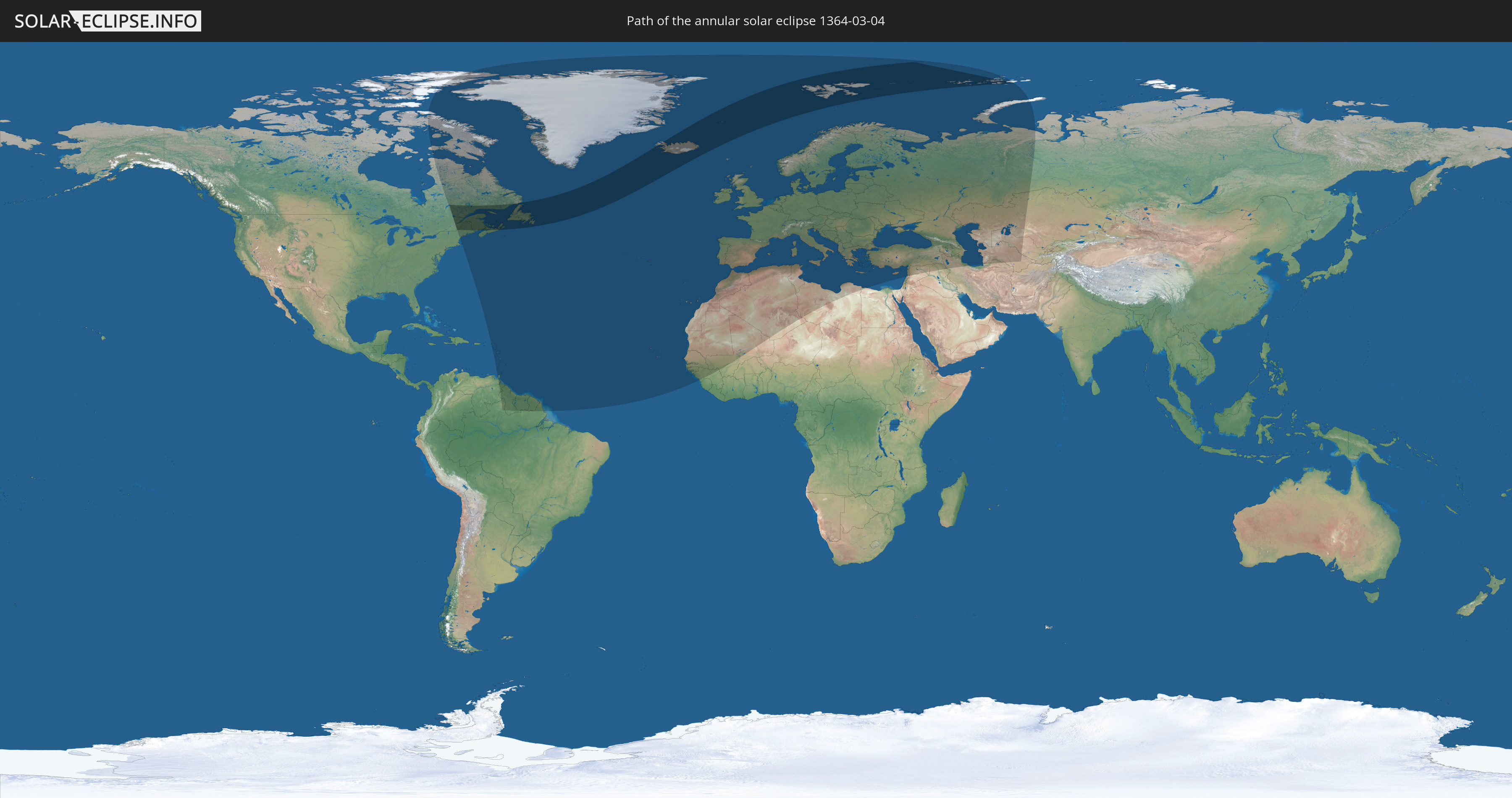
Annular solar eclipse of 03/04/1364
| Day of week: | Sunday |
| Maximum duration of eclipse: | 05m41s |
| Maximum width of eclipse path: | 580 km |
| Saros cycle: | 100 |
| Coverage: | 93.5% |
| Magnitude: | 0.9352 |
| Gamma: | 0.9095 |
Wo kann man die Sonnenfinsternis vom 03/04/1364 sehen?
Die Sonnenfinsternis am 03/04/1364 kann man in 99 Ländern als partielle Sonnenfinsternis beobachten.
Der Finsternispfad verläuft durch 6 Länder. Nur in diesen Ländern ist sie als annular Sonnenfinsternis zu sehen.
In den folgenden Ländern ist die Sonnenfinsternis annular zu sehen
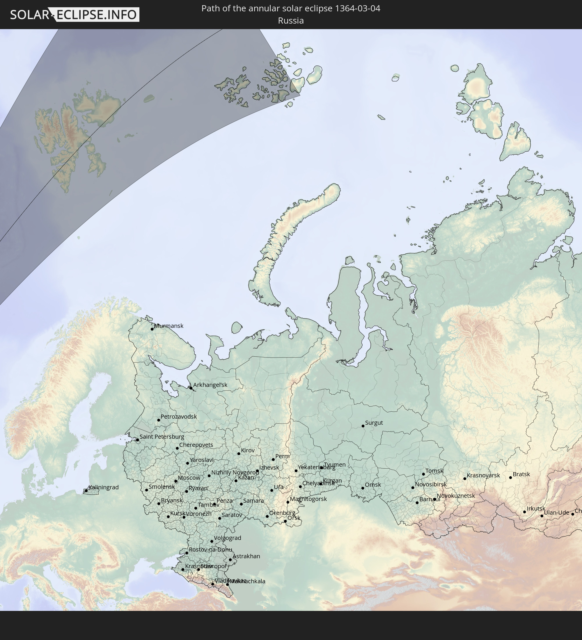 Russia
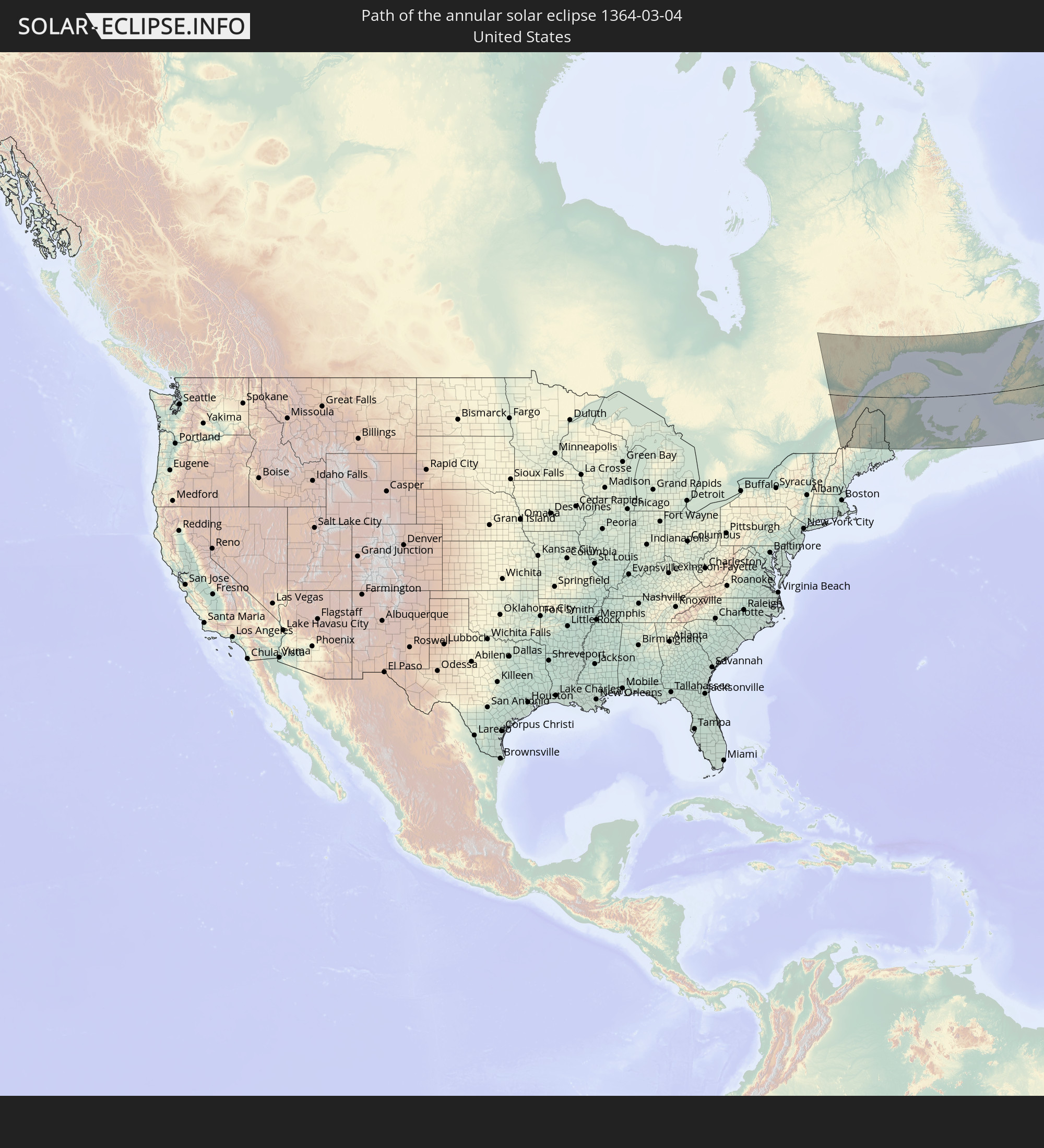 United States
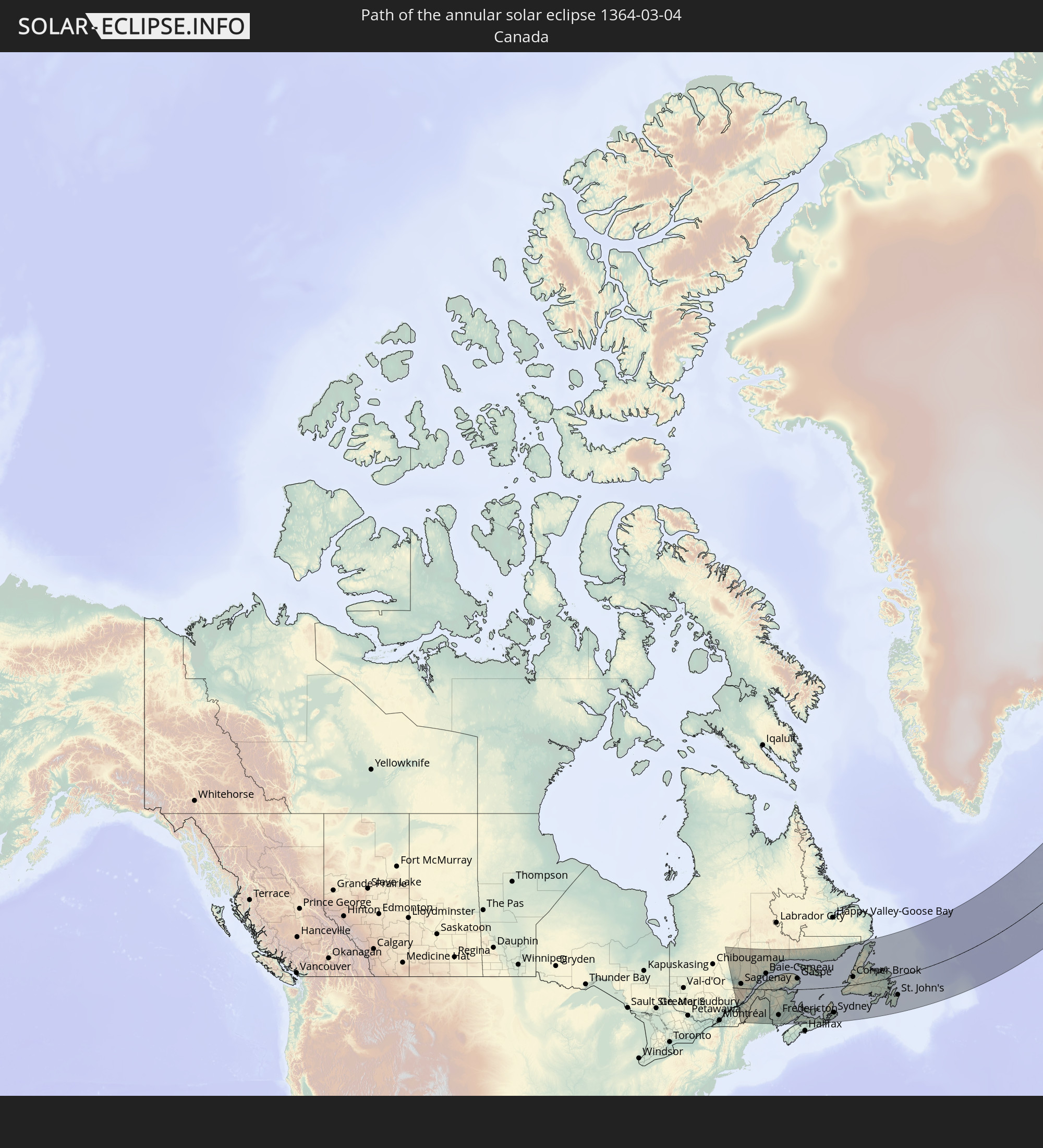 Canada
 Saint Pierre and Miquelon
 Iceland
 Svalbard and Jan Mayen
In den folgenden Ländern ist die Sonnenfinsternis partiell zu sehen
 Russia
 United States
 Canada
 Greenland
 Brazil
 Venezuela
 Bermuda
 Anguilla
 Collectivity of Saint Martin
 Saint Barthélemy
 Saint Kitts and Nevis
 Antigua and Barbuda
 Montserrat
 Trinidad and Tobago
 Guadeloupe
 Grenada
 Dominica
 Saint Vincent and the Grenadines
 Guyana
 Martinique
 Saint Lucia
 Barbados
 Suriname
 Saint Pierre and Miquelon
 French Guiana
 Portugal
 Cabo Verde
 Iceland
 Spain
Spain
 Senegal
 Mauritania
 The Gambia
 Guinea-Bissau
 Guinea
 Morocco
 Mali
Mali
 Republic of Ireland
 Svalbard and Jan Mayen
 Algeria
 United Kingdom
 Faroe Islands
 Gibraltar
 France
 Isle of Man
 Guernsey
 Jersey
 Andorra
 Belgium
 Netherlands
 Norway
 Luxembourg
 Germany
 Switzerland
 Italy
Italy
 Monaco
 Tunisia
 Denmark
 Libya
Libya
 Liechtenstein
 Austria
 Sweden
 Czechia
 San Marino
 Vatican City
 Slovenia
 Croatia
 Poland
 Malta
Malta
 Bosnia and Herzegovina
 Hungary
 Slovakia
 Montenegro
 Serbia
 Albania
 Åland Islands
 Greece
 Romania
 Republic of Macedonia
 Finland
 Lithuania
 Latvia
 Estonia
 Ukraine
 Bulgaria
 Belarus
 Egypt
Egypt
 Turkey
 Moldova
 Cyprus
 Lebanon
 Syria
Syria
 Iraq
Iraq
 Georgia
 Armenia
 Iran
Iran
 Azerbaijan
 Kazakhstan
 Turkmenistan
 Uzbekistan
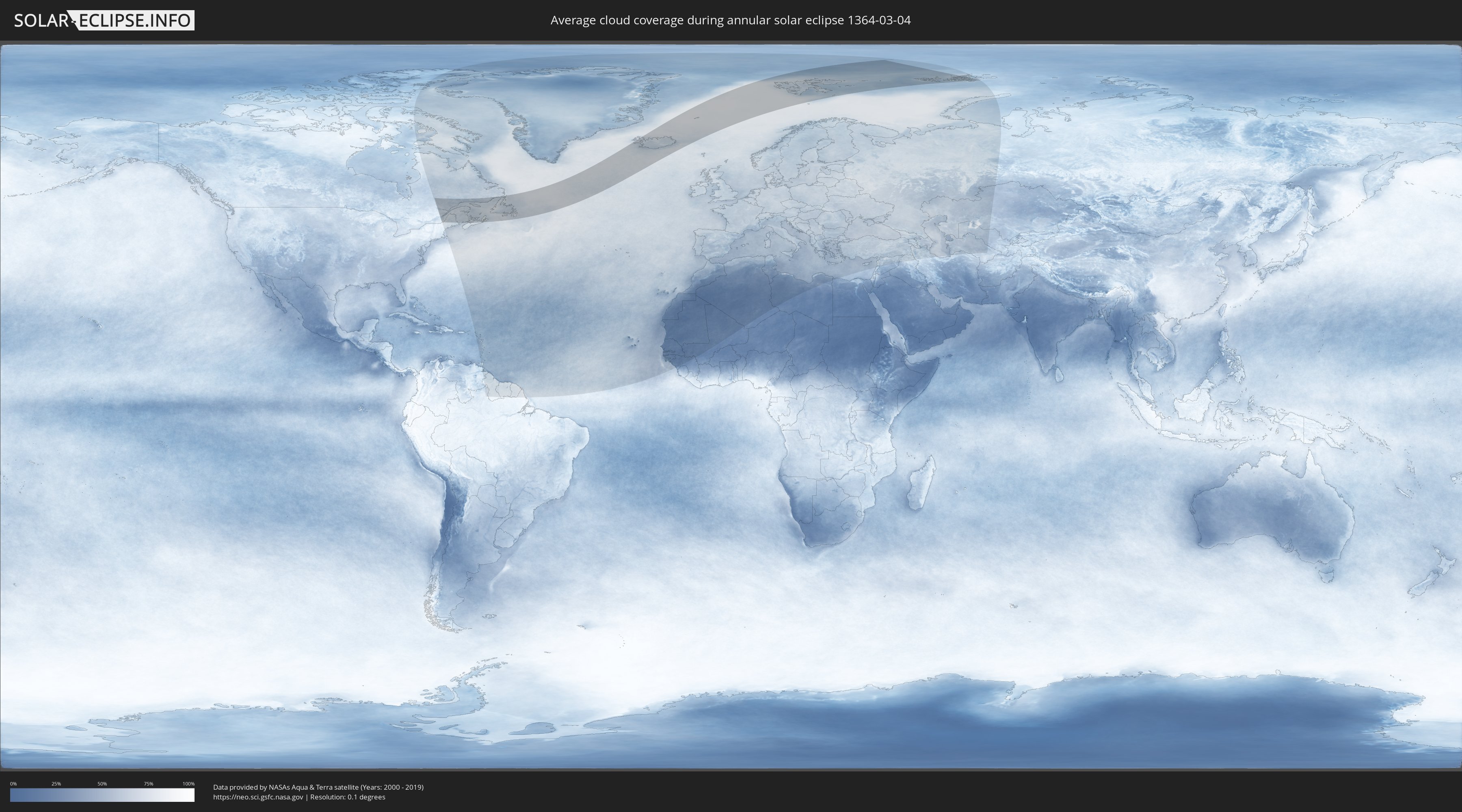
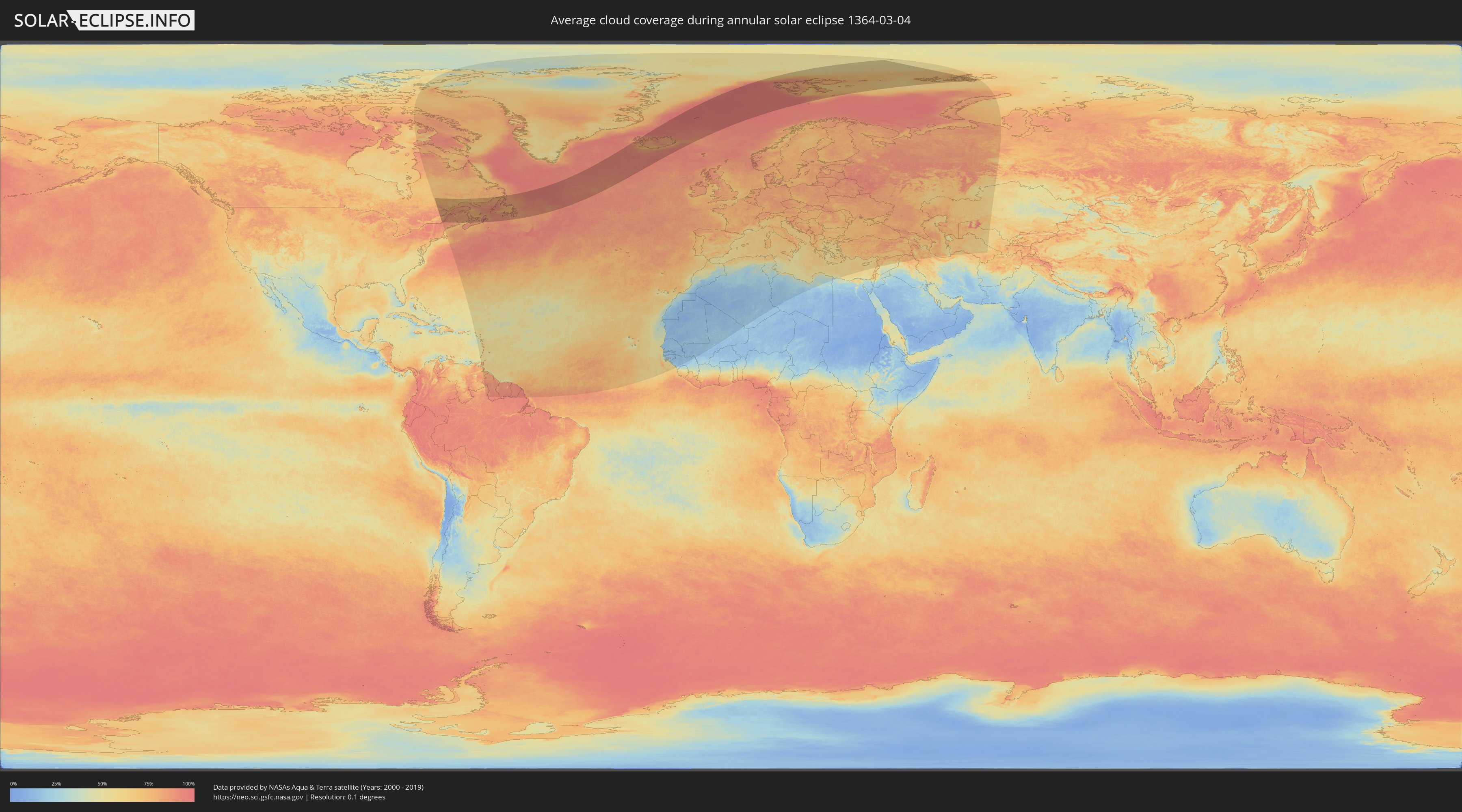
How will be the weather during the annular solar eclipse on 03/04/1364?
Where is the best place to see the annular solar eclipse of 03/04/1364?
The following maps show the average cloud coverage for the day of the annular solar eclipse.
With the help of these maps, it is possible to find the place along the eclipse path, which has the best
chance of a cloudless sky.
Nevertheless, you should consider local circumstances and inform about the weather of your chosen
observation site.
The data is provided by NASAs satellites
AQUA and TERRA.
The cloud maps are averaged over a period of 19 years (2000 - 2019).
Detailed country maps
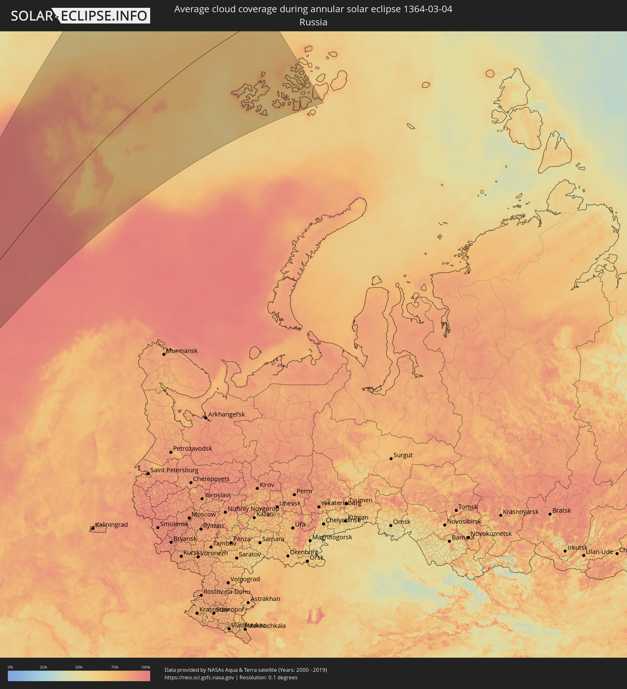 Russia
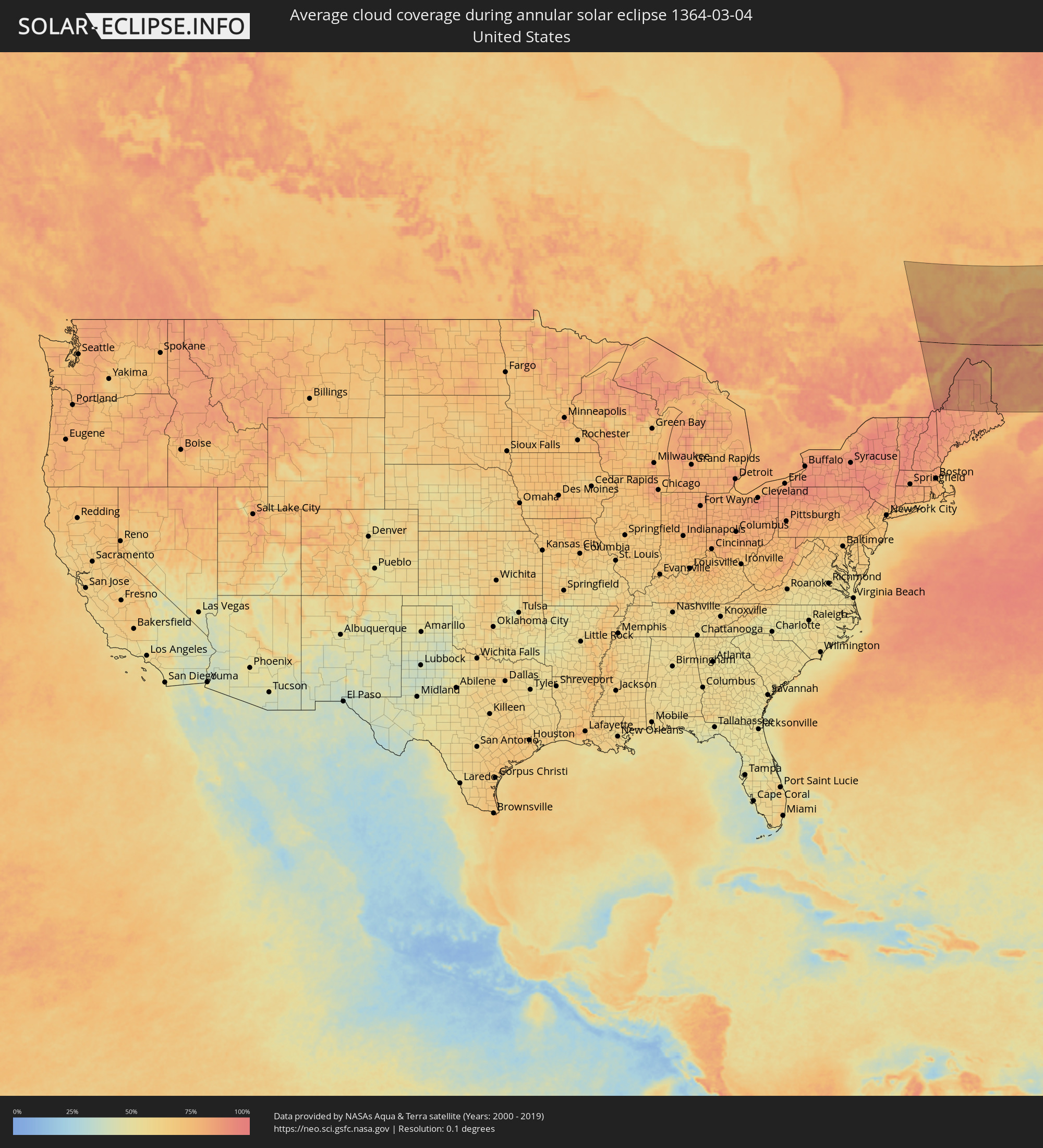 United States
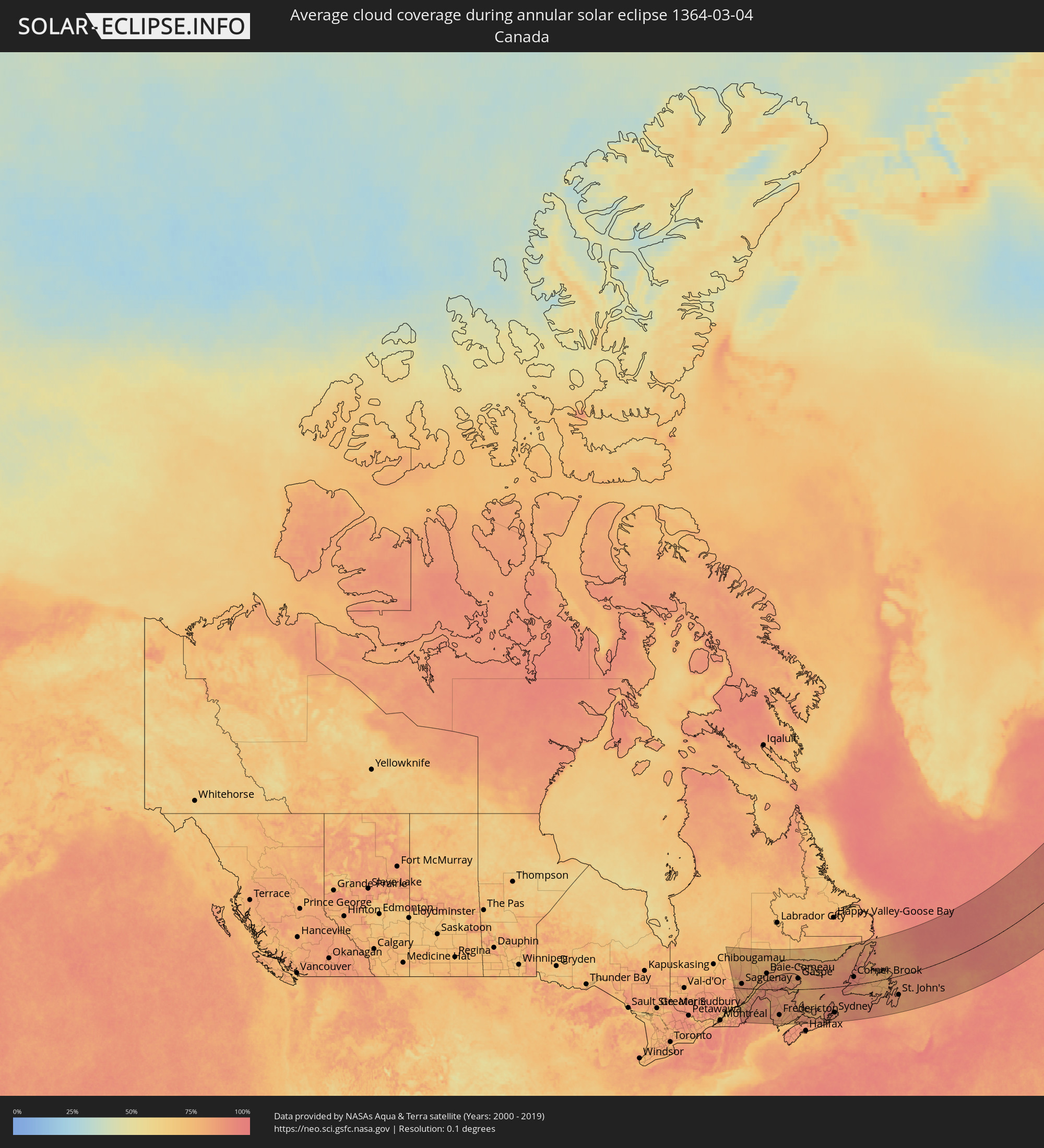 Canada
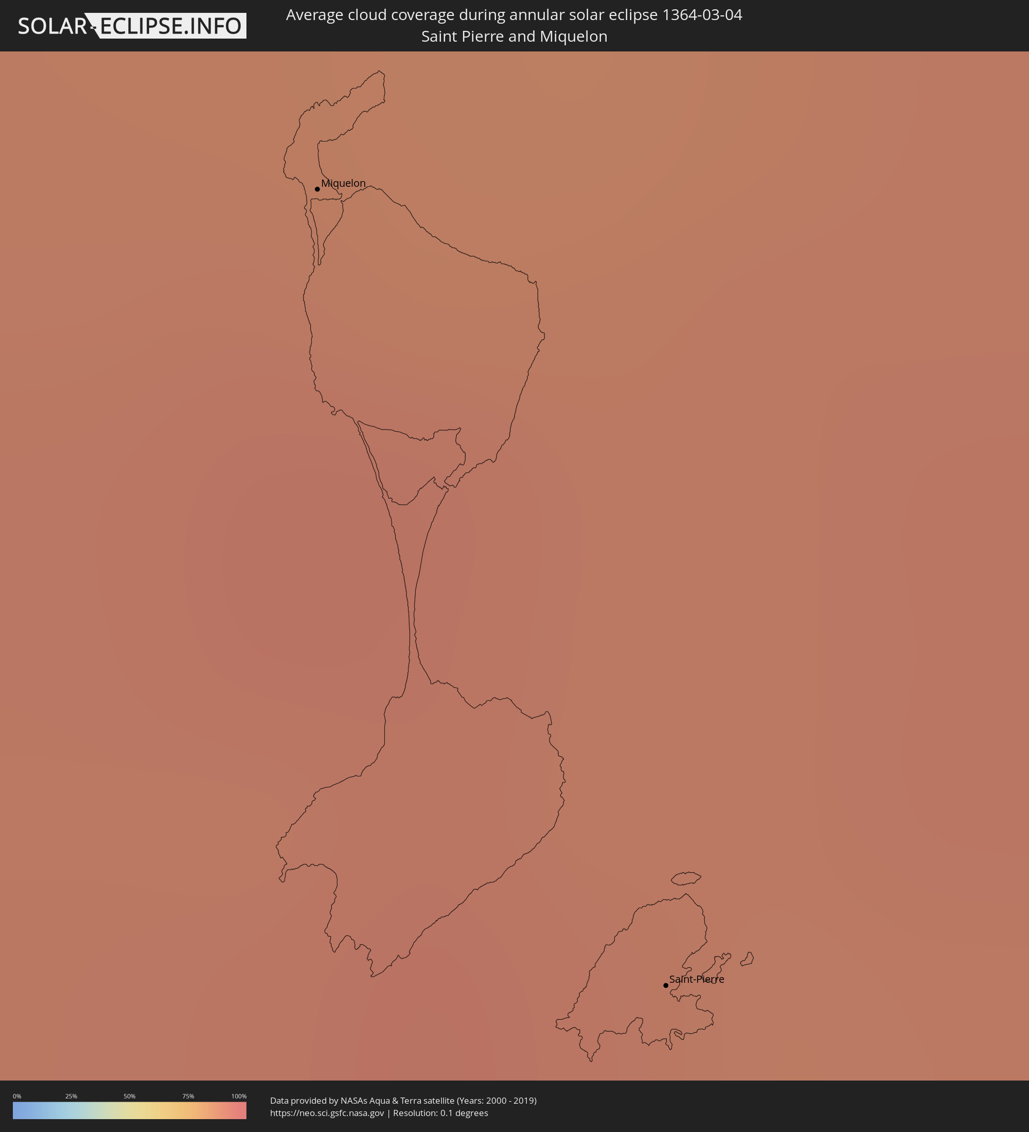 Saint Pierre and Miquelon
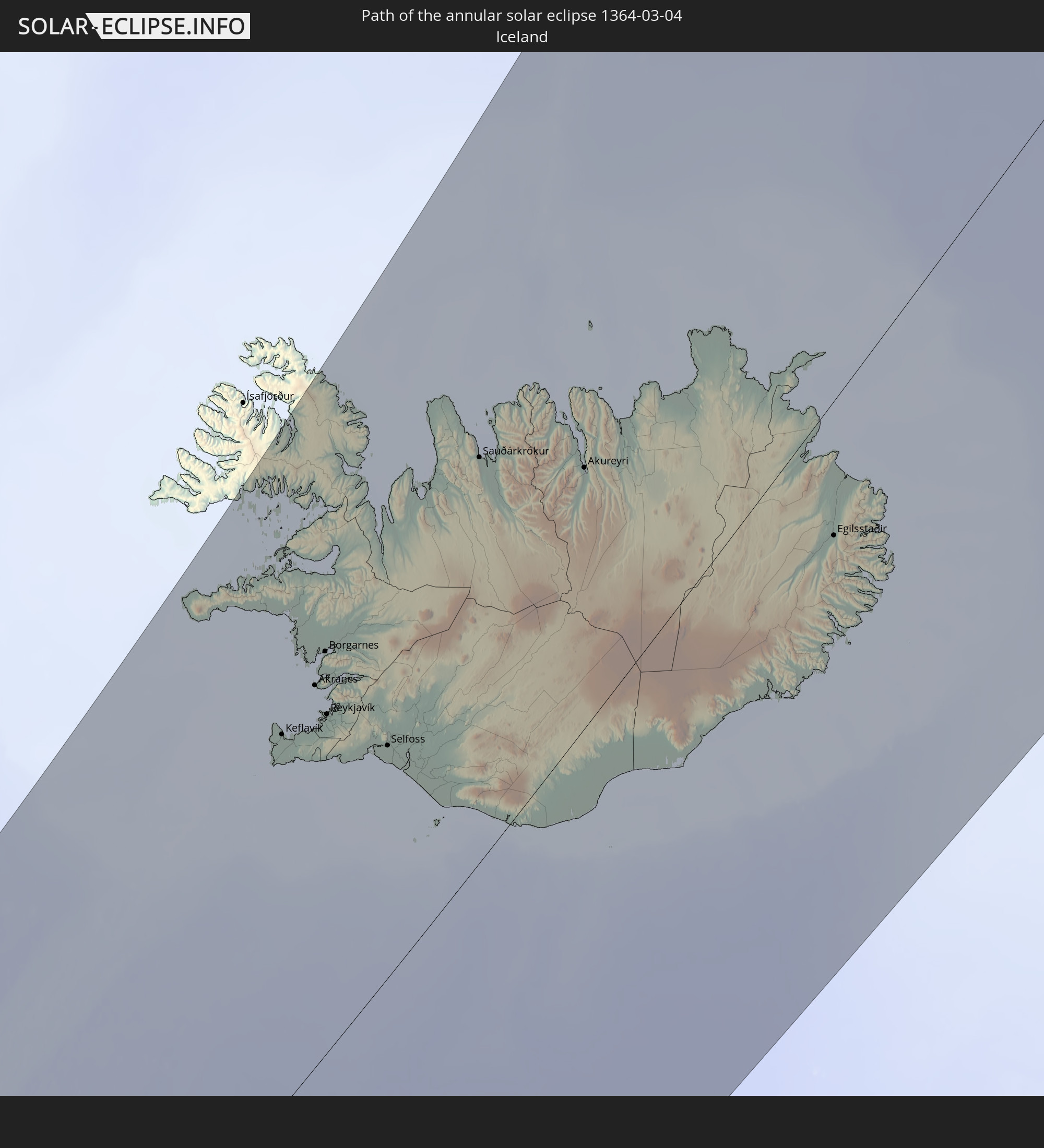
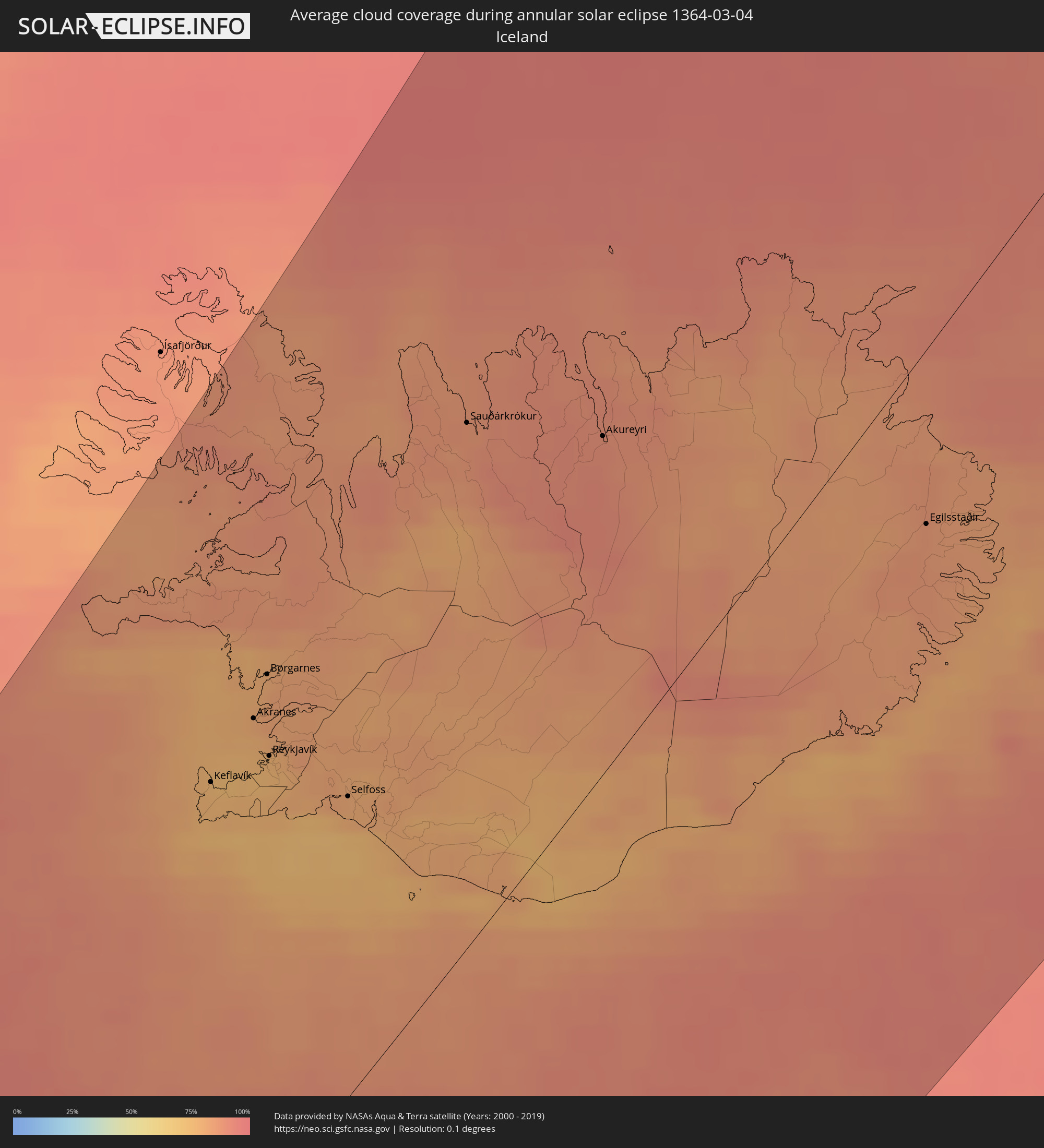 Iceland
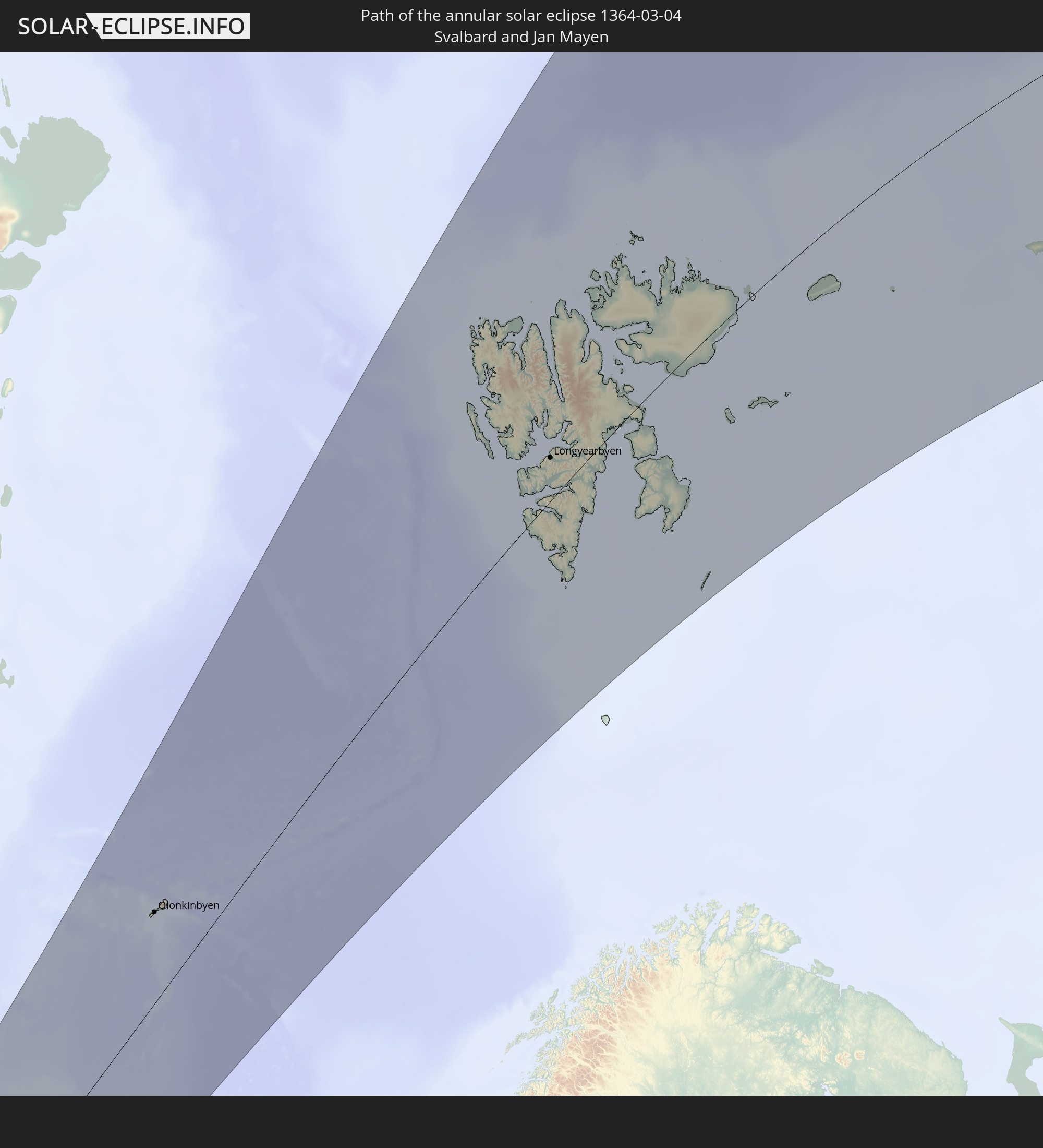
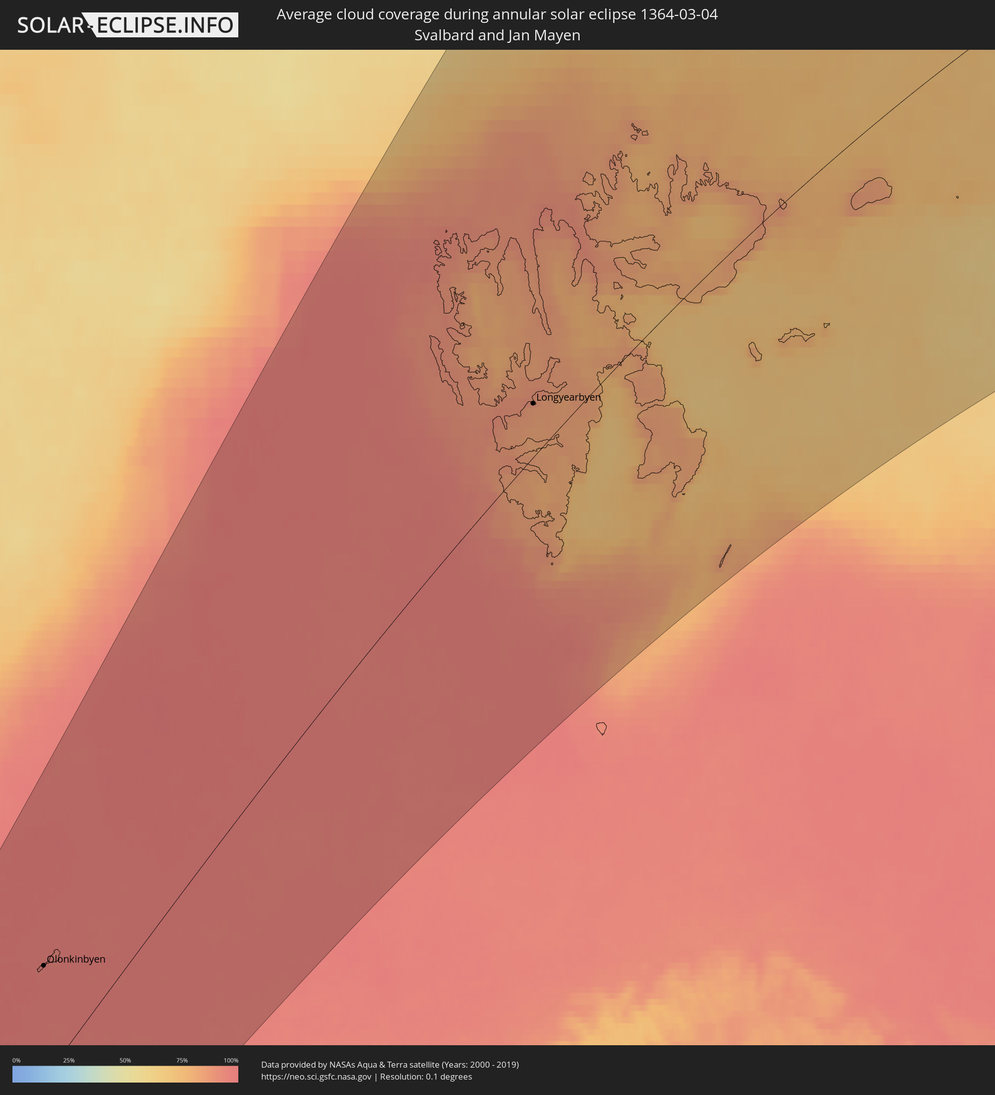 Svalbard and Jan Mayen
Cities inside the path of the eclipse
The following table shows all locations with a population of more than 5,000 inside the eclipse path. Cities which have more than 100,000 inhabitants are marked bold. A click at the locations opens a detailed map.
| City | Type | Eclipse duration | Local time of max. eclipse | Distance to central line | Ø Cloud coverage |
|
Dolbeau-Mistassini, Quebec
|
annular | - | 06:13:44 UTC-05:00 | 83 km | 74% |
|
Pont Rouge, Quebec
|
annular | - | 06:13:45 UTC-05:00 | 83 km | 74% |
|
Alma, Quebec
|
annular | - | 06:13:10 UTC-05:00 | 48 km | 74% |
|
Saint-Augustin-de-Desmaures, Quebec
|
annular | - | 06:09:46 UTC-05:00 | 151 km | 77% |
|
L'Ancienne-Lorette, Quebec
|
annular | - | 06:09:53 UTC-05:00 | 145 km | 79% |
|
Thetford-Mines, Quebec
|
annular | - | 06:08:35 UTC-05:00 | 222 km | 83% |
|
Québec, Quebec
|
annular | - | 06:09:56 UTC-05:00 | 142 km | 77% |
|
Saguenay, Quebec
|
annular | - | 06:12:59 UTC-05:00 | 37 km | 80% |
|
Sainte-Marie, Quebec
|
annular | - | 06:09:15 UTC-05:00 | 183 km | 78% |
|
Saint-Georges, Quebec
|
annular | - | 06:08:41 UTC-05:00 | 217 km | 84% |
|
Montmagny, Quebec
|
annular | - | 06:10:19 UTC-05:00 | 120 km | 79% |
|
La Malbaie, Quebec
|
annular | - | 06:11:39 UTC-05:00 | 44 km | 79% |
|
Rivière-du-Loup, Quebec
|
annular | - | 06:12:05 UTC-05:00 | 22 km | 79% |
|
Rimouski, Quebec
|
annular | - | 06:13:28 UTC-05:00 | 50 km | 85% |
|
Edmundston, New Brunswick
|
annular | - | 06:57:02 UTC-04:14 | 69 km | 83% |
|
Baie-Comeau, Quebec
|
annular | - | 06:15:02 UTC-05:00 | 137 km | 81% |
|
Presque Isle, Maine
|
annular | - | 06:10:10 UTC-05:00 | 146 km | 79% |
|
Caribou, Maine
|
annular | - | 06:10:30 UTC-05:00 | 126 km | 74% |
|
Matane, Quebec
|
annular | - | 06:14:25 UTC-05:00 | 94 km | 86% |
|
Fredericton, New Brunswick
|
annular | - | 06:54:38 UTC-04:14 | 226 km | 83% |
|
Oromocto, New Brunswick
|
annular | - | 06:54:28 UTC-04:14 | 238 km | 83% |
|
Sept-Îles, Quebec
|
annular | - | 06:17:24 UTC-05:00 | 248 km | 73% |
|
Saint John, New Brunswick
|
annular | - | 06:53:30 UTC-04:14 | 301 km | 76% |
|
Bathurst, New Brunswick
|
annular | - | 06:58:06 UTC-04:14 | 40 km | 82% |
|
Miramichi, New Brunswick
|
annular | - | 06:57:00 UTC-04:14 | 106 km | 86% |
|
Lutes Mountain, New Brunswick
|
annular | - | 06:55:26 UTC-04:14 | 206 km | 83% |
|
Moncton, New Brunswick
|
annular | - | 06:55:23 UTC-04:14 | 211 km | 84% |
|
Dieppe, New Brunswick
|
annular | - | 06:55:23 UTC-04:14 | 213 km | 83% |
|
Chandler, Quebec
|
annular | - | 06:14:13 UTC-05:00 | 40 km | 85% |
|
Gaspé, Quebec
|
annular | - | 06:15:14 UTC-05:00 | 94 km | 84% |
|
Amherst, Nova Scotia
|
annular | - | 06:55:03 UTC-04:14 | 241 km | 87% |
|
Summerside, Prince Edward Island
|
annular | - | 06:56:16 UTC-04:14 | 179 km | 80% |
|
Truro, Nova Scotia
|
annular | - | 06:54:26 UTC-04:14 | 295 km | 83% |
|
Charlottetown, Prince Edward Island
|
annular | - | 06:56:10 UTC-04:14 | 199 km | 80% |
|
New Glasgow, Nova Scotia
|
annular | - | 06:55:03 UTC-04:14 | 274 km | 87% |
|
Sydney, Nova Scotia
|
annular | - | 06:57:02 UTC-04:14 | 226 km | 89% |
|
Glace Bay, Nova Scotia
|
annular | - | 06:57:15 UTC-04:14 | 221 km | 88% |
|
Corner Brook, Newfoundland and Labrador
|
annular | - | 07:47:11 UTC-03:30 | 66 km | 93% |
|
Miquelon, Miquelon-Langlade
|
annular | - | 07:30:28 UTC-03:44 | 156 km | 91% |
|
Saint-Pierre, Saint-Pierre
|
annular | - | 07:29:56 UTC-03:44 | 193 km | 90% |
|
Grand Falls-Windsor, Newfoundland and Labrador
|
annular | - | 07:48:21 UTC-03:30 | 36 km | 81% |
|
Bay Roberts, Newfoundland and Labrador
|
annular | - | 07:47:05 UTC-03:30 | 146 km | 89% |
|
Conception Bay South, Newfoundland and Labrador
|
annular | - | 07:47:03 UTC-03:30 | 161 km | 86% |
|
St. John's, Newfoundland and Labrador
|
annular | - | 07:47:22 UTC-03:30 | 159 km | 87% |
|
Keflavík, Southern Peninsula
|
annular | - | 10:47:12 UTC-01:28 | 173 km | 76% |
|
Akranes, West
|
annular | - | 10:48:02 UTC-01:28 | 174 km | 77% |
|
Hafnarfjörður, Capital Region
|
annular | - | 10:47:53 UTC-01:28 | 152 km | 75% |
|
Garðabær, Capital Region
|
annular | - | 10:47:55 UTC-01:28 | 152 km | 75% |
|
Borgarnes, West
|
annular | - | 10:48:25 UTC-01:28 | 182 km | 81% |
|
Kópavogur, Capital Region
|
annular | - | 10:47:57 UTC-01:28 | 154 km | 75% |
|
Reykjavík, Capital Region
|
annular | - | 10:48:00 UTC-01:28 | 155 km | 75% |
|
Mosfellsbær, Capital Region
|
annular | - | 10:48:13 UTC-01:28 | 150 km | 79% |
|
Selfoss, South
|
annular | - | 10:48:40 UTC-01:28 | 107 km | 78% |
|
Sauðárkrókur, Northwest
|
annular | - | 10:51:50 UTC-01:28 | 172 km | 87% |
|
Akureyri, Northeast
|
annular | - | 10:53:13 UTC-01:28 | 109 km | 90% |
|
Egilsstaðir, East
|
annular | - | 10:56:25 UTC-01:28 | 55 km | 86% |
|
Olonkinbyen, Jan Mayen
|
annular | - | 13:32:26 UTC+01:00 | 123 km | 97% |
|
Longyearbyen, Svalbard
|
annular | - | 13:44:44 UTC+01:00 | 41 km | 84% |