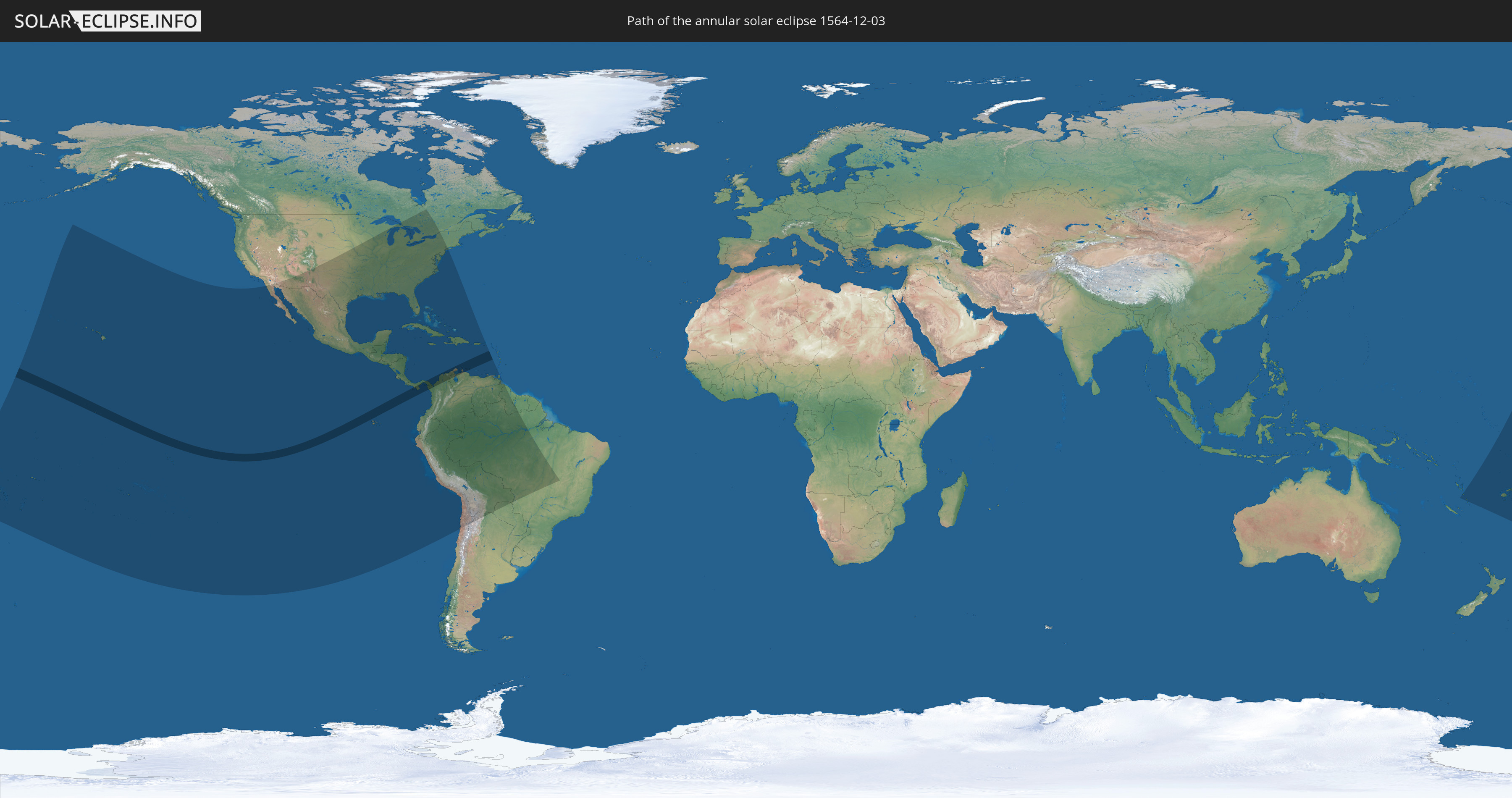
Annular solar eclipse of 12/03/1564
| Day of week: | Thursday |
| Maximum duration of eclipse: | 06m42s |
| Maximum width of eclipse path: | 195 km |
| Saros cycle: | 125 |
| Coverage: | 94.9% |
| Magnitude: | 0.9487 |
| Gamma: | 0.2504 |
Wo kann man die Sonnenfinsternis vom 12/03/1564 sehen?
Die Sonnenfinsternis am 12/03/1564 kann man in 48 Ländern als partielle Sonnenfinsternis beobachten.
Der Finsternispfad verläuft durch 9 Länder. Nur in diesen Ländern ist sie als annular Sonnenfinsternis zu sehen.
In den folgenden Ländern ist die Sonnenfinsternis annular zu sehen
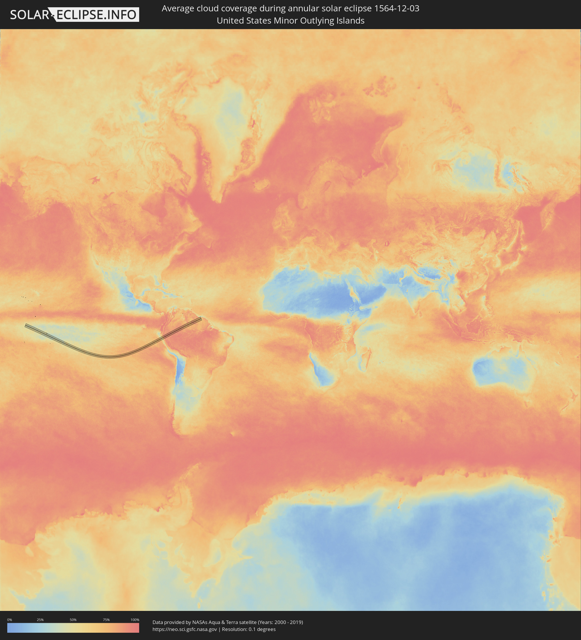
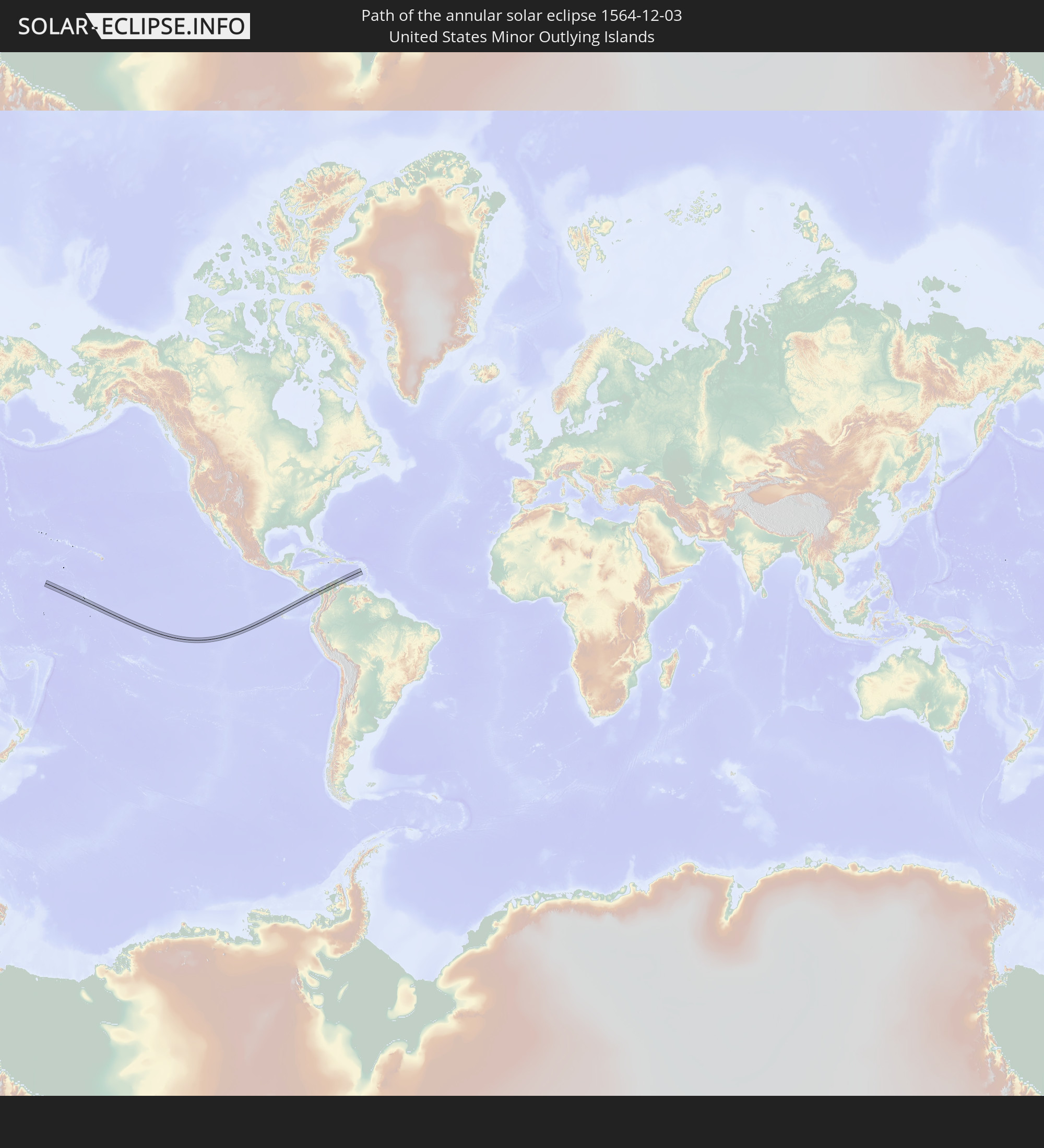 United States Minor Outlying Islands
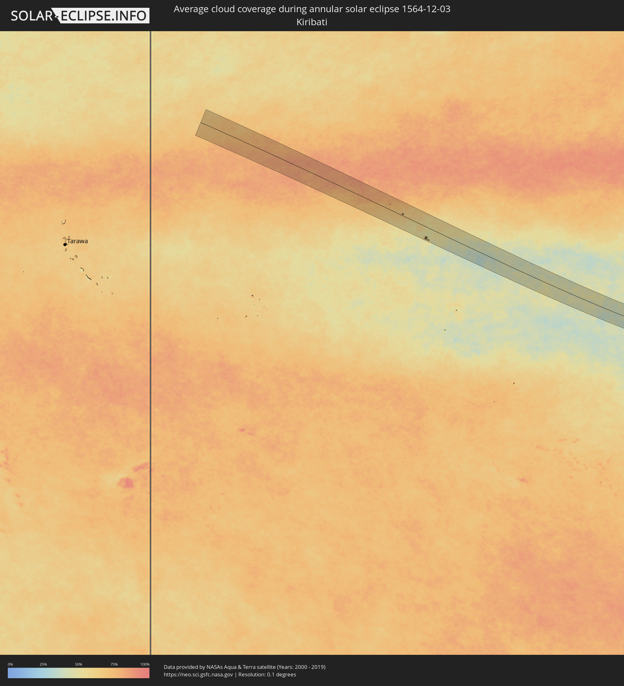
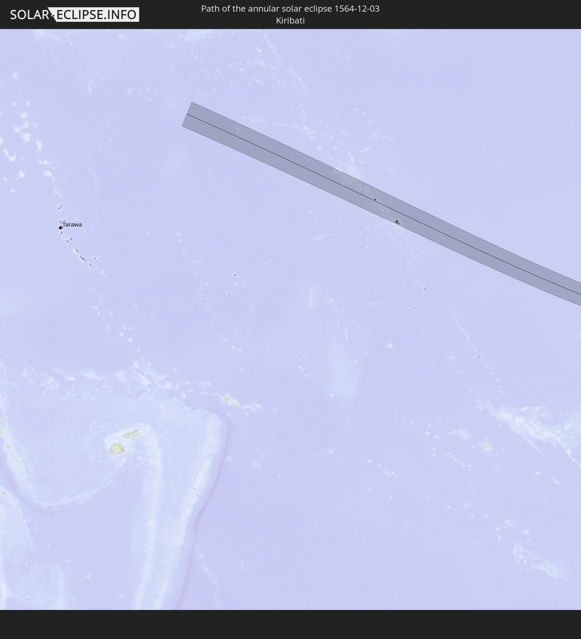 Kiribati
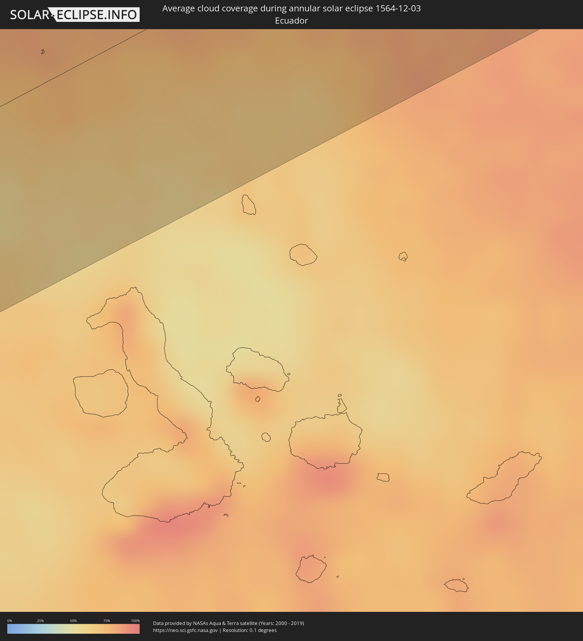
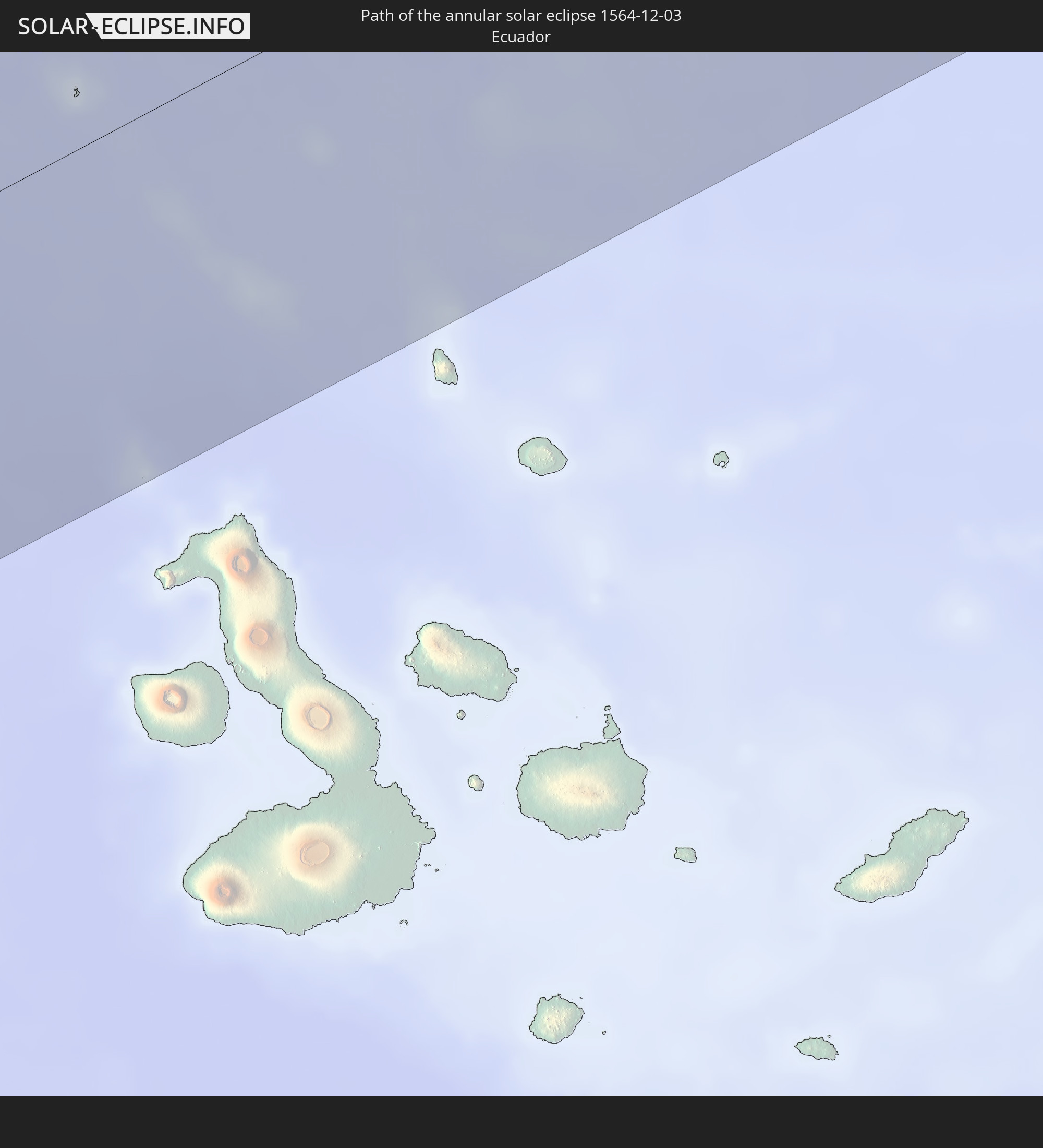 Ecuador
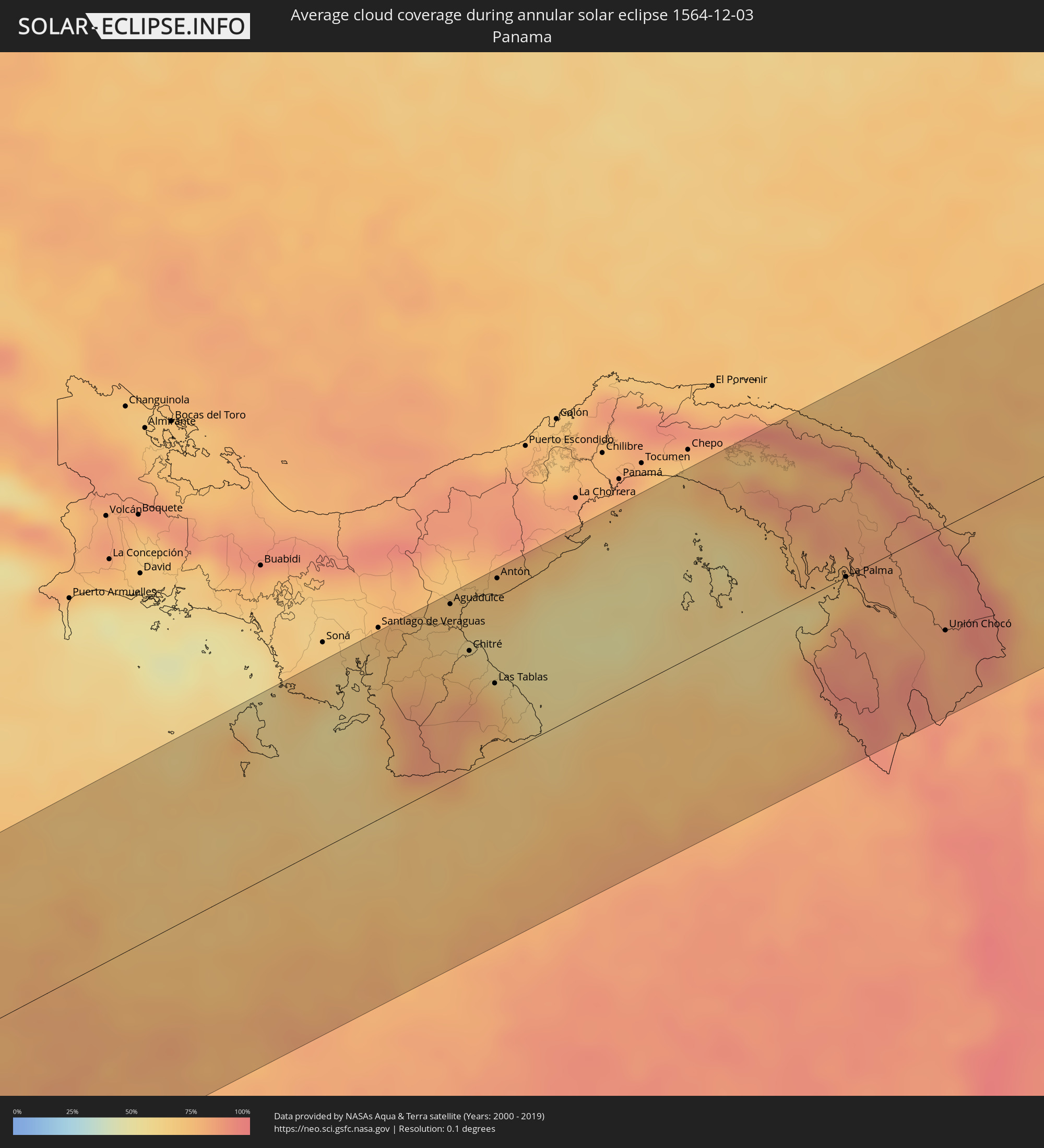
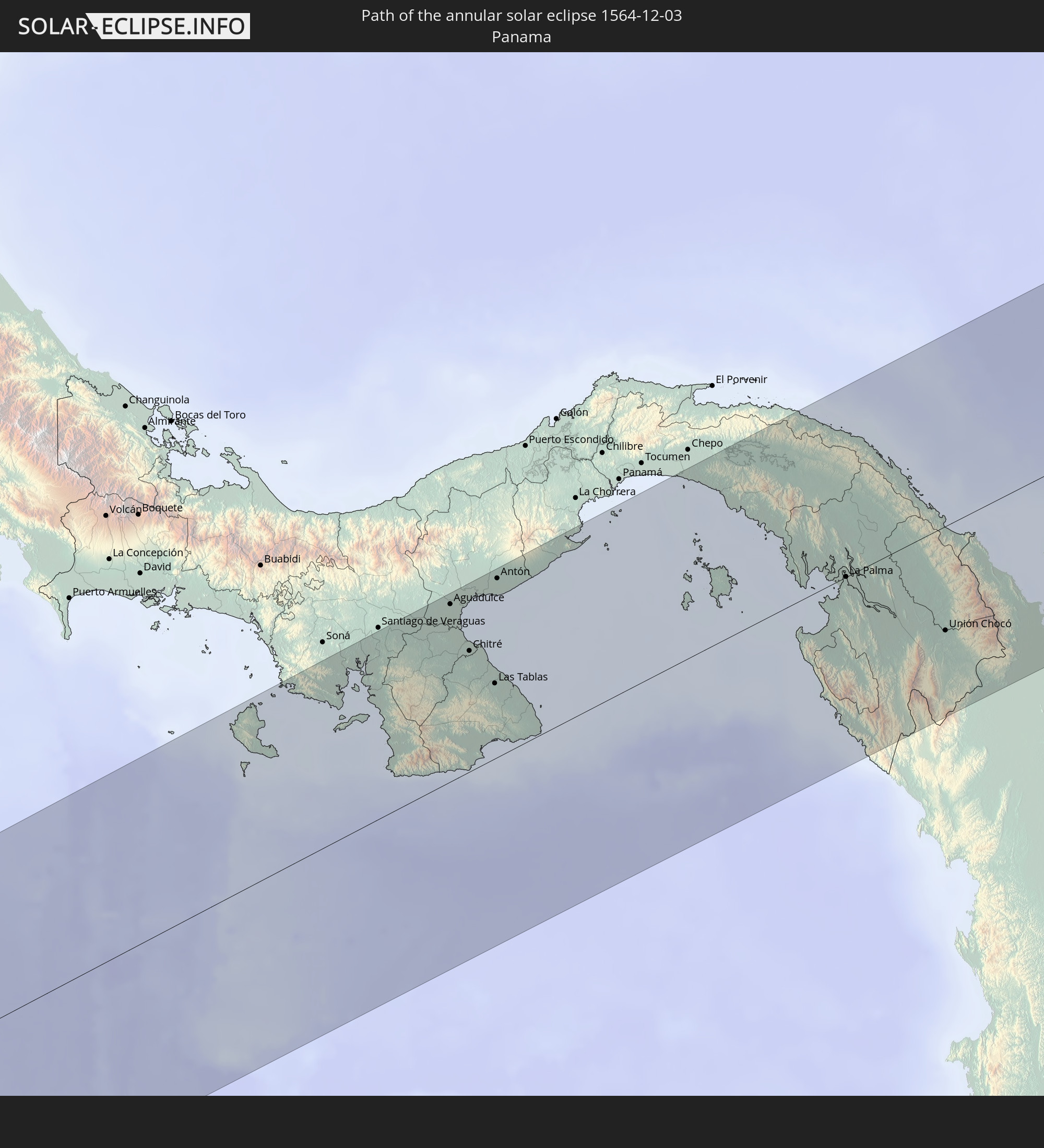 Panama
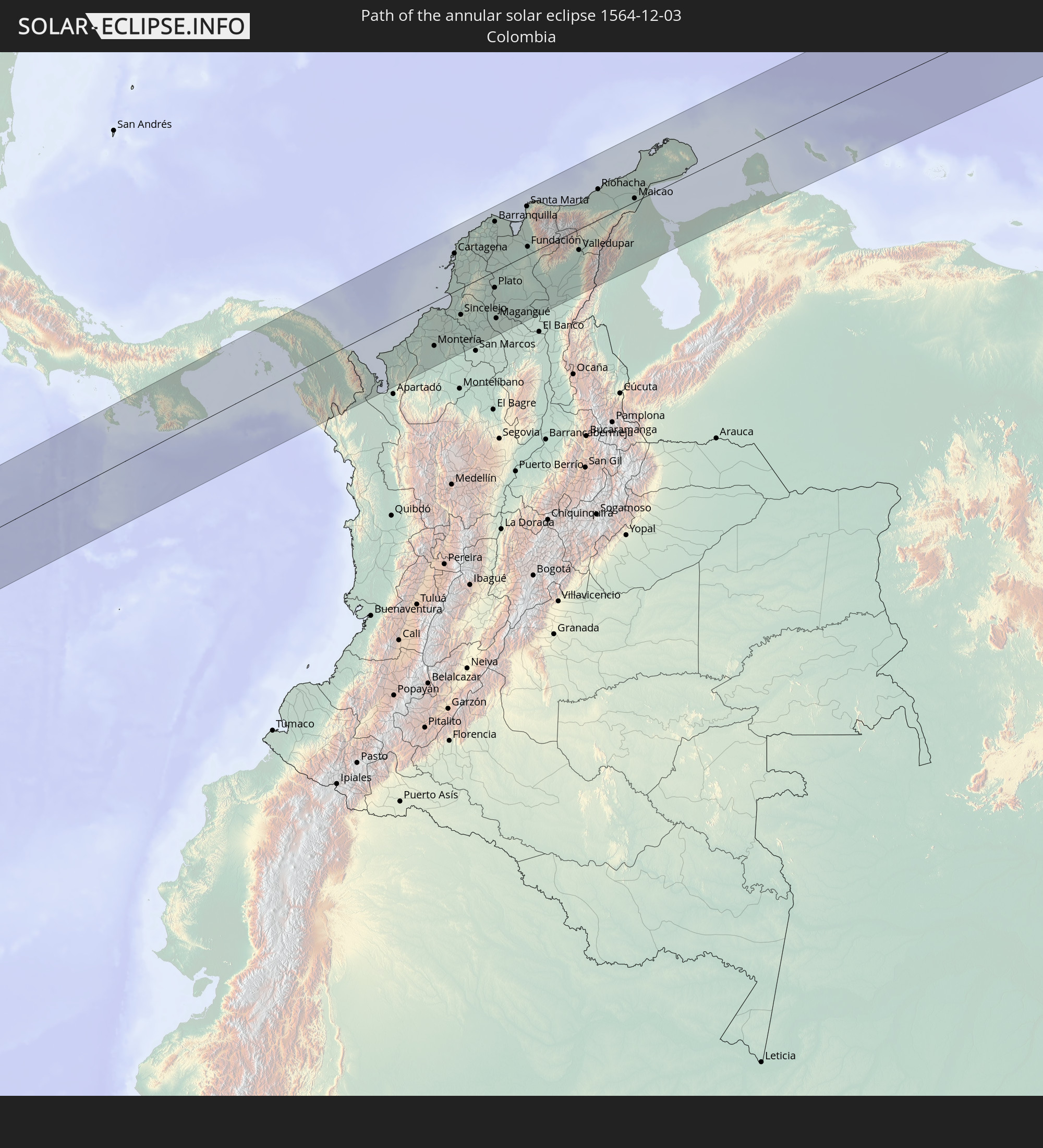 Colombia
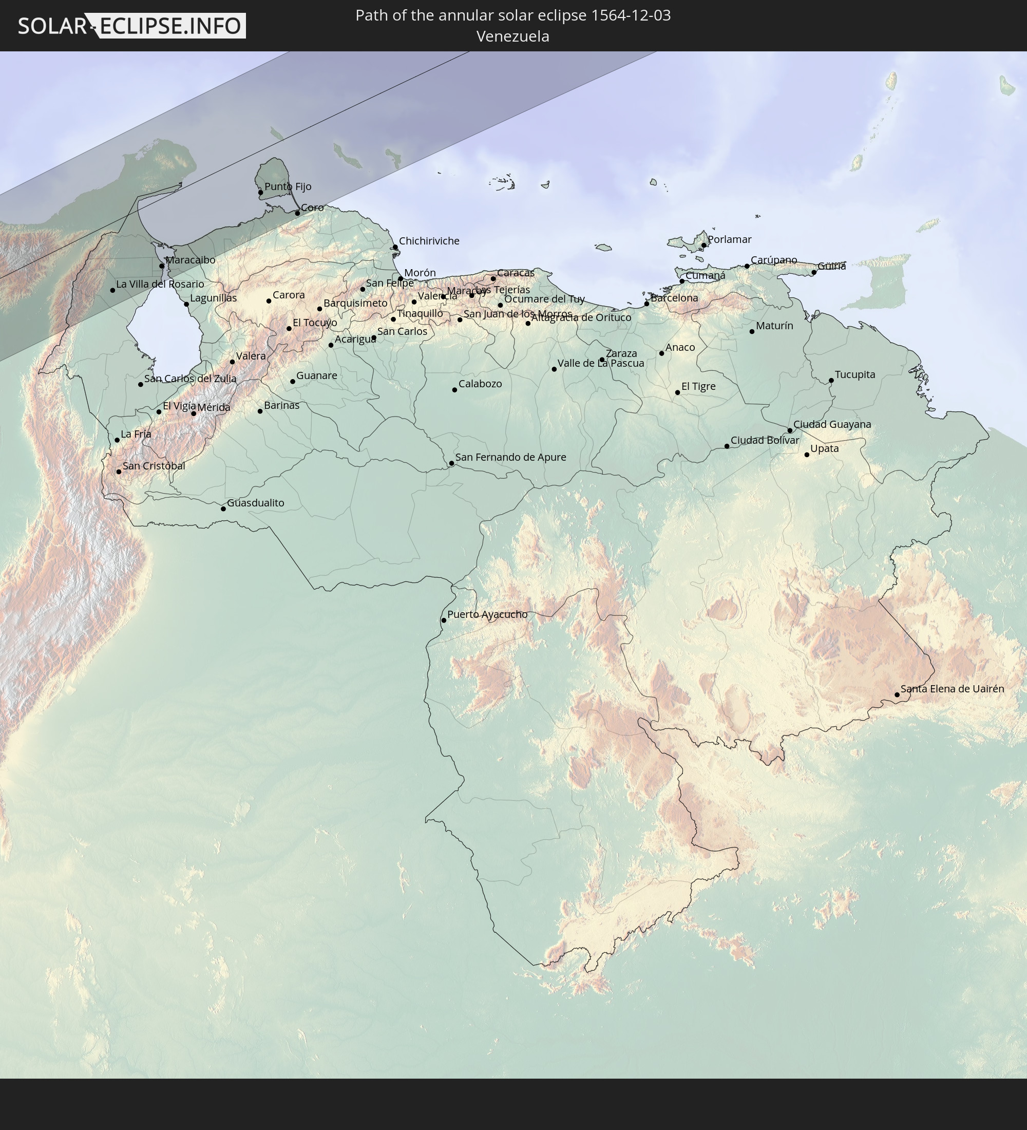 Venezuela
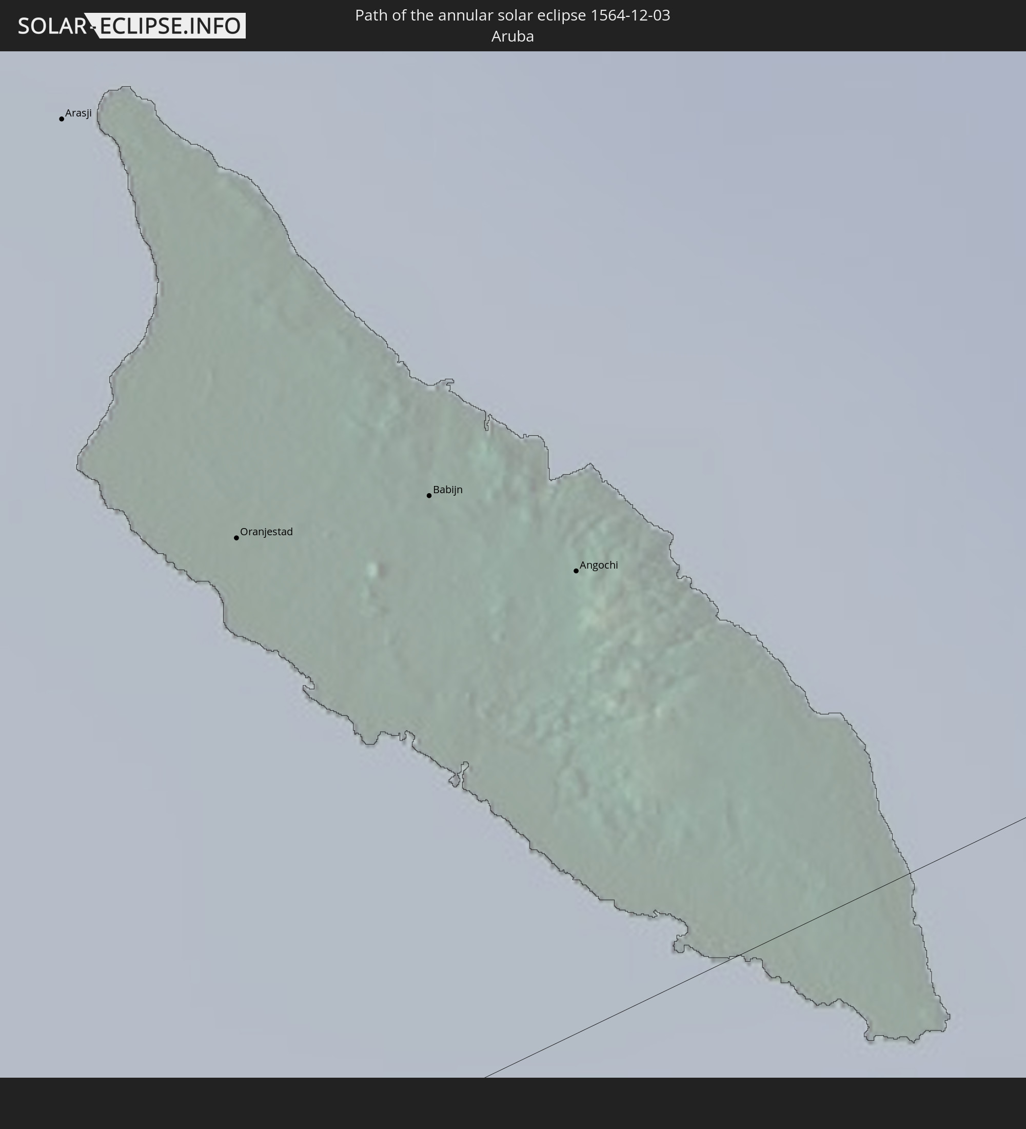 Aruba
Aruba
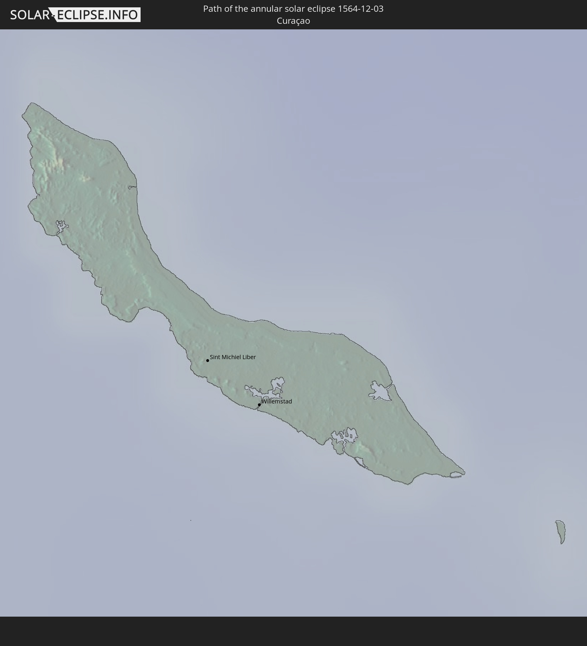 Curaçao
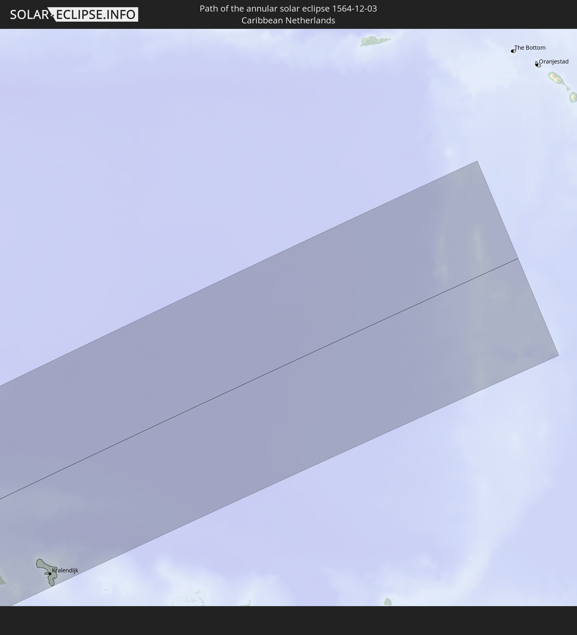 Caribbean Netherlands
In den folgenden Ländern ist die Sonnenfinsternis partiell zu sehen
 Fiji
Fiji
 United States
 United States Minor Outlying Islands
 Wallis and Futuna
 Tonga
Tonga
 Kiribati
 Samoa
Samoa
 Tokelau
 American Samoa
 Niue
Niue
 Cook Islands
 French Polynesia
 Canada
 Pitcairn Islands
 Mexico
 Chile
Chile
 Guatemala
 Ecuador
 El Salvador
 Honduras
 Belize
 Nicaragua
 Costa Rica
 Cuba
Cuba
 Panama
 Colombia
 Cayman Islands
 Peru
Peru
 The Bahamas
 Jamaica
 Haiti
Haiti
 Brazil
 Argentina
 Venezuela
 Turks and Caicos Islands
 Dominican Republic
 Aruba
Aruba
 Bolivia
 Puerto Rico
 United States Virgin Islands
 British Virgin Islands
 Paraguay
 Trinidad and Tobago
 Grenada
 Guyana
 Suriname
 Vanuatu
 Tuvalu
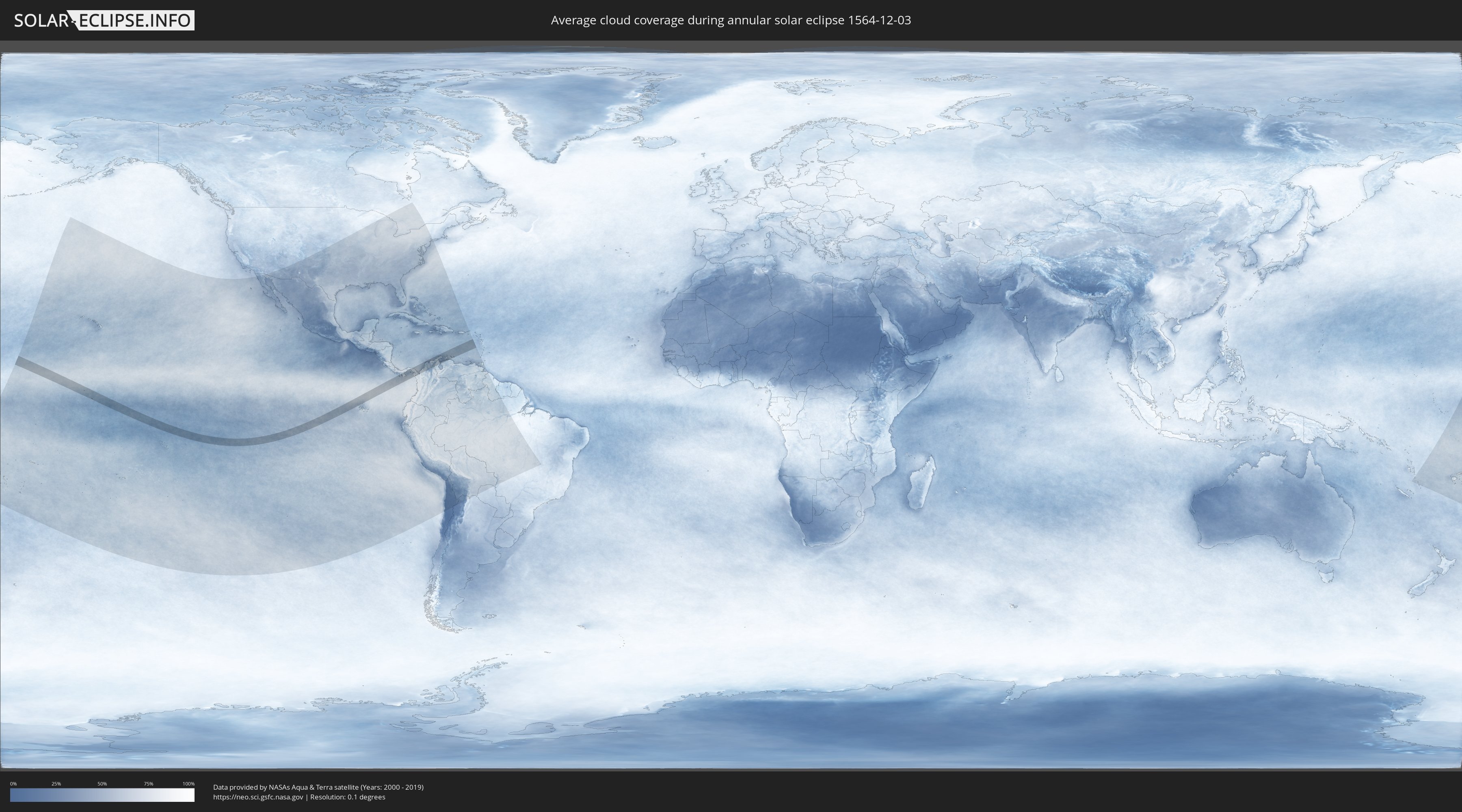
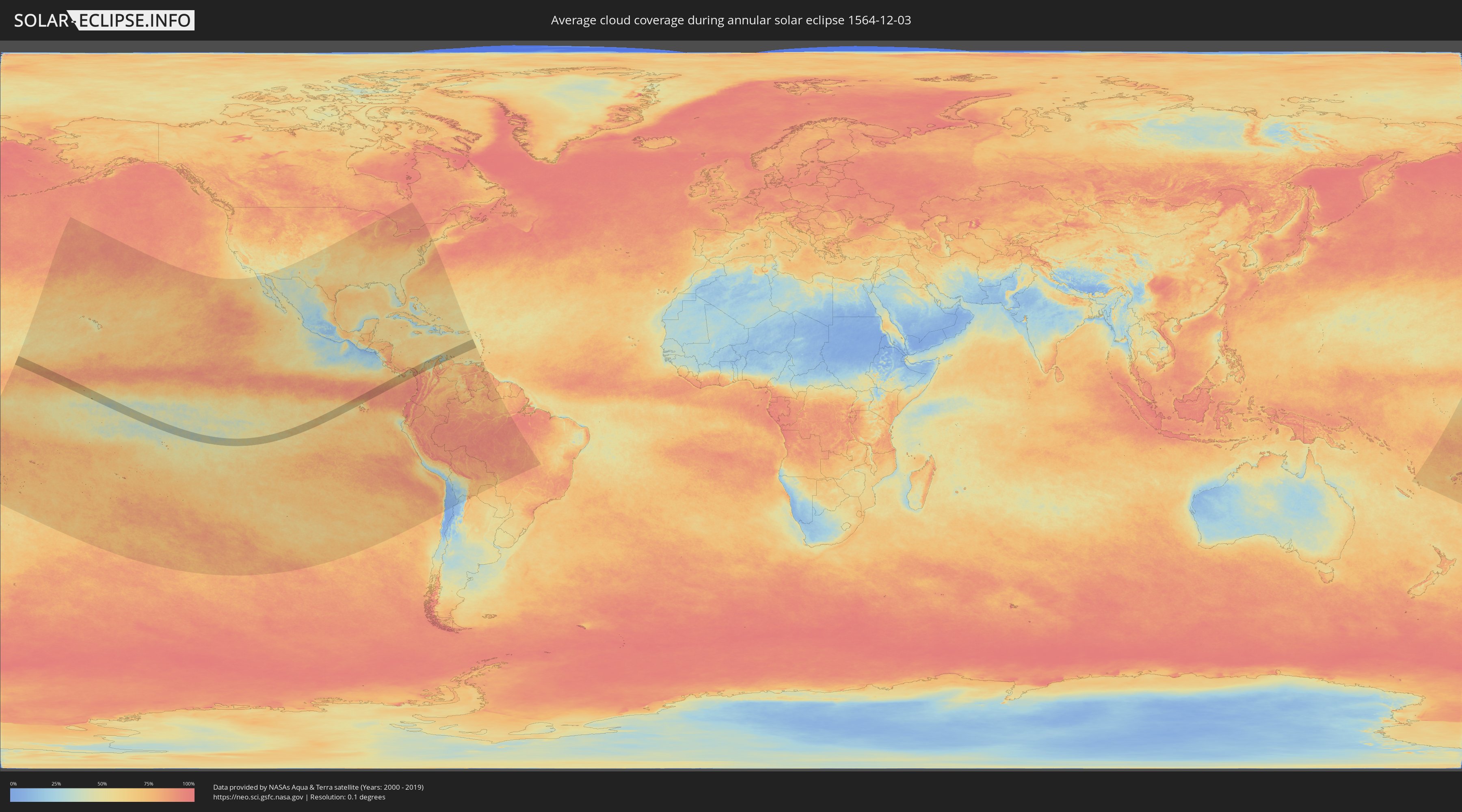
How will be the weather during the annular solar eclipse on 12/03/1564?
Where is the best place to see the annular solar eclipse of 12/03/1564?
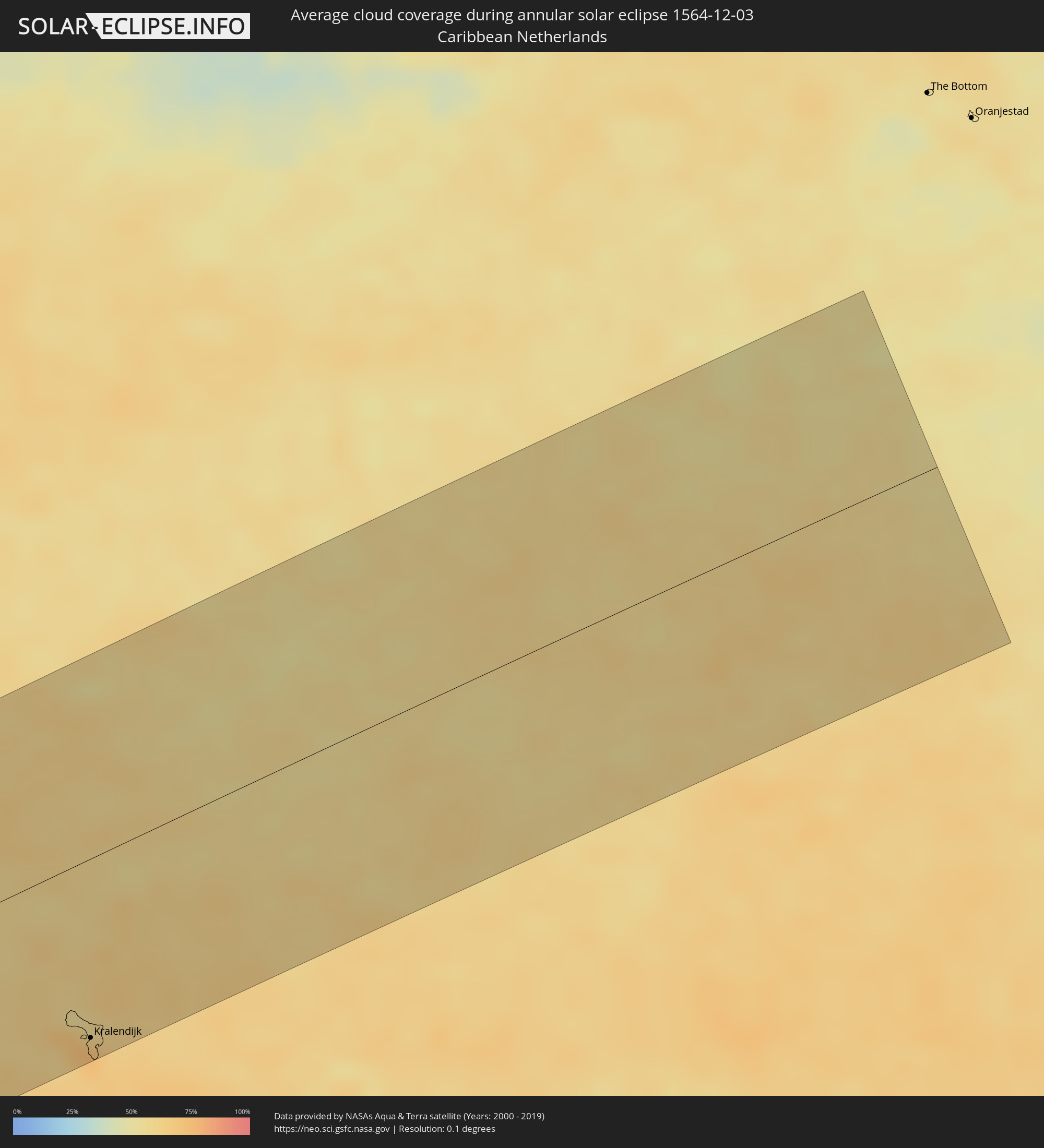
The following maps show the average cloud coverage for the day of the annular solar eclipse.
With the help of these maps, it is possible to find the place along the eclipse path, which has the best
chance of a cloudless sky.
Nevertheless, you should consider local circumstances and inform about the weather of your chosen
observation site.
The data is provided by NASAs satellites
AQUA and TERRA.
The cloud maps are averaged over a period of 19 years (2000 - 2019).
Detailed country maps
 United States Minor Outlying Islands
 Kiribati
 Ecuador
 Panama
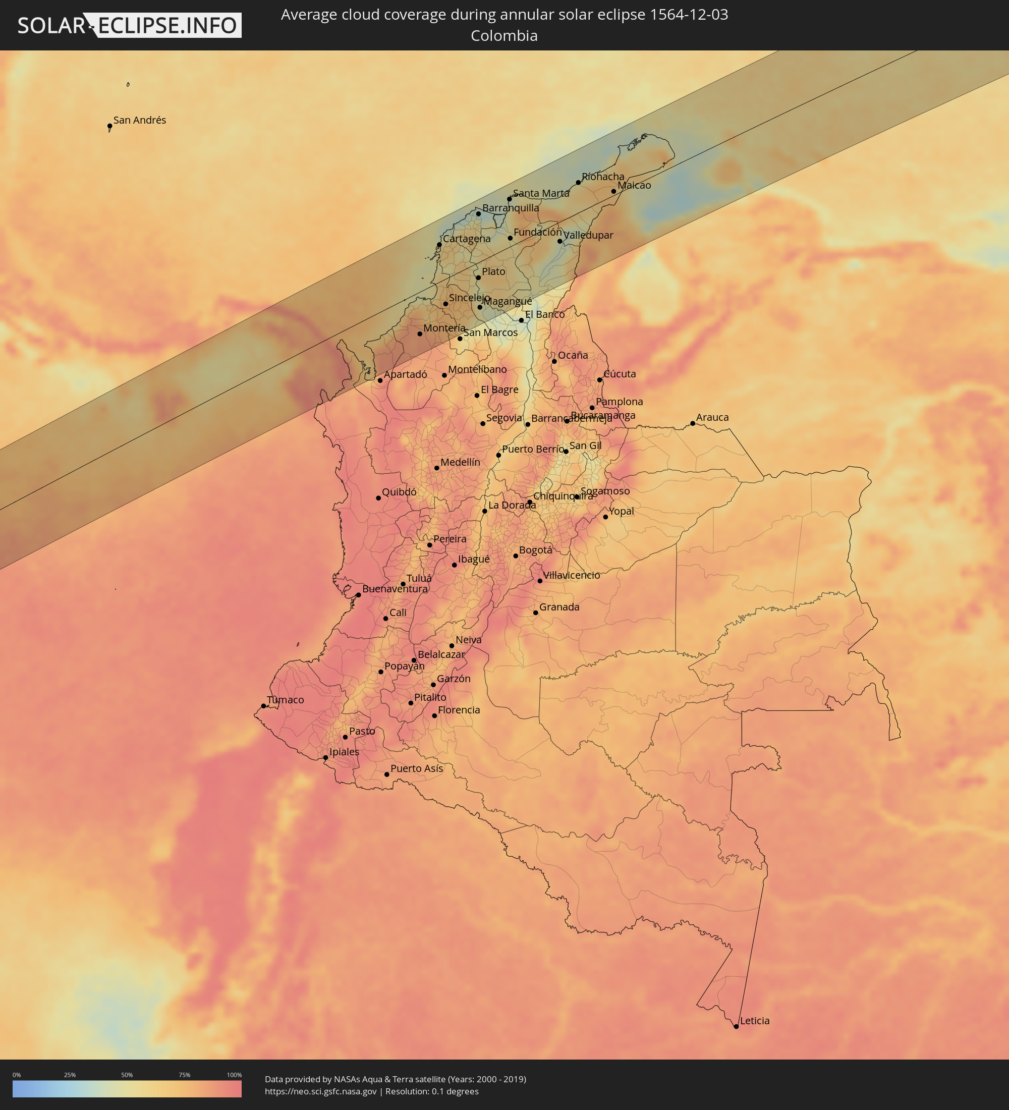 Colombia
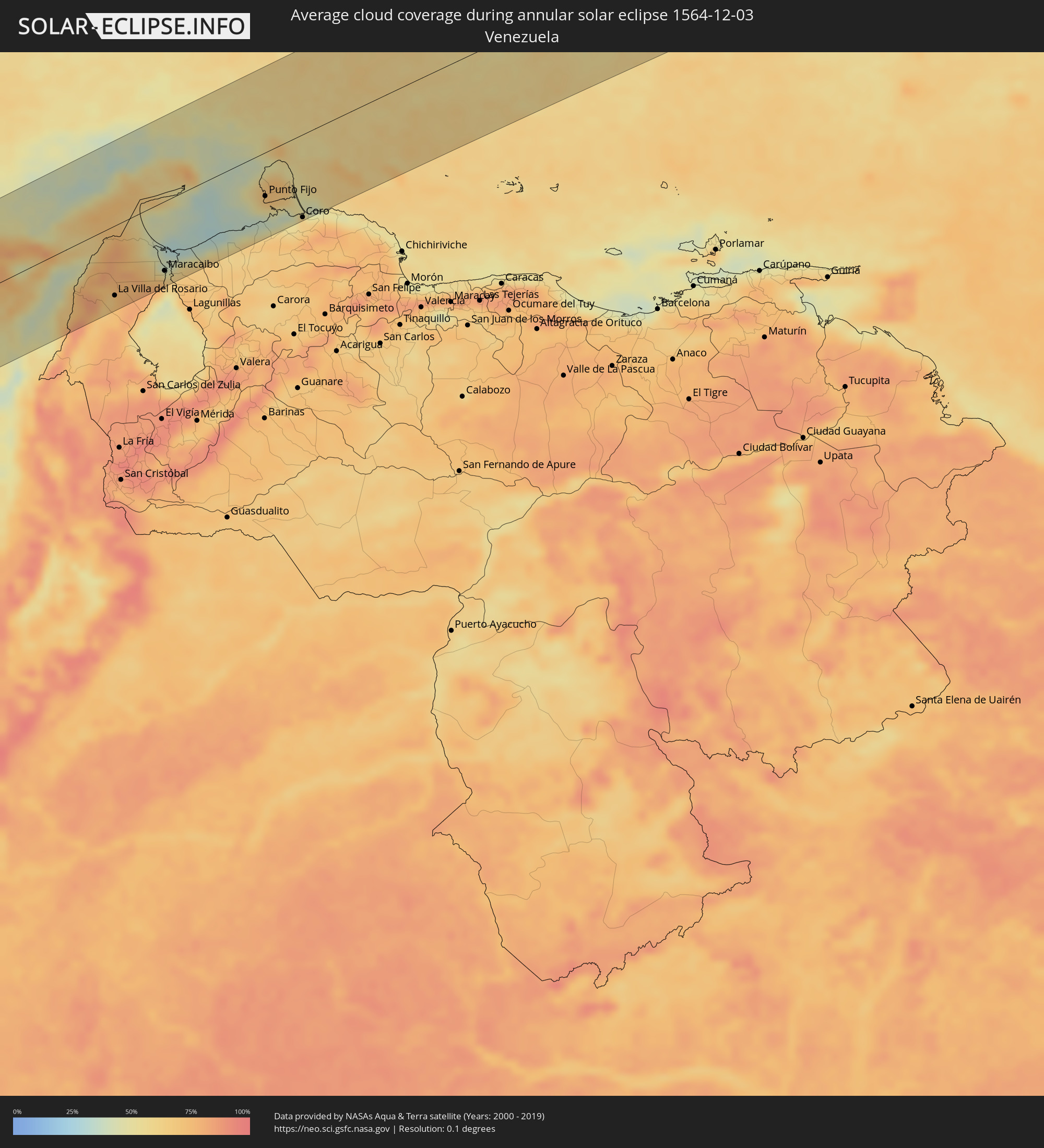 Venezuela
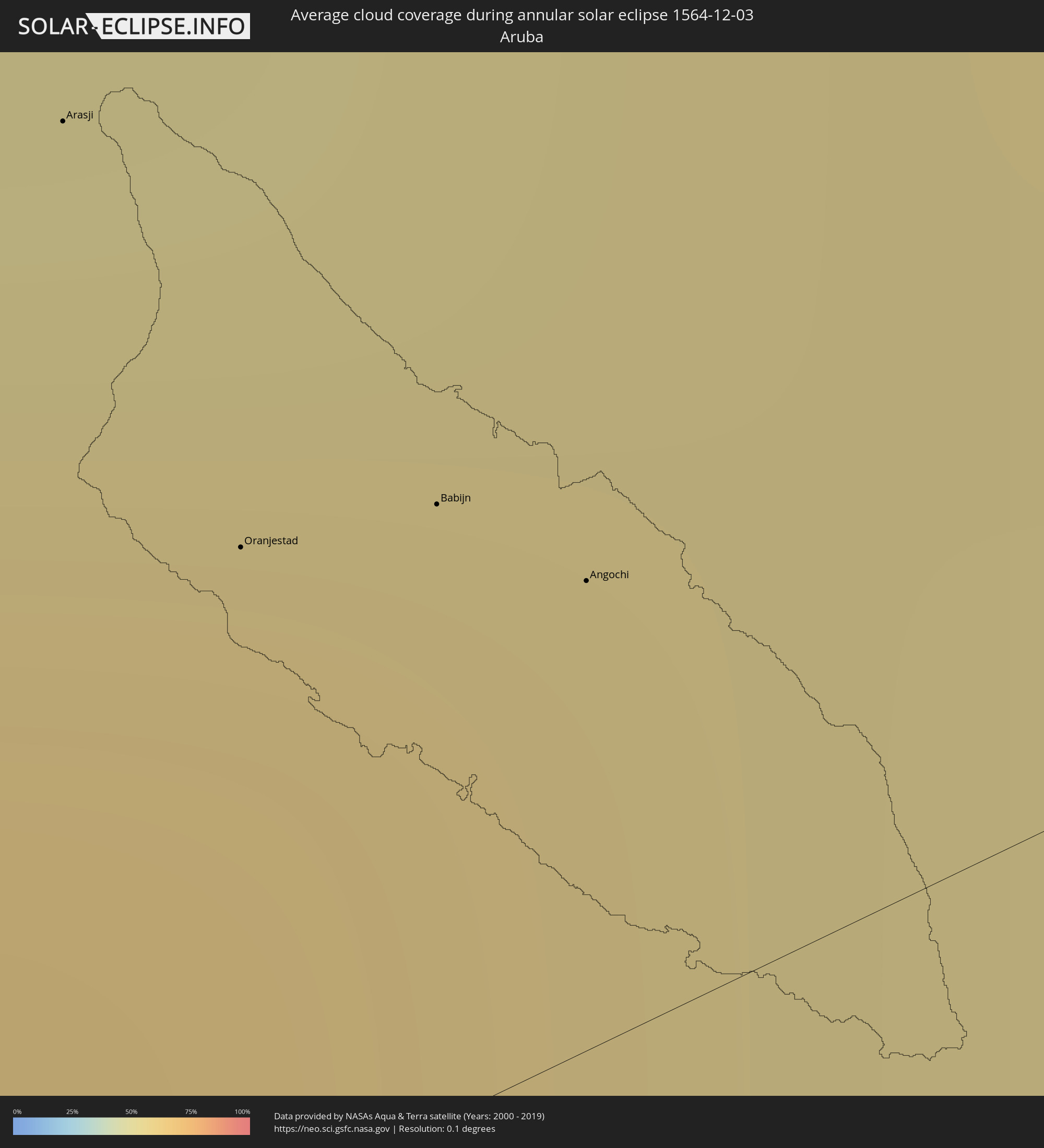 Aruba
Aruba
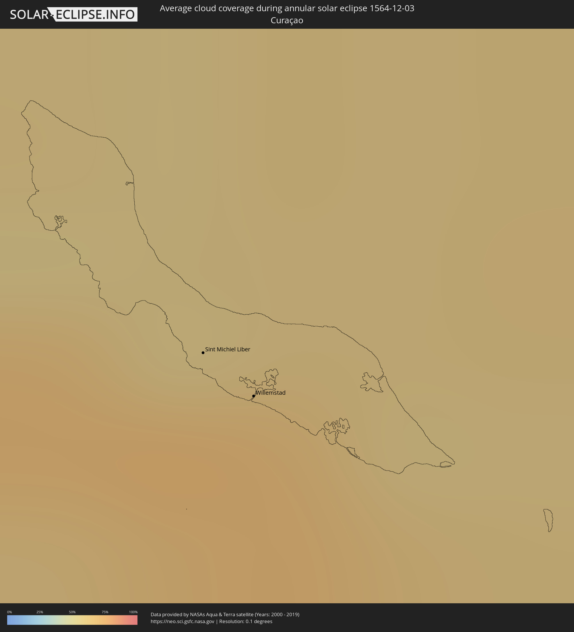 Curaçao
 Caribbean Netherlands
Cities inside the path of the eclipse
The following table shows all locations with a population of more than 5,000 inside the eclipse path. Cities which have more than 100,000 inhabitants are marked bold. A click at the locations opens a detailed map.
| City | Type | Eclipse duration | Local time of max. eclipse | Distance to central line | Ø Cloud coverage |
|
Pocrí, Coclé
|
annular | - | 16:13:58 UTC-05:19 | 107 km | 72% |
|
Aguadulce, Coclé
|
annular | - | 16:13:58 UTC-05:19 | 106 km | 69% |
|
Chitré, Herrera
|
annular | - | 16:13:59 UTC-05:19 | 72 km | 64% |
|
Los Santos, Los Santos
|
annular | - | 16:13:59 UTC-05:19 | 69 km | 70% |
|
Las Tablas, Los Santos
|
annular | - | 16:14:03 UTC-05:19 | 45 km | 70% |
|
Antón, Coclé
|
annular | - | 16:14:14 UTC-05:19 | 106 km | 68% |
|
La Palma, Darién
|
annular | - | 16:15:47 UTC-05:19 | 0 km | 74% |
|
Unión Chocó, Emberá
|
annular | - | 16:16:06 UTC-05:19 | 62 km | 85% |
|
Turbo, Antioquia
|
annular | - | 16:39:56 UTC-04:56 | 102 km | 77% |
|
Montería, Córdoba
|
annular | - | 16:40:35 UTC-04:56 | 79 km | 85% |
|
Lorica, Córdoba
|
annular | - | 16:40:44 UTC-04:56 | 34 km | 67% |
|
Cereté, Córdoba
|
annular | - | 16:40:40 UTC-04:56 | 70 km | 84% |
|
Tolú, Sucre
|
annular | - | 16:40:55 UTC-04:56 | 17 km | 62% |
|
San Onofre, Sucre
|
annular | - | 16:40:59 UTC-04:56 | 2 km | 65% |
|
Cartagena, Bolívar
|
annular | - | 16:41:05 UTC-04:56 | 67 km | 59% |
|
Sahagún, Córdoba
|
annular | - | 16:40:52 UTC-04:56 | 81 km | 76% |
|
Sincelejo, Sucre
|
annular | - | 16:40:58 UTC-04:56 | 47 km | 75% |
|
Arjona, Bolívar
|
annular | - | 16:41:10 UTC-04:56 | 44 km | 60% |
|
María la Baja, Bolívar
|
annular | - | 16:41:08 UTC-04:56 | 15 km | 53% |
|
Sincé, Sucre
|
annular | - | 16:41:05 UTC-04:56 | 66 km | 69% |
|
El Carmen de Bolívar, Bolívar
|
annular | - | 16:41:11 UTC-04:56 | 20 km | 70% |
|
San Juan Nepomuceno, Bolívar
|
annular | - | 16:41:15 UTC-04:56 | 1 km | 66% |
|
Puerto Colombia, Atlántico
|
annular | - | 16:41:28 UTC-04:56 | 98 km | 40% |
|
Sabanalarga, Atlántico
|
annular | - | 16:41:26 UTC-04:56 | 61 km | 66% |
|
Baranoa, Atlántico
|
annular | - | 16:41:27 UTC-04:56 | 77 km | 61% |
|
Campo de la Cruz, Atlántico
|
annular | - | 16:41:25 UTC-04:56 | 34 km | 51% |
|
Plato, Magdalena
|
annular | - | 16:41:23 UTC-04:56 | 29 km | 47% |
|
Barranquilla, Atlántico
|
annular | - | 16:41:33 UTC-04:56 | 88 km | 53% |
|
Magangué, Bolívar
|
annular | - | 16:41:17 UTC-04:56 | 85 km | 52% |
|
Palmar de Varela, Atlántico
|
annular | - | 16:41:32 UTC-04:56 | 64 km | 56% |
|
Pivijay, Magdalena
|
annular | - | 16:41:34 UTC-04:56 | 29 km | 58% |
|
Mompós, Bolívar
|
annular | - | 16:41:27 UTC-04:56 | 101 km | 44% |
|
Ciénaga, Magdalena
|
annular | - | 16:41:49 UTC-04:56 | 66 km | 51% |
|
Santa Marta, Magdalena
|
annular | - | 16:41:52 UTC-04:56 | 86 km | 50% |
|
Fundación, Magdalena
|
annular | - | 16:41:47 UTC-04:56 | 14 km | 55% |
|
Ariguaní, Cesar
|
annular | - | 16:41:50 UTC-04:56 | 22 km | 53% |
|
Valledupar, Cesar
|
annular | - | 16:42:12 UTC-04:56 | 37 km | 41% |
|
Agustín Codazzi, Cesar
|
annular | - | 16:42:09 UTC-04:56 | 80 km | 51% |
|
San Juan del Cesar, La Guajira
|
annular | - | 16:42:20 UTC-04:56 | 18 km | 40% |
|
Ríohacha, La Guajira
|
annular | - | 16:42:28 UTC-04:56 | 54 km | 64% |
|
Fonseca, La Guajira
|
annular | - | 16:42:25 UTC-04:56 | 14 km | 45% |
|
Machiques, Zulia
|
annular | - | 17:11:02 UTC-04:27 | 111 km | 69% |
|
La Villa del Rosario, Zulia
|
annular | - | 17:11:10 UTC-04:27 | 96 km | 74% |
|
Maicao, La Guajira
|
annular | - | 16:42:43 UTC-04:56 | 6 km | 69% |
|
Maracaibo, Zulia
|
annular | - | 17:11:29 UTC-04:27 | 96 km | 64% |
|
Santa Rita, Zulia
|
annular | - | 17:11:30 UTC-04:27 | 114 km | 54% |
|
Punta Cardón, Falcón
|
annular | - | 17:12:02 UTC-04:27 | 63 km | 54% |
|
Punto Fijo, Falcón
|
annular | - | 17:12:03 UTC-04:27 | 60 km | 54% |
|
Arasji
|
annular | - | 17:04:01 UTC-04:35 | 26 km | 64% |
|
Oranjestad
|
annular | - | 17:04:01 UTC-04:35 | 15 km | 69% |
|
Babijn
|
annular | - | 17:04:02 UTC-04:35 | 13 km | 69% |
|
Angochi
|
annular | - | 17:04:03 UTC-04:35 | 10 km | 69% |
|
Coro, Falcón
|
annular | - | 17:12:11 UTC-04:27 | 114 km | 62% |
 Sint Michiel Liber
|
annular | - | 17:04:18 UTC-04:35 | 72 km | 72% |
|
Willemstad
|
annular | - | 17:04:18 UTC-04:35 | 78 km | 70% |
 Kralendijk, Bonaire
|
annular | - | 17:04:28 UTC-04:35 | 105 km | 73% |