Annular solar eclipse of 01/26/1656
| Day of week: | Wednesday |
| Maximum duration of eclipse: | 09m38s |
| Maximum width of eclipse path: | 820 km |
| Saros cycle: | 135 |
| Coverage: | 91.1% |
| Magnitude: | 0.9106 |
| Gamma: | 0.9122 |
Wo kann man die Sonnenfinsternis vom 01/26/1656 sehen?
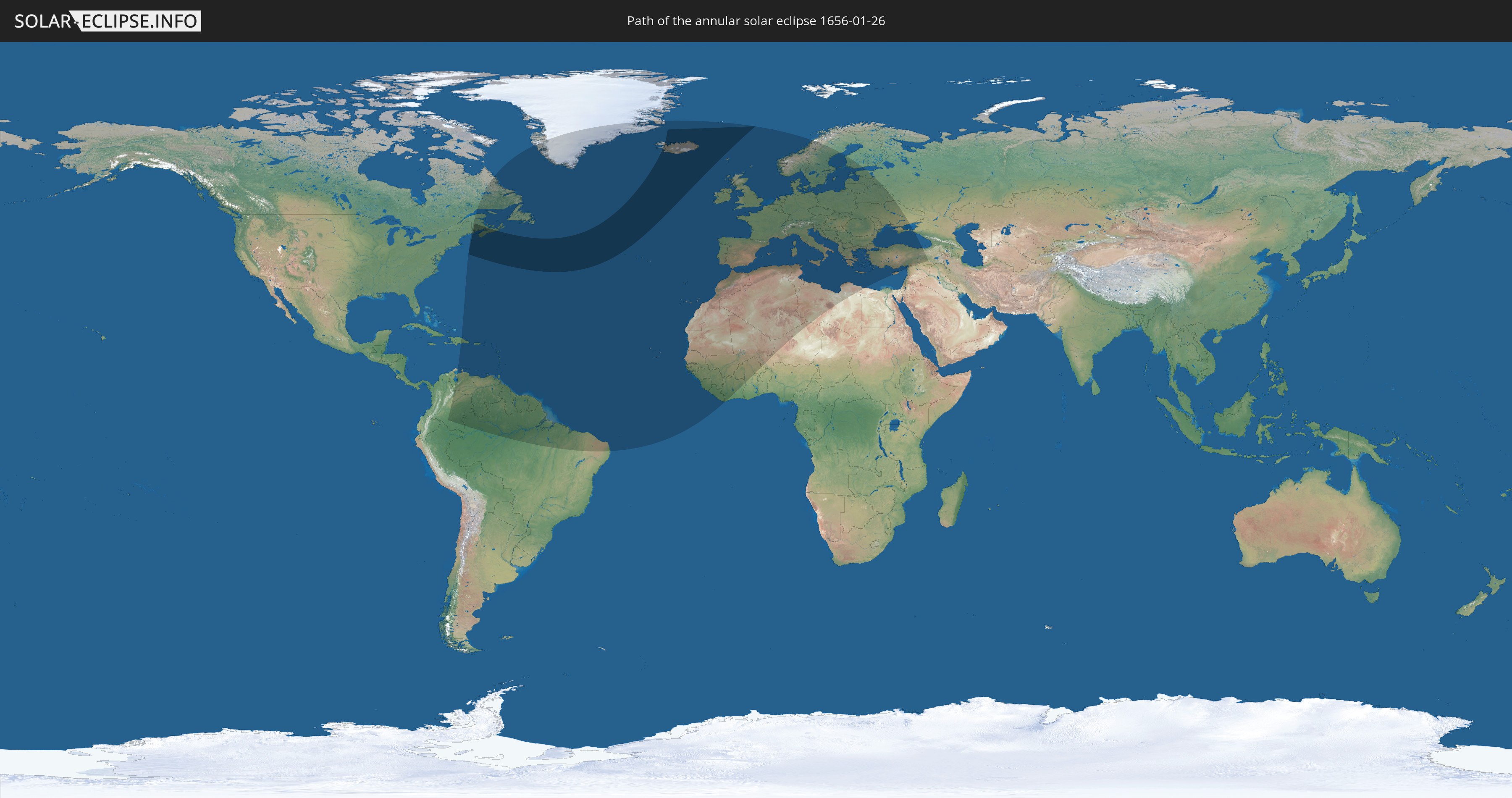
Die Sonnenfinsternis am 01/26/1656 kann man in 102 Ländern als partielle Sonnenfinsternis beobachten.
Der Finsternispfad verläuft durch 3 Länder. Nur in diesen Ländern ist sie als annular Sonnenfinsternis zu sehen.
In den folgenden Ländern ist die Sonnenfinsternis annular zu sehen
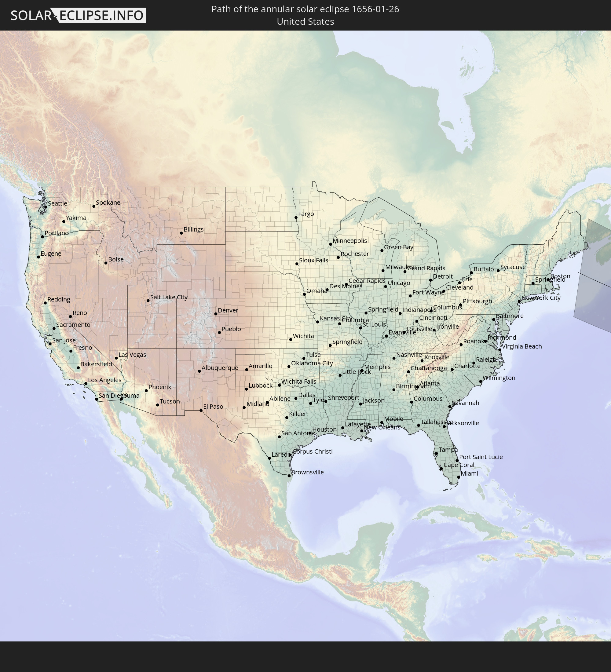 United States
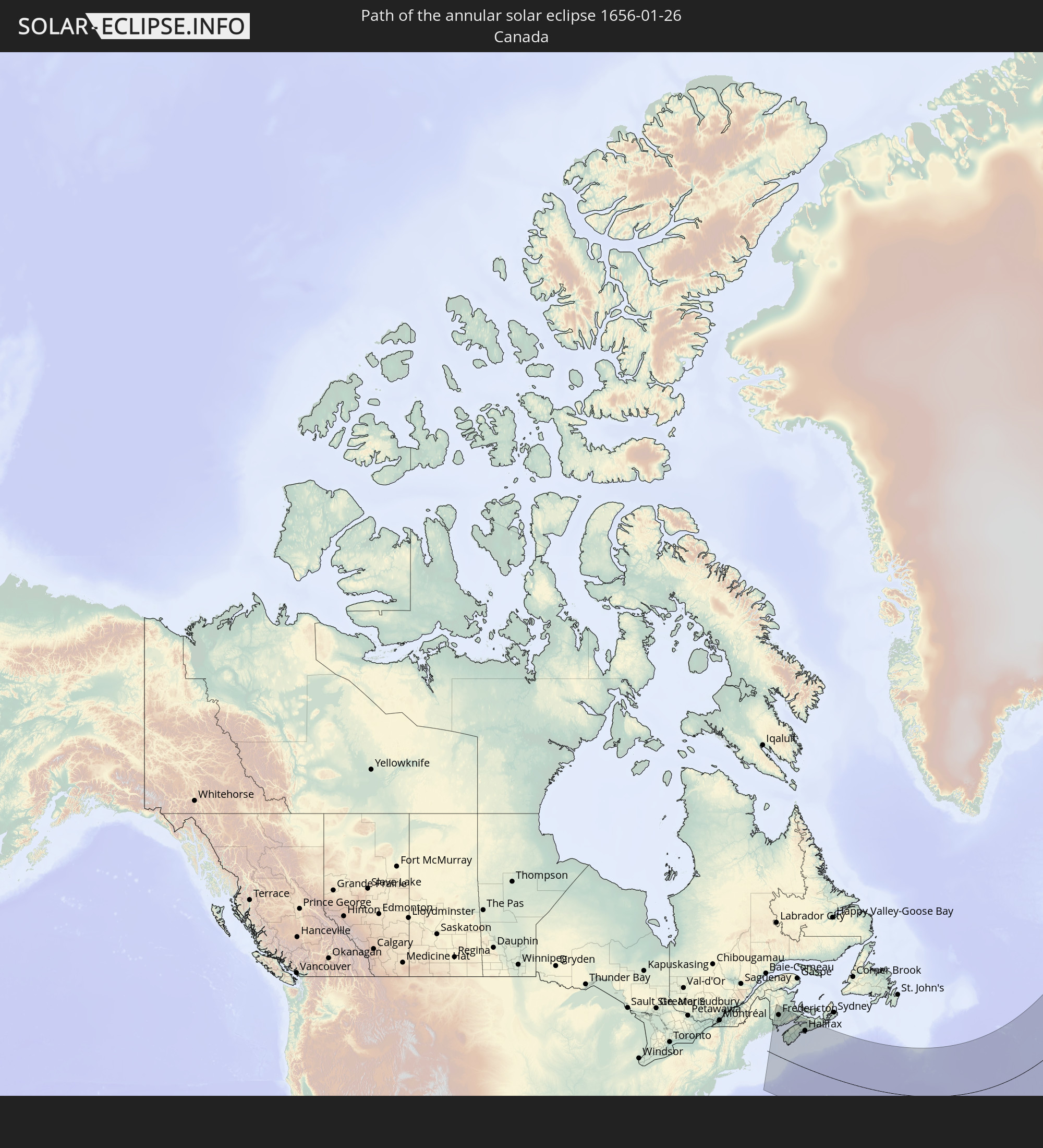 Canada
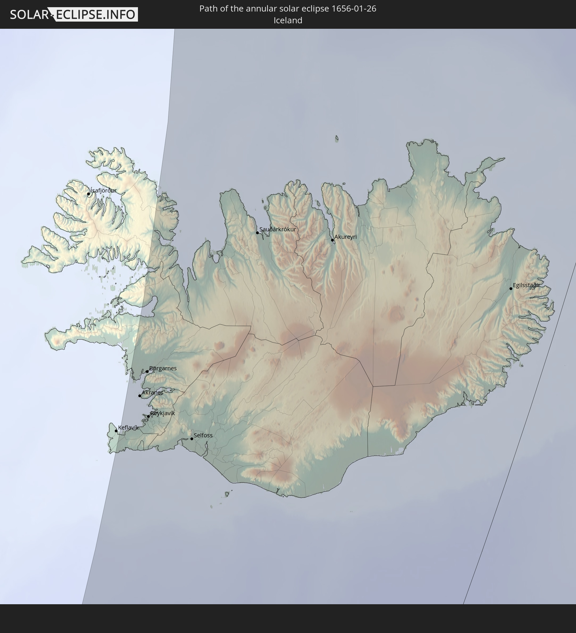 Iceland
In den folgenden Ländern ist die Sonnenfinsternis partiell zu sehen
 Russia
 United States
 Canada
 Greenland
 Colombia
 Brazil
 Venezuela
 Dominican Republic
 Aruba
Aruba
 Puerto Rico
 United States Virgin Islands
 Bermuda
 British Virgin Islands
 Anguilla
 Collectivity of Saint Martin
 Saint Barthélemy
 Saint Kitts and Nevis
 Antigua and Barbuda
 Montserrat
 Trinidad and Tobago
 Guadeloupe
 Grenada
 Dominica
 Saint Vincent and the Grenadines
 Guyana
 Martinique
 Saint Lucia
 Barbados
 Suriname
 Saint Pierre and Miquelon
 French Guiana
 Portugal
 Cabo Verde
 Iceland
 Spain
Spain
 Senegal
 Mauritania
 The Gambia
 Guinea-Bissau
 Guinea
 Sierra Leone
 Morocco
 Mali
Mali
 Liberia
 Republic of Ireland
 Svalbard and Jan Mayen
 Algeria
 United Kingdom
 Ivory Coast
 Faroe Islands
 Burkina Faso
 Gibraltar
 France
 Isle of Man
 Ghana
Ghana
 Guernsey
 Jersey
 Niger
Niger
 Andorra
 Belgium
 Netherlands
 Norway
 Luxembourg
 Germany
 Switzerland
 Italy
Italy
 Monaco
 Tunisia
 Denmark
 Libya
Libya
 Liechtenstein
 Austria
 Sweden
 Czechia
 San Marino
 Vatican City
 Slovenia
 Croatia
 Poland
 Malta
Malta
 Bosnia and Herzegovina
 Hungary
 Slovakia
 Montenegro
 Serbia
 Albania
 Åland Islands
 Greece
 Romania
 Republic of Macedonia
 Finland
 Lithuania
 Latvia
 Estonia
 Ukraine
 Bulgaria
 Belarus
 Egypt
Egypt
 Turkey
 Moldova
 Cyprus
 Syria
Syria
How will be the weather during the annular solar eclipse on 01/26/1656?
Where is the best place to see the annular solar eclipse of 01/26/1656?
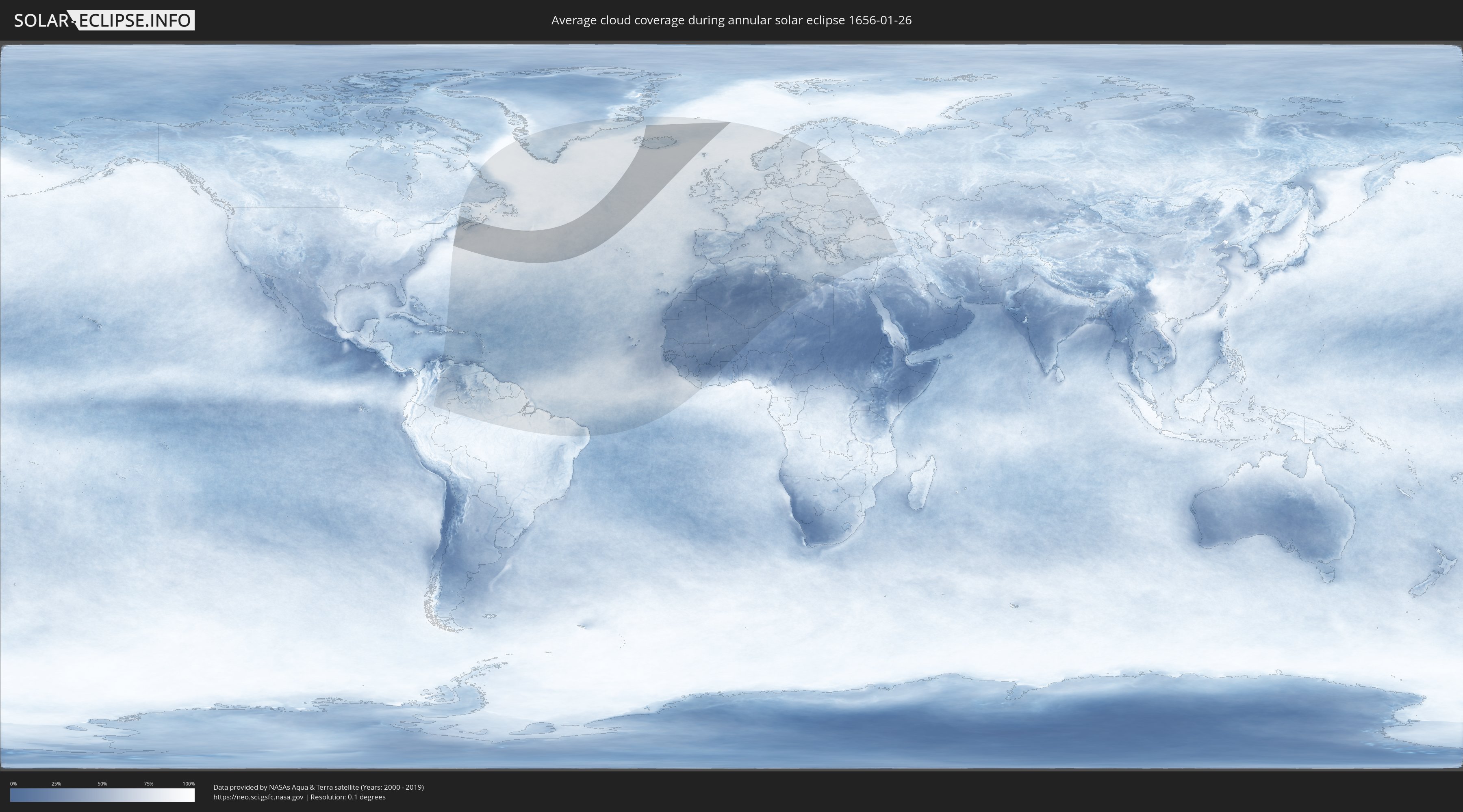
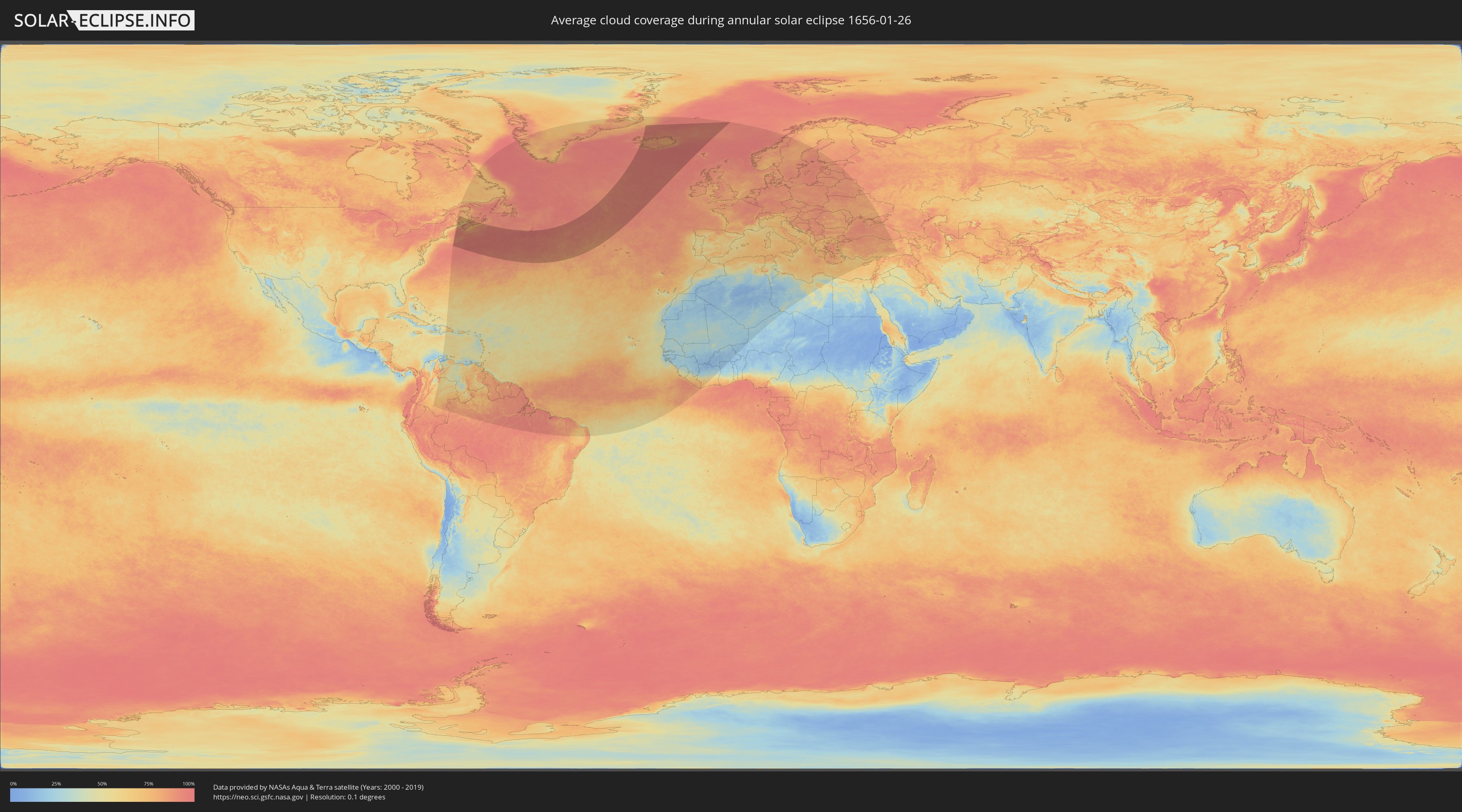
The following maps show the average cloud coverage for the day of the annular solar eclipse.
With the help of these maps, it is possible to find the place along the eclipse path, which has the best
chance of a cloudless sky.
Nevertheless, you should consider local circumstances and inform about the weather of your chosen
observation site.
The data is provided by NASAs satellites
AQUA and TERRA.
The cloud maps are averaged over a period of 19 years (2000 - 2019).
Detailed country maps
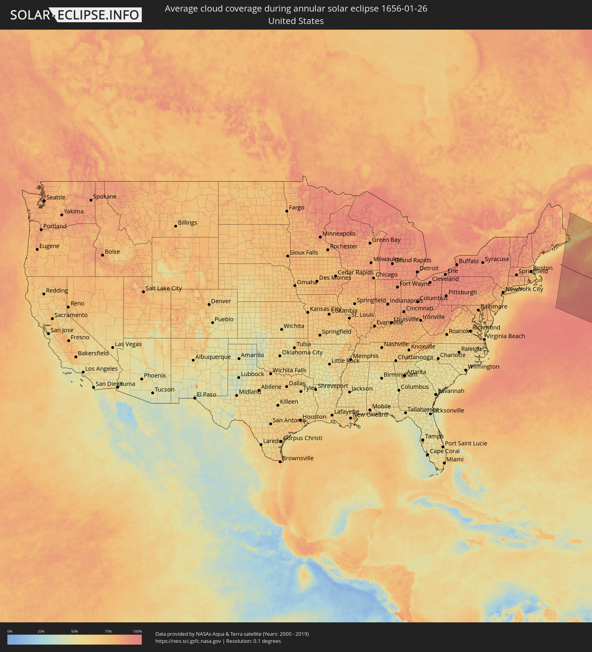 United States
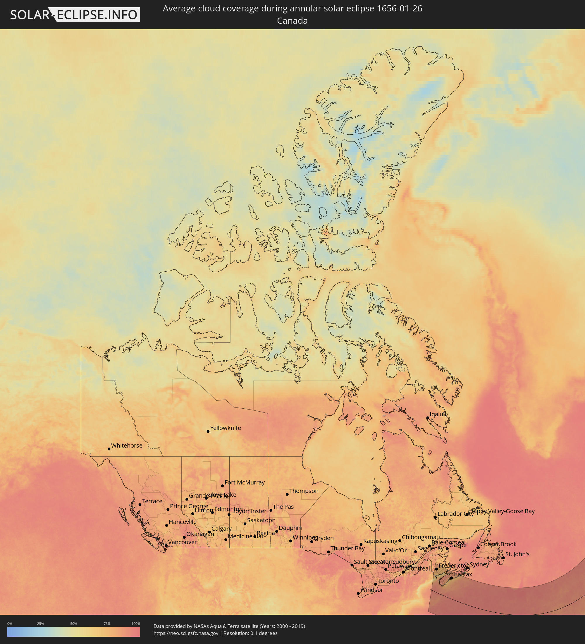 Canada
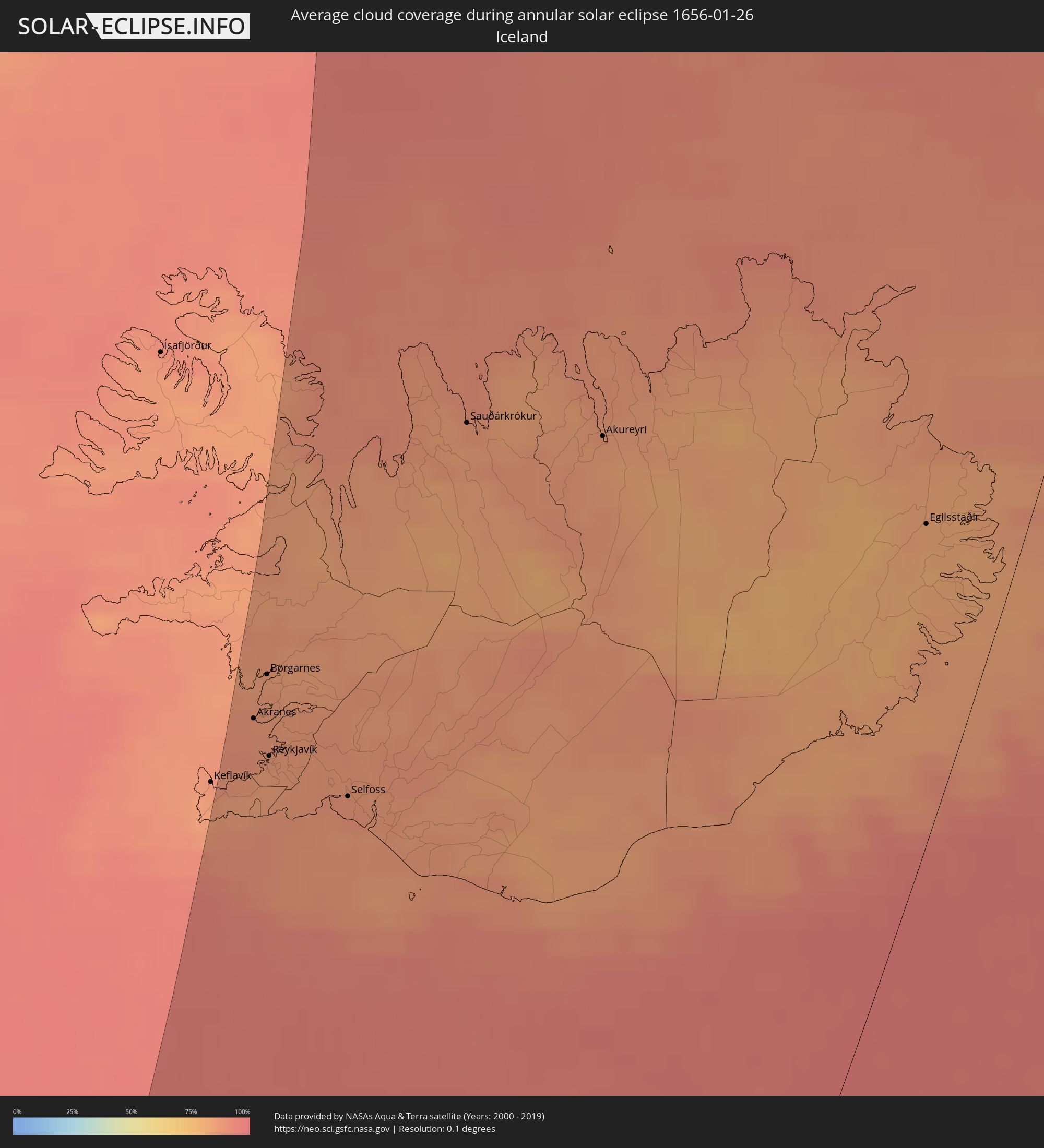 Iceland
Cities inside the path of the eclipse
The following table shows all locations with a population of more than 5,000 inside the eclipse path. Cities which have more than 100,000 inhabitants are marked bold. A click at the locations opens a detailed map.
| City | Type | Eclipse duration | Local time of max. eclipse | Distance to central line | Ø Cloud coverage |
|
Fredericton, New Brunswick
|
annular | - | 07:51:33 UTC-04:14 | 350 km | 79% |
|
Oromocto, New Brunswick
|
annular | - | 07:51:29 UTC-04:14 | 343 km | 77% |
|
Yarmouth, Nova Scotia
|
annular | - | 07:47:48 UTC-04:14 | 156 km | 88% |
|
Saint John, New Brunswick
|
annular | - | 07:50:40 UTC-04:14 | 301 km | 68% |
|
Greenwood, Nova Scotia
|
annular | - | 07:51:00 UTC-04:14 | 311 km | 90% |
|
Bridgewater, Nova Scotia
|
annular | - | 07:50:10 UTC-04:14 | 265 km | 79% |
|
Kentville, Nova Scotia
|
annular | - | 07:51:34 UTC-04:14 | 336 km | 88% |
|
Amherst, Nova Scotia
|
annular | - | 07:53:20 UTC-04:14 | 422 km | 83% |
|
Lower Sacvkille, Nova Scotia
|
annular | - | 07:51:41 UTC-04:14 | 334 km | 85% |
|
Dartmouth, Nova Scotia
|
annular | - | 07:51:34 UTC-04:14 | 326 km | 81% |
|
Halifax, Nova Scotia
|
annular | - | 07:51:31 UTC-04:14 | 324 km | 78% |
|
Cole Harbour, Nova Scotia
|
annular | - | 07:51:39 UTC-04:14 | 330 km | 82% |
|
Truro, Nova Scotia
|
annular | - | 07:53:13 UTC-04:14 | 407 km | 86% |
|
Akranes, West
|
annular | - | 11:56:58 UTC-01:28 | 380 km | 88% |
|
Hafnarfjörður, Capital Region
|
annular | - | 11:57:02 UTC-01:28 | 367 km | 85% |
|
Garðabær, Capital Region
|
annular | - | 11:57:04 UTC-01:28 | 367 km | 85% |
|
Borgarnes, West
|
annular | - | 11:57:11 UTC-01:28 | 377 km | 86% |
|
Kópavogur, Capital Region
|
annular | - | 11:57:05 UTC-01:28 | 367 km | 85% |
|
Reykjavík, Capital Region
|
annular | - | 11:57:06 UTC-01:28 | 367 km | 85% |
|
Mosfellsbær, Capital Region
|
annular | - | 11:57:19 UTC-01:28 | 358 km | 86% |
|
Selfoss, South
|
annular | - | 11:58:00 UTC-01:28 | 319 km | 88% |
|
Sauðárkrókur, Northwest
|
annular | - | 11:59:43 UTC-01:28 | 300 km | 84% |
|
Akureyri, Northeast
|
annular | - | 12:01:14 UTC-01:28 | 229 km | 84% |
|
Egilsstaðir, East
|
annular | - | 12:04:48 UTC-01:28 | 52 km | 80% |