Total solar eclipse of 05/12/1706
| Day of week: | Wednesday |
| Maximum duration of eclipse: | 04m06s |
| Maximum width of eclipse path: | 242 km |
| Saros cycle: | 133 |
| Coverage: | 100% |
| Magnitude: | 1.0591 |
| Gamma: | 0.5984 |
Wo kann man die Sonnenfinsternis vom 05/12/1706 sehen?
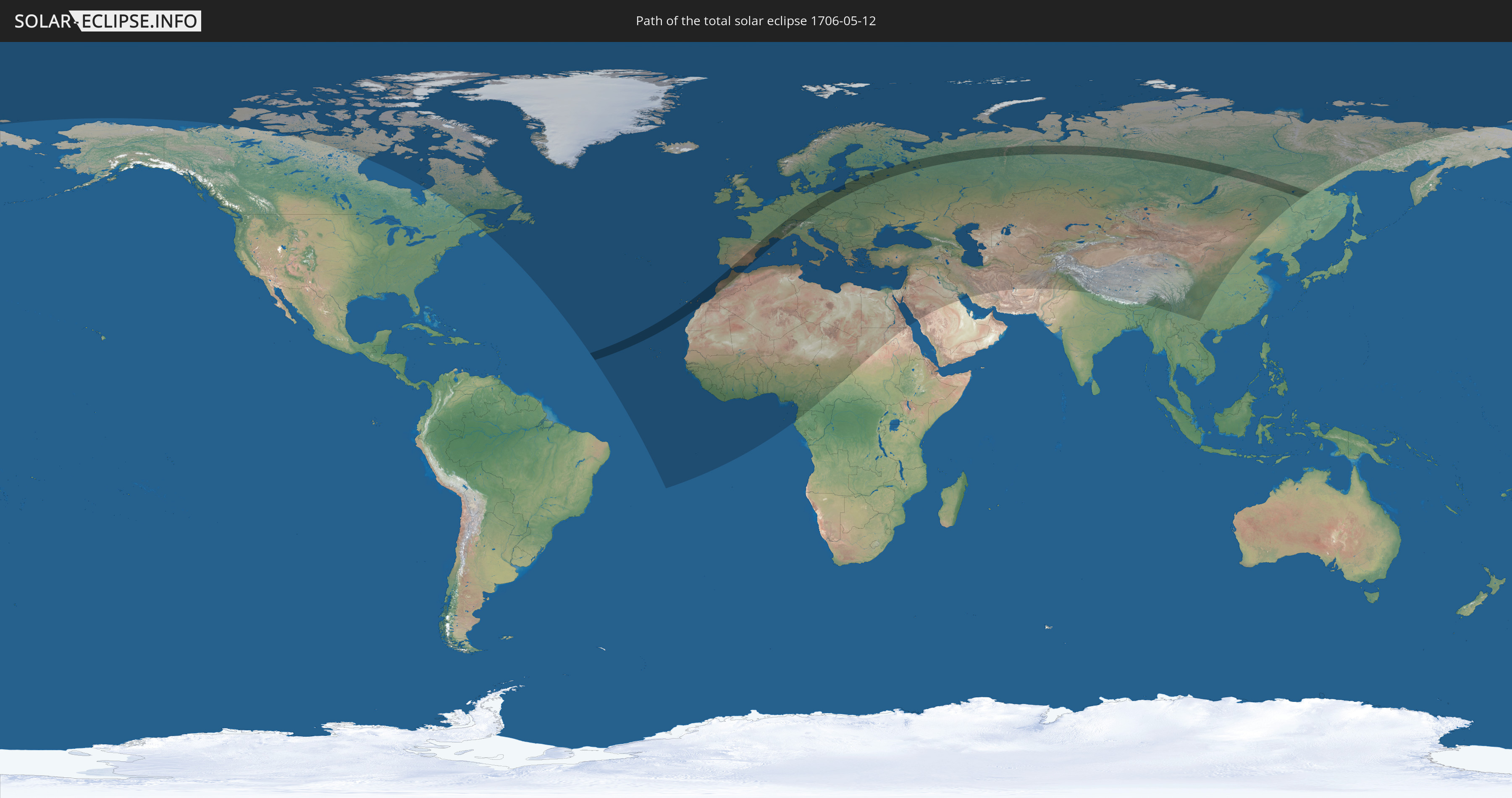
Die Sonnenfinsternis am 05/12/1706 kann man in 110 Ländern als partielle Sonnenfinsternis beobachten.
Der Finsternispfad verläuft durch 16 Länder. Nur in diesen Ländern ist sie als total Sonnenfinsternis zu sehen.
In den folgenden Ländern ist die Sonnenfinsternis total zu sehen
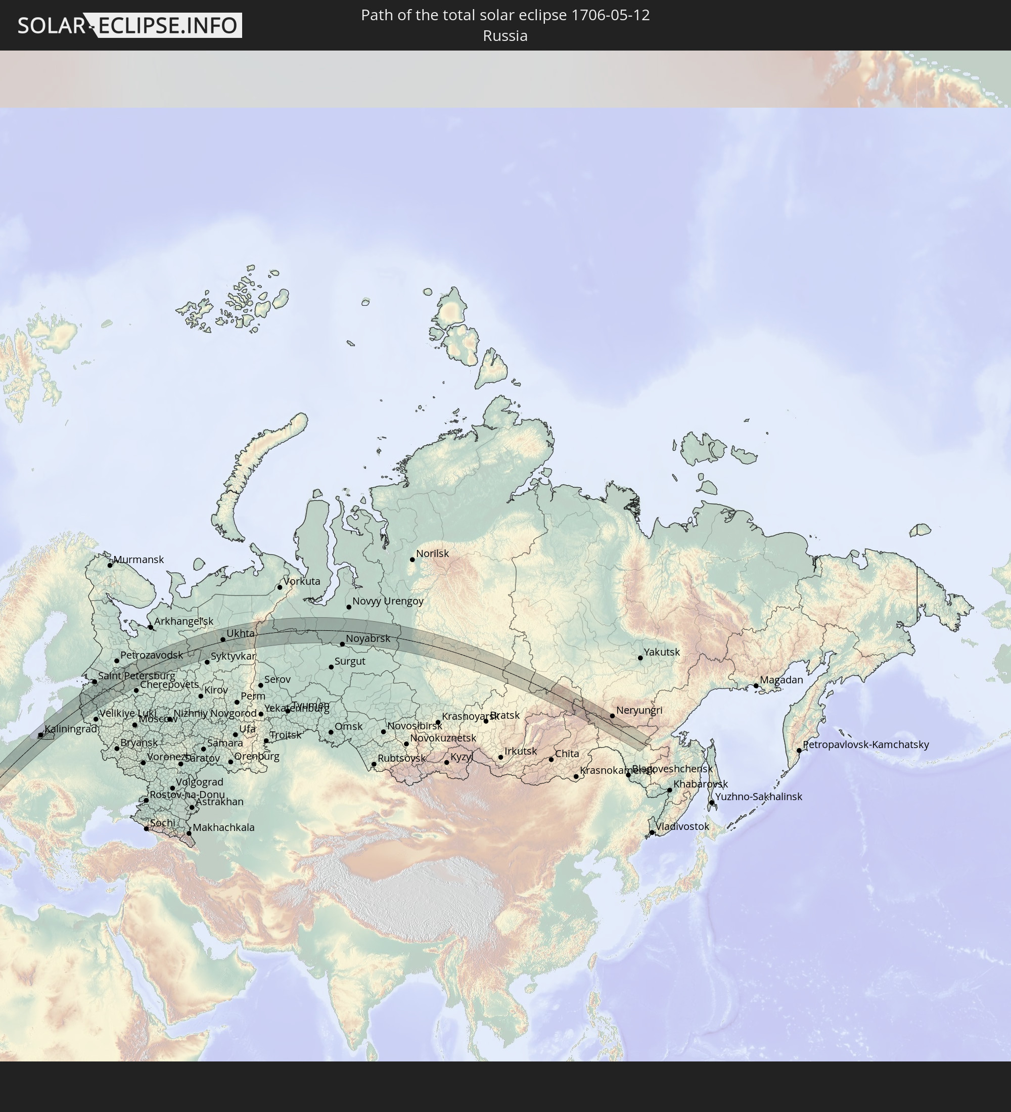 Russia
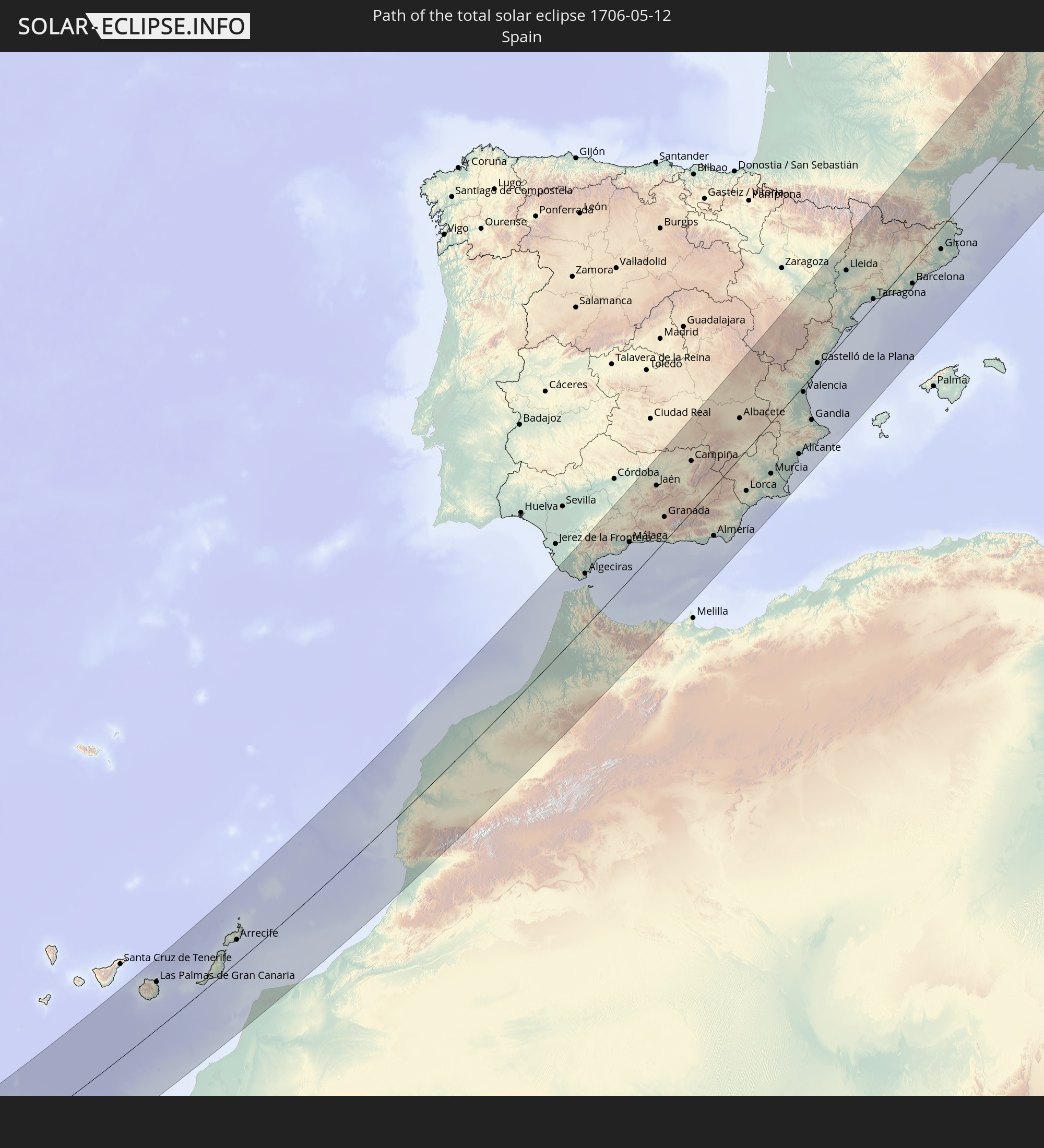 Spain
Spain
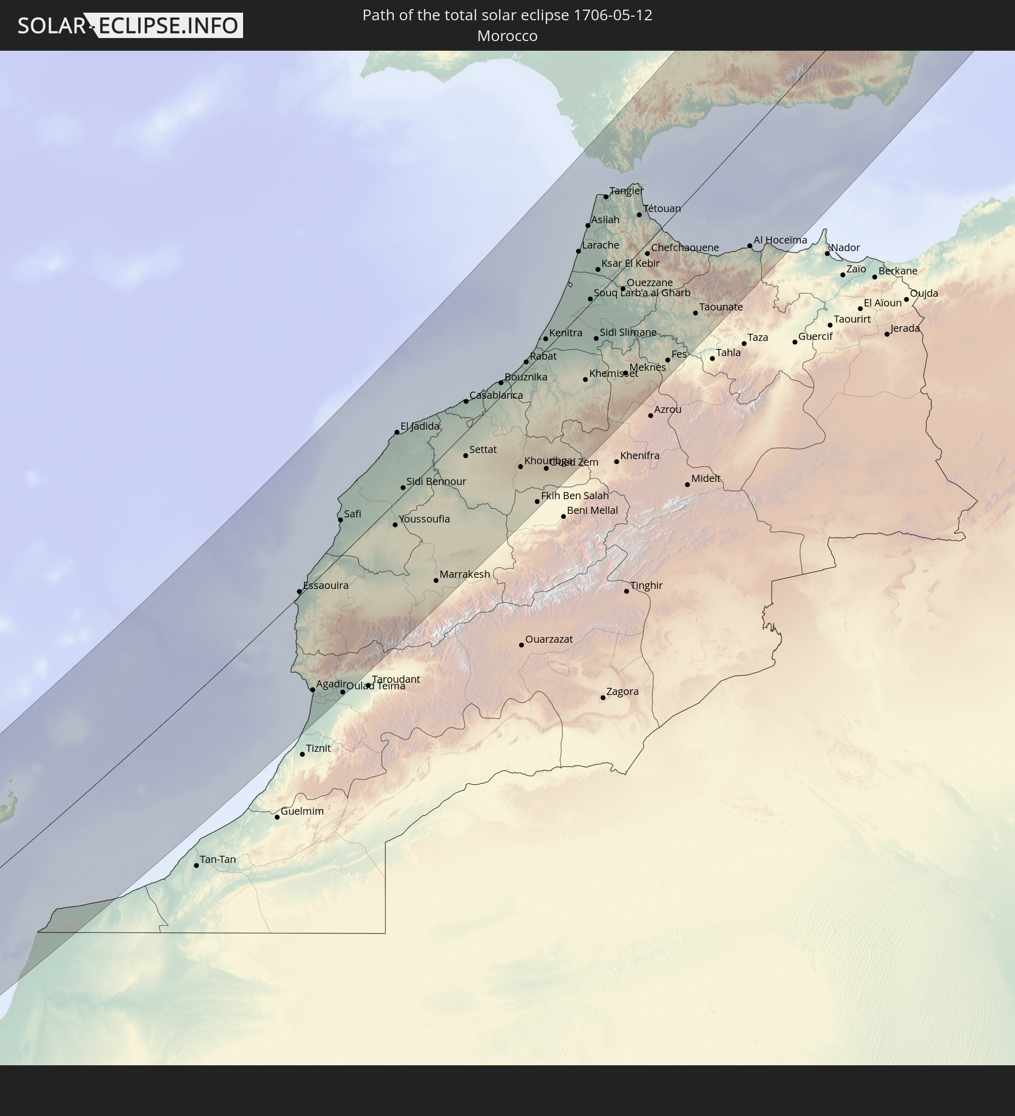 Morocco
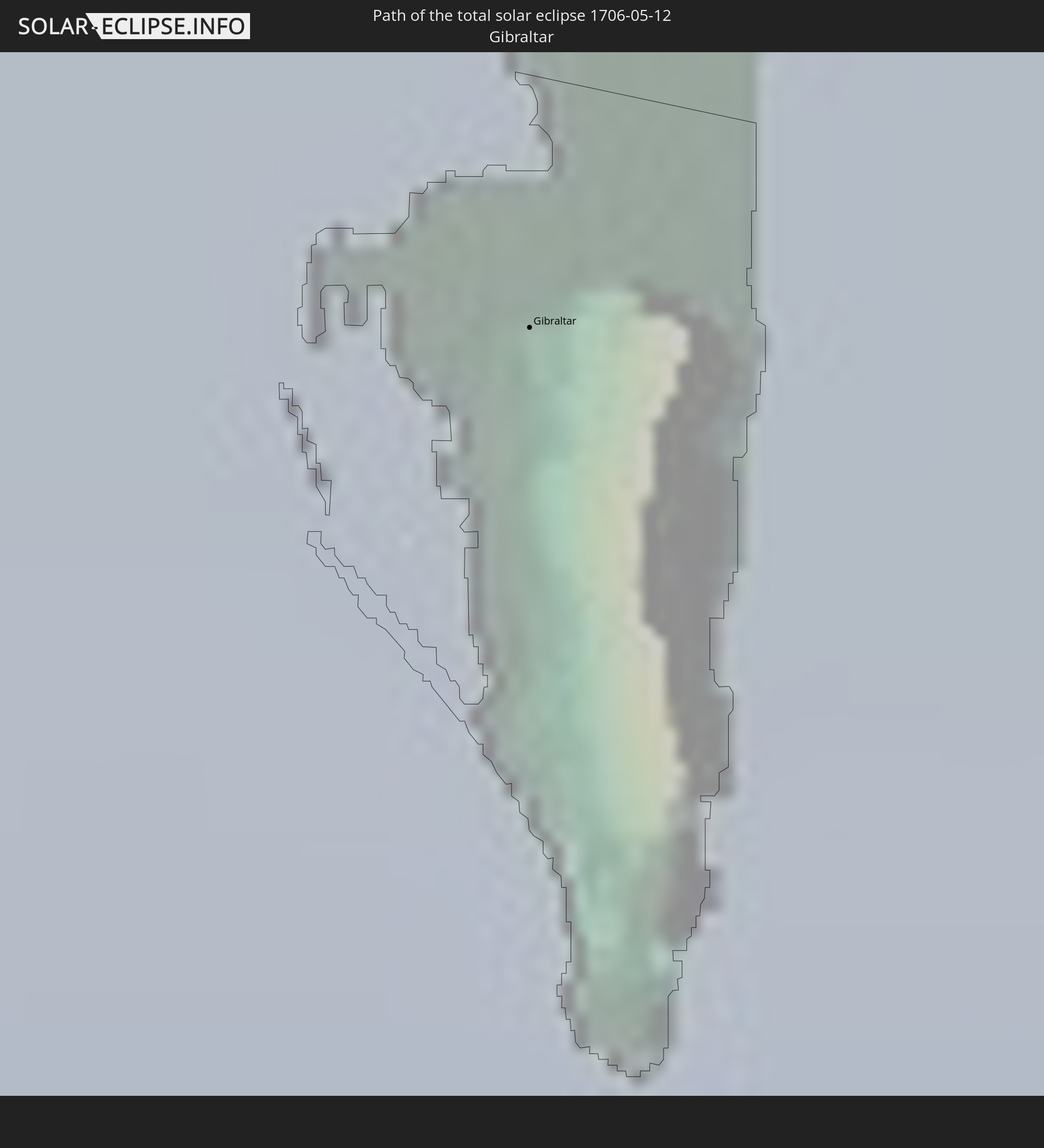 Gibraltar
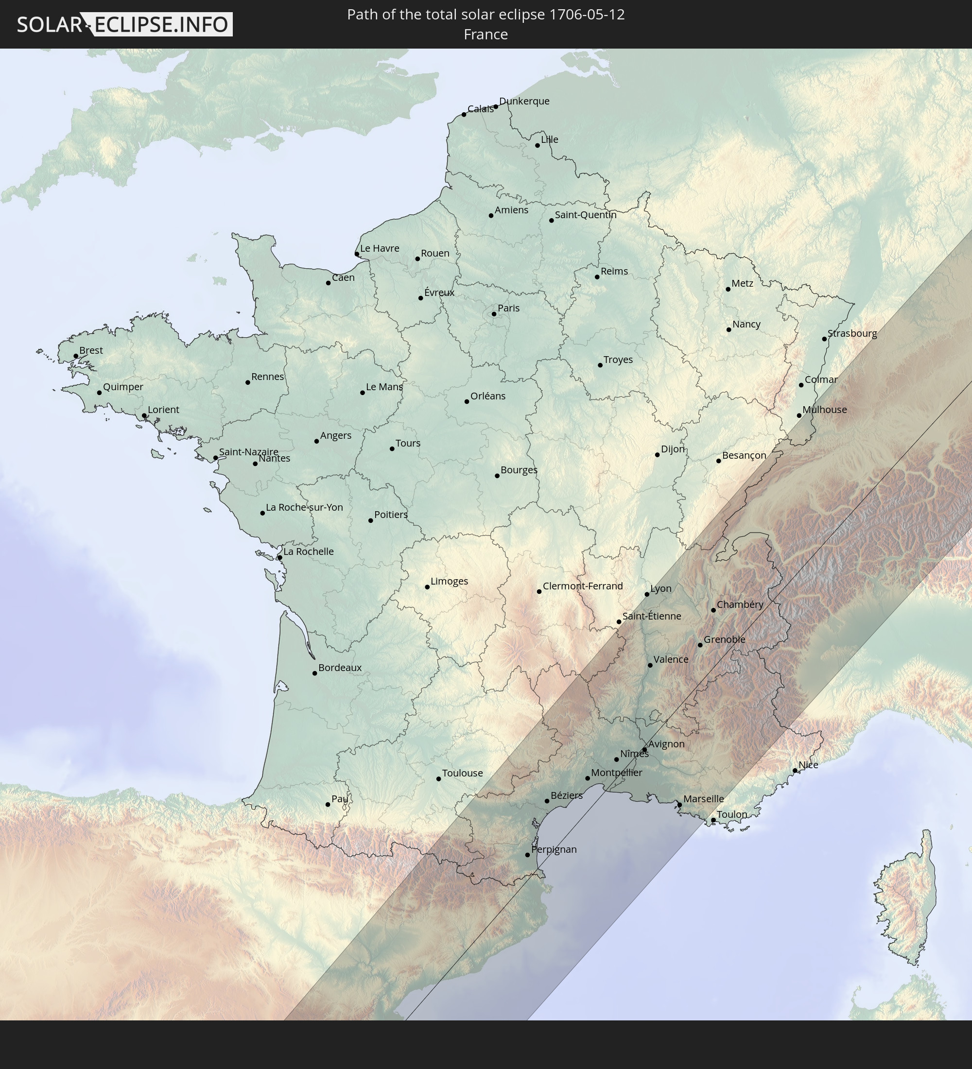 France
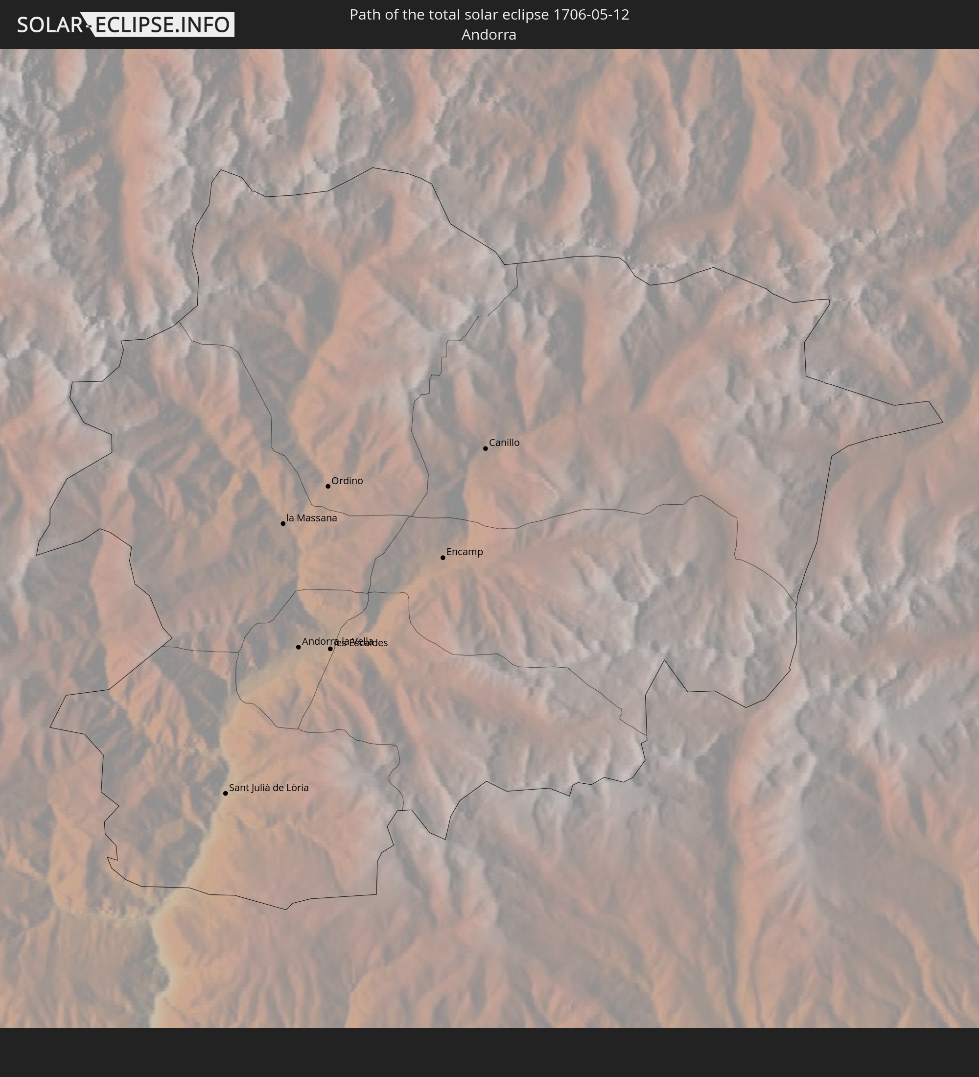 Andorra
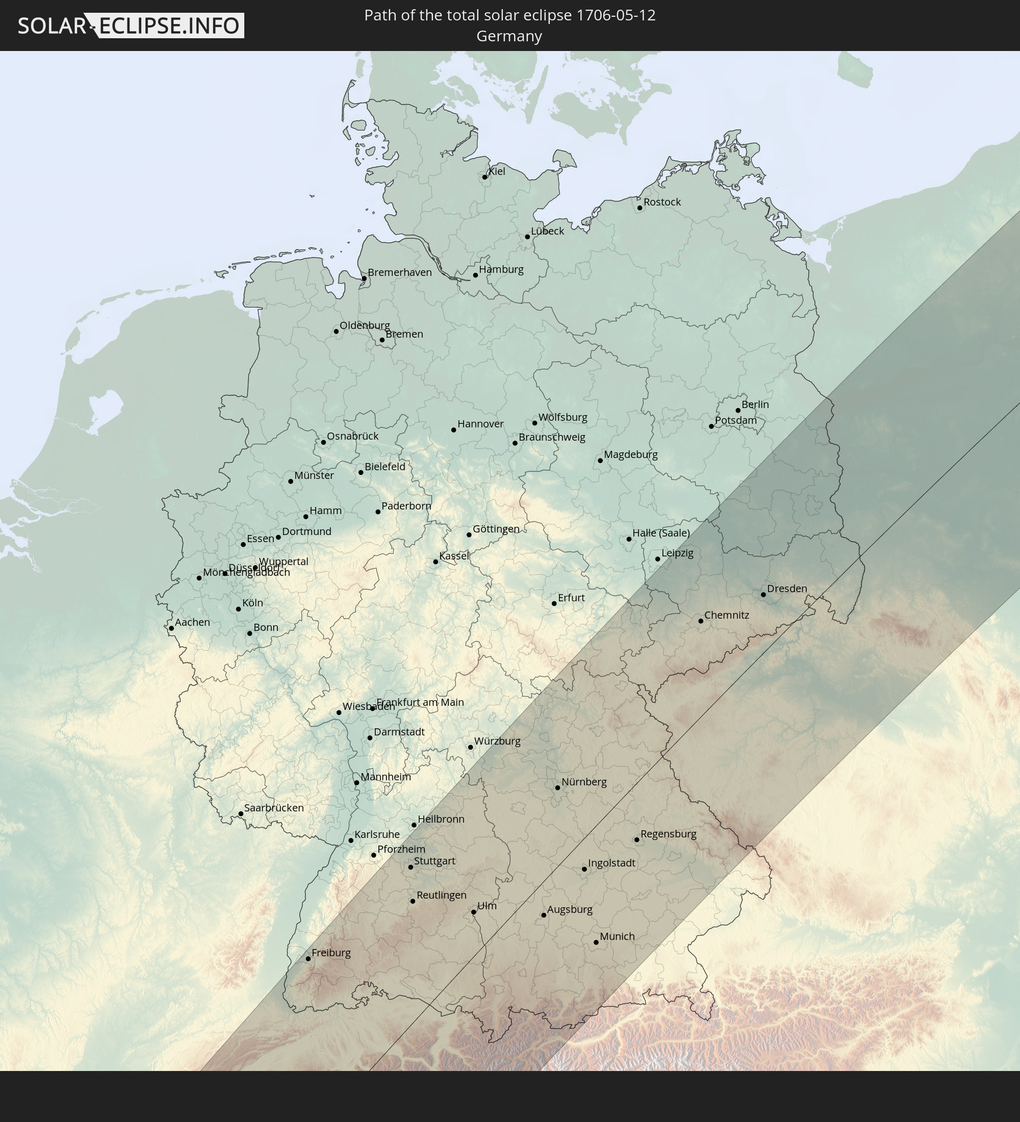 Germany
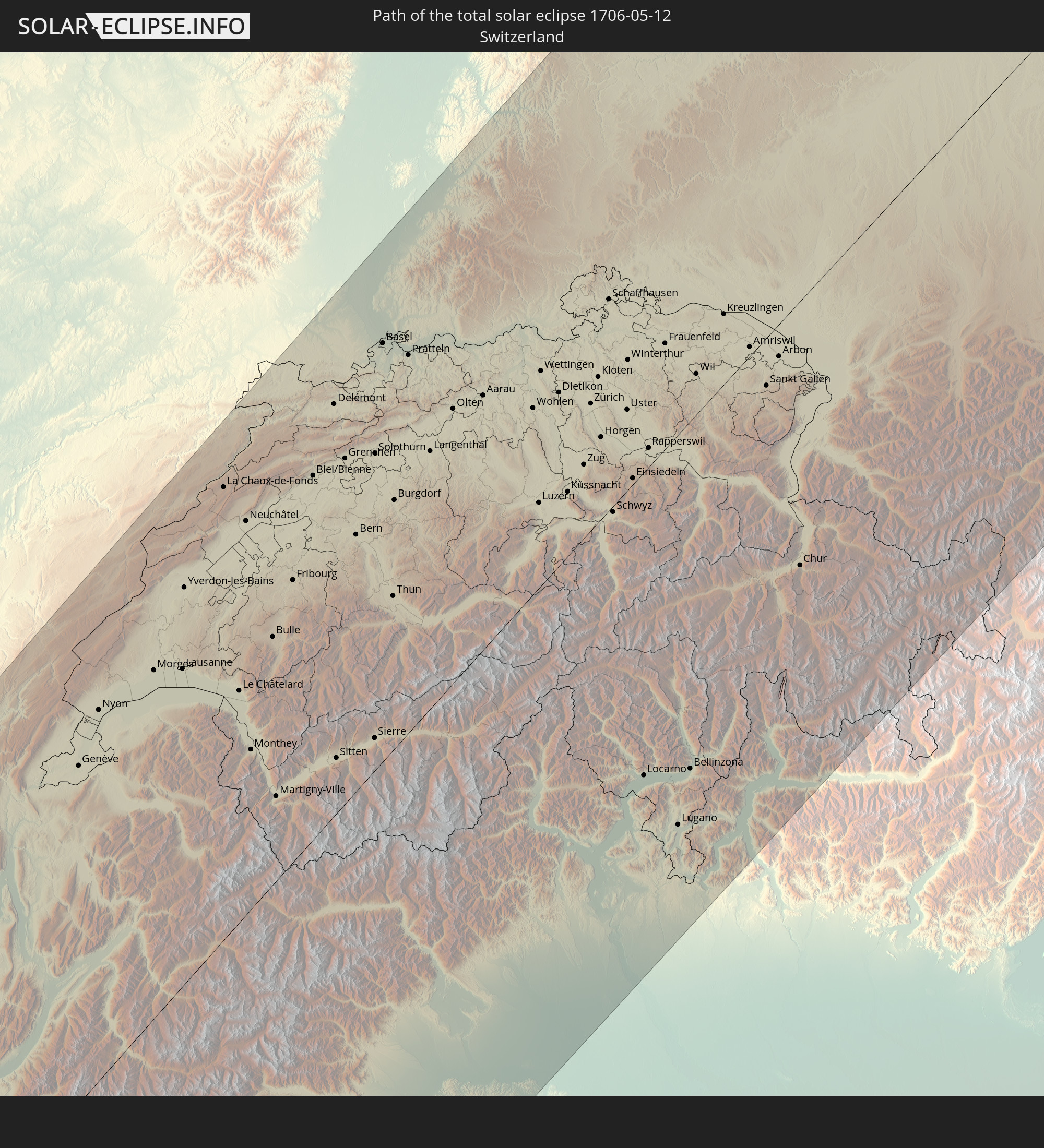 Switzerland
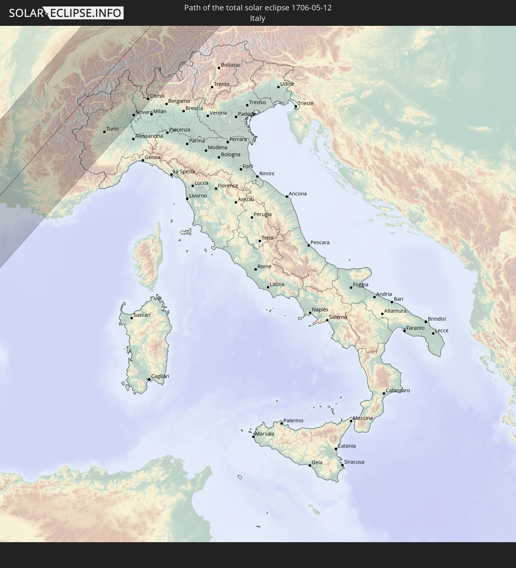 Italy
Italy
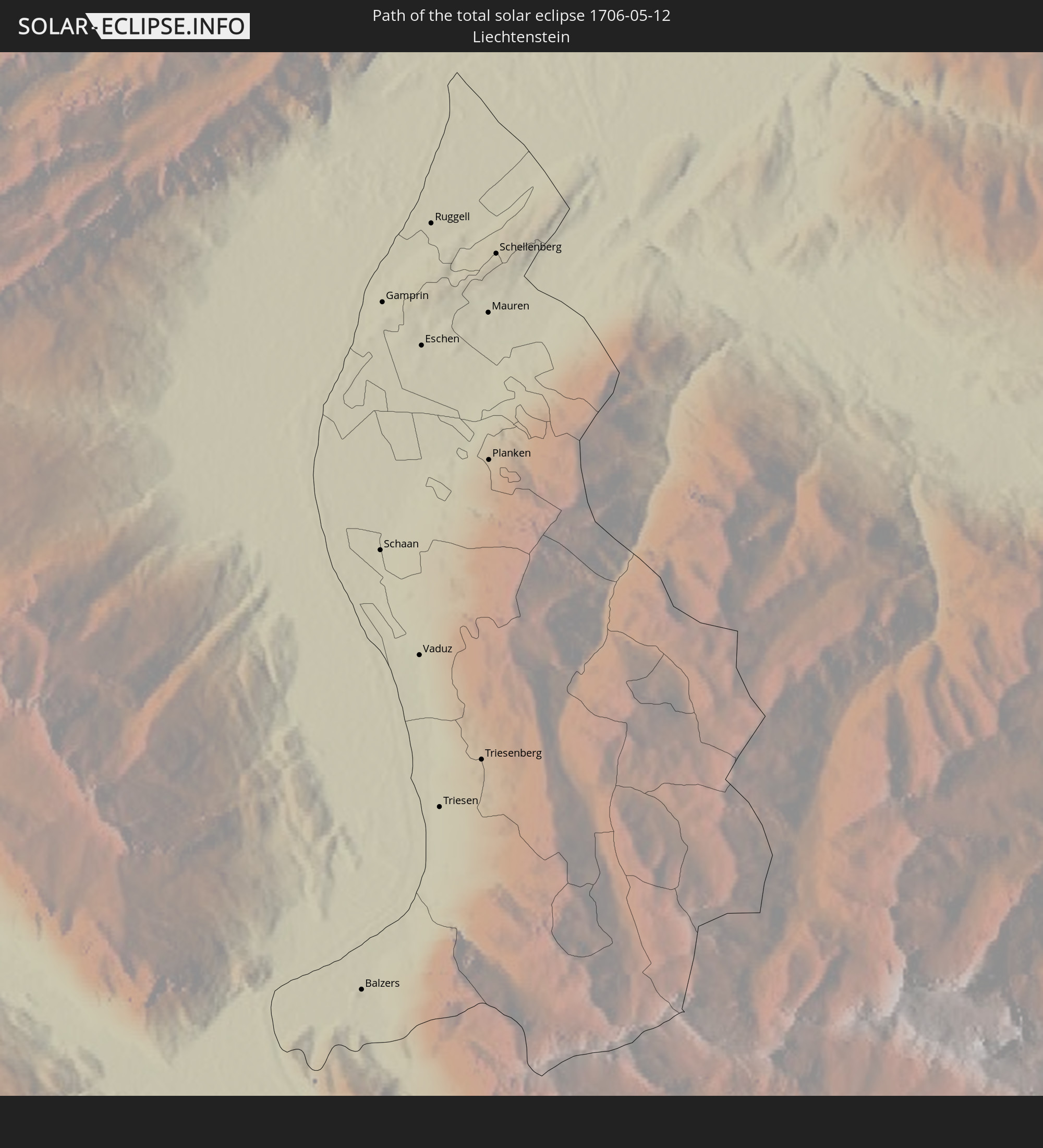 Liechtenstein
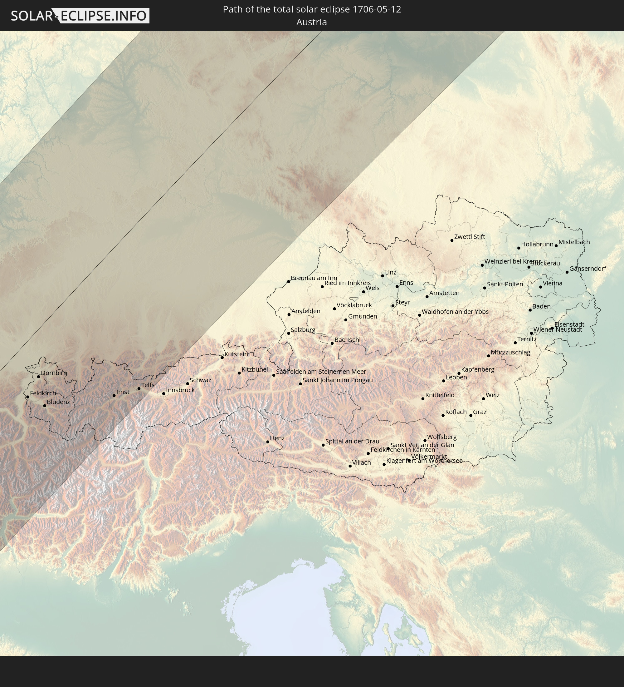 Austria
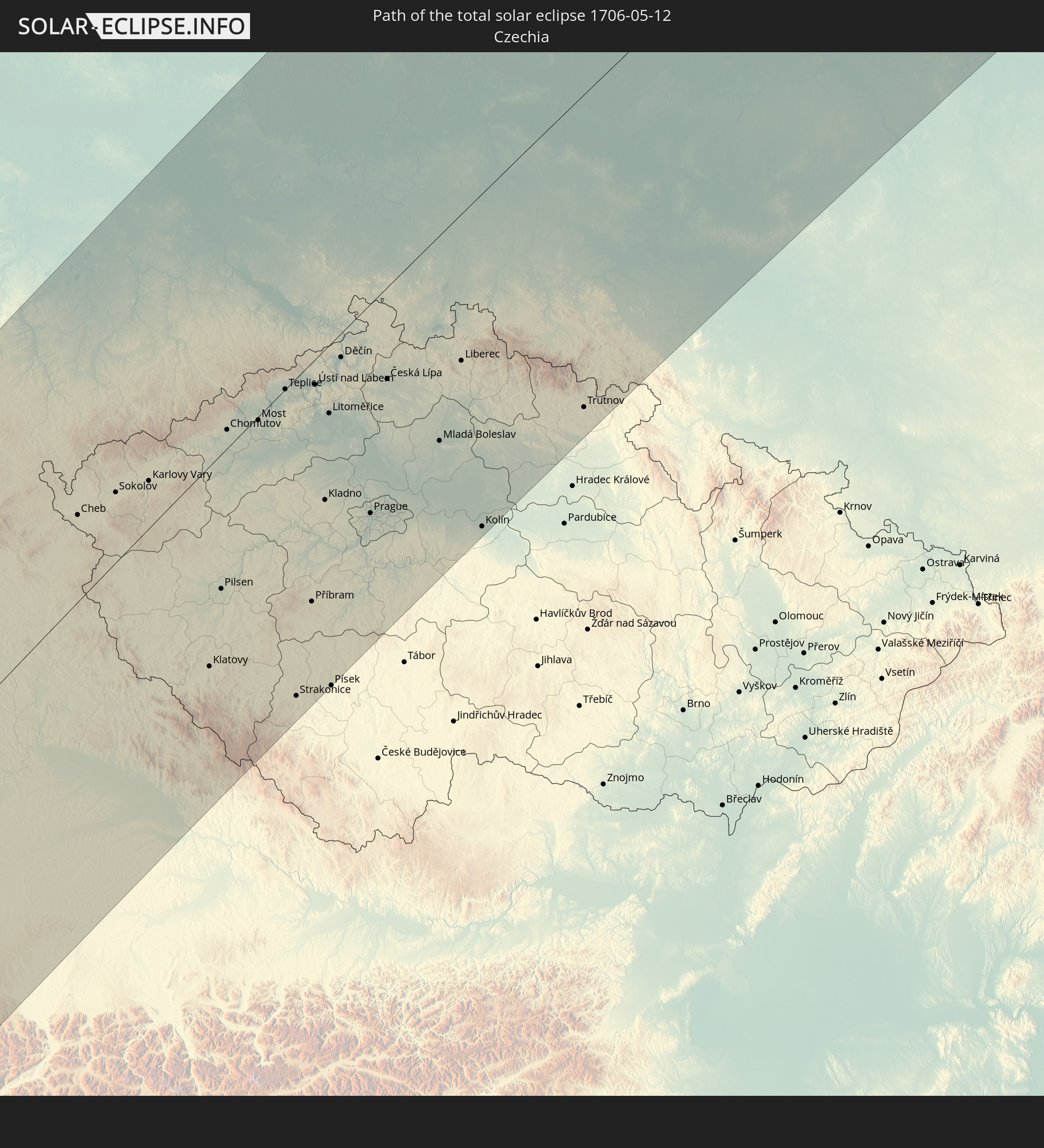 Czechia
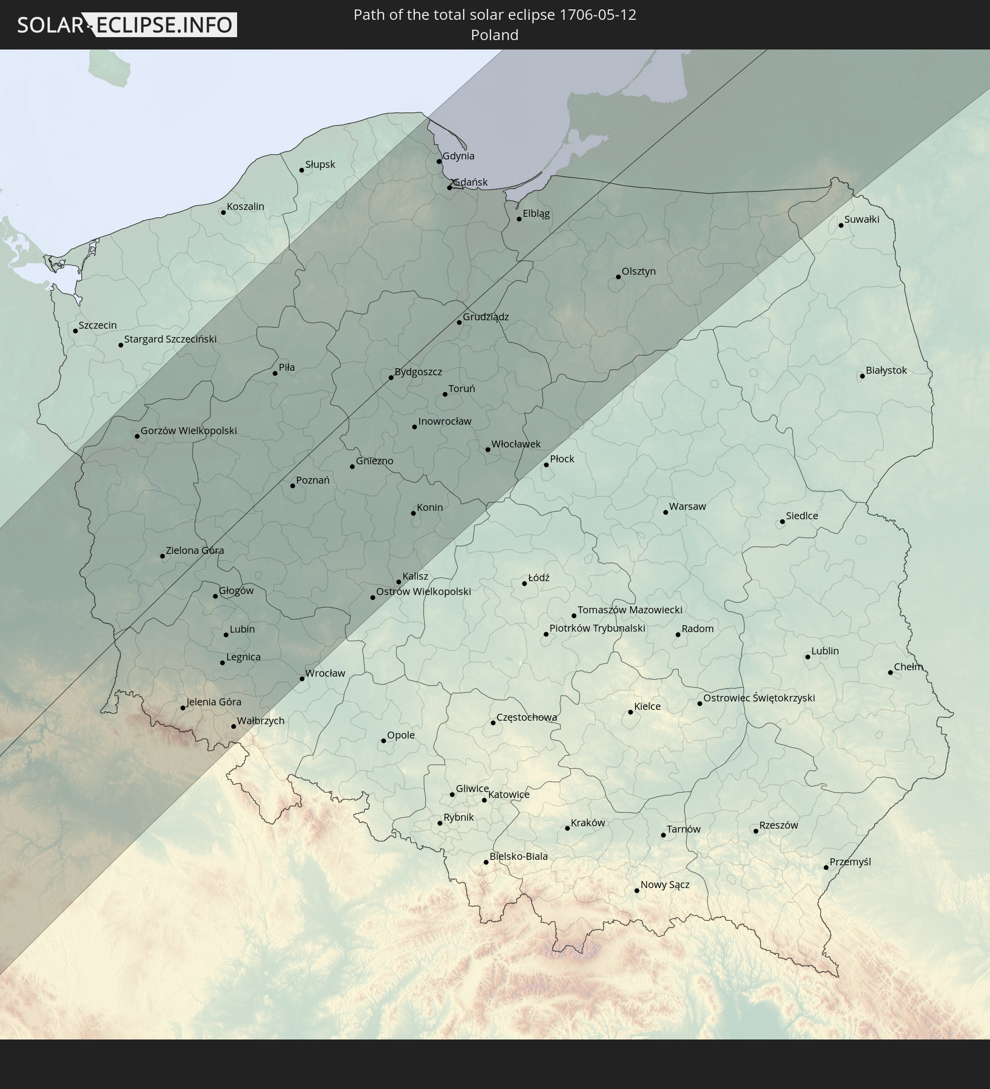 Poland
 Lithuania
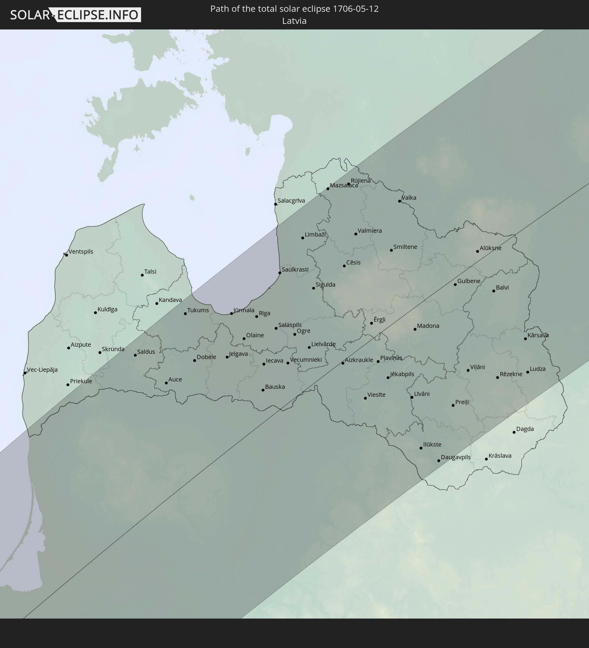 Latvia
 Estonia
In den folgenden Ländern ist die Sonnenfinsternis partiell zu sehen
 Russia
 Canada
 Greenland
 Saint Pierre and Miquelon
 Portugal
 Cabo Verde
 Iceland
 Spain
Spain
 Senegal
 Mauritania
 The Gambia
 Guinea-Bissau
 Guinea
 Saint Helena, Ascension and Tristan da Cunha
 Sierra Leone
 Morocco
 Mali
Mali
 Liberia
 Republic of Ireland
 Svalbard and Jan Mayen
 Algeria
 United Kingdom
 Ivory Coast
 Faroe Islands
 Burkina Faso
 Gibraltar
 France
 Isle of Man
 Ghana
Ghana
 Guernsey
 Jersey
 Togo
Togo
 Niger
Niger
 Benin
Benin
 Andorra
 Belgium
 Nigeria
 Netherlands
 Norway
 Equatorial Guinea
 Luxembourg
 Germany
 Switzerland
 São Tomé and Príncipe
 Italy
Italy
 Monaco
 Tunisia
 Denmark
 Cameroon
 Gabon
Gabon
 Libya
Libya
 Liechtenstein
 Austria
 Sweden
 Czechia
 San Marino
 Vatican City
 Slovenia
 Chad
Chad
 Croatia
 Poland
 Malta
Malta
 Central African Republic
 Bosnia and Herzegovina
 Hungary
 Slovakia
 Montenegro
 Serbia
 Albania
 Åland Islands
 Greece
 Romania
 Republic of Macedonia
 Finland
 Lithuania
 Latvia
 Estonia
 Sudan
Sudan
 Ukraine
 Bulgaria
 Belarus
 Egypt
Egypt
 Turkey
 Moldova
 Cyprus
 State of Palestine
 Israel
 Saudi Arabia
 Jordan
 Lebanon
 Syria
Syria
 Iraq
Iraq
 Georgia
 Armenia
 Iran
Iran
 Azerbaijan
 Kazakhstan
 Kuwait
 Turkmenistan
 Uzbekistan
 Afghanistan
 Pakistan
 Tajikistan
 India
India
 Kyrgyzstan
 China
China
 Nepal
Nepal
 Mongolia
 Bhutan
 Myanmar
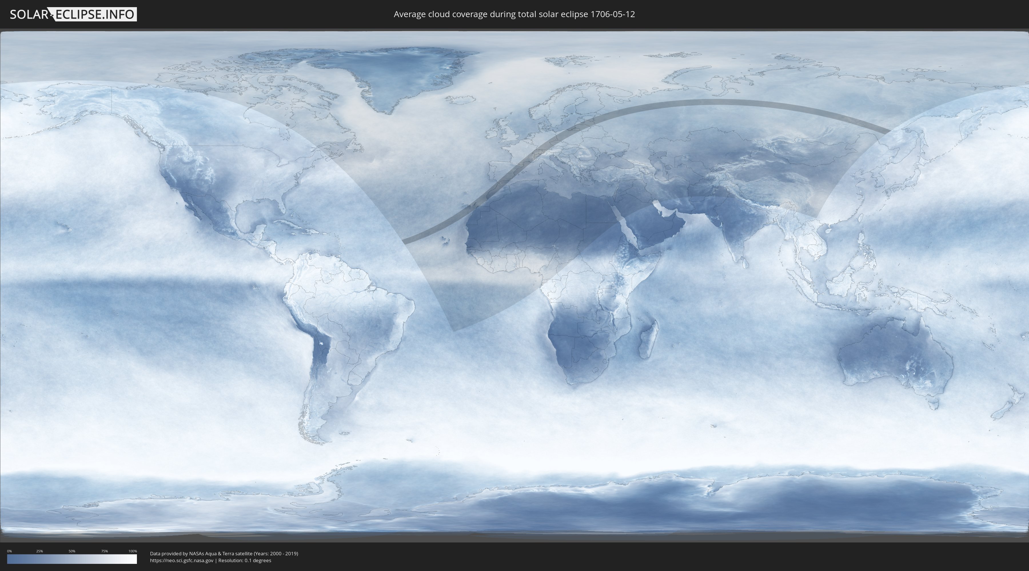
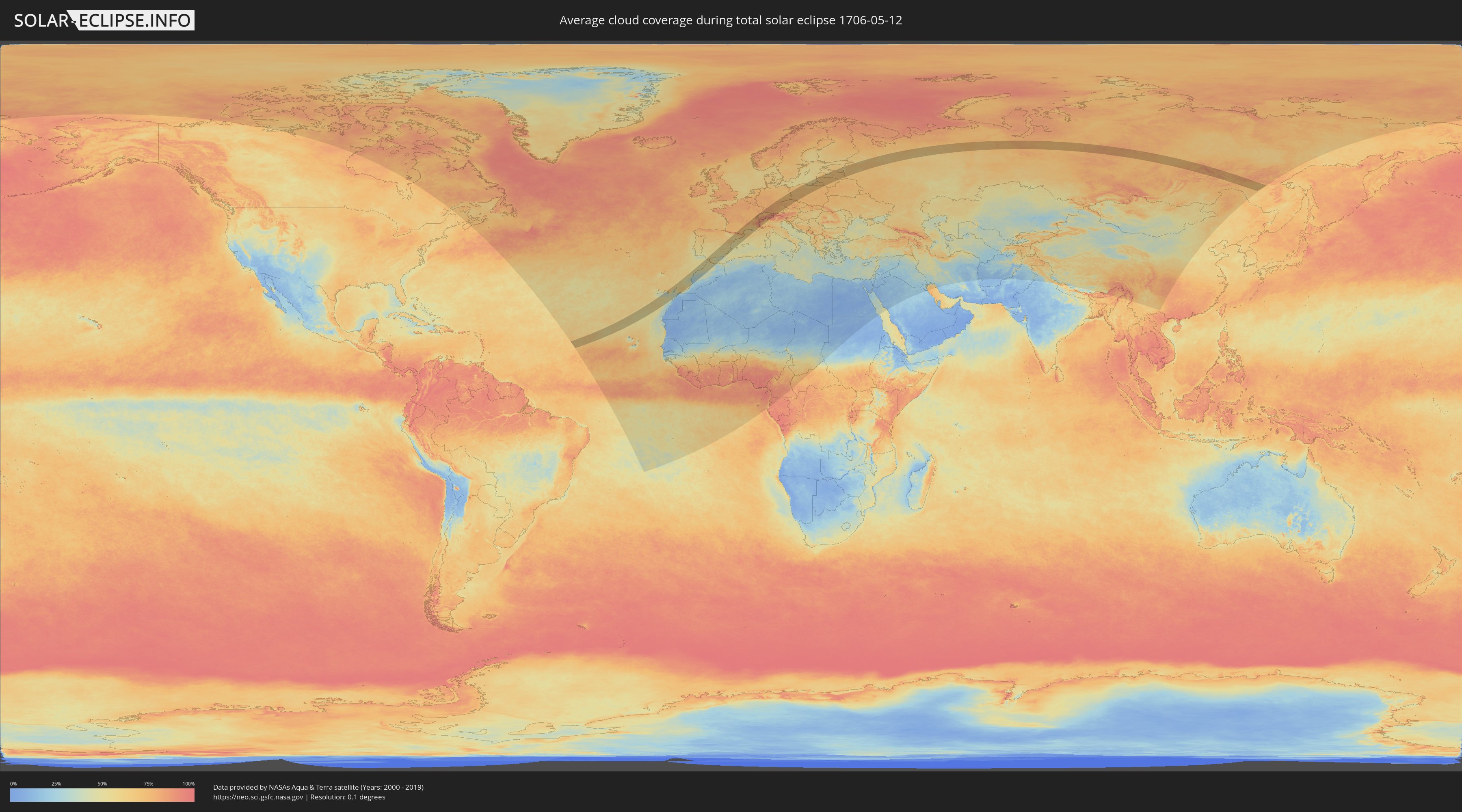
How will be the weather during the total solar eclipse on 05/12/1706?
Where is the best place to see the total solar eclipse of 05/12/1706?
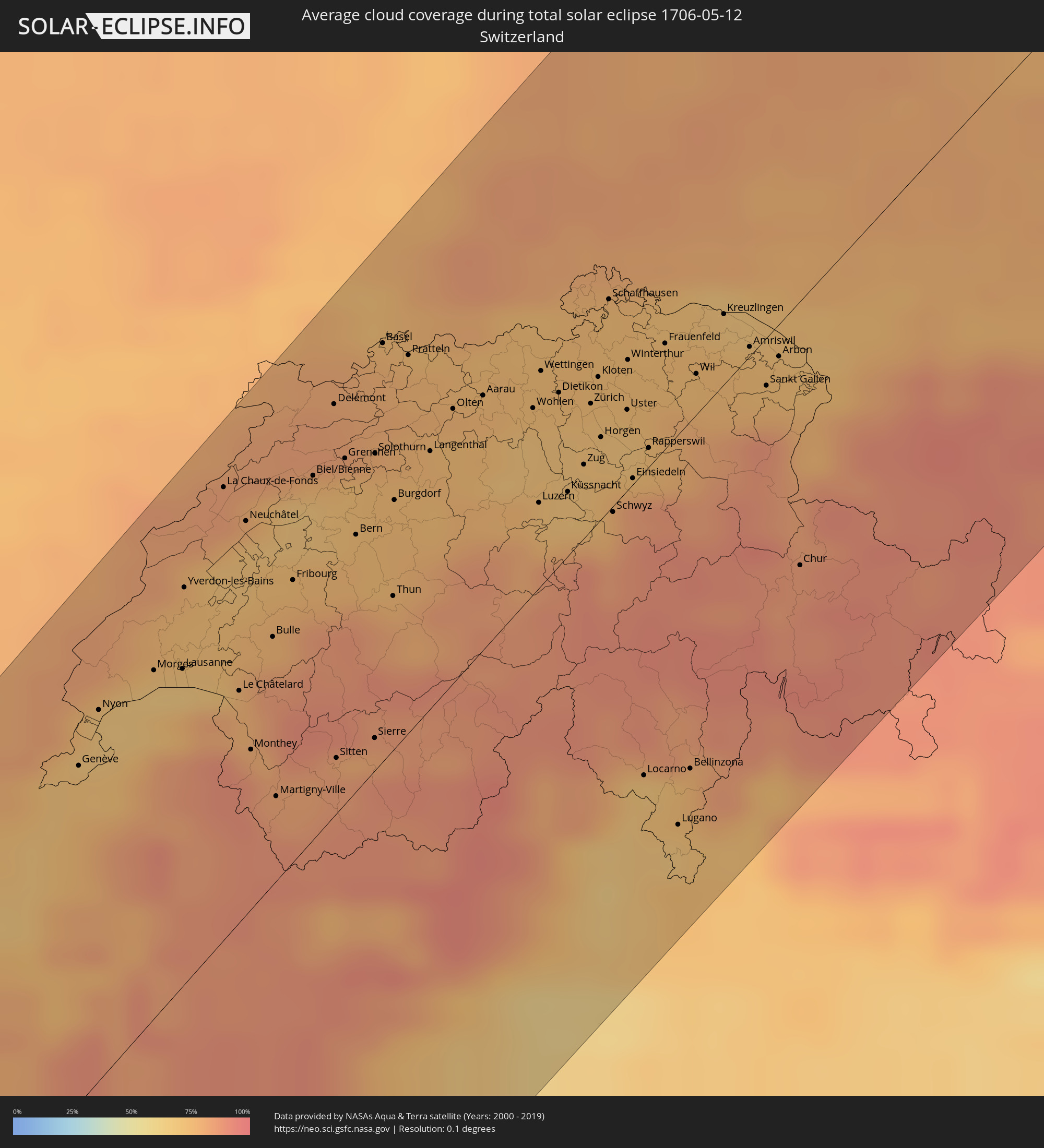
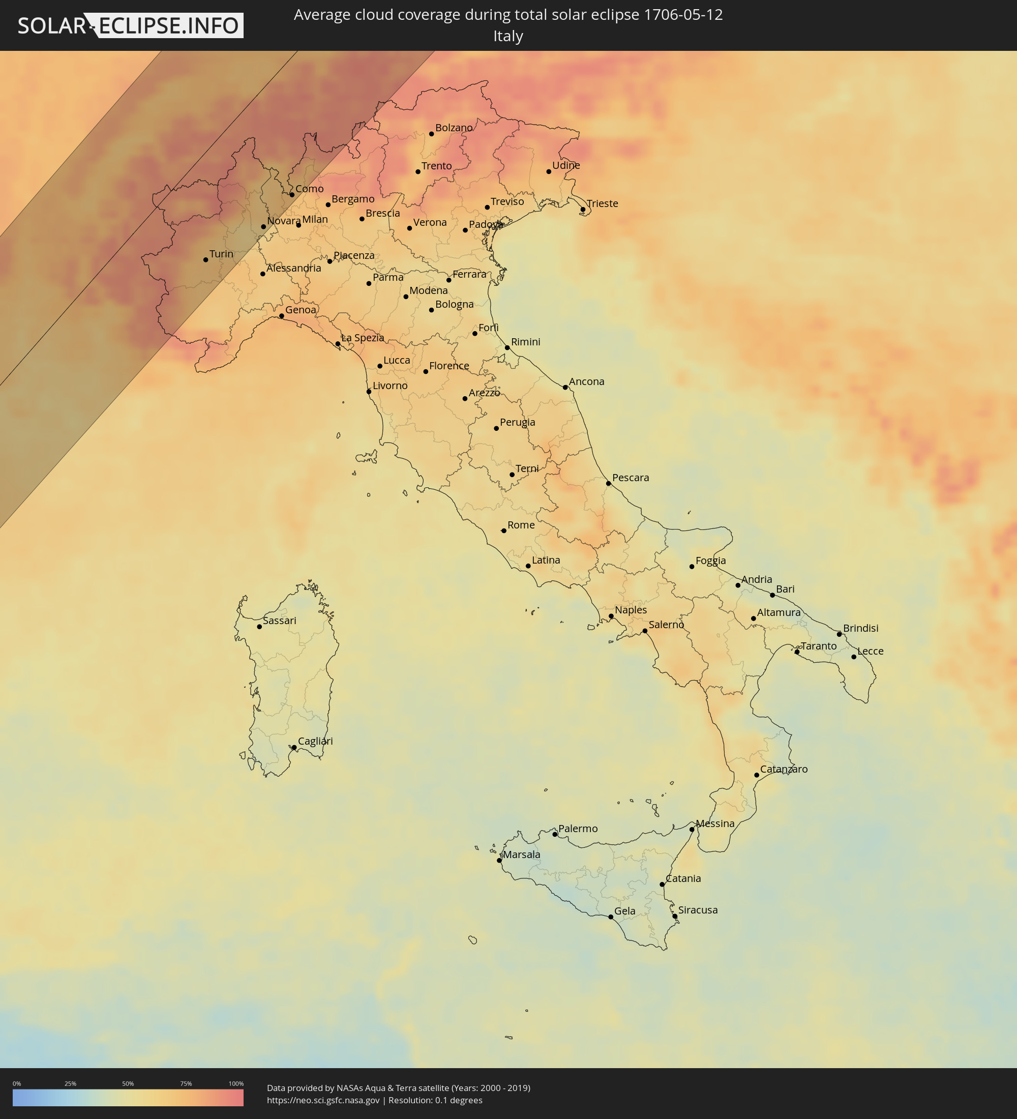
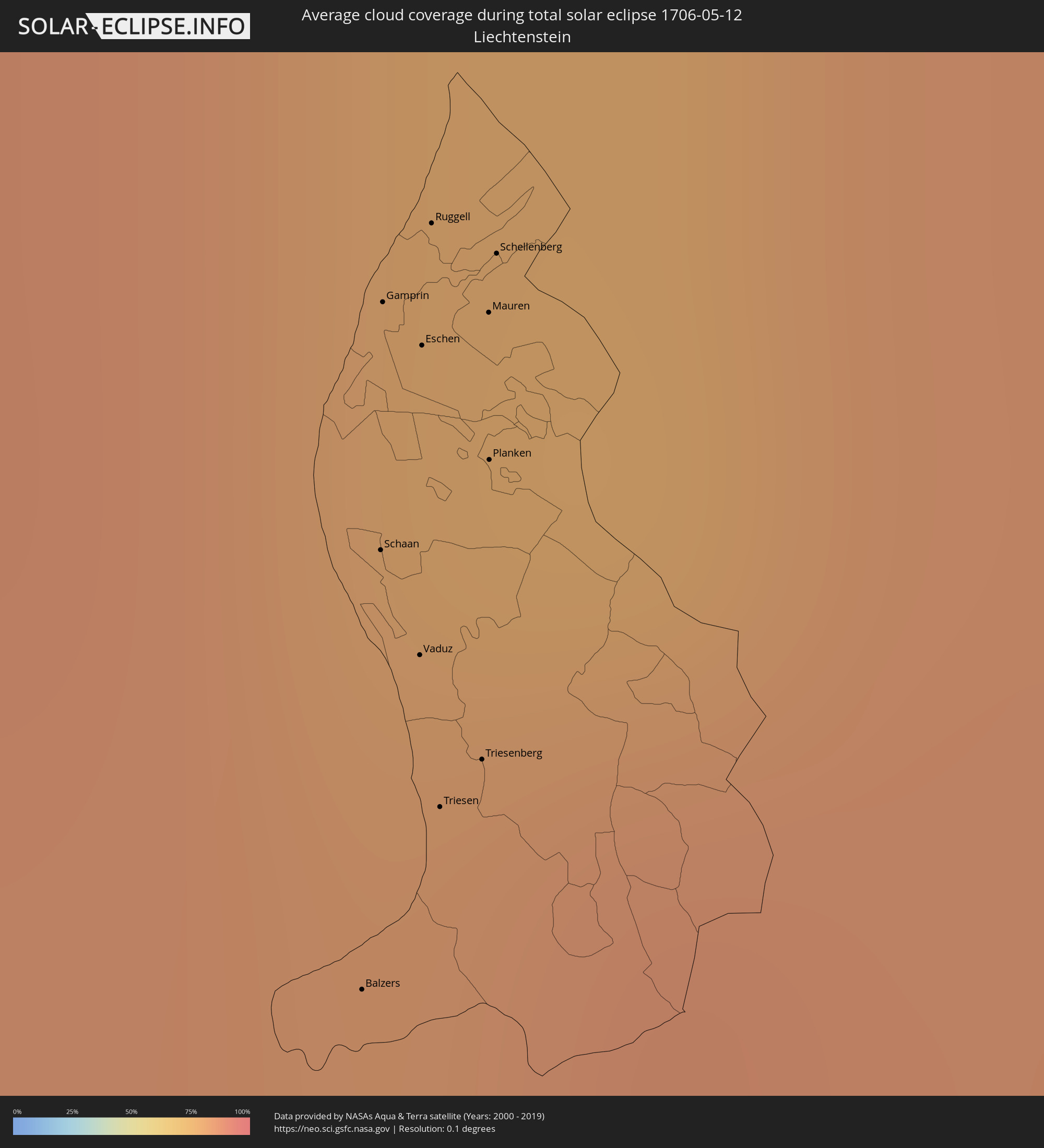
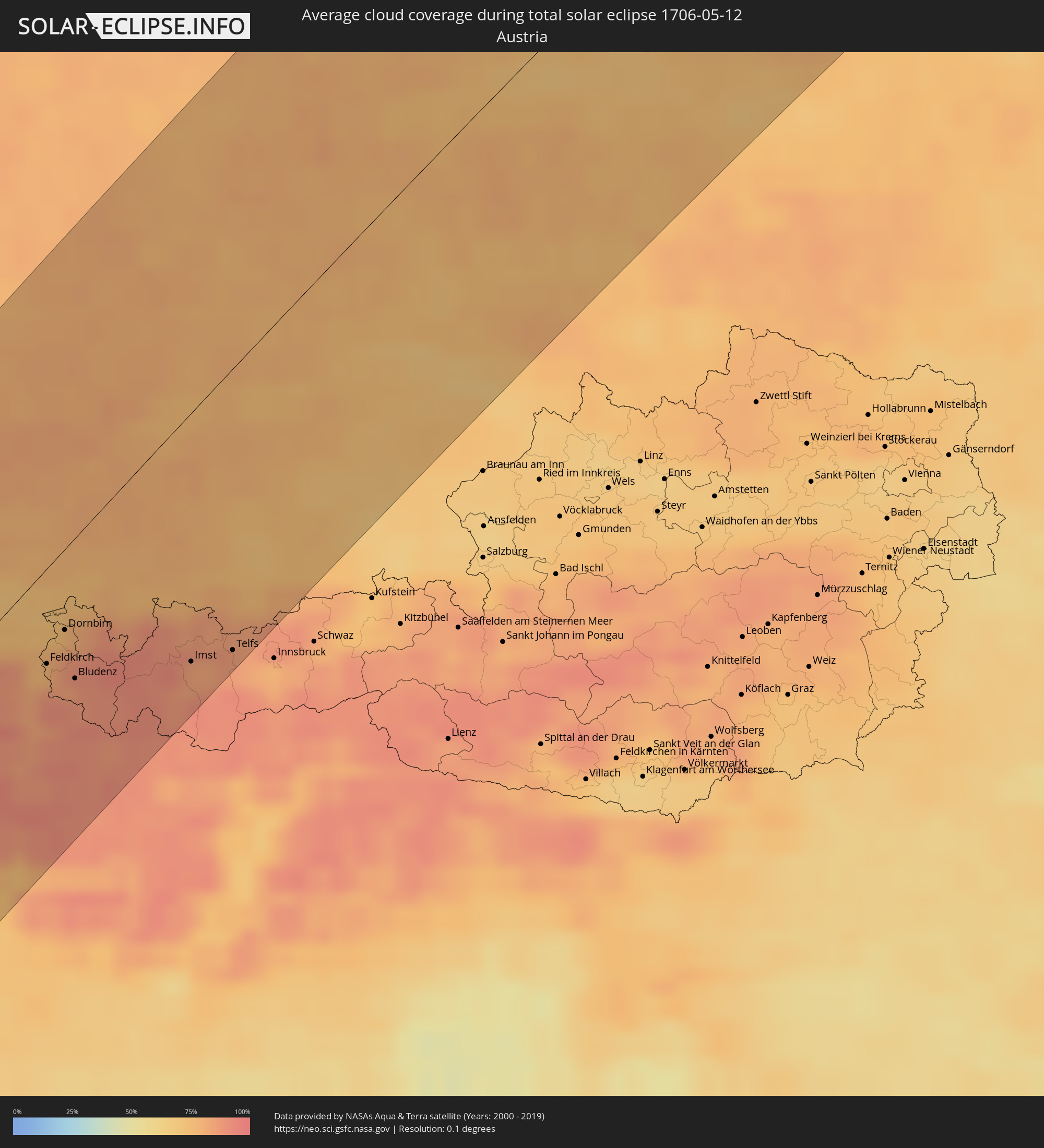
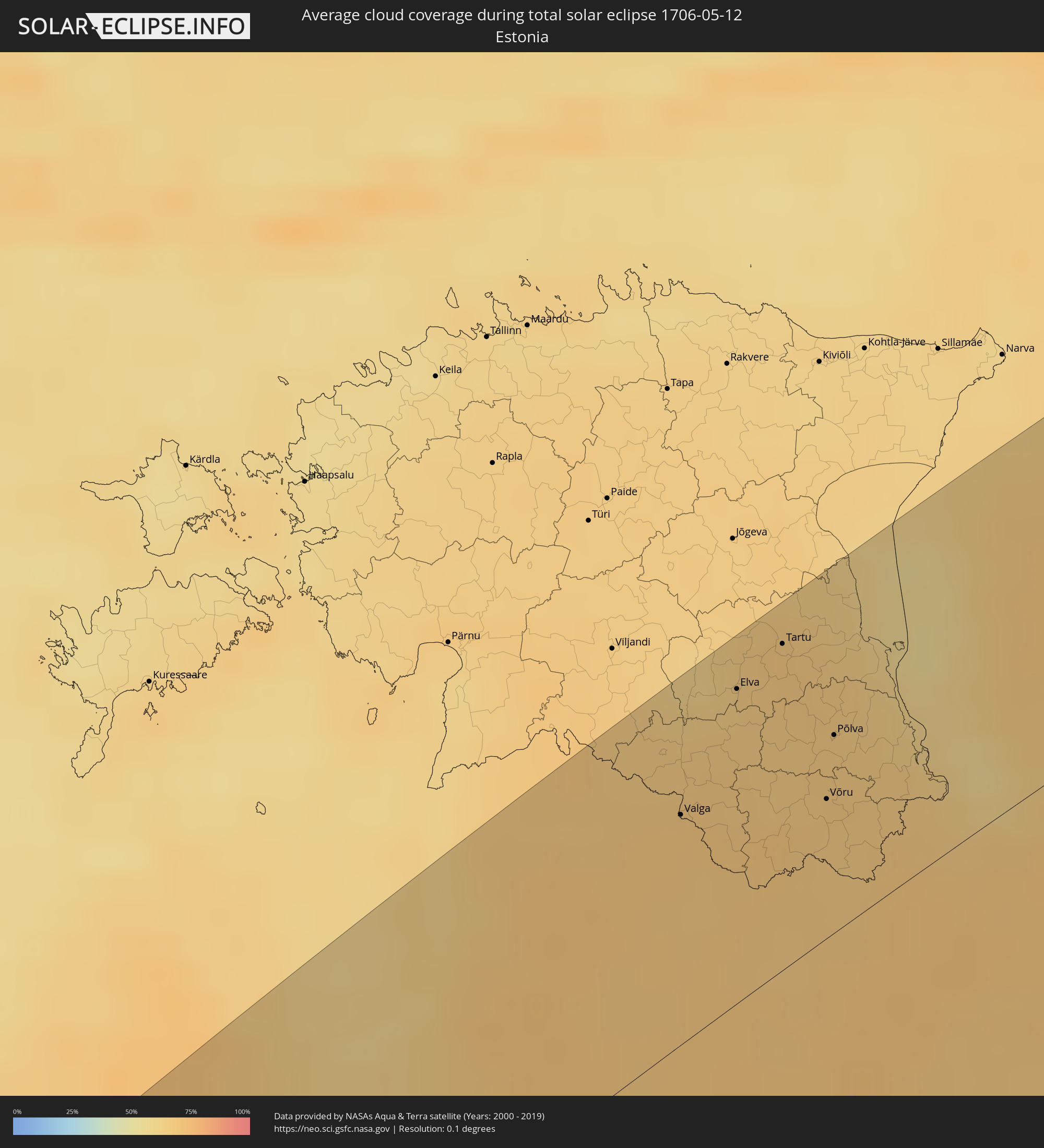
The following maps show the average cloud coverage for the day of the total solar eclipse.
With the help of these maps, it is possible to find the place along the eclipse path, which has the best
chance of a cloudless sky.
Nevertheless, you should consider local circumstances and inform about the weather of your chosen
observation site.
The data is provided by NASAs satellites
AQUA and TERRA.
The cloud maps are averaged over a period of 19 years (2000 - 2019).
Detailed country maps
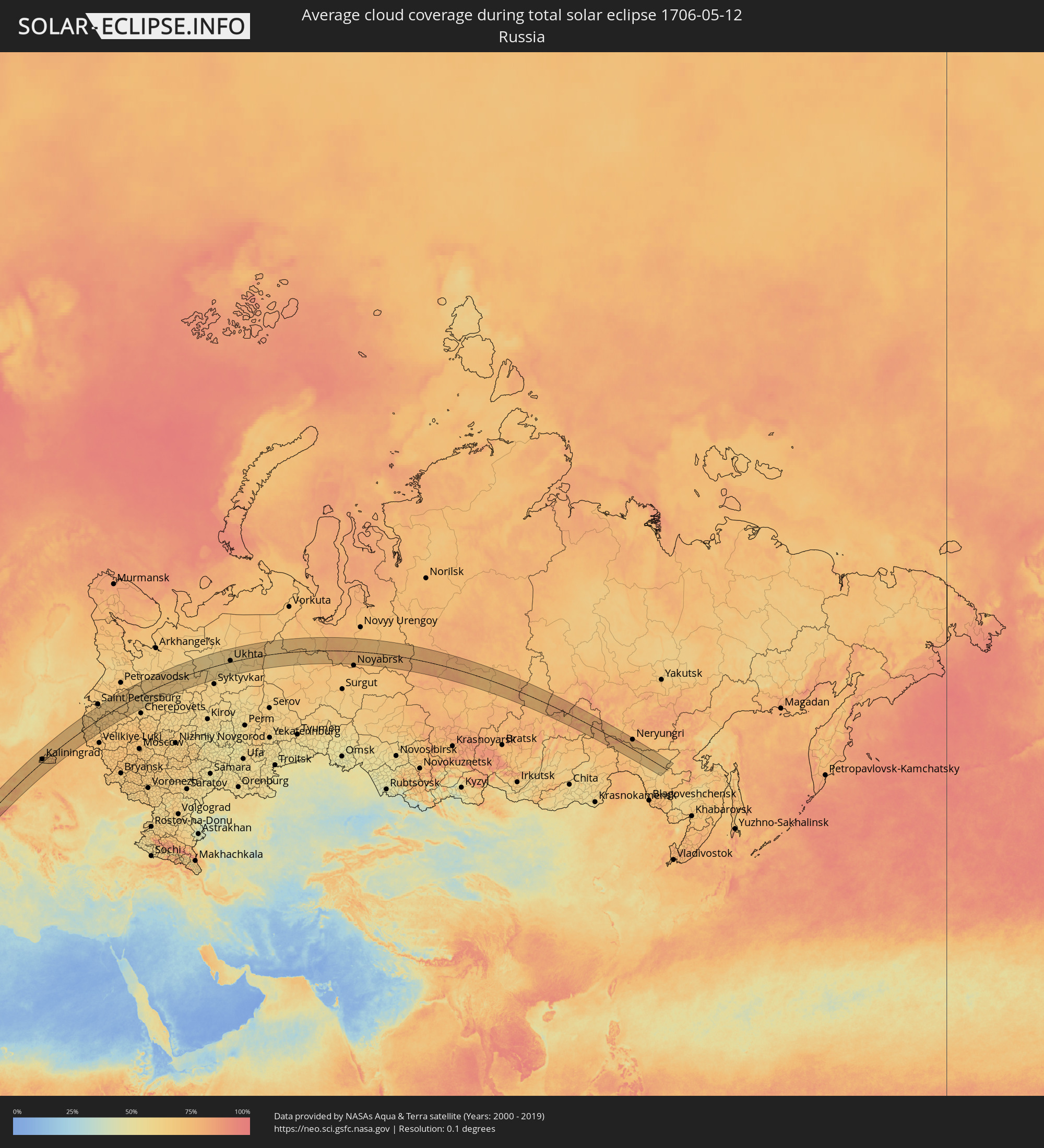 Russia
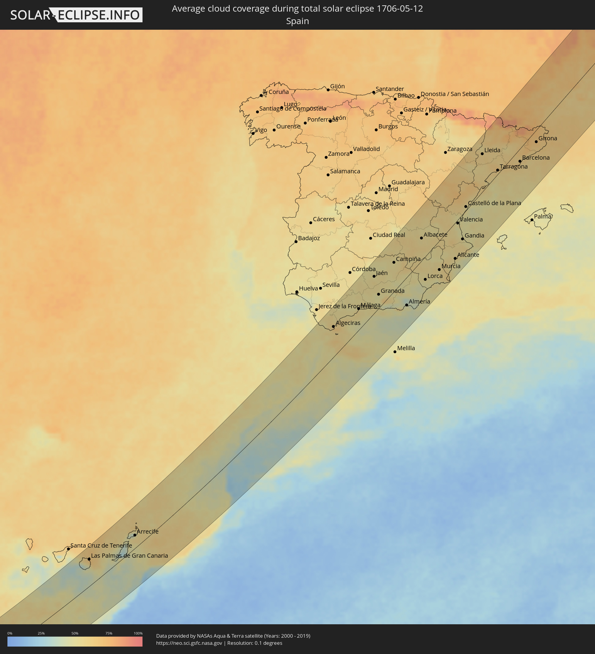 Spain
Spain
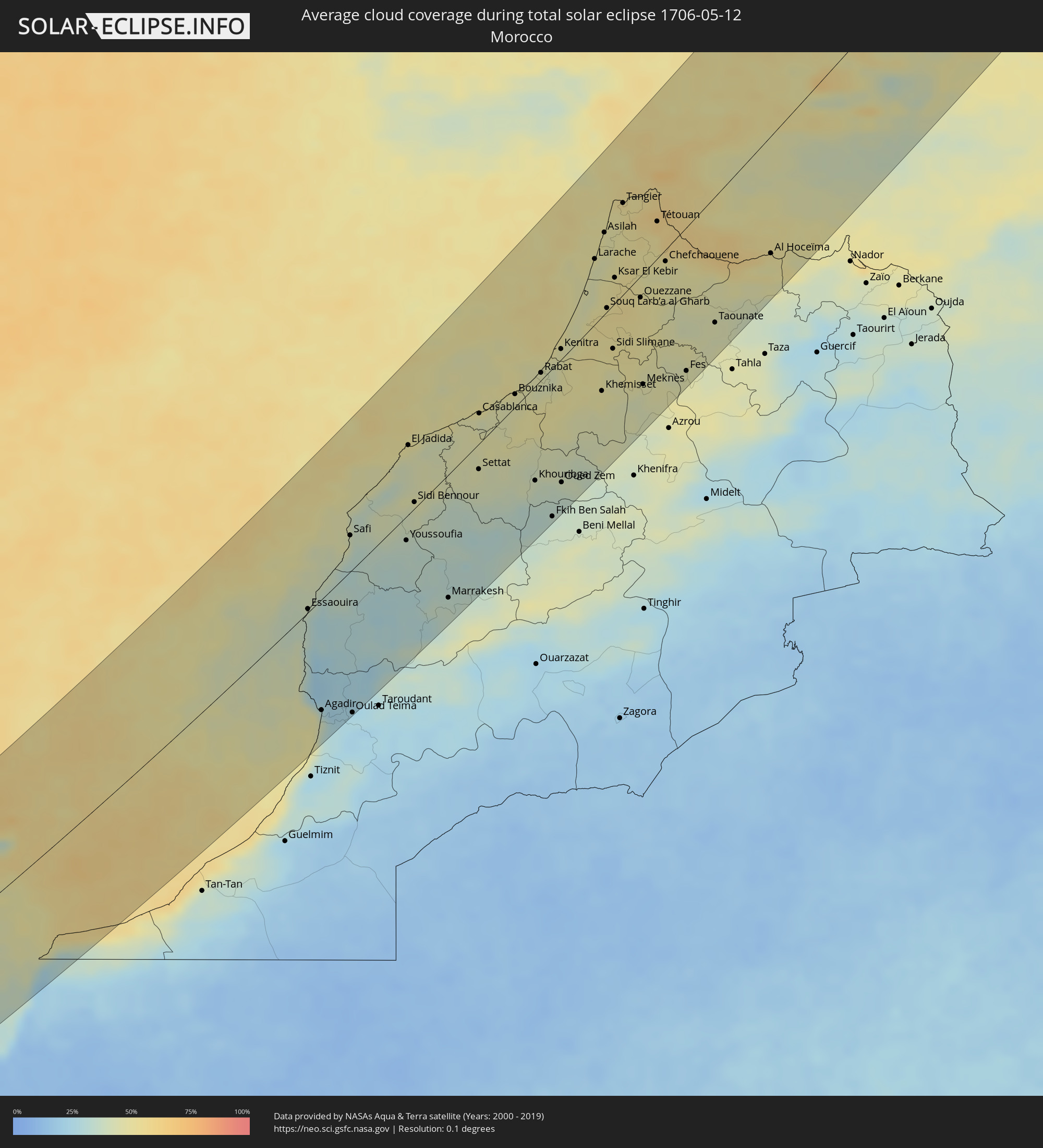 Morocco
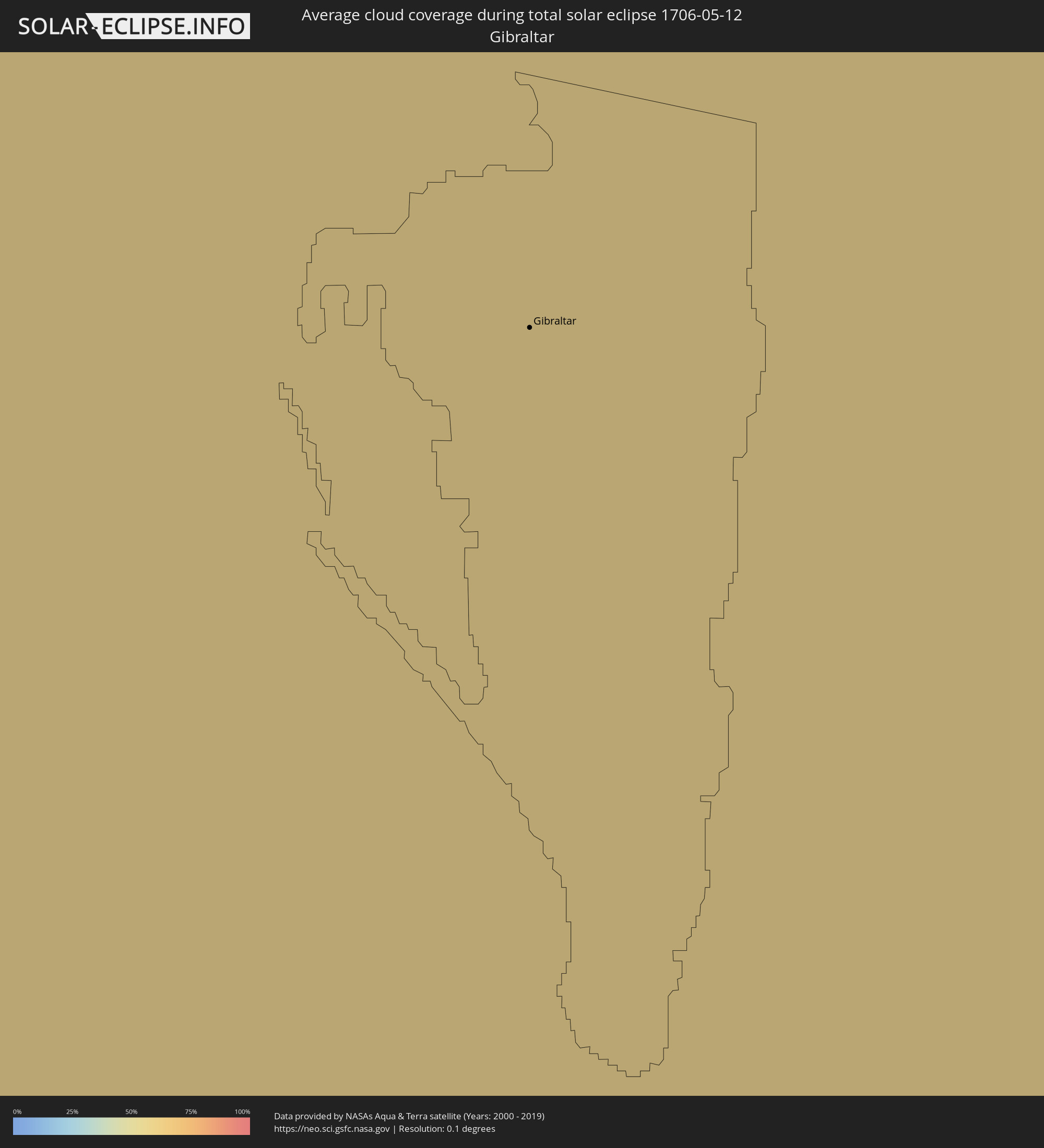 Gibraltar
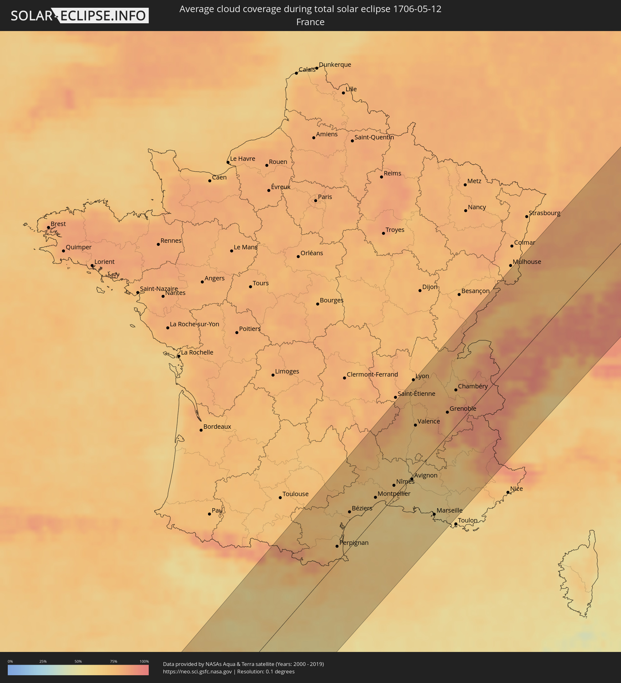 France
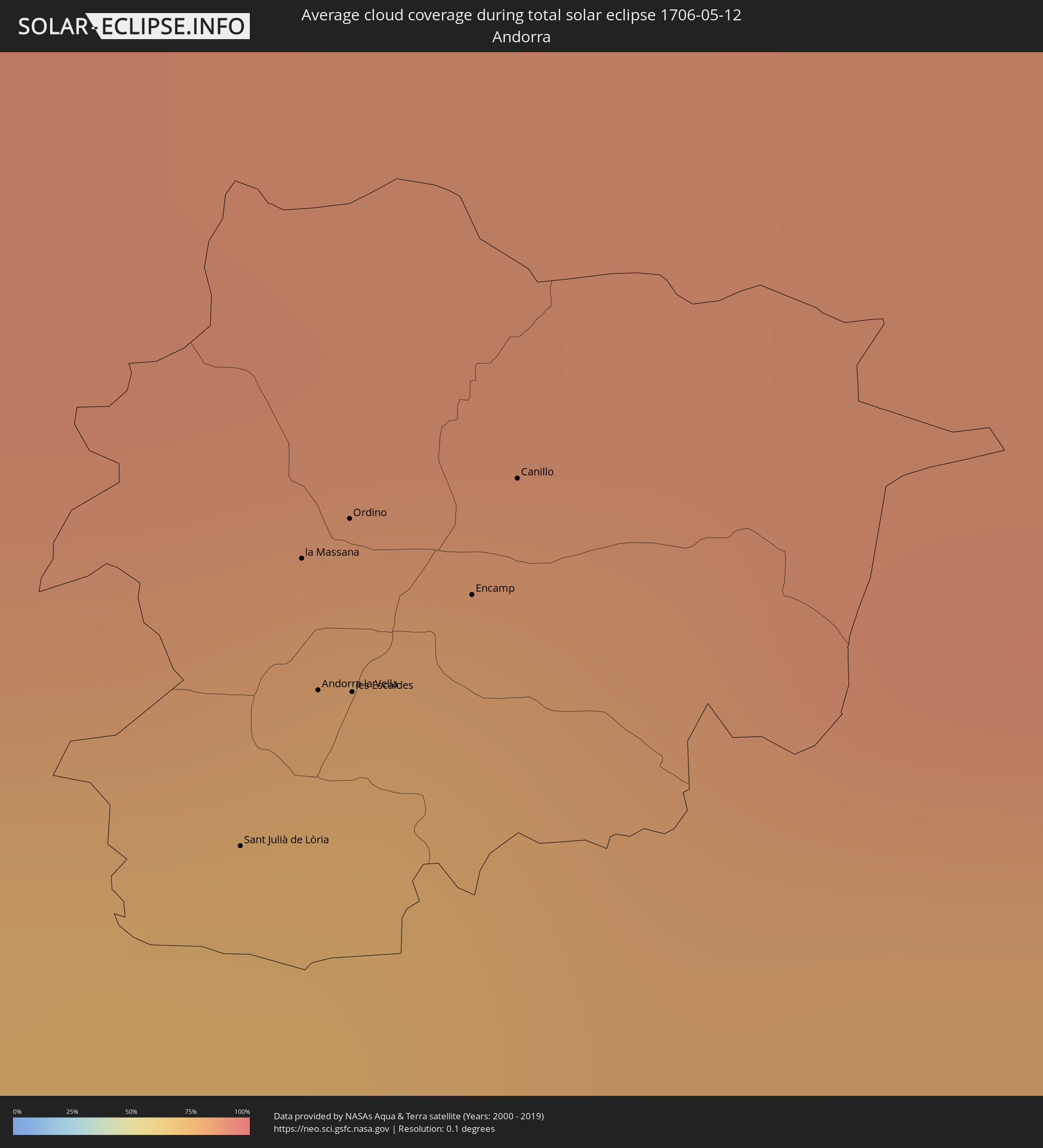 Andorra
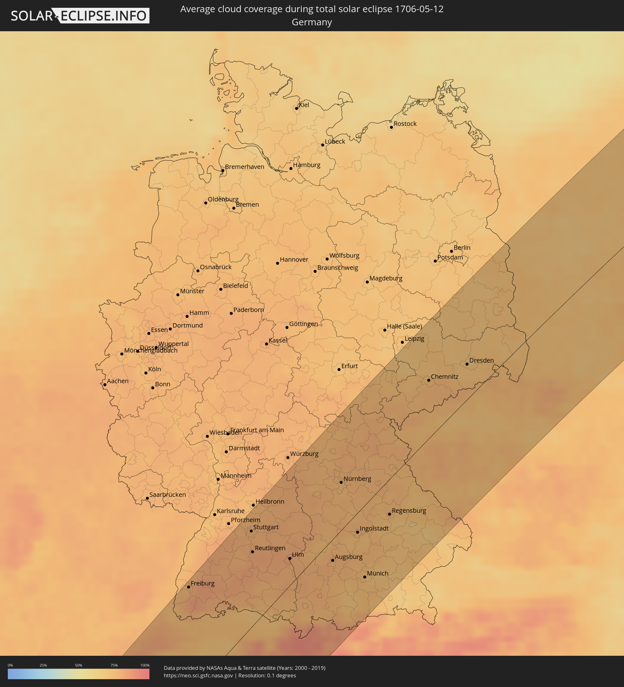 Germany
 Switzerland
 Italy
Italy
 Liechtenstein
 Austria
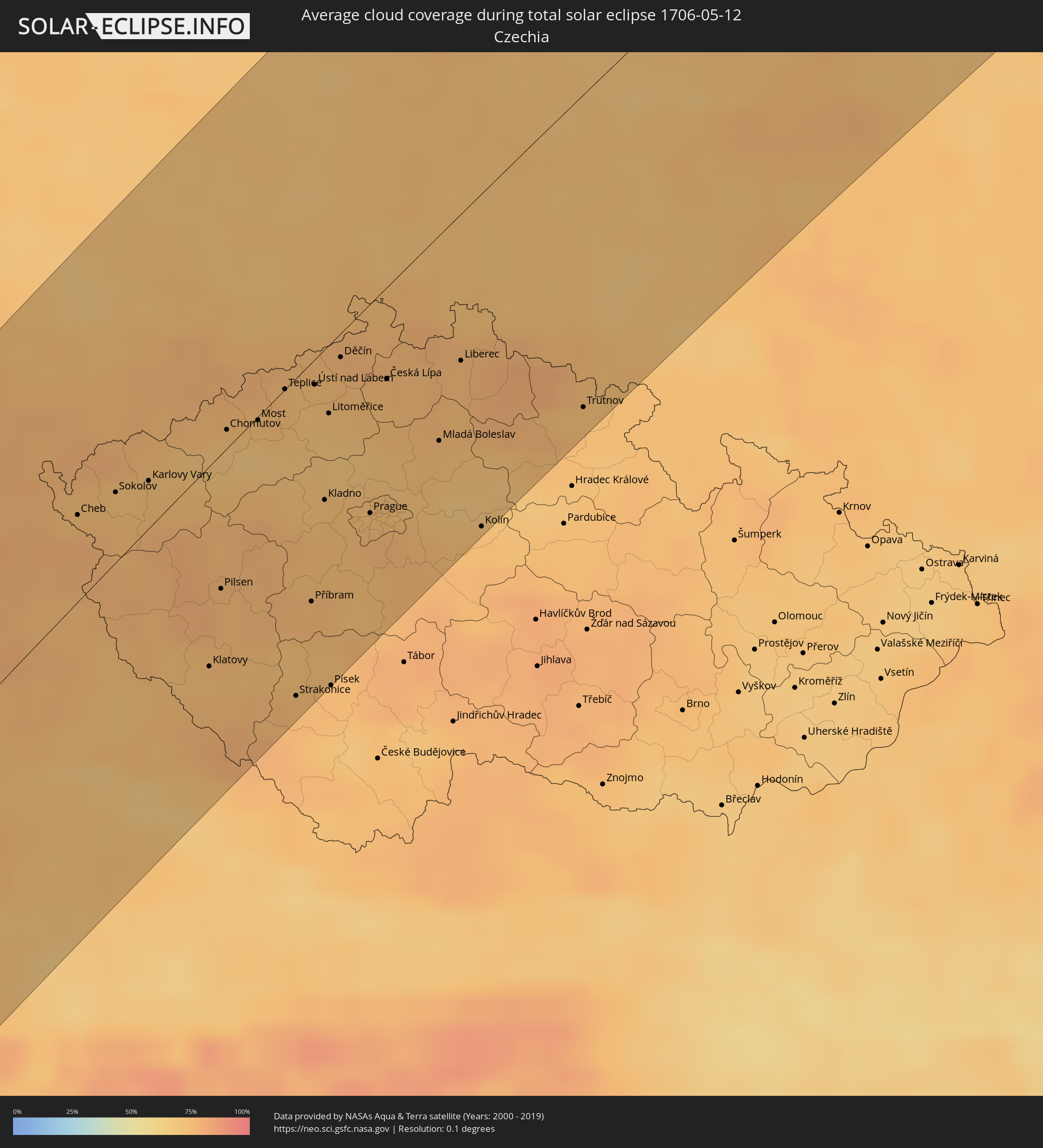 Czechia
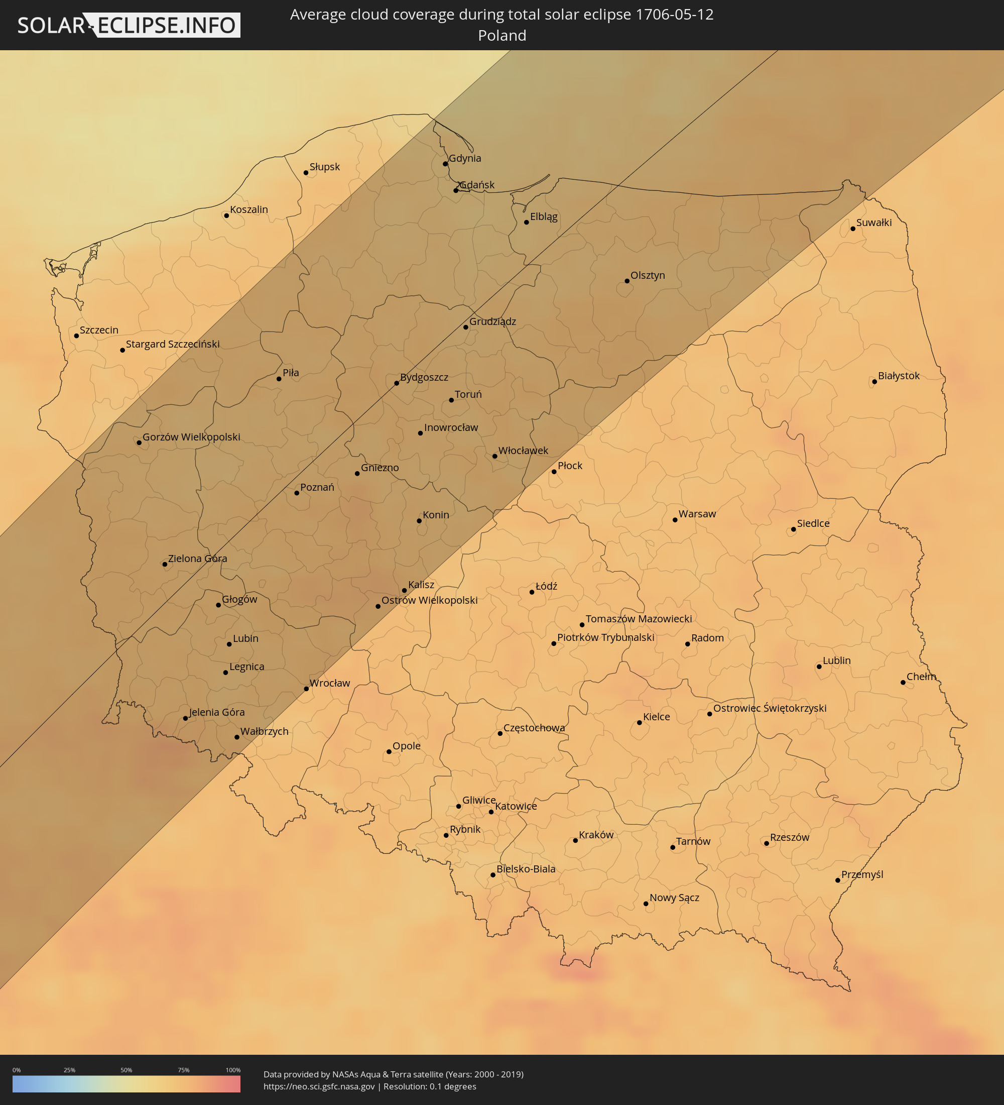 Poland
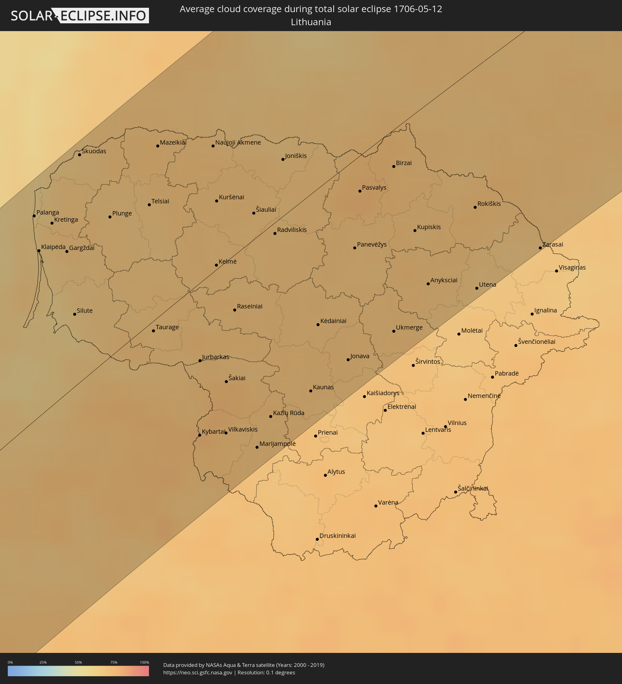 Lithuania
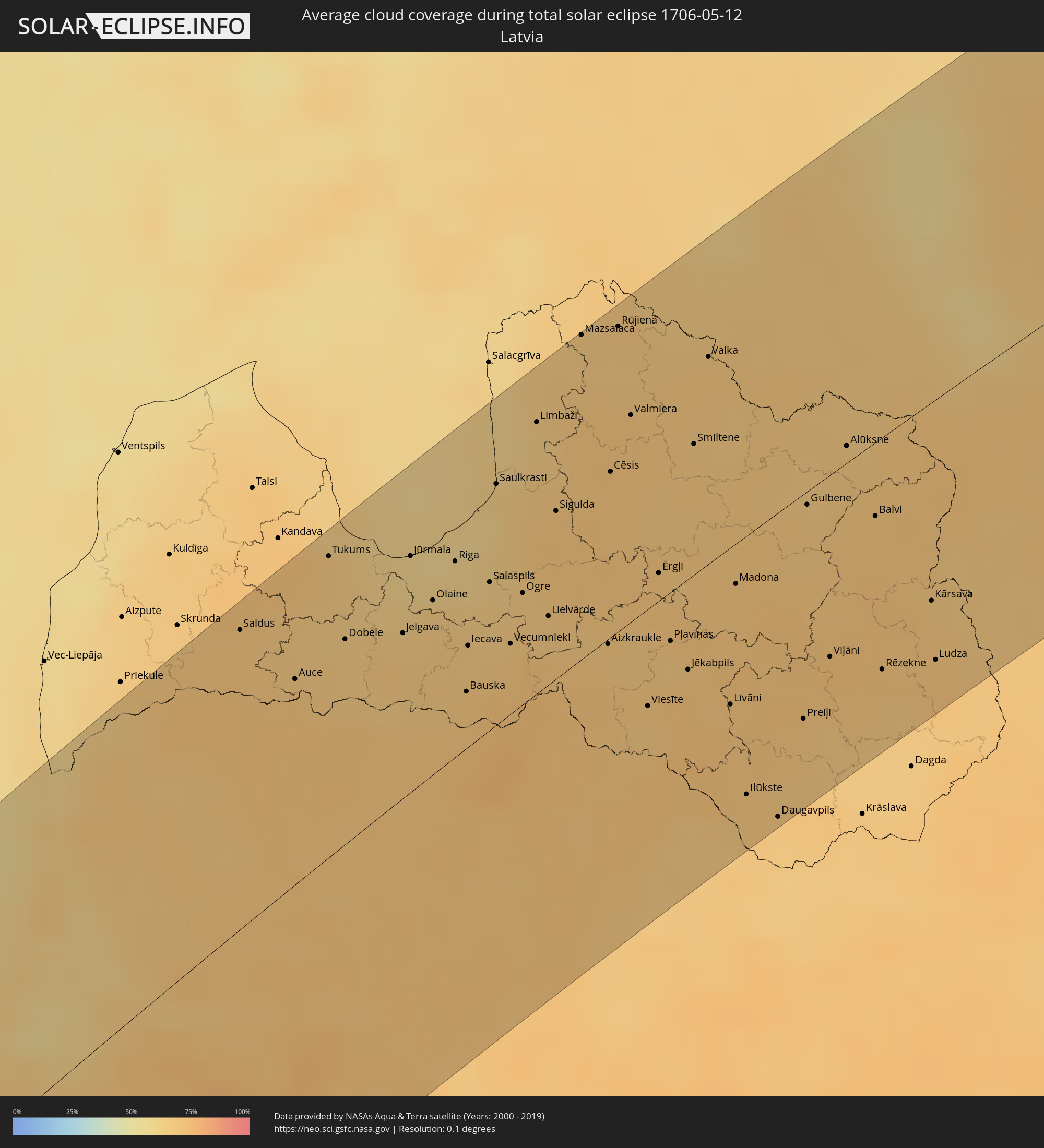 Latvia
 Estonia
Cities inside the path of the eclipse
The following table shows all locations with a population of more than 5,000 inside the eclipse path. Cities which have more than 100,000 inhabitants are marked bold. A click at the locations opens a detailed map.
| City | Type | Eclipse duration | Local time of max. eclipse | Distance to central line | Ø Cloud coverage |
|
Las Palmas de Gran Canaria, Canary Islands
|
total | - | 07:27:02 UTC-01:01 | 85 km | 58% |
|
Agadir, Souss-Massa-Drâa
|
total | - | 08:04:42 UTC-00:30 | 97 km | 38% |
|
Safi, Doukkala-Abda
|
total | - | 08:08:14 UTC-00:30 | 31 km | 36% |
|
Marrakesh, Marrakech-Tensift-Al Haouz
|
total | - | 08:07:43 UTC-00:30 | 108 km | 36% |
|
Casablanca, Grand Casablanca
|
total | - | 08:11:29 UTC-00:30 | 27 km | 43% |
|
Mohammedia, Grand Casablanca
|
total | - | 08:11:48 UTC-00:30 | 37 km | 45% |
|
Khouribga, Chaouia-Ouardigha
|
total | - | 08:10:37 UTC-00:30 | 77 km | 37% |
|
Rabat, Rabat-Salé-Zemmour-Zaër
|
total | - | 08:12:44 UTC-00:30 | 29 km | 43% |
|
Kenitra, Gharb-Chrarda-Beni Hssen
|
total | - | 08:13:21 UTC-00:30 | 9 km | 47% |
|
Tangier, Tanger-Tétouan
|
total | - | 08:16:38 UTC-00:30 | 77 km | 51% |
|
Meknès, Meknès-Tafilalet
|
total | - | 08:13:20 UTC-00:30 | 94 km | 45% |
|
Tétouan, Tanger-Tétouan
|
total | - | 08:16:34 UTC-00:30 | 34 km | 60% |
|
Gibraltar
|
total | - | 08:47:58 UTC+00:00 | 77 km | 60% |
|
Fes, Fès-Boulemane
|
total | - | 08:13:57 UTC-00:30 | 115 km | 45% |
|
Málaga, Andalusia
|
total | - | 08:49:41 UTC+00:00 | 52 km | 56% |
|
Al Hoceïma, Taza-Al Hoceima-Taounate
|
total | - | 08:16:57 UTC-00:30 | 93 km | 51% |
|
Granada, Andalusia
|
total | - | 08:51:09 UTC+00:00 | 41 km | 48% |
|
Almería, Andalusia
|
total | - | 08:51:21 UTC+00:00 | 68 km | 47% |
|
Albacete, Castille-La Mancha
|
total | - | 08:55:53 UTC+00:00 | 54 km | 54% |
|
Murcia, Murcia
|
total | - | 08:54:34 UTC+00:00 | 75 km | 54% |
|
Cartagena, Murcia
|
total | - | 08:53:57 UTC+00:00 | 108 km | 54% |
|
Elche, Valencia
|
total | - | 08:55:26 UTC+00:00 | 79 km | 56% |
|
Alicante, Valencia
|
total | - | 08:55:46 UTC+00:00 | 89 km | 52% |
|
Valencia, Valencia
|
total | - | 08:57:59 UTC+00:00 | 11 km | 50% |
|
Castelló de la Plana, Valencia
|
total | - | 08:59:14 UTC+00:00 | 9 km | 52% |
|
Sant Julià de Lòria, Sant Julià de Loria
|
total | - | 09:05:14 UTC+00:00 | 94 km | 74% |
|
la Massana, La Massana
|
total | - | 09:05:24 UTC+00:00 | 97 km | 74% |
|
Andorra la Vella, Andorra la Vella
|
total | - | 09:05:20 UTC+00:00 | 94 km | 74% |
|
Ordino, Ordino
|
total | - | 09:05:26 UTC+00:00 | 96 km | 78% |
|
les Escaldes, Escaldes-Engordany
|
total | - | 09:05:21 UTC+00:00 | 93 km | 74% |
|
Encamp, Encamp
|
total | - | 09:05:26 UTC+00:00 | 91 km | 78% |
|
Canillo, Canillo
|
total | - | 09:05:31 UTC+00:00 | 92 km | 82% |
|
Terrassa, Catalonia
|
total | - | 09:04:01 UTC+00:00 | 9 km | 60% |
|
Barcelona, Catalonia
|
total | - | 09:03:49 UTC+00:00 | 32 km | 60% |
|
Perpignan, Occitania
|
total | - | 09:16:17 UTC+00:09 | 24 km | 70% |
|
Narbonne, Occitania
|
total | - | 09:17:17 UTC+00:09 | 50 km | 65% |
|
Béziers, Occitania
|
total | - | 09:17:47 UTC+00:09 | 52 km | 66% |
|
Montpellier, Occitania
|
total | - | 09:18:54 UTC+00:09 | 32 km | 66% |
|
Nîmes, Occitania
|
total | - | 09:19:46 UTC+00:09 | 15 km | 69% |
|
Arles, Provence-Alpes-Côte d'Azur
|
total | - | 09:19:45 UTC+00:09 | 14 km | 60% |
|
Avignon, Provence-Alpes-Côte d'Azur
|
total | - | 09:20:25 UTC+00:09 | 29 km | 63% |
|
Lyon, Auvergne-Rhône-Alpes
|
total | - | 09:23:45 UTC+00:09 | 125 km | 75% |
|
Valence, Auvergne-Rhône-Alpes
|
total | - | 09:22:19 UTC+00:09 | 62 km | 68% |
|
Marseille, Provence-Alpes-Côte d'Azur
|
total | - | 09:19:47 UTC+00:09 | 88 km | 58% |
|
Aix-en-Provence, Provence-Alpes-Côte d'Azur
|
total | - | 09:20:16 UTC+00:09 | 80 km | 58% |
|
Grenoble, Auvergne-Rhône-Alpes
|
total | - | 09:23:32 UTC+00:09 | 31 km | 75% |
|
Chambéry, Auvergne-Rhône-Alpes
|
total | - | 09:24:29 UTC+00:09 | 49 km | 74% |
|
Genève, Geneva
|
total | - | 10:16:29 UTC+01:00 | 82 km | 72% |
|
Lausanne, Vaud
|
total | - | 10:17:32 UTC+01:00 | 78 km | 66% |
|
La Chaux-de-Fonds, Neuchâtel
|
total | - | 10:18:46 UTC+01:00 | 109 km | 83% |
|
Biel/Bienne, Bern
|
total | - | 10:19:15 UTC+01:00 | 87 km | 69% |
|
Aosta, Aosta Valley
|
total | - | 10:16:50 UTC+01:00 | 25 km | 84% |
|
Pinerolo, Piedmont
|
total | - | 10:15:19 UTC+01:00 | 85 km | 76% |
|
Bern, Bern
|
total | - | 10:19:07 UTC+01:00 | 62 km | 75% |
|
Basel, Basel-City
|
total | - | 10:20:19 UTC+01:00 | 99 km | 75% |
|
Thun, Bern
|
total | - | 10:18:57 UTC+01:00 | 37 km | 77% |
|
Turin, Piedmont
|
total | - | 10:16:01 UTC+01:00 | 95 km | 70% |
|
Carmagnola, Piedmont
|
total | - | 10:15:39 UTC+01:00 | 112 km | 69% |
|
Freiburg, Baden-Württemberg
|
total | - | 10:21:22 UTC+01:00 | 116 km | 80% |
|
Ivrea, Piedmont
|
total | - | 10:16:55 UTC+01:00 | 76 km | 73% |
|
Chivasso, Piedmont
|
total | - | 10:16:27 UTC+01:00 | 95 km | 67% |
|
Biella, Piedmont
|
total | - | 10:17:17 UTC+01:00 | 79 km | 73% |
|
Luzern, Lucerne
|
total | - | 10:20:11 UTC+01:00 | 20 km | 71% |
|
Vercelli, Piedmont
|
total | - | 10:17:14 UTC+01:00 | 118 km | 63% |
|
Zürich, Zurich
|
total | - | 10:20:59 UTC+01:00 | 35 km | 71% |
|
Verbania, Piedmont
|
total | - | 10:18:27 UTC+01:00 | 81 km | 64% |
|
Novara, Piedmont
|
total | - | 10:17:40 UTC+01:00 | 118 km | 59% |
|
Schaffhausen, Schaffhausen
|
total | - | 10:21:39 UTC+01:00 | 52 km | 73% |
|
Winterthur, Zurich
|
total | - | 10:21:25 UTC+01:00 | 31 km | 74% |
|
Rapperswil, Saint Gallen
|
total | - | 10:21:01 UTC+01:00 | 16 km | 75% |
|
Varese, Lombardy
|
total | - | 10:18:33 UTC+01:00 | 103 km | 70% |
|
Busto Arsizio, Lombardy
|
total | - | 10:18:12 UTC+01:00 | 121 km | 69% |
|
Como, Lombardy
|
total | - | 10:18:48 UTC+01:00 | 117 km | 72% |
|
Stuttgart, Baden-Württemberg
|
total | - | 10:24:05 UTC+01:00 | 103 km | 79% |
|
Reutlingen, Baden-Württemberg
|
total | - | 10:23:36 UTC+01:00 | 78 km | 81% |
|
Sankt Gallen, Saint Gallen
|
total | - | 10:21:57 UTC+01:00 | 29 km | 78% |
|
Balzers, Balzers
|
total | - | 10:21:28 UTC+01:00 | 46 km | 83% |
|
Schaan, Schaan
|
total | - | 10:21:39 UTC+01:00 | 41 km | 81% |
|
Gamprin, Gamprin
|
total | - | 10:21:44 UTC+01:00 | 39 km | 81% |
|
Vaduz, Vaduz
|
total | - | 10:21:37 UTC+01:00 | 43 km | 83% |
|
Eschen, Eschen
|
total | - | 10:21:44 UTC+01:00 | 41 km | 81% |
|
Ruggell, Ruggell
|
total | - | 10:21:47 UTC+01:00 | 40 km | 81% |
|
Triesen, Triesen
|
total | - | 10:21:34 UTC+01:00 | 45 km | 83% |
|
Triesenberg, Triesenberg
|
total | - | 10:21:36 UTC+01:00 | 46 km | 83% |
|
Mauren, Mauren
|
total | - | 10:21:46 UTC+01:00 | 42 km | 81% |
|
Planken, Planken
|
total | - | 10:21:43 UTC+01:00 | 43 km | 81% |
|
Schellenberg, Schellenberg
|
total | - | 10:21:48 UTC+01:00 | 42 km | 81% |
|
Feldkirch, Vorarlberg
|
total | - | 10:21:51 UTC+01:00 | 46 km | 85% |
|
Götzis, Vorarlberg
|
total | - | 10:22:04 UTC+01:00 | 39 km | 76% |
|
Höchst, Vorarlberg
|
total | - | 10:22:18 UTC+01:00 | 26 km | 73% |
|
Rankweil, Vorarlberg
|
total | - | 10:21:58 UTC+01:00 | 45 km | 76% |
|
Altach, Vorarlberg
|
total | - | 10:22:07 UTC+01:00 | 37 km | 81% |
|
Lauterach, Vorarlberg
|
total | - | 10:22:26 UTC+01:00 | 27 km | 73% |
|
Dornbirn, Vorarlberg
|
total | - | 10:22:19 UTC+01:00 | 34 km | 81% |
|
Wolfurt, Vorarlberg
|
total | - | 10:22:25 UTC+01:00 | 29 km | 78% |
|
Hörbranz, Vorarlberg
|
total | - | 10:22:34 UTC+01:00 | 23 km | 75% |
|
Bludenz, Vorarlberg
|
total | - | 10:21:58 UTC+01:00 | 62 km | 84% |
|
Ulm, Baden-Württemberg
|
total | - | 10:24:17 UTC+01:00 | 38 km | 77% |
|
Landeck, Tyrol
|
total | - | 10:22:44 UTC+01:00 | 100 km | 87% |
|
Imst, Tyrol
|
total | - | 10:23:07 UTC+01:00 | 104 km | 85% |
|
Augsburg, Bavaria
|
total | - | 10:25:12 UTC+01:00 | 30 km | 78% |
|
Erlangen, Bavaria
|
total | - | 10:27:21 UTC+01:00 | 66 km | 76% |
|
Telfs, Tyrol
|
total | - | 10:23:35 UTC+01:00 | 114 km | 85% |
|
Nürnberg, Bavaria
|
total | - | 10:27:12 UTC+01:00 | 51 km | 75% |
|
Ingolstadt, Bavaria
|
total | - | 10:26:26 UTC+01:00 | 31 km | 74% |
|
Munich, Bavaria
|
total | - | 10:25:33 UTC+01:00 | 80 km | 74% |
|
Gera, Thuringia
|
total | - | 10:30:35 UTC+01:00 | 108 km | 73% |
|
Regensburg, Bavaria
|
total | - | 10:27:35 UTC+01:00 | 45 km | 71% |
|
Cheb, Karlovarský
|
total | - | 10:29:37 UTC+01:00 | 35 km | 75% |
|
Karlovy Vary, Karlovarský
|
total | - | 10:30:24 UTC+01:00 | 17 km | 75% |
|
Chemnitz, Saxony
|
total | - | 10:31:26 UTC+01:00 | 60 km | 77% |
|
Pilsen, Plzeňský
|
total | - | 10:30:11 UTC+01:00 | 48 km | 76% |
|
Chomutov, Ústecký
|
total | - | 10:31:22 UTC+01:00 | 6 km | 71% |
|
Most, Ústecký
|
total | - | 10:31:41 UTC+01:00 | 1 km | 71% |
|
Dresden, Saxony
|
total | - | 10:32:39 UTC+01:00 | 38 km | 70% |
|
Příbram, Central Bohemia
|
total | - | 10:30:48 UTC+01:00 | 86 km | 76% |
|
Ústí nad Labem, Ústecký
|
total | - | 10:32:22 UTC+01:00 | 10 km | 73% |
|
Kladno, Central Bohemia
|
total | - | 10:31:38 UTC+01:00 | 53 km | 73% |
|
Děčín, Ústecký
|
total | - | 10:32:45 UTC+01:00 | 15 km | 75% |
|
Prague, Praha
|
total | - | 10:31:54 UTC+01:00 | 73 km | 74% |
|
Česká Lípa, Liberecký
|
total | - | 10:32:58 UTC+01:00 | 39 km | 74% |
|
Mladá Boleslav, Central Bohemia
|
total | - | 10:32:57 UTC+01:00 | 74 km | 74% |
|
Liberec, Liberecký
|
total | - | 10:33:40 UTC+01:00 | 51 km | 75% |
|
Gorzów Wielkopolski, Lubusz
|
total | - | 11:00:50 UTC+01:24 | 99 km | 69% |
|
Zielona Góra, Lubusz
|
total | - | 10:59:57 UTC+01:24 | 28 km | 72% |
|
Legnica, Lower Silesian Voivodeship
|
total | - | 10:59:36 UTC+01:24 | 70 km | 68% |
|
Wałbrzych, Lower Silesian Voivodeship
|
total | - | 10:59:05 UTC+01:24 | 112 km | 75% |
|
Poznań, Greater Poland Voivodeship
|
total | - | 11:02:14 UTC+01:24 | 18 km | 72% |
|
Bydgoszcz, Kujawsko-Pomorskie
|
total | - | 11:04:27 UTC+01:24 | 1 km | 71% |
|
Kalisz, Greater Poland Voivodeship
|
total | - | 11:02:38 UTC+01:24 | 116 km | 73% |
|
Gdynia, Pomeranian Voivodeship
|
total | - | 11:06:55 UTC+01:24 | 91 km | 64% |
|
Toruń, Kujawsko-Pomorskie
|
total | - | 11:04:58 UTC+01:24 | 42 km | 70% |
|
Gdańsk, Pomeranian Voivodeship
|
total | - | 11:06:50 UTC+01:24 | 73 km | 64% |
|
Włocławek, Kujawsko-Pomorskie
|
total | - | 11:05:00 UTC+01:24 | 89 km | 72% |
|
Elbląg, Warmian-Masurian Voivodeship
|
total | - | 11:07:25 UTC+01:24 | 25 km | 63% |
|
Olsztyn, Warmian-Masurian Voivodeship
|
total | - | 11:08:10 UTC+01:24 | 56 km | 71% |
|
Kaliningrad, Kaliningrad
|
total | - | 10:45:21 UTC+01:00 | 29 km | 64% |
|
Klaipėda, Klaipėda County
|
total | - | 11:11:16 UTC+01:24 | 82 km | 65% |
|
Chernyakhovsk, Kaliningrad
|
total | - | 10:46:44 UTC+01:00 | 39 km | 71% |
|
Plunge, Telšiai County
|
total | - | 11:12:18 UTC+01:24 | 69 km | 68% |
|
Sovetsk, Kaliningrad
|
total | - | 10:47:21 UTC+01:00 | 13 km | 66% |
|
Telsiai, Telšiai County
|
total | - | 11:12:49 UTC+01:24 | 60 km | 69% |
|
Taurage, Tauragė County
|
total | - | 11:12:01 UTC+01:24 | 20 km | 69% |
|
Mazeikiai, Telšiai County
|
total | - | 11:13:18 UTC+01:24 | 86 km | 72% |
|
Saldus, Saldus Rajons
|
total | - | 11:26:25 UTC+01:36 | 109 km | 69% |
|
Tukums, Tukuma Rajons
|
total | - | 11:27:29 UTC+01:36 | 110 km | 67% |
|
Šiauliai, Šiauliai County
|
total | - | 11:13:57 UTC+01:24 | 14 km | 68% |
|
Marijampolė, Marijampolė County
|
total | - | 11:12:26 UTC+01:24 | 109 km | 70% |
|
Jelgava, Jelgava
|
total | - | 11:27:45 UTC+01:36 | 62 km | 66% |
|
Jūrmala, Jūrmala
|
total | - | 11:28:09 UTC+01:36 | 86 km | 60% |
|
Kaunas, Kaunas County
|
total | - | 11:13:27 UTC+01:24 | 100 km | 70% |
|
Olaine, Olaine
|
total | - | 11:28:08 UTC+01:36 | 64 km | 66% |
|
Kėdainiai, Kaunas County
|
total | - | 11:13:59 UTC+01:24 | 71 km | 71% |
|
Riga, Riga
|
total | - | 11:28:29 UTC+01:36 | 72 km | 63% |
|
Jonava, Kaunas County
|
total | - | 11:14:06 UTC+01:24 | 100 km | 71% |
|
Panevėžys, Panevėžys
|
total | - | 11:14:54 UTC+01:24 | 45 km | 69% |
|
Salaspils, Salaspils
|
total | - | 11:28:41 UTC+01:36 | 54 km | 64% |
|
Ogre, Ogre
|
total | - | 11:28:55 UTC+01:36 | 41 km | 67% |
|
Ukmerge, Vilnius County
|
total | - | 11:14:50 UTC+01:24 | 104 km | 71% |
|
Cēsis, Cēsu Rajons
|
total | - | 11:30:09 UTC+01:36 | 61 km | 70% |
|
Valmiera, Valmieras Rajons
|
total | - | 11:30:32 UTC+01:36 | 76 km | 70% |
|
Utena, Utena County
|
total | - | 11:16:05 UTC+01:24 | 113 km | 67% |
|
Jēkabpils, Jēkabpils Municipality
|
total | - | 11:29:59 UTC+01:36 | 34 km | 70% |
|
Valga, Valgamaa
|
total | - | 11:33:52 UTC+01:39 | 76 km | 69% |
|
Elva, Tartu
|
total | - | 11:34:41 UTC+01:39 | 101 km | 65% |
|
Daugavpils, Daugavpils municipality
|
total | - | 11:30:08 UTC+01:36 | 114 km | 69% |
|
Tartu, Tartu
|
total | - | 11:35:09 UTC+01:39 | 106 km | 68% |
|
Võru, Võrumaa
|
total | - | 11:34:59 UTC+01:39 | 45 km | 67% |
|
Põlva, Põlvamaa
|
total | - | 11:35:14 UTC+01:39 | 65 km | 67% |
|
Rēzekne, Rēzekne
|
total | - | 11:31:38 UTC+01:36 | 86 km | 71% |
|
Pskov, Pskov
|
total | - | 12:27:42 UTC+02:30 | 13 km | 65% |
|
Gatchina, Leningradskaya Oblast'
|
total | - | 12:31:01 UTC+02:30 | 103 km | 69% |
|
Kolpino, St.-Petersburg
|
total | - | 12:31:37 UTC+02:30 | 105 km | 67% |
|
Tosno, Leningradskaya Oblast'
|
total | - | 12:31:46 UTC+02:30 | 77 km | 68% |
|
Velikiy Novgorod, Novgorod
|
total | - | 12:31:28 UTC+02:30 | 31 km | 63% |
|
Kirishi, Leningradskaya Oblast'
|
total | - | 12:32:55 UTC+02:30 | 35 km | 68% |
|
Volkhov, Leningradskaya Oblast'
|
total | - | 12:33:33 UTC+02:30 | 69 km | 66% |
|
Tikhvin, Leningradskaya Oblast'
|
total | - | 12:34:38 UTC+02:30 | 11 km | 69% |
|
Ukhta, Komi Republic
|
total | - | 12:54:31 UTC+02:30 | 10 km | 67% |
|
Neryungri, Sakha
|
total | - | 19:35:42 UTC+08:38 | 89 km | 74% |