Hybrid solar eclipse of 03/29/1987
Wo kann man die Sonnenfinsternis vom 03/29/1987 sehen?

Die Sonnenfinsternis am 03/29/1987 kann man in 96 Ländern als partielle Sonnenfinsternis beobachten.
Der Finsternispfad verläuft durch 10 Länder. Nur in diesen Ländern ist sie als hybrid Sonnenfinsternis zu sehen.
In den folgenden Ländern ist die Sonnenfinsternis hybrid zu sehen
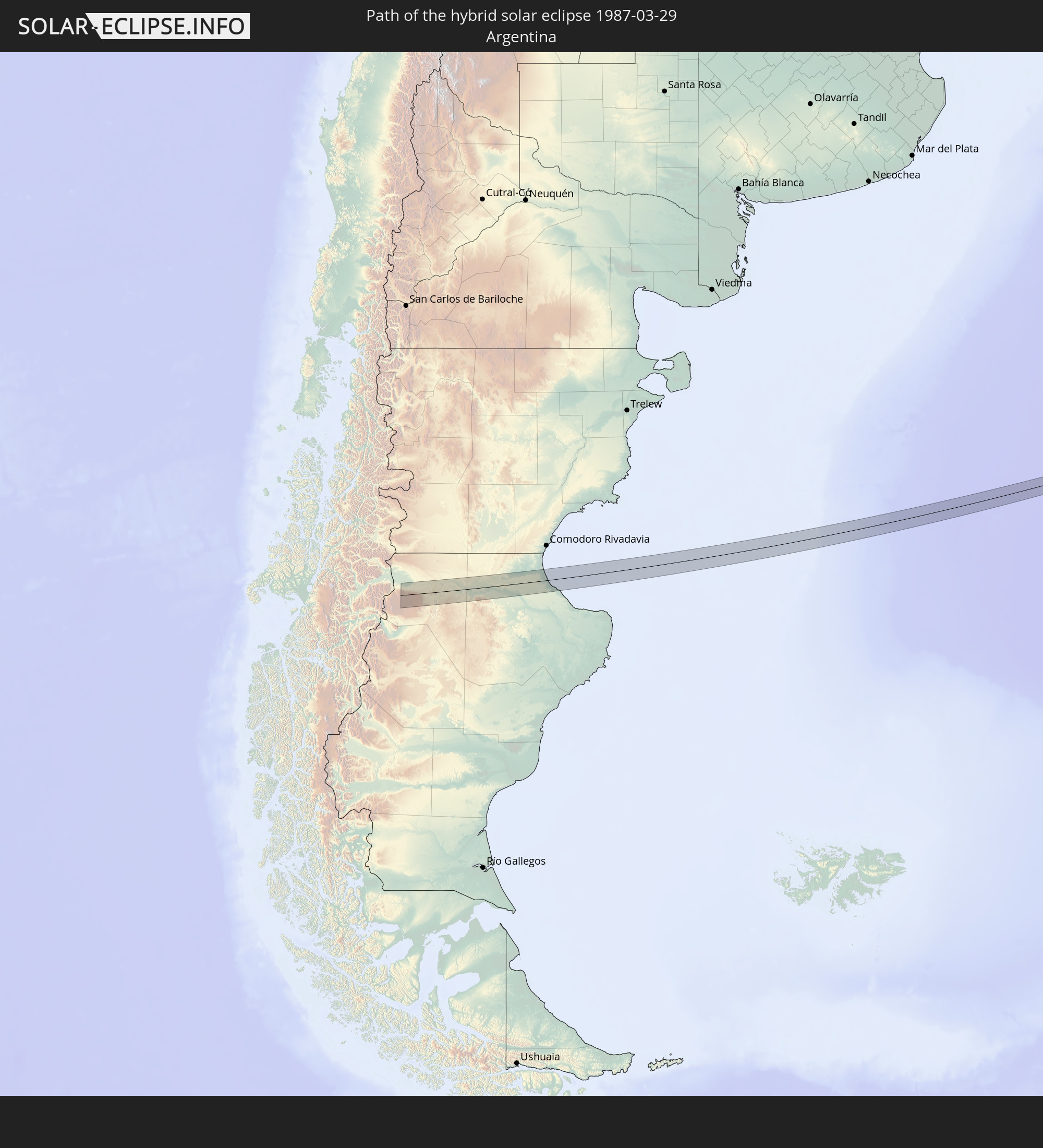 Argentina
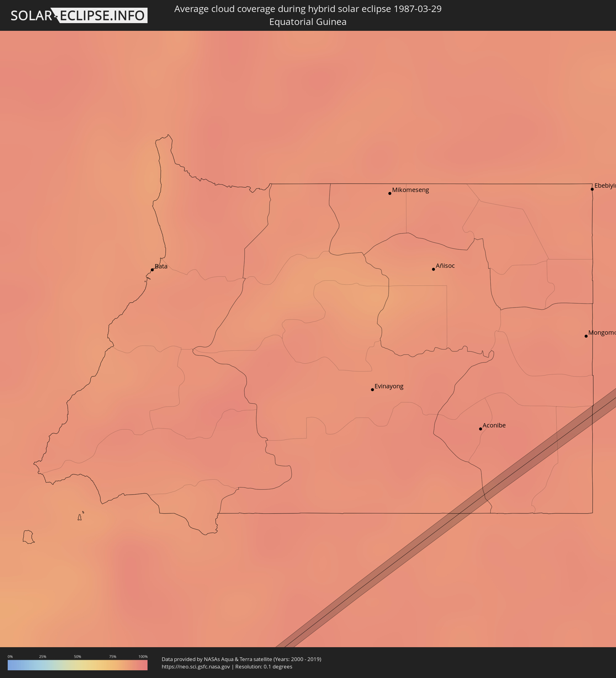
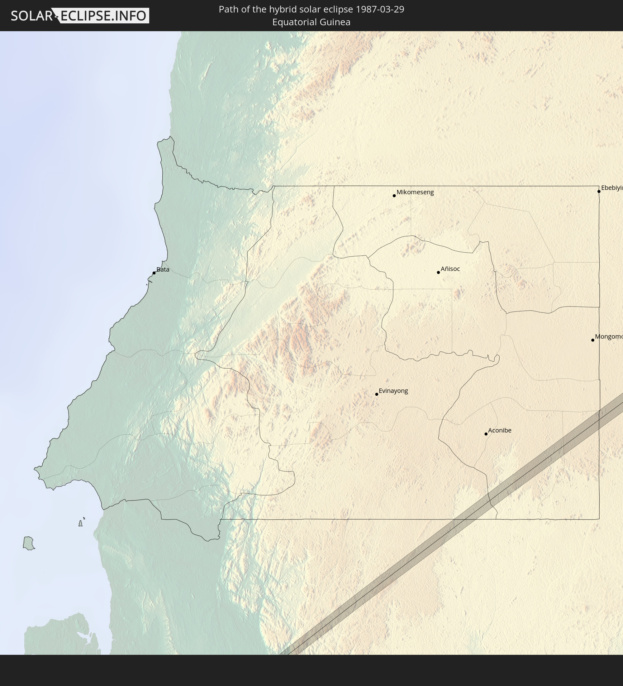 Equatorial Guinea
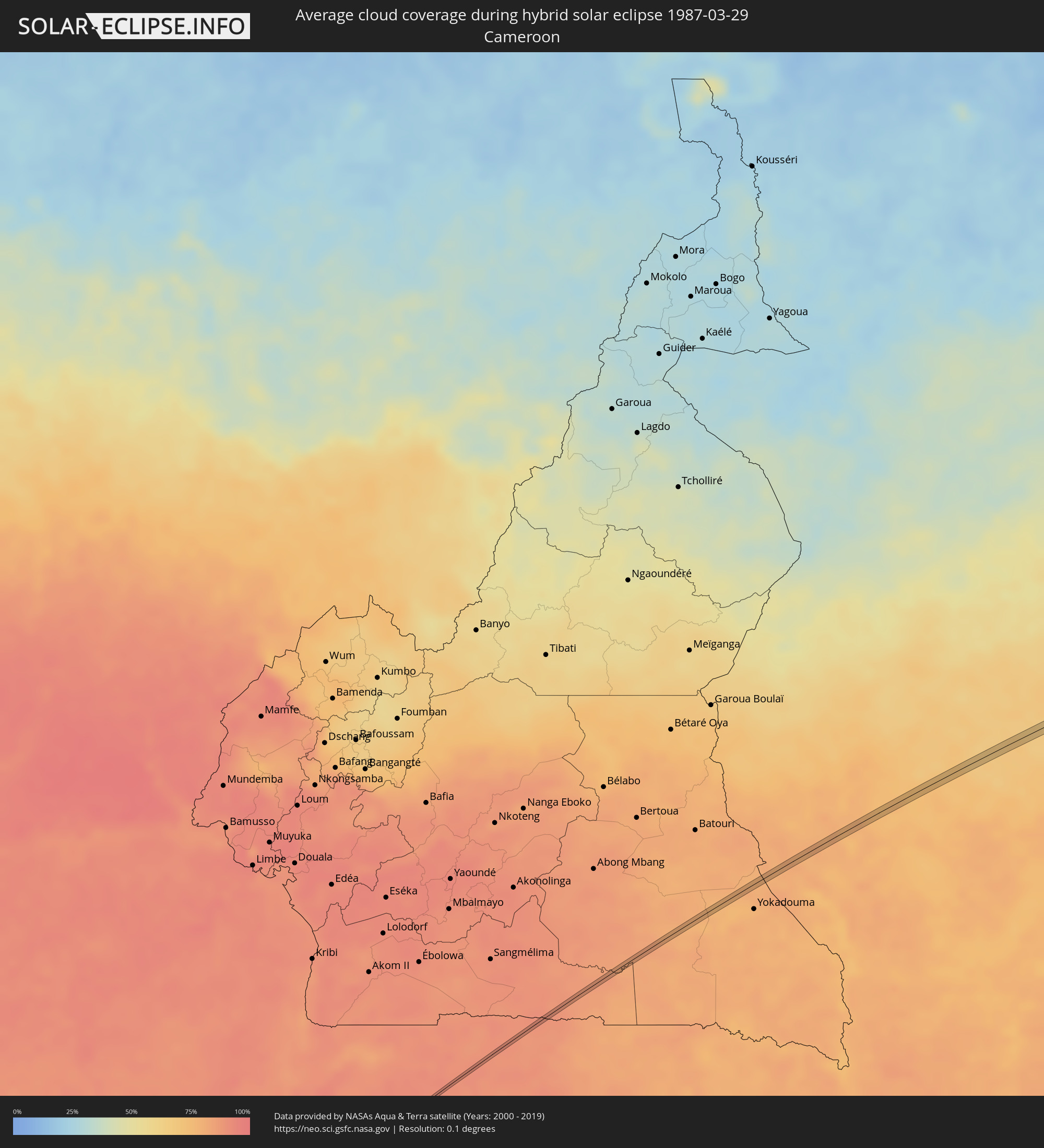
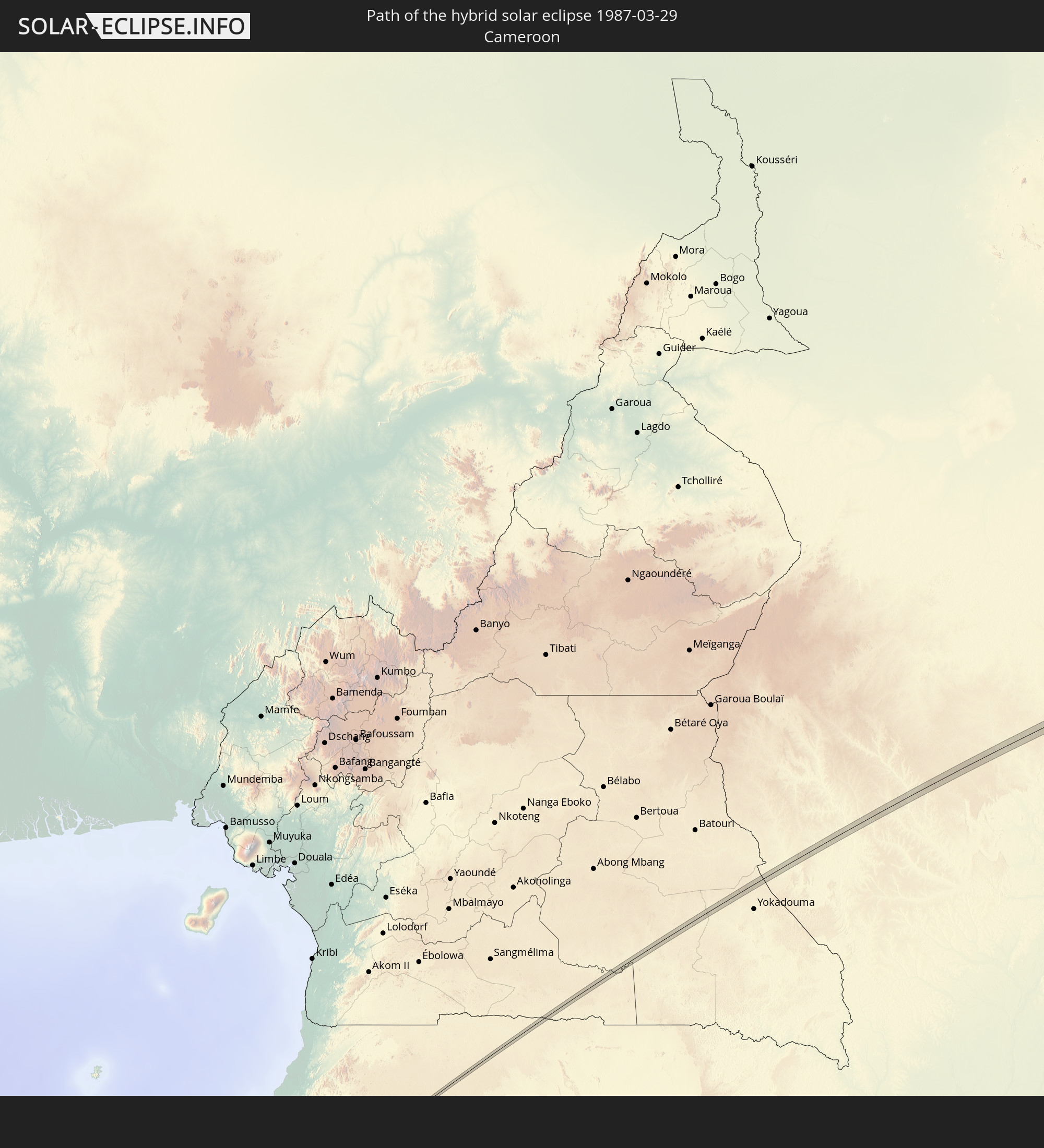 Cameroon
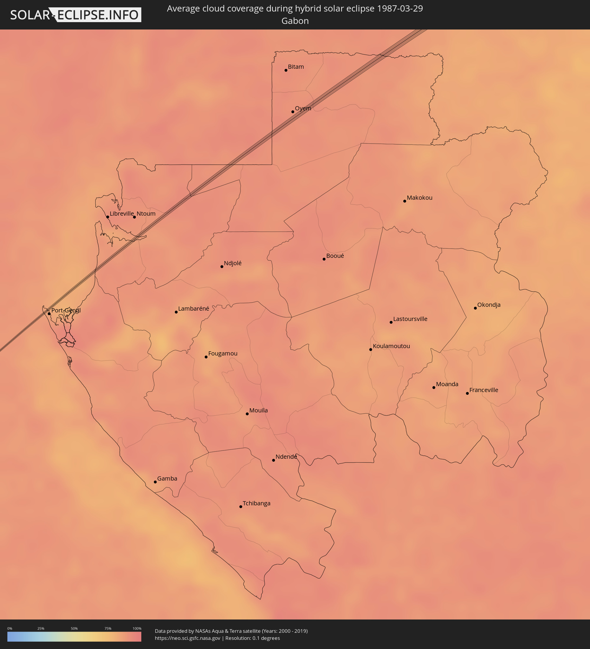
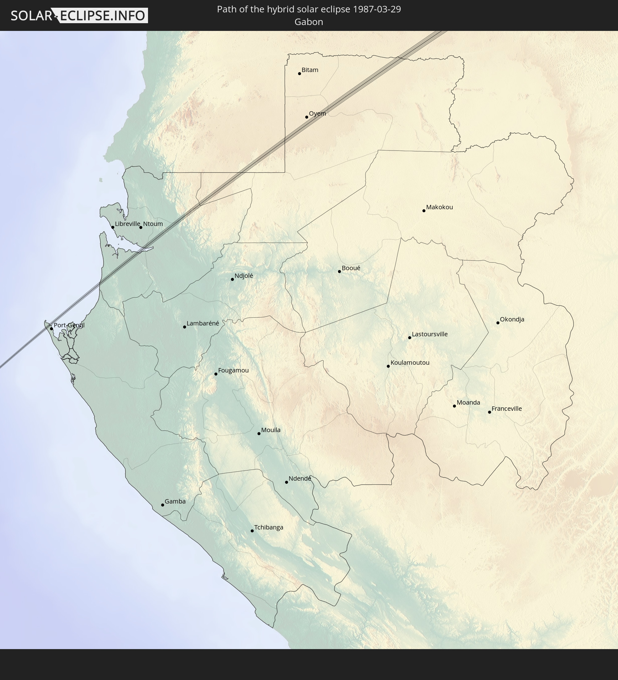 Gabon
Gabon
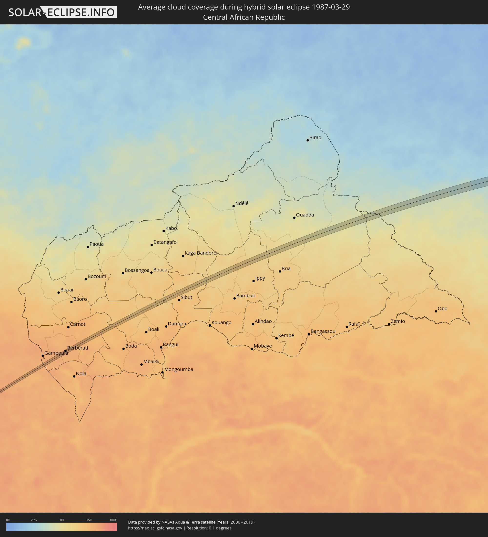
 Central African Republic
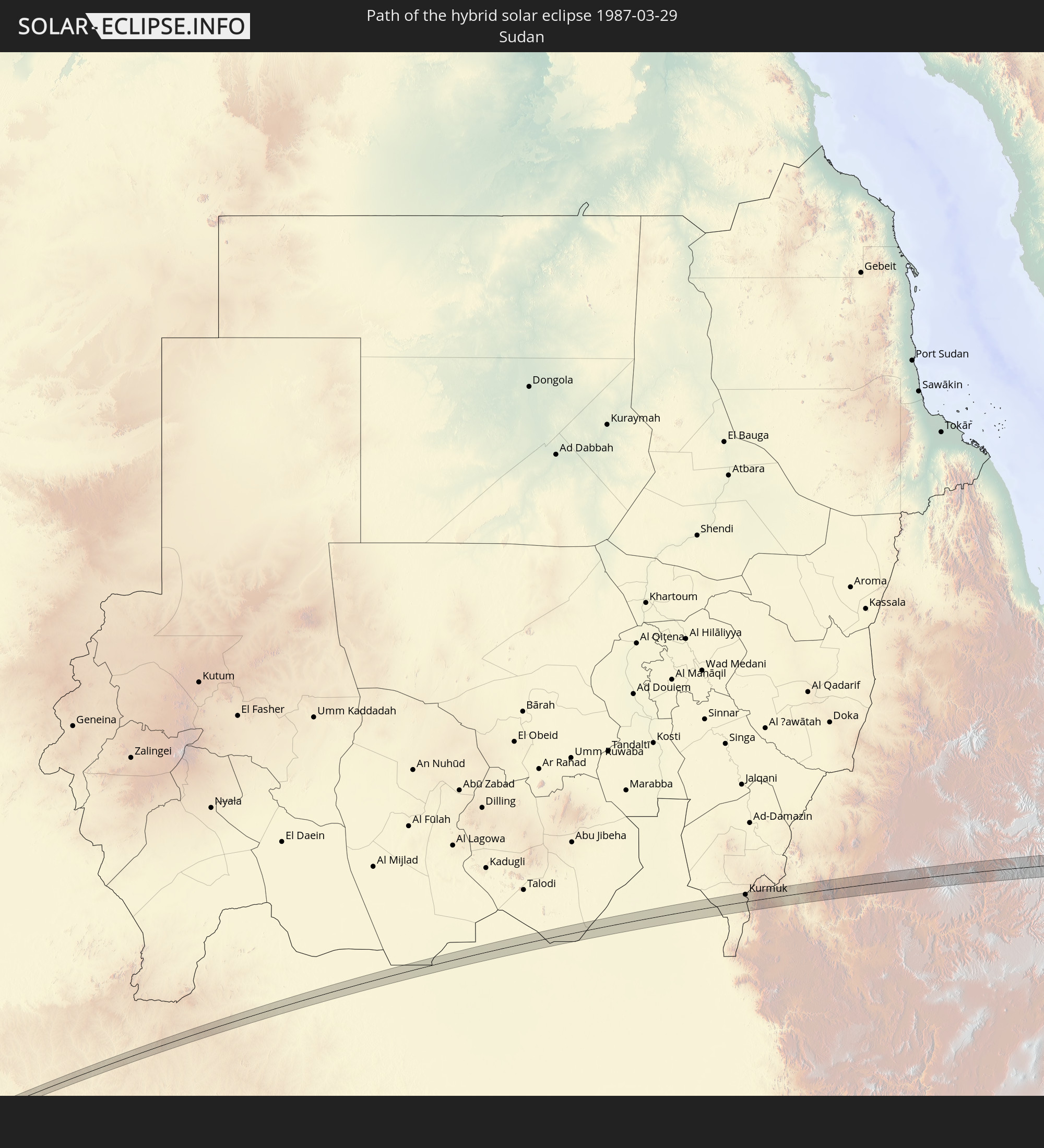 Sudan
Sudan
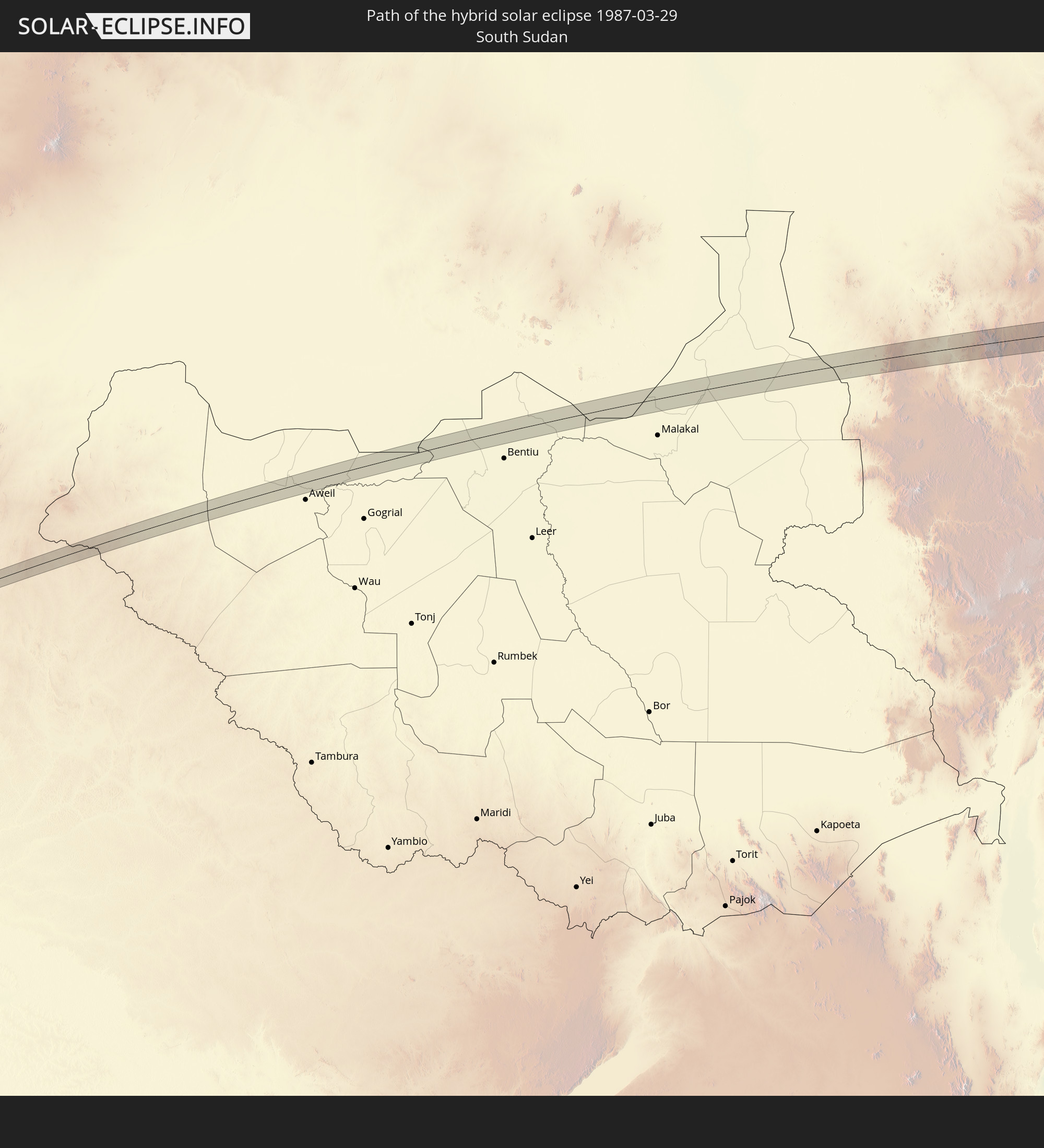 South Sudan
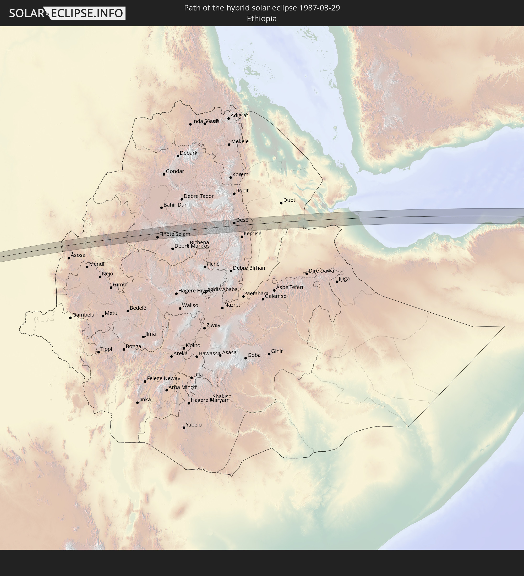 Ethiopia
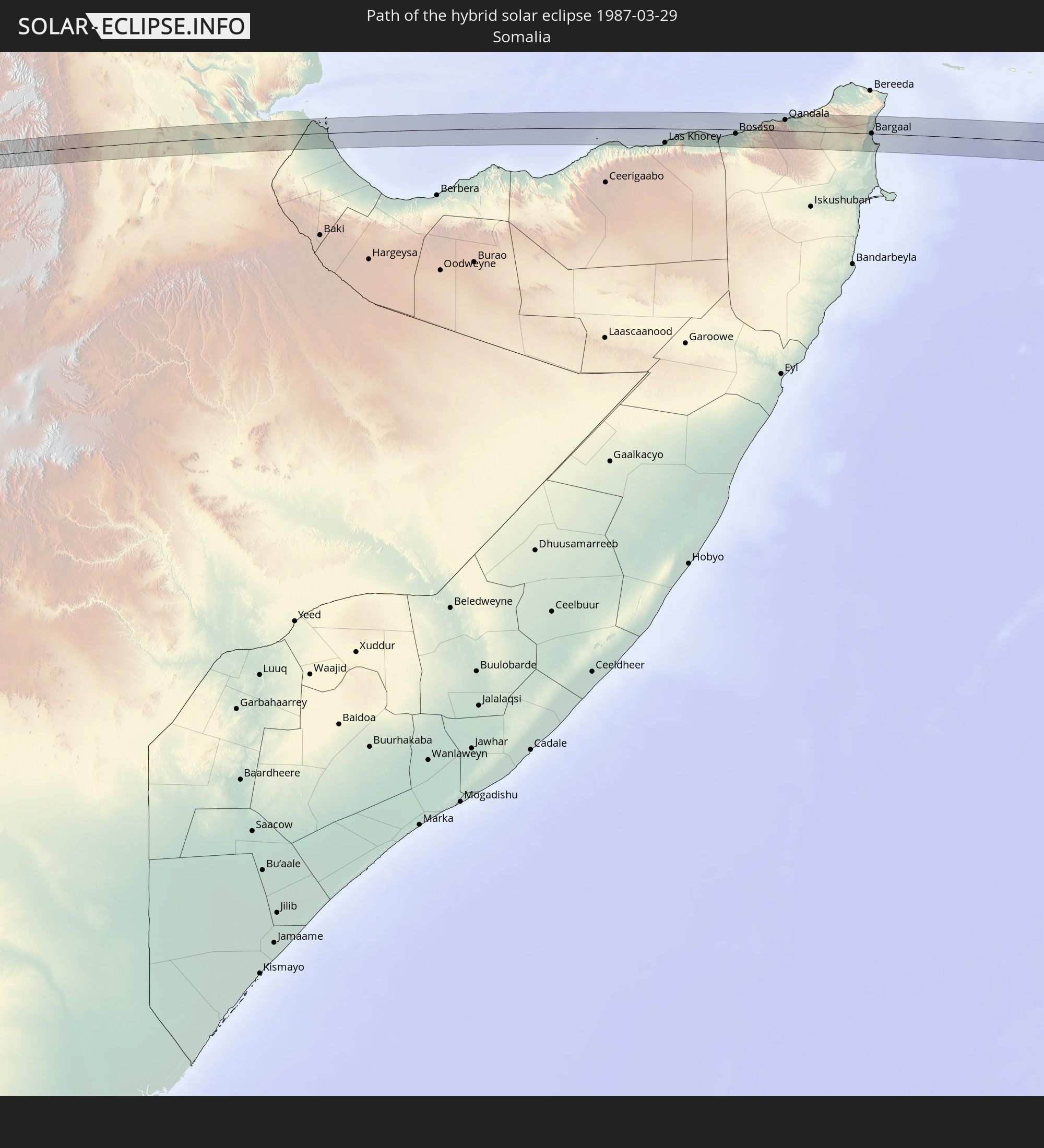 Somalia
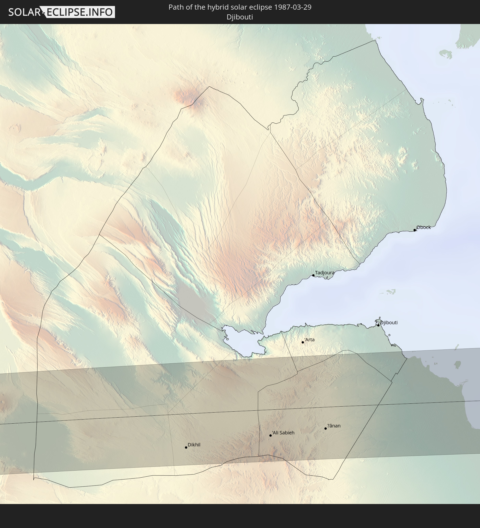 Djibouti
In den folgenden Ländern ist die Sonnenfinsternis partiell zu sehen
 Russia
 Antarctica
 Chile
Chile
 Peru
Peru
 Brazil
 Argentina
 Bolivia
 Paraguay
 Falkland Islands
 Uruguay
 South Georgia and the South Sandwich Islands
 Senegal
 Mauritania
 The Gambia
 Guinea-Bissau
 Guinea
 Saint Helena, Ascension and Tristan da Cunha
 Sierra Leone
 Morocco
 Mali
Mali
 Liberia
 Algeria
 Ivory Coast
 Burkina Faso
 Ghana
Ghana
 Togo
Togo
 Niger
Niger
 Benin
Benin
 Nigeria
 Bouvet Island
 Equatorial Guinea
 São Tomé and Príncipe
 Italy
Italy
 Tunisia
 Cameroon
 Gabon
Gabon
 Libya
Libya
 Republic of the Congo
 Angola
 Namibia
 Democratic Republic of the Congo
 Chad
Chad
 Malta
Malta
 Central African Republic
 South Africa
 Albania
 Greece
 Botswana
 Republic of Macedonia
 Sudan
Sudan
 Zambia
 Bulgaria
 Egypt
Egypt
 Zimbabwe
 Turkey
 Lesotho
 Rwanda
 Burundi
 Tanzania
 Uganda
 Mozambique
 Swaziland
 Cyprus
 Malawi
 Ethiopia
 Kenya
Kenya
 State of Palestine
 Israel
 Saudi Arabia
 Jordan
 Lebanon
 Syria
Syria
 Eritrea
 Iraq
Iraq
 Georgia
 French Southern and Antarctic Lands
 Somalia
 Djibouti
 Yemen
Yemen
 Madagascar
 Comoros
 Armenia
 Iran
Iran
 Azerbaijan
 Mayotte
 Seychelles
 Kazakhstan
 Kuwait
 Bahrain
 Qatar
Qatar
 United Arab Emirates
 Oman
Oman
 Turkmenistan
 Réunion
 Uzbekistan
 Mauritius
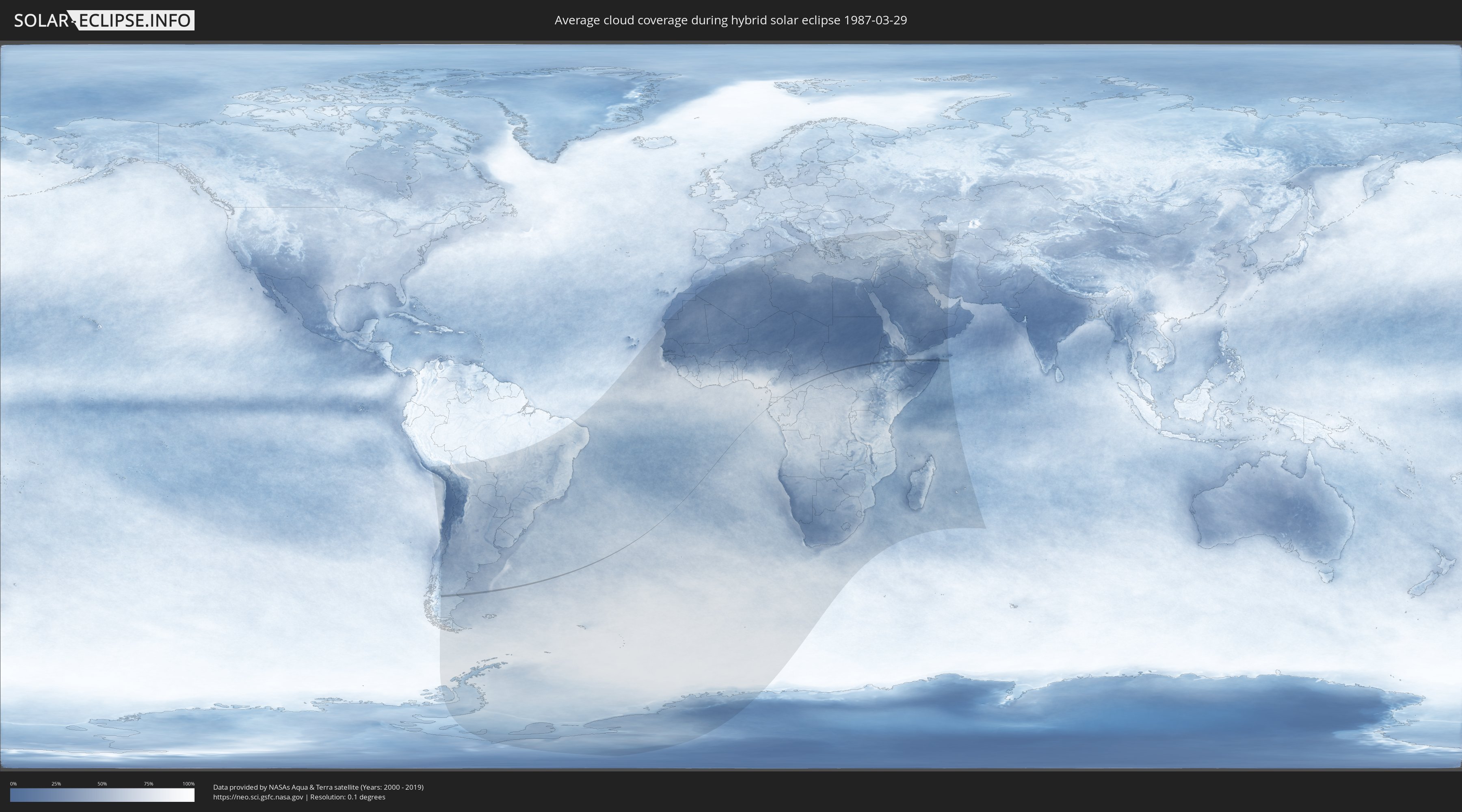
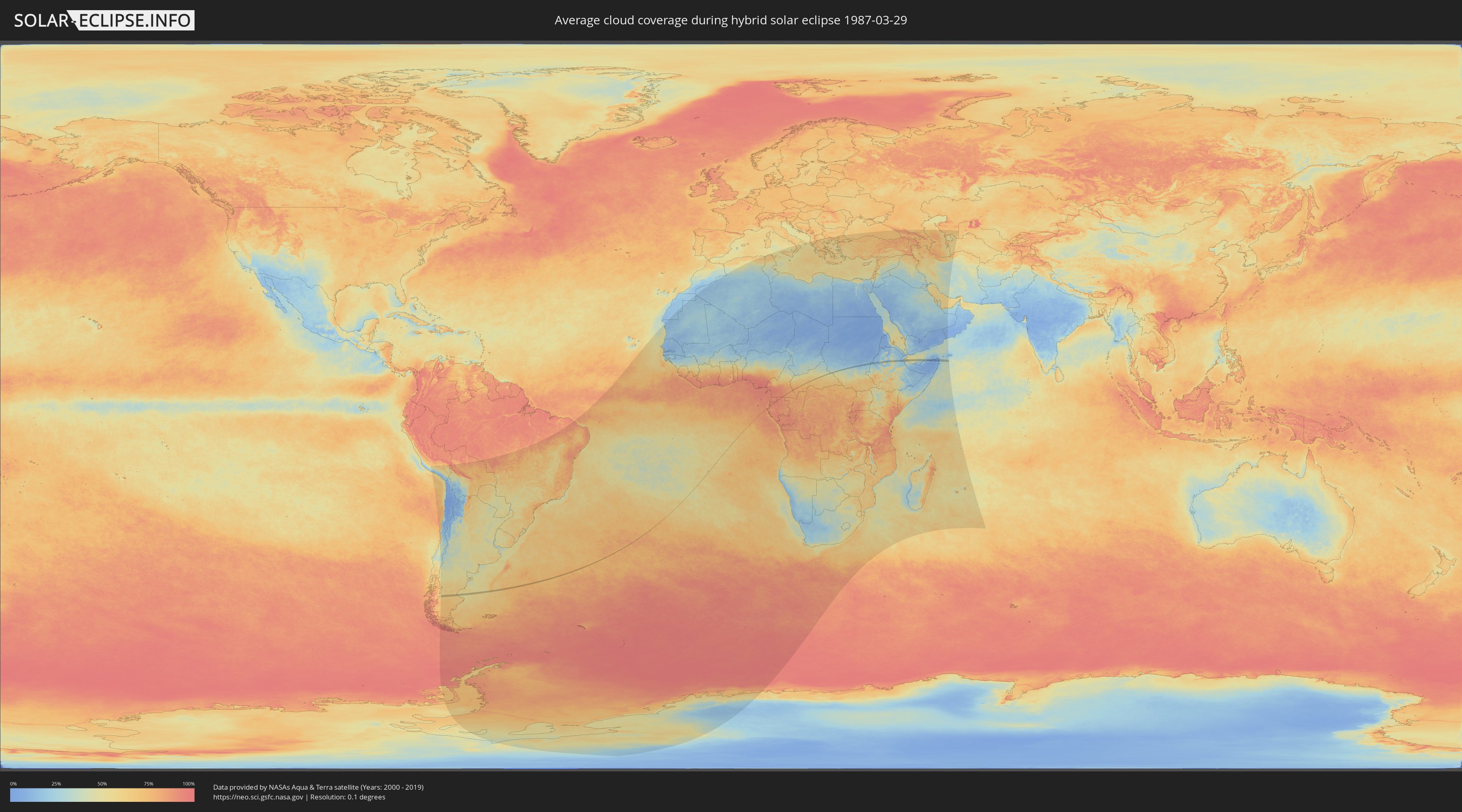
How will be the weather during the hybrid solar eclipse on 03/29/1987?
Where is the best place to see the hybrid solar eclipse of 03/29/1987?
The following maps show the average cloud coverage for the day of the hybrid solar eclipse.
With the help of these maps, it is possible to find the place along the eclipse path, which has the best
chance of a cloudless sky.
Nevertheless, you should consider local circumstances and inform about the weather of your chosen
observation site.
The data is provided by NASAs satellites
AQUA and TERRA.
The cloud maps are averaged over a period of 19 years (2000 - 2019).
Detailed country maps
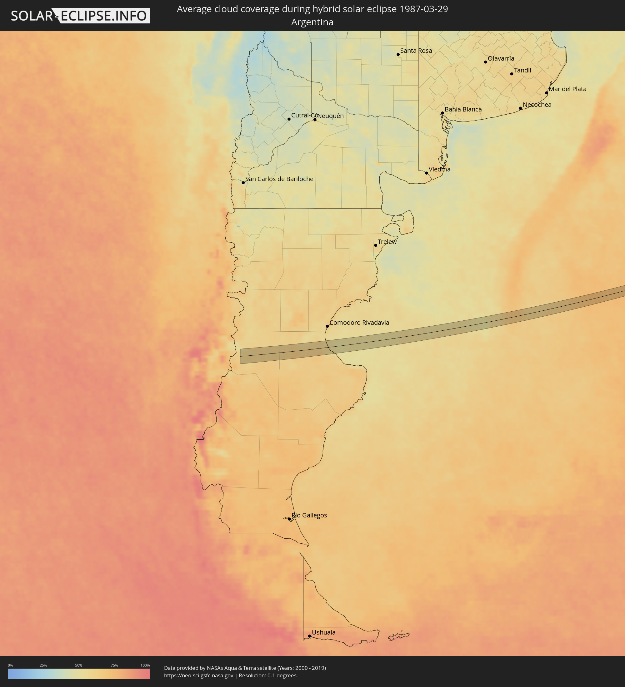 Argentina
 Equatorial Guinea
 Cameroon
 Gabon
Gabon
 Central African Republic
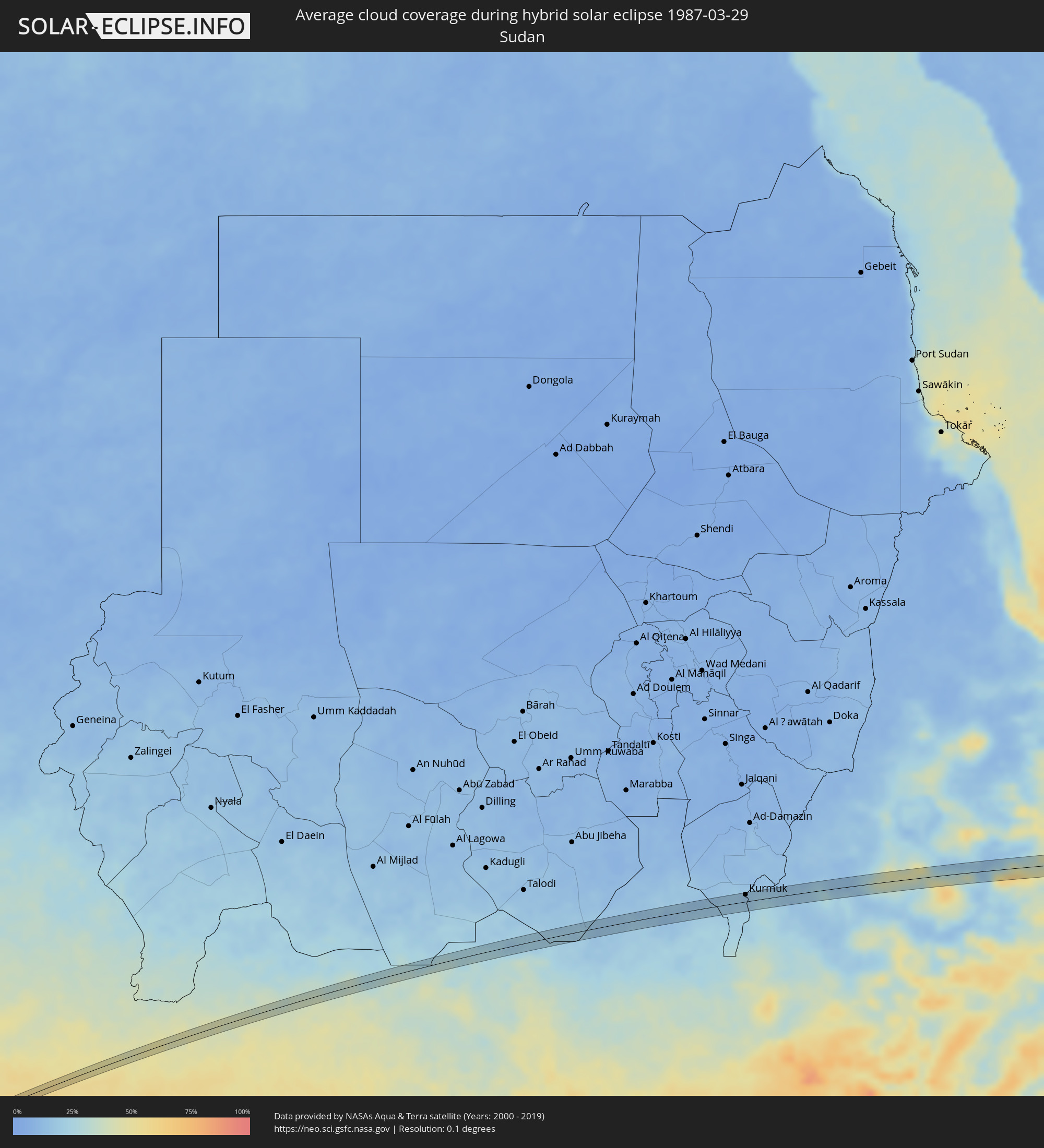 Sudan
Sudan
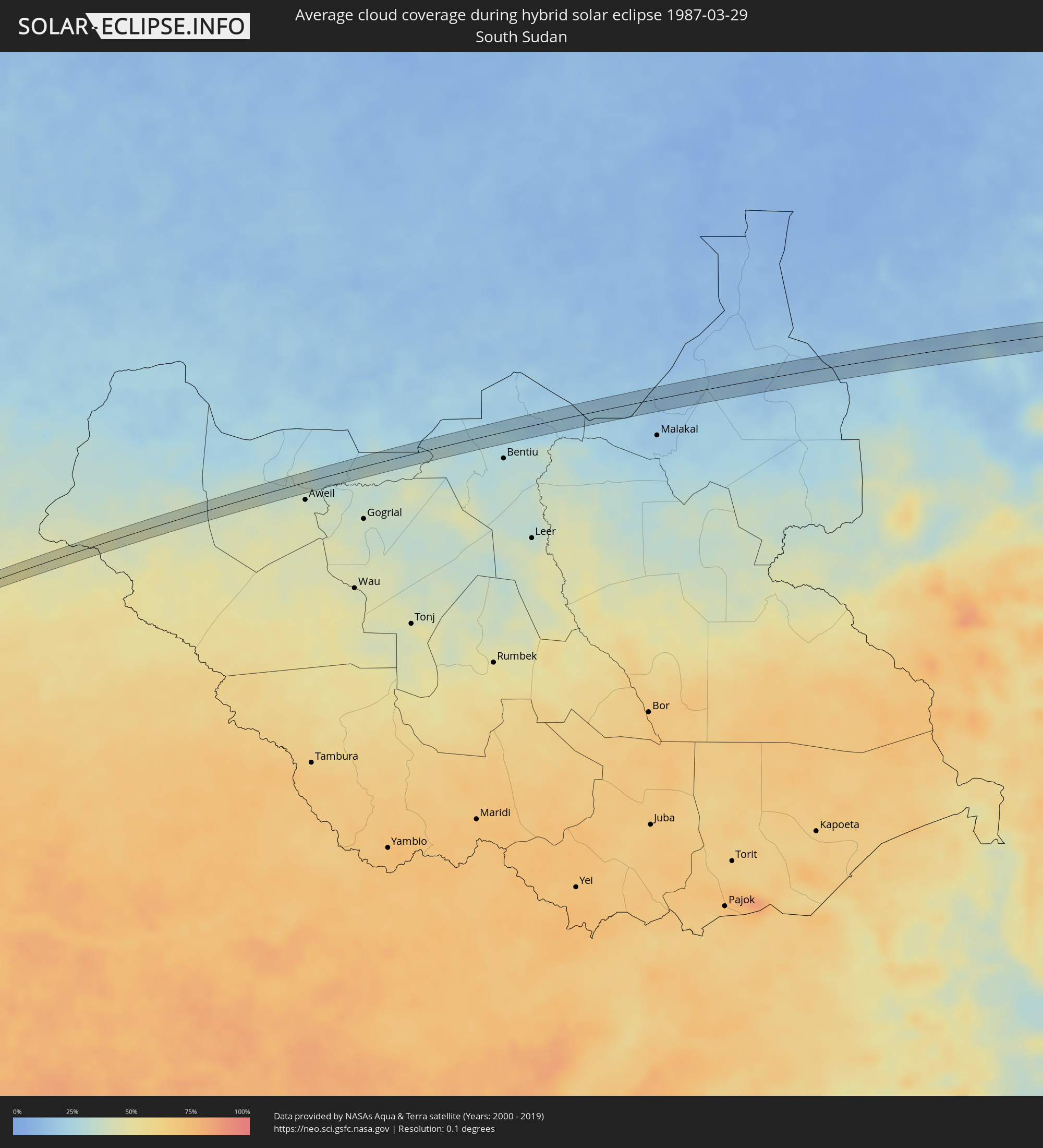 South Sudan
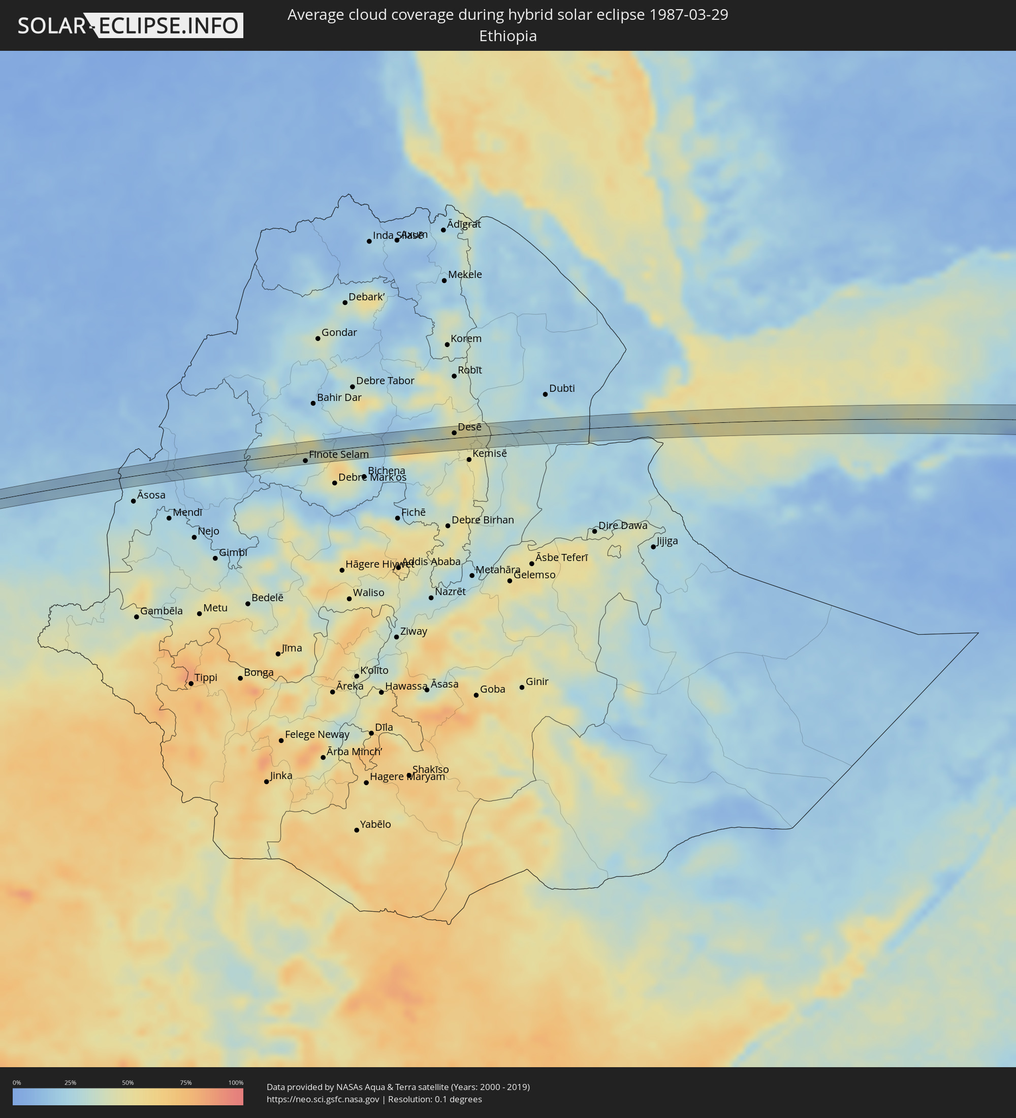 Ethiopia
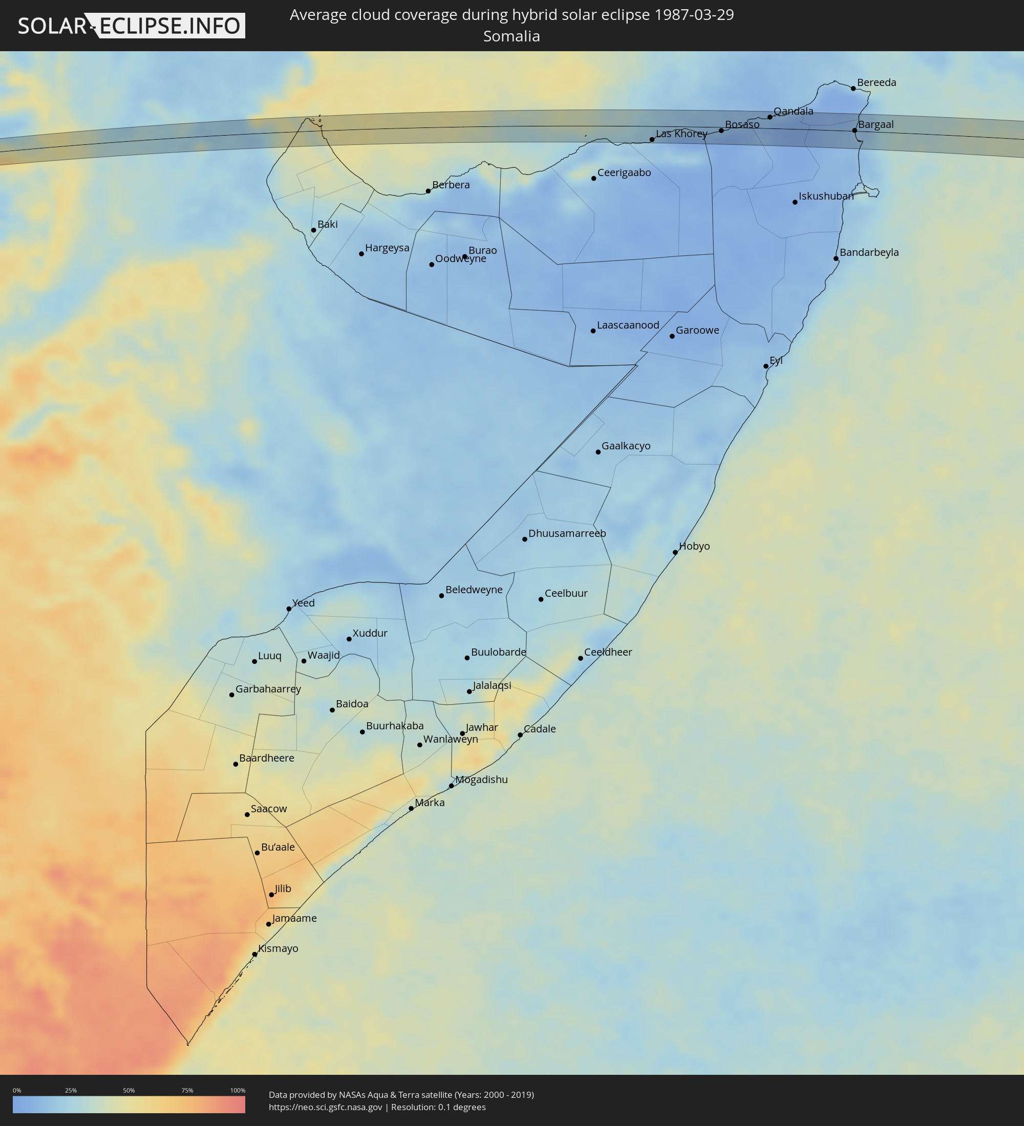 Somalia
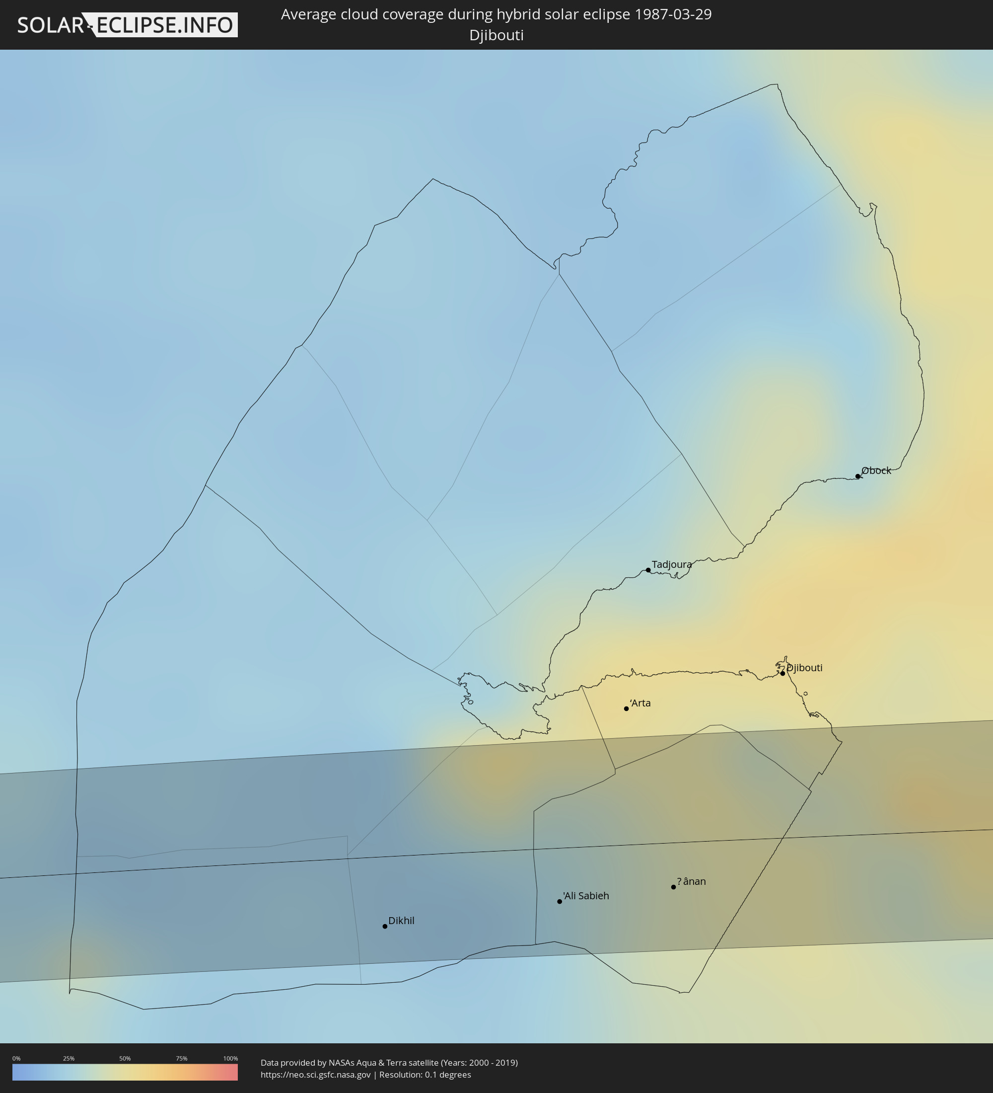 Djibouti
Cities inside the path of the eclipse
The following table shows all locations with a population of more than 5,000 inside the eclipse path. Cities which have more than 100,000 inhabitants are marked bold. A click at the locations opens a detailed map.
| City | Type | Eclipse duration | Local time of max. eclipse | Distance to central line | Ø Cloud coverage |
|
Las Heras, Santa Cruz Province
|
annular | - | 08:04:46 UTC-03:00 | 9 km | 63% |
|
Caleta Olivia, Santa Cruz Province
|
annular | - | 08:04:51 UTC-03:00 | 9 km | 58% |
|
Berbérati, Mambéré-Kadéï
|
annular | - | 14:56:41 UTC+01:00 | 2 km | 80% |
|
Kurmuk, Blue Nile
|
annular | - | 16:25:46 UTC+02:00 | 13 km | 16% |
|
Burē, Amhara
|
annular | - | 17:27:44 UTC+03:00 | 12 km | 27% |
|
Finote Selam, Amhara
|
annular | - | 17:27:51 UTC+03:00 | 14 km | 26% |
|
Desē, Amhara
|
annular | - | 17:29:30 UTC+03:00 | 8 km | 46% |
|
Kombolcha, Amhara
|
annular | - | 17:29:31 UTC+03:00 | 1 km | 46% |
|
Batī, Amhara
|
annular | - | 17:29:44 UTC+03:00 | 11 km | 45% |
|
Dikhil, Dikhil
|
annular | - | 17:30:44 UTC+03:00 | 15 km | 23% |
|
'Ali Sabieh, Ali Sabieh
|
annular | - | 17:30:54 UTC+03:00 | 11 km | 24% |
|
Ḏânan, Ali Sabieh
|
annular | - | 17:31:00 UTC+03:00 | 10 km | 40% |
|
Las Khorey, Sanaag
|
annular | - | 17:32:32 UTC+03:00 | 22 km | 16% |
|
Bosaso, Bari
|
annular | - | 17:32:47 UTC+03:00 | 6 km | 5% |
|
Qandala, Bari
|
annular | - | 17:33:00 UTC+03:00 | 17 km | 8% |
|
Bargaal, Bari
|
annular | - | 17:33:03 UTC+03:00 | 0 km | 18% |