Hybrid solar eclipse of 10/17/2172
| Day of week: | Saturday |
| Maximum duration of eclipse: | 01m34s |
| Maximum width of eclipse path: | 60 km |
| Saros cycle: | 146 |
| Coverage: | 100% |
| Magnitude: | 1.0174 |
| Gamma: | -0.1484 |
Wo kann man die Sonnenfinsternis vom 10/17/2172 sehen?
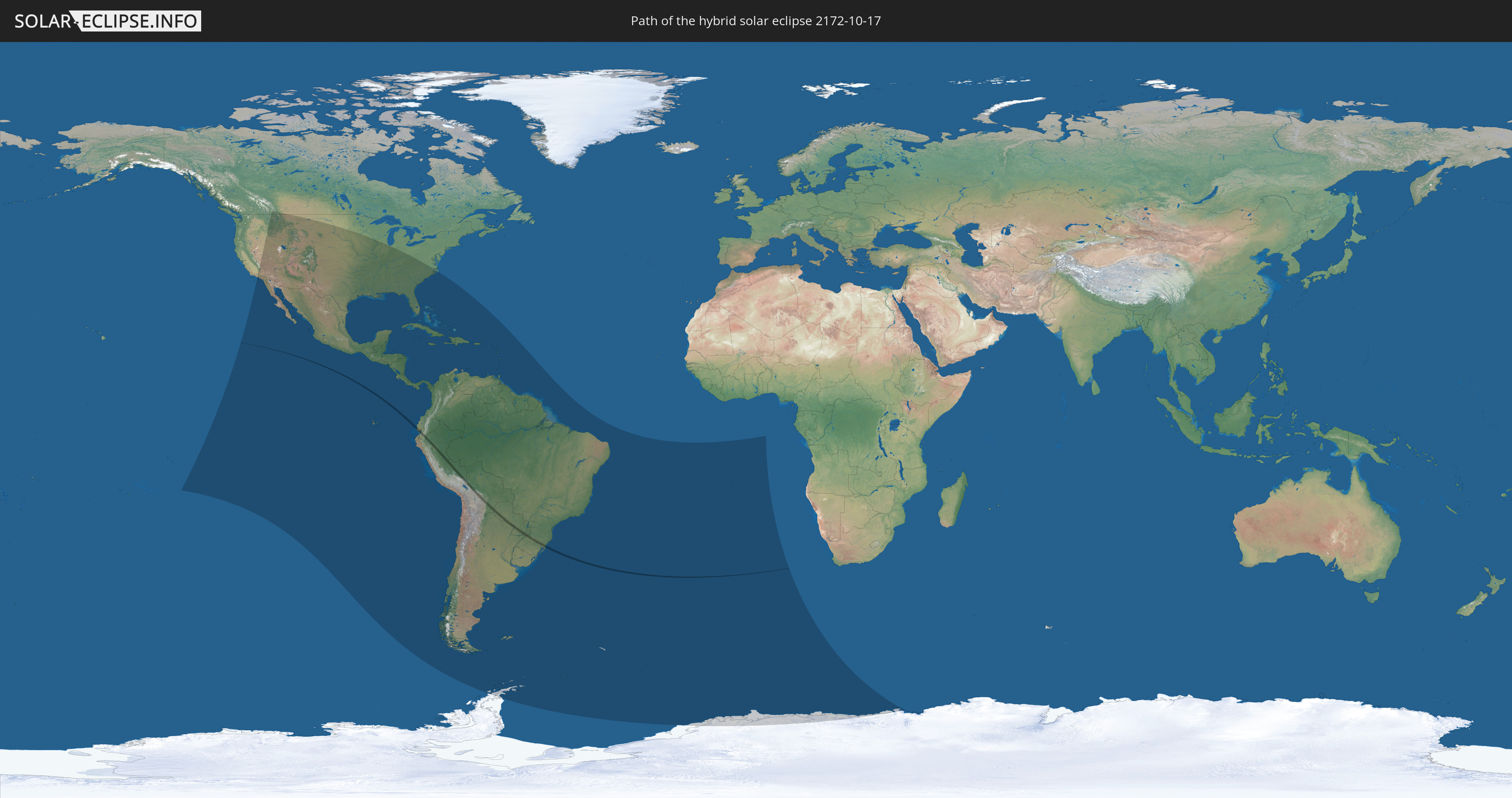
Die Sonnenfinsternis am 10/17/2172 kann man in 54 Ländern als partielle Sonnenfinsternis beobachten.
Der Finsternispfad verläuft durch 7 Länder. Nur in diesen Ländern ist sie als hybrid Sonnenfinsternis zu sehen.
In den folgenden Ländern ist die Sonnenfinsternis hybrid zu sehen
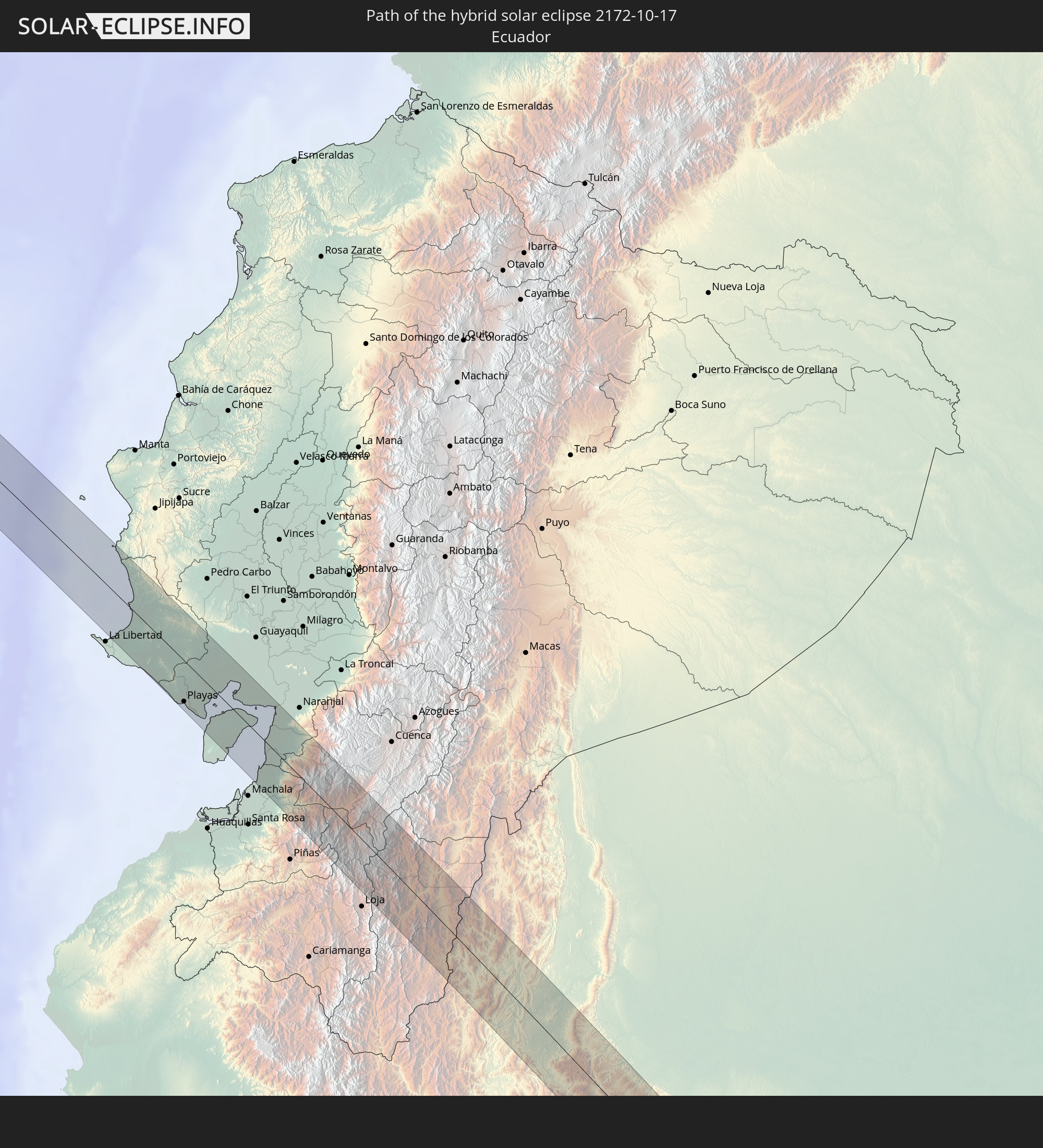 Ecuador
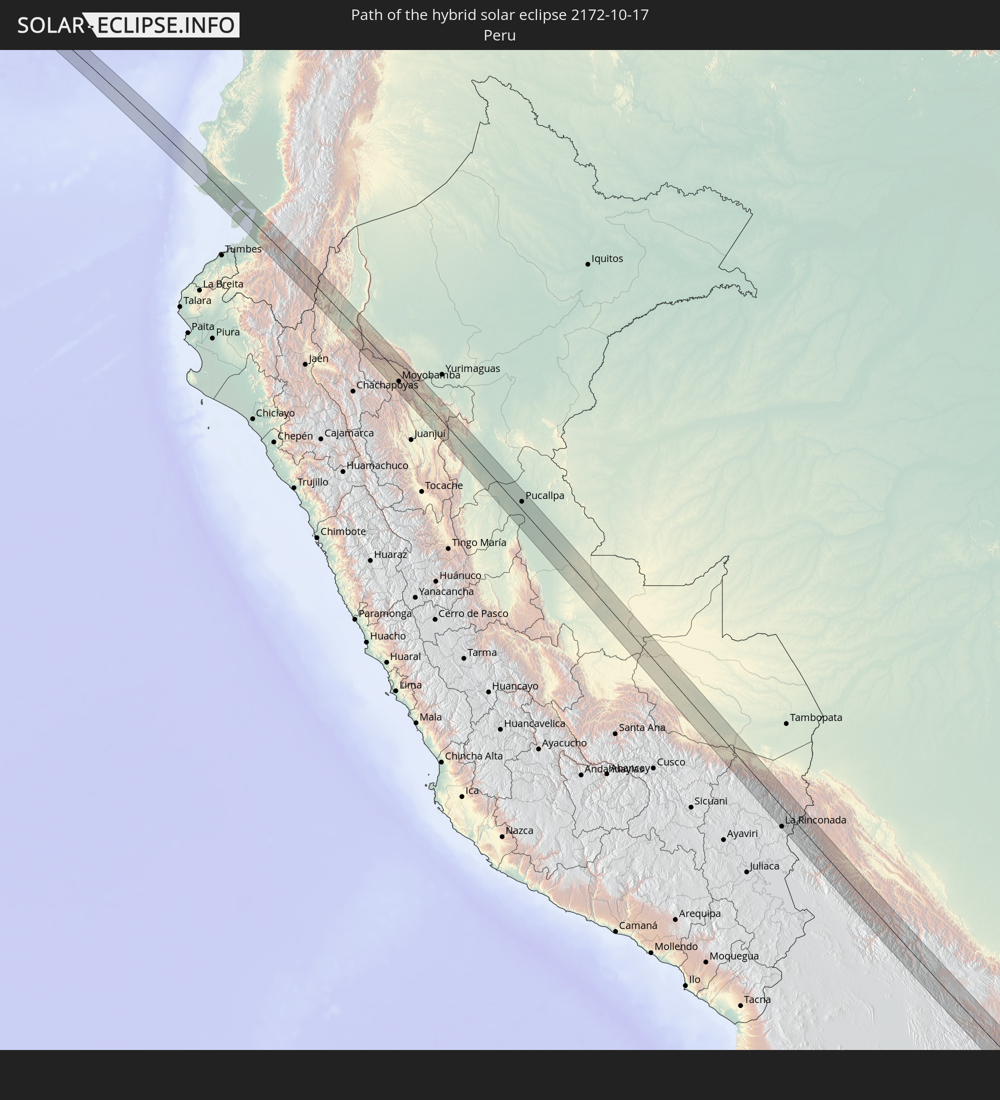 Peru
Peru
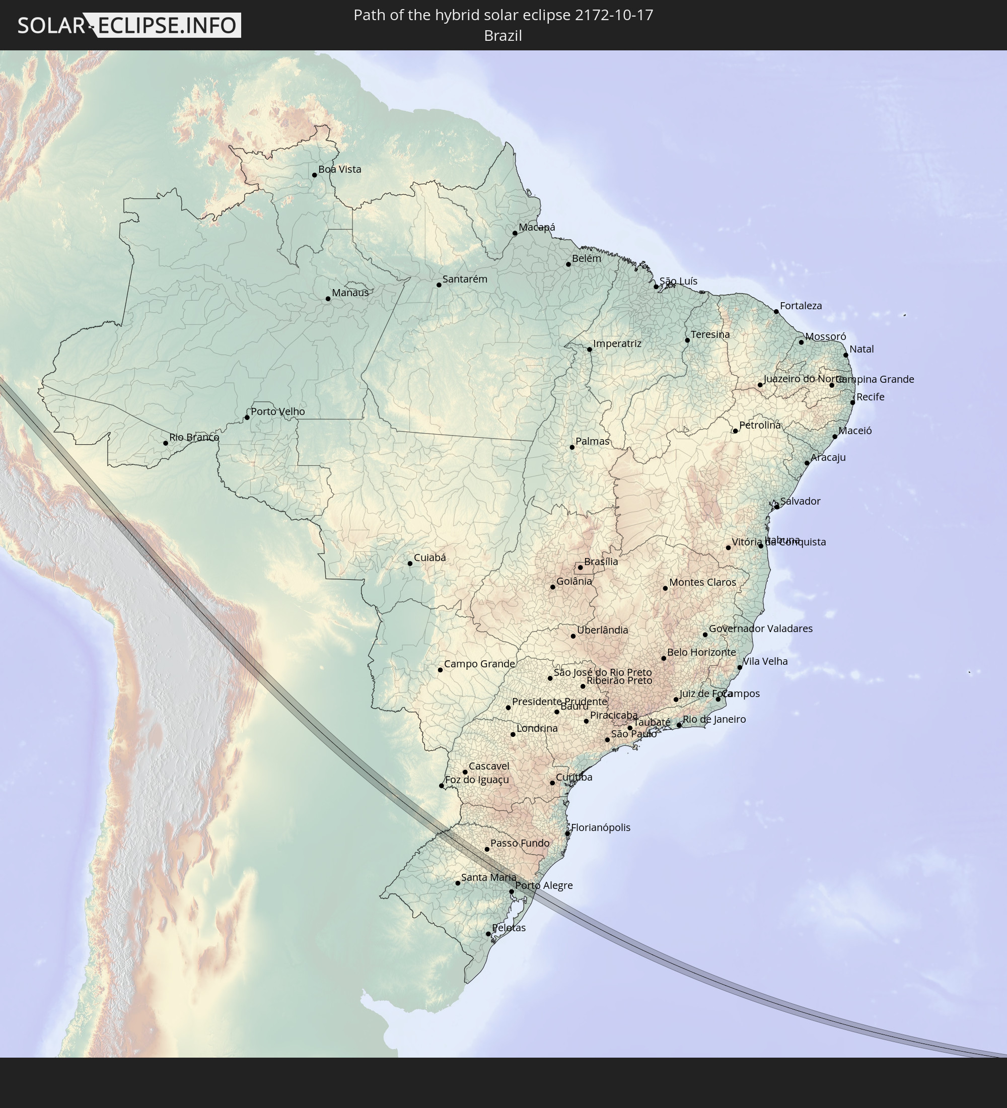 Brazil
 Argentina
 Bolivia
 Paraguay
 Saint Helena, Ascension and Tristan da Cunha
In den folgenden Ländern ist die Sonnenfinsternis partiell zu sehen
 Antarctica
 United States
 United States Minor Outlying Islands
 Canada
 Mexico
 Chile
Chile
 Guatemala
 Ecuador
 El Salvador
 Honduras
 Belize
 Nicaragua
 Costa Rica
 Cuba
Cuba
 Panama
 Colombia
 Cayman Islands
 Peru
Peru
 The Bahamas
 Jamaica
 Haiti
Haiti
 Brazil
 Argentina
 Venezuela
 Turks and Caicos Islands
 Dominican Republic
 Aruba
Aruba
 Bolivia
 Puerto Rico
 United States Virgin Islands
 British Virgin Islands
 Anguilla
 Collectivity of Saint Martin
 Saint Barthélemy
 Saint Kitts and Nevis
 Paraguay
 Antigua and Barbuda
 Montserrat
 Trinidad and Tobago
 Guadeloupe
 Grenada
 Dominica
 Saint Vincent and the Grenadines
 Falkland Islands
 Guyana
 Martinique
 Saint Lucia
 Barbados
 Uruguay
 Suriname
 French Guiana
 South Georgia and the South Sandwich Islands
 Saint Helena, Ascension and Tristan da Cunha
 Bouvet Island
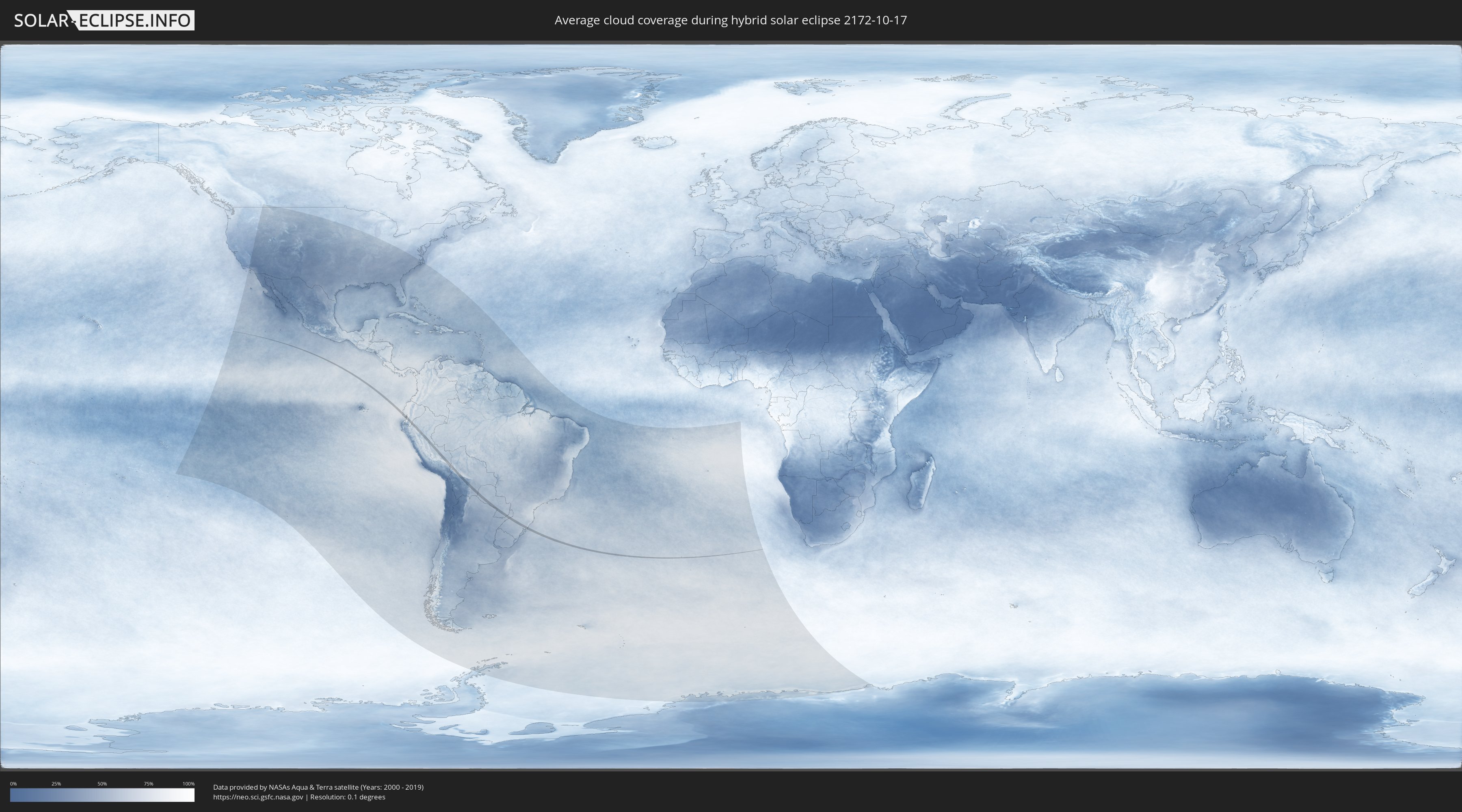
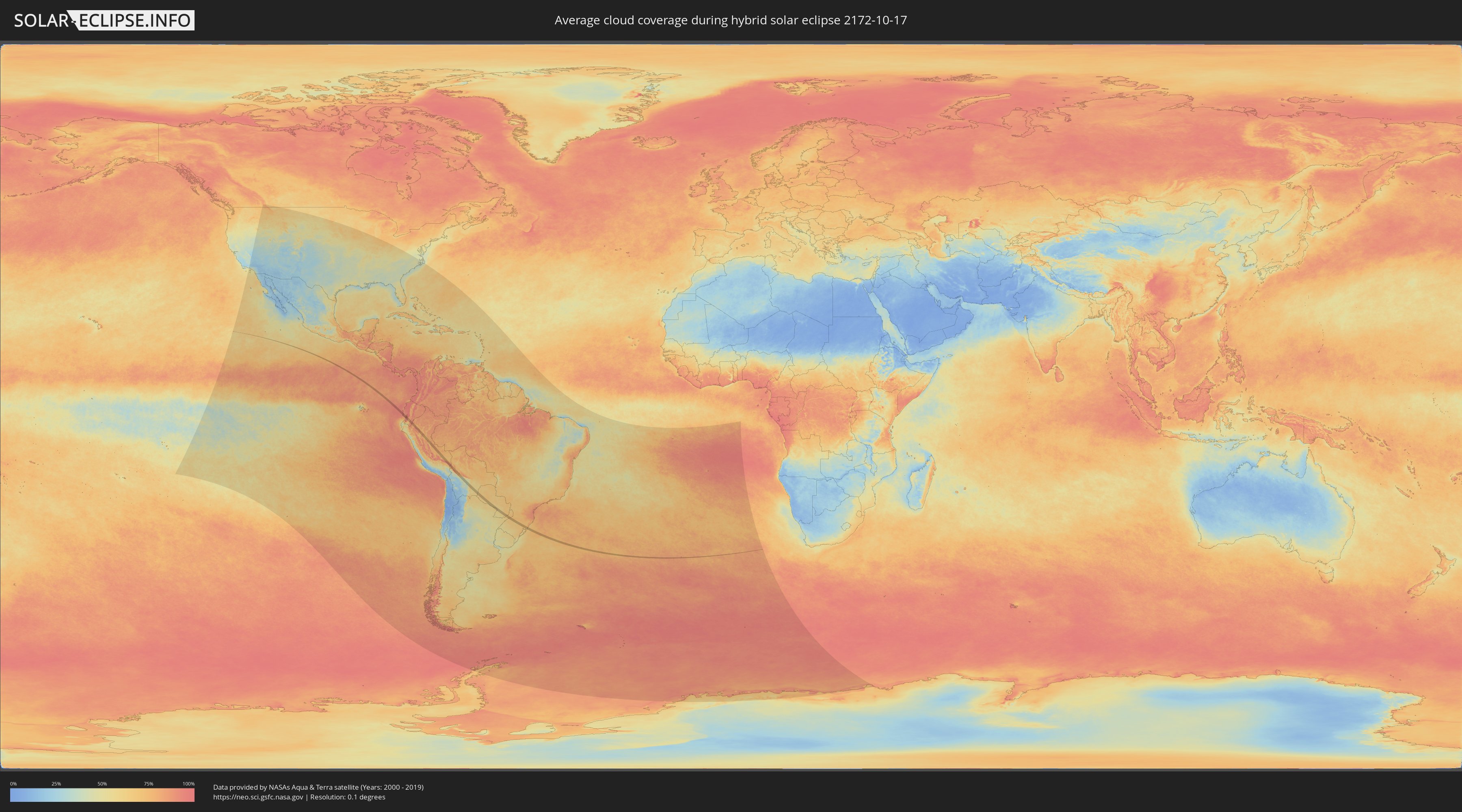
How will be the weather during the hybrid solar eclipse on 10/17/2172?
Where is the best place to see the hybrid solar eclipse of 10/17/2172?
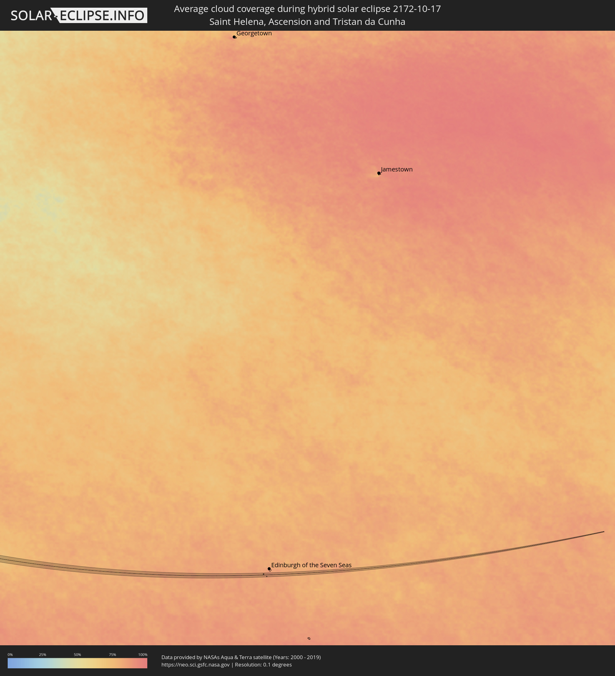
The following maps show the average cloud coverage for the day of the hybrid solar eclipse.
With the help of these maps, it is possible to find the place along the eclipse path, which has the best
chance of a cloudless sky.
Nevertheless, you should consider local circumstances and inform about the weather of your chosen
observation site.
The data is provided by NASAs satellites
AQUA and TERRA.
The cloud maps are averaged over a period of 19 years (2000 - 2019).
Detailed country maps
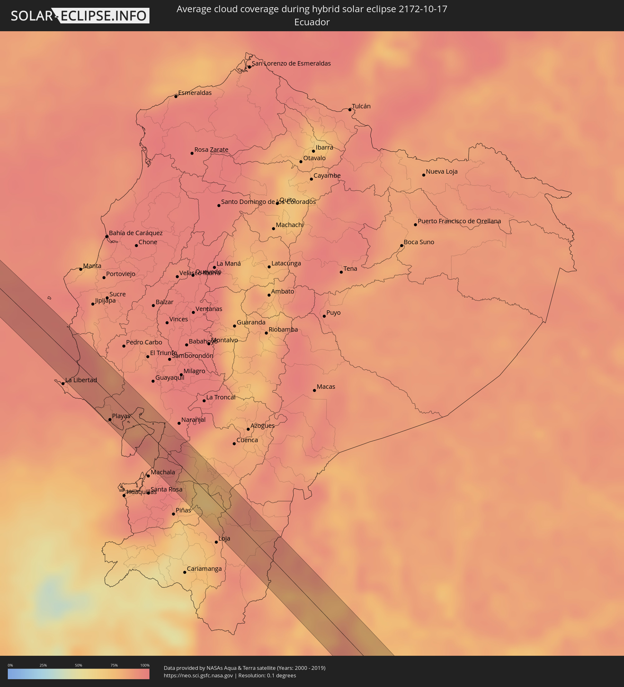 Ecuador
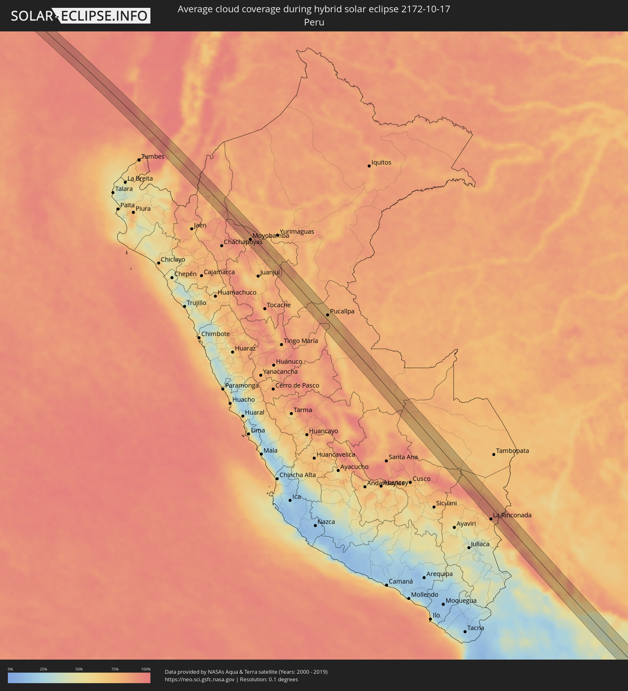 Peru
Peru
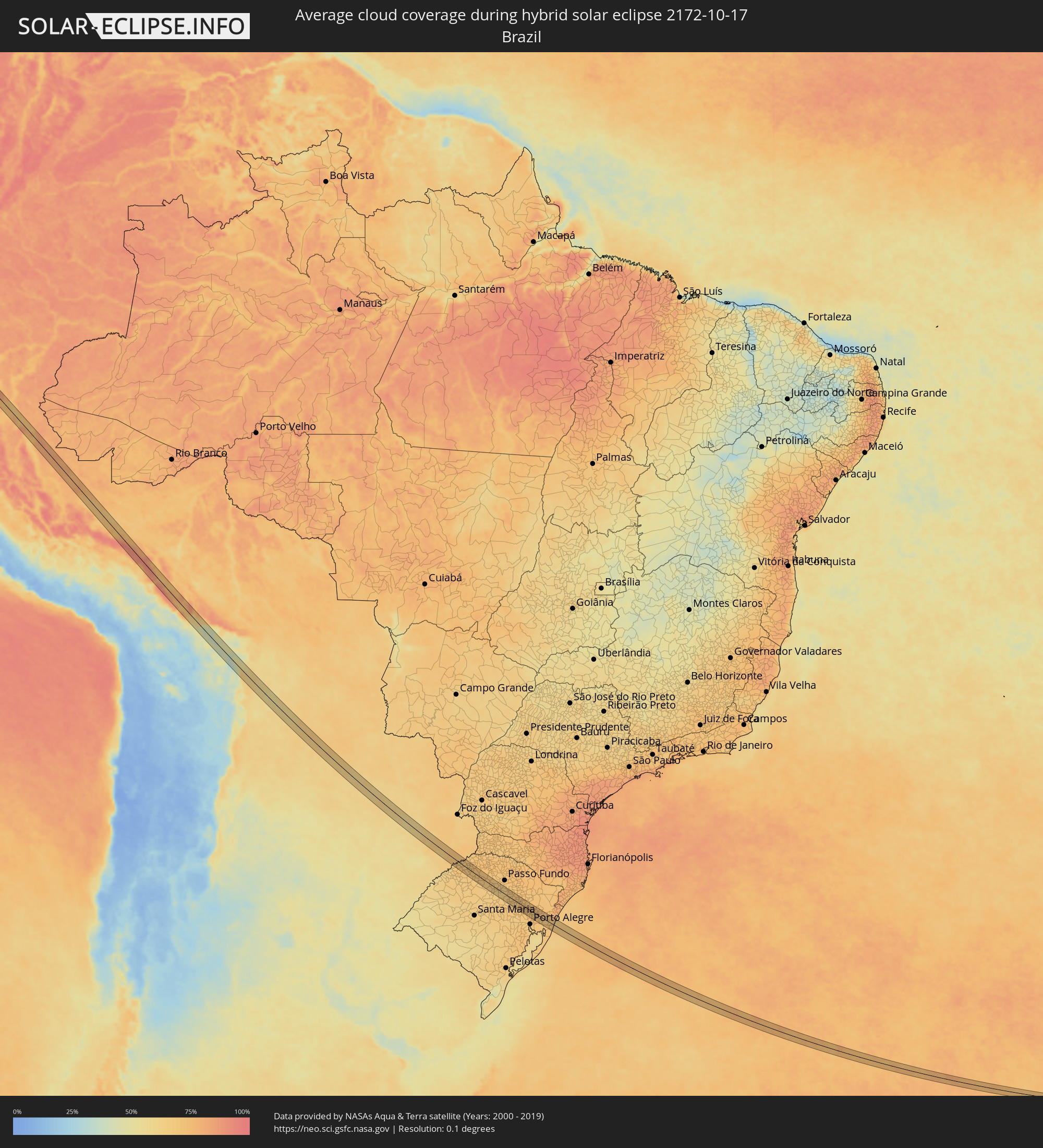 Brazil
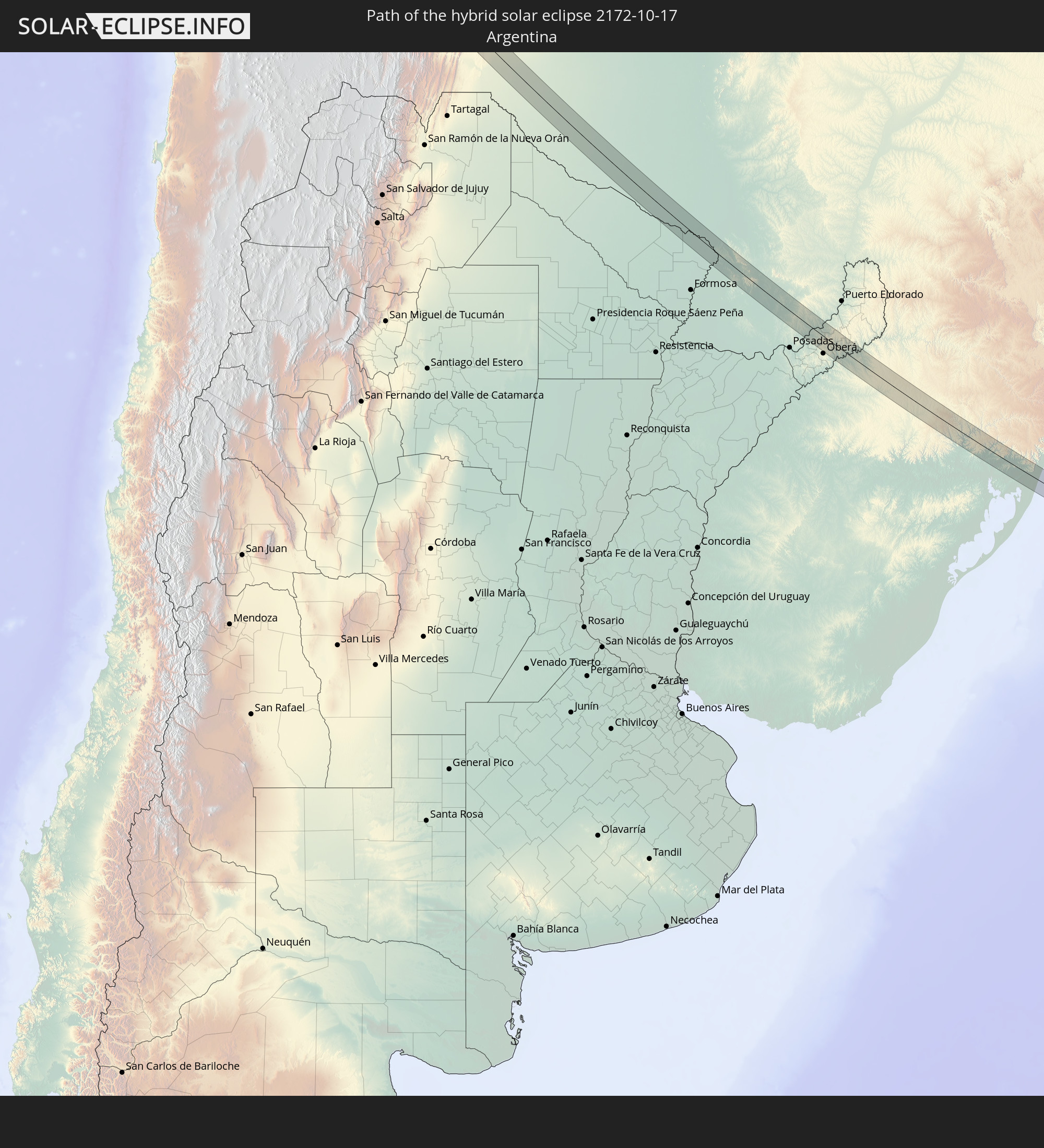
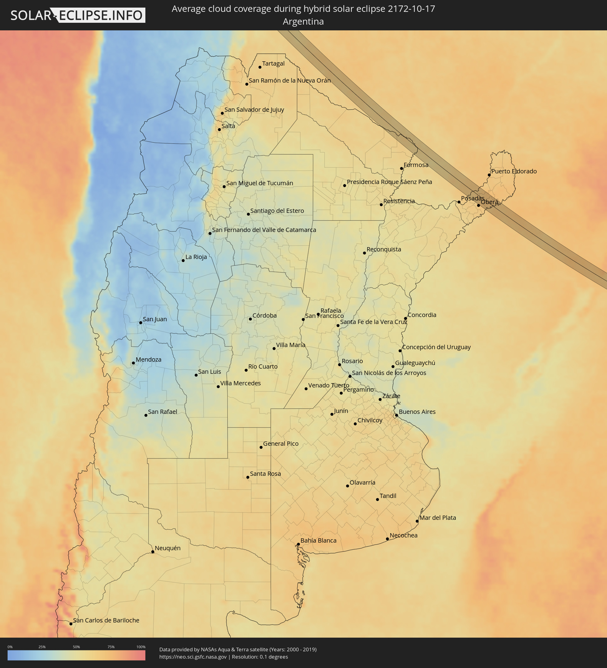 Argentina
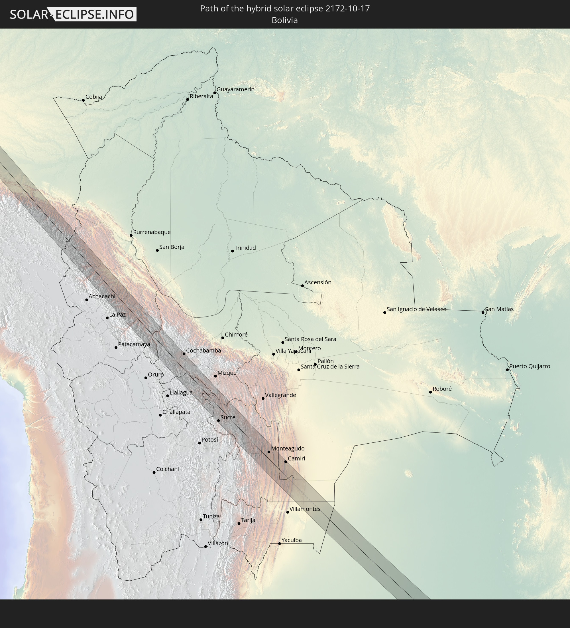
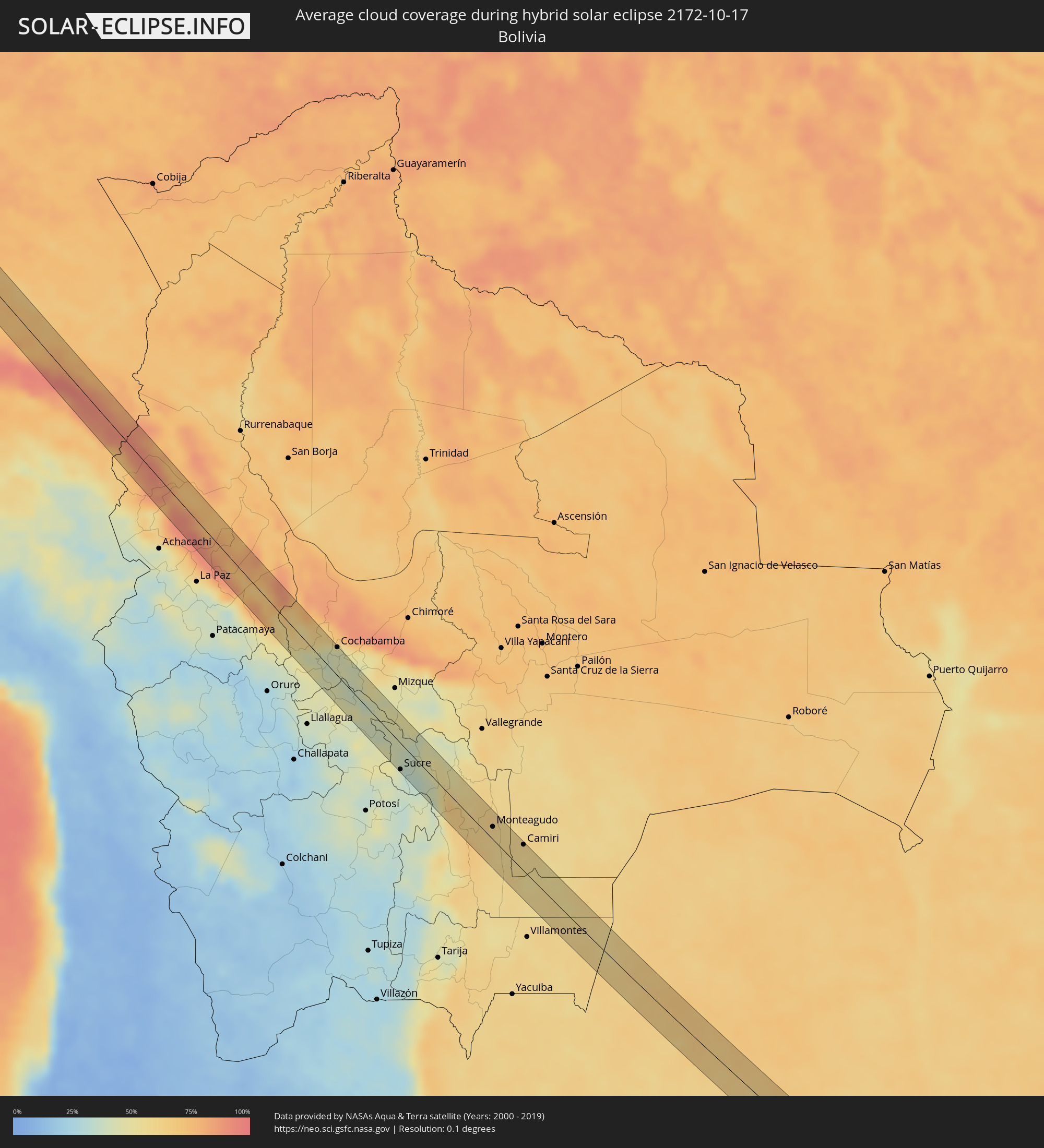 Bolivia
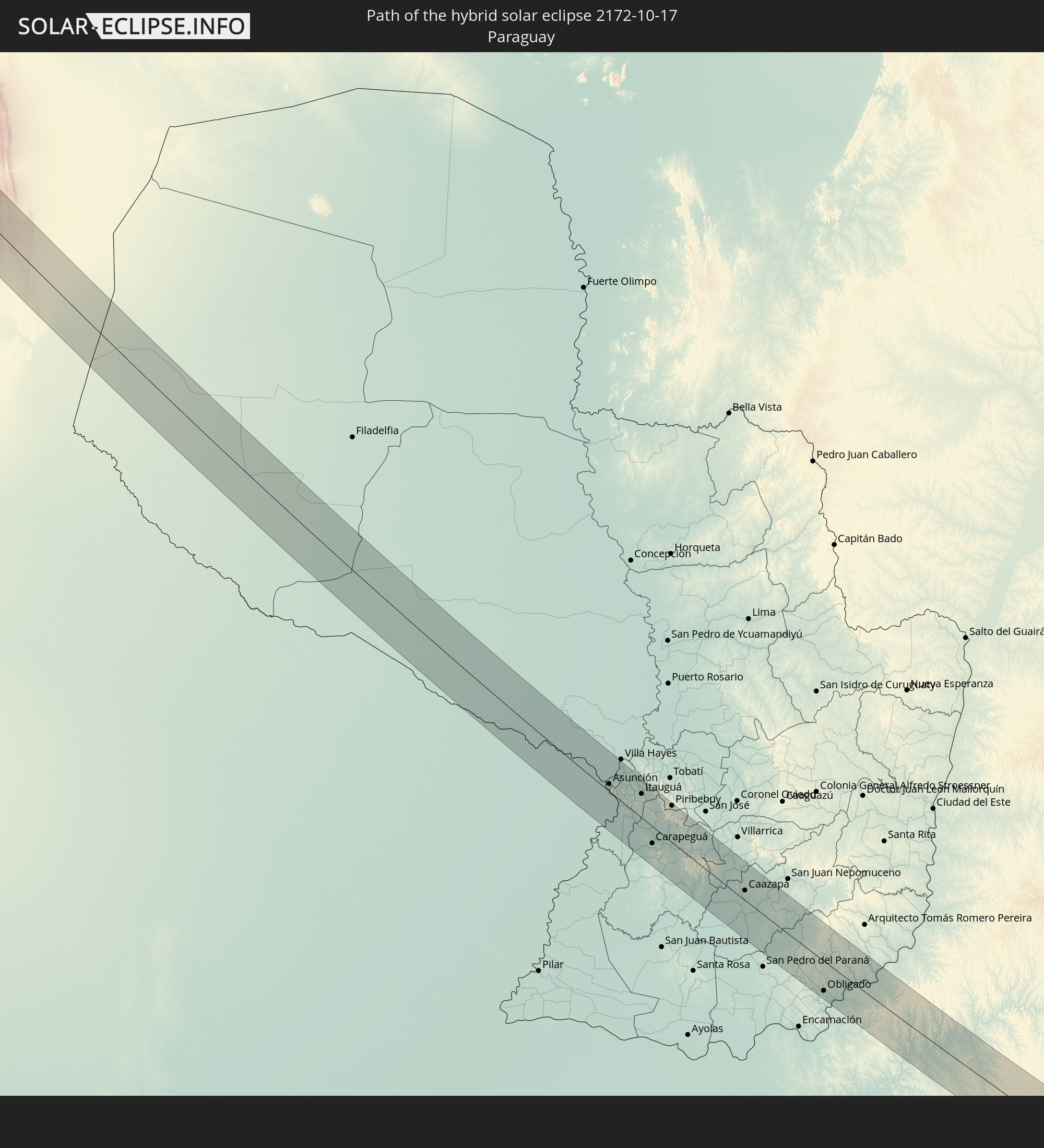
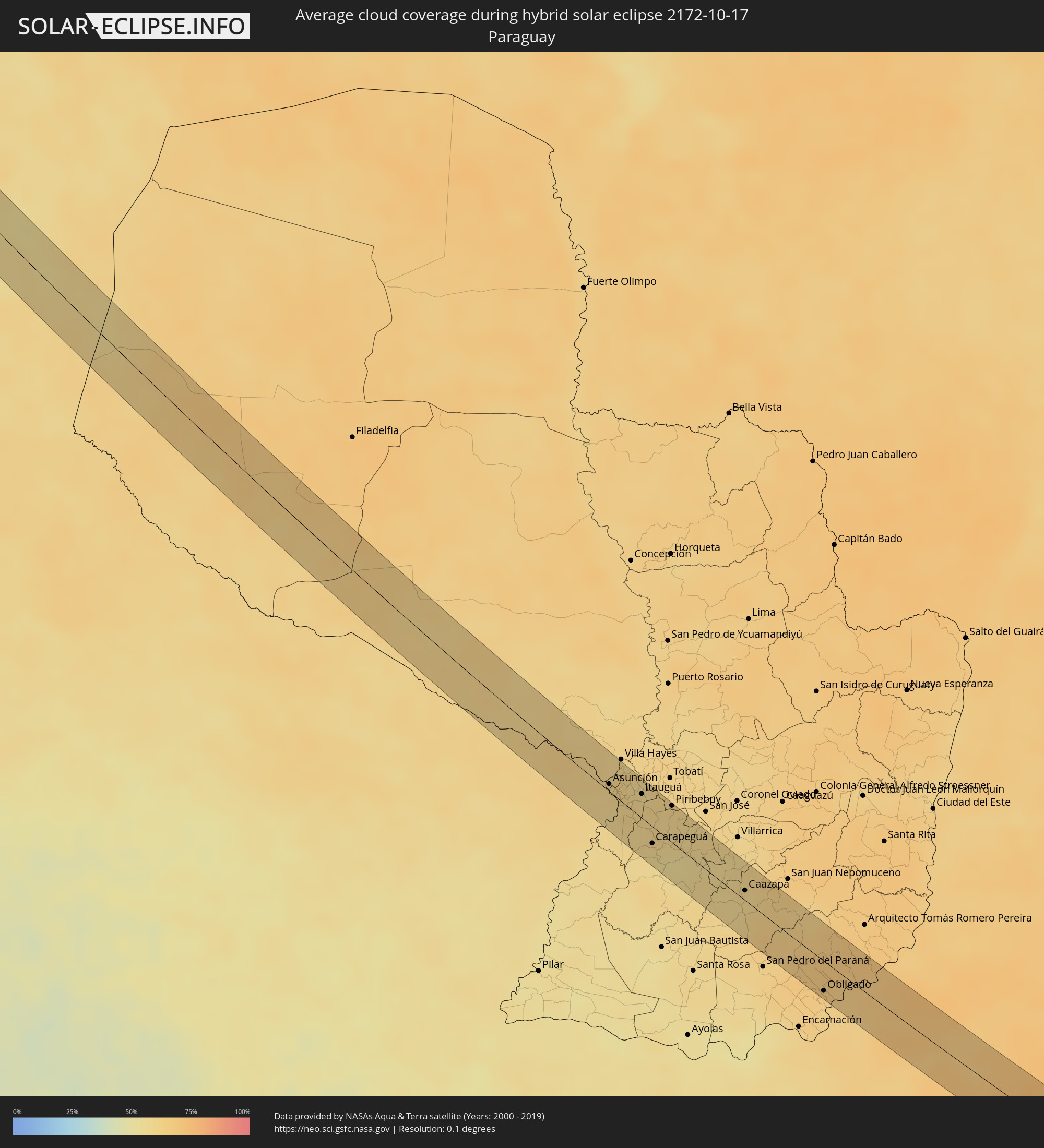 Paraguay
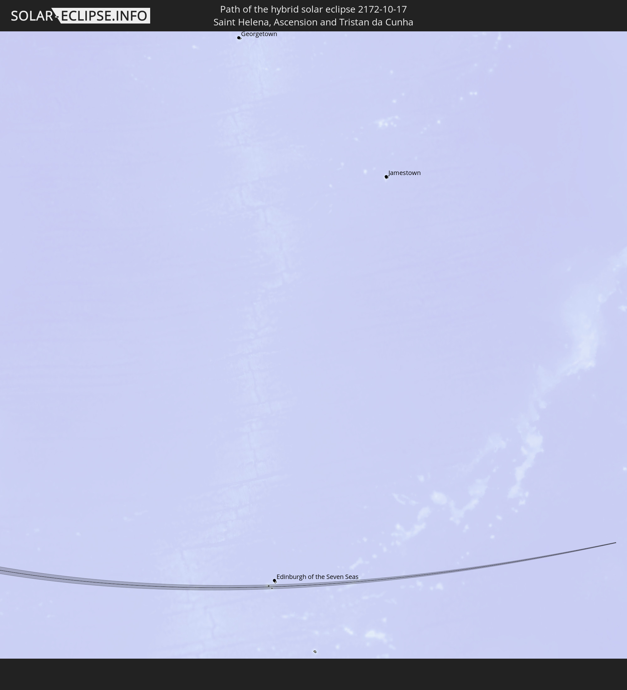
 Saint Helena, Ascension and Tristan da Cunha
Cities inside the path of the eclipse
The following table shows all locations with a population of more than 5,000 inside the eclipse path. Cities which have more than 100,000 inhabitants are marked bold. A click at the locations opens a detailed map.
| City | Type | Eclipse duration | Local time of max. eclipse | Distance to central line | Ø Cloud coverage |
|
Playas, Guayas
|
total | - | 10:00:37 UTC-05:00 | 22 km | 87% |
|
Baláo, Guayas
|
total | - | 10:01:59 UTC-05:00 | 2 km | 94% |
|
Zamora, Zamora-Chinchipe
|
total | - | 10:05:32 UTC-05:00 | 20 km | 89% |
|
Yantzaza, Zamora-Chinchipe
|
total | - | 10:05:22 UTC-05:00 | 13 km | 85% |
|
Moyobamba, San Martín
|
total | - | 10:12:36 UTC-05:00 | 11 km | 82% |
|
Jepelacio, San Martín
|
total | - | 10:12:49 UTC-05:00 | 16 km | 83% |
|
Tabalosos, San Martín
|
total | - | 10:13:43 UTC-05:00 | 11 km | 83% |
|
Lamas, San Martín
|
total | - | 10:14:06 UTC-05:00 | 4 km | 75% |
|
Picota, San Martín
|
total | - | 10:15:29 UTC-05:00 | 26 km | 75% |
|
Chazuta, San Martín
|
total | - | 10:15:03 UTC-05:00 | 16 km | 75% |
|
Campoverde, Ucayali
|
total | - | 10:21:17 UTC-05:00 | 16 km | 85% |
|
Pucallpa, Ucayali
|
total | - | 10:21:30 UTC-05:00 | 12 km | 83% |
|
La Rinconada, Puno
|
total | - | 10:44:08 UTC-05:00 | 28 km | 73% |
|
Capinota, Cochabamba
|
total | - | 11:56:47 UTC-04:00 | 3 km | 40% |
|
Cochabamba, Cochabamba
|
total | - | 11:56:18 UTC-04:00 | 29 km | 44% |
|
Tarata, Cochabamba
|
total | - | 11:57:01 UTC-04:00 | 23 km | 42% |
|
Sucre, Chuquisaca
|
total | - | 12:01:28 UTC-04:00 | 27 km | 41% |
|
Monteagudo, Chuquisaca
|
total | - | 12:05:35 UTC-04:00 | 13 km | 60% |
|
Camiri, Santa Cruz
|
total | - | 12:06:55 UTC-04:00 | 27 km | 58% |
|
Clorinda, Formosa Province
|
total | - | 13:28:05 UTC-03:00 | 1 km | 59% |
|
Nanawa, Presidente Hayes
|
total | - | 13:28:09 UTC-03:00 | 6 km | 59% |
|
Asunción, Asunción
|
total | - | 13:28:16 UTC-03:00 | 5 km | 60% |
|
Lambaré, Central
|
total | - | 13:28:24 UTC-03:00 | 3 km | 60% |
|
Villa Elisa, Central
|
total | - | 13:28:28 UTC-03:00 | 2 km | 59% |
|
Colonia Mariano Roque Alonso, Central
|
total | - | 13:28:12 UTC-03:00 | 22 km | 61% |
|
San Antonio, Central
|
total | - | 13:28:38 UTC-03:00 | 1 km | 59% |
|
Nemby, Central
|
total | - | 13:28:37 UTC-03:00 | 4 km | 59% |
|
Fernando de la Mora, Central
|
total | - | 13:28:33 UTC-03:00 | 9 km | 62% |
|
San Lorenzo, Central
|
total | - | 13:28:34 UTC-03:00 | 10 km | 62% |
|
Limpio, Central
|
total | - | 13:28:20 UTC-03:00 | 26 km | 62% |
|
Guarambaré, Central
|
total | - | 13:28:54 UTC-03:00 | 0 km | 61% |
|
Capiatá, Central
|
total | - | 13:28:43 UTC-03:00 | 13 km | 60% |
|
Areguá, Central
|
total | - | 13:28:46 UTC-03:00 | 20 km | 60% |
|
Itá, Central
|
total | - | 13:29:07 UTC-03:00 | 5 km | 60% |
|
Itauguá, Central
|
total | - | 13:28:59 UTC-03:00 | 18 km | 60% |
|
Yaguarón, Paraguarí
|
total | - | 13:29:25 UTC-03:00 | 1 km | 60% |
|
Ypacarai, Central
|
total | - | 13:29:07 UTC-03:00 | 18 km | 60% |
|
Carapeguá, Paraguarí
|
total | - | 13:29:52 UTC-03:00 | 12 km | 56% |
|
Paraguarí, Paraguarí
|
total | - | 13:29:45 UTC-03:00 | 9 km | 59% |
|
Piribebuy, Cordillera
|
total | - | 13:29:42 UTC-03:00 | 27 km | 58% |
|
Caazapá, Caazapá
|
total | - | 13:32:11 UTC-03:00 | 7 km | 58% |
|
Obligado, Itapúa
|
total | - | 13:34:53 UTC-03:00 | 22 km | 65% |
|
Gobernador Roca, Misiones Province
|
total | - | 13:35:26 UTC-03:00 | 26 km | 63% |
|
Santo Pipó, Misiones Province
|
total | - | 13:35:29 UTC-03:00 | 18 km | 64% |
|
Jardín América, Misiones Province
|
total | - | 13:35:41 UTC-03:00 | 1 km | 67% |
|
Capioví, Misiones Province
|
total | - | 13:35:49 UTC-03:00 | 21 km | 68% |
|
Campo Viera, Misiones Province
|
total | - | 13:36:33 UTC-03:00 | 18 km | 68% |
|
Campo Ramón, Misiones Province
|
total | - | 13:36:42 UTC-03:00 | 24 km | 66% |
|
Campo Grande, Misiones Province
|
total | - | 13:36:24 UTC-03:00 | 1 km | 68% |
|
Aristóbulo del Valle, Misiones Province
|
total | - | 13:36:23 UTC-03:00 | 16 km | 70% |
|
Veinticinco de Mayo, Misiones Province
|
total | - | 13:37:06 UTC-03:00 | 0 km | 67% |
|
Alba Posse, Misiones Province
|
total | - | 13:37:29 UTC-03:00 | 14 km | 68% |
|
Colonia Aurora, Misiones Province
|
total | - | 13:37:39 UTC-03:00 | 4 km | 70% |
|
Horizontina, Rio Grande do Sul
|
total | - | 13:38:17 UTC-03:00 | 3 km | 69% |
|
Três de Maio, Rio Grande do Sul
|
total | - | 13:38:37 UTC-03:00 | 7 km | 67% |
|
Santo Augusto, Rio Grande do Sul
|
total | - | 13:39:36 UTC-03:00 | 13 km | 70% |
|
Panambi, Rio Grande do Sul
|
total | - | 13:40:44 UTC-03:00 | 12 km | 68% |
|
Ibirubá, Rio Grande do Sul
|
total | - | 13:41:58 UTC-03:00 | 20 km | 66% |
|
Espumoso, Rio Grande do Sul
|
total | - | 13:42:32 UTC-03:00 | 16 km | 64% |
|
Não Me Toque, Rio Grande do Sul
|
total | - | 13:42:14 UTC-03:00 | 10 km | 66% |
|
Soledade, Rio Grande do Sul
|
total | - | 13:43:17 UTC-03:00 | 6 km | 66% |
|
Guaporé, Rio Grande do Sul
|
total | - | 13:44:28 UTC-03:00 | 24 km | 70% |
|
Encantado, Rio Grande do Sul
|
total | - | 13:45:00 UTC-03:00 | 11 km | 67% |
|
Garibaldi, Rio Grande do Sul
|
total | - | 13:45:39 UTC-03:00 | 5 km | 74% |
|
Bento Gonçalves, Rio Grande do Sul
|
total | - | 13:45:34 UTC-03:00 | 13 km | 72% |
|
Carlos Barbosa, Rio Grande do Sul
|
total | - | 13:45:45 UTC-03:00 | 2 km | 74% |
|
São Sebastião do Caí, Rio Grande do Sul
|
total | - | 13:46:21 UTC-03:00 | 18 km | 69% |
|
Farroupilha, Rio Grande do Sul
|
total | - | 13:45:57 UTC-03:00 | 17 km | 73% |
|
Portão, Rio Grande do Sul
|
total | - | 13:46:44 UTC-03:00 | 22 km | 71% |
|
Estância Velha, Rio Grande do Sul
|
total | - | 13:46:47 UTC-03:00 | 14 km | 71% |
|
Ivoti, Rio Grande do Sul
|
total | - | 13:46:44 UTC-03:00 | 7 km | 71% |
|
São Leopoldo, Rio Grande do Sul
|
total | - | 13:46:58 UTC-03:00 | 23 km | 72% |
|
Novo Hamburgo, Rio Grande do Sul
|
total | - | 13:46:54 UTC-03:00 | 14 km | 72% |
|
Nova Petrópolis, Rio Grande do Sul
|
total | - | 13:46:34 UTC-03:00 | 15 km | 71% |
|
Sapiranga, Rio Grande do Sul
|
total | - | 13:47:05 UTC-03:00 | 4 km | 71% |
|
Parobé, Rio Grande do Sul
|
total | - | 13:47:23 UTC-03:00 | 6 km | 69% |
|
Igrejinha, Rio Grande do Sul
|
total | - | 13:47:24 UTC-03:00 | 13 km | 69% |
|
Taquara, Rio Grande do Sul
|
total | - | 13:47:30 UTC-03:00 | 6 km | 70% |
|
Três Coroas, Rio Grande do Sul
|
total | - | 13:47:21 UTC-03:00 | 19 km | 69% |
|
Rolante, Rio Grande do Sul
|
total | - | 13:47:52 UTC-03:00 | 17 km | 70% |
|
Osório, Rio Grande do Sul
|
total | - | 13:48:42 UTC-03:00 | 10 km | 69% |
|
Cidreira, Rio Grande do Sul
|
total | - | 13:49:10 UTC-03:00 | 15 km | 68% |
|
Tramandaí, Rio Grande do Sul
|
total | - | 13:49:04 UTC-03:00 | 7 km | 65% |