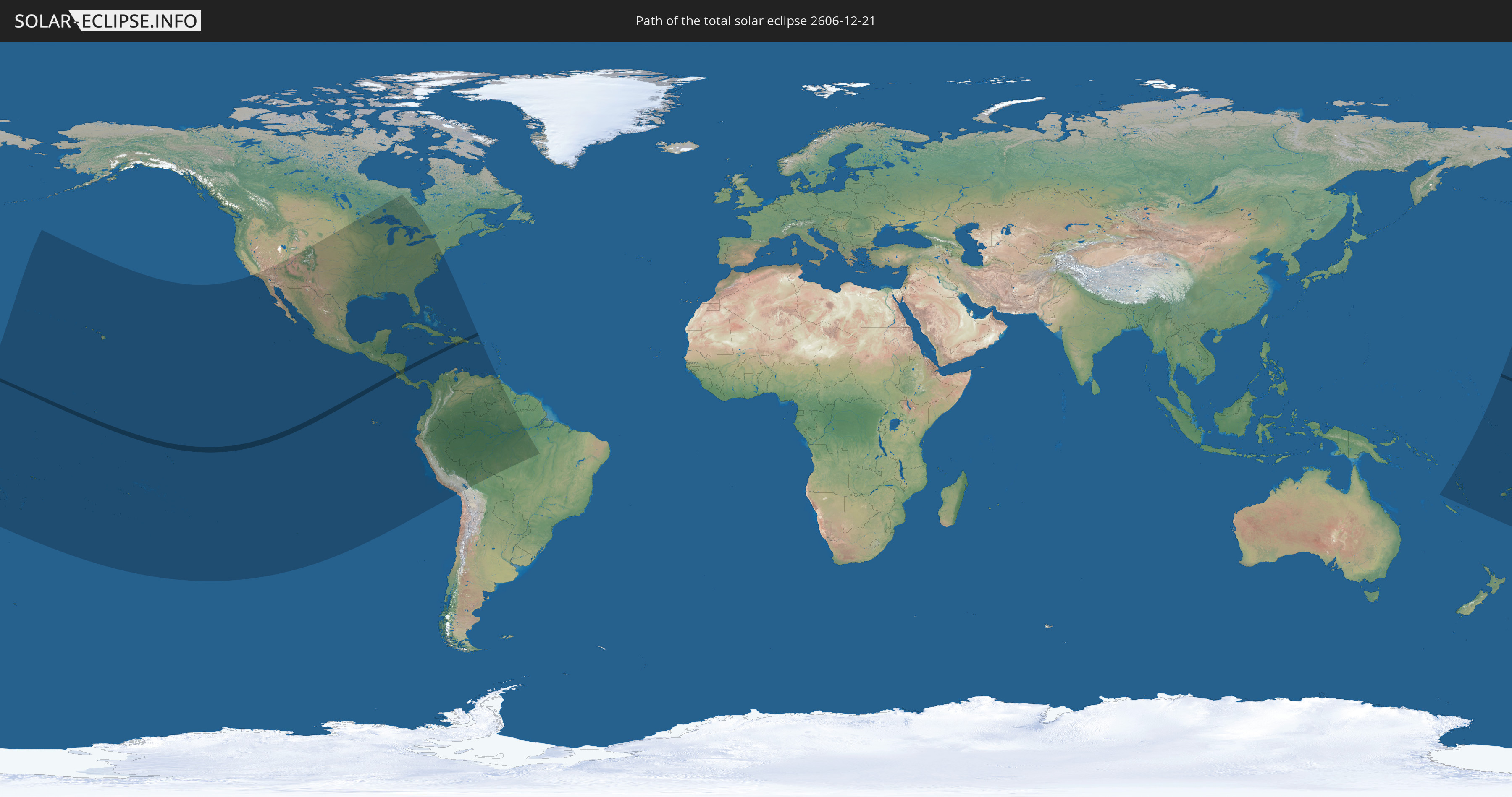
Total solar eclipse of 12/21/2606
| Day of week: | Sunday |
| Maximum duration of eclipse: | 03m50s |
| Maximum width of eclipse path: | 135 km |
| Saros cycle: | 161 |
| Coverage: | 100% |
| Magnitude: | 1.0387 |
| Gamma: | 0.2888 |
Wo kann man die Sonnenfinsternis vom 12/21/2606 sehen?
Die Sonnenfinsternis am 12/21/2606 kann man in 43 Ländern als partielle Sonnenfinsternis beobachten.
Der Finsternispfad verläuft durch 5 Länder. Nur in diesen Ländern ist sie als total Sonnenfinsternis zu sehen.
In den folgenden Ländern ist die Sonnenfinsternis total zu sehen
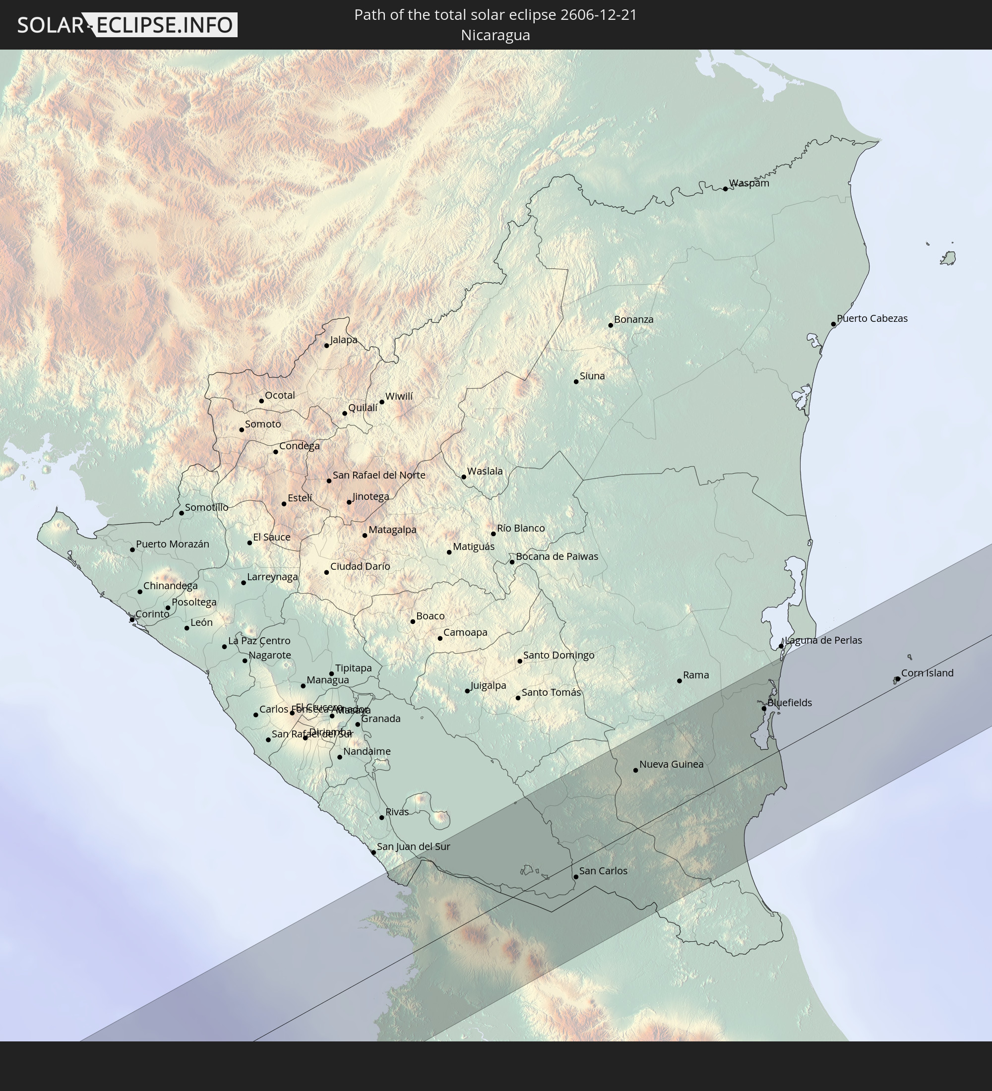 Nicaragua
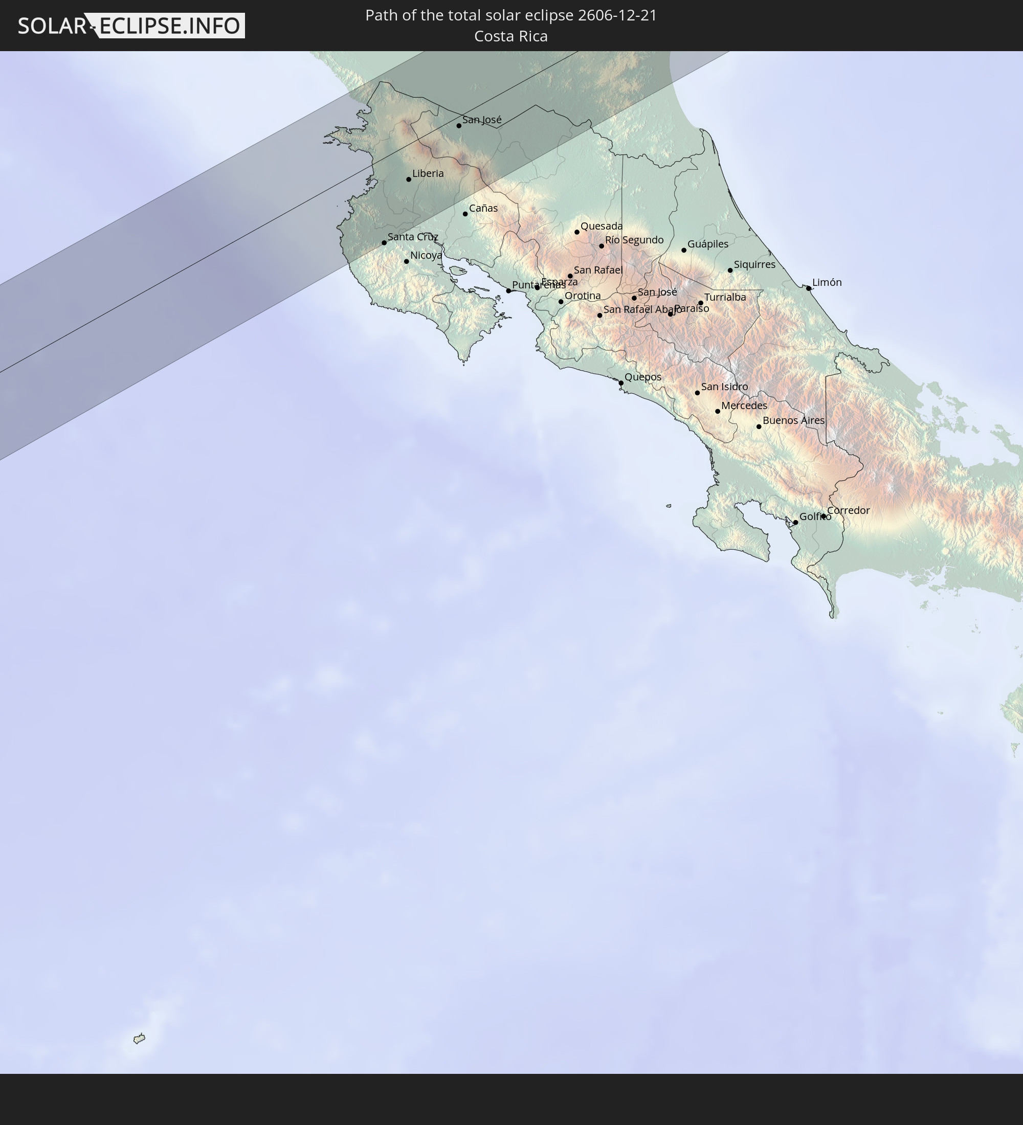 Costa Rica
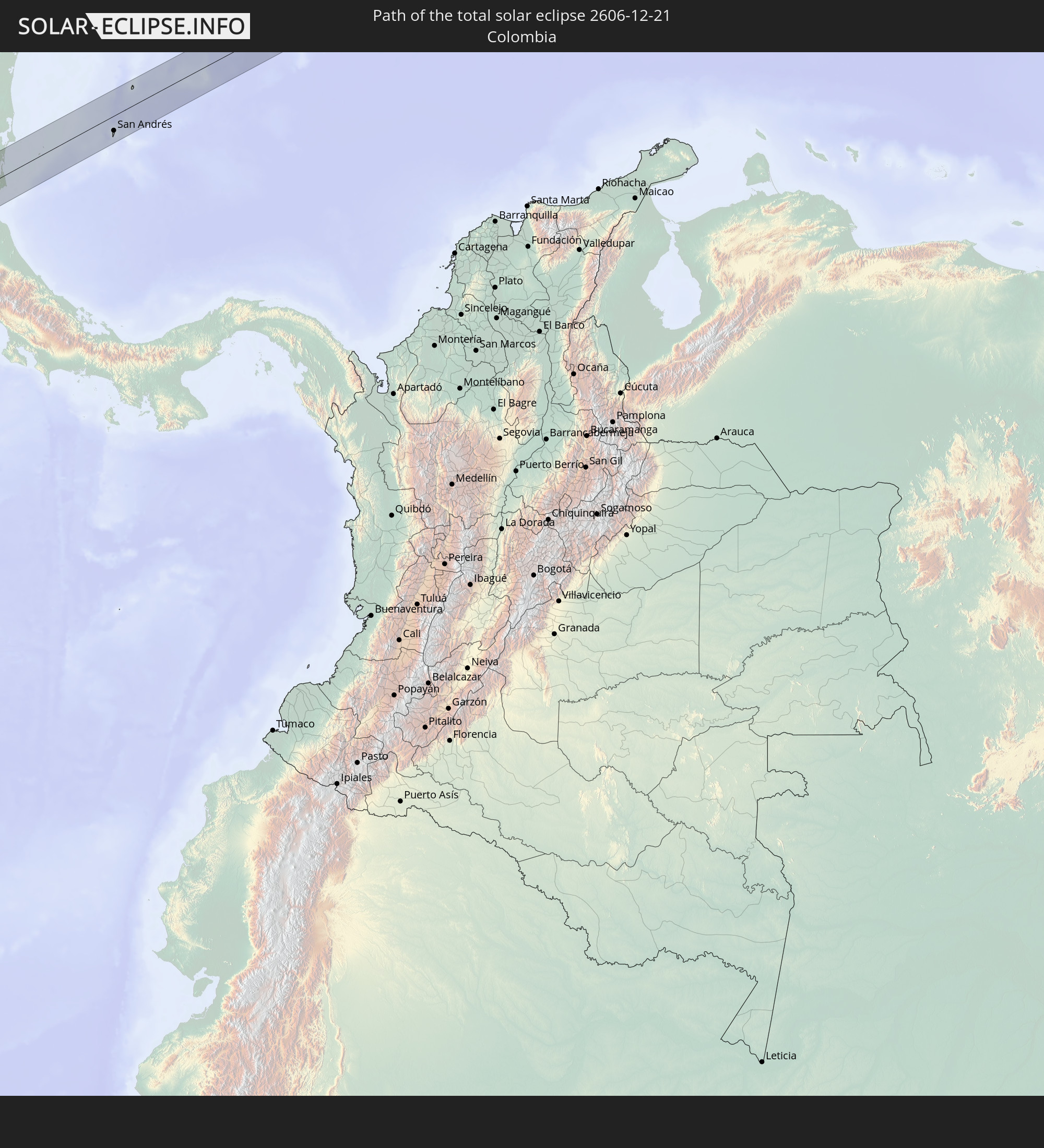 Colombia
 Haiti
Haiti
 Dominican Republic
In den folgenden Ländern ist die Sonnenfinsternis partiell zu sehen
 Fiji
Fiji
 United States
 United States Minor Outlying Islands
 Wallis and Futuna
 Tonga
Tonga
 Kiribati
 Samoa
Samoa
 Tokelau
 American Samoa
 Niue
Niue
 Cook Islands
 French Polynesia
 Canada
 Pitcairn Islands
 Mexico
 Chile
Chile
 Guatemala
 Ecuador
 El Salvador
 Honduras
 Belize
 Nicaragua
 Costa Rica
 Cuba
Cuba
 Panama
 Colombia
 Cayman Islands
 Peru
Peru
 The Bahamas
 Jamaica
 Haiti
Haiti
 Brazil
 Venezuela
 Turks and Caicos Islands
 Dominican Republic
 Aruba
Aruba
 Bolivia
 Puerto Rico
 Trinidad and Tobago
 Guyana
 Solomon Islands
 Vanuatu
 Tuvalu
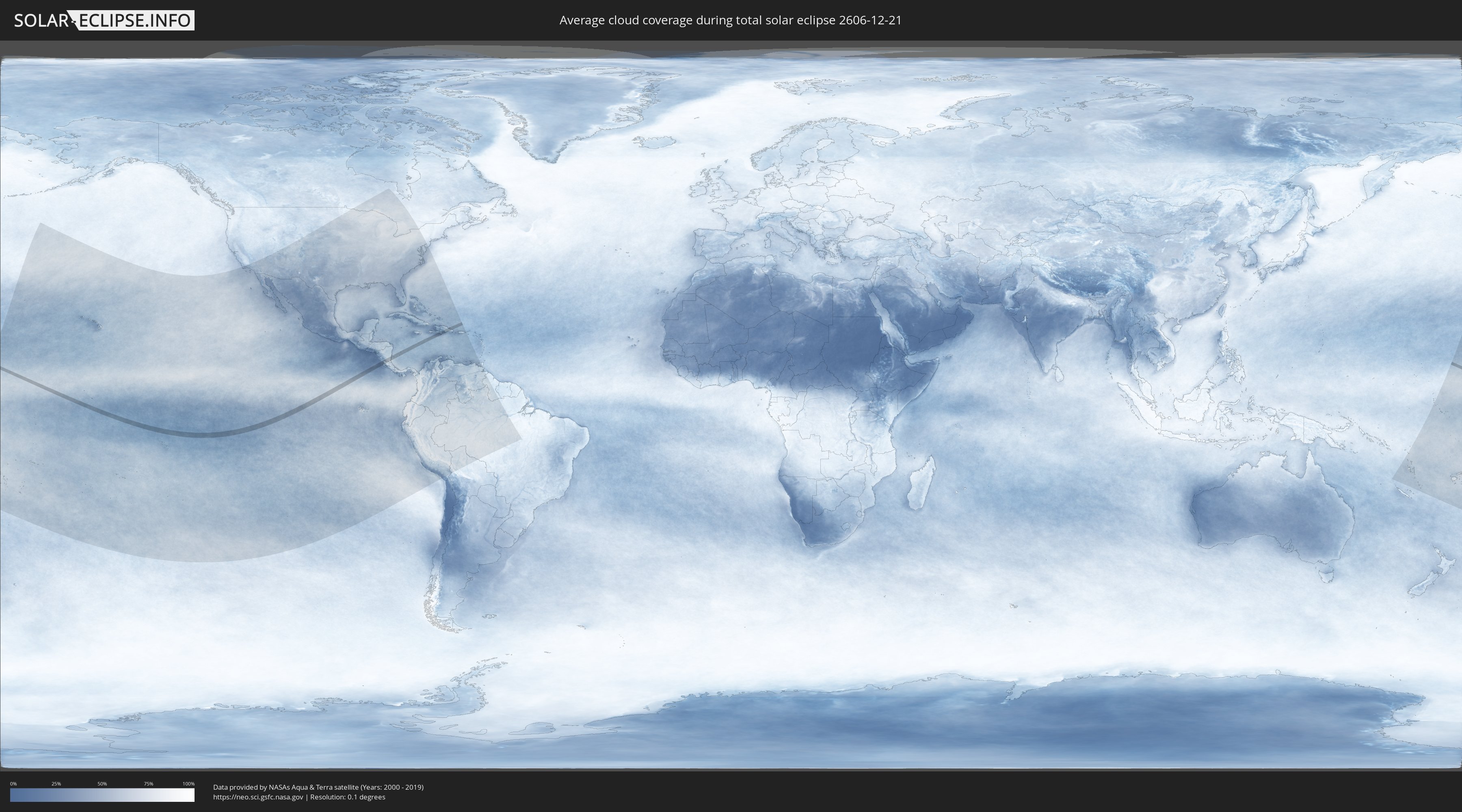
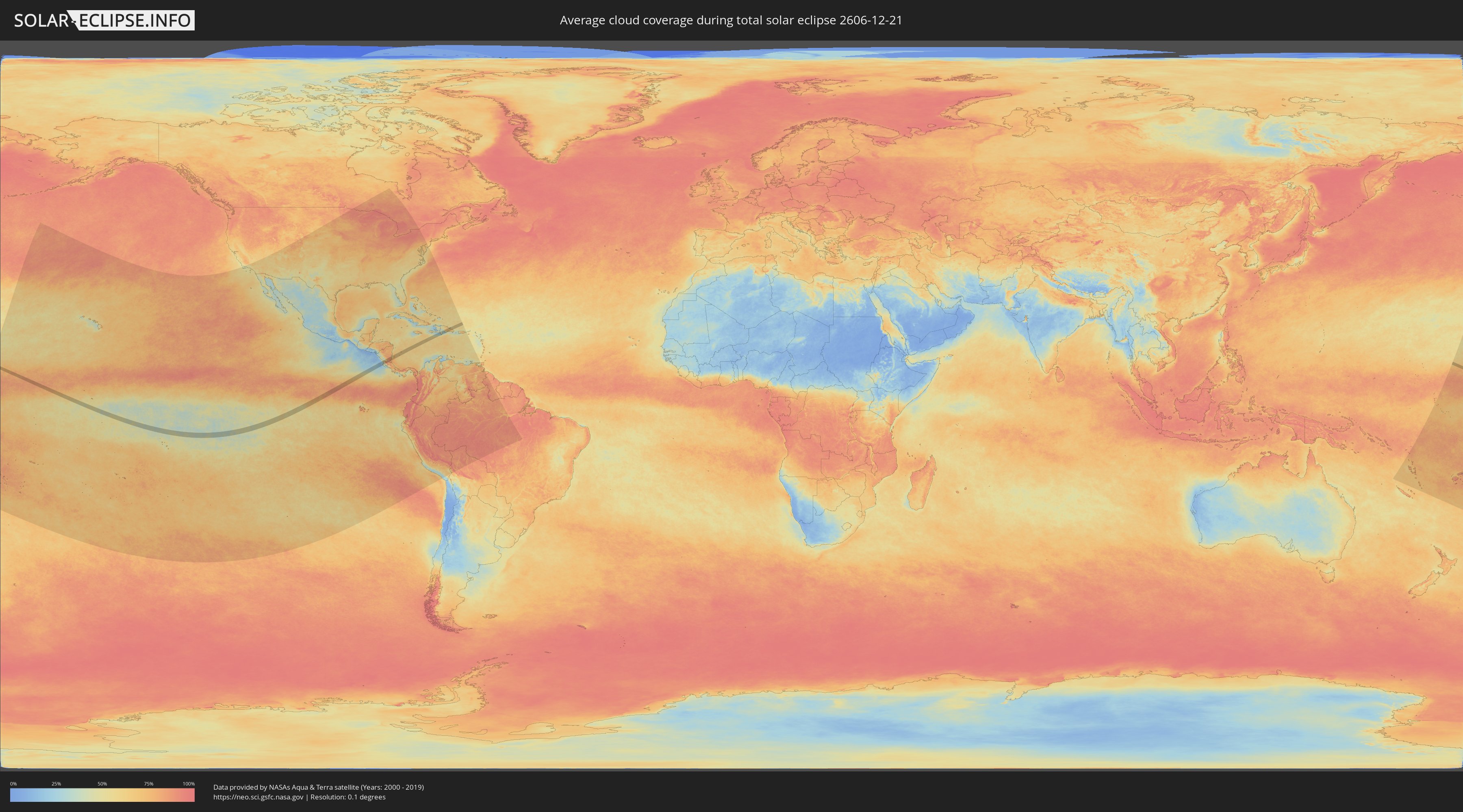
How will be the weather during the total solar eclipse on 12/21/2606?
Where is the best place to see the total solar eclipse of 12/21/2606?
The following maps show the average cloud coverage for the day of the total solar eclipse.
With the help of these maps, it is possible to find the place along the eclipse path, which has the best
chance of a cloudless sky.
Nevertheless, you should consider local circumstances and inform about the weather of your chosen
observation site.
The data is provided by NASAs satellites
AQUA and TERRA.
The cloud maps are averaged over a period of 19 years (2000 - 2019).
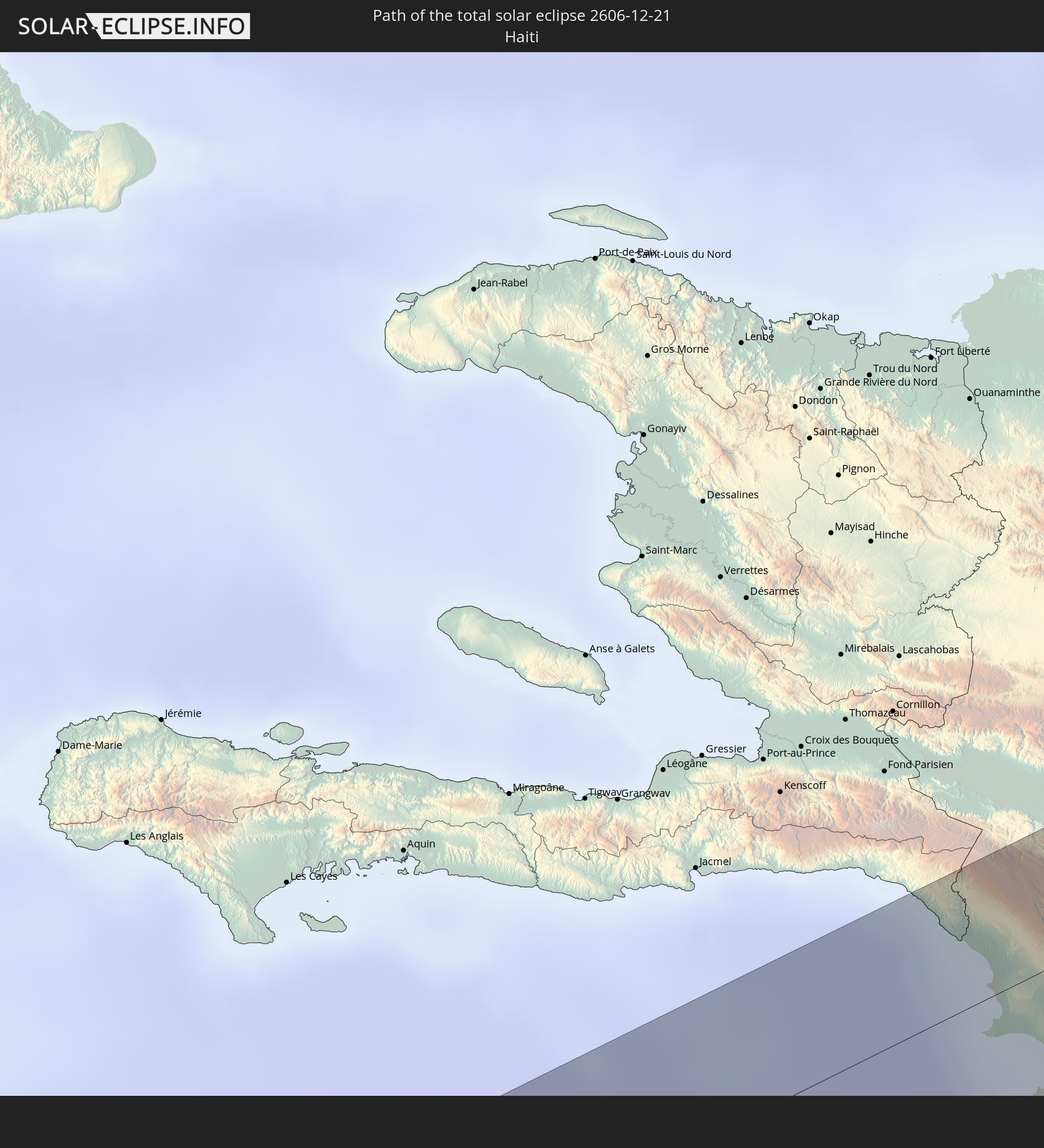
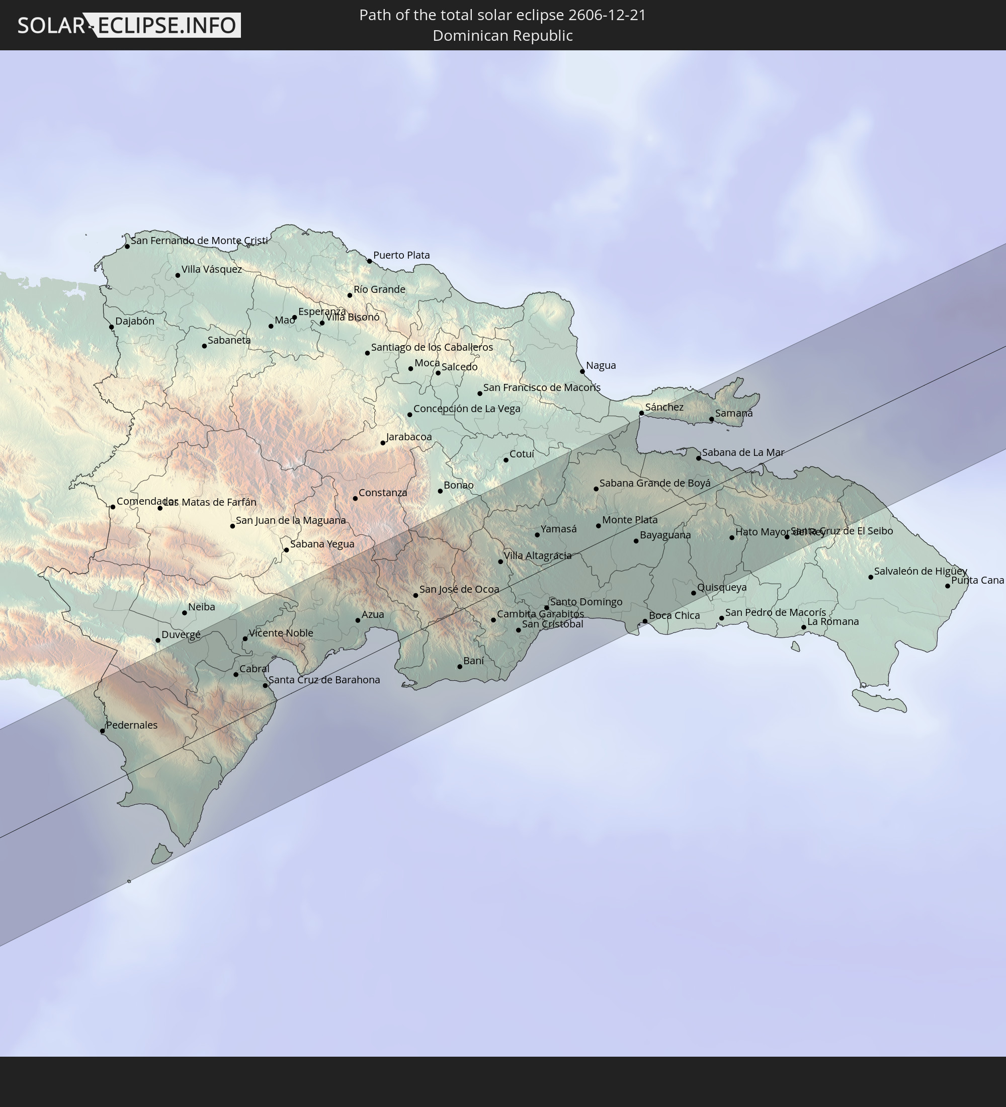
Detailed country maps
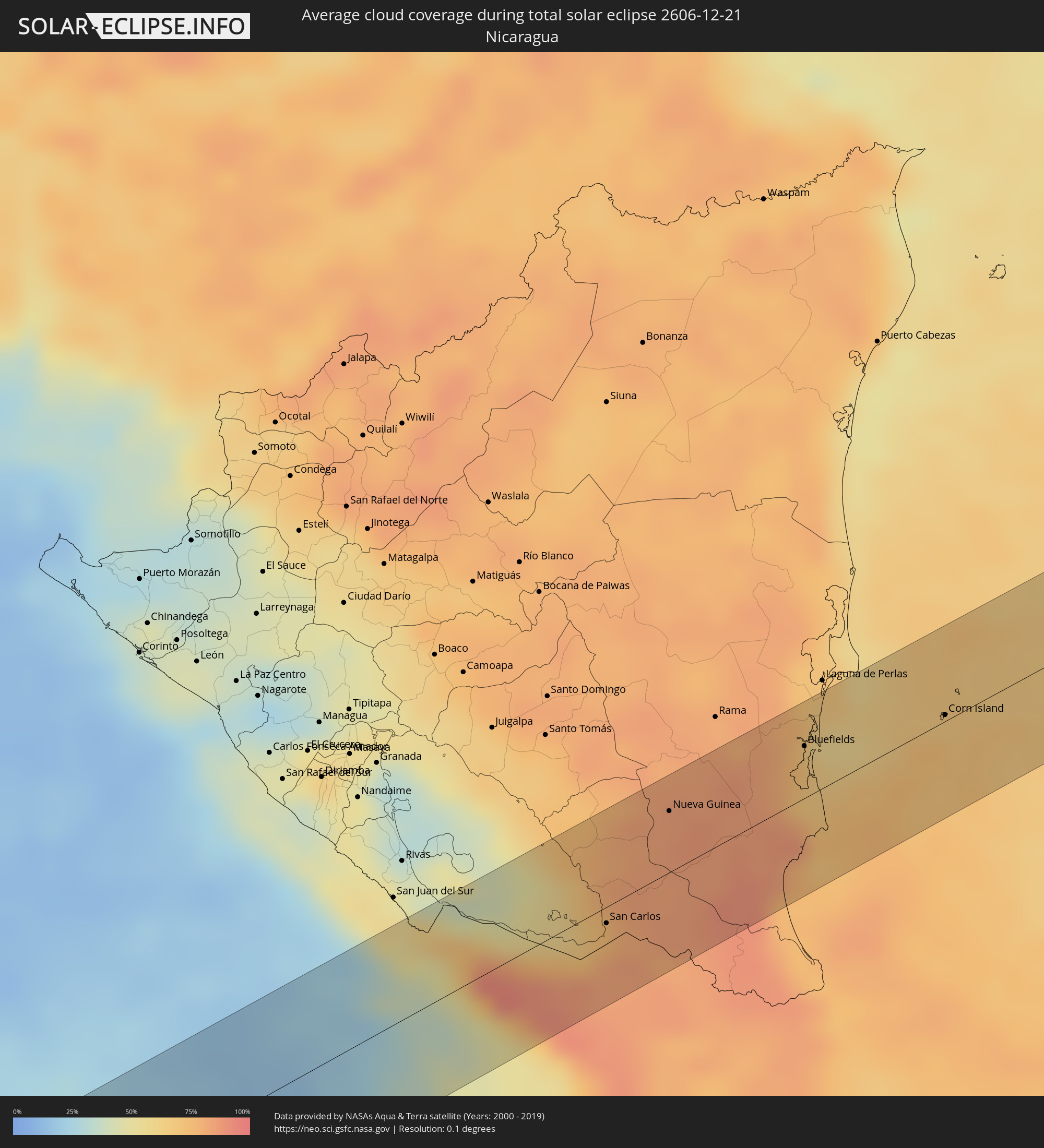 Nicaragua
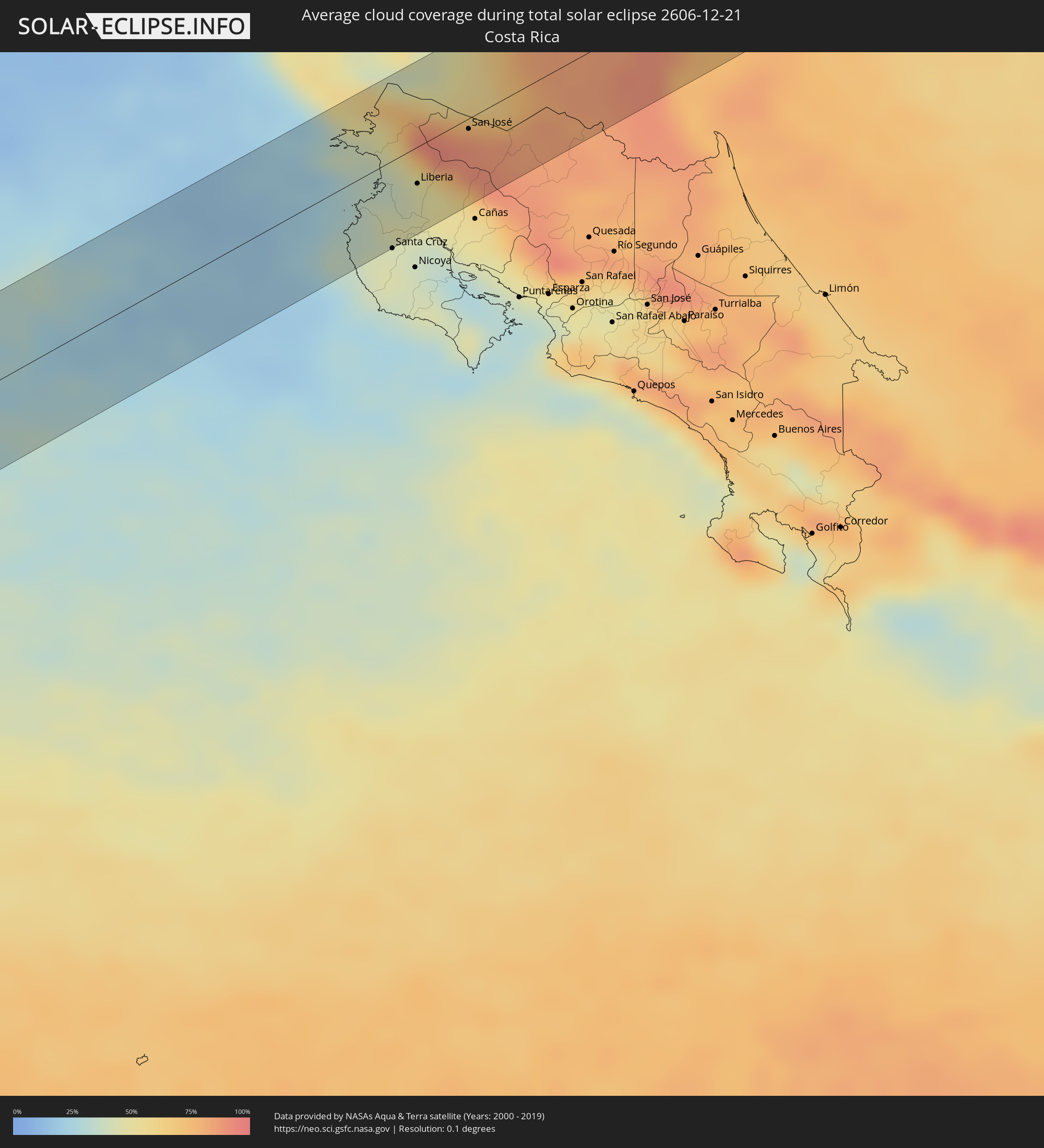 Costa Rica
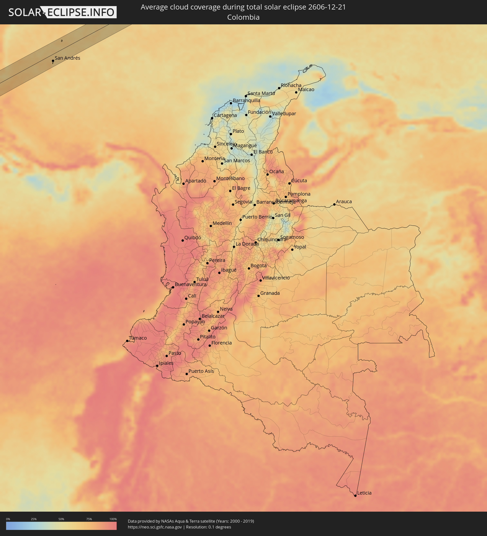 Colombia
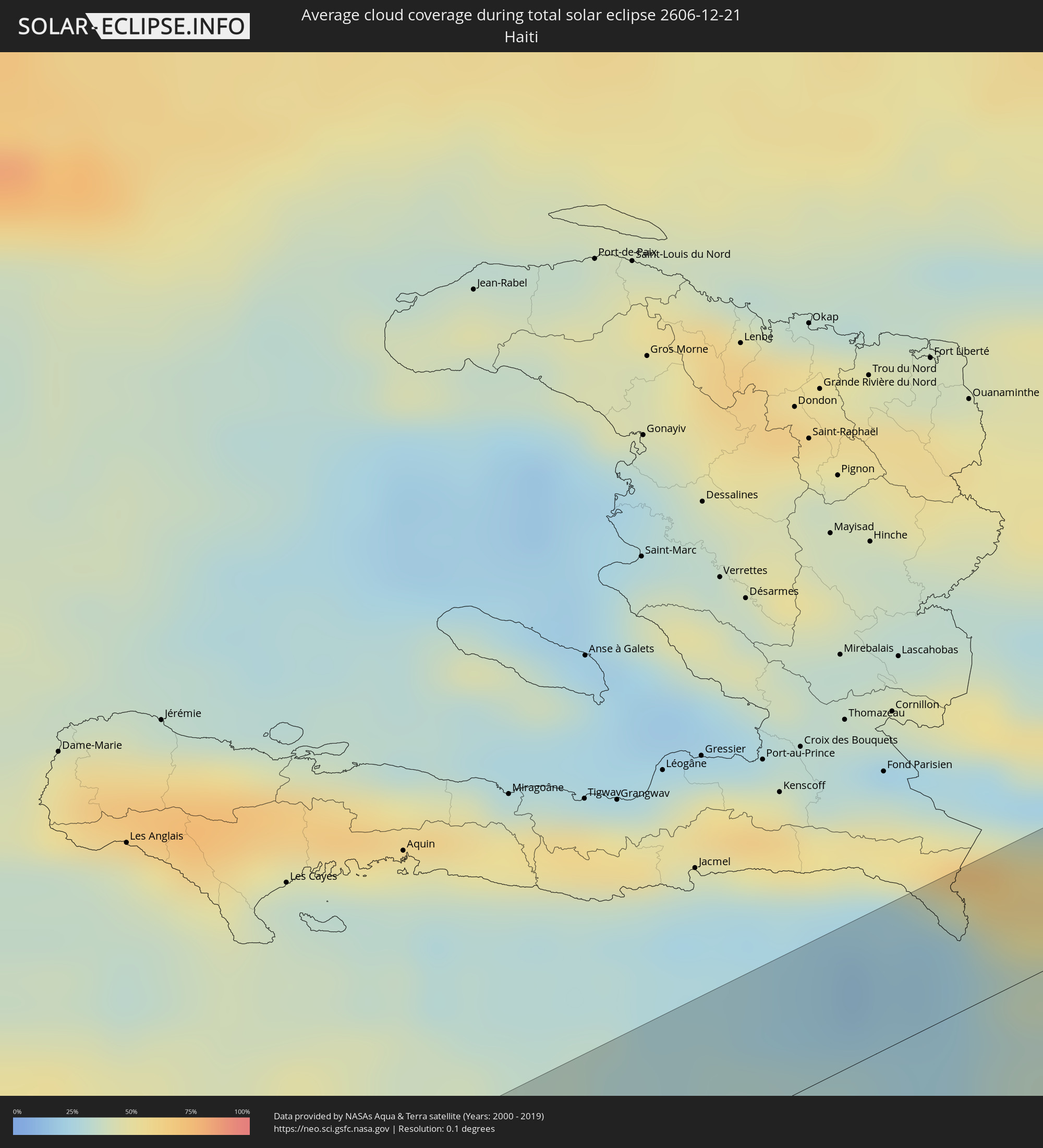 Haiti
Haiti
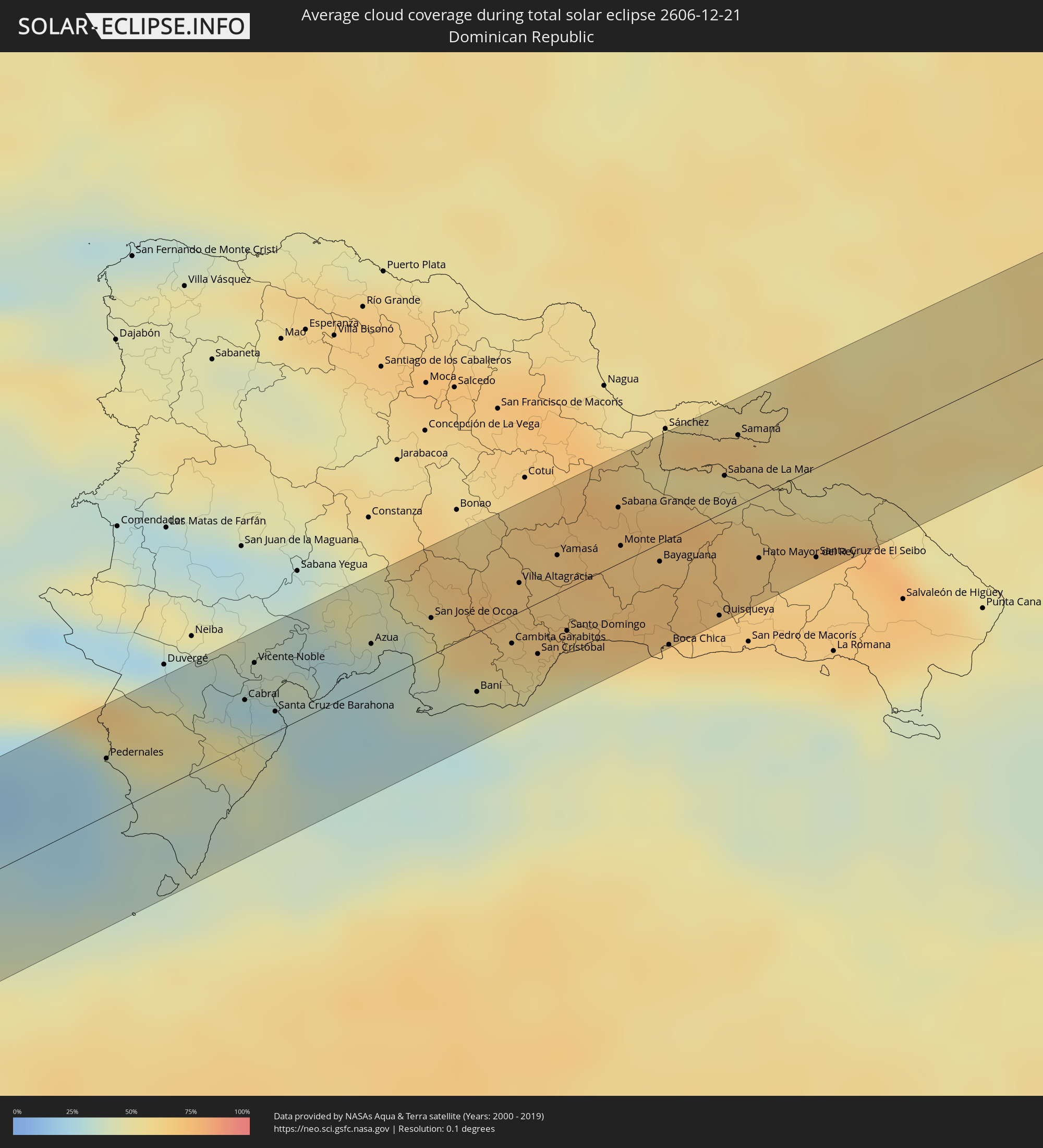 Dominican Republic
Cities inside the path of the eclipse
The following table shows all locations with a population of more than 5,000 inside the eclipse path. Cities which have more than 100,000 inhabitants are marked bold. A click at the locations opens a detailed map.
| City | Type | Eclipse duration | Local time of max. eclipse | Distance to central line | Ø Cloud coverage |
|
Liberia, Guanacaste
|
total | - | 15:36:26 UTC-06:00 | 21 km | 45% |
|
San José, Alajuela
|
total | - | 15:36:46 UTC-06:00 | 6 km | 88% |
|
San Carlos, Río San Juan
|
total | - | 15:37:06 UTC-06:00 | 8 km | 80% |
|
Nueva Guinea, Atlántico Sur
|
total | - | 15:37:28 UTC-06:00 | 30 km | 83% |
|
Bluefields, Atlántico Sur
|
total | - | 15:38:04 UTC-06:00 | 25 km | 72% |
|
Corn Island, Atlántico Sur
|
total | - | 15:38:37 UTC-06:00 | 3 km | 69% |
|
San Andrés, Archipiélago de San Andrés, Providencia y Santa Catalina
|
total | - | 16:39:37 UTC-05:00 | 26 km | 63% |
|
Pedernales, Pedernales
|
total | - | 17:44:12 UTC-04:00 | 21 km | 32% |
|
Enriquillo, Barahona
|
total | - | 17:44:20 UTC-04:00 | 17 km | 38% |
|
Cabral, Barahona
|
total | - | 17:44:18 UTC-04:00 | 17 km | 27% |
|
Tamayo, Baoruco
|
total | - | 17:44:18 UTC-04:00 | 31 km | 33% |
|
Vicente Noble, Barahona
|
total | - | 17:44:18 UTC-04:00 | 29 km | 33% |
|
Paraíso, Barahona
|
total | - | 17:44:21 UTC-04:00 | 11 km | 42% |
|
Santa Cruz de Barahona, Barahona
|
total | - | 17:44:20 UTC-04:00 | 7 km | 35% |
|
Yayas de Viajama, Azua
|
total | - | 17:44:20 UTC-04:00 | 39 km | 37% |
|
Peralta, Azua
|
total | - | 17:44:22 UTC-04:00 | 29 km | 44% |
|
Azua, Azua
|
total | - | 17:44:24 UTC-04:00 | 15 km | 34% |
|
Estebanía, Azua
|
total | - | 17:44:25 UTC-04:00 | 11 km | 35% |
|
San José de Ocoa, San José de Ocoa
|
total | - | 17:44:26 UTC-04:00 | 13 km | 48% |
|
Baní, Peravia
|
total | - | 17:44:30 UTC-04:00 | 21 km | 42% |
|
Piedra Blanca, Monseñor Nouel
|
total | - | 17:44:26 UTC-04:00 | 34 km | 68% |
|
Paya, Peravia
|
total | - | 17:44:31 UTC-04:00 | 25 km | 42% |
|
Nizao, Peravia
|
total | - | 17:44:32 UTC-04:00 | 30 km | 38% |
|
Cambita Garabitos, San Cristóbal
|
total | - | 17:44:31 UTC-04:00 | 10 km | 61% |
|
Yaguate, San Cristóbal
|
total | - | 17:44:32 UTC-04:00 | 23 km | 46% |
|
Villa Altagracia, San Cristóbal
|
total | - | 17:44:29 UTC-04:00 | 10 km | 66% |
|
San Cristóbal, San Cristóbal
|
total | - | 17:44:32 UTC-04:00 | 18 km | 51% |
|
San Gregorio de Nigua, San Cristóbal
|
total | - | 17:44:33 UTC-04:00 | 23 km | 51% |
|
Esperalvillo, Monte Plata
|
total | - | 17:44:30 UTC-04:00 | 18 km | 67% |
|
Bajos de Haina, San Cristóbal
|
total | - | 17:44:33 UTC-04:00 | 22 km | 48% |
|
Yamasá, Monte Plata
|
total | - | 17:44:30 UTC-04:00 | 14 km | 67% |
|
Santo Domingo Oeste, Santo Domingo
|
total | - | 17:44:33 UTC-04:00 | 15 km | 64% |
|
Santo Domingo, Nacional
|
total | - | 17:44:33 UTC-04:00 | 15 km | 64% |
|
Bella Vista, Nacional
|
total | - | 17:44:34 UTC-04:00 | 22 km | 61% |
|
Cristo Rey, Nacional
|
total | - | 17:44:34 UTC-04:00 | 18 km | 61% |
|
La Julia, Nacional
|
total | - | 17:44:34 UTC-04:00 | 21 km | 61% |
|
La Agustina, Nacional
|
total | - | 17:44:34 UTC-04:00 | 18 km | 61% |
|
Villa Francisca, Nacional
|
total | - | 17:44:34 UTC-04:00 | 23 km | 61% |
|
Villa Consuelo, Nacional
|
total | - | 17:44:34 UTC-04:00 | 21 km | 61% |
|
Ensanche Luperón, Nacional
|
total | - | 17:44:34 UTC-04:00 | 19 km | 61% |
|
Ciudad Nueva, Nacional
|
total | - | 17:44:34 UTC-04:00 | 23 km | 61% |
|
San Carlos, Nacional
|
total | - | 17:44:34 UTC-04:00 | 21 km | 61% |
|
Santo Domingo Este, Santo Domingo
|
total | - | 17:44:35 UTC-04:00 | 23 km | 61% |
|
Sabana Grande de Boyá, Monte Plata
|
total | - | 17:44:32 UTC-04:00 | 20 km | 68% |
|
Monte Plata, Monte Plata
|
total | - | 17:44:33 UTC-04:00 | 6 km | 68% |
|
Bayaguana, Monte Plata
|
total | - | 17:44:35 UTC-04:00 | 7 km | 70% |
|
Boca Chica, Santo Domingo
|
total | - | 17:44:38 UTC-04:00 | 38 km | 61% |
|
Los Llanos, San Pedro de Macorís
|
total | - | 17:44:38 UTC-04:00 | 26 km | 69% |
|
Quisqueya, San Pedro de Macorís
|
total | - | 17:44:39 UTC-04:00 | 37 km | 68% |
|
Sabana de La Mar, Hato Mayor
|
total | - | 17:44:35 UTC-04:00 | 13 km | 57% |
|
El Valle, Hato Mayor
|
total | - | 17:44:36 UTC-04:00 | 4 km | 70% |
|
Samaná, Samaná
|
total | - | 17:44:35 UTC-04:00 | 25 km | 57% |
|
Hato Mayor del Rey, Hato Mayor
|
total | - | 17:44:39 UTC-04:00 | 23 km | 68% |
|
Miches, El Seíbo
|
total | - | 17:44:40 UTC-04:00 | 10 km | 66% |
|
Santa Cruz de El Seibo, El Seíbo
|
total | - | 17:44:42 UTC-04:00 | 32 km | 64% |