Total solar eclipse of 10/21/2693
| Day of week: | Saturday |
| Maximum duration of eclipse: | 04m37s |
| Maximum width of eclipse path: | 189 km |
| Saros cycle: | 164 |
| Coverage: | 100% |
| Magnitude: | 1.0566 |
| Gamma: | -0.1793 |
Wo kann man die Sonnenfinsternis vom 10/21/2693 sehen?
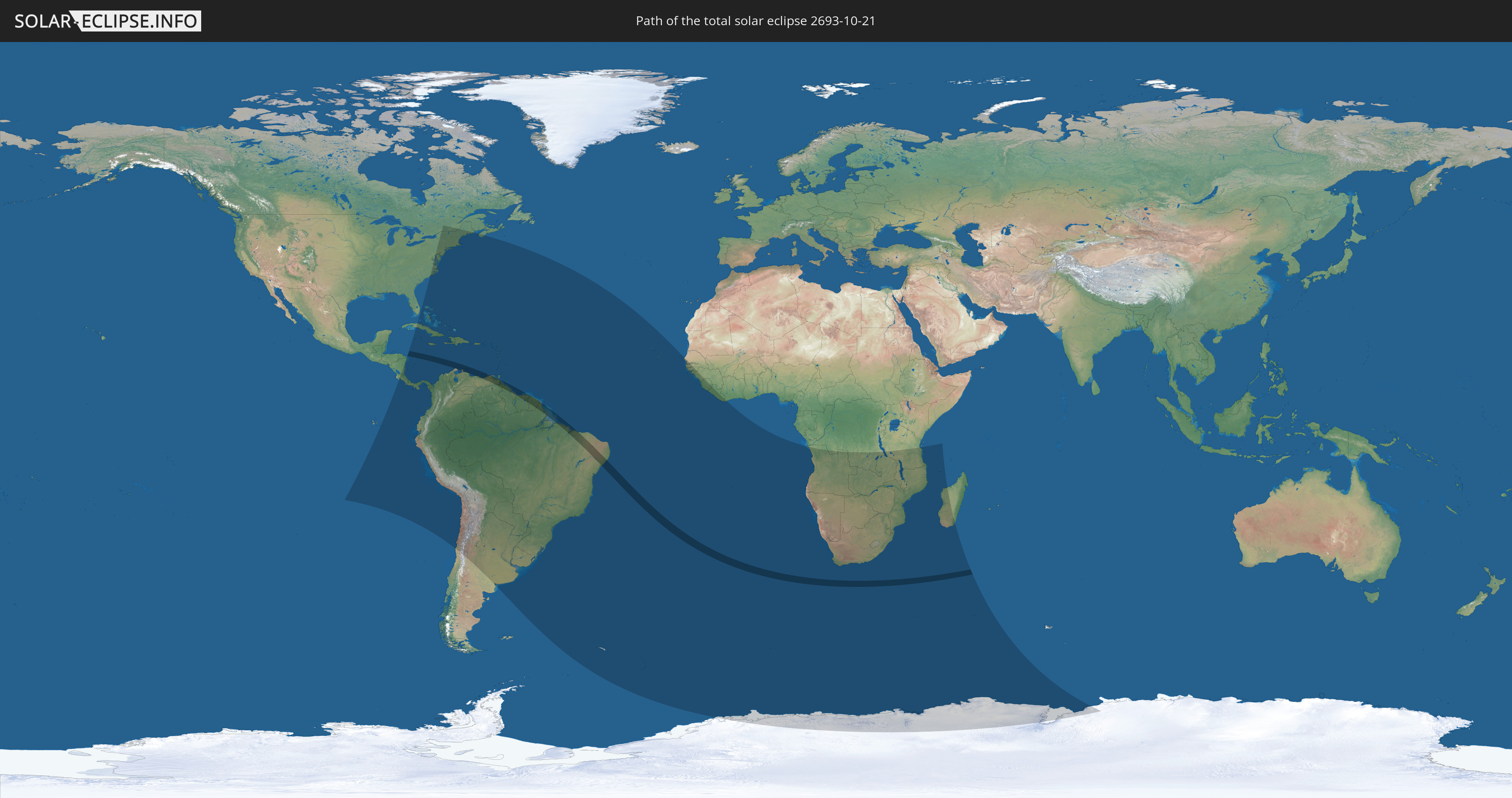
Die Sonnenfinsternis am 10/21/2693 kann man in 73 Ländern als partielle Sonnenfinsternis beobachten.
Der Finsternispfad verläuft durch 10 Länder. Nur in diesen Ländern ist sie als total Sonnenfinsternis zu sehen.
In den folgenden Ländern ist die Sonnenfinsternis total zu sehen
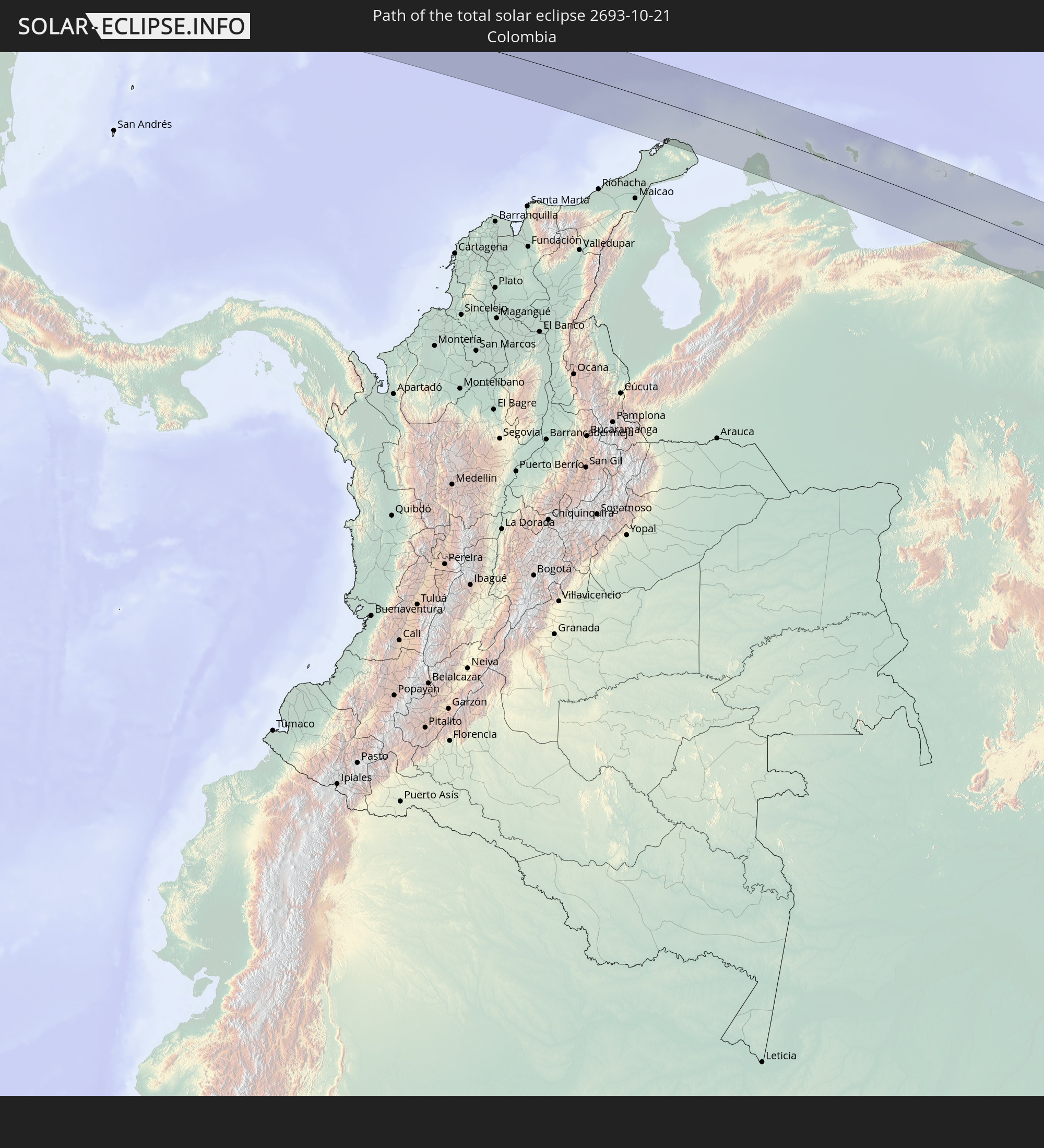 Colombia
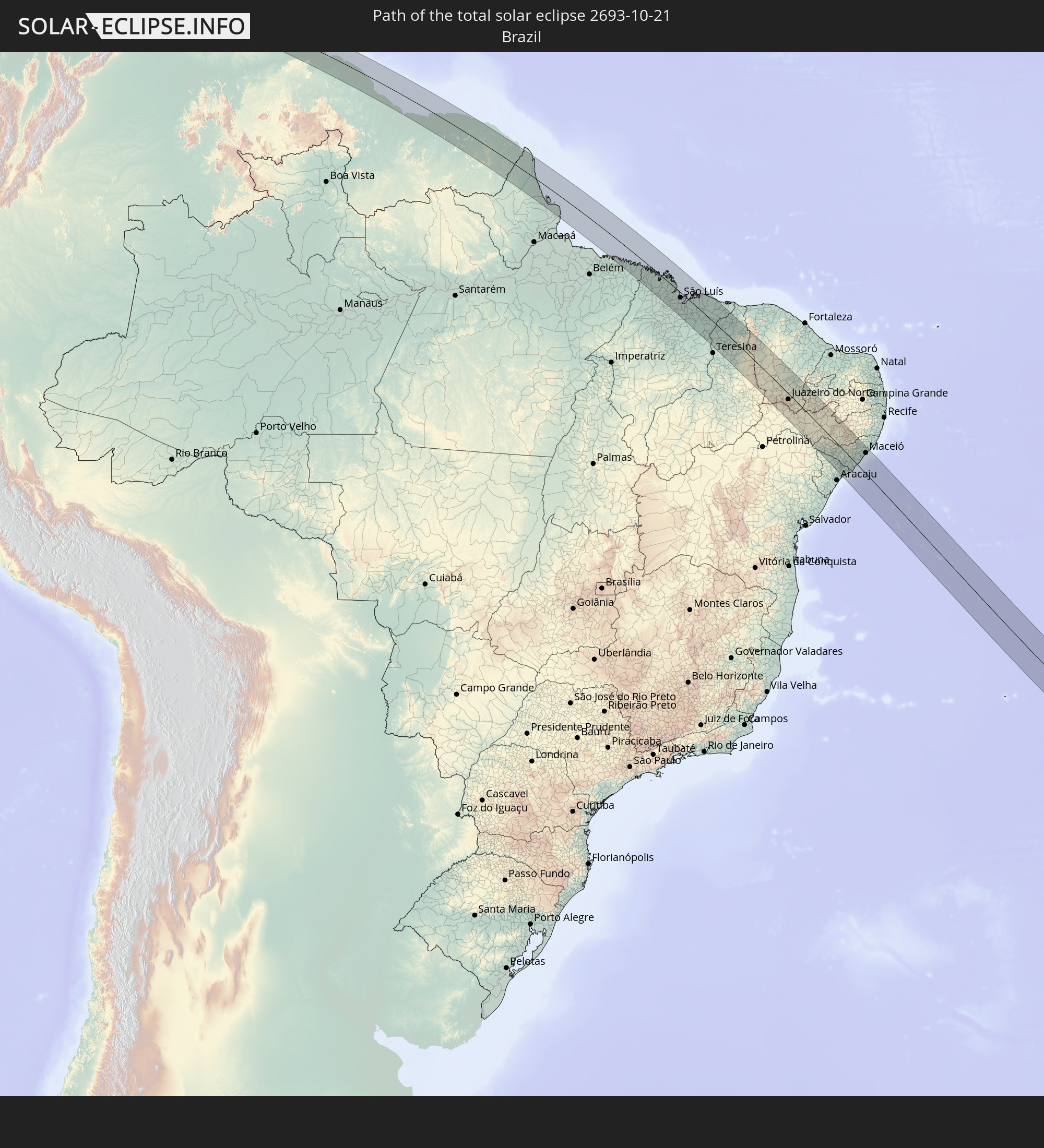 Brazil
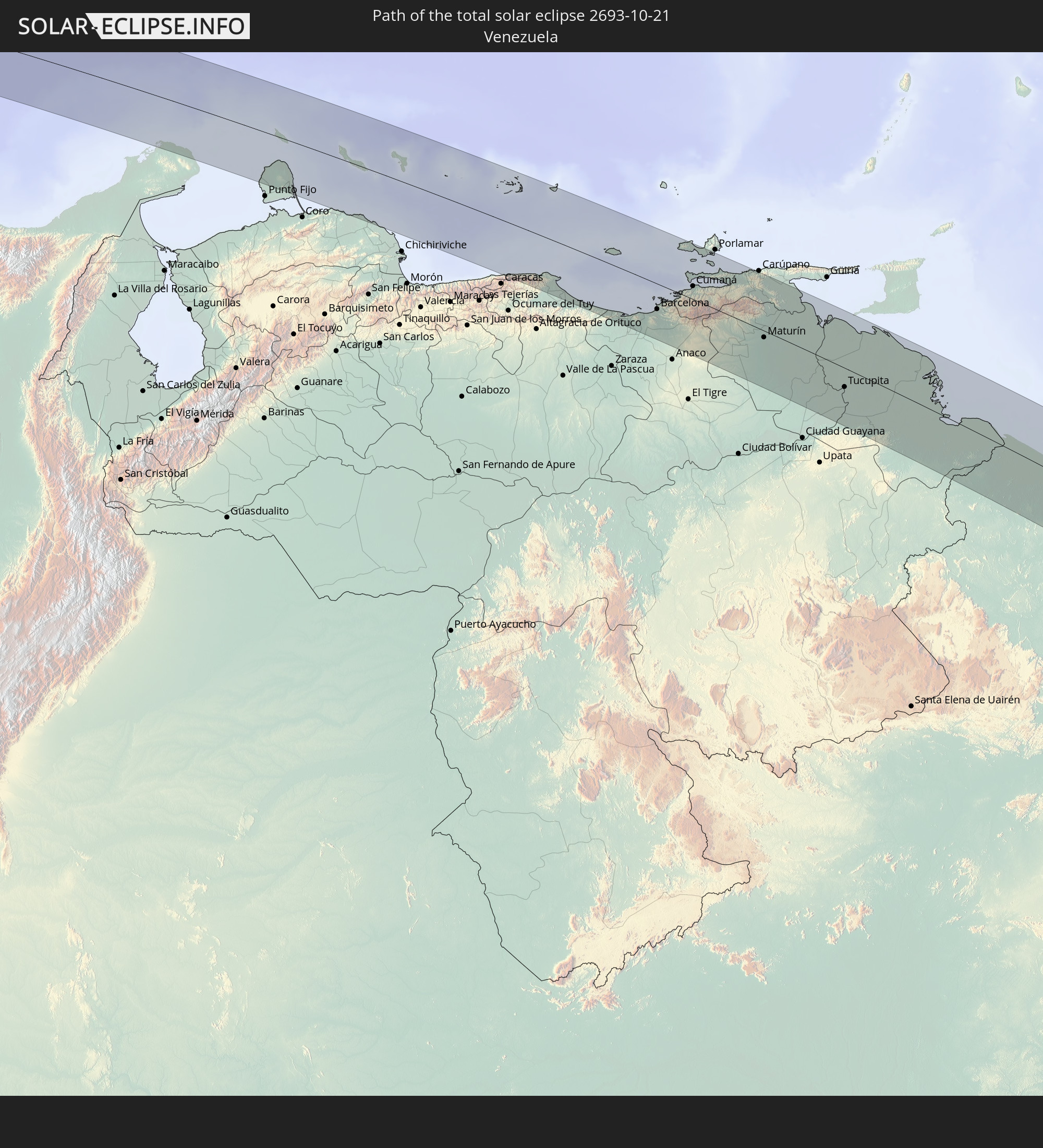 Venezuela
 Aruba
Aruba
 Curaçao
 Trinidad and Tobago
 Guyana
 Suriname
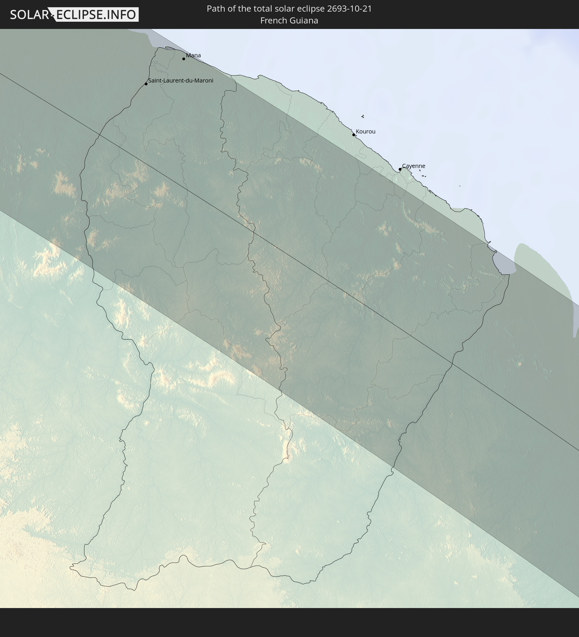 French Guiana
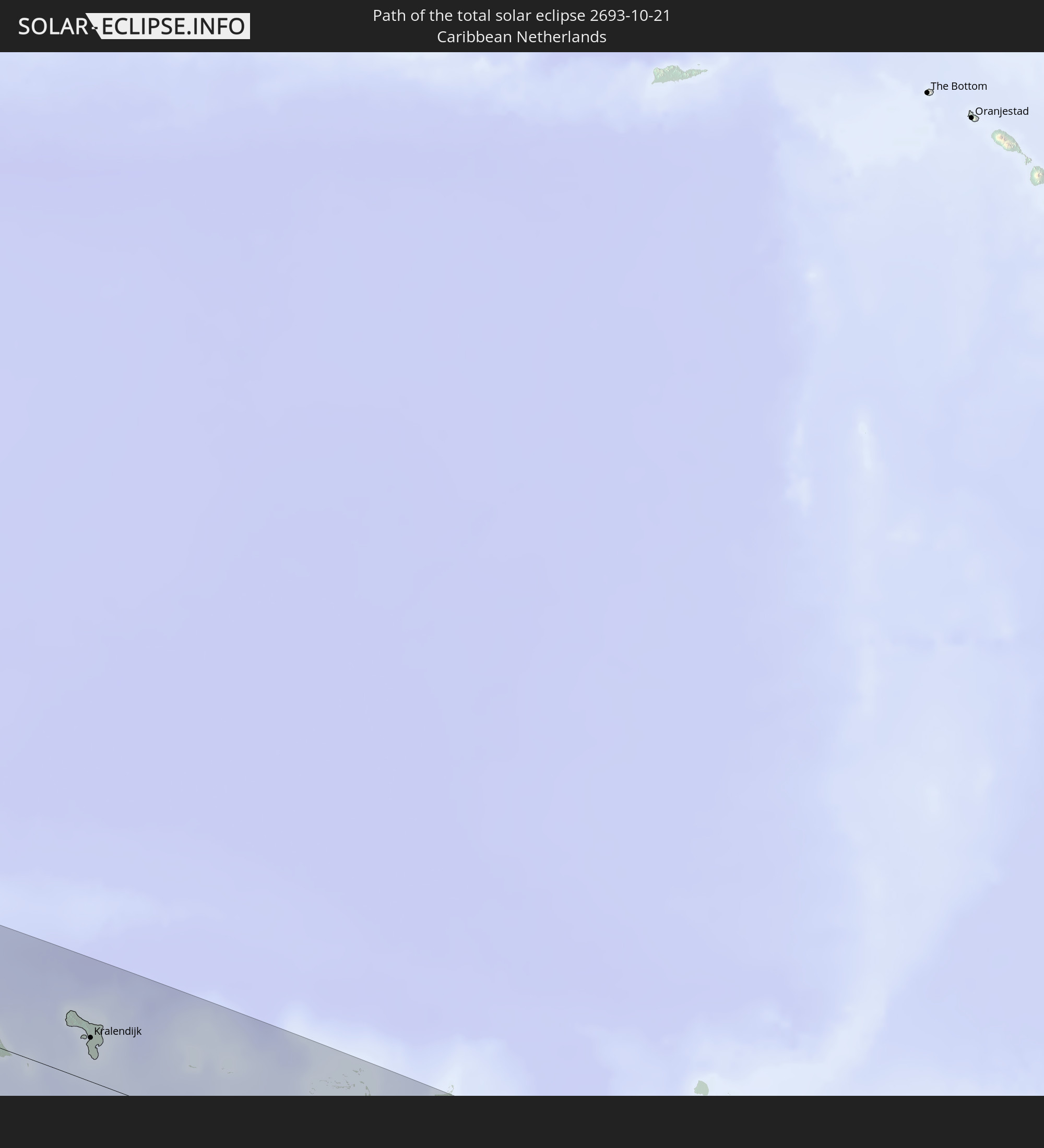 Caribbean Netherlands
In den folgenden Ländern ist die Sonnenfinsternis partiell zu sehen
 Antarctica
 United States
 United States Minor Outlying Islands
 Canada
 Chile
Chile
 Ecuador
 Honduras
 Nicaragua
 Costa Rica
 Cuba
Cuba
 Panama
 Colombia
 Cayman Islands
 Peru
Peru
 The Bahamas
 Jamaica
 Haiti
Haiti
 Brazil
 Argentina
 Venezuela
 Turks and Caicos Islands
 Dominican Republic
 Aruba
Aruba
 Bolivia
 Puerto Rico
 United States Virgin Islands
 Bermuda
 British Virgin Islands
 Anguilla
 Collectivity of Saint Martin
 Saint Barthélemy
 Saint Kitts and Nevis
 Paraguay
 Antigua and Barbuda
 Montserrat
 Trinidad and Tobago
 Guadeloupe
 Grenada
 Dominica
 Saint Vincent and the Grenadines
 Guyana
 Martinique
 Saint Lucia
 Barbados
 Uruguay
 Suriname
 French Guiana
 South Georgia and the South Sandwich Islands
 Cabo Verde
 Senegal
 The Gambia
 Guinea-Bissau
 Guinea
 Saint Helena, Ascension and Tristan da Cunha
 Sierra Leone
 Liberia
 Ivory Coast
 Bouvet Island
 Angola
 Namibia
 Democratic Republic of the Congo
 South Africa
 Botswana
 Zambia
 Zimbabwe
 Lesotho
 Tanzania
 Mozambique
 Swaziland
 Malawi
 French Southern and Antarctic Lands
 Madagascar
 Comoros
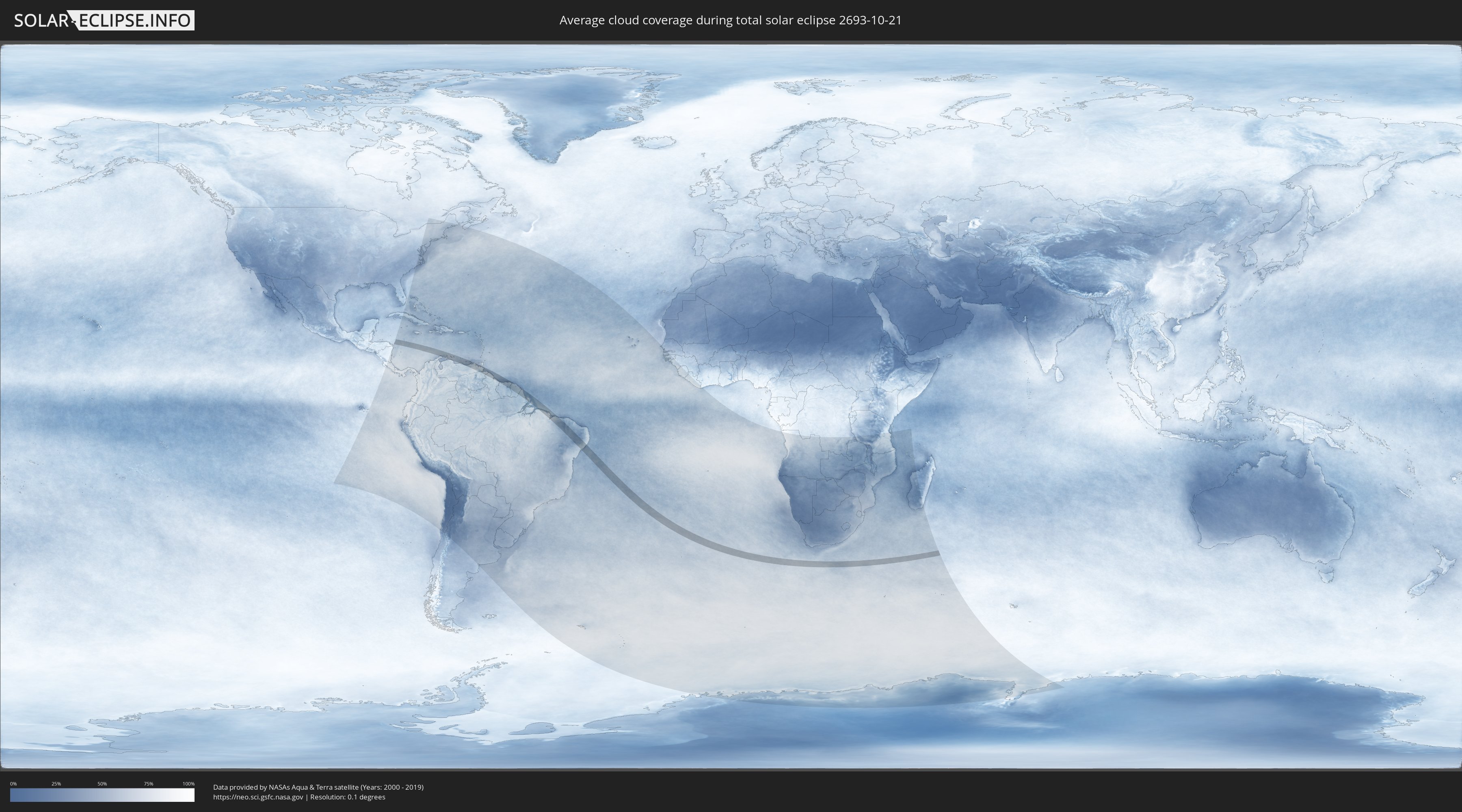
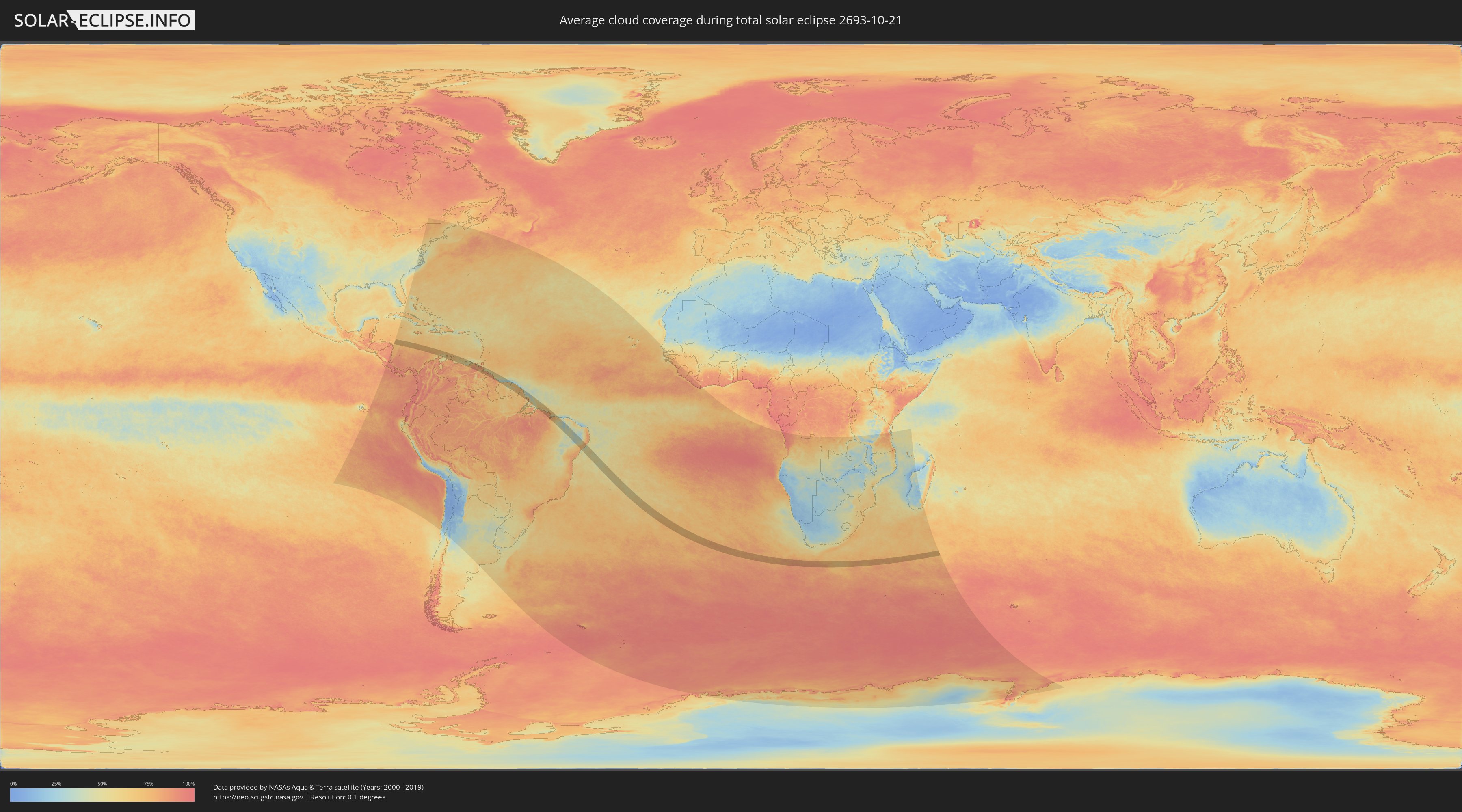
How will be the weather during the total solar eclipse on 10/21/2693?
Where is the best place to see the total solar eclipse of 10/21/2693?
The following maps show the average cloud coverage for the day of the total solar eclipse.
With the help of these maps, it is possible to find the place along the eclipse path, which has the best
chance of a cloudless sky.
Nevertheless, you should consider local circumstances and inform about the weather of your chosen
observation site.
The data is provided by NASAs satellites
AQUA and TERRA.
The cloud maps are averaged over a period of 19 years (2000 - 2019).
Detailed country maps
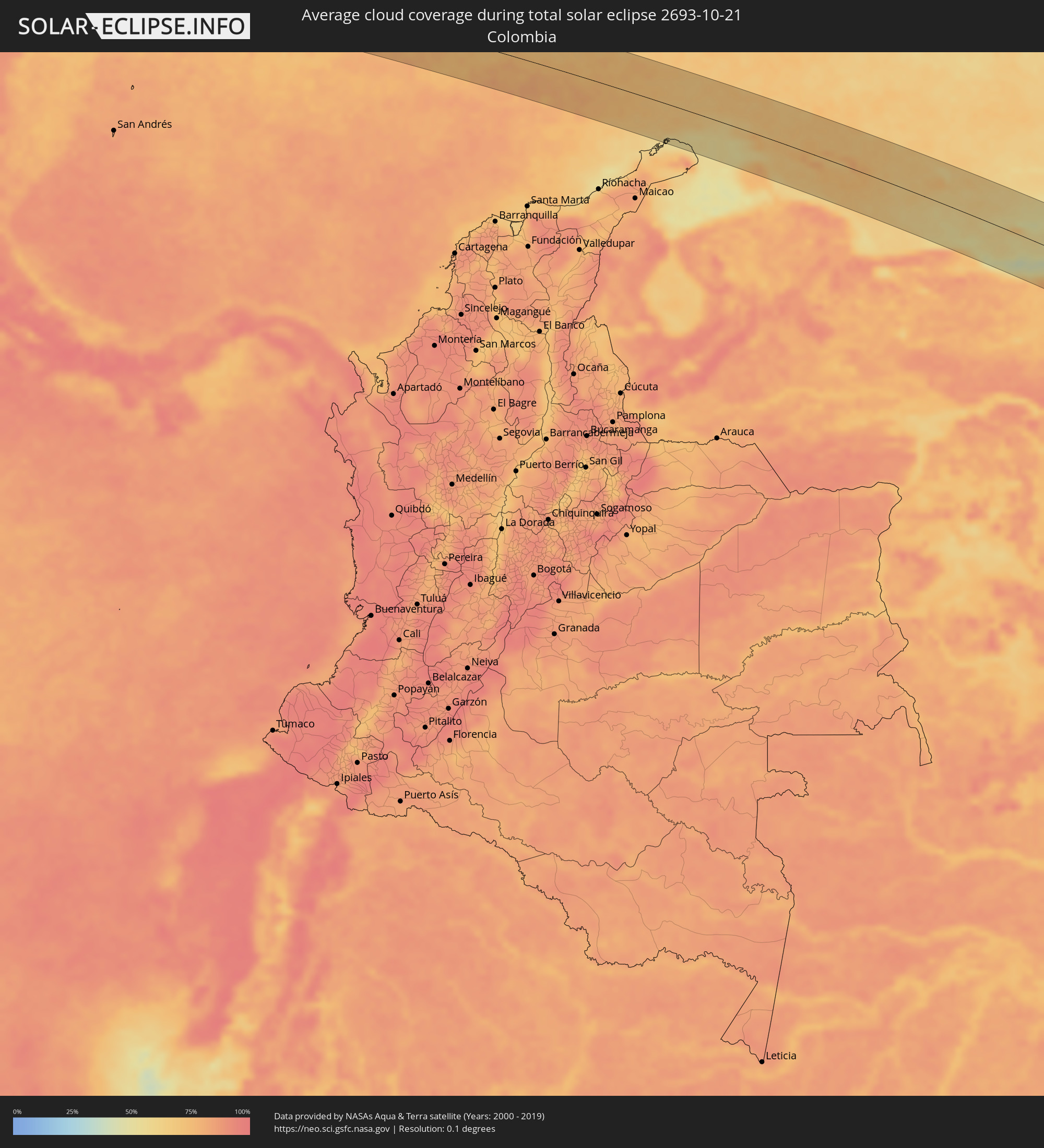 Colombia
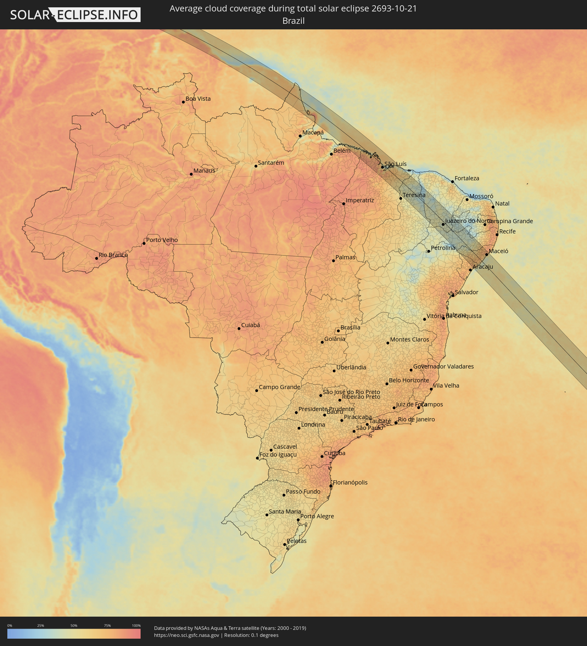 Brazil
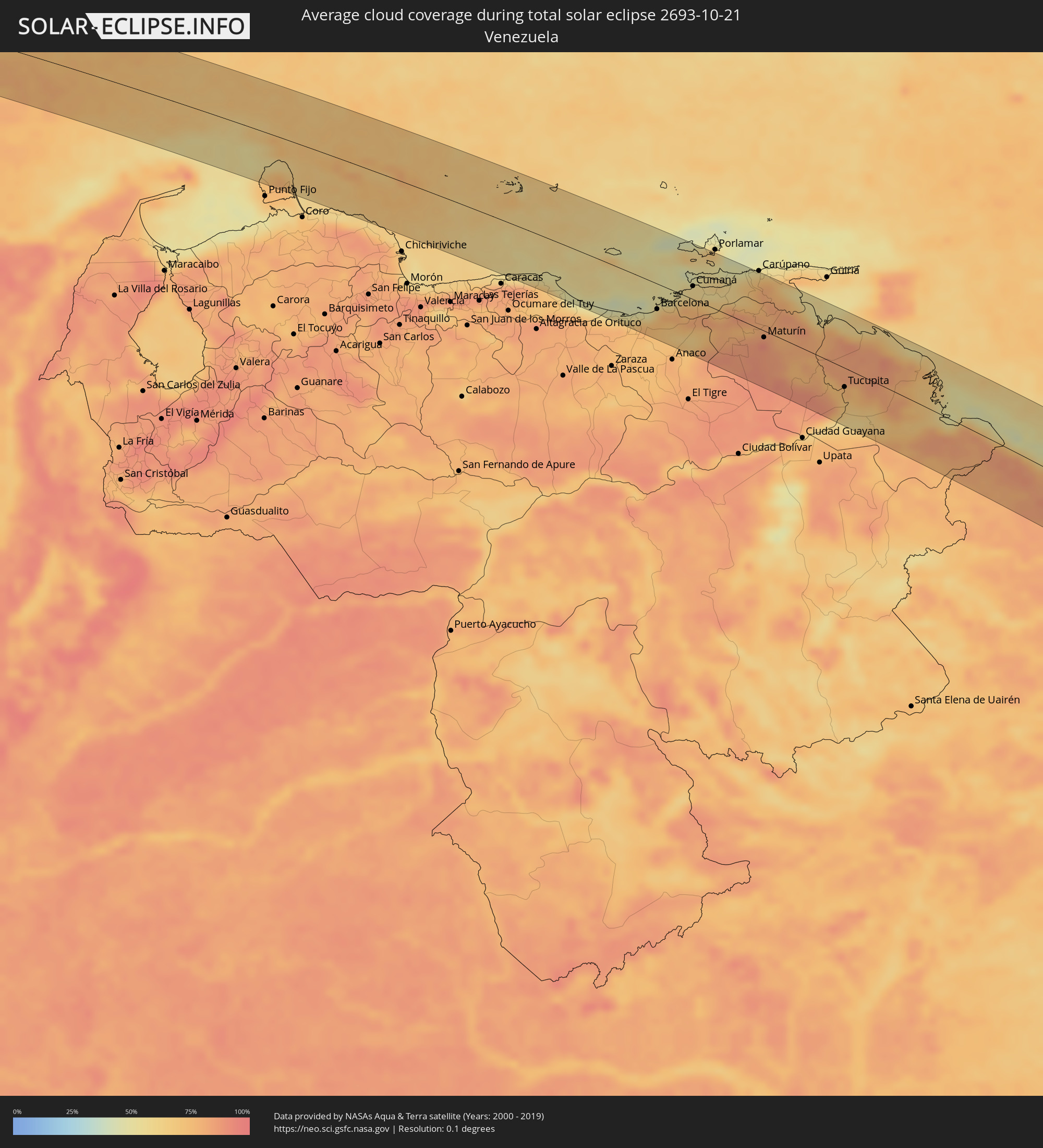 Venezuela
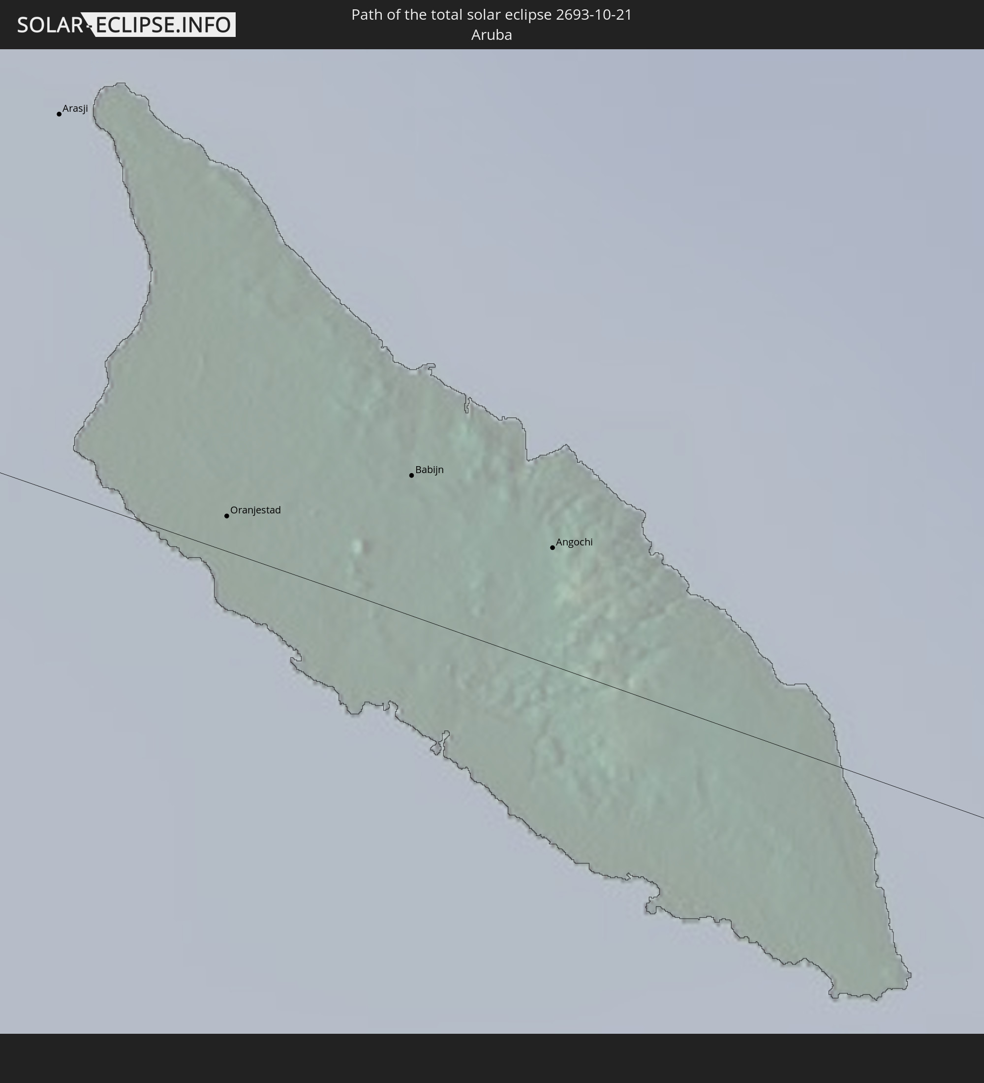
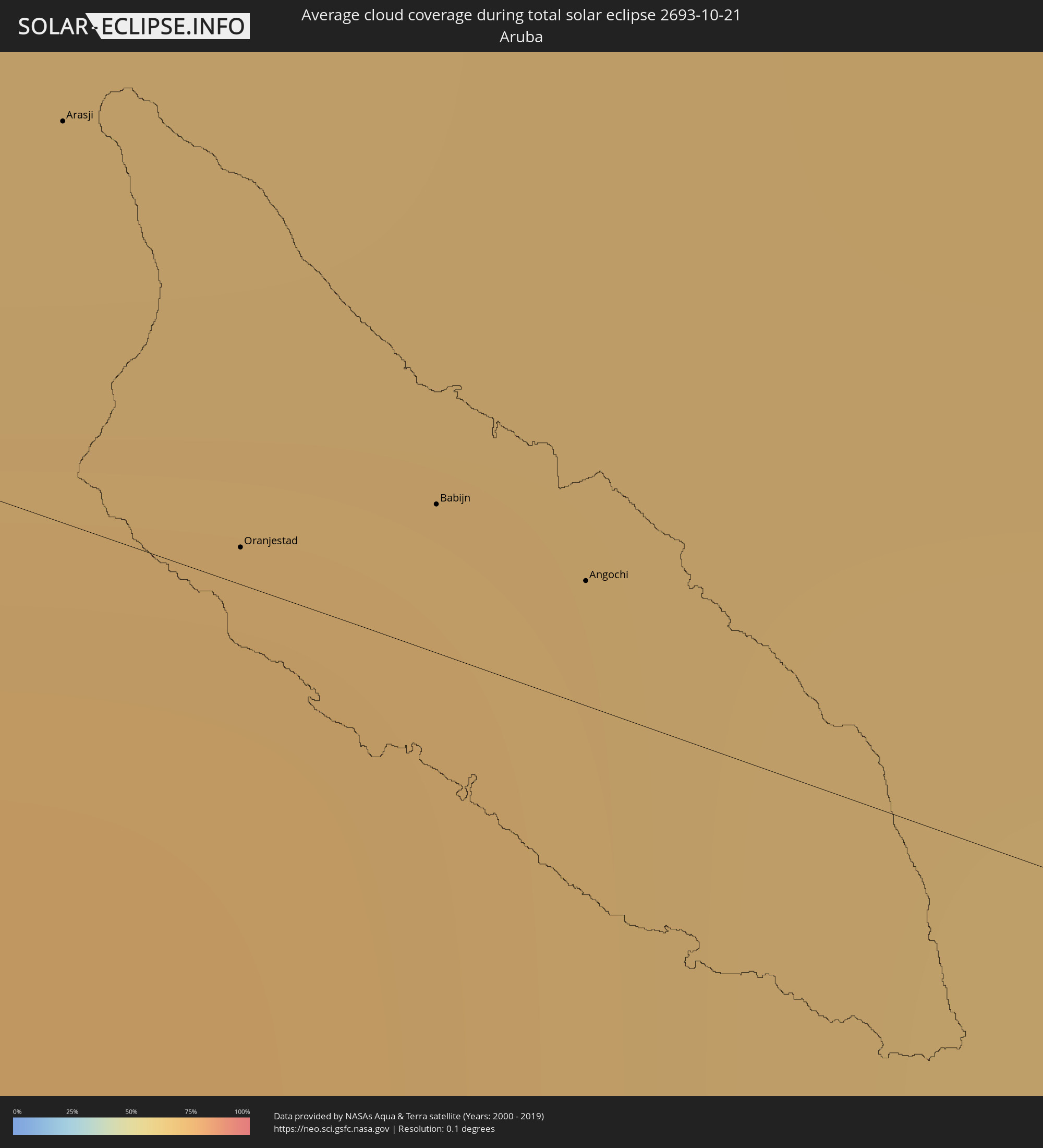 Aruba
Aruba
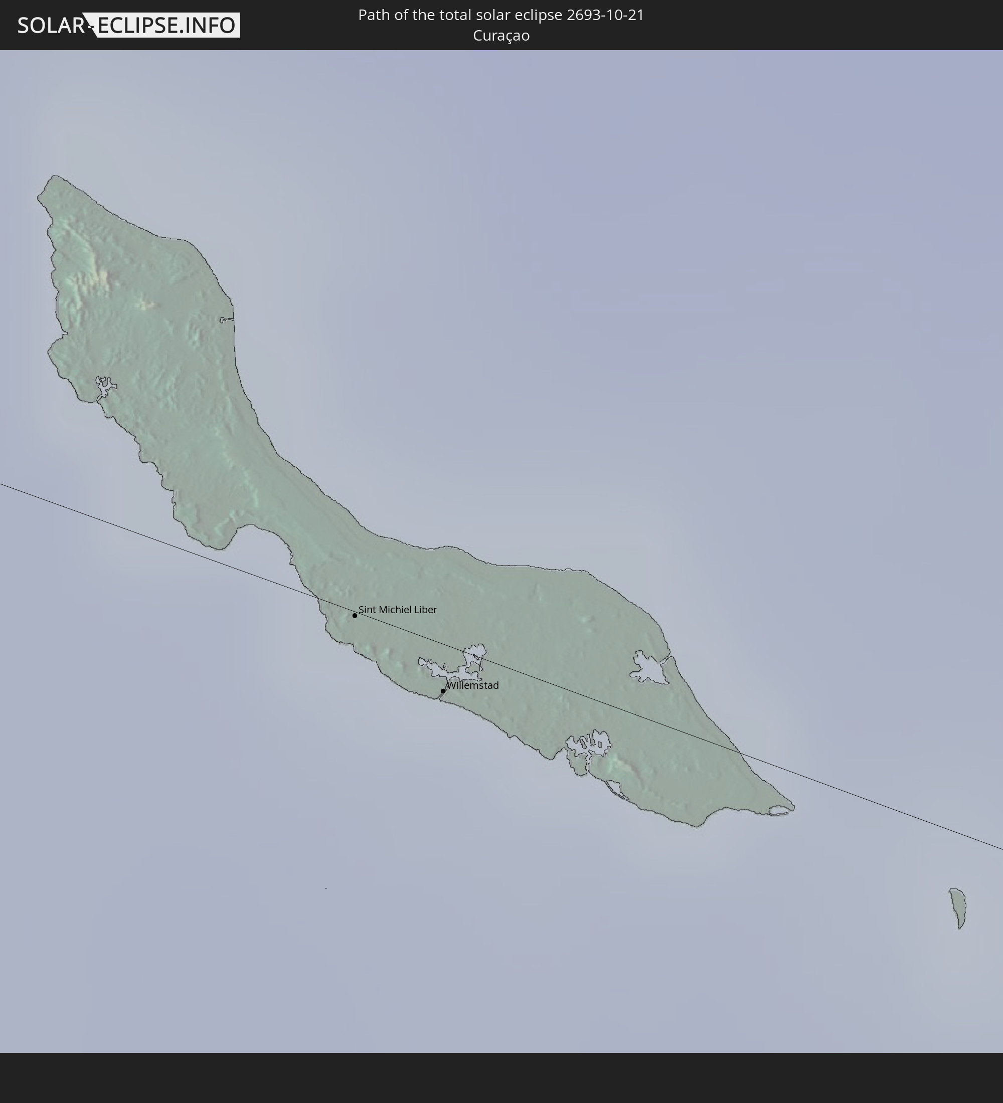
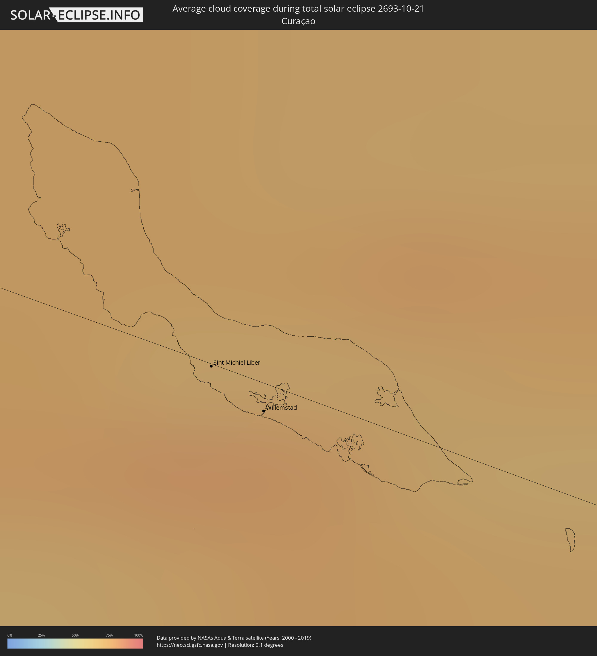 Curaçao
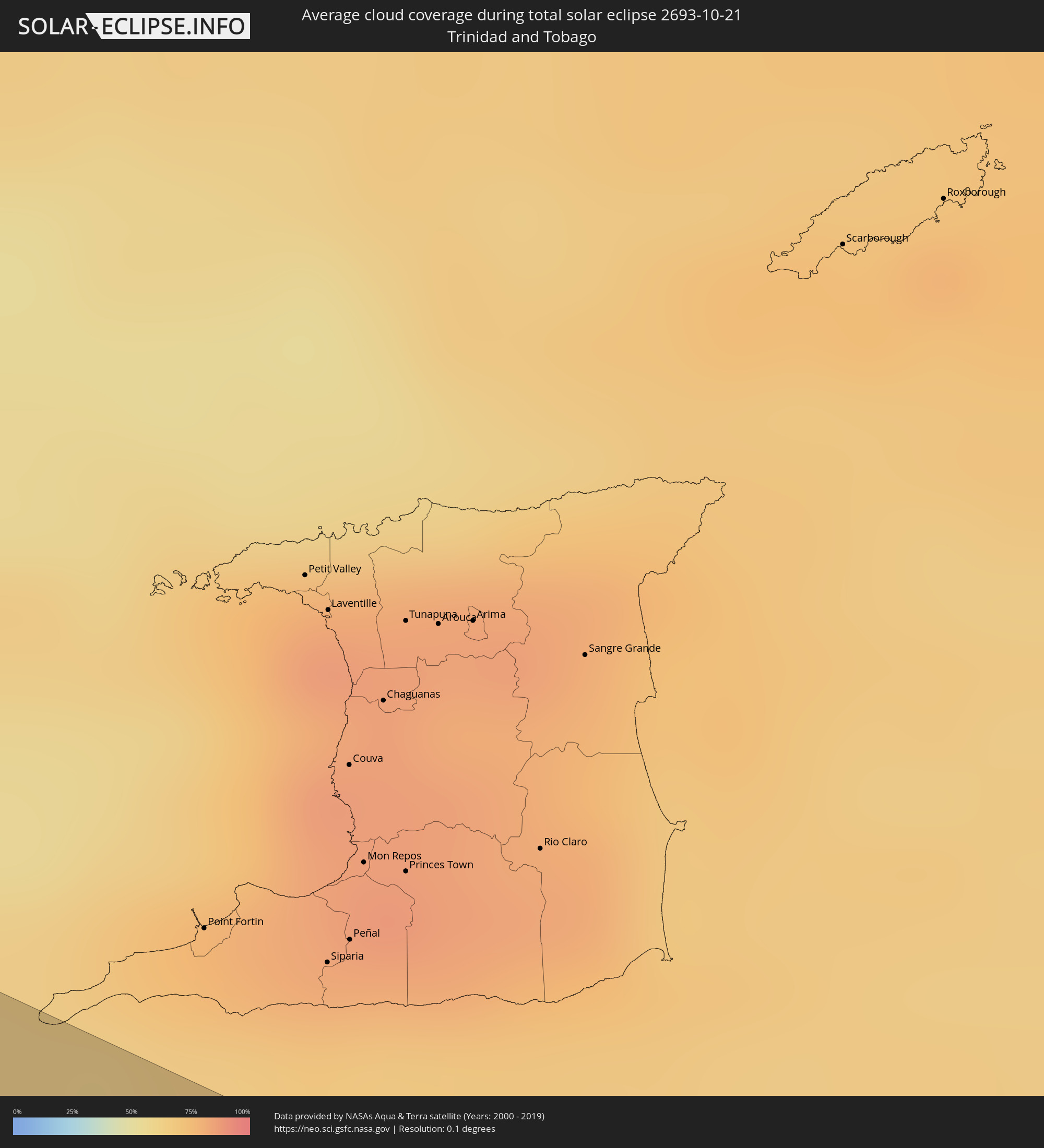 Trinidad and Tobago
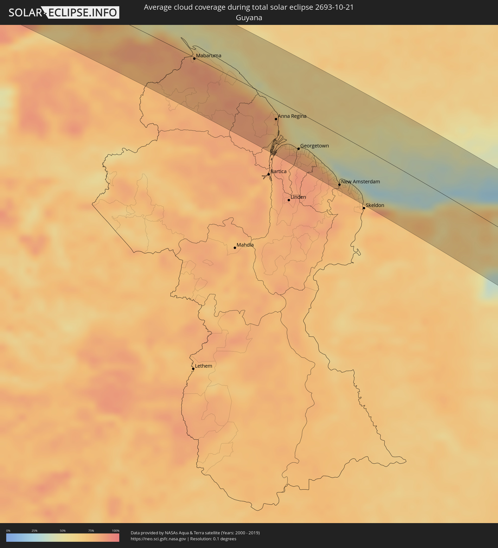 Guyana
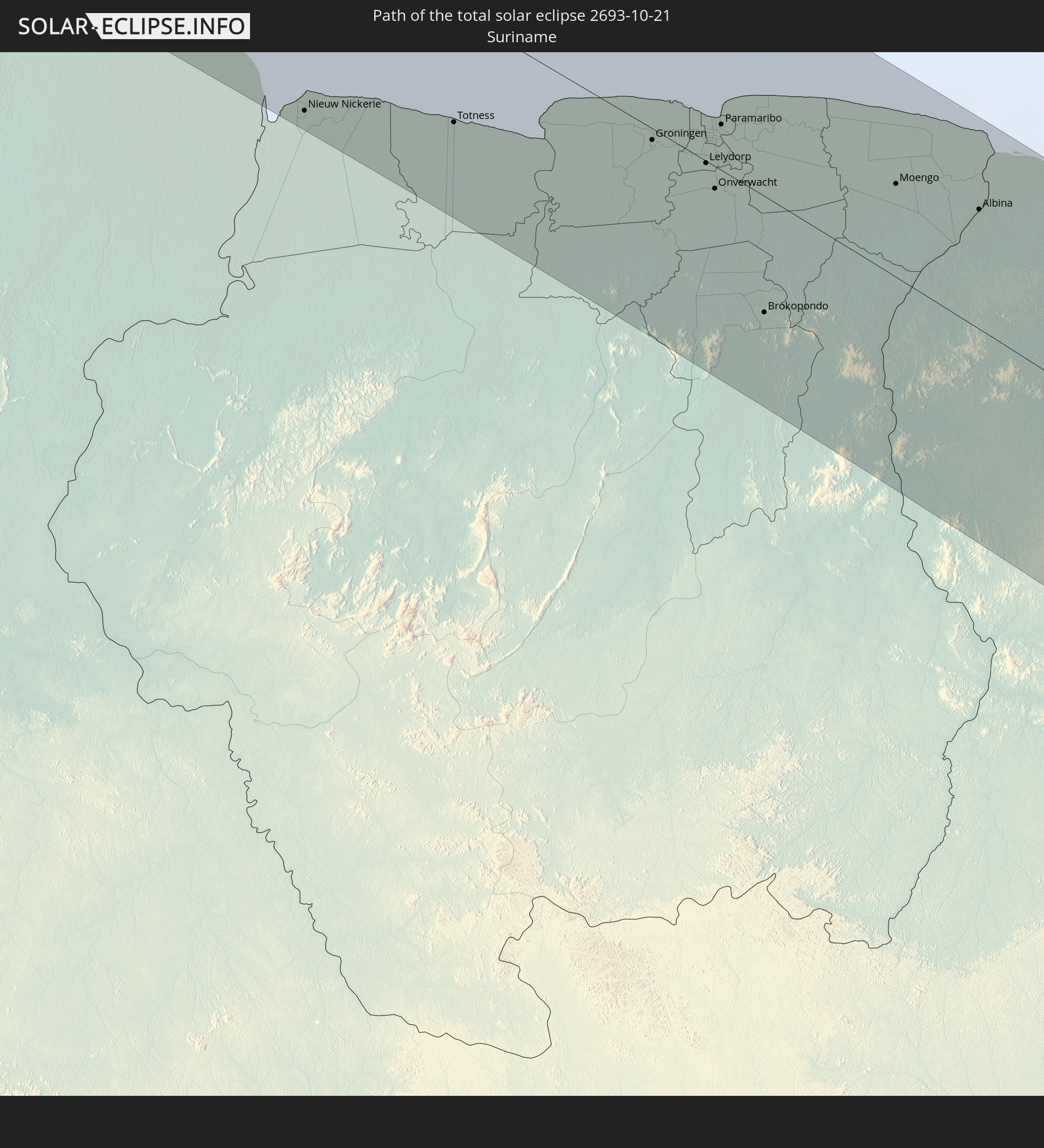
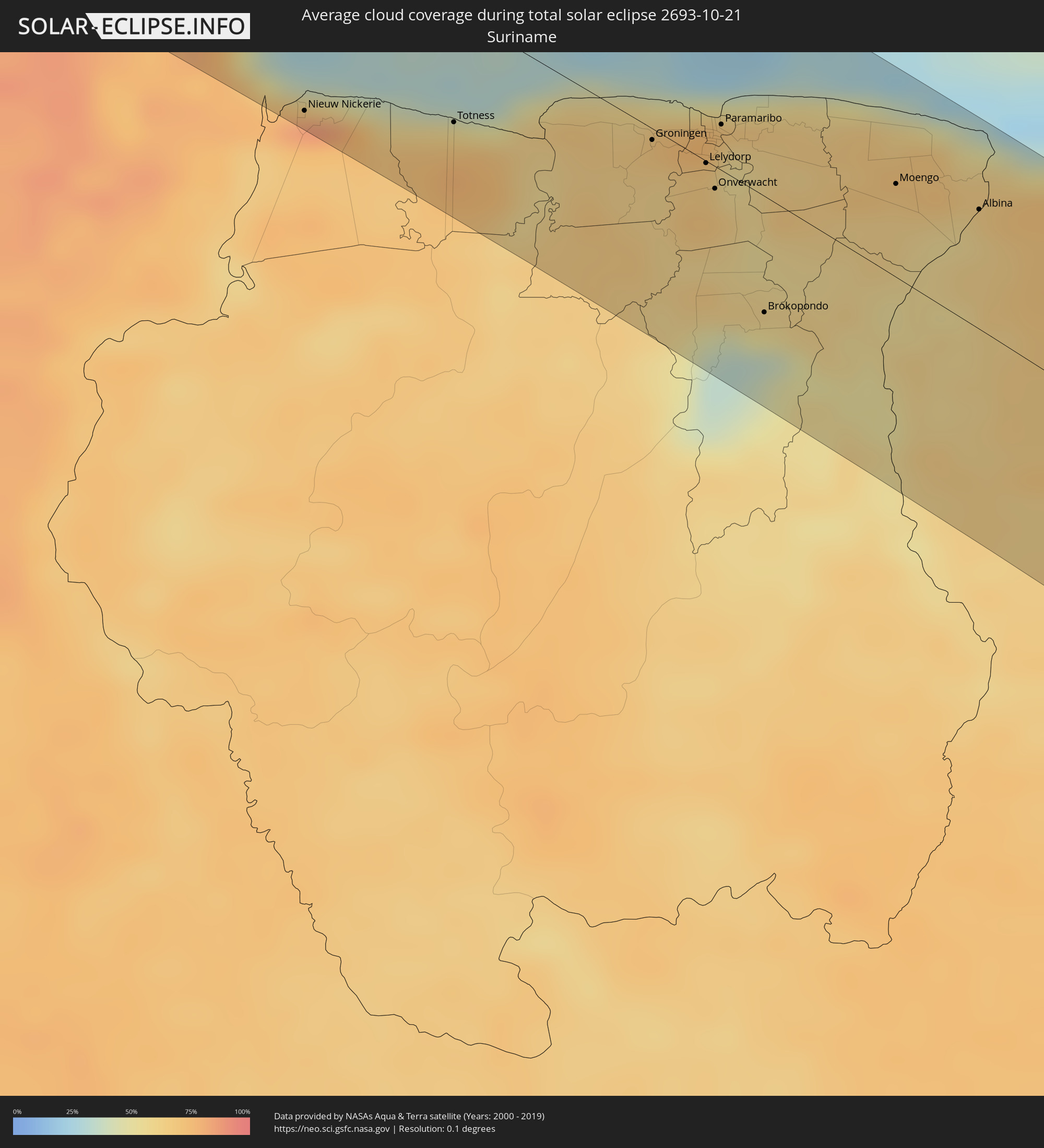 Suriname
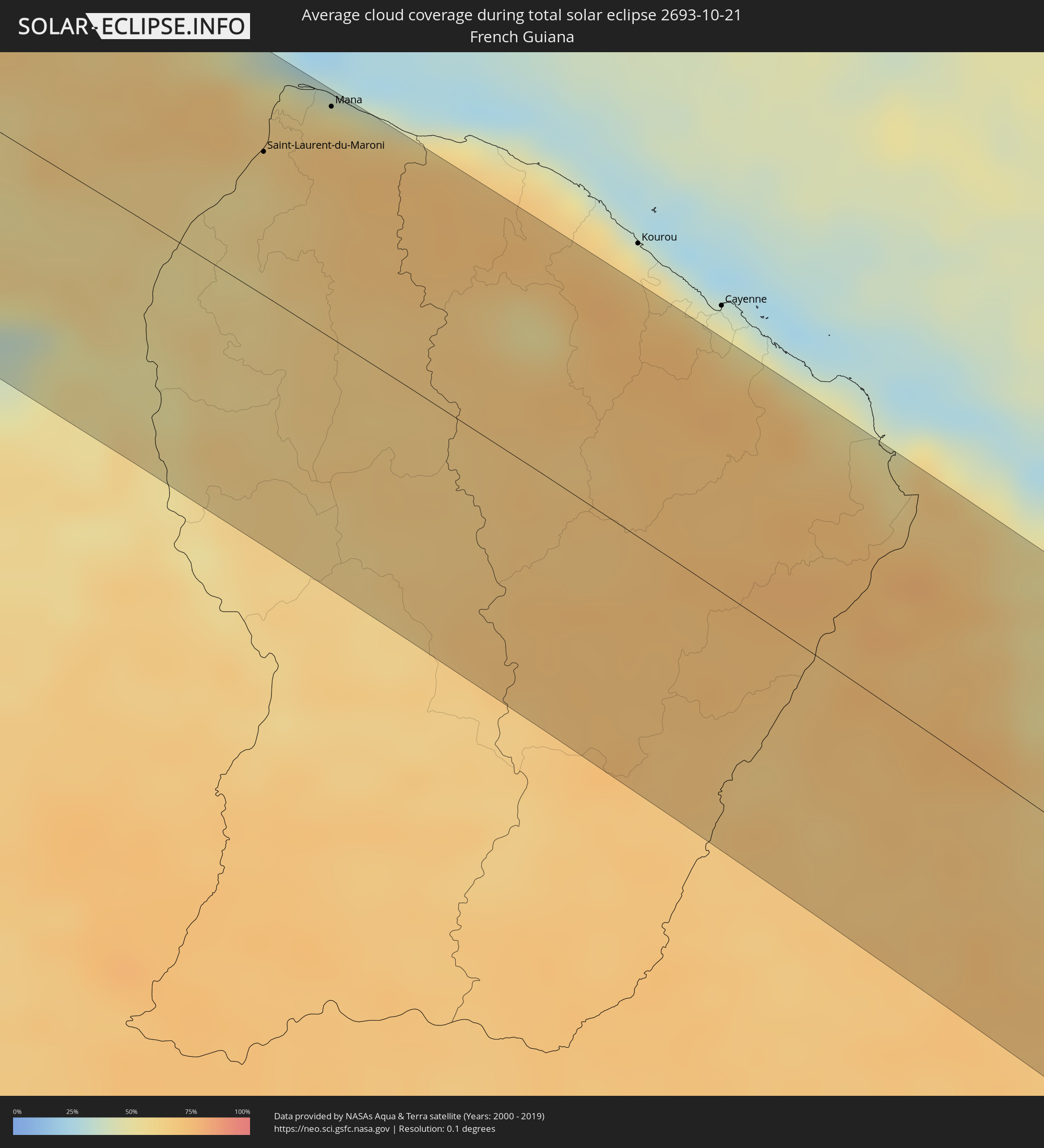 French Guiana
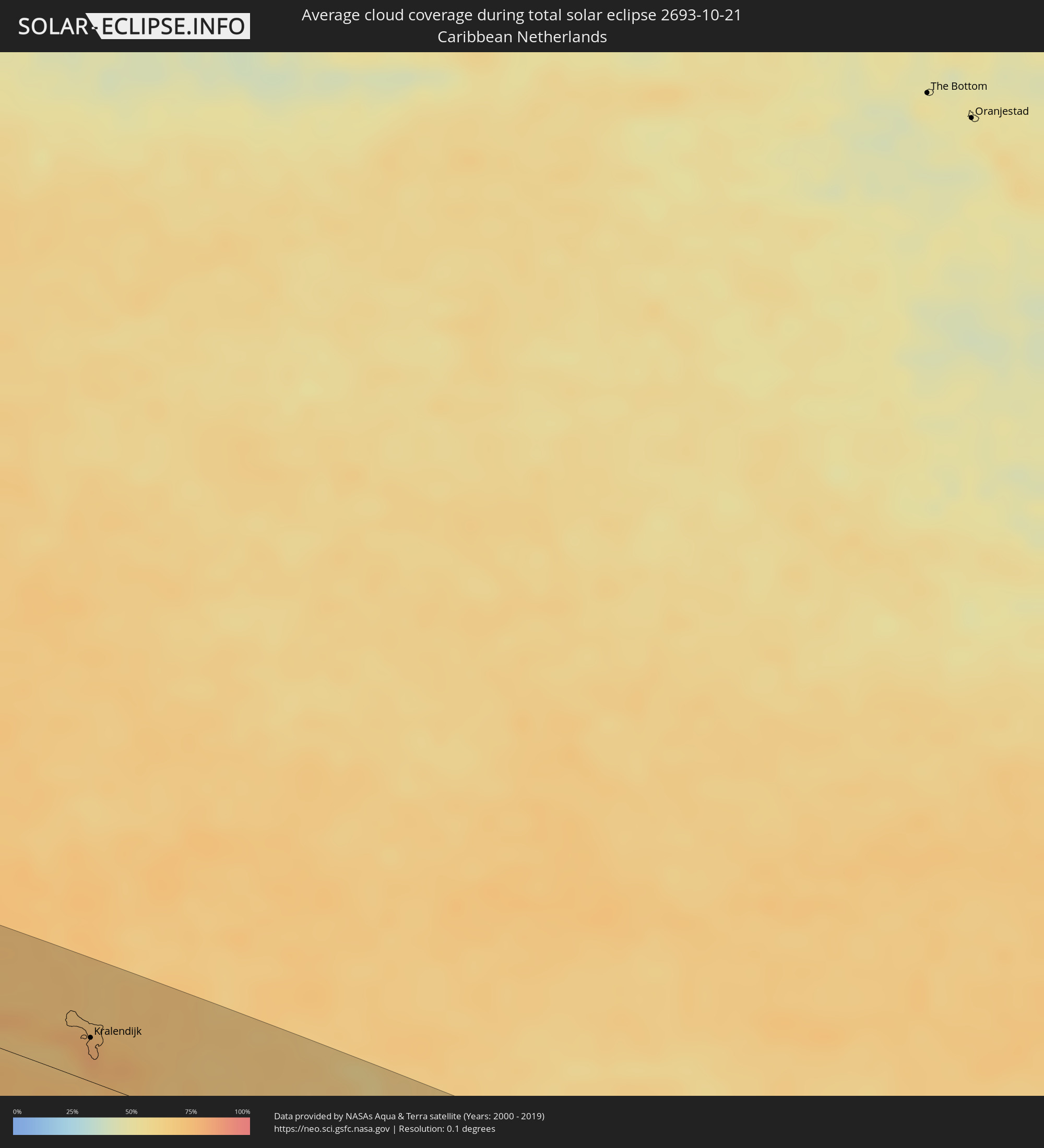 Caribbean Netherlands
Cities inside the path of the eclipse
The following table shows all locations with a population of more than 5,000 inside the eclipse path. Cities which have more than 100,000 inhabitants are marked bold. A click at the locations opens a detailed map.
| City | Type | Eclipse duration | Local time of max. eclipse | Distance to central line | Ø Cloud coverage |
|
Arasji
|
total | - | 07:31:26 UTC-04:00 | 9 km | 75% |
|
Oranjestad
|
total | - | 07:31:31 UTC-04:00 | 1 km | 73% |
|
Babijn
|
total | - | 07:31:31 UTC-04:00 | 3 km | 73% |
|
Angochi
|
total | - | 07:31:32 UTC-04:00 | 3 km | 73% |
 Sint Michiel Liber
|
total | - | 07:32:04 UTC-04:00 | 0 km | 78% |
|
Willemstad
|
total | - | 07:32:06 UTC-04:00 | 3 km | 75% |
 Kralendijk, Bonaire
|
total | - | 07:32:16 UTC-04:00 | 27 km | 79% |
|
Barcelona, Anzoátegui
|
total | - | 07:35:12 UTC-04:00 | 36 km | 74% |
|
Puerto La Cruz, Anzoátegui
|
total | - | 07:35:09 UTC-04:00 | 25 km | 77% |
|
Cumaná, Sucre
|
total | - | 07:35:08 UTC-04:00 | 18 km | 59% |
|
Maturín, Monagas
|
total | - | 07:36:13 UTC-04:00 | 9 km | 87% |
|
Tucupita, Delta Amacuro
|
total | - | 07:37:25 UTC-04:00 | 27 km | 74% |
|
Mabaruma, Barima-Waini
|
total | - | 07:39:31 UTC-04:00 | 2 km | 86% |
|
Anna Regina, Pomeroon-Supenaam
|
total | - | 07:41:17 UTC-04:00 | 29 km | 78% |
|
Vreed-en-Hoop, Essequibo Islands-West Demerara
|
total | - | 07:41:58 UTC-04:00 | 57 km | 83% |
|
Georgetown, Demerara-Mahaica
|
total | - | 07:42:00 UTC-04:00 | 55 km | 83% |
|
Fort Wellington, Mahaica-Berbice
|
total | - | 07:42:50 UTC-04:00 | 66 km | 72% |
|
Rosignol, Mahaica-Berbice
|
total | - | 07:43:01 UTC-04:00 | 74 km | 76% |
|
New Amsterdam, East Berbice-Corentyne
|
total | - | 07:43:03 UTC-04:00 | 75 km | 77% |
|
Nieuw Nickerie, Nickerie
|
total | - | 08:43:48 UTC-03:00 | 77 km | 82% |
|
Totness, Coronie
|
total | - | 08:44:20 UTC-03:00 | 46 km | 55% |
|
Groningen, Saramacca
|
total | - | 08:45:03 UTC-03:00 | 5 km | 66% |
|
Lelydorp, Wanica
|
total | - | 08:45:21 UTC-03:00 | 1 km | 66% |
|
Onverwacht, Para
|
total | - | 08:45:31 UTC-03:00 | 9 km | 66% |
|
Paramaribo, Paramaribo
|
total | - | 08:45:12 UTC-03:00 | 19 km | 72% |
|
Nieuw Amsterdam, Commewijne
|
total | - | 08:45:14 UTC-03:00 | 25 km | 67% |
|
Brokopondo, Brokopondo
|
total | - | 08:46:19 UTC-03:00 | 48 km | 60% |
|
Moengo, Marowijne
|
total | - | 08:46:06 UTC-03:00 | 38 km | 66% |
|
Albina, Marowijne
|
total | - | 08:46:31 UTC-03:00 | 49 km | 60% |
|
Saint-Laurent-du-Maroni, Guyane
|
total | - | 08:46:32 UTC-03:00 | 50 km | 64% |
|
Mana, Guyane
|
total | - | 08:46:32 UTC-03:00 | 80 km | 52% |
|
Salinópolis, Pará
|
total | - | 09:01:23 UTC-03:00 | 75 km | 71% |
|
Bragança, Pará
|
total | - | 09:02:44 UTC-03:00 | 72 km | 83% |
|
Pinheiro, Maranhão
|
total | - | 09:07:05 UTC-03:00 | 76 km | 83% |
|
São Luís, Maranhão
|
total | - | 09:08:02 UTC-03:00 | 20 km | 75% |
|
Chapadinha, Maranhão
|
total | - | 09:11:16 UTC-03:00 | 50 km | 61% |
|
Coelho Neto, Maranhão
|
total | - | 09:12:36 UTC-03:00 | 67 km | 52% |
|
Campo Maior, Piauí
|
total | - | 09:14:42 UTC-03:00 | 50 km | 43% |
|
Piripiri, Piauí
|
total | - | 09:14:14 UTC-03:00 | 25 km | 43% |
|
Crateús, Ceará
|
total | - | 09:17:20 UTC-03:00 | 36 km | 41% |
|
Juazeiro do Norte, Ceará
|
total | - | 09:22:59 UTC-03:00 | 20 km | 43% |
|
Iguatu, Ceará
|
total | - | 09:21:25 UTC-03:00 | 49 km | 44% |
|
Salgueiro, Pernambuco
|
total | - | 09:24:53 UTC-03:00 | 72 km | 43% |
|
Cajazeiras, Paraíba
|
total | - | 09:23:28 UTC-03:00 | 65 km | 33% |
|
Serra Talhada, Pernambuco
|
total | - | 09:25:56 UTC-03:00 | 1 km | 36% |
|
Delmiro Gouveia, Alagoas
|
total | - | 09:29:03 UTC-03:00 | 86 km | 51% |
|
Arcoverde, Pernambuco
|
total | - | 09:28:36 UTC-03:00 | 64 km | 38% |
|
Arapiraca, Alagoas
|
total | - | 09:31:47 UTC-03:00 | 8 km | 72% |
|
Penedo, Alagoas
|
total | - | 09:32:57 UTC-03:00 | 43 km | 66% |
|
Garanhuns, Pernambuco
|
total | - | 09:30:20 UTC-03:00 | 72 km | 59% |
|
Coruripe, Alagoas
|
total | - | 09:33:16 UTC-03:00 | 2 km | 56% |
|
São Miguel dos Campos, Alagoas
|
total | - | 09:32:43 UTC-03:00 | 35 km | 69% |
|
União dos Palmares, Alagoas
|
total | - | 09:31:36 UTC-03:00 | 88 km | 77% |
|
Marechal Deodoro, Alagoas
|
total | - | 09:32:53 UTC-03:00 | 56 km | 51% |
|
Rio Largo, Alagoas
|
total | - | 09:32:30 UTC-03:00 | 78 km | 75% |
|
Maceió, Alagoas
|
total | - | 09:33:03 UTC-03:00 | 73 km | 46% |