Annular solar eclipse of 05/19/2748
| Day of week: | Wednesday |
| Maximum duration of eclipse: | 02m53s |
| Maximum width of eclipse path: | 213 km |
| Saros cycle: | 169 |
| Coverage: | 96.2% |
| Magnitude: | 0.9624 |
| Gamma: | 0.7709 |
Wo kann man die Sonnenfinsternis vom 05/19/2748 sehen?
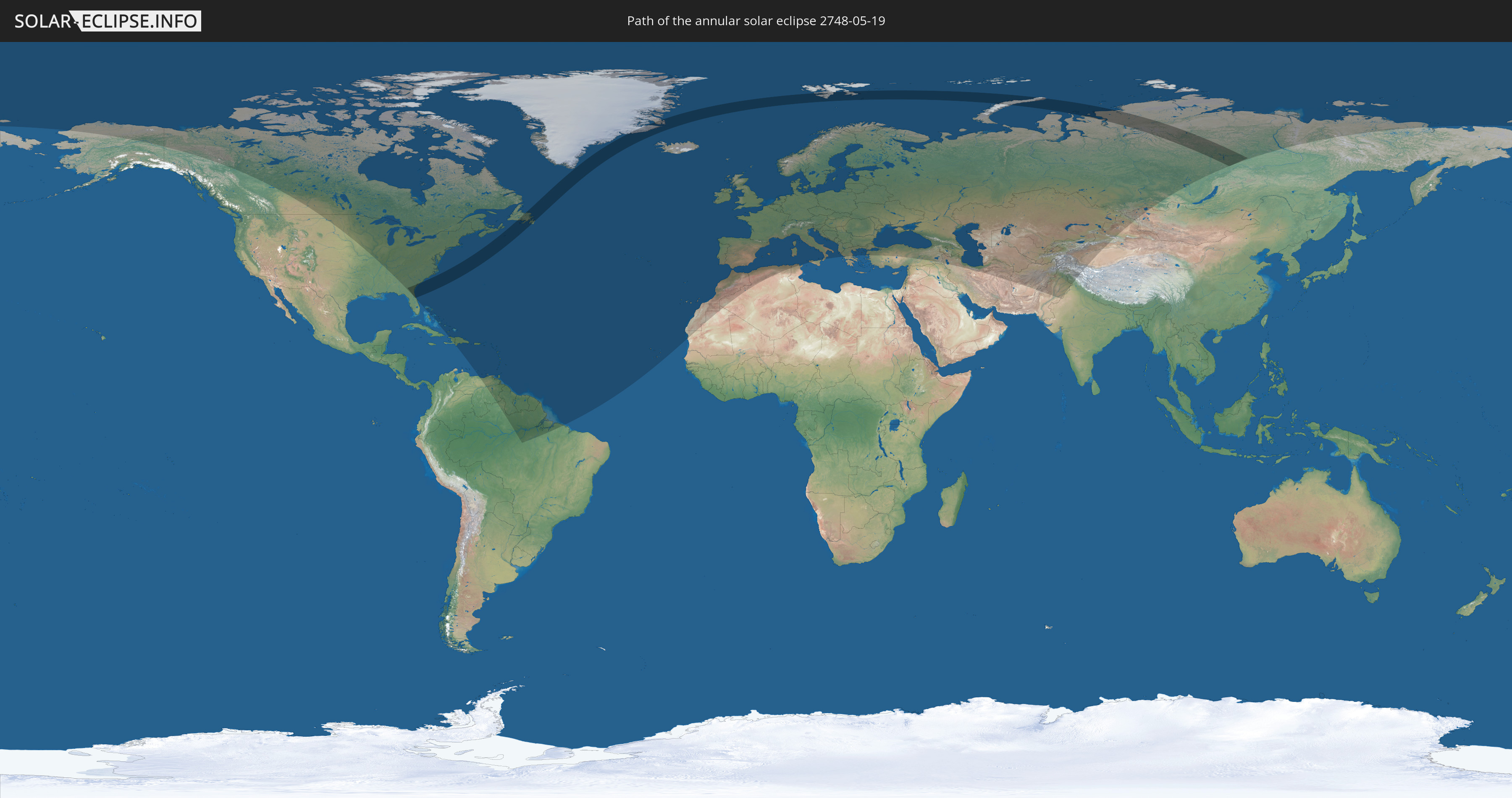
Die Sonnenfinsternis am 05/19/2748 kann man in 101 Ländern als partielle Sonnenfinsternis beobachten.
Der Finsternispfad verläuft durch 6 Länder. Nur in diesen Ländern ist sie als annular Sonnenfinsternis zu sehen.
In den folgenden Ländern ist die Sonnenfinsternis annular zu sehen
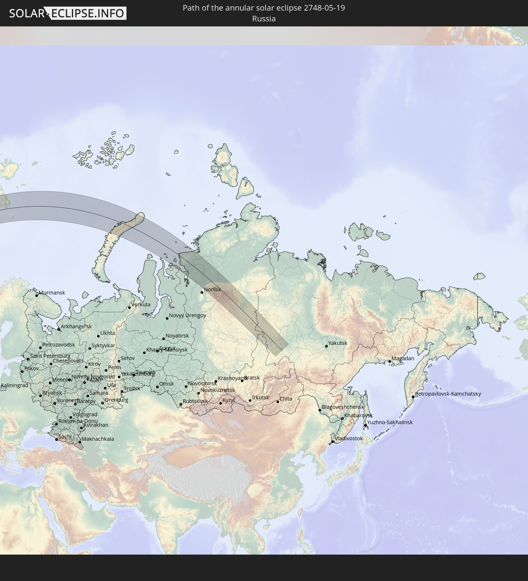 Russia
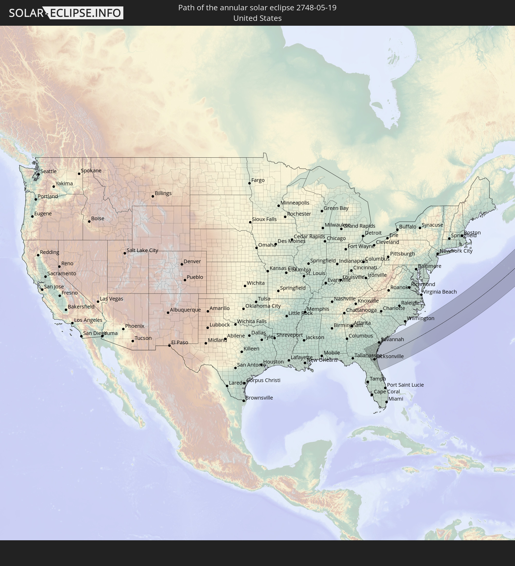 United States
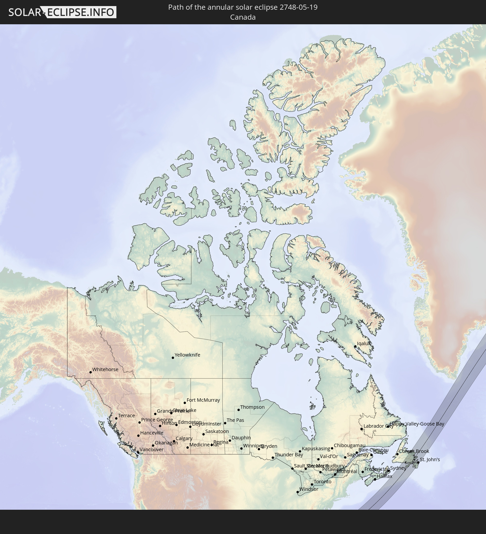 Canada
 Greenland
 Saint Pierre and Miquelon
 Svalbard and Jan Mayen
In den folgenden Ländern ist die Sonnenfinsternis partiell zu sehen
 Russia
 United States
 Canada
 Greenland
 The Bahamas
 Haiti
Haiti
 Brazil
 Venezuela
 Turks and Caicos Islands
 Dominican Republic
 Puerto Rico
 United States Virgin Islands
 Bermuda
 British Virgin Islands
 Anguilla
 Collectivity of Saint Martin
 Saint Barthélemy
 Saint Kitts and Nevis
 Antigua and Barbuda
 Montserrat
 Trinidad and Tobago
 Guadeloupe
 Grenada
 Dominica
 Saint Vincent and the Grenadines
 Guyana
 Martinique
 Saint Lucia
 Barbados
 Suriname
 Saint Pierre and Miquelon
 French Guiana
 Portugal
 Cabo Verde
 Iceland
 Spain
Spain
 Mauritania
 Morocco
 Republic of Ireland
 Svalbard and Jan Mayen
 Algeria
 United Kingdom
 Faroe Islands
 Gibraltar
 France
 Isle of Man
 Guernsey
 Jersey
 Andorra
 Belgium
 Netherlands
 Norway
 Luxembourg
 Germany
 Switzerland
 Italy
Italy
 Monaco
 Tunisia
 Denmark
 Liechtenstein
 Austria
 Sweden
 Czechia
 San Marino
 Vatican City
 Slovenia
 Croatia
 Poland
 Bosnia and Herzegovina
 Hungary
 Slovakia
 Montenegro
 Serbia
 Albania
 Åland Islands
 Greece
 Romania
 Republic of Macedonia
 Finland
 Lithuania
 Latvia
 Estonia
 Ukraine
 Bulgaria
 Belarus
 Turkey
 Moldova
 Georgia
 Armenia
 Iran
Iran
 Azerbaijan
 Kazakhstan
 Turkmenistan
 Uzbekistan
 Afghanistan
 Pakistan
 Tajikistan
 India
India
 Kyrgyzstan
 China
China
 Mongolia
How will be the weather during the annular solar eclipse on 05/19/2748?
Where is the best place to see the annular solar eclipse of 05/19/2748?
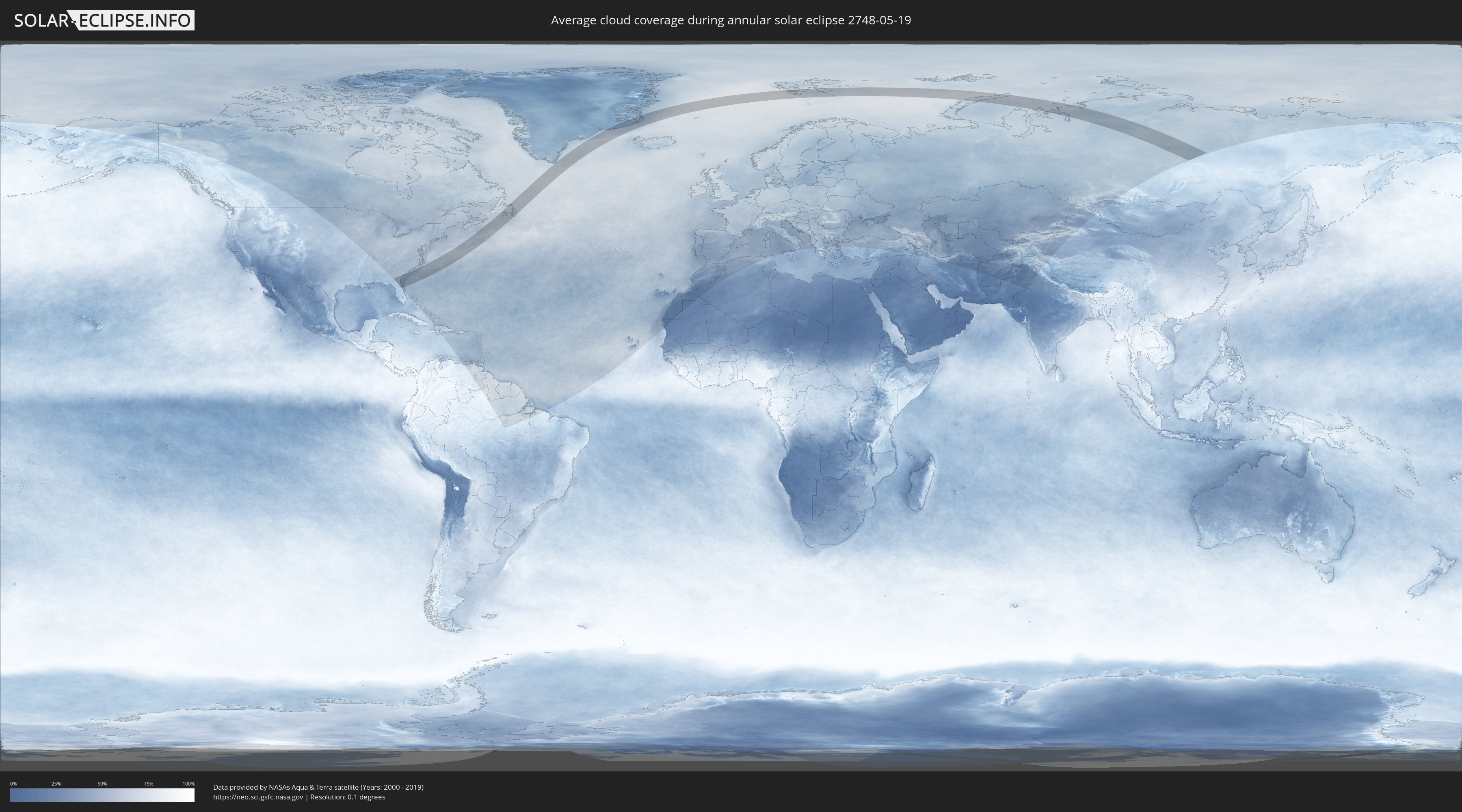
The following maps show the average cloud coverage for the day of the annular solar eclipse.
With the help of these maps, it is possible to find the place along the eclipse path, which has the best
chance of a cloudless sky.
Nevertheless, you should consider local circumstances and inform about the weather of your chosen
observation site.
The data is provided by NASAs satellites
AQUA and TERRA.
The cloud maps are averaged over a period of 19 years (2000 - 2019).

Detailed country maps
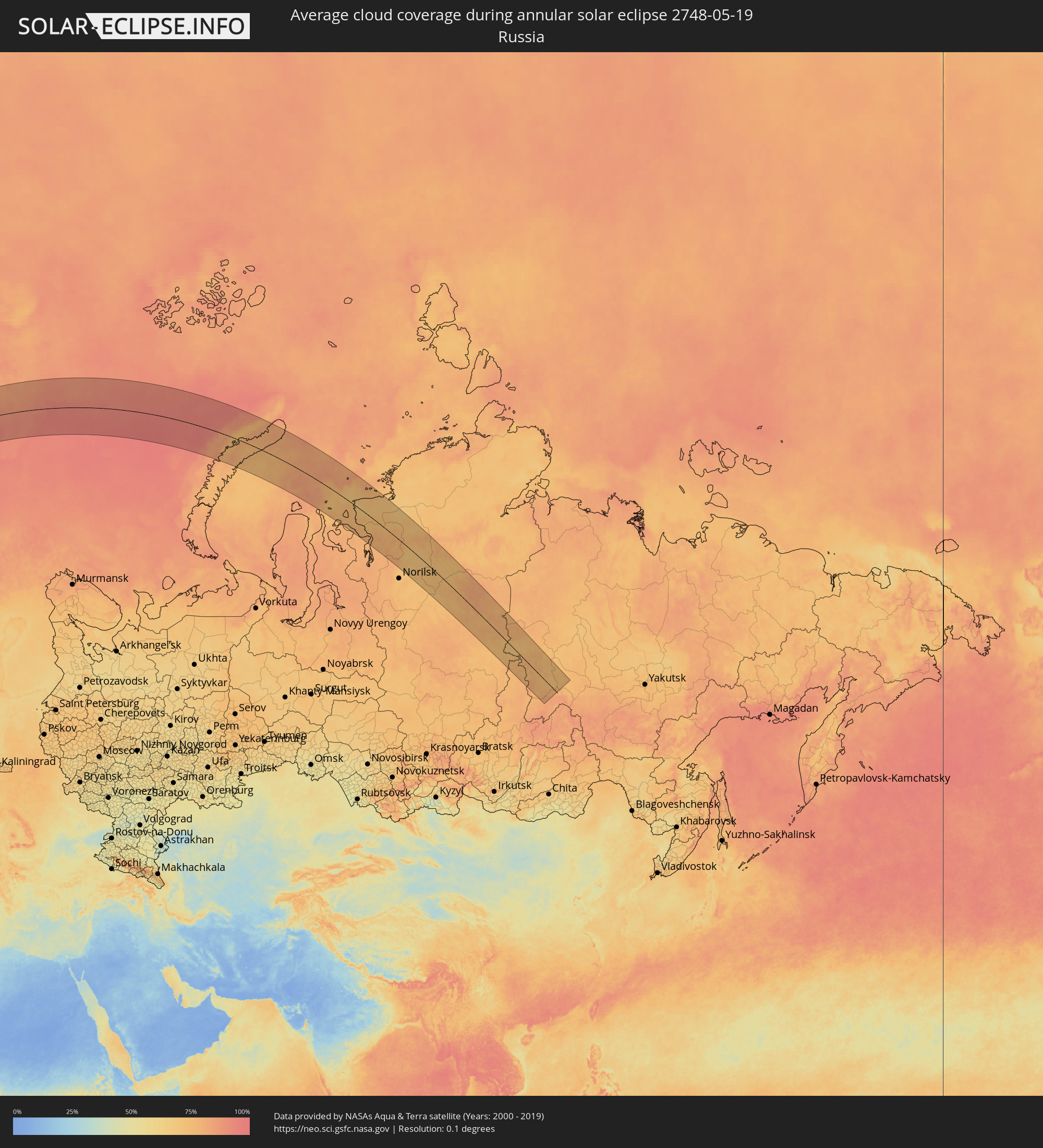 Russia
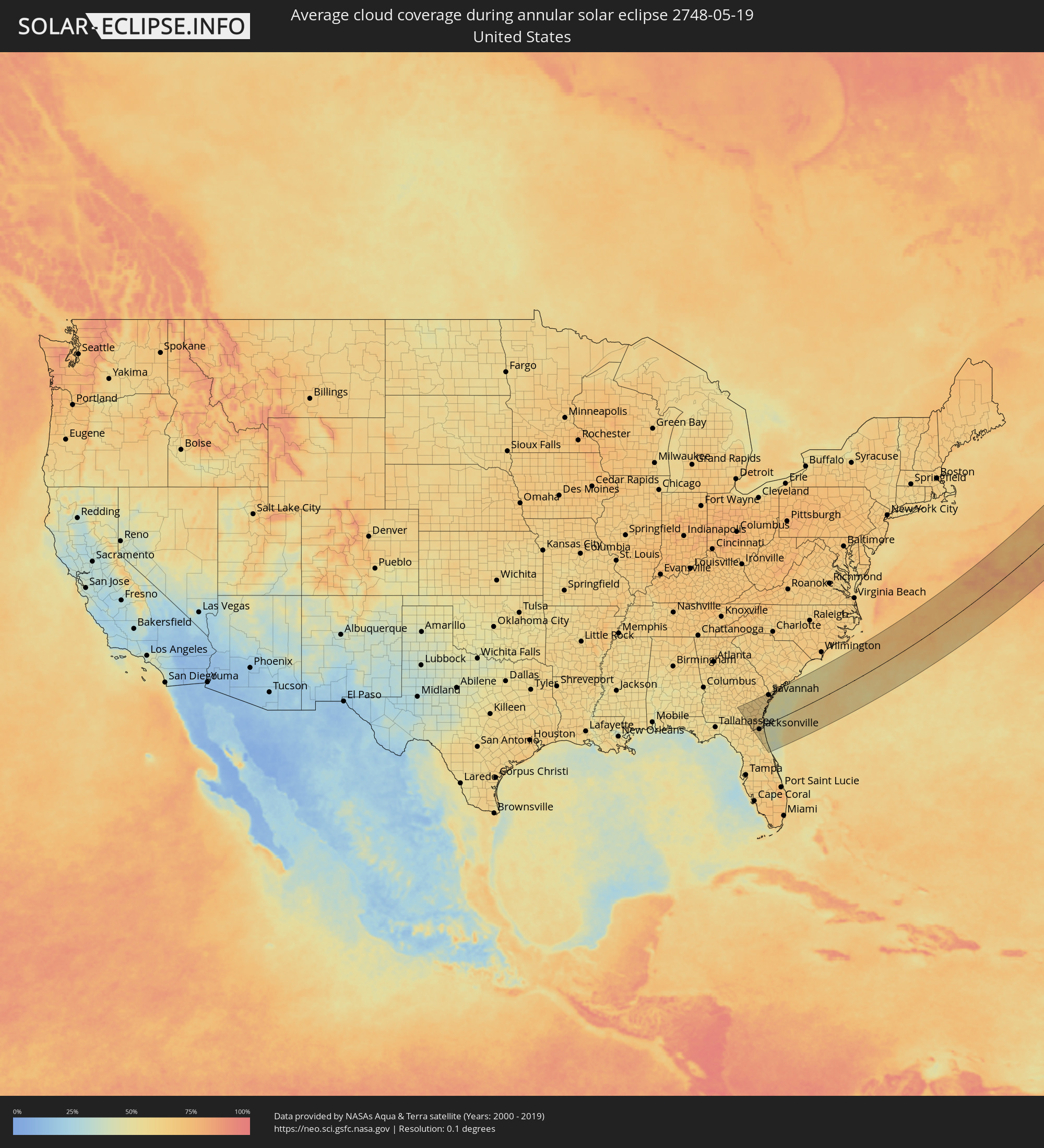 United States
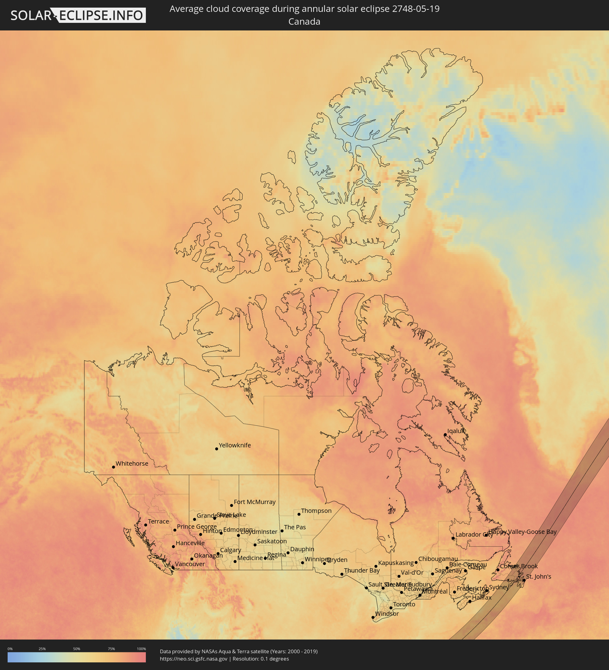 Canada
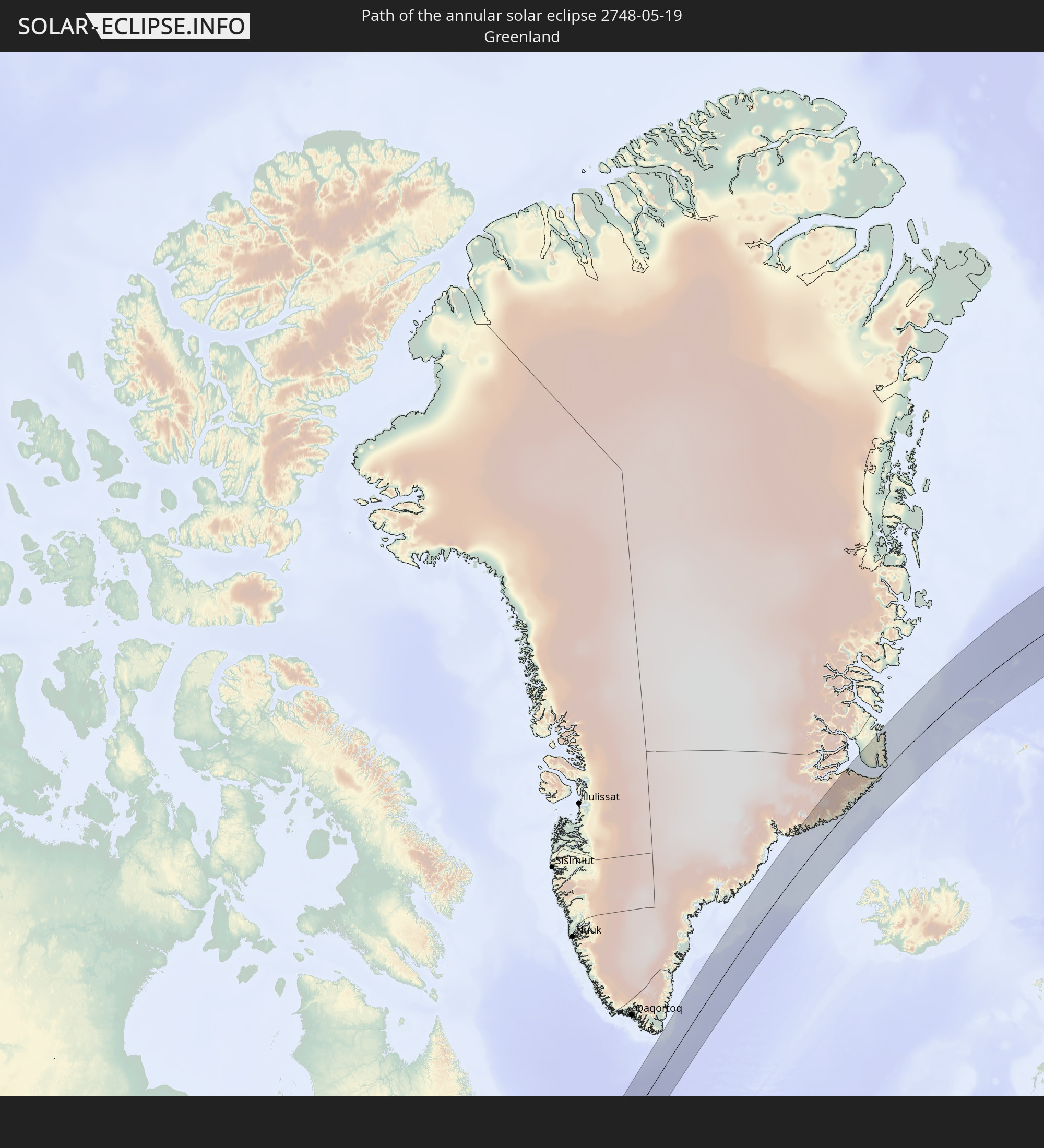
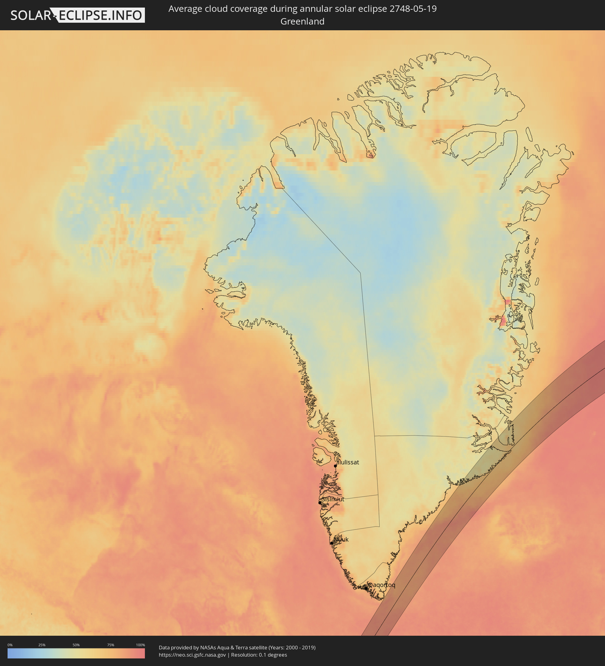 Greenland
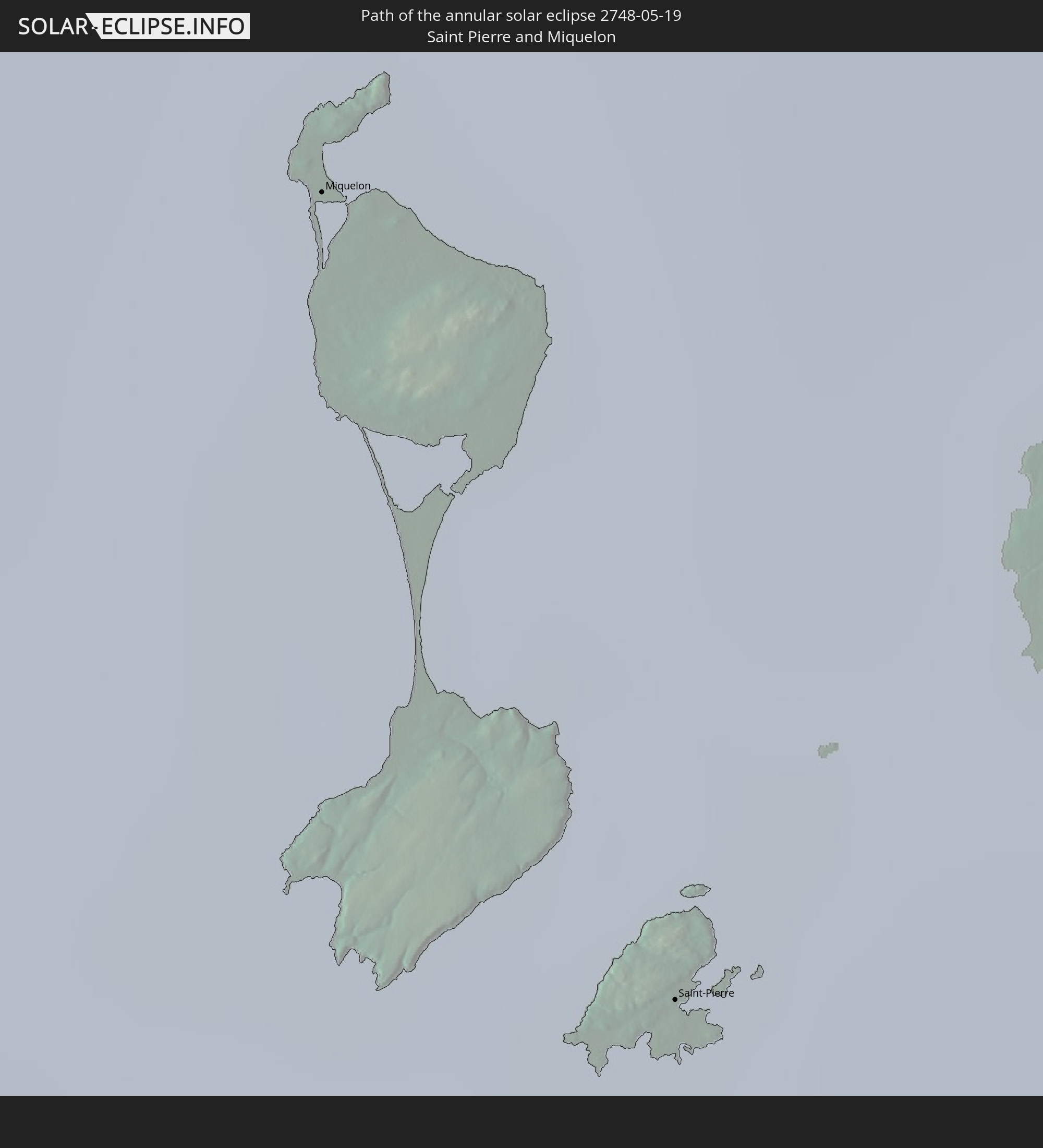
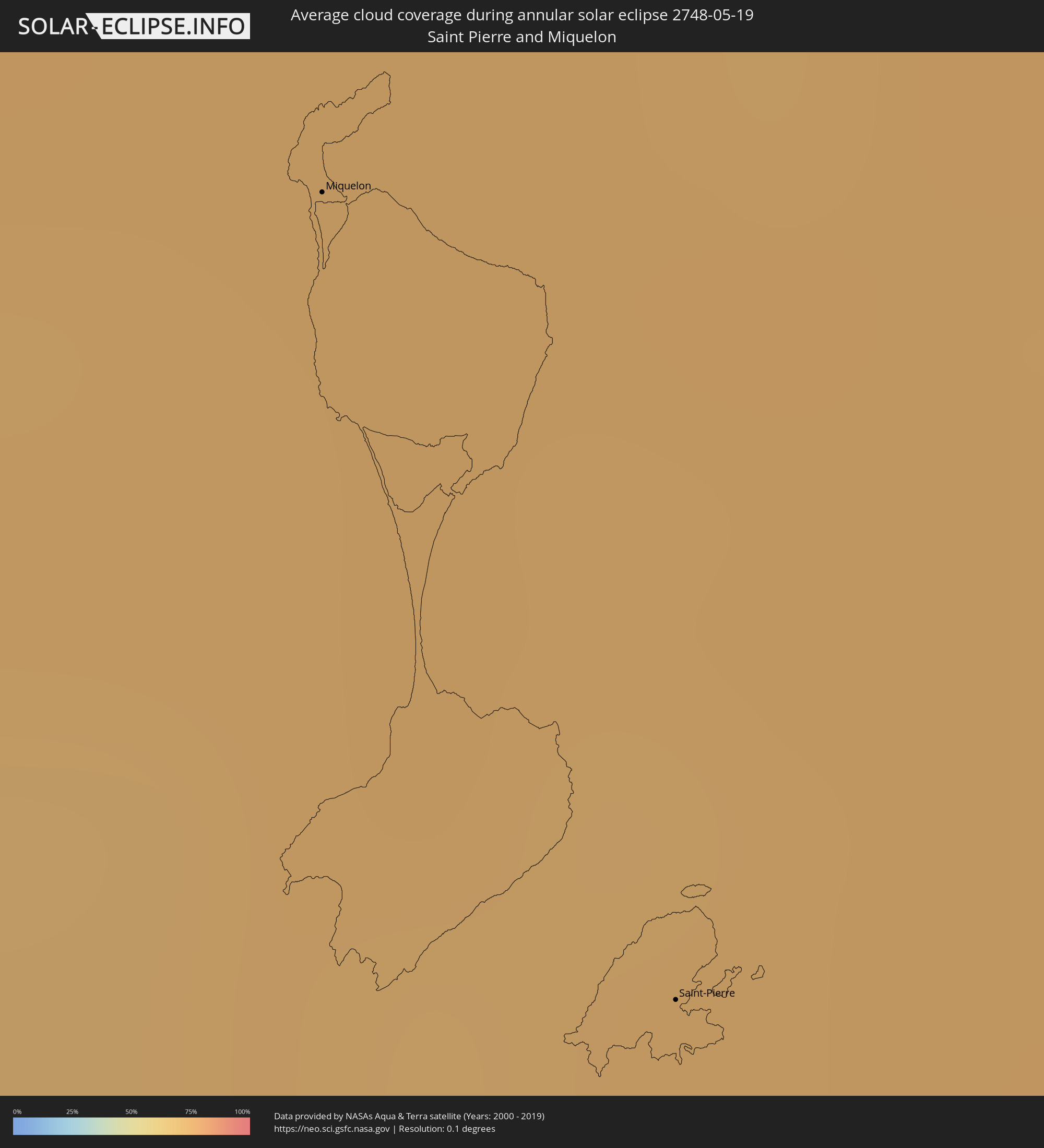 Saint Pierre and Miquelon
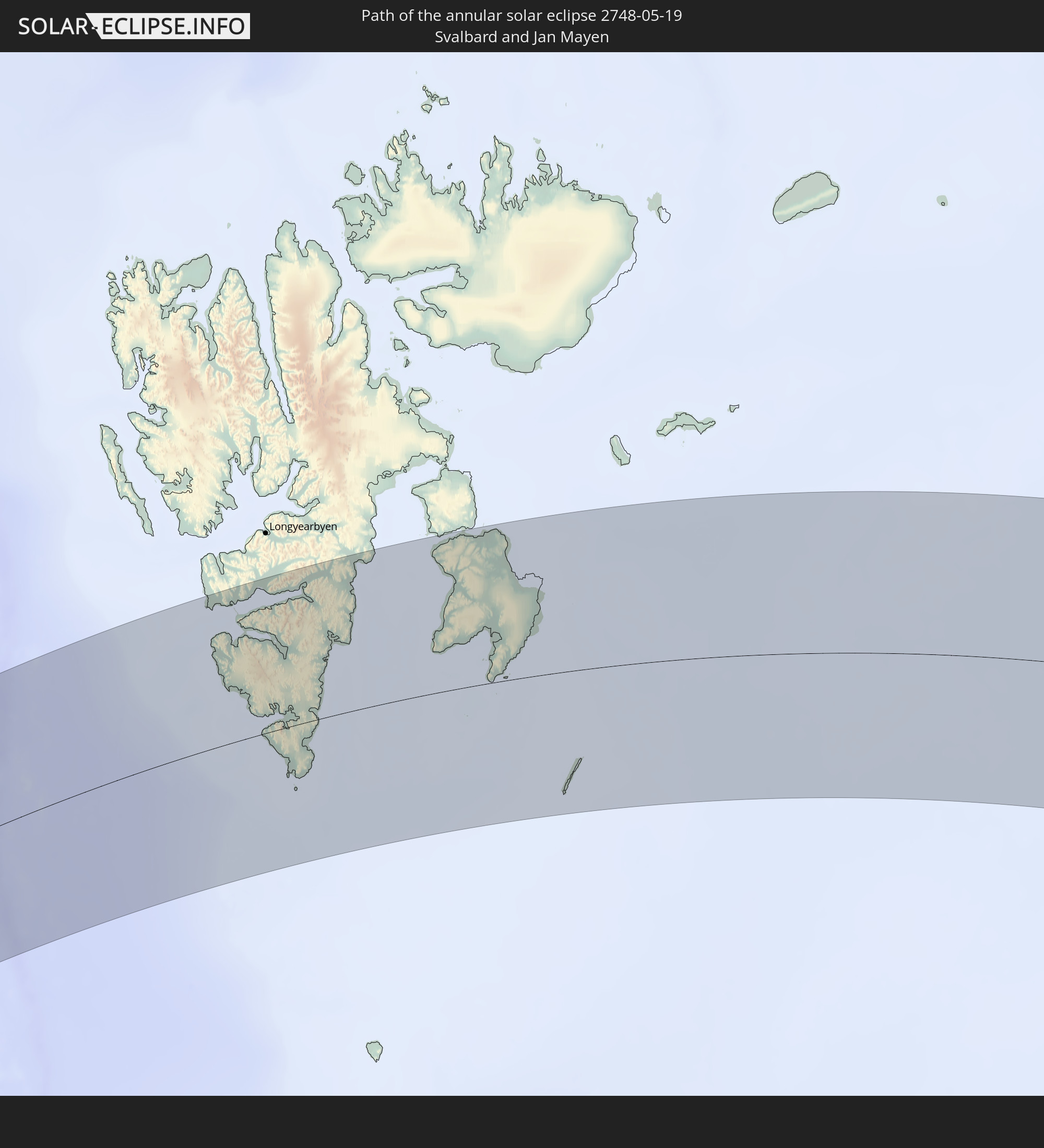
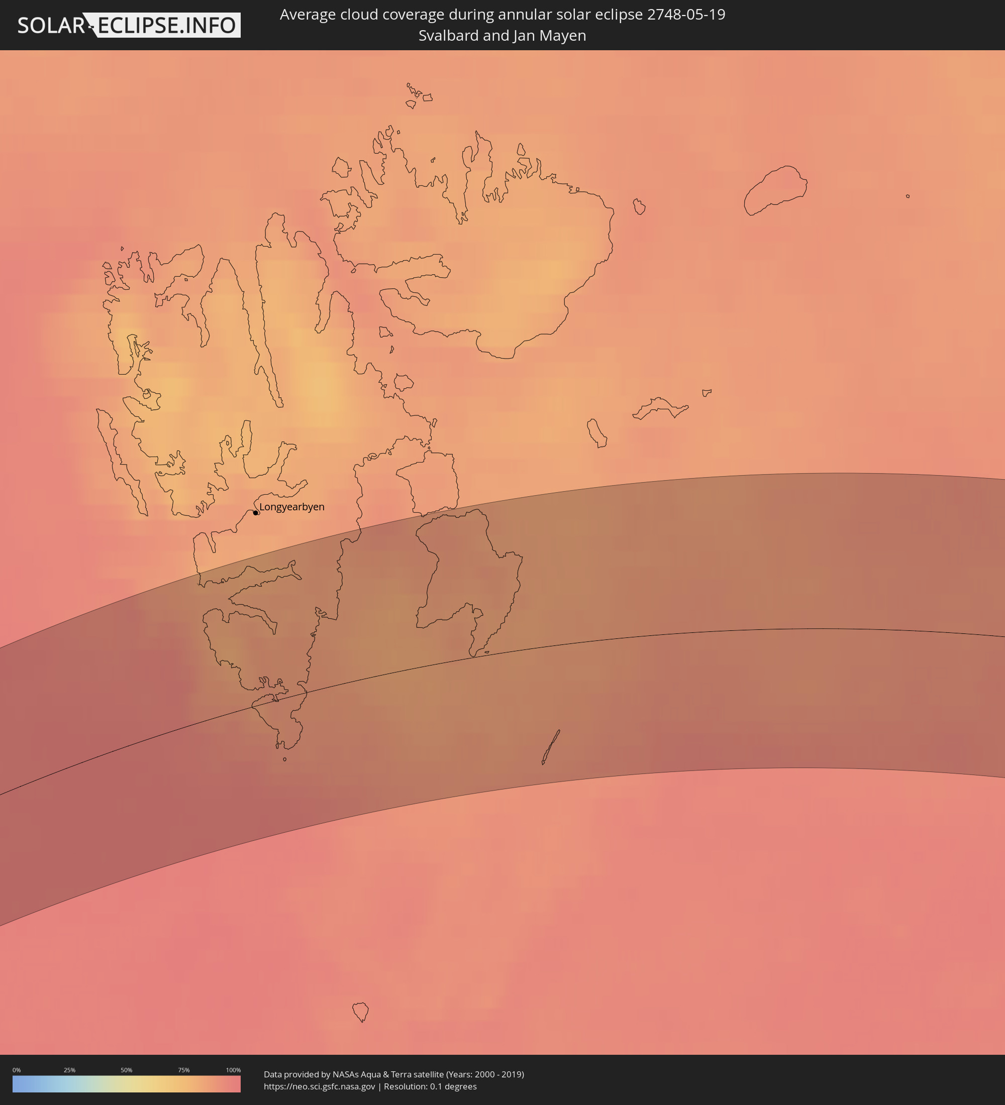 Svalbard and Jan Mayen
Cities inside the path of the eclipse
The following table shows all locations with a population of more than 5,000 inside the eclipse path. Cities which have more than 100,000 inhabitants are marked bold. A click at the locations opens a detailed map.
| City | Type | Eclipse duration | Local time of max. eclipse | Distance to central line | Ø Cloud coverage |
|
Douglas, Georgia
|
annular | - | 05:39:49 UTC-05:00 | 155 km | 60% |
|
Waycross, Georgia
|
annular | - | 05:39:11 UTC-05:00 | 106 km | 59% |
|
Jesup, Georgia
|
annular | - | 05:39:30 UTC-05:00 | 129 km | 64% |
|
Middleburg, Florida
|
annular | - | 05:37:23 UTC-05:00 | 30 km | 63% |
|
Asbury Lake, Florida
|
annular | - | 05:37:20 UTC-05:00 | 34 km | 63% |
|
Nassau Village-Ratliff, Florida
|
annular | - | 05:37:57 UTC-05:00 | 29 km | 62% |
|
Lakeside, Florida
|
annular | - | 05:37:25 UTC-05:00 | 30 km | 60% |
|
Bellair-Meadowbrook Terrace, Florida
|
annular | - | 05:37:29 UTC-05:00 | 29 km | 57% |
|
Orange Park, Florida
|
annular | - | 05:37:26 UTC-05:00 | 32 km | 57% |
|
Kingsland, Georgia
|
annular | - | 05:38:17 UTC-05:00 | 38 km | 63% |
|
Green Cove Springs, Florida
|
annular | - | 05:37:12 UTC-05:00 | 47 km | 57% |
|
Jacksonville, Florida
|
annular | - | 05:37:38 UTC-05:00 | 24 km | 59% |
|
Fruit Cove, Florida
|
annular | - | 05:37:20 UTC-05:00 | 41 km | 57% |
|
Yulee, Florida
|
annular | - | 05:38:01 UTC-05:00 | 18 km | 60% |
|
Hinesville, Georgia
|
annular | - | 05:39:41 UTC-05:00 | 141 km | 62% |
|
St. Marys, Georgia
|
annular | - | 05:38:08 UTC-05:00 | 26 km | 56% |
|
Dock Junction, Georgia
|
annular | - | 05:38:46 UTC-05:00 | 75 km | 59% |
|
Brunswick, Georgia
|
annular | - | 05:38:41 UTC-05:00 | 69 km | 62% |
|
Country Club Estates, Georgia
|
annular | - | 05:38:45 UTC-05:00 | 73 km | 59% |
|
Fernandina Beach, Florida
|
annular | - | 05:38:00 UTC-05:00 | 19 km | 56% |
|
Saint Simon Mills, Georgia
|
annular | - | 05:38:40 UTC-05:00 | 66 km | 53% |
|
Atlantic Beach, Florida
|
annular | - | 05:37:31 UTC-05:00 | 21 km | 54% |
|
Neptune Beach, Florida
|
annular | - | 05:37:29 UTC-05:00 | 23 km | 54% |
|
Jacksonville Beach, Florida
|
annular | - | 05:37:28 UTC-05:00 | 25 km | 54% |
|
Palm Valley, Florida
|
annular | - | 05:37:18 UTC-05:00 | 37 km | 56% |
|
Ponte Vedra Beach, Florida
|
annular | - | 05:37:23 UTC-05:00 | 31 km | 56% |
|
Saint Simons Island, Georgia
|
annular | - | 05:38:37 UTC-05:00 | 62 km | 53% |
|
Saint Augustine, Florida
|
annular | - | 05:36:53 UTC-05:00 | 70 km | 53% |
|
Saint Augustine Shores, Florida
|
annular | - | 05:36:46 UTC-05:00 | 79 km | 54% |
|
Richmond Hill, Georgia
|
annular | - | 05:39:41 UTC-05:00 | 140 km | 60% |
|
Saint Augustine Beach, Florida
|
annular | - | 05:36:48 UTC-05:00 | 76 km | 53% |
|
Pooler, Georgia
|
annular | - | 05:39:54 UTC-05:00 | 154 km | 65% |
|
Georgetown, Georgia
|
annular | - | 05:39:42 UTC-05:00 | 140 km | 63% |
|
Palm Coast, Florida
|
annular | - | 05:36:25 UTC-05:00 | 106 km | 52% |
|
Port Wentworth, Georgia
|
annular | - | 05:39:54 UTC-05:00 | 154 km | 65% |
|
Garden City, Georgia
|
annular | - | 05:39:51 UTC-05:00 | 150 km | 65% |
|
Savannah, Georgia
|
annular | - | 05:39:47 UTC-05:00 | 145 km | 63% |
|
Ormond-by-the-Sea, Florida
|
annular | - | 05:36:02 UTC-05:00 | 135 km | 55% |
|
Ormond Beach, Florida
|
annular | - | 05:35:56 UTC-05:00 | 142 km | 55% |
|
Skidaway Island, Georgia
|
annular | - | 05:39:33 UTC-05:00 | 128 km | 60% |
|
Holly Hill, Florida
|
annular | - | 05:35:53 UTC-05:00 | 147 km | 53% |
|
Daytona Beach, Florida
|
annular | - | 05:35:50 UTC-05:00 | 151 km | 53% |
|
Whitemarsh Island, Georgia
|
annular | - | 05:39:40 UTC-05:00 | 136 km | 69% |
|
Wilmington Island, Georgia
|
annular | - | 05:39:37 UTC-05:00 | 132 km | 69% |
|
Bluffton, South Carolina
|
annular | - | 05:39:54 UTC-05:00 | 152 km | 59% |
|
Hilton Head Island, South Carolina
|
annular | - | 05:39:49 UTC-05:00 | 145 km | 55% |
|
Miquelon, Miquelon-Langlade
|
annular | - | 08:02:51 UTC-03:00 | 75 km | 73% |
|
Saint-Pierre, Saint-Pierre
|
annular | - | 08:02:15 UTC-03:00 | 49 km | 73% |
|
Bay Roberts, Newfoundland and Labrador
|
annular | - | 07:34:44 UTC-03:30 | 83 km | 79% |
|
Carbonear, Newfoundland and Labrador
|
annular | - | 07:35:01 UTC-03:30 | 75 km | 84% |
|
Conception Bay South, Newfoundland and Labrador
|
annular | - | 07:34:36 UTC-03:30 | 104 km | 78% |
|
Mount Pearl, Newfoundland and Labrador
|
annular | - | 07:34:42 UTC-03:30 | 115 km | 80% |
|
St. John's, Newfoundland and Labrador
|
annular | - | 07:34:50 UTC-03:30 | 117 km | 81% |
|
Chernyshevskiy, Sakha
|
annular | - | 22:03:06 UTC+09:00 | 37 km | 73% |
|
Mirny, Sakha
|
annular | - | 22:02:57 UTC+09:00 | 56 km | 73% |