Annular solar eclipse of 01/26/2791
| Day of week: | Saturday |
| Maximum duration of eclipse: | 00m15s |
| Maximum width of eclipse path: | 9 km |
| Saros cycle: | 163 |
| Coverage: | 99.8% |
| Magnitude: | 0.9975 |
| Gamma: | 0.0751 |
Wo kann man die Sonnenfinsternis vom 01/26/2791 sehen?
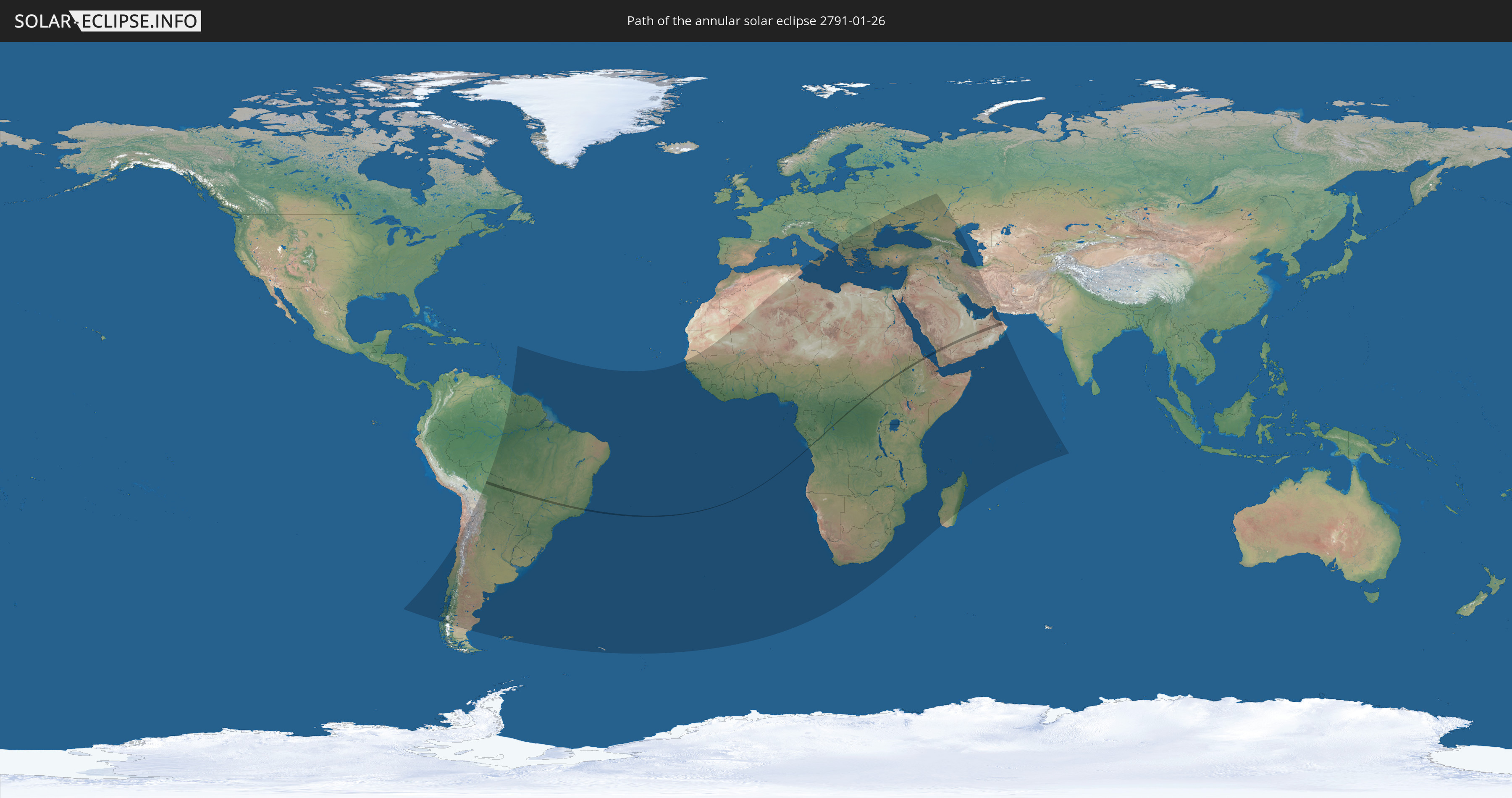
Die Sonnenfinsternis am 01/26/2791 kann man in 98 Ländern als partielle Sonnenfinsternis beobachten.
Der Finsternispfad verläuft durch 13 Länder. Nur in diesen Ländern ist sie als annular Sonnenfinsternis zu sehen.
In den folgenden Ländern ist die Sonnenfinsternis annular zu sehen
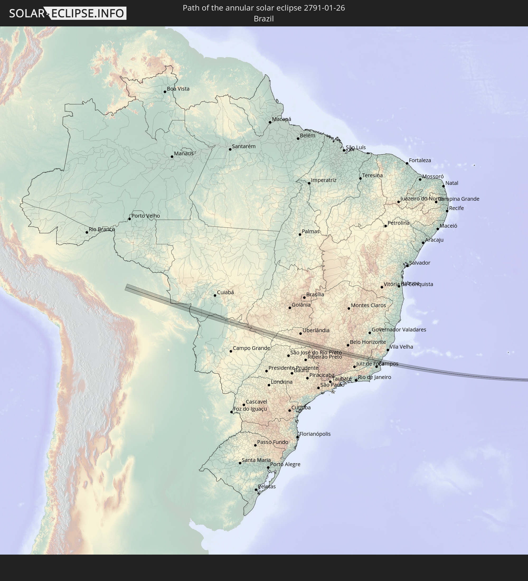 Brazil
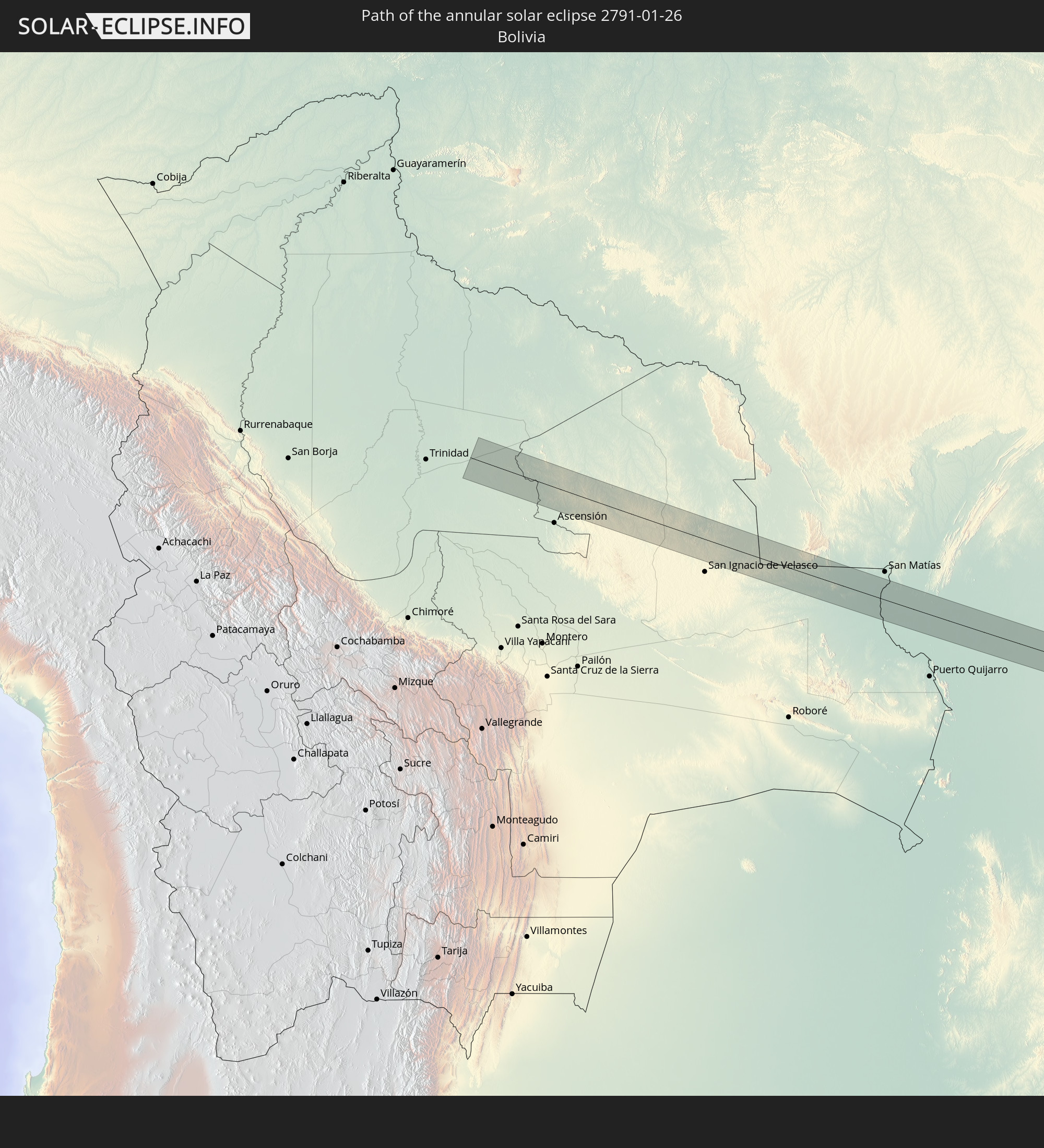 Bolivia
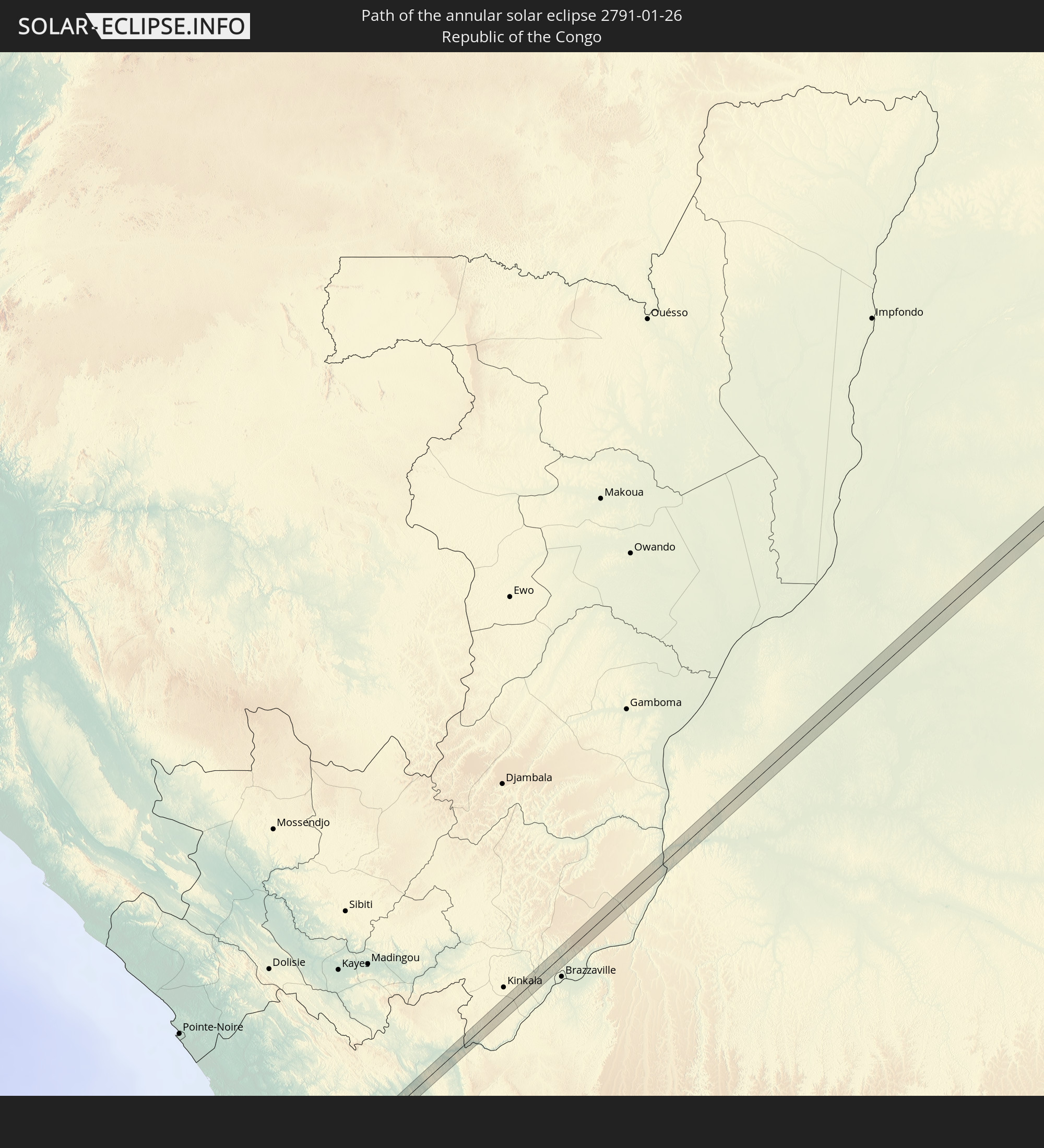 Republic of the Congo
 Angola
 Democratic Republic of the Congo
 Central African Republic
 Sudan
Sudan
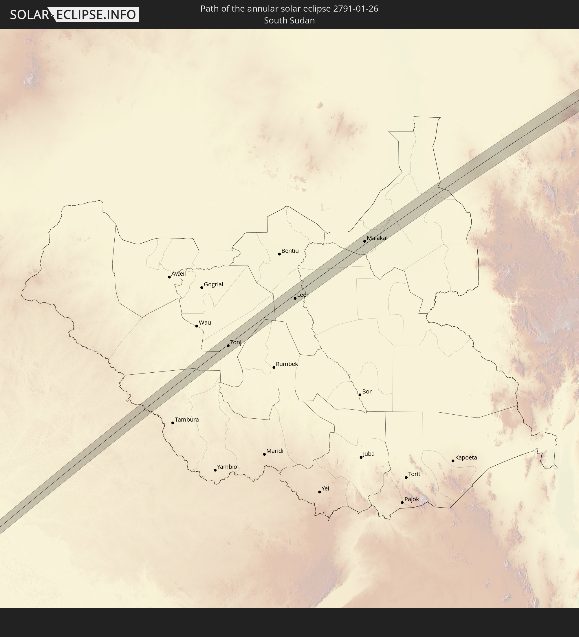 South Sudan
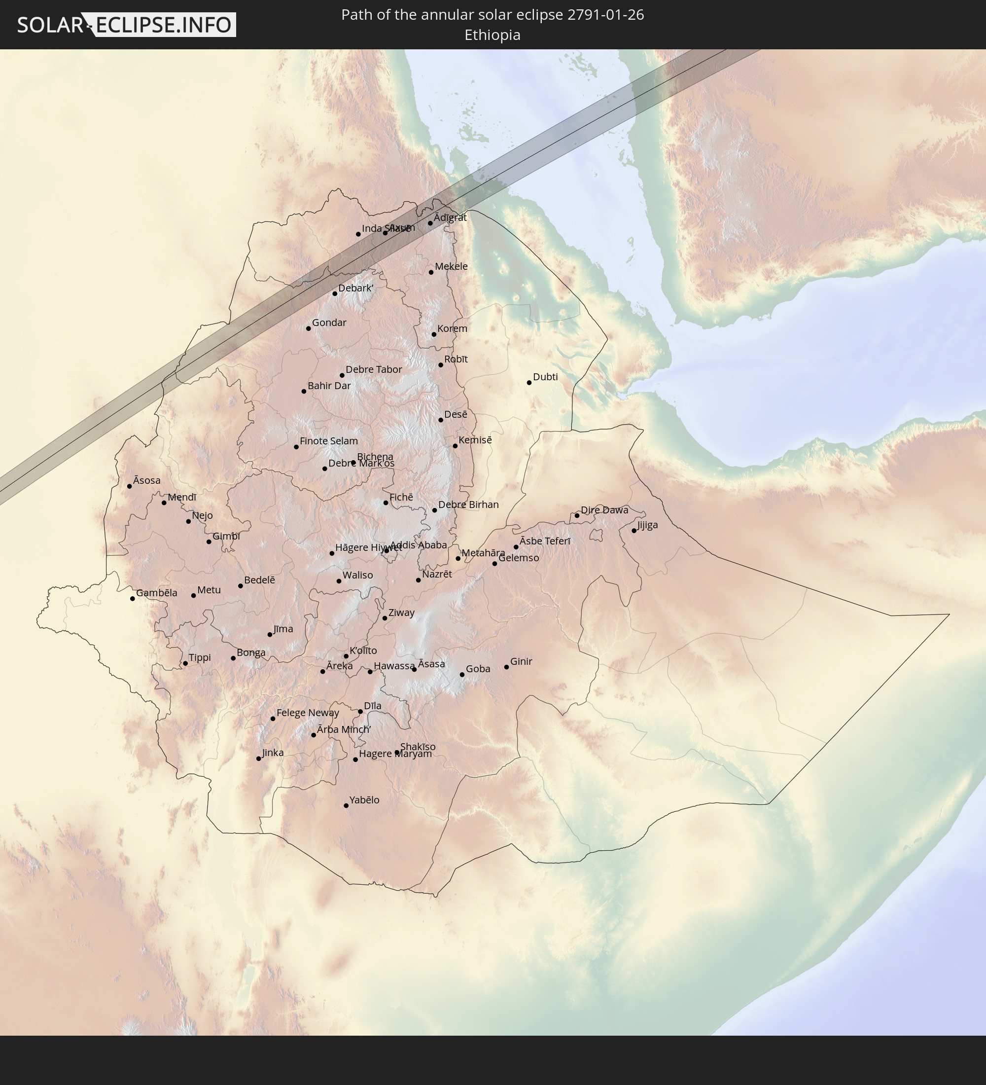 Ethiopia
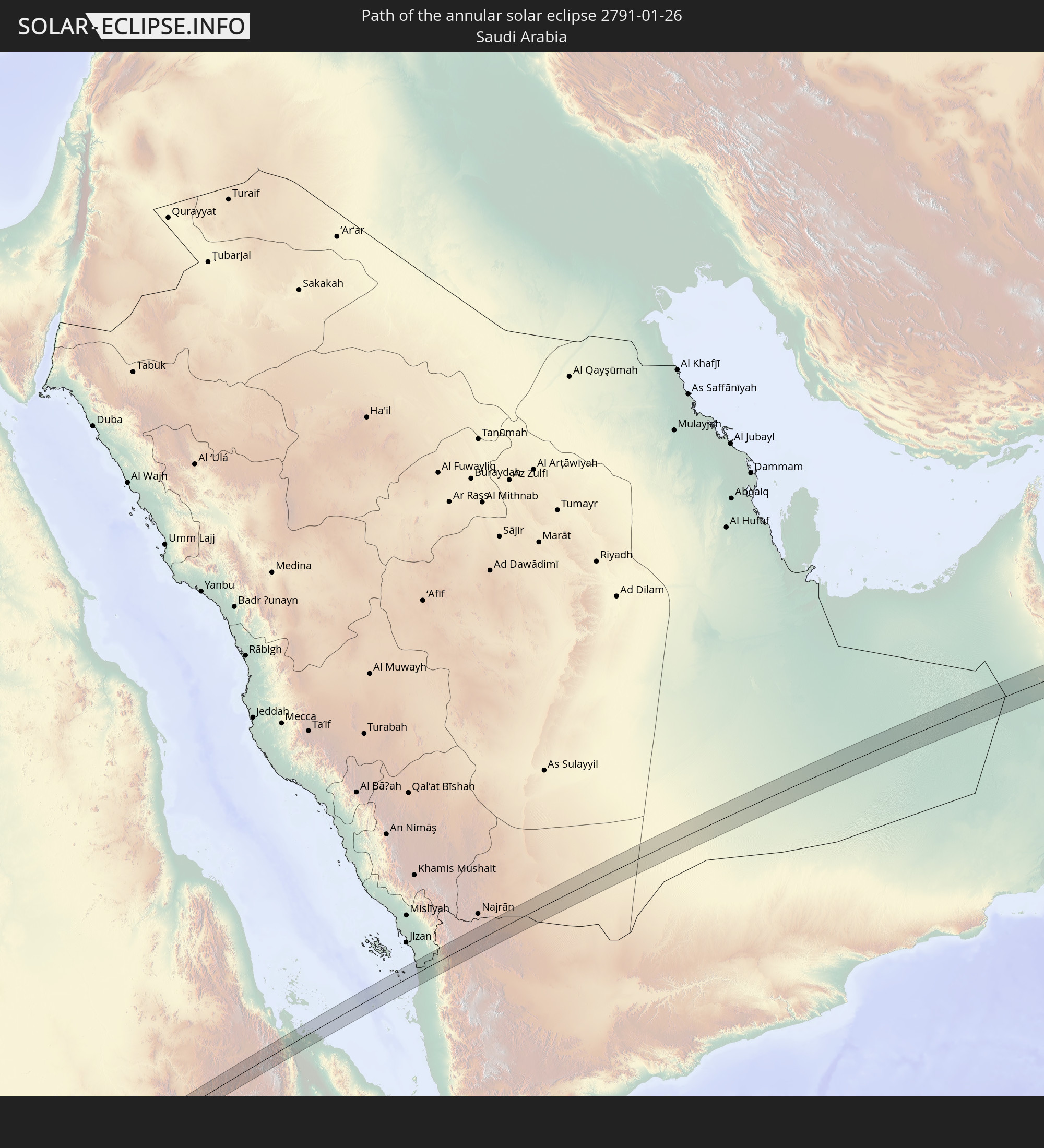 Saudi Arabia
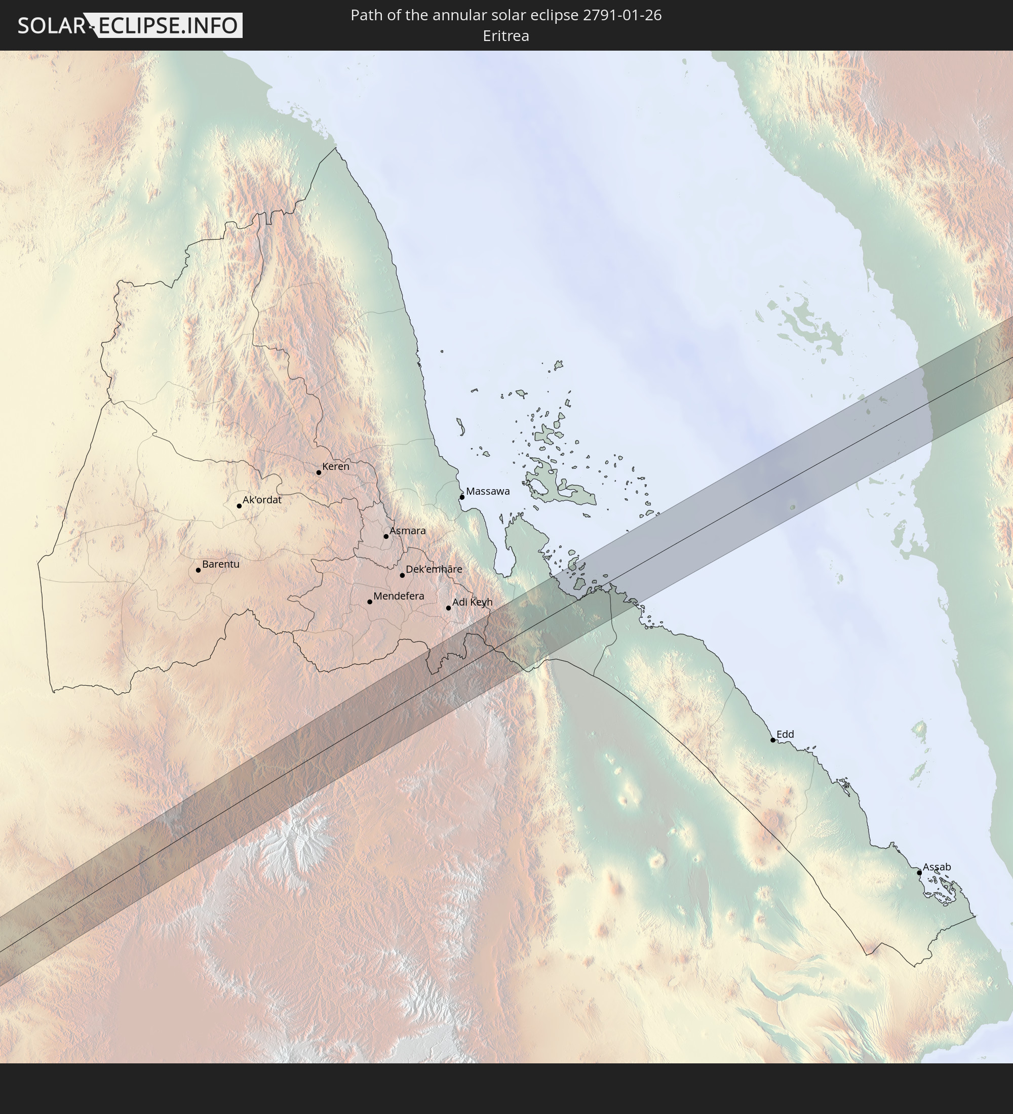 Eritrea
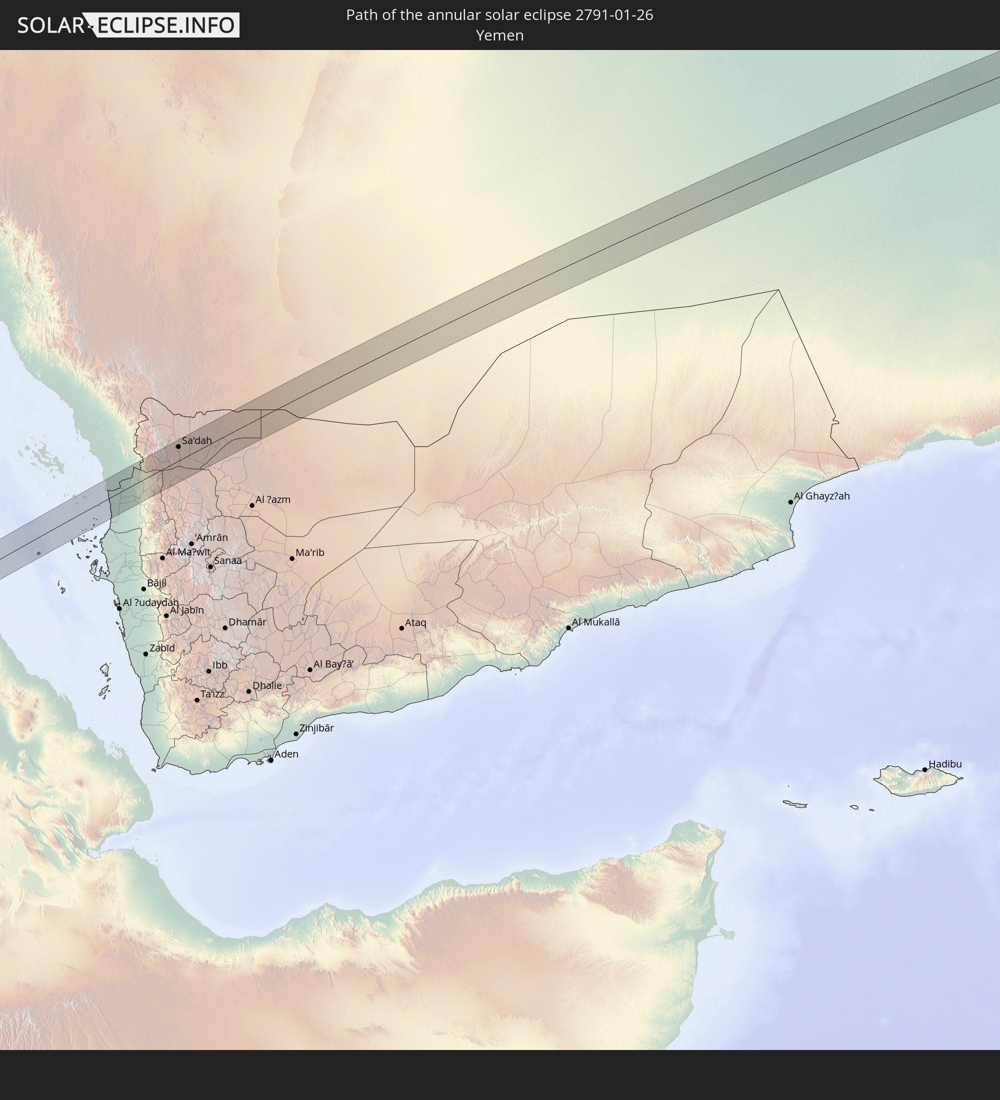 Yemen
Yemen
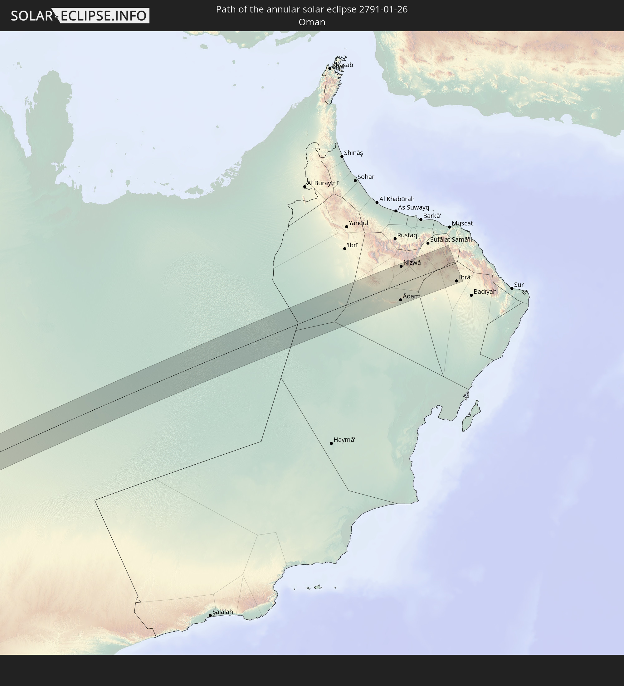 Oman
Oman
In den folgenden Ländern ist die Sonnenfinsternis partiell zu sehen
 Russia
 Chile
Chile
 Brazil
 Argentina
 Bolivia
 Paraguay
 Falkland Islands
 Guyana
 Uruguay
 Suriname
 French Guiana
 South Georgia and the South Sandwich Islands
 Senegal
 Mauritania
 The Gambia
 Guinea-Bissau
 Guinea
 Saint Helena, Ascension and Tristan da Cunha
 Sierra Leone
 Mali
Mali
 Liberia
 Algeria
 Ivory Coast
 Burkina Faso
 Ghana
Ghana
 Togo
Togo
 Niger
Niger
 Benin
Benin
 Nigeria
 Equatorial Guinea
 São Tomé and Príncipe
 Italy
Italy
 Tunisia
 Cameroon
 Gabon
Gabon
 Libya
Libya
 Republic of the Congo
 Angola
 Namibia
 Democratic Republic of the Congo
 Chad
Chad
 Malta
Malta
 Central African Republic
 South Africa
 Montenegro
 Serbia
 Albania
 Greece
 Botswana
 Romania
 Republic of Macedonia
 Sudan
Sudan
 Zambia
 Ukraine
 Bulgaria
 Egypt
Egypt
 Zimbabwe
 Turkey
 Moldova
 Lesotho
 Rwanda
 Burundi
 Tanzania
 Uganda
 Mozambique
 Swaziland
 Cyprus
 Malawi
 Ethiopia
 Kenya
Kenya
 State of Palestine
 Israel
 Saudi Arabia
 Jordan
 Lebanon
 Syria
Syria
 Eritrea
 Iraq
Iraq
 Georgia
 French Southern and Antarctic Lands
 Somalia
 Djibouti
 Yemen
Yemen
 Madagascar
 Comoros
 Armenia
 Iran
Iran
 Azerbaijan
 Mayotte
 Seychelles
 Kazakhstan
 Kuwait
 Bahrain
 Qatar
Qatar
 United Arab Emirates
 Oman
Oman
 Mauritius
 British Indian Ocean Territory
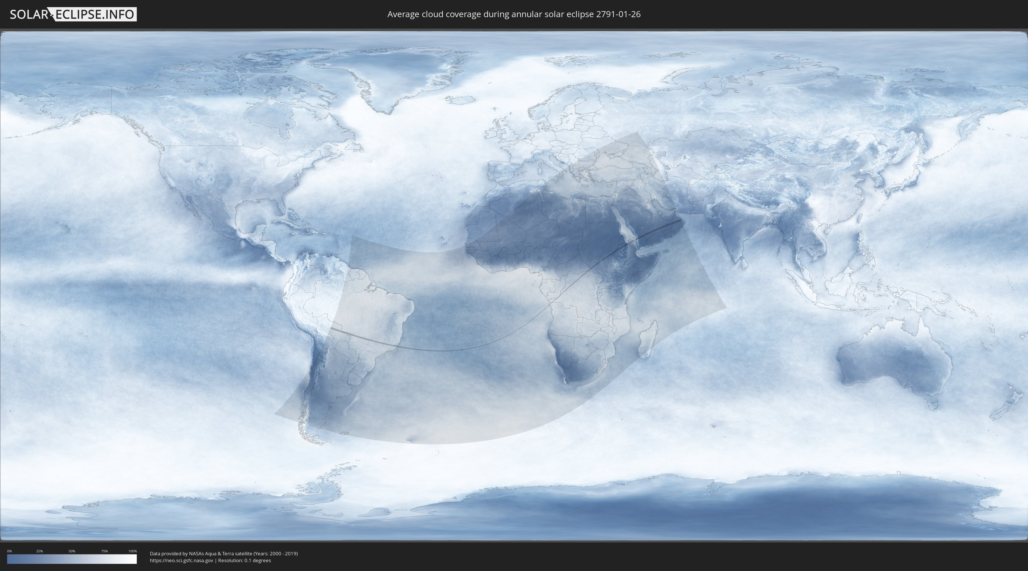
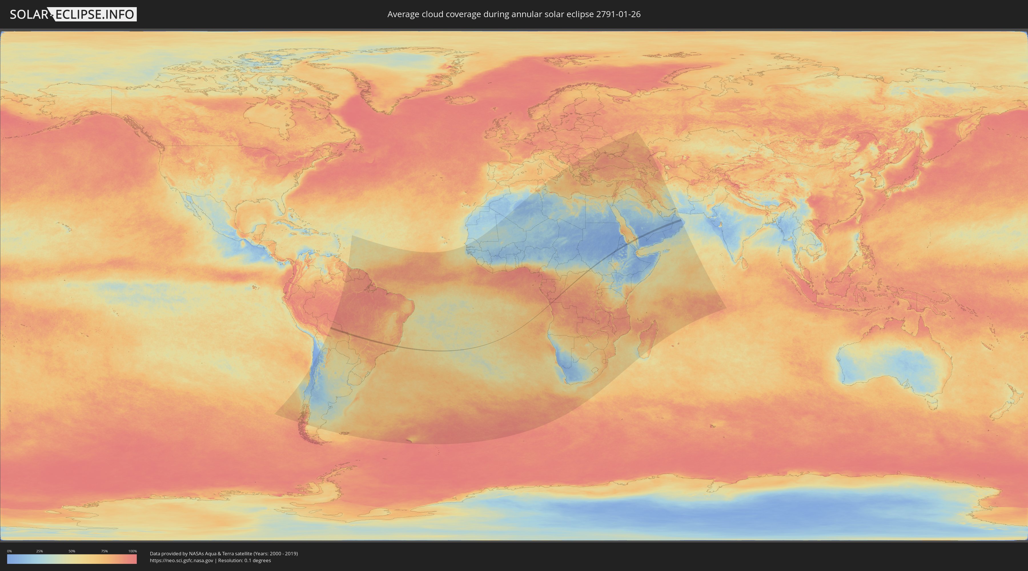
How will be the weather during the annular solar eclipse on 01/26/2791?
Where is the best place to see the annular solar eclipse of 01/26/2791?
The following maps show the average cloud coverage for the day of the annular solar eclipse.
With the help of these maps, it is possible to find the place along the eclipse path, which has the best
chance of a cloudless sky.
Nevertheless, you should consider local circumstances and inform about the weather of your chosen
observation site.
The data is provided by NASAs satellites
AQUA and TERRA.
The cloud maps are averaged over a period of 19 years (2000 - 2019).
Detailed country maps
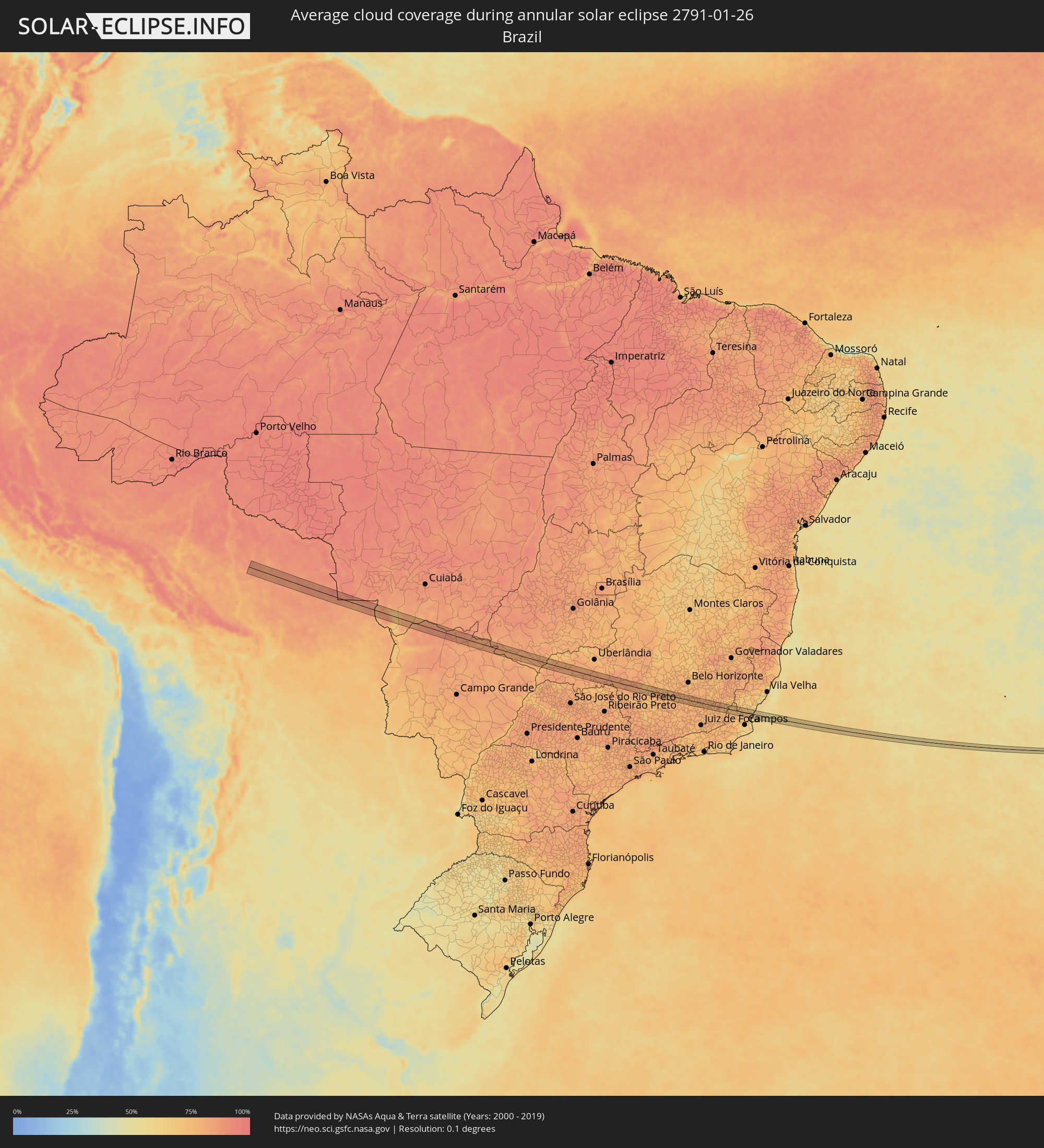 Brazil
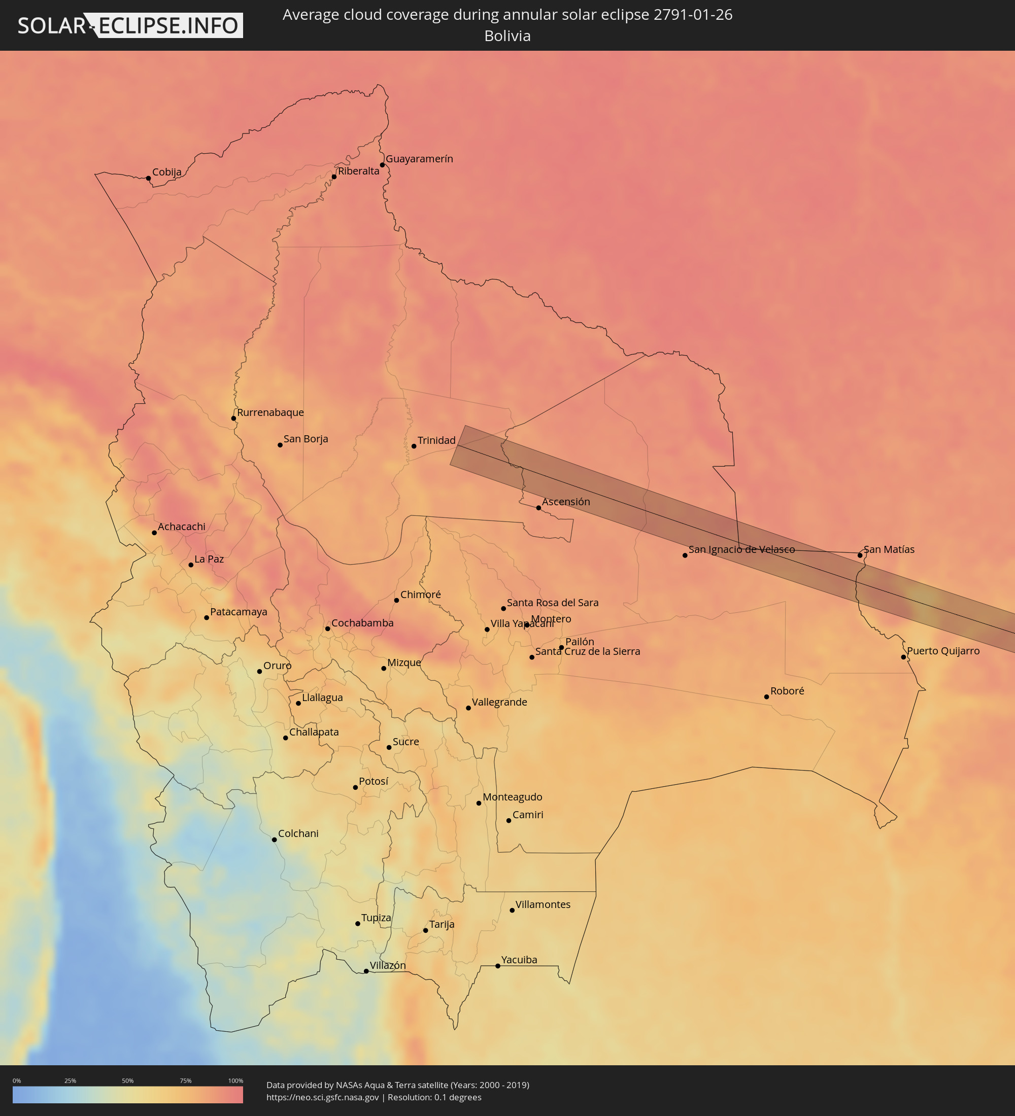 Bolivia
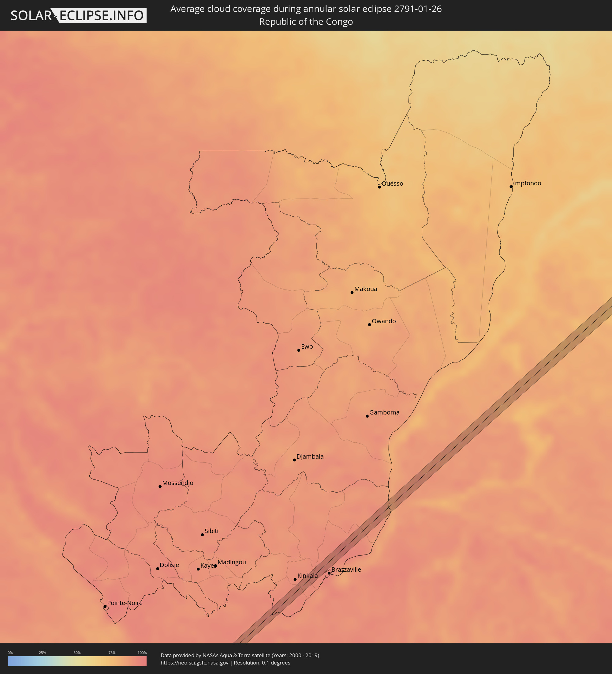 Republic of the Congo
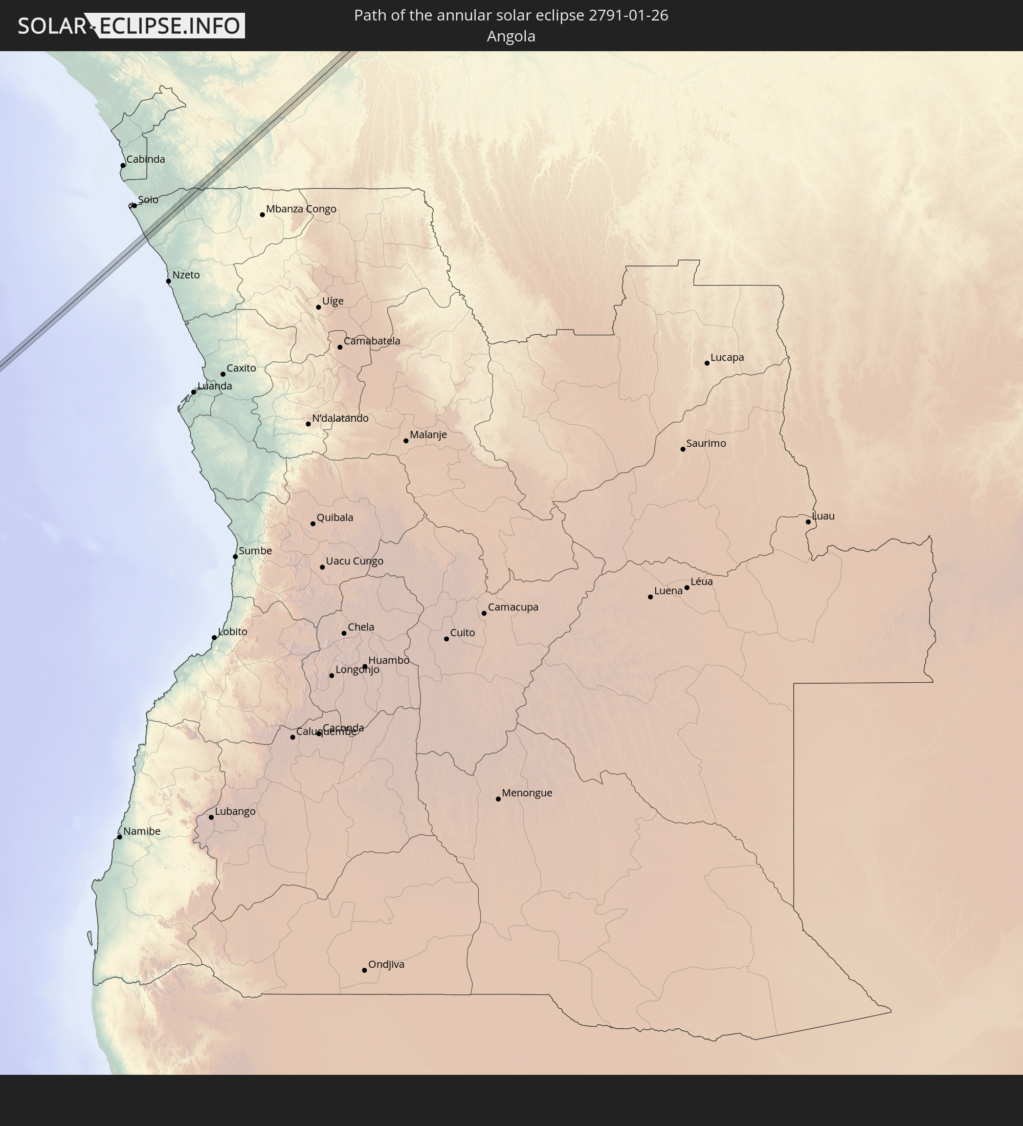
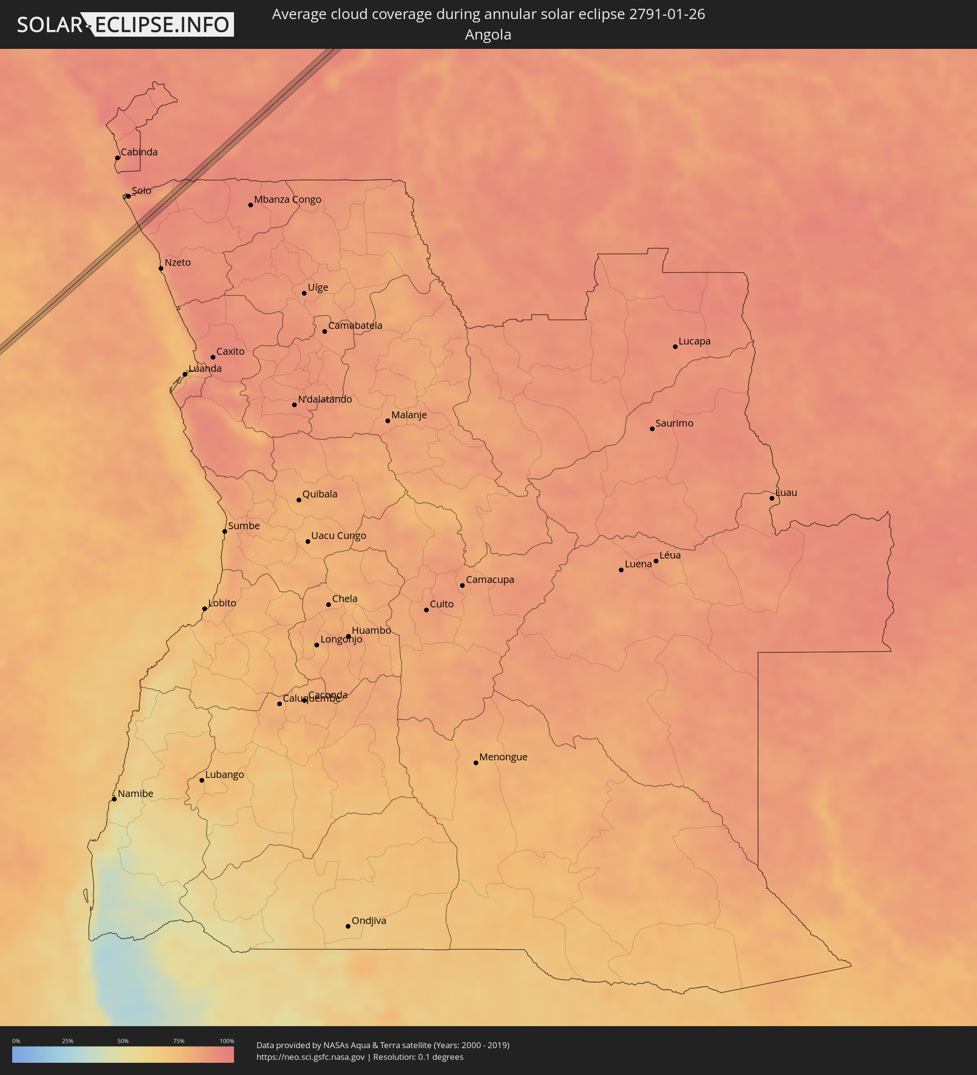 Angola
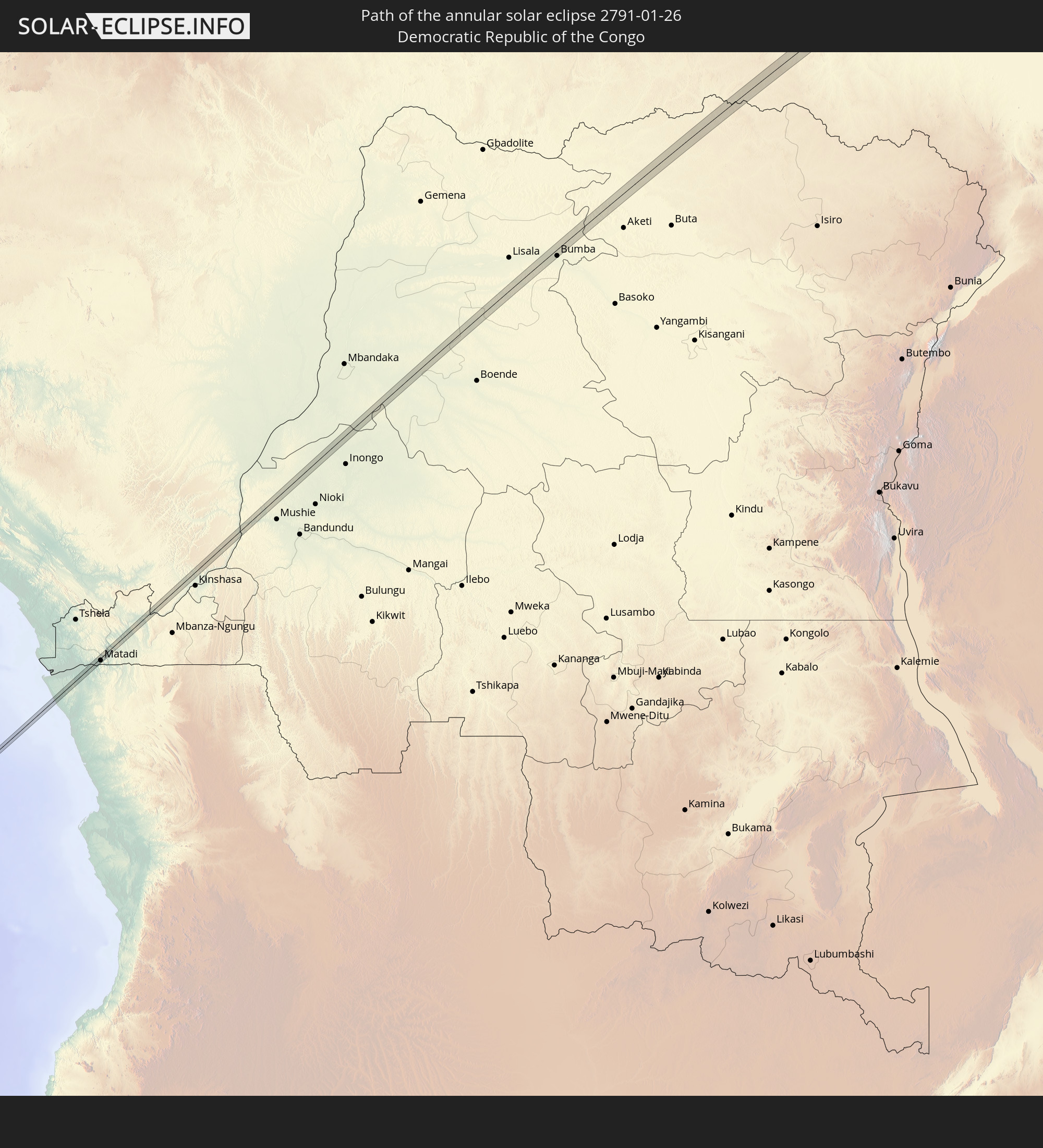
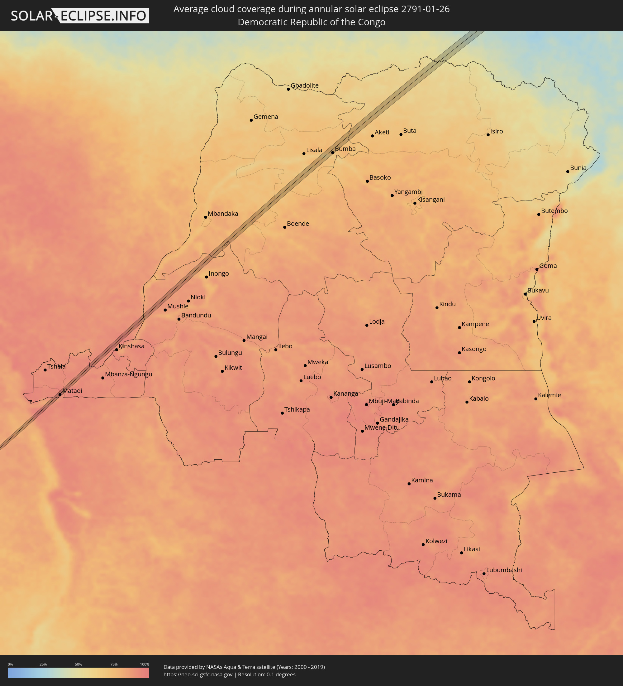 Democratic Republic of the Congo
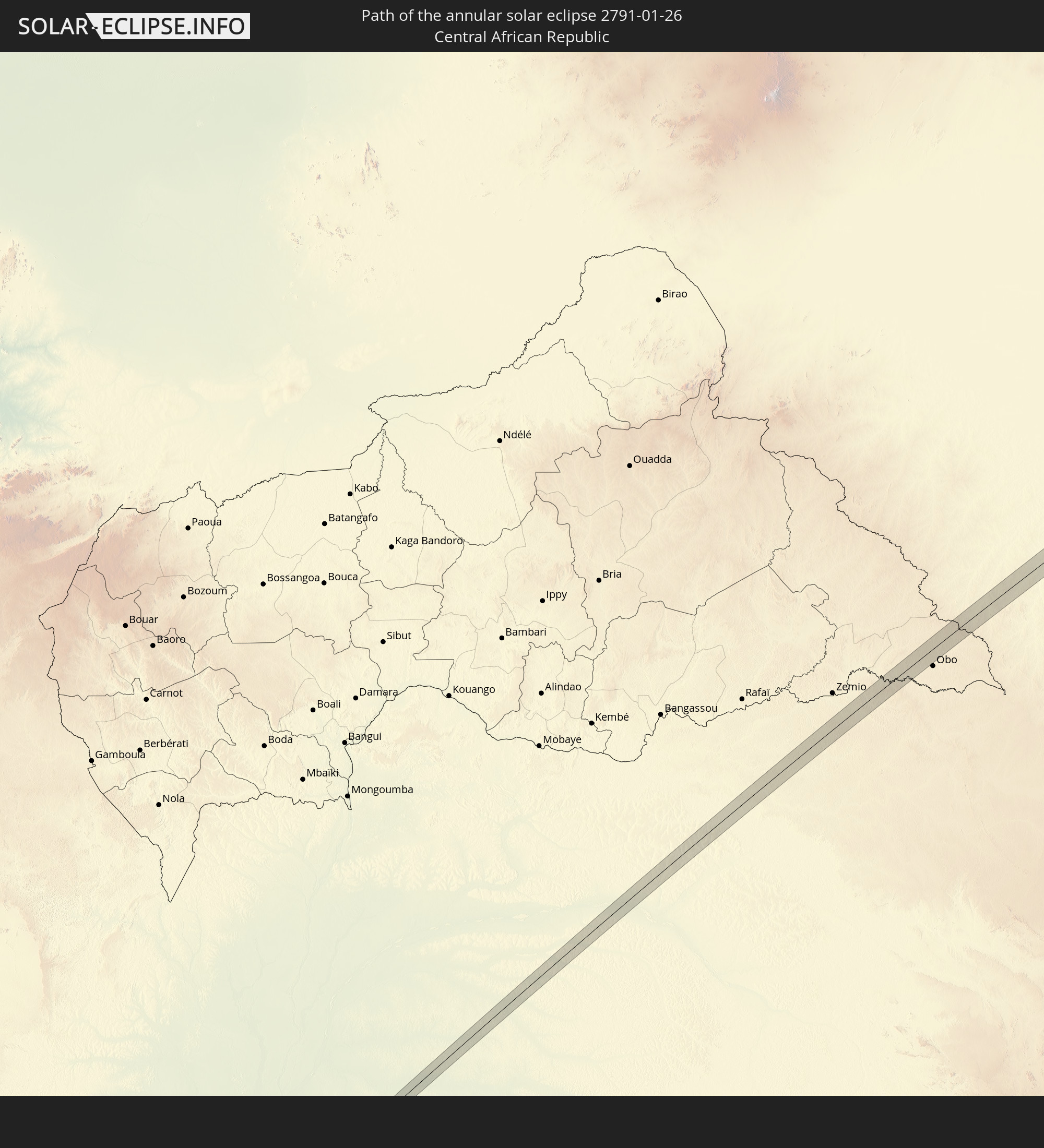
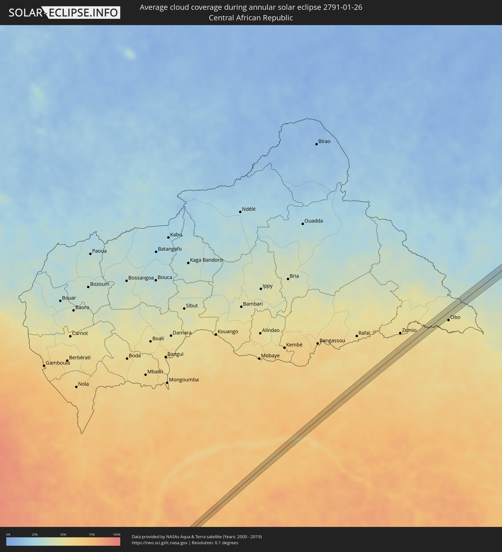 Central African Republic
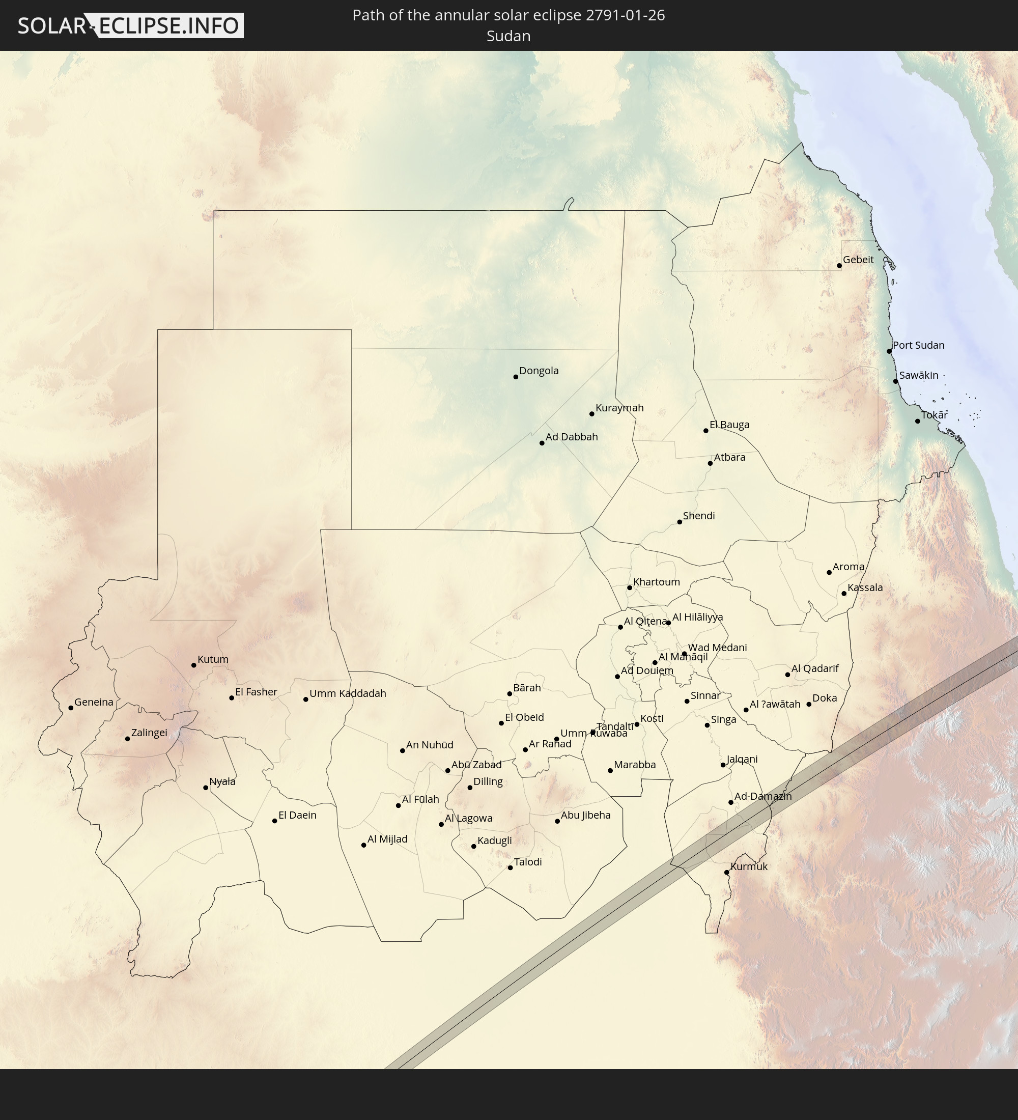
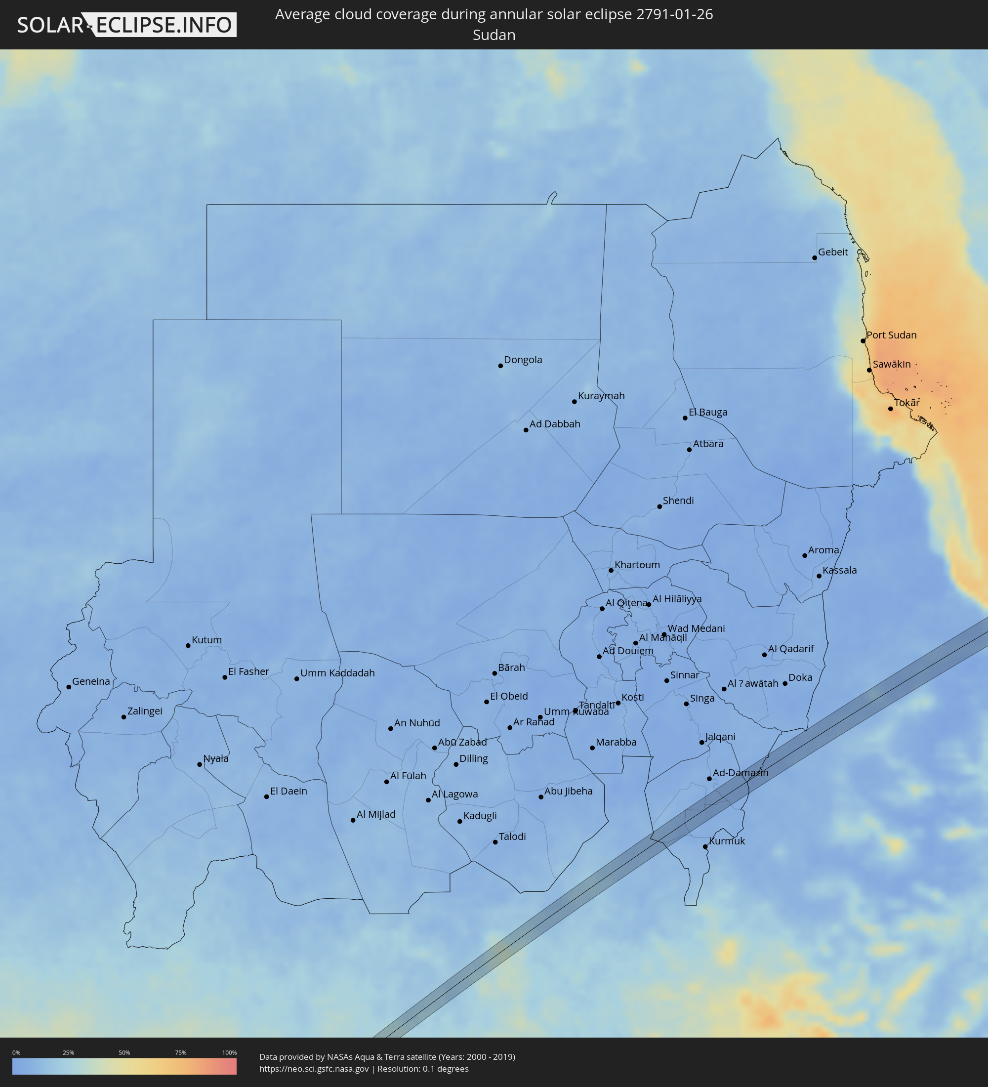 Sudan
Sudan
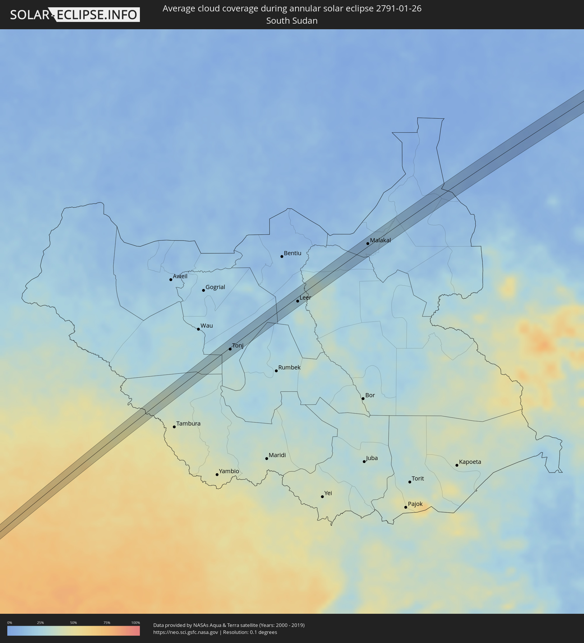 South Sudan
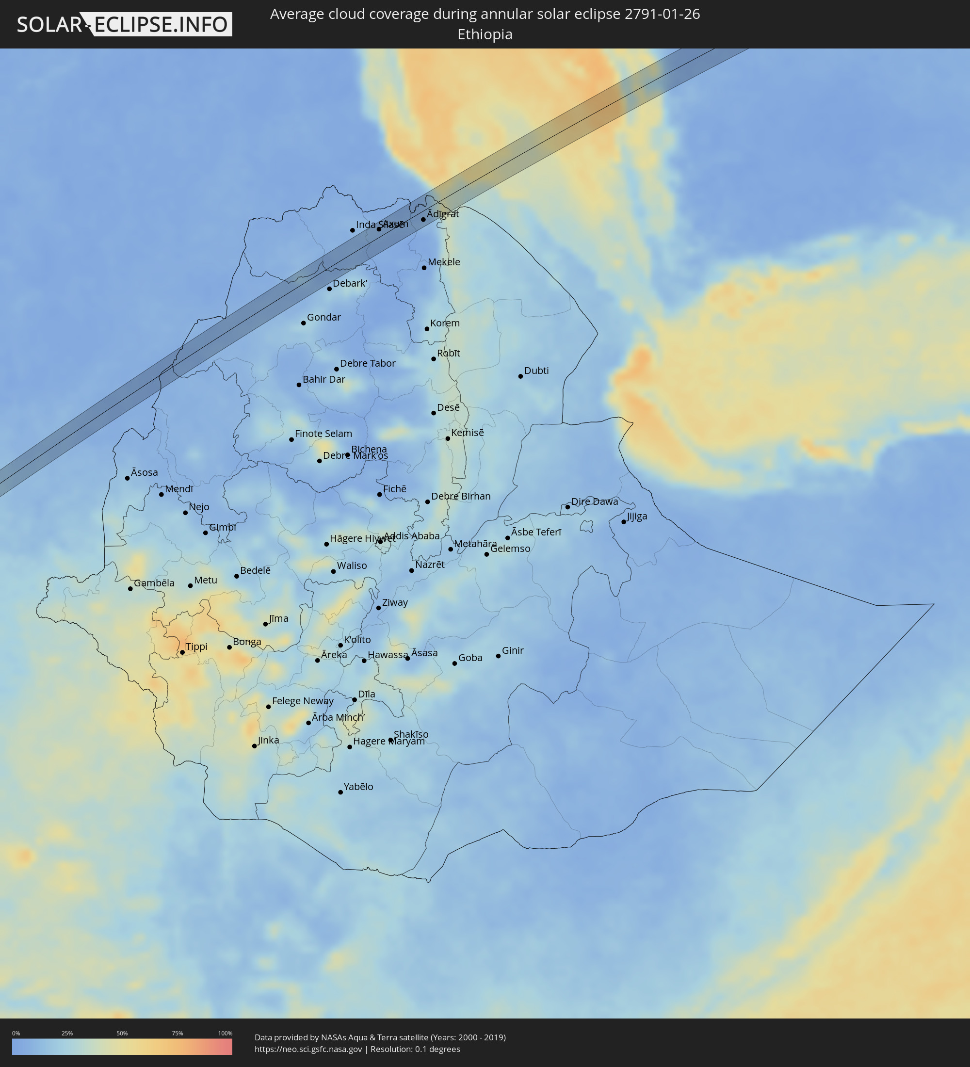 Ethiopia
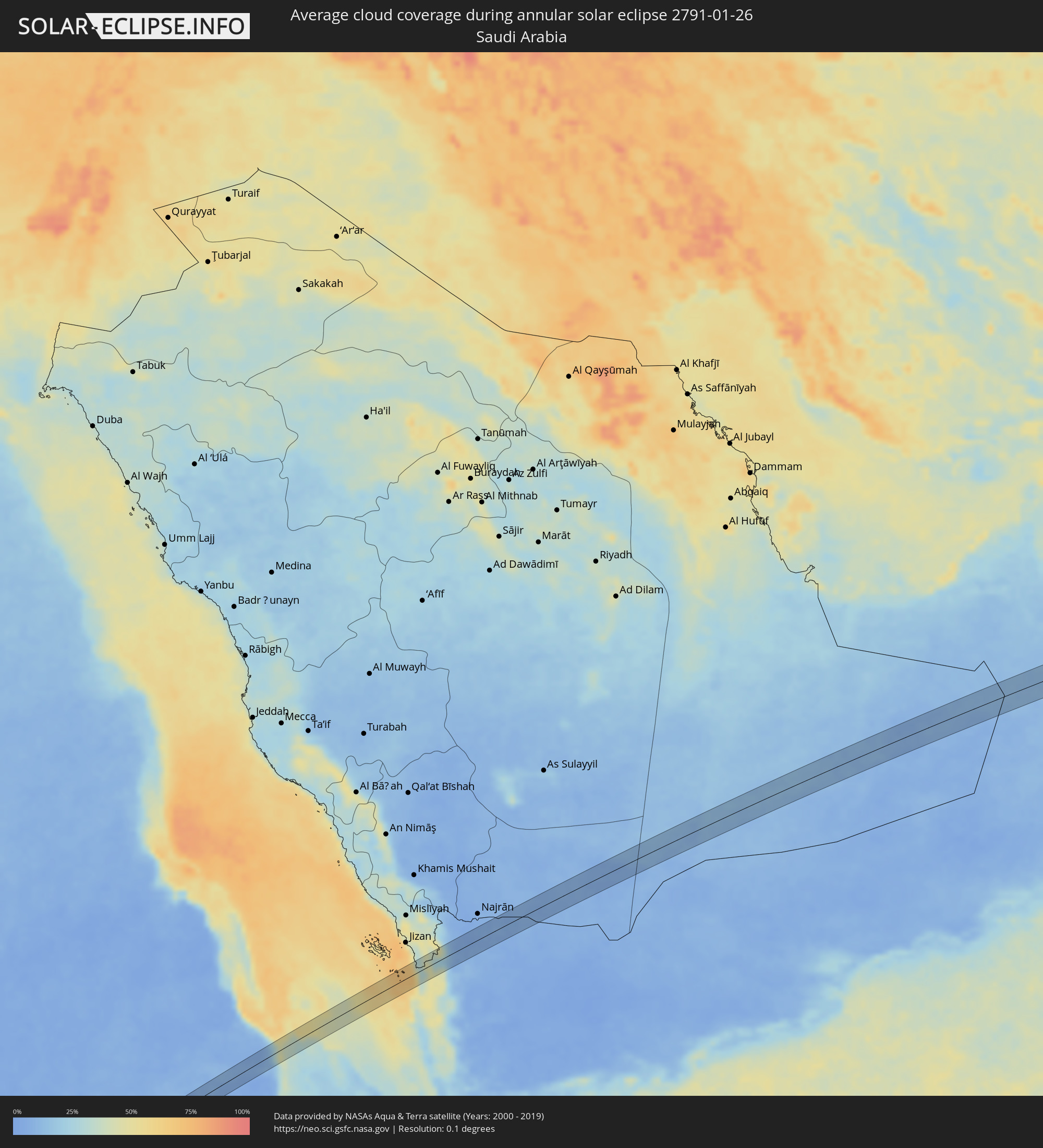 Saudi Arabia
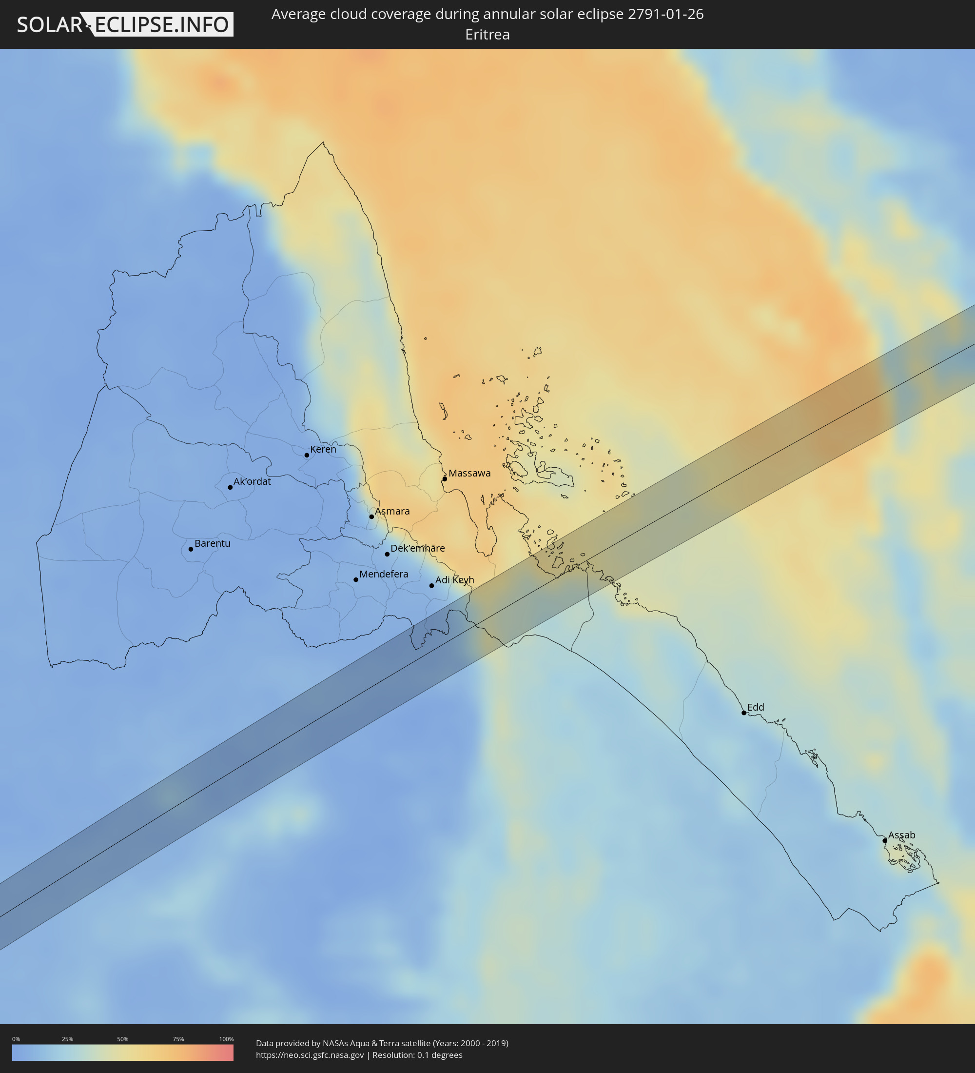 Eritrea
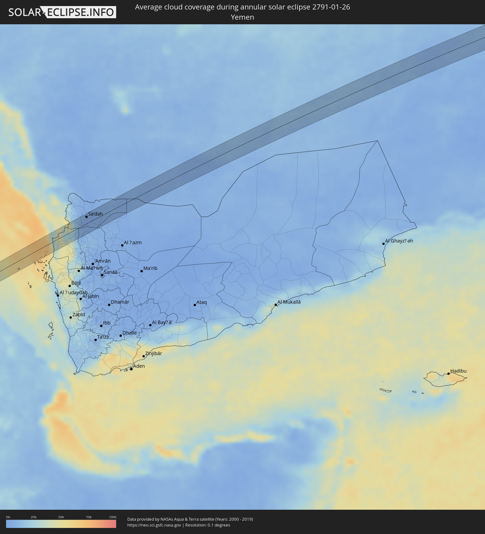 Yemen
Yemen
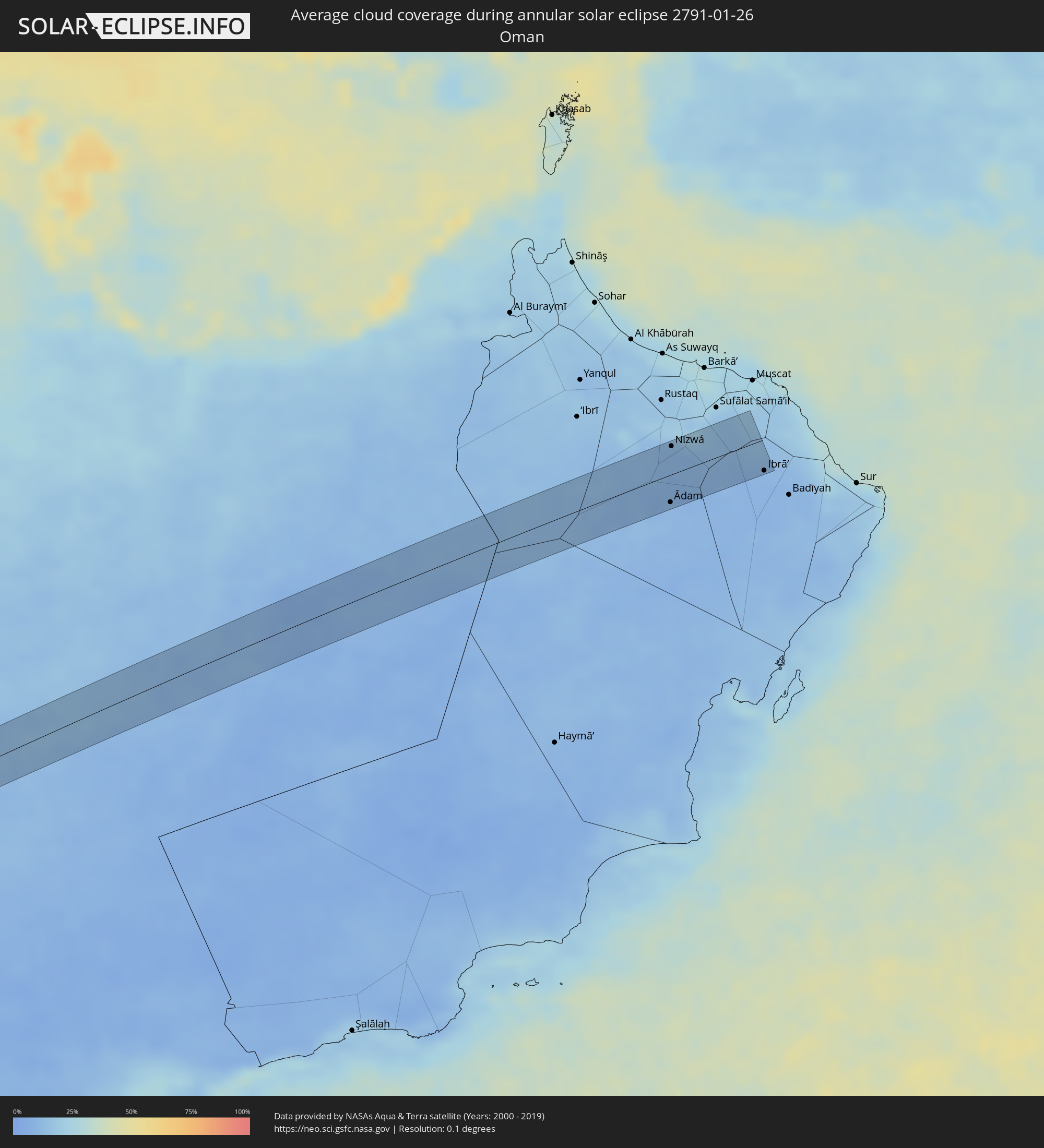 Oman
Oman
Cities inside the path of the eclipse
The following table shows all locations with a population of more than 5,000 inside the eclipse path. Cities which have more than 100,000 inhabitants are marked bold. A click at the locations opens a detailed map.
| City | Type | Eclipse duration | Local time of max. eclipse | Distance to central line | Ø Cloud coverage |
|
Campina Verde, Minas Gerais
|
annular | - | 07:11:23 UTC-03:00 | 21 km | 79% |
|
Prata, Minas Gerais
|
annular | - | 07:11:37 UTC-03:00 | 19 km | 81% |
|
Uberaba, Minas Gerais
|
annular | - | 07:12:17 UTC-03:00 | 1 km | 83% |
|
Sacramento, Minas Gerais
|
annular | - | 07:12:36 UTC-03:00 | 1 km | 79% |
|
Bambuí, Minas Gerais
|
annular | - | 07:13:34 UTC-03:00 | 22 km | 75% |
|
Arcos, Minas Gerais
|
annular | - | 07:13:56 UTC-03:00 | 3 km | 79% |
|
Formiga, Minas Gerais
|
annular | - | 07:14:03 UTC-03:00 | 14 km | 79% |
|
Itapecerica, Minas Gerais
|
annular | - | 07:14:16 UTC-03:00 | 7 km | 77% |
|
Cláudio, Minas Gerais
|
annular | - | 07:14:31 UTC-03:00 | 5 km | 77% |
|
Congonhas, Minas Gerais
|
annular | - | 07:15:13 UTC-03:00 | 20 km | 79% |
|
Conselheiro Lafaiete, Minas Gerais
|
annular | - | 07:15:18 UTC-03:00 | 5 km | 78% |
|
Viçosa, Minas Gerais
|
annular | - | 07:16:03 UTC-03:00 | 16 km | 77% |
|
Visconde do Rio Branco, Minas Gerais
|
annular | - | 07:16:08 UTC-03:00 | 11 km | 76% |
|
Muriaé, Minas Gerais
|
annular | - | 07:16:33 UTC-03:00 | 14 km | 73% |
|
Porciúncula, Rio de Janeiro
|
annular | - | 07:16:48 UTC-03:00 | 12 km | 69% |
|
Natividade, Rio de Janeiro
|
annular | - | 07:16:52 UTC-03:00 | 5 km | 69% |
|
Itaperuna, Rio de Janeiro
|
annular | - | 07:16:59 UTC-03:00 | 11 km | 72% |
|
Bom Jesus do Itabapoana, Rio de Janeiro
|
annular | - | 07:17:09 UTC-03:00 | 1 km | 73% |
|
São José do Calçado, Espírito Santo
|
annular | - | 07:17:09 UTC-03:00 | 13 km | 73% |
|
Mimoso do Sul, Espírito Santo
|
annular | - | 07:17:25 UTC-03:00 | 15 km | 72% |
|
Matadi, Bas-Congo
|
annular | - | 13:38:15 UTC+01:00 | 4 km | 88% |
|
Bumba, Équateur
|
annular | - | 14:06:57 UTC+01:00 | 11 km | 65% |
 Tonj, Warrap
|
annular | - | 15:21:09 UTC+02:00 | 4 km | 26% |
|
Leer, Unity
|
annular | - | 15:23:46 UTC+02:00 | 8 km | 24% |
|
Malakal, Upper Nile
|
annular | - | 15:26:26 UTC+02:00 | 5 km | 14% |
|
Axum, Tigray
|
annular | - | 16:35:24 UTC+03:00 | 11 km | 8% |
|
Ādīgrat, Tigray
|
annular | - | 16:35:55 UTC+03:00 | 15 km | 11% |
|
Al Jarādīyah, Jizan
|
annular | - | 16:38:57 UTC+03:00 | 25 km | 34% |
|
Şāmitah, Jizan
|
annular | - | 16:38:58 UTC+03:00 | 25 km | 34% |
|
Sa'dah, Şa‘dah
|
annular | - | 16:39:28 UTC+03:00 | 18 km | 5% |
|
Ādam, Muḩāfaz̧at ad Dākhilīyah
|
annular | - | 17:43:36 UTC+04:00 | 28 km | 10% |
|
Nizwá, Muḩāfaz̧at ad Dākhilīyah
|
annular | - | 17:43:41 UTC+04:00 | 29 km | 10% |
|
Izkī, Muḩāfaz̧at ad Dākhilīyah
|
annular | - | 17:43:40 UTC+04:00 | 21 km | 10% |
|
Ibrā’, Ash Sharqiyah North Governorate
|
annular | - | 17:43:37 UTC+04:00 | 33 km | 9% |