Total solar eclipse of 06/12/-0371
| Day of week: | Sunday |
| Maximum duration of eclipse: | 06m46s |
| Maximum width of eclipse path: | 243 km |
| Saros cycle: | 60 |
| Coverage: | 100% |
| Magnitude: | 1.0749 |
| Gamma: | -0.0234 |
Wo kann man die Sonnenfinsternis vom 06/12/-0371 sehen?
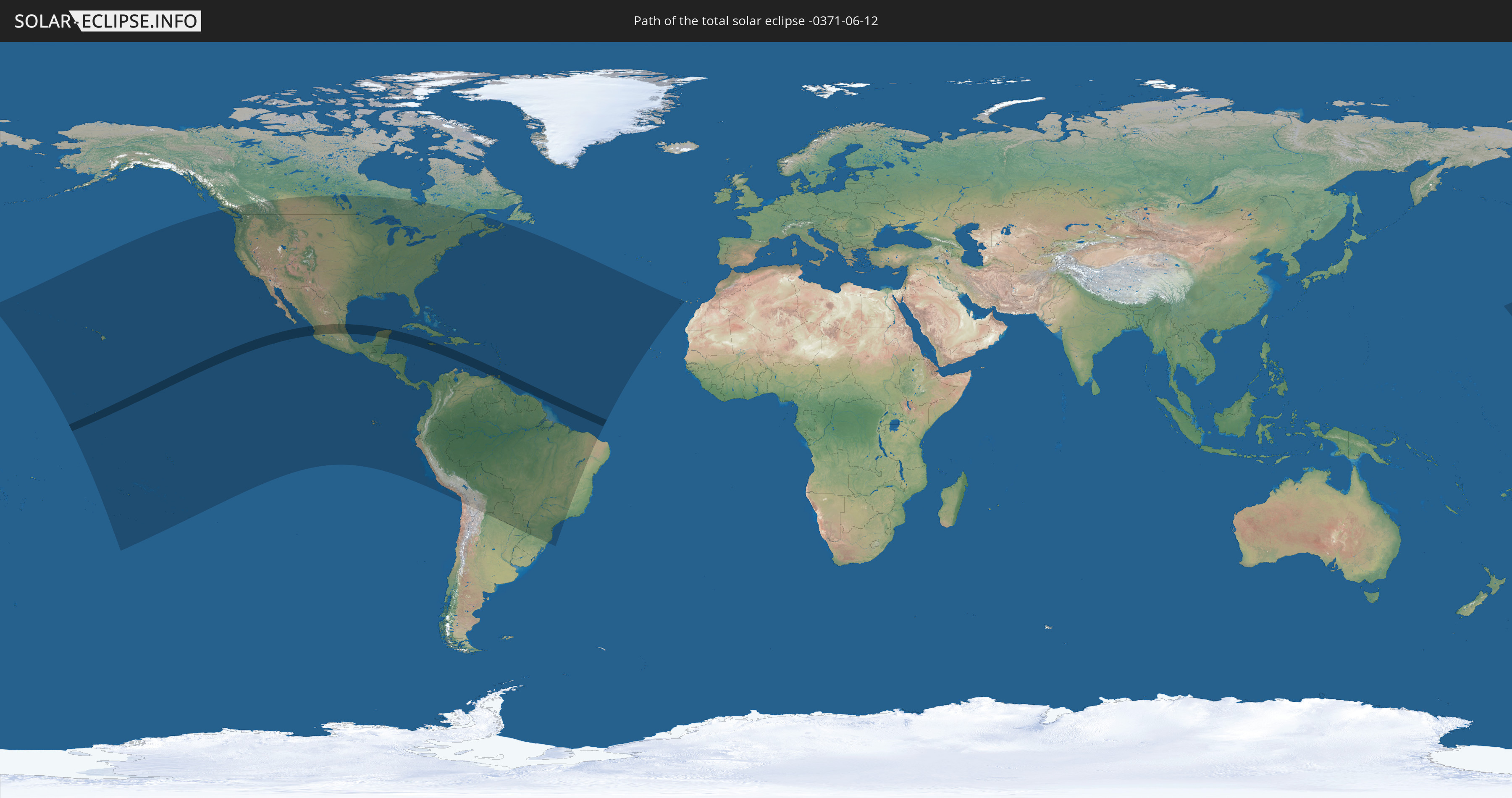
Die Sonnenfinsternis am 06/12/-0371 kann man in 53 Ländern als partielle Sonnenfinsternis beobachten.
Der Finsternispfad verläuft durch 8 Länder. Nur in diesen Ländern ist sie als total Sonnenfinsternis zu sehen.
In den folgenden Ländern ist die Sonnenfinsternis total zu sehen
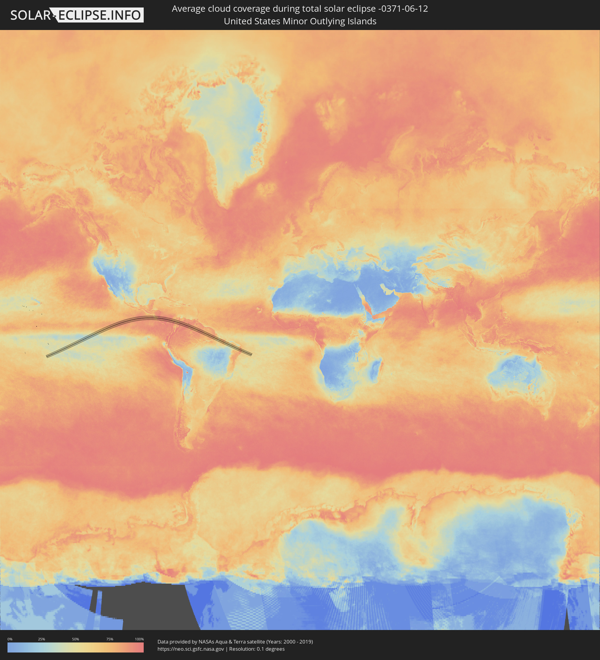
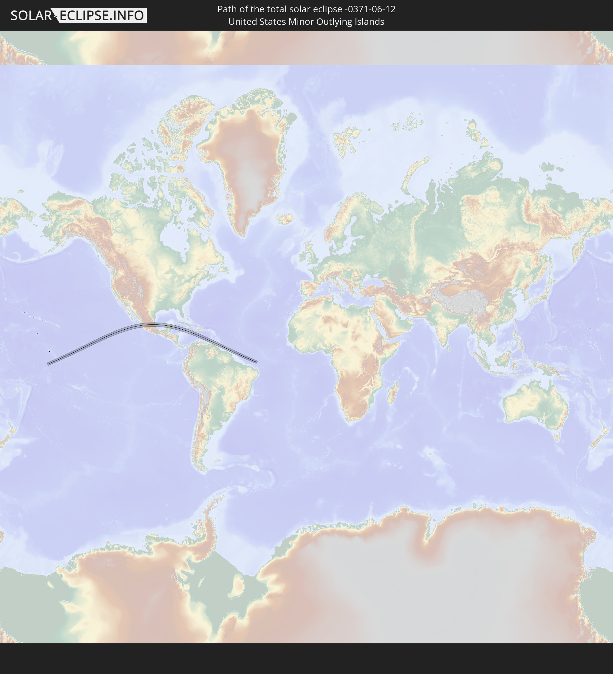 United States Minor Outlying Islands
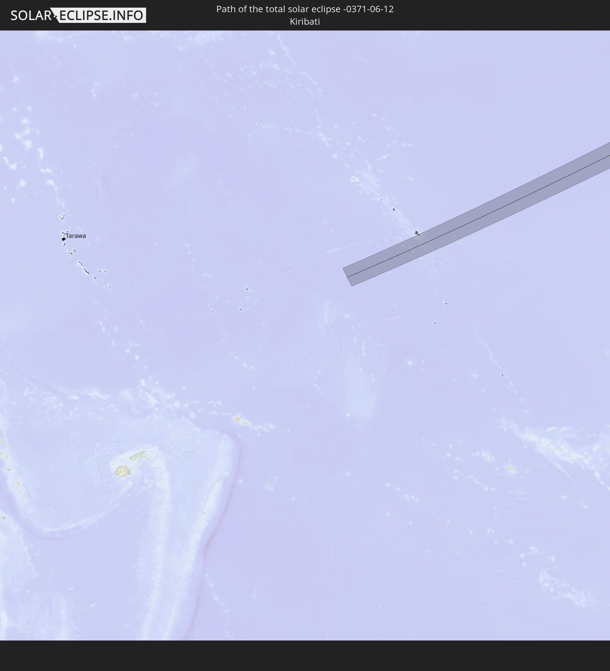 Kiribati
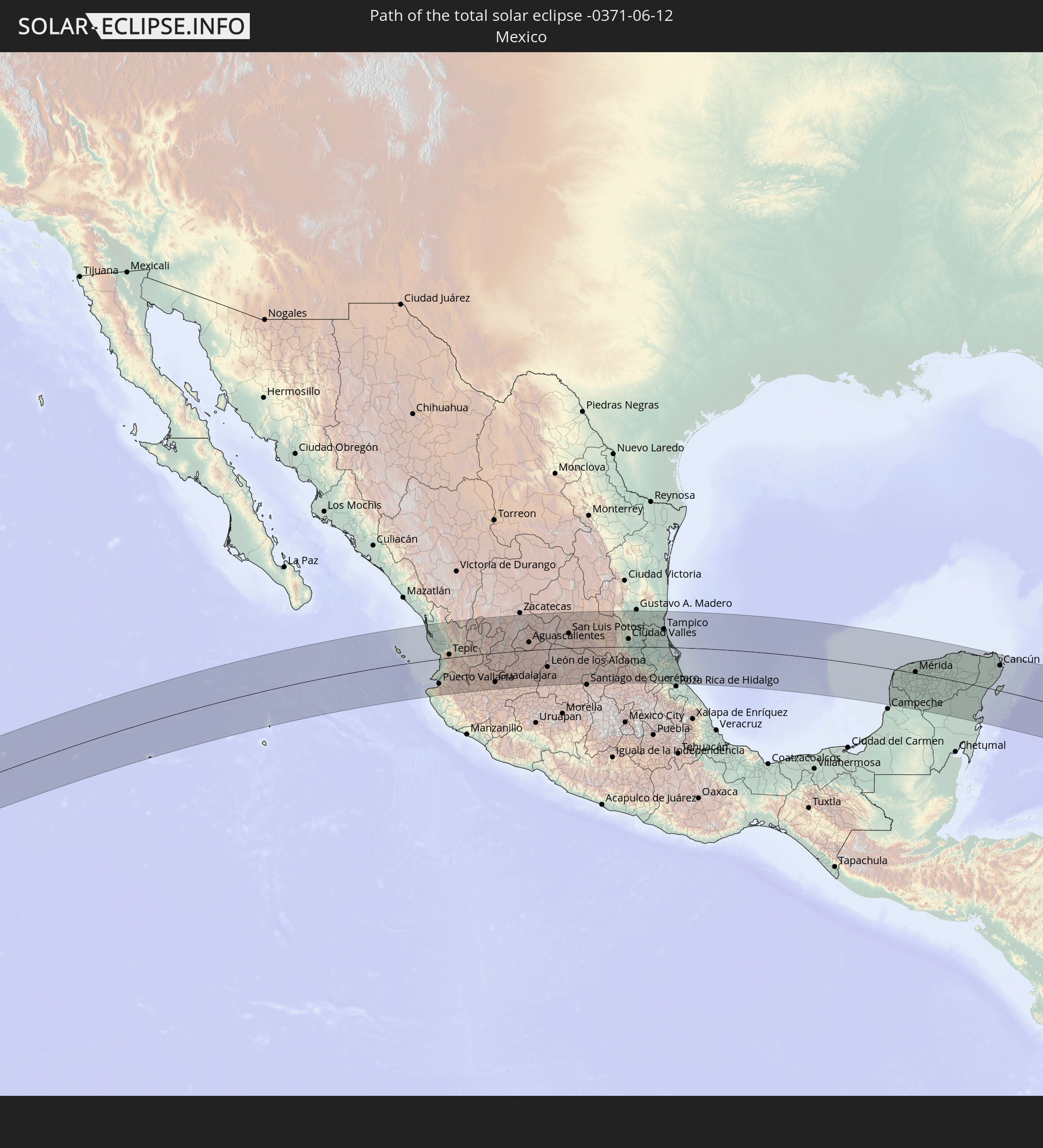 Mexico
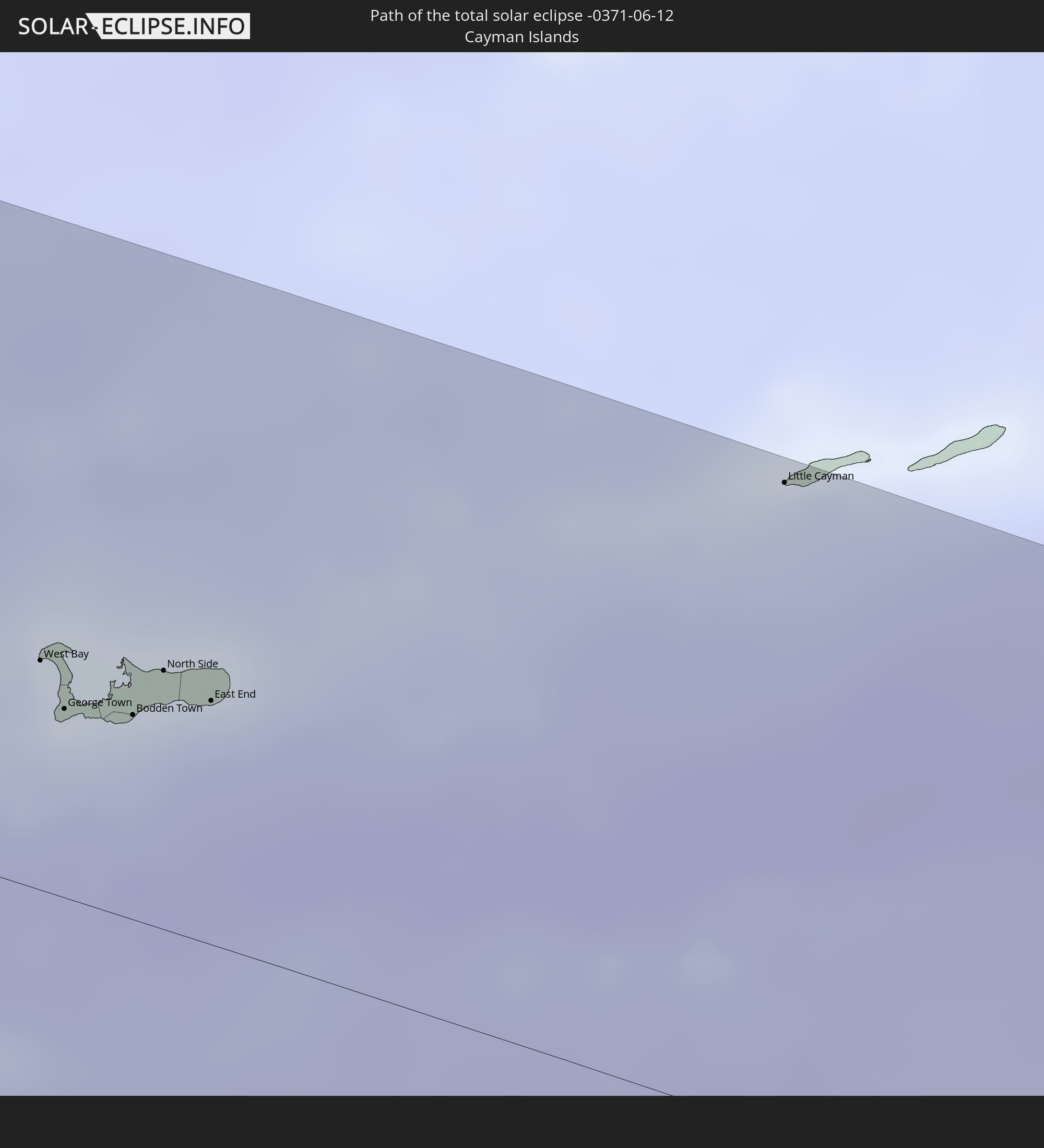 Cayman Islands
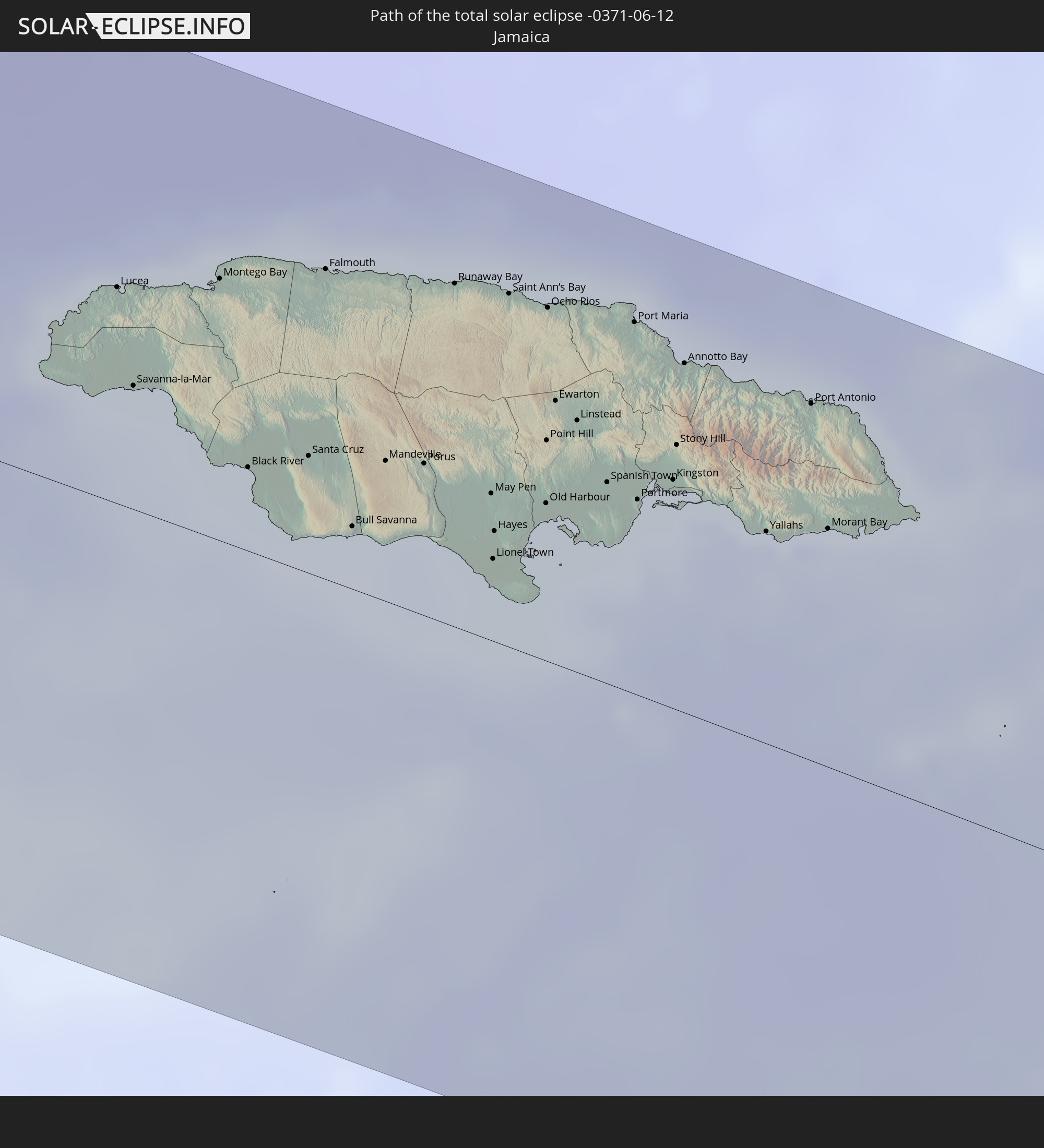 Jamaica
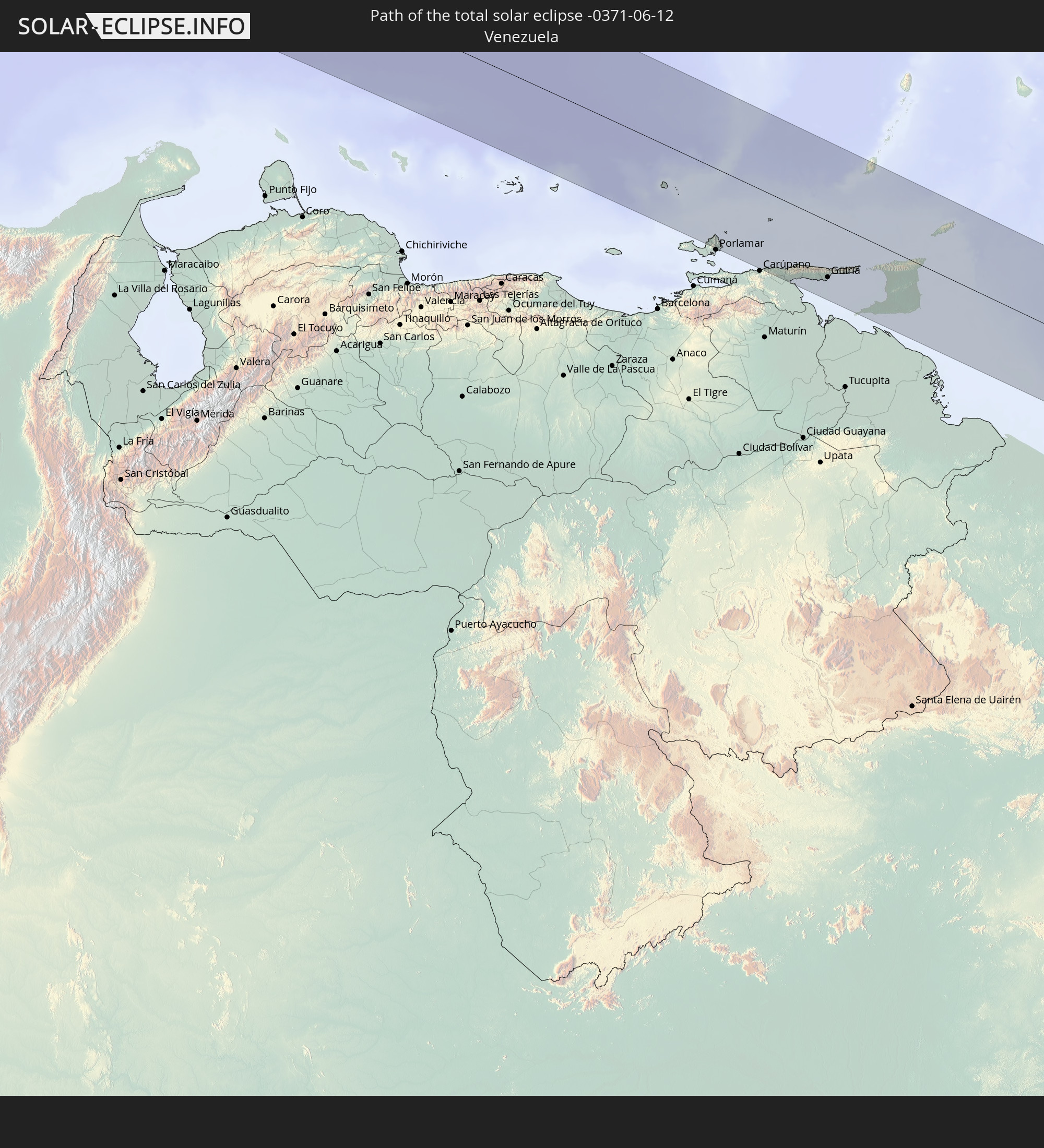 Venezuela
 Trinidad and Tobago
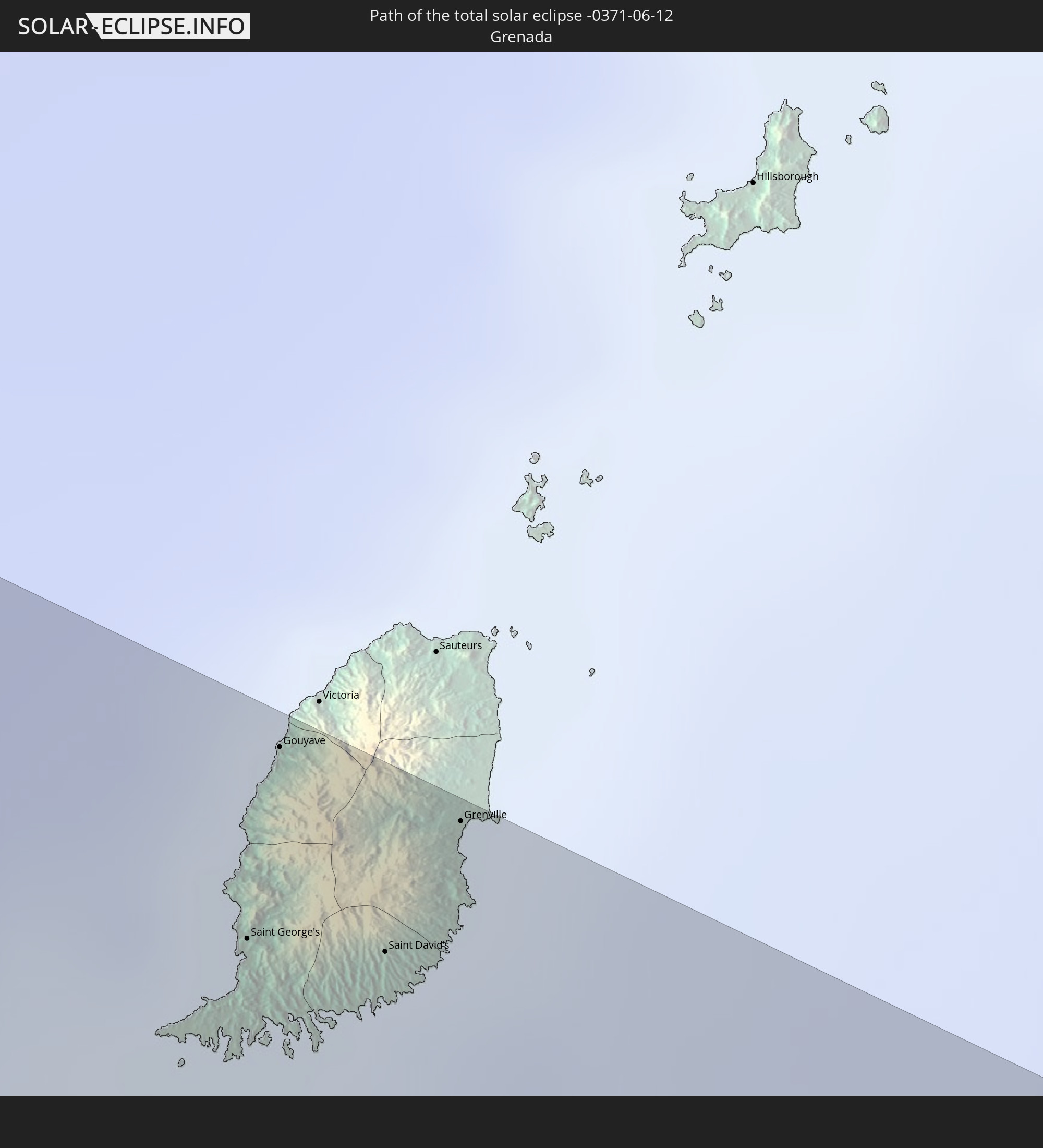 Grenada
In den folgenden Ländern ist die Sonnenfinsternis partiell zu sehen
 United States
 United States Minor Outlying Islands
 Kiribati
 Cook Islands
 French Polynesia
 Canada
 Mexico
 Chile
Chile
 Guatemala
 Ecuador
 El Salvador
 Honduras
 Belize
 Nicaragua
 Costa Rica
 Cuba
Cuba
 Panama
 Colombia
 Cayman Islands
 Peru
Peru
 The Bahamas
 Jamaica
 Haiti
Haiti
 Brazil
 Argentina
 Venezuela
 Turks and Caicos Islands
 Dominican Republic
 Aruba
Aruba
 Bolivia
 Puerto Rico
 United States Virgin Islands
 Bermuda
 British Virgin Islands
 Anguilla
 Collectivity of Saint Martin
 Saint Barthélemy
 Saint Kitts and Nevis
 Paraguay
 Antigua and Barbuda
 Montserrat
 Trinidad and Tobago
 Guadeloupe
 Grenada
 Dominica
 Saint Vincent and the Grenadines
 Guyana
 Martinique
 Saint Lucia
 Barbados
 Suriname
 French Guiana
 Spain
Spain
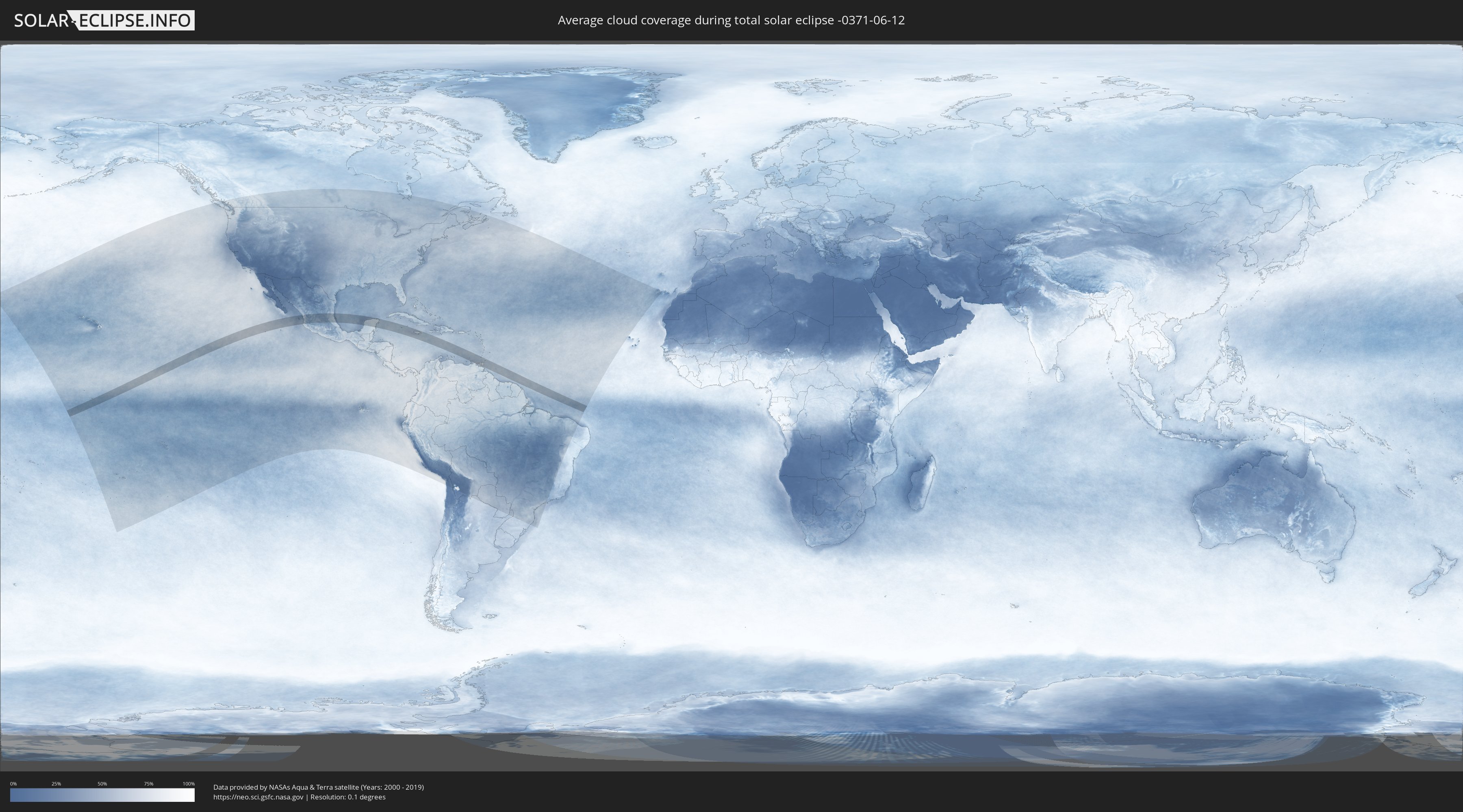
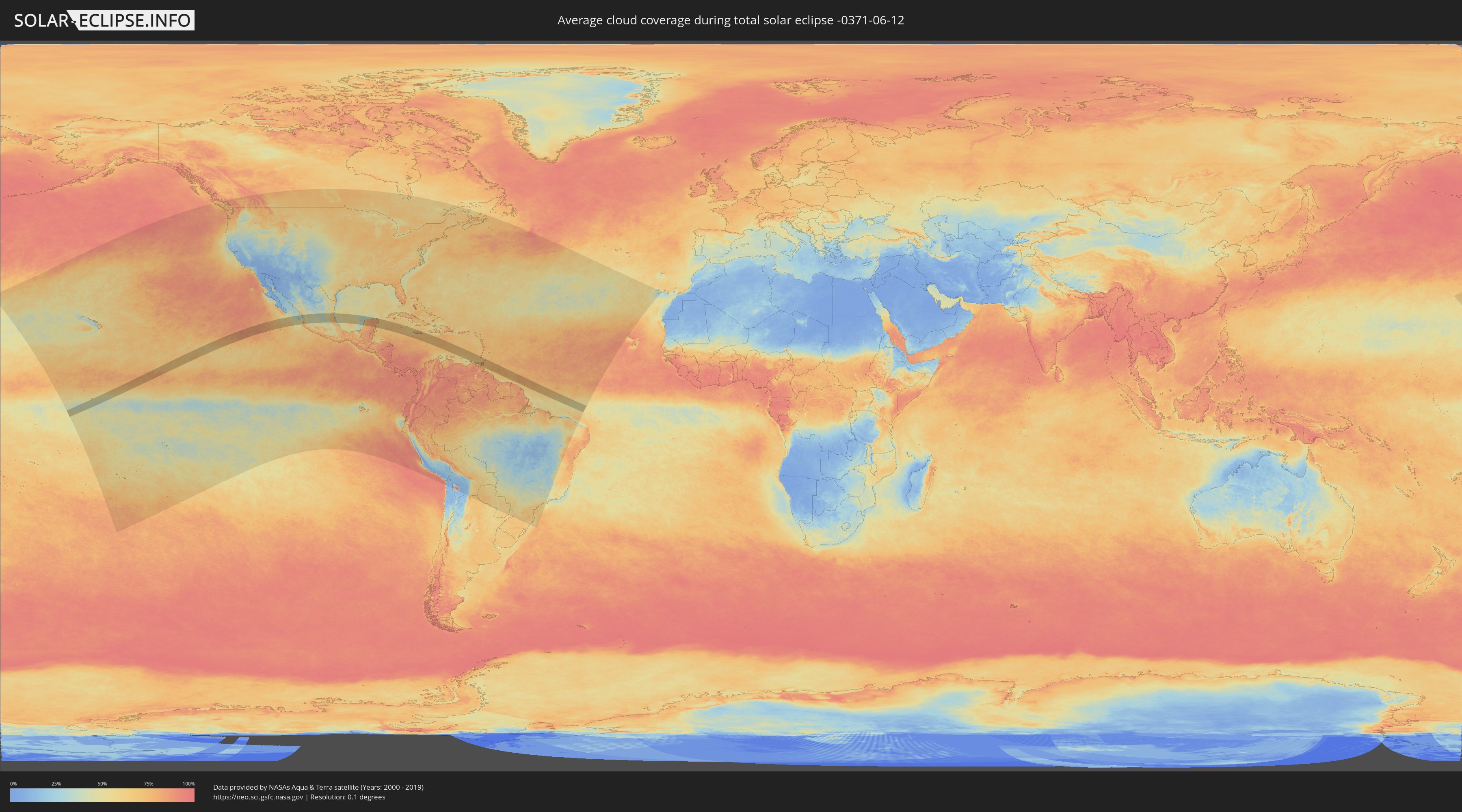
How will be the weather during the total solar eclipse on 06/12/-0371?
Where is the best place to see the total solar eclipse of 06/12/-0371?
The following maps show the average cloud coverage for the day of the total solar eclipse.
With the help of these maps, it is possible to find the place along the eclipse path, which has the best
chance of a cloudless sky.
Nevertheless, you should consider local circumstances and inform about the weather of your chosen
observation site.
The data is provided by NASAs satellites
AQUA and TERRA.
The cloud maps are averaged over a period of 19 years (2000 - 2019).
Detailed country maps
 United States Minor Outlying Islands
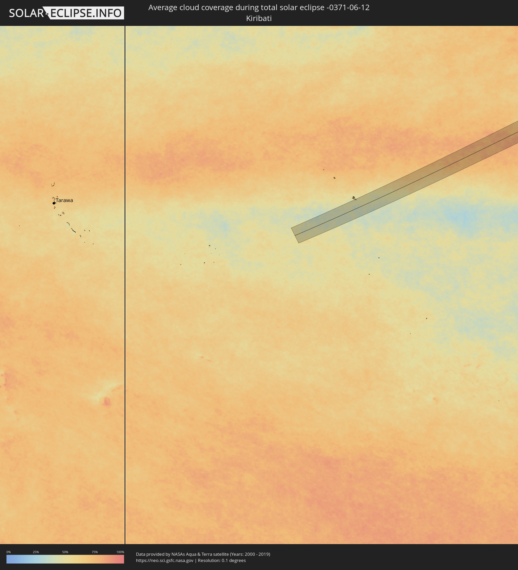 Kiribati
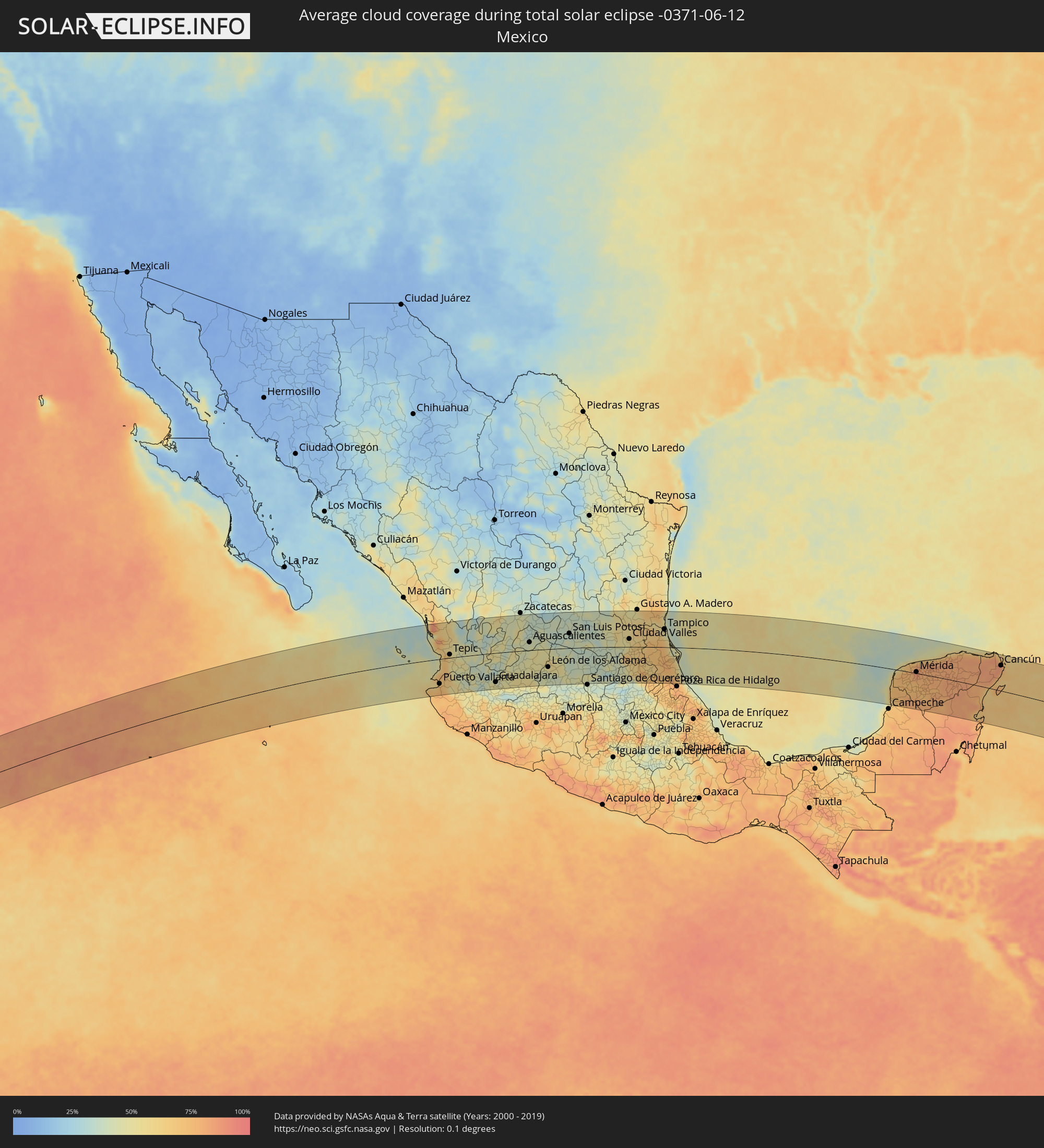 Mexico
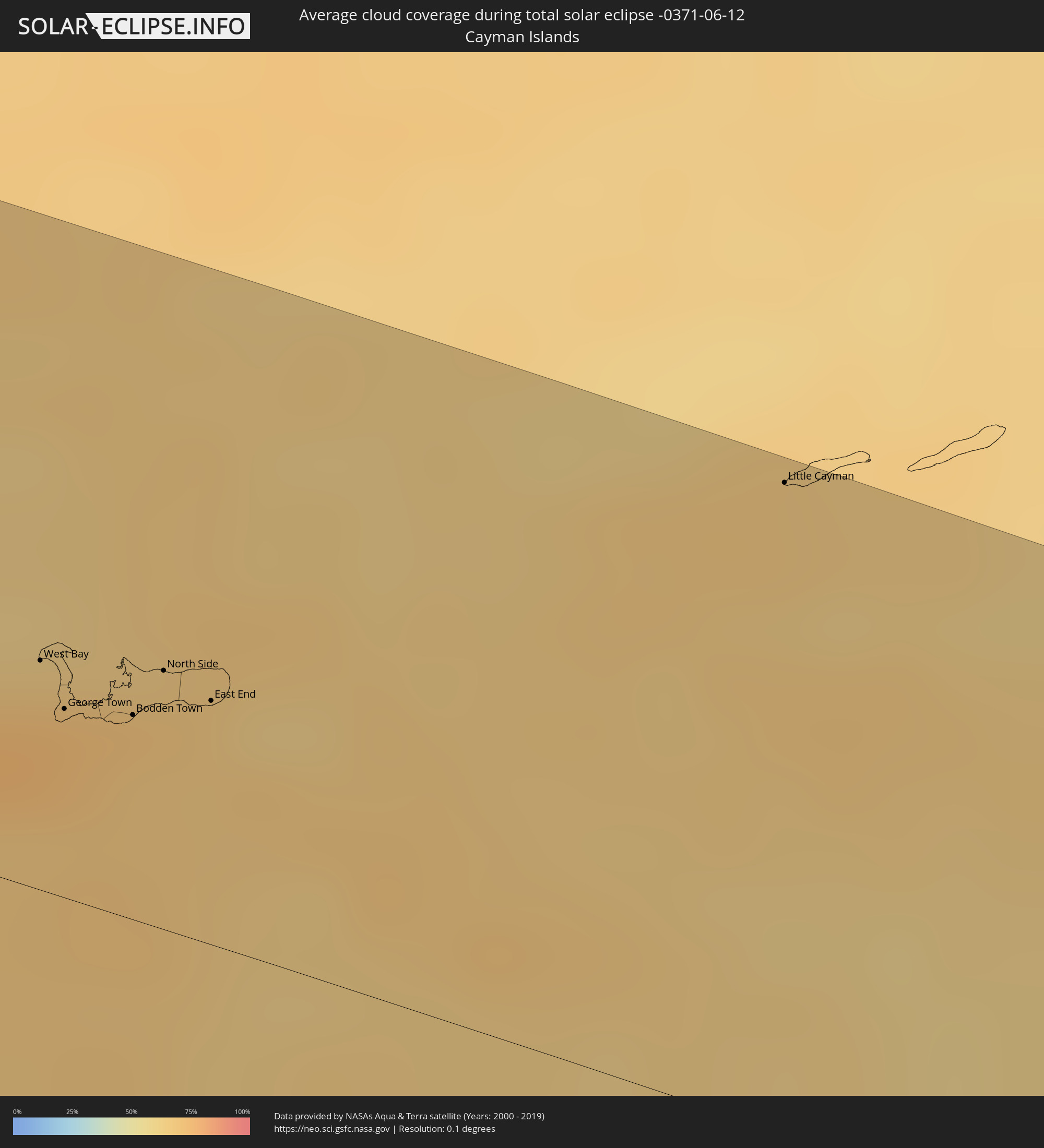 Cayman Islands
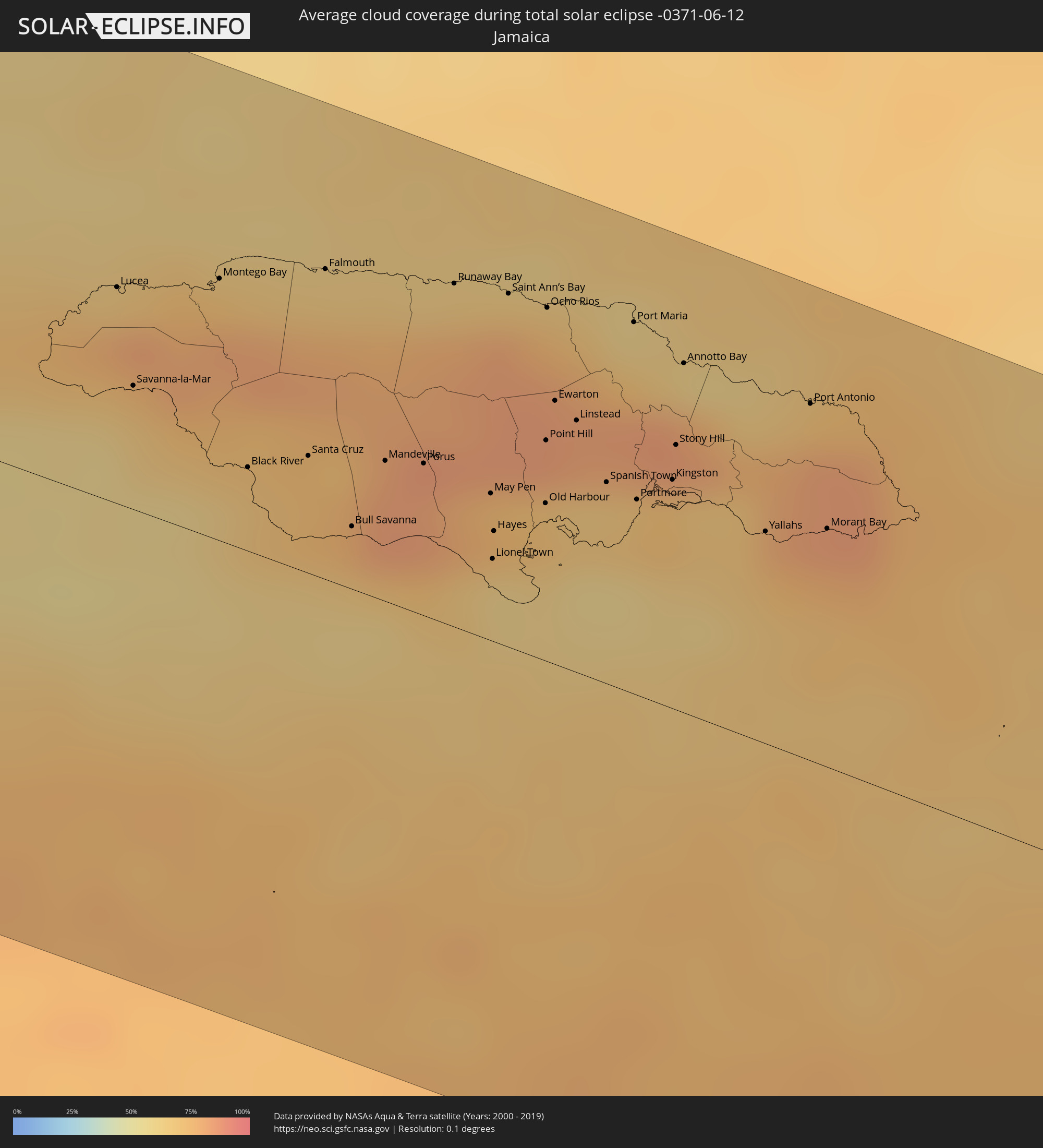 Jamaica
 Venezuela
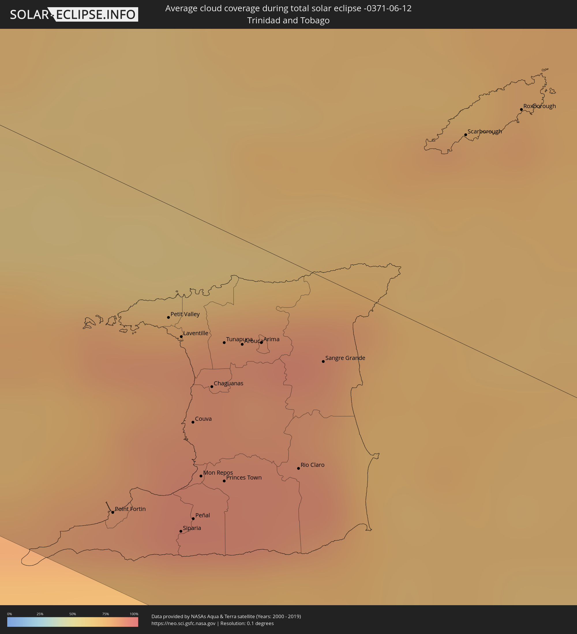 Trinidad and Tobago
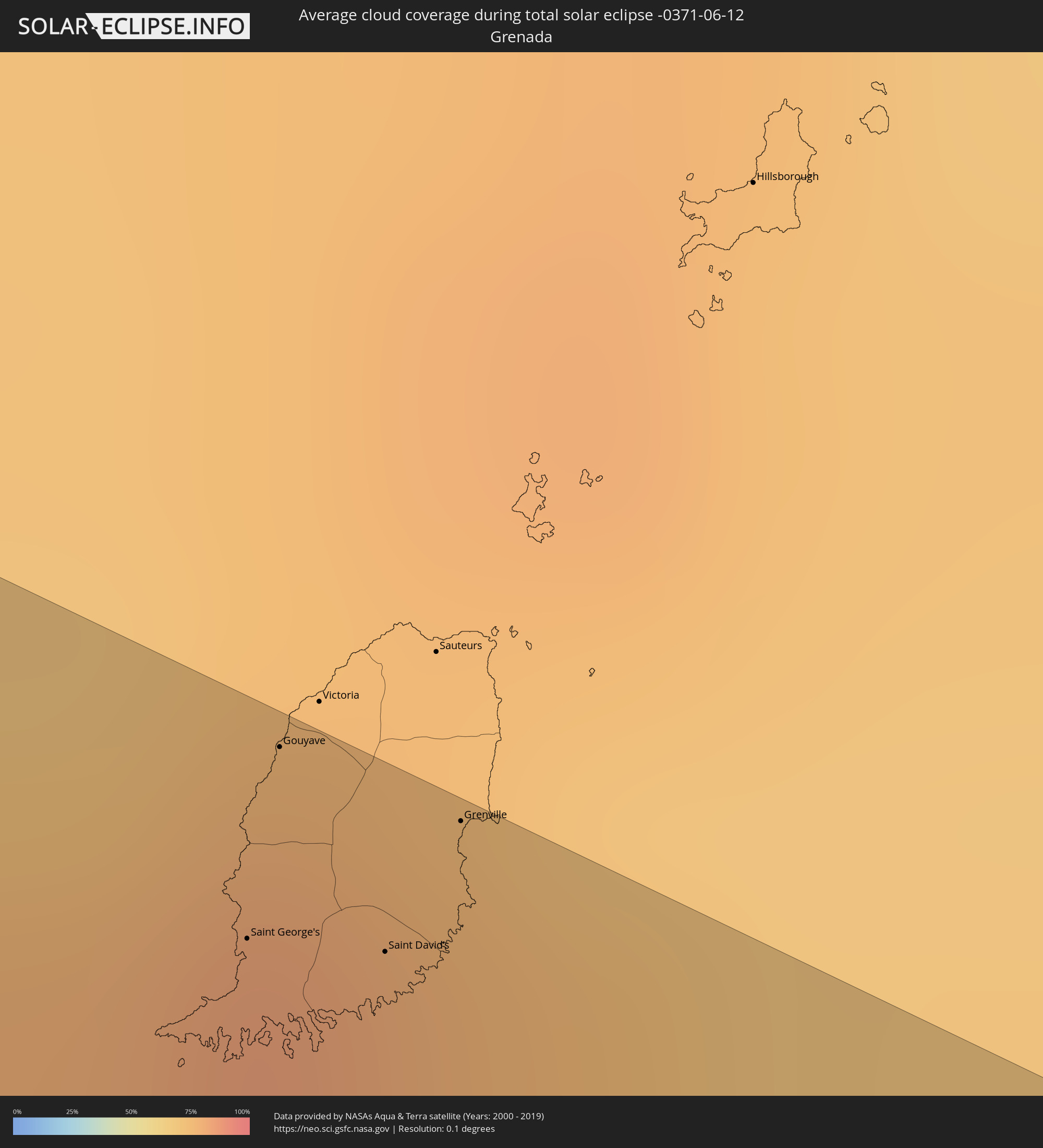 Grenada
Cities inside the path of the eclipse
The following table shows all locations with a population of more than 5,000 inside the eclipse path. Cities which have more than 100,000 inhabitants are marked bold. A click at the locations opens a detailed map.
| City | Type | Eclipse duration | Local time of max. eclipse | Distance to central line | Ø Cloud coverage |
|
Puerto Vallarta, Jalisco
|
total | - | 11:40:31 UTC-06:36 | 83 km | 74% |
|
Tepic, Nayarit
|
total | - | 11:12:43 UTC-07:05 | 11 km | 57% |
|
Guadalajara, Jalisco
|
total | - | 11:45:49 UTC-06:36 | 99 km | 47% |
|
Hacienda Santa Fe, Jalisco
|
total | - | 11:45:49 UTC-06:36 | 115 km | 47% |
|
Tonalá, Jalisco
|
total | - | 11:46:16 UTC-06:36 | 105 km | 50% |
|
Jerez de García Salinas, Zacatecas
|
total | - | 11:47:28 UTC-06:36 | 117 km | 44% |
|
Tepatitlán de Morelos, Jalisco
|
total | - | 11:47:41 UTC-06:36 | 88 km | 53% |
|
Arandas, Jalisco
|
total | - | 11:48:53 UTC-06:36 | 103 km | 57% |
|
San Juan de los Lagos, Jalisco
|
total | - | 11:49:02 UTC-06:36 | 43 km | 50% |
|
Aguascalientes, Aguascalientes
|
total | - | 11:49:18 UTC-06:36 | 27 km | 41% |
|
Lagos de Moreno, Jalisco
|
total | - | 11:50:12 UTC-06:36 | 34 km | 48% |
|
San Francisco del Rincón, Guanajuato
|
total | - | 11:50:22 UTC-06:36 | 72 km | 44% |
|
León de los Aldama, Guanajuato
|
total | - | 11:50:55 UTC-06:36 | 61 km | 46% |
|
Silao, Guanajuato
|
total | - | 11:51:36 UTC-06:36 | 83 km | 39% |
|
Irapuato, Guanajuato
|
total | - | 11:51:46 UTC-06:36 | 113 km | 39% |
|
Guanajuato, Guanajuato
|
total | - | 11:52:07 UTC-06:36 | 75 km | 47% |
|
San Luis Potosí, San Luis Potosí
|
total | - | 11:53:04 UTC-06:36 | 49 km | 37% |
|
Dolores Hidalgo Cuna de la Independencia Nacional, Guanajuato
|
total | - | 11:53:05 UTC-06:36 | 61 km | 38% |
|
San Miguel de Allende, Guanajuato
|
total | - | 11:53:36 UTC-06:36 | 89 km | 49% |
|
San Luis de la Paz, Guanajuato
|
total | - | 11:54:18 UTC-06:36 | 47 km | 39% |
|
Río Verde, San Luis Potosí
|
total | - | 11:55:53 UTC-06:36 | 22 km | 34% |
|
Ciudad Valles, San Luis Potosí
|
total | - | 11:58:41 UTC-06:36 | 27 km | 57% |
|
Ciudad Mante, Tamaulipas
|
total | - | 11:58:48 UTC-06:36 | 111 km | 52% |
|
Huejutla de Reyes, Hidalgo
|
total | - | 12:00:25 UTC-06:36 | 67 km | 64% |
|
Tantoyuca, Veracruz
|
total | - | 12:00:58 UTC-06:36 | 43 km | 73% |
|
Tampico, Tamaulipas
|
total | - | 12:01:57 UTC-06:36 | 61 km | 55% |
|
Temapache, Veracruz
|
total | - | 12:02:41 UTC-06:36 | 74 km | 71% |
|
Tuxpan de Rodríguez Cano, Veracruz
|
total | - | 12:03:23 UTC-06:36 | 85 km | 55% |
|
Progreso de Castro, Yucatán
|
total | - | 12:25:02 UTC-06:36 | 38 km | 71% |
|
Mérida, Yucatán
|
total | - | 12:25:17 UTC-06:36 | 4 km | 86% |
|
Tizimín, Yucatán
|
total | - | 12:29:01 UTC-06:36 | 52 km | 80% |
|
Playa del Carmen, Quintana Roo
|
total | - | 13:21:36 UTC-05:47 | 19 km | 71% |
|
San Miguel de Cozumel, Quintana Roo
|
total | - | 13:22:01 UTC-05:47 | 9 km | 77% |
|
Cancún, Quintana Roo
|
total | - | 13:21:50 UTC-05:47 | 84 km | 78% |
|
West Bay, West Bay
|
total | - | 14:03:23 UTC-05:19 | 40 km | 74% |
|
George Town, George Town
|
total | - | 14:03:33 UTC-05:19 | 33 km | 74% |
|
Bodden Town, Bodden Town
|
total | - | 14:03:49 UTC-05:19 | 36 km | 71% |
|
North Side, North Side
|
total | - | 14:03:53 UTC-05:19 | 46 km | 70% |
|
East End, East End
|
total | - | 14:04:06 UTC-05:19 | 43 km | 67% |
|
Little Cayman, Sister Island
|
total | - | 14:05:58 UTC-05:19 | 114 km | 67% |
|
Lucea, Hanover
|
total | - | 14:23:23 UTC-05:07 | 53 km | 67% |
|
Savanna-la-Mar, Westmoreland
|
total | - | 14:23:40 UTC-05:07 | 31 km | 67% |
|
Montego Bay, St. James
|
total | - | 14:23:52 UTC-05:07 | 65 km | 72% |
|
Black River, St. Elizabeth
|
total | - | 14:24:23 UTC-05:07 | 21 km | 69% |
|
Santa Cruz, St. Elizabeth
|
total | - | 14:24:40 UTC-05:07 | 29 km | 73% |
|
Falmouth, Trelawny
|
total | - | 14:24:22 UTC-05:07 | 76 km | 67% |
|
Bull Savanna, St. Elizabeth
|
total | - | 14:25:01 UTC-05:07 | 15 km | 66% |
|
Mandeville, Manchester
|
total | - | 14:25:03 UTC-05:07 | 35 km | 82% |
|
Porus, Manchester
|
total | - | 14:25:14 UTC-05:07 | 37 km | 82% |
|
Runaway Bay, St Ann
|
total | - | 14:25:01 UTC-05:07 | 85 km | 66% |
|
May Pen, Clarendon
|
total | - | 14:25:37 UTC-05:07 | 36 km | 74% |
|
Lionel Town, Clarendon
|
total | - | 14:25:46 UTC-05:07 | 20 km | 61% |
|
Hayes, Clarendon
|
total | - | 14:25:43 UTC-05:07 | 27 km | 62% |
|
Saint Ann’s Bay, St Ann
|
total | - | 14:25:18 UTC-05:07 | 87 km | 81% |
|
Old Harbour, Saint Catherine
|
total | - | 14:25:54 UTC-05:07 | 39 km | 63% |
|
Point Hill, Saint Catherine
|
total | - | 14:25:47 UTC-05:07 | 54 km | 83% |
|
Ocho Rios, St Ann
|
total | - | 14:25:31 UTC-05:07 | 87 km | 76% |
|
Old Harbour Bay, Saint Catherine
|
total | - | 14:25:57 UTC-05:07 | 36 km | 63% |
|
Ewarton, Saint Catherine
|
total | - | 14:25:45 UTC-05:07 | 65 km | 84% |
|
Linstead, Saint Catherine
|
total | - | 14:25:53 UTC-05:07 | 62 km | 81% |
|
Bog Walk, Saint Catherine
|
total | - | 14:25:58 UTC-05:07 | 59 km | 81% |
|
Spanish Town, Saint Catherine
|
total | - | 14:26:09 UTC-05:07 | 50 km | 67% |
|
Port Maria, St. Mary
|
total | - | 14:25:57 UTC-05:07 | 92 km | 62% |
|
Portmore, Saint Catherine
|
total | - | 14:26:20 UTC-05:07 | 48 km | 69% |
|
Half Way Tree, St. Andrew
|
total | - | 14:26:26 UTC-05:07 | 58 km | 72% |
|
Constant Spring, St. Andrew
|
total | - | 14:26:25 UTC-05:07 | 62 km | 83% |
|
Kingston, Kingston
|
total | - | 14:26:28 UTC-05:07 | 56 km | 72% |
|
Stony Hill, St. Andrew
|
total | - | 14:26:24 UTC-05:07 | 65 km | 83% |
|
New Kingston, St. Andrew
|
total | - | 14:26:28 UTC-05:07 | 58 km | 72% |
|
Annotto Bay, St. Mary
|
total | - | 14:26:17 UTC-05:07 | 86 km | 67% |
|
Yallahs, St. Thomas
|
total | - | 14:27:00 UTC-05:07 | 52 km | 68% |
|
Port Antonio, Portland
|
total | - | 14:26:57 UTC-05:07 | 88 km | 68% |
|
Morant Bay, St. Thomas
|
total | - | 14:27:17 UTC-05:07 | 59 km | 76% |
|
Juan Griego, Nueva Esparta
|
total | - | 15:30:54 UTC-04:27 | 105 km | 71% |
|
La Asunción, Nueva Esparta
|
total | - | 15:31:03 UTC-04:27 | 105 km | 71% |
|
Güiria, Sucre
|
total | - | 15:33:00 UTC-04:27 | 78 km | 72% |
|
Saint George's, Saint George
|
total | - | 15:54:02 UTC-04:06 | 96 km | 82% |
|
Gouyave, Saint John
|
total | - | 15:53:58 UTC-04:06 | 108 km | 84% |
|
Point Fortin, Point Fortin
|
total | - | 15:55:30 UTC-04:06 | 89 km | 84% |
|
Saint David’s, Saint David
|
total | - | 15:54:07 UTC-04:06 | 99 km | 74% |
|
Grenville, Saint Andrew
|
total | - | 15:54:06 UTC-04:06 | 109 km | 77% |
|
Petit Valley, Diego Martin
|
total | - | 15:55:16 UTC-04:06 | 30 km | 85% |
|
Port of Spain, City of Port of Spain
|
total | - | 15:55:18 UTC-04:06 | 33 km | 85% |
|
Siparia, Siparia
|
total | - | 15:55:42 UTC-04:06 | 86 km | 76% |
|
Laventille, San Juan/Laventille
|
total | - | 15:55:20 UTC-04:06 | 34 km | 84% |
|
Couva, Couva-Tabaquite-Talparo
|
total | - | 15:55:32 UTC-04:06 | 55 km | 89% |
|
San Fernando, City of San Fernando
|
total | - | 15:55:38 UTC-04:06 | 69 km | 90% |
|
Peñal, Penal/Debe
|
total | - | 15:55:43 UTC-04:06 | 81 km | 89% |
|
Marabella, City of San Fernando
|
total | - | 15:55:38 UTC-04:06 | 66 km | 90% |
|
Mon Repos, City of San Fernando
|
total | - | 15:55:39 UTC-04:06 | 68 km | 90% |
|
Chaguanas, Chaguanas
|
total | - | 15:55:30 UTC-04:06 | 43 km | 87% |
|
Tunapuna, Tunapuna/Piarco
|
total | - | 15:55:27 UTC-04:06 | 30 km | 87% |
|
Princes Town, Princes Town
|
total | - | 15:55:43 UTC-04:06 | 67 km | 90% |
|
Paradise, Tunapuna/Piarco
|
total | - | 15:55:27 UTC-04:06 | 27 km | 87% |
|
Arouca, Tunapuna/Piarco
|
total | - | 15:55:30 UTC-04:06 | 28 km | 85% |
|
Arima, Borough of Arima
|
total | - | 15:55:33 UTC-04:06 | 25 km | 85% |
|
Rio Claro, Mayaro
|
total | - | 15:55:53 UTC-04:06 | 54 km | 88% |
|
Sangre Grande, Sangre Grande
|
total | - | 15:55:44 UTC-04:06 | 22 km | 84% |
|
Scarborough, Tobago
|
total | - | 15:55:39 UTC-04:06 | 56 km | 74% |
|
Roxborough, Eastern Tobago
|
total | - | 15:55:44 UTC-04:06 | 70 km | 79% |