Total solar eclipse of 08/07/-1239
| Day of week: | Sunday |
| Maximum duration of eclipse: | 03m28s |
| Maximum width of eclipse path: | 119 km |
| Saros cycle: | 35 |
| Coverage: | 100% |
| Magnitude: | 1.0354 |
| Gamma: | 0.0136 |
Wo kann man die Sonnenfinsternis vom 08/07/-1239 sehen?
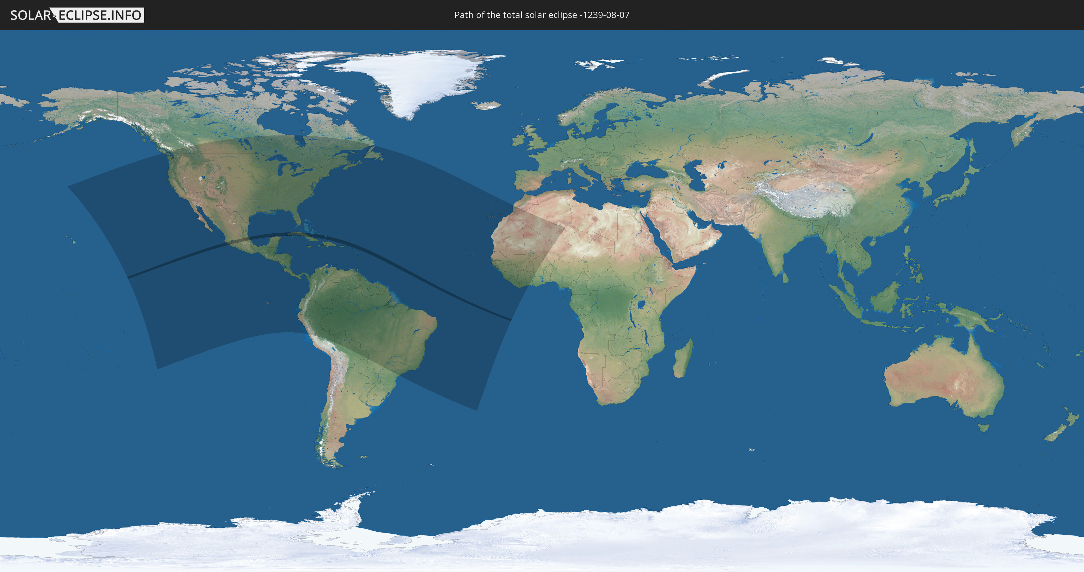
Die Sonnenfinsternis am 08/07/-1239 kann man in 65 Ländern als partielle Sonnenfinsternis beobachten.
Der Finsternispfad verläuft durch 10 Länder. Nur in diesen Ländern ist sie als total Sonnenfinsternis zu sehen.
In den folgenden Ländern ist die Sonnenfinsternis total zu sehen
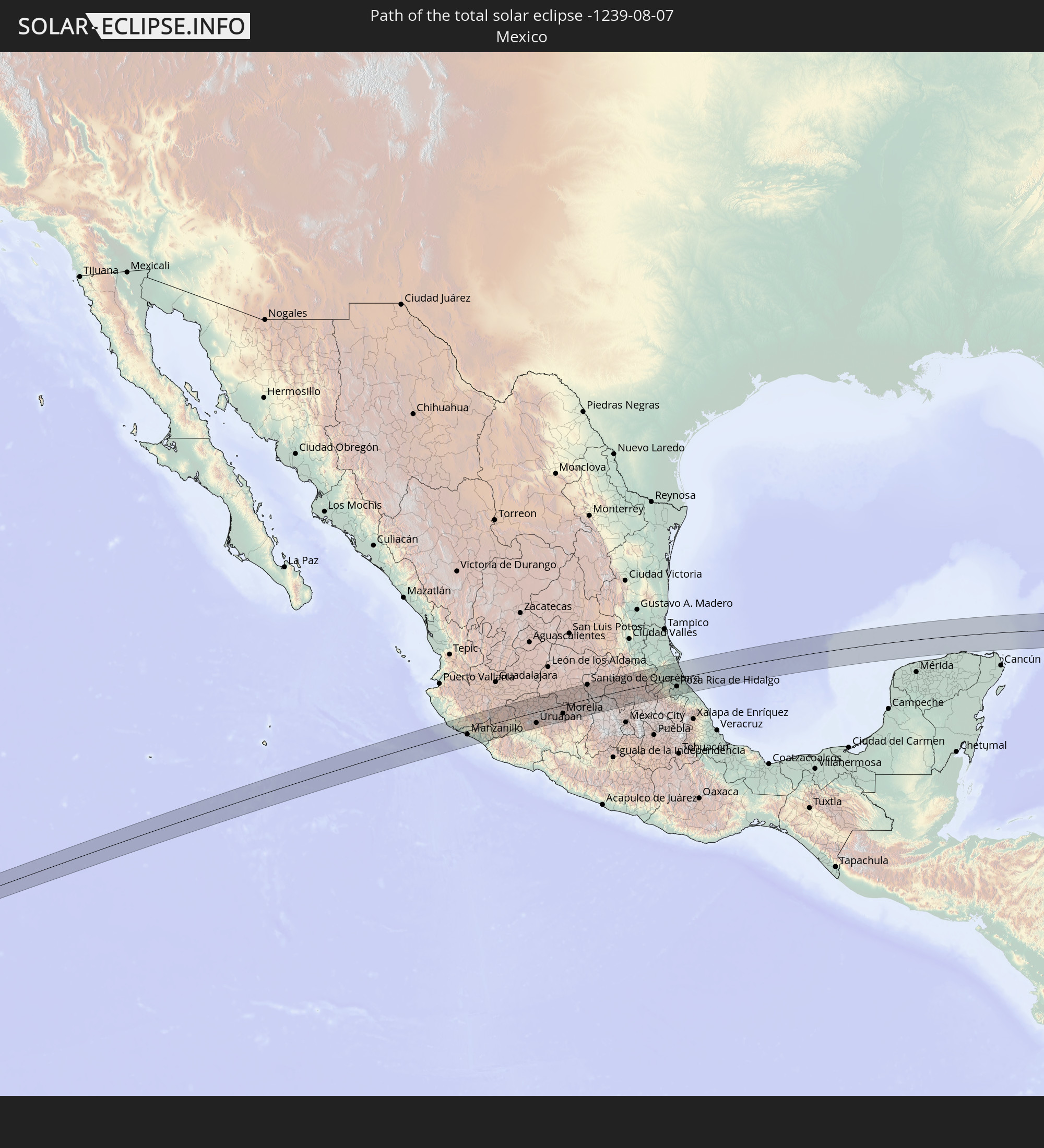 Mexico
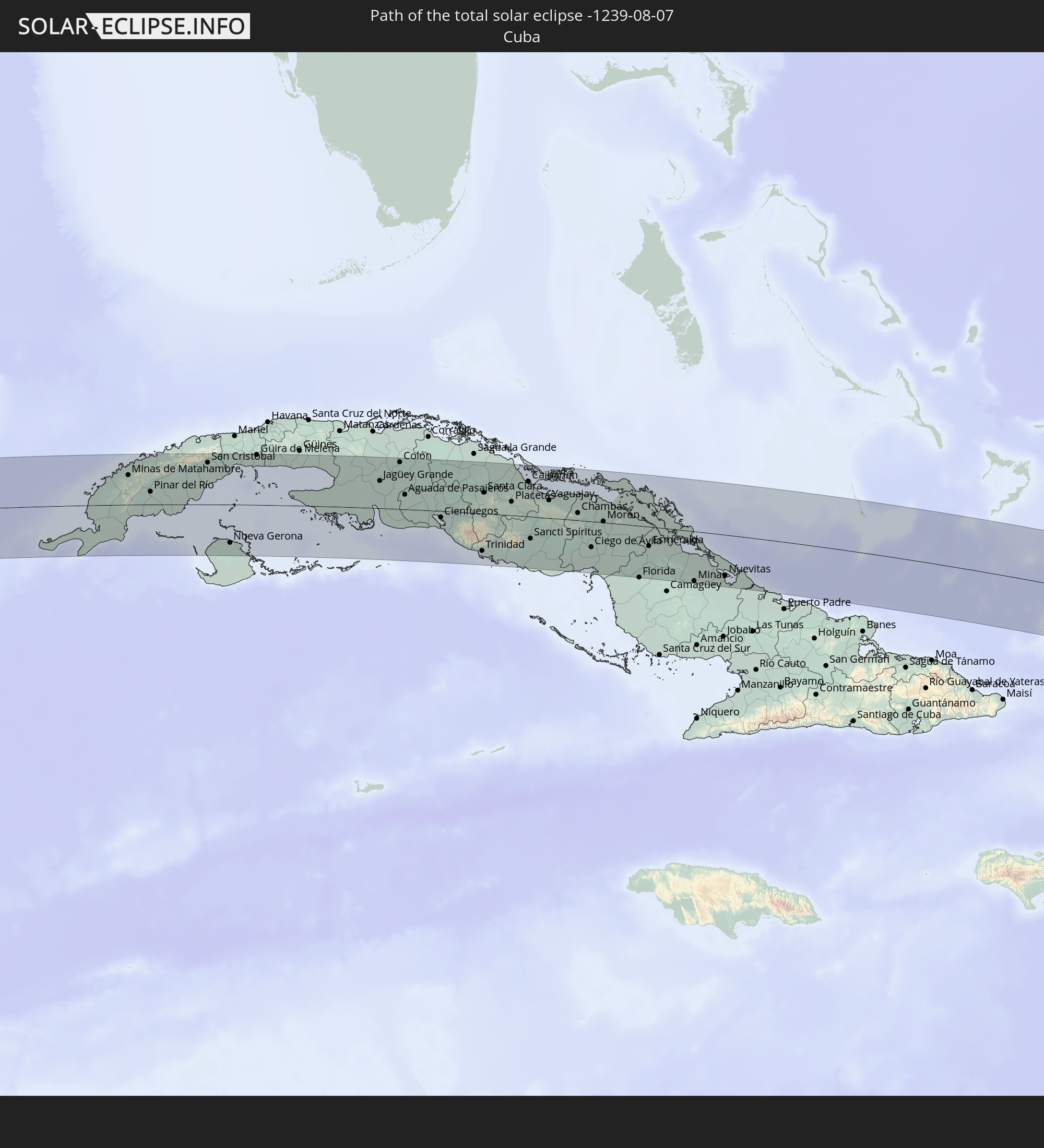 Cuba
Cuba
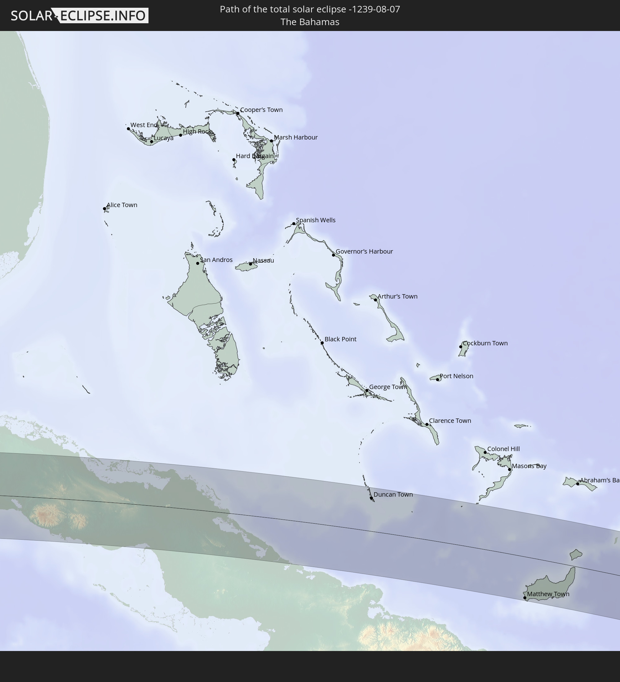 The Bahamas
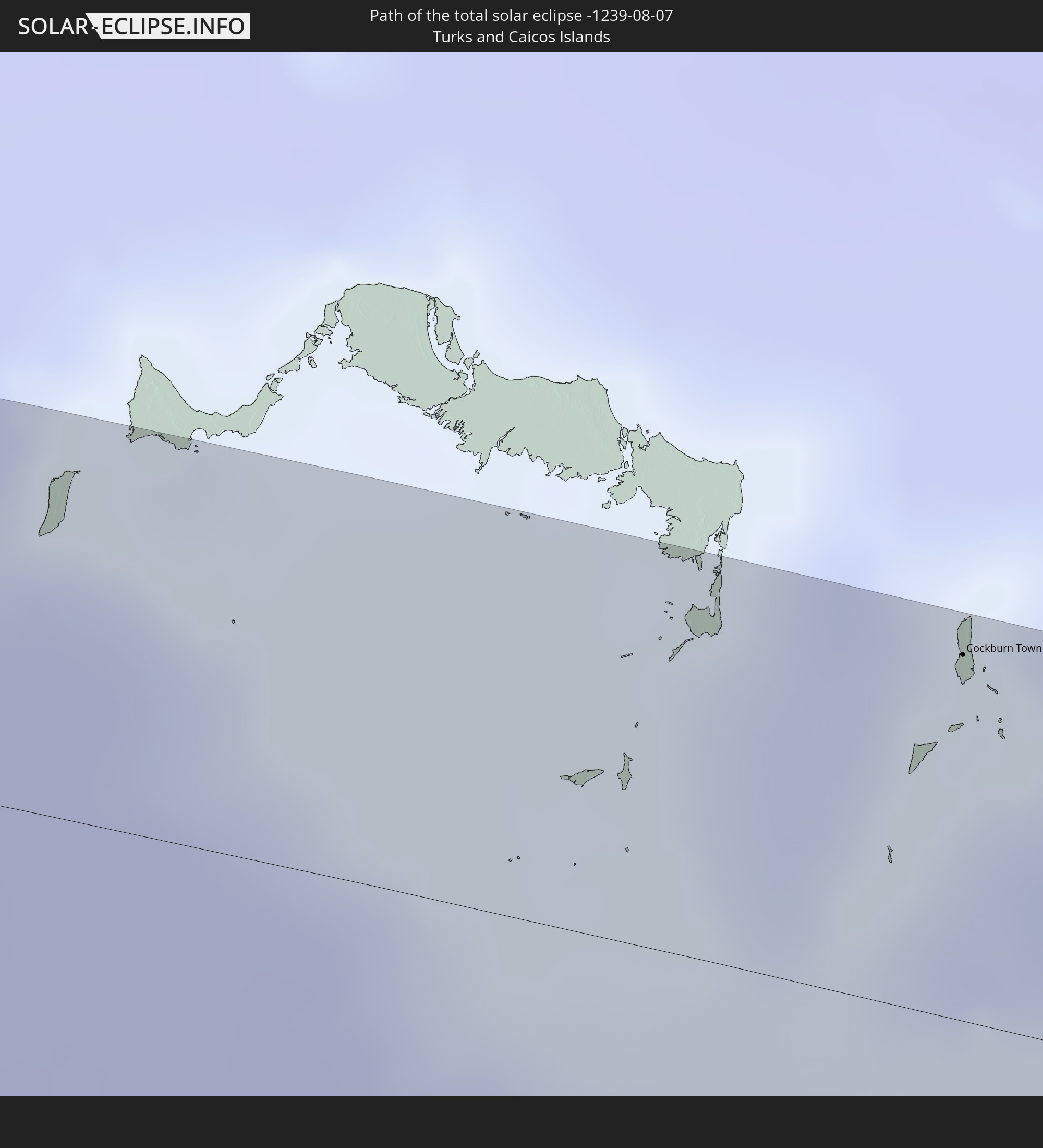 Turks and Caicos Islands
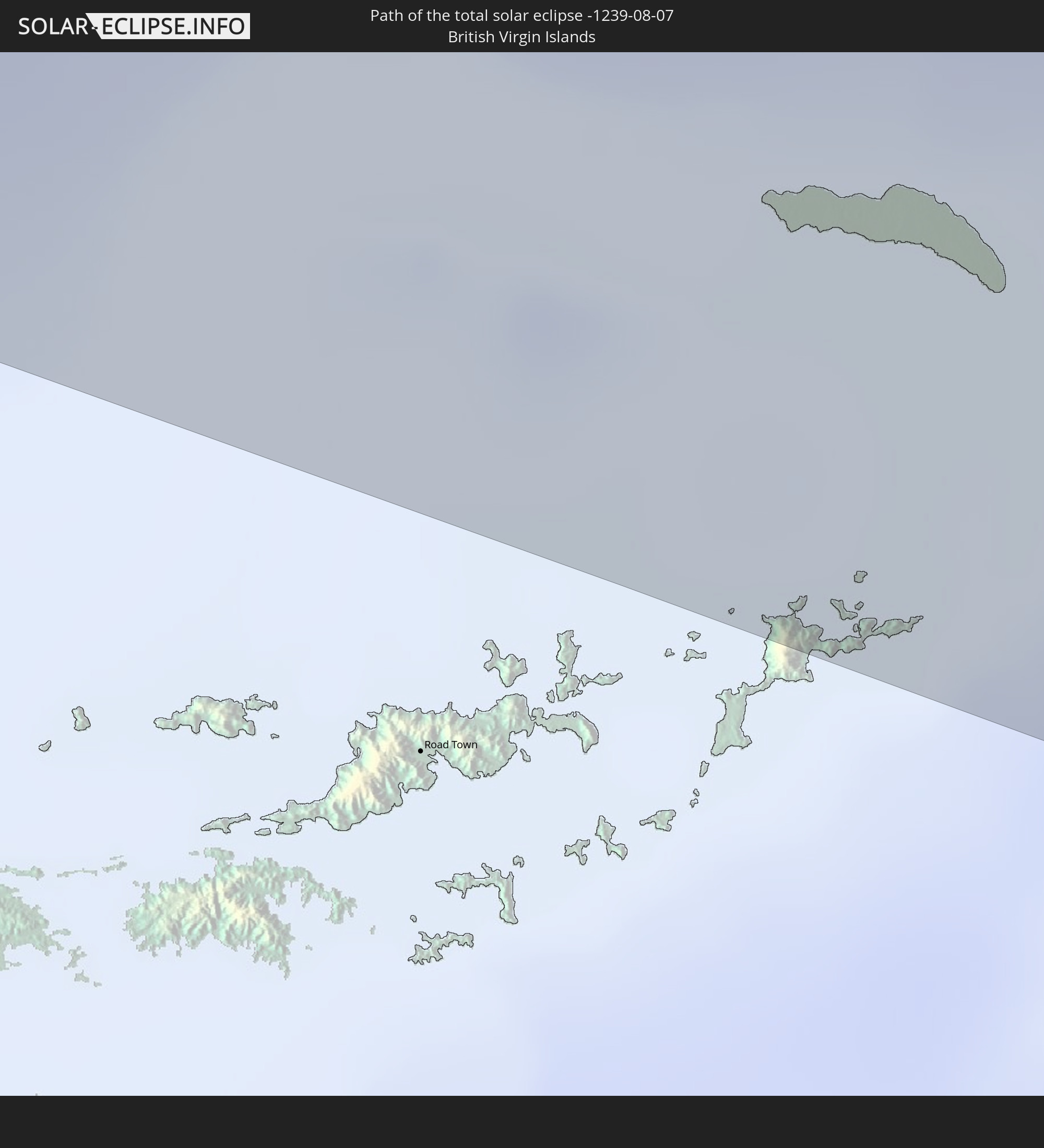 British Virgin Islands
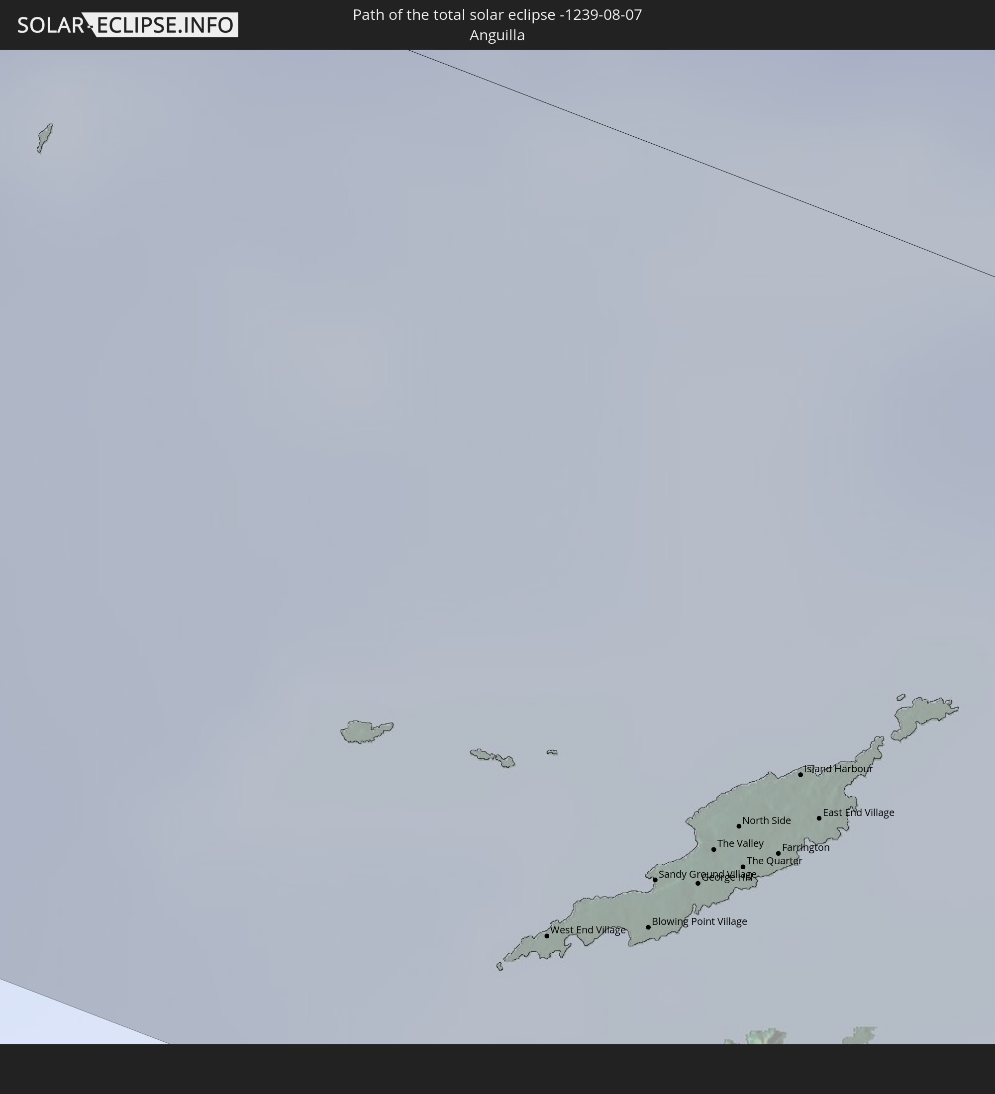 Anguilla
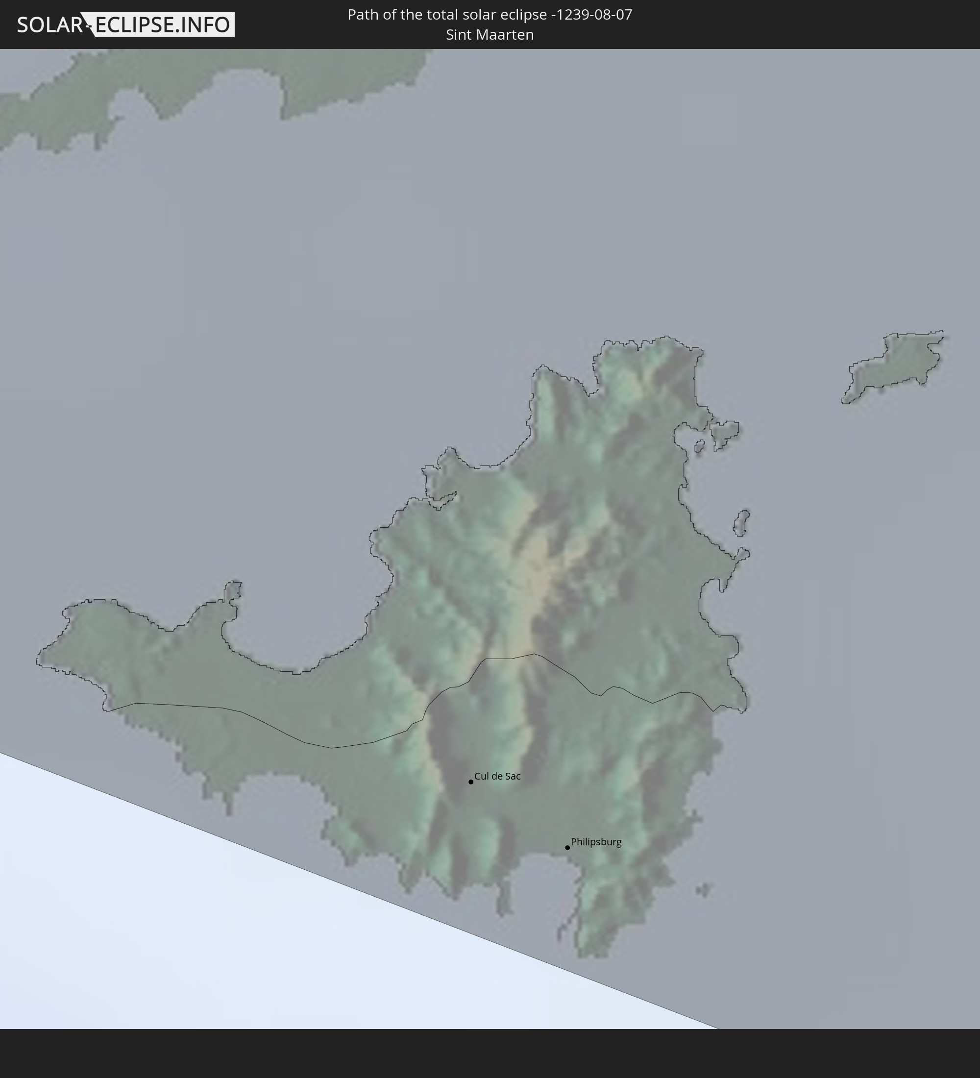 Sint Maarten
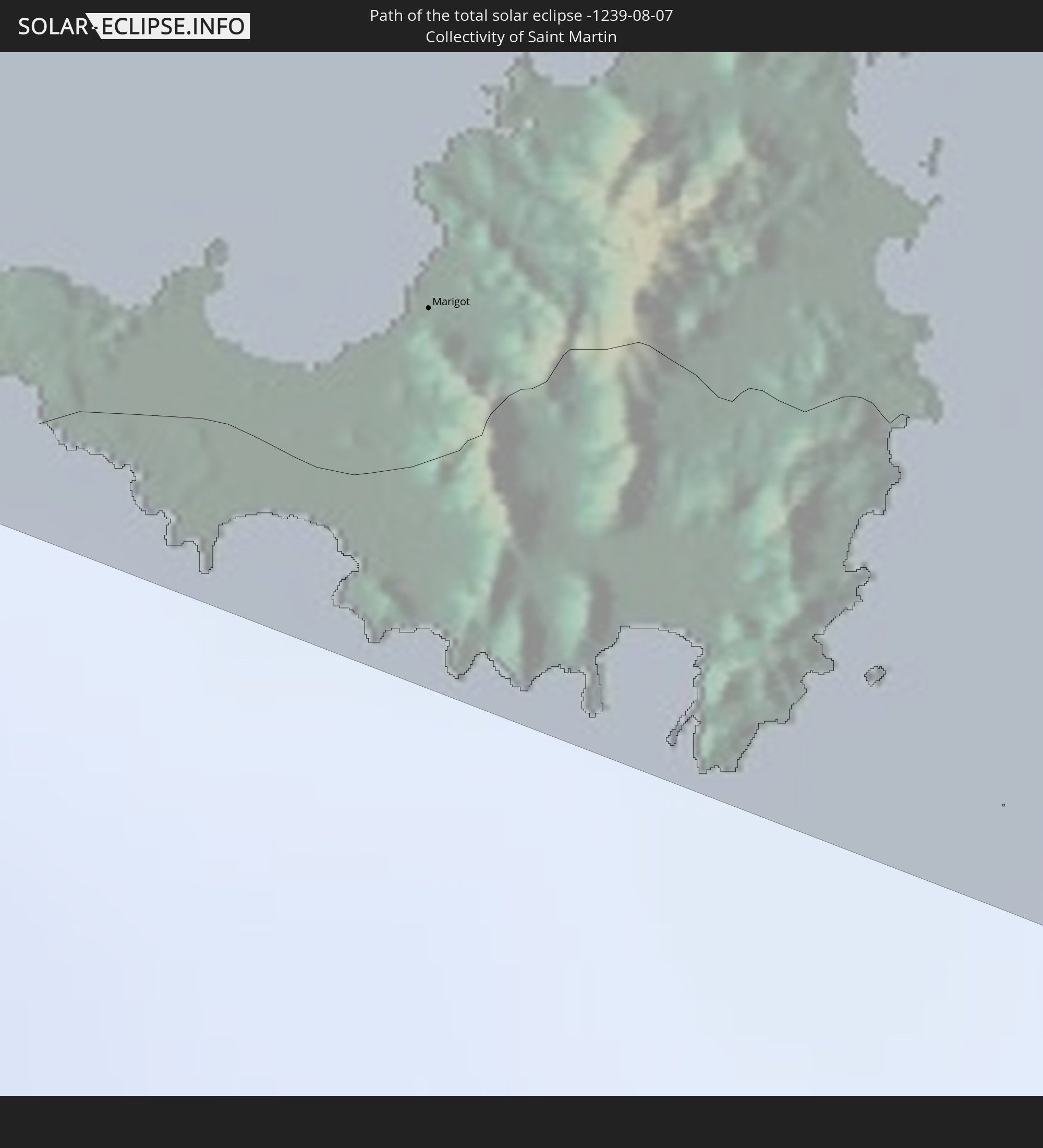 Collectivity of Saint Martin
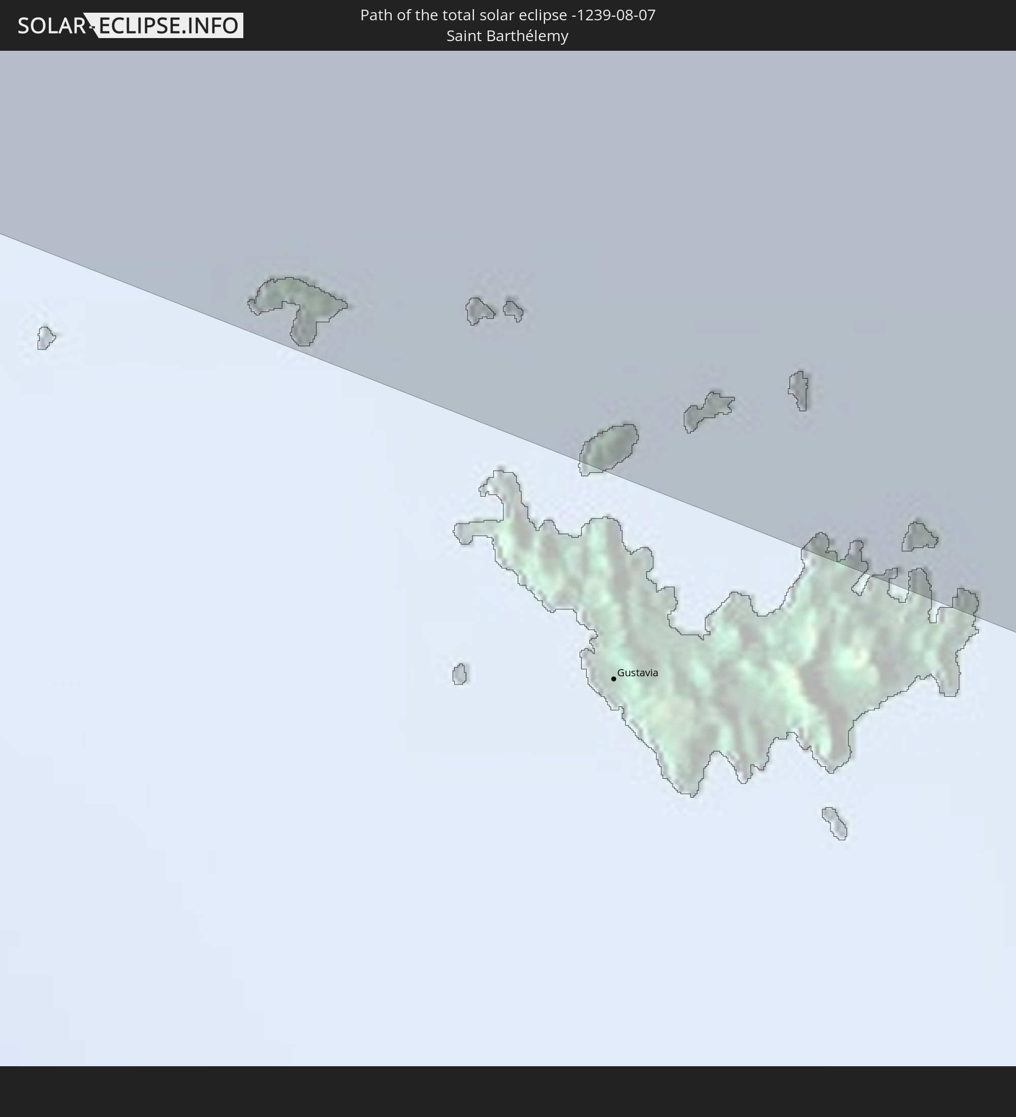 Saint Barthélemy
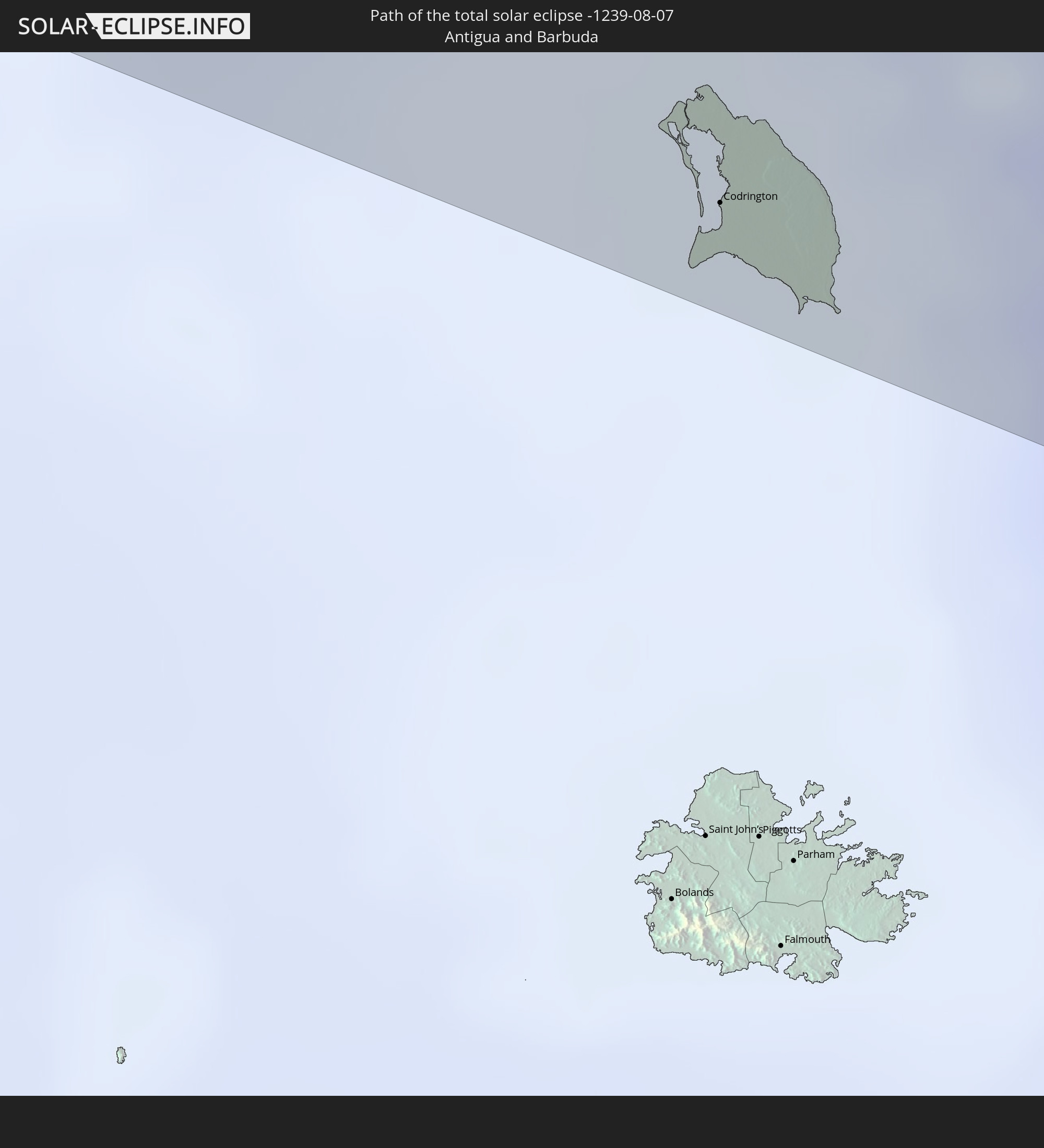 Antigua and Barbuda
In den folgenden Ländern ist die Sonnenfinsternis partiell zu sehen
 United States
 United States Minor Outlying Islands
 Canada
 Mexico
 Guatemala
 Ecuador
 El Salvador
 Honduras
 Belize
 Nicaragua
 Costa Rica
 Cuba
Cuba
 Panama
 Colombia
 Cayman Islands
 Peru
Peru
 The Bahamas
 Jamaica
 Haiti
Haiti
 Brazil
 Venezuela
 Turks and Caicos Islands
 Dominican Republic
 Aruba
Aruba
 Bolivia
 Puerto Rico
 United States Virgin Islands
 Bermuda
 British Virgin Islands
 Anguilla
 Collectivity of Saint Martin
 Saint Barthélemy
 Saint Kitts and Nevis
 Antigua and Barbuda
 Montserrat
 Trinidad and Tobago
 Guadeloupe
 Grenada
 Dominica
 Saint Vincent and the Grenadines
 Guyana
 Martinique
 Saint Lucia
 Barbados
 Suriname
 Saint Pierre and Miquelon
 French Guiana
 Portugal
 Cabo Verde
 Spain
Spain
 Senegal
 Mauritania
 The Gambia
 Guinea-Bissau
 Guinea
 Saint Helena, Ascension and Tristan da Cunha
 Sierra Leone
 Morocco
 Mali
Mali
 Liberia
 Algeria
 Ivory Coast
 Burkina Faso
 Ghana
Ghana
 Niger
Niger
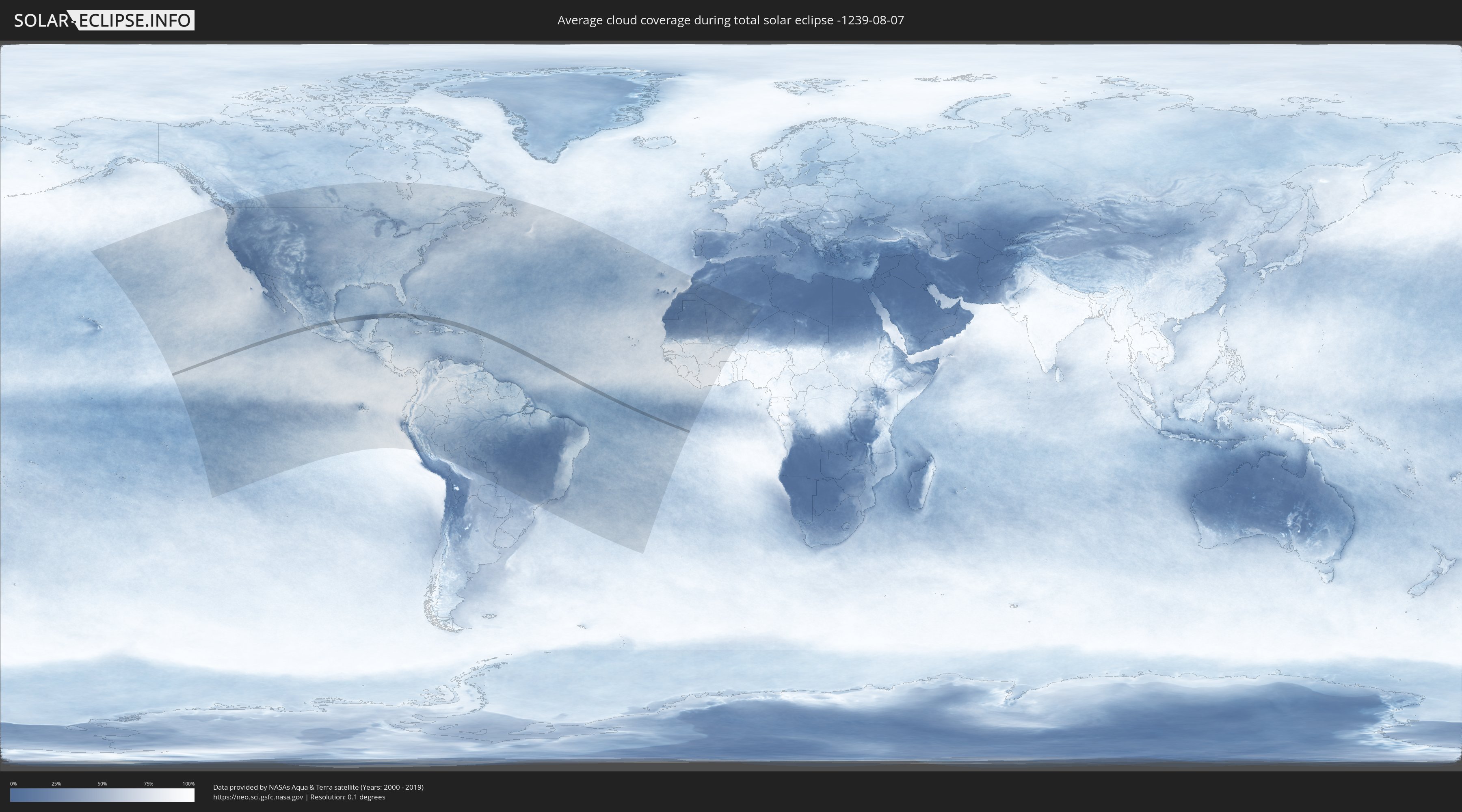
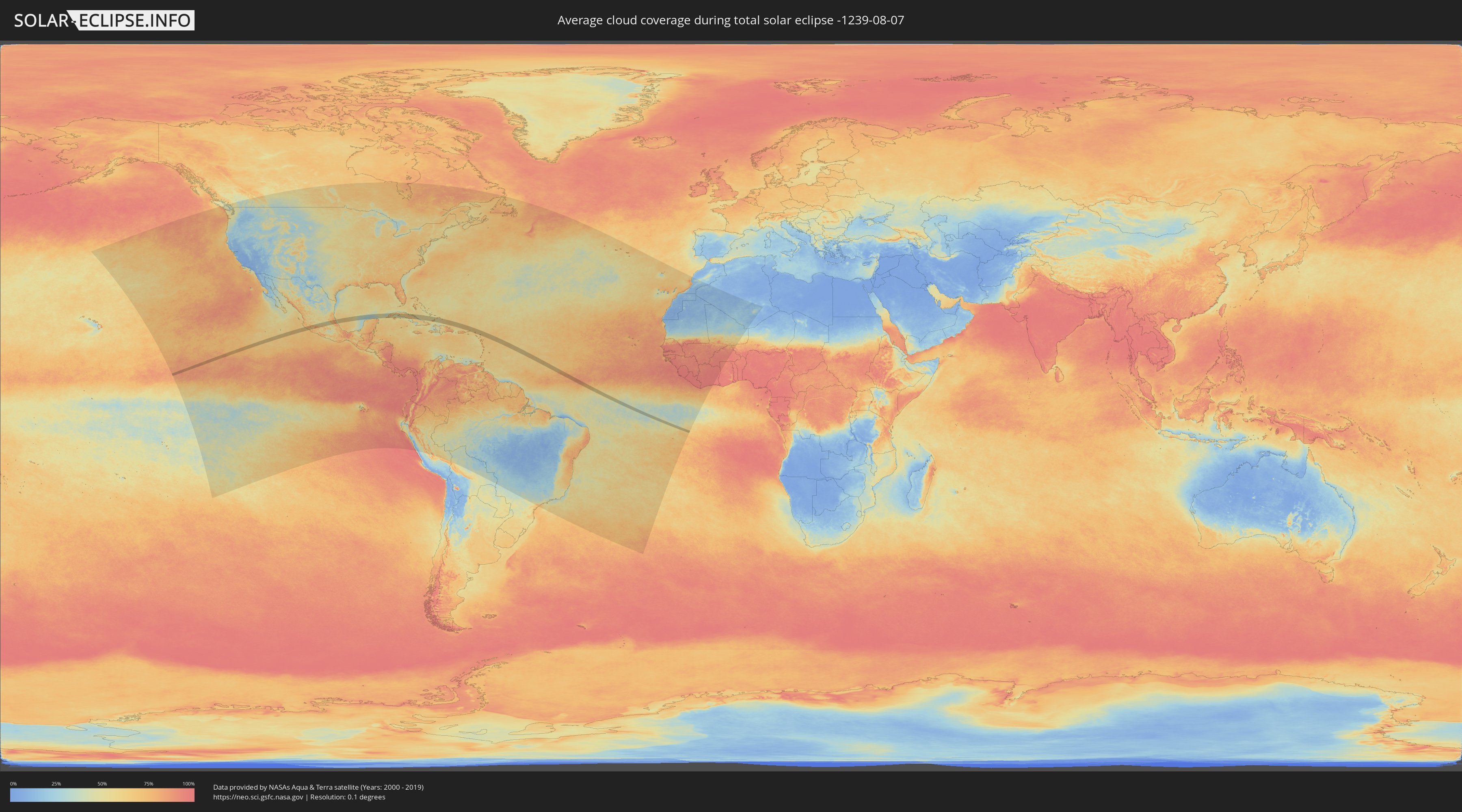
How will be the weather during the total solar eclipse on 08/07/-1239?
Where is the best place to see the total solar eclipse of 08/07/-1239?
The following maps show the average cloud coverage for the day of the total solar eclipse.
With the help of these maps, it is possible to find the place along the eclipse path, which has the best
chance of a cloudless sky.
Nevertheless, you should consider local circumstances and inform about the weather of your chosen
observation site.
The data is provided by NASAs satellites
AQUA and TERRA.
The cloud maps are averaged over a period of 19 years (2000 - 2019).
Detailed country maps
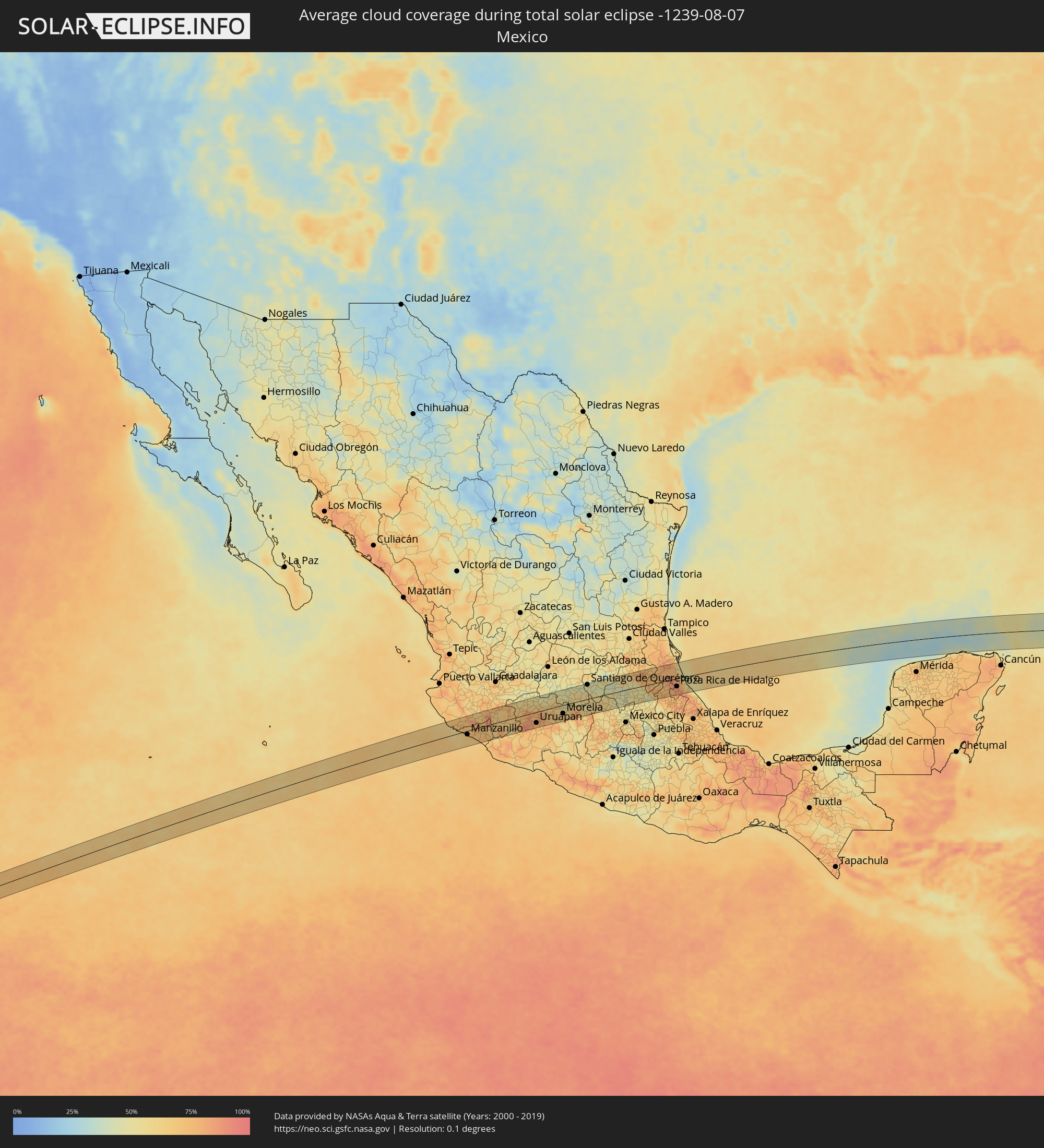 Mexico
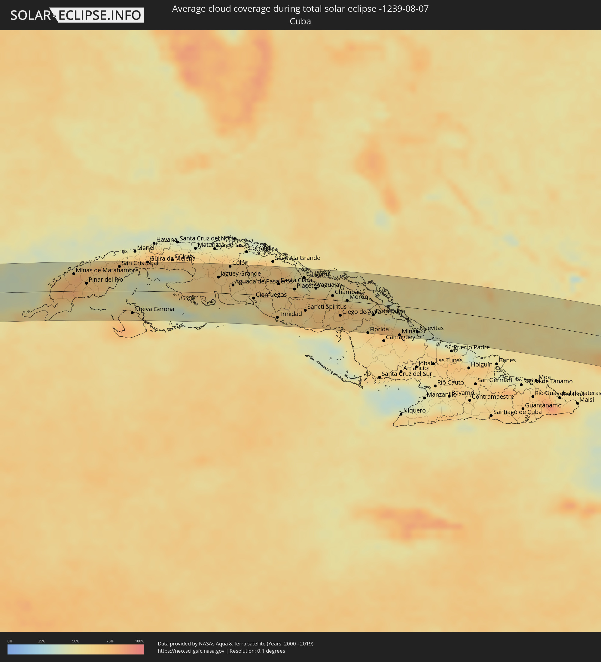 Cuba
Cuba
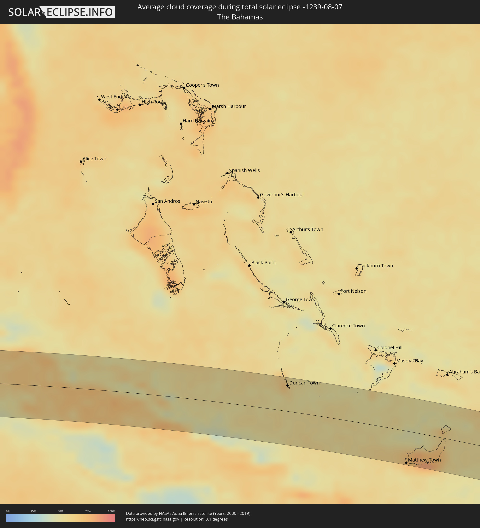 The Bahamas
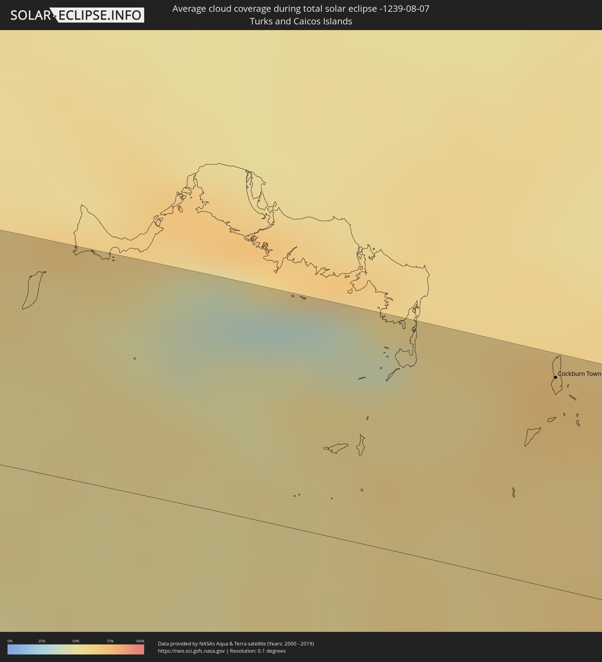 Turks and Caicos Islands
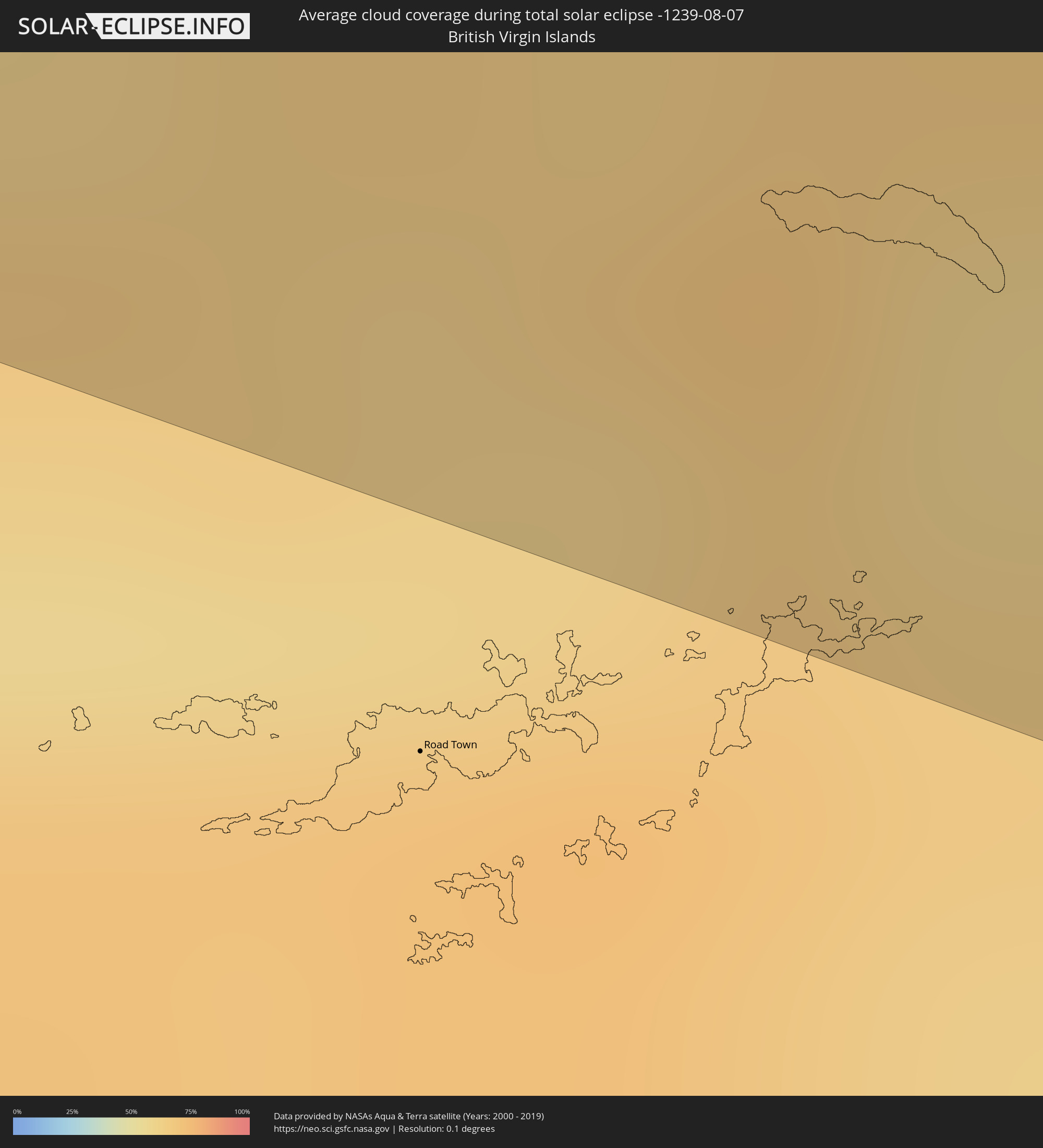 British Virgin Islands
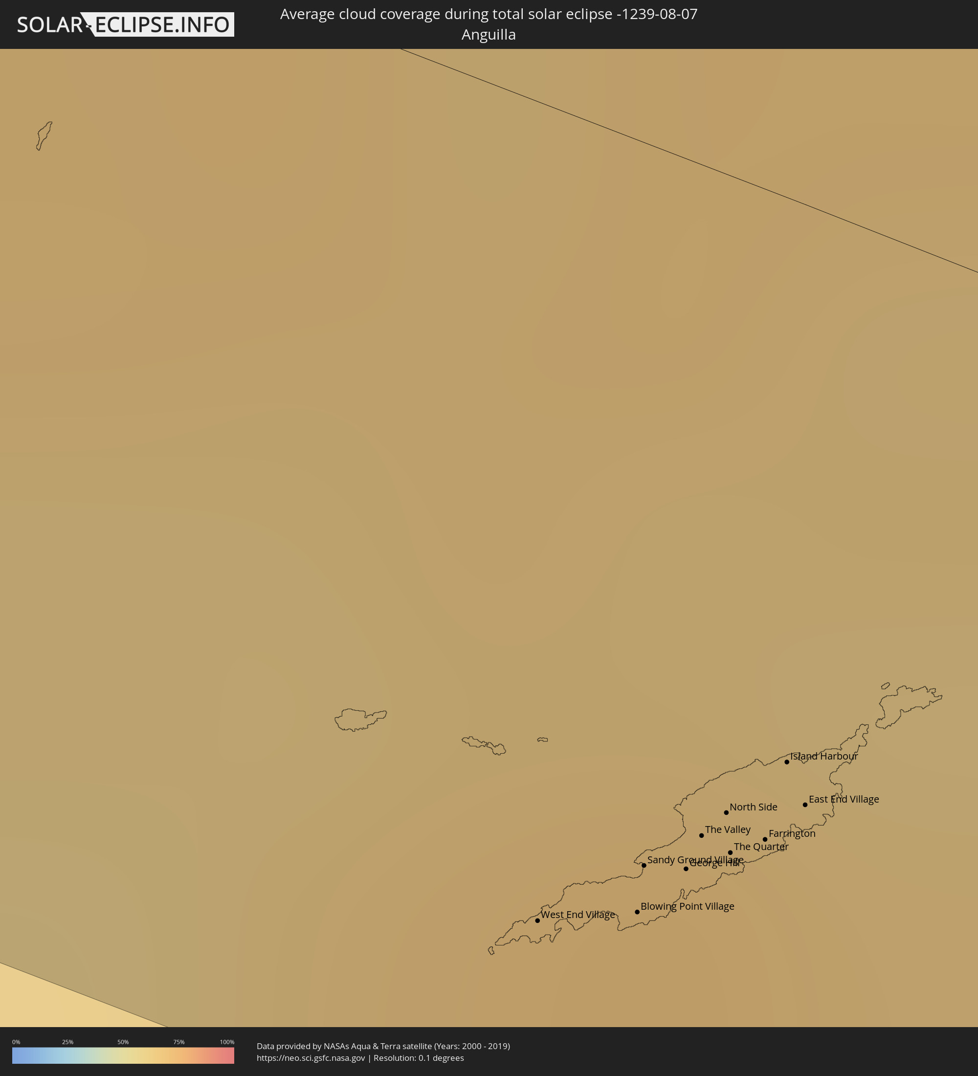 Anguilla
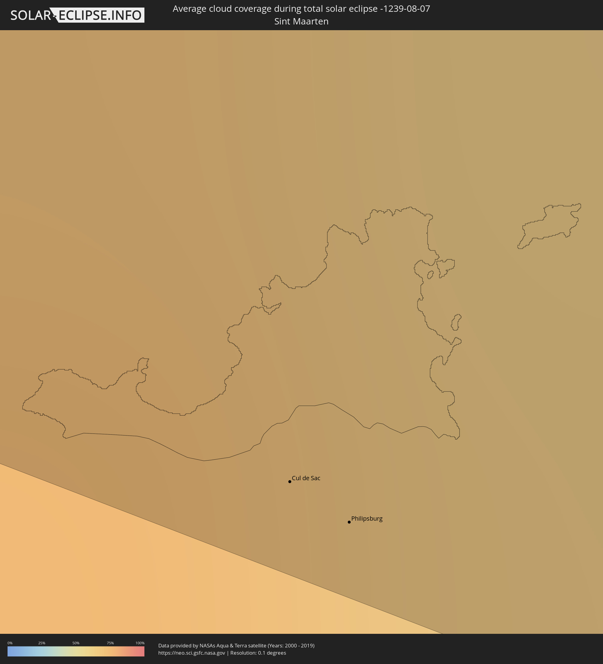 Sint Maarten
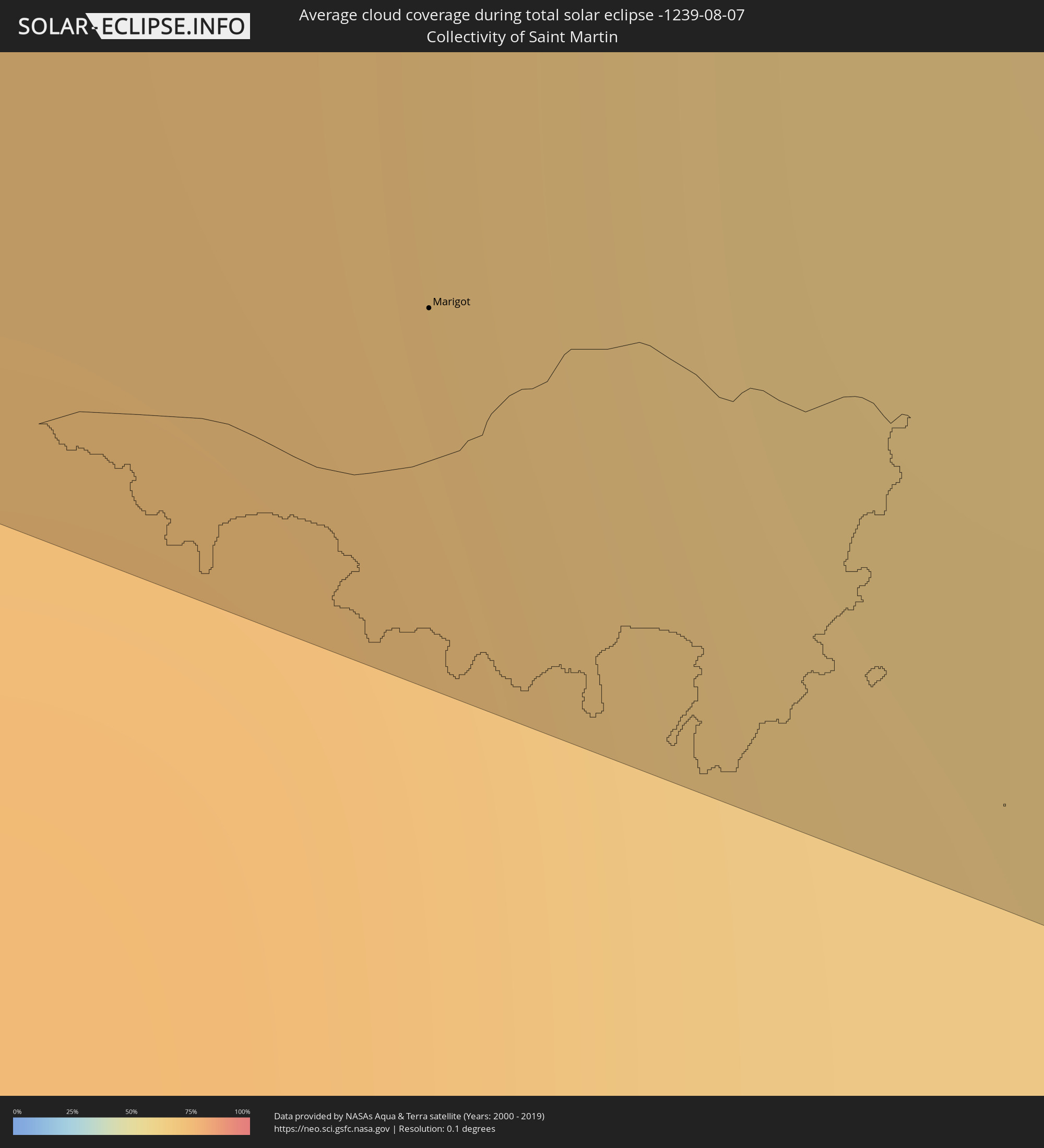 Collectivity of Saint Martin
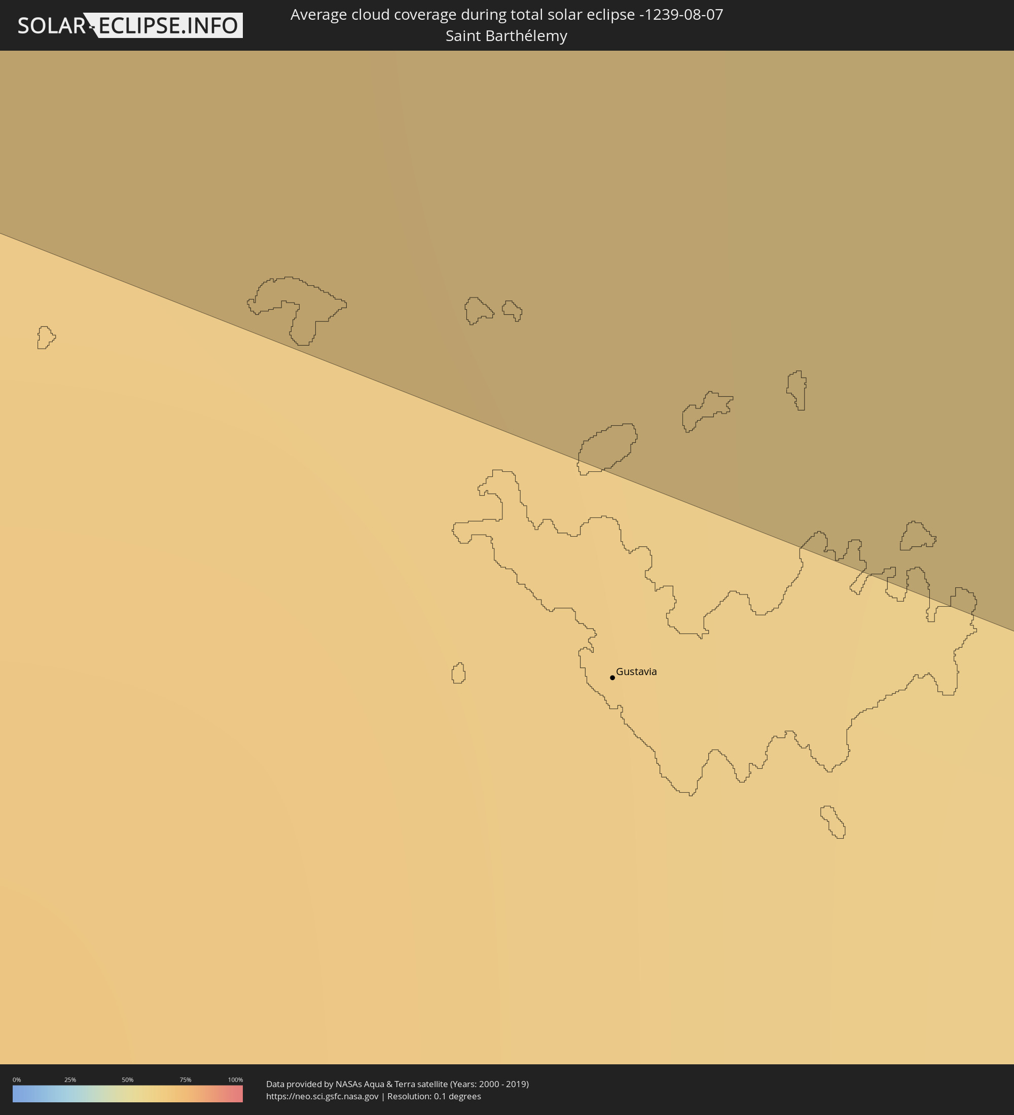 Saint Barthélemy
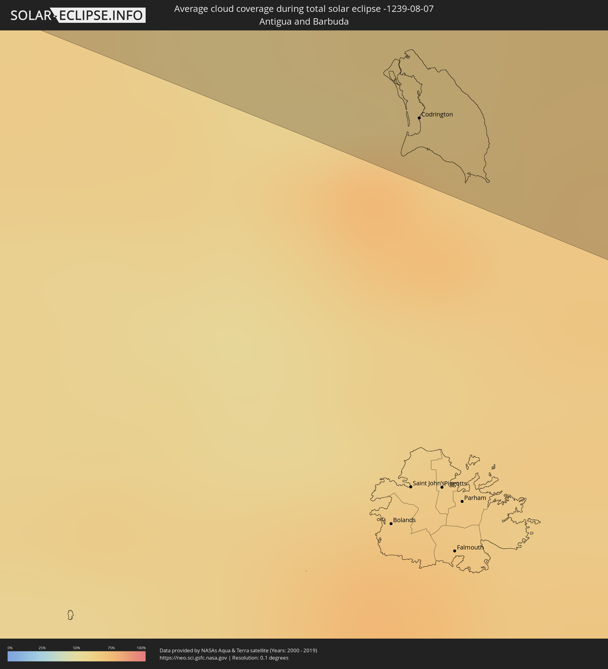 Antigua and Barbuda
Cities inside the path of the eclipse
The following table shows all locations with a population of more than 5,000 inside the eclipse path. Cities which have more than 100,000 inhabitants are marked bold. A click at the locations opens a detailed map.
| City | Type | Eclipse duration | Local time of max. eclipse | Distance to central line | Ø Cloud coverage |
|
Manzanillo, Colima
|
total | - | 08:49:37 UTC-06:36 | 12 km | 72% |
|
Tecoman, Colima
|
total | - | 08:50:11 UTC-06:36 | 39 km | 70% |
|
Colima, Colima
|
total | - | 08:50:37 UTC-06:36 | 8 km | 73% |
|
Ciudad Guzmán, Jalisco
|
total | - | 08:51:18 UTC-06:36 | 34 km | 69% |
|
Sahuayo de Morelos, Michoacán
|
total | - | 08:52:39 UTC-06:36 | 51 km | 57% |
|
Zamora, Michoacán
|
total | - | 08:53:16 UTC-06:36 | 32 km | 60% |
|
Uruapan, Michoacán
|
total | - | 08:53:16 UTC-06:36 | 36 km | 76% |
|
Zacapú, Michoacán
|
total | - | 08:53:57 UTC-06:36 | 0 km | 69% |
|
Pátzcuaro, Michoacán
|
total | - | 08:54:03 UTC-06:36 | 37 km | 78% |
|
Valle de Santiago, Guanajuato
|
total | - | 08:55:17 UTC-06:36 | 47 km | 49% |
|
Morelia, Michoacán
|
total | - | 08:54:52 UTC-06:36 | 28 km | 68% |
|
Uriangato, Guanajuato
|
total | - | 08:55:08 UTC-06:36 | 19 km | 54% |
|
Cortazar, Guanajuato
|
total | - | 08:55:43 UTC-06:36 | 50 km | 47% |
|
Celaya, Guanajuato
|
total | - | 08:55:59 UTC-06:36 | 51 km | 49% |
|
Acámbaro, Guanajuato
|
total | - | 08:55:50 UTC-06:36 | 4 km | 60% |
|
Ciudad Hidalgo, Michoacán
|
total | - | 08:55:54 UTC-06:36 | 45 km | 68% |
|
Santiago de Querétaro, Querétaro
|
total | - | 08:56:44 UTC-06:36 | 48 km | 48% |
|
San Juan del Río, Querétaro
|
total | - | 08:57:17 UTC-06:36 | 16 km | 50% |
|
Pachuca de Soto, Hidalgo
|
total | - | 08:59:21 UTC-06:36 | 43 km | 53% |
|
Huauchinango, Puebla
|
total | - | 09:00:37 UTC-06:36 | 53 km | 70% |
|
Xicotepec de Juárez, Puebla
|
total | - | 09:00:51 UTC-06:36 | 44 km | 72% |
|
Temapache, Veracruz
|
total | - | 09:01:54 UTC-06:36 | 35 km | 76% |
|
Poza Rica de Hidalgo, Veracruz
|
total | - | 09:01:57 UTC-06:36 | 27 km | 84% |
|
Tuxpan de Rodríguez Cano, Veracruz
|
total | - | 09:02:17 UTC-06:36 | 18 km | 63% |
|
Papantla de Olarte, Veracruz
|
total | - | 09:02:09 UTC-06:36 | 39 km | 85% |
|
Pinar del Río, Pinar del Río
|
total | - | 10:41:37 UTC-05:29 | 15 km | 72% |
|
Consolación del Sur, Pinar del Río
|
total | - | 10:42:06 UTC-05:29 | 24 km | 69% |
|
San Cristobal, Artemisa
|
total | - | 10:43:21 UTC-05:29 | 48 km | 71% |
|
Güira de Melena, Artemisa
|
total | - | 10:44:51 UTC-05:29 | 58 km | 65% |
|
Jagüey Grande, Matanzas
|
total | - | 10:48:40 UTC-05:29 | 31 km | 64% |
|
Colón, Matanzas
|
total | - | 10:49:16 UTC-05:29 | 54 km | 65% |
|
Cienfuegos, Cienfuegos
|
total | - | 10:50:38 UTC-05:29 | 7 km | 51% |
|
Santo Domingo, Villa Clara
|
total | - | 10:51:08 UTC-05:29 | 42 km | 67% |
|
Cumanayagua, Cienfuegos
|
total | - | 10:51:19 UTC-05:29 | 6 km | 52% |
|
Ranchuelo, Villa Clara
|
total | - | 10:51:26 UTC-05:29 | 19 km | 68% |
|
Cifuentes, Villa Clara
|
total | - | 10:51:40 UTC-05:29 | 51 km | 63% |
|
Trinidad, Sancti Spíritus
|
total | - | 10:52:01 UTC-05:29 | 43 km | 57% |
|
Manicaragua, Villa Clara
|
total | - | 10:51:58 UTC-05:29 | 5 km | 64% |
|
Santa Clara, Villa Clara
|
total | - | 10:51:57 UTC-05:29 | 24 km | 63% |
|
Condado, Sancti Spíritus
|
total | - | 10:52:25 UTC-05:29 | 34 km | 62% |
|
Camajuaní, Villa Clara
|
total | - | 10:52:33 UTC-05:29 | 34 km | 61% |
|
Placetas, Villa Clara
|
total | - | 10:52:51 UTC-05:29 | 16 km | 64% |
|
Cabaiguán, Sancti Spíritus
|
total | - | 10:53:21 UTC-05:29 | 9 km | 70% |
|
Caibarién, Villa Clara
|
total | - | 10:53:21 UTC-05:29 | 40 km | 52% |
|
Sancti Spíritus, Sancti Spíritus
|
total | - | 10:53:32 UTC-05:29 | 25 km | 57% |
|
Yaguajay, Sancti Spíritus
|
total | - | 10:54:03 UTC-05:29 | 20 km | 71% |
|
Ciego de Ávila, Ciego de Ávila
|
total | - | 10:55:32 UTC-05:29 | 30 km | 68% |
|
Morón, Ciego de Ávila
|
total | - | 10:55:51 UTC-05:29 | 1 km | 71% |
|
Florida, Camagüey
|
partial | - | 10:57:11 UTC-05:29 | 59 km | 64% |
|
Nuevitas, Camagüey
|
total | - | 11:00:00 UTC-05:29 | 47 km | 49% |
|
Duncan Town, Ragged Island
|
total | - | 11:24:21 UTC-05:09 | 45 km | 57% |
|
Matthew Town, Inagua
|
total | - | 11:31:04 UTC-05:09 | 57 km | 52% |
|
Cockburn Town
|
total | - | 11:40:32 UTC-05:07 | 54 km | 66% |
|
West End Village, West End
|
total | - | 13:07:30 UTC-04:06 | 45 km | 70% |
|
Blowing Point Village, Blowing Point
|
total | - | 13:07:39 UTC-04:06 | 42 km | 70% |
|
Sandy Ground Village, Sandy Ground
|
total | - | 13:07:38 UTC-04:06 | 40 km | 70% |
|
South Hill Village, South Hill
|
total | - | 13:07:38 UTC-04:06 | 41 km | 70% |
|
Marigot
|
total | - | 13:07:48 UTC-04:06 | 53 km | 73% |
|
North Hill Village, North Hill
|
total | - | 13:07:39 UTC-04:06 | 39 km | 70% |
|
George Hill, George Hill
|
total | - | 13:07:41 UTC-04:06 | 39 km | 70% |
 Cul de Sac
|
total | - | 12:38:10 UTC-04:35 | 56 km | 67% |
|
The Valley, The Valley
|
total | - | 13:07:42 UTC-04:06 | 37 km | 70% |
|
Stoney Ground, Stoney Ground
|
total | - | 13:07:43 UTC-04:06 | 36 km | 64% |
|
Philipsburg
|
total | - | 12:38:14 UTC-04:35 | 56 km | 66% |
|
North Side, North Side
|
total | - | 13:07:43 UTC-04:06 | 35 km | 64% |
|
The Quarter, The Quarter
|
total | - | 13:07:45 UTC-04:06 | 37 km | 64% |
|
Farrington, The Farrington
|
total | - | 13:07:48 UTC-04:06 | 36 km | 64% |
|
Sandy Hill, Sandy Hill
|
total | - | 13:07:49 UTC-04:06 | 35 km | 64% |
|
Island Harbour, Island Harbour
|
total | - | 13:07:47 UTC-04:06 | 31 km | 64% |
|
East End Village, East End
|
total | - | 13:07:50 UTC-04:06 | 33 km | 64% |
|
Codrington, Barbuda
|
total | - | 13:11:38 UTC-04:06 | 49 km | 72% |