Total solar eclipse of 07/06/-1274
| Day of week: | Monday |
| Maximum duration of eclipse: | 03m41s |
| Maximum width of eclipse path: | 415 km |
| Saros cycle: | 45 |
| Coverage: | 100% |
| Magnitude: | 1.0658 |
| Gamma: | 0.8514 |
Wo kann man die Sonnenfinsternis vom 07/06/-1274 sehen?
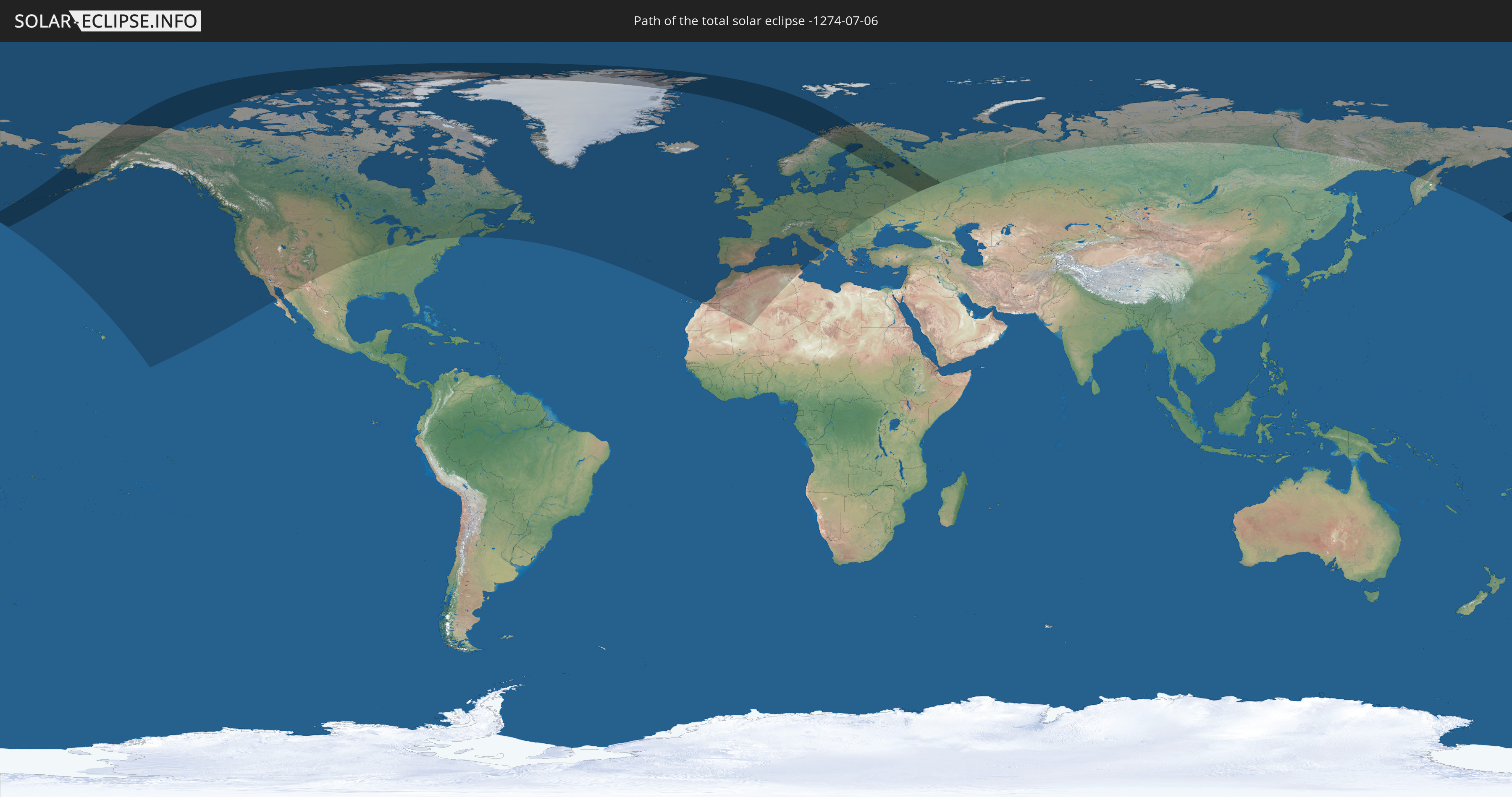
Die Sonnenfinsternis am 07/06/-1274 kann man in 56 Ländern als partielle Sonnenfinsternis beobachten.
Der Finsternispfad verläuft durch 7 Länder. Nur in diesen Ländern ist sie als total Sonnenfinsternis zu sehen.
In den folgenden Ländern ist die Sonnenfinsternis total zu sehen
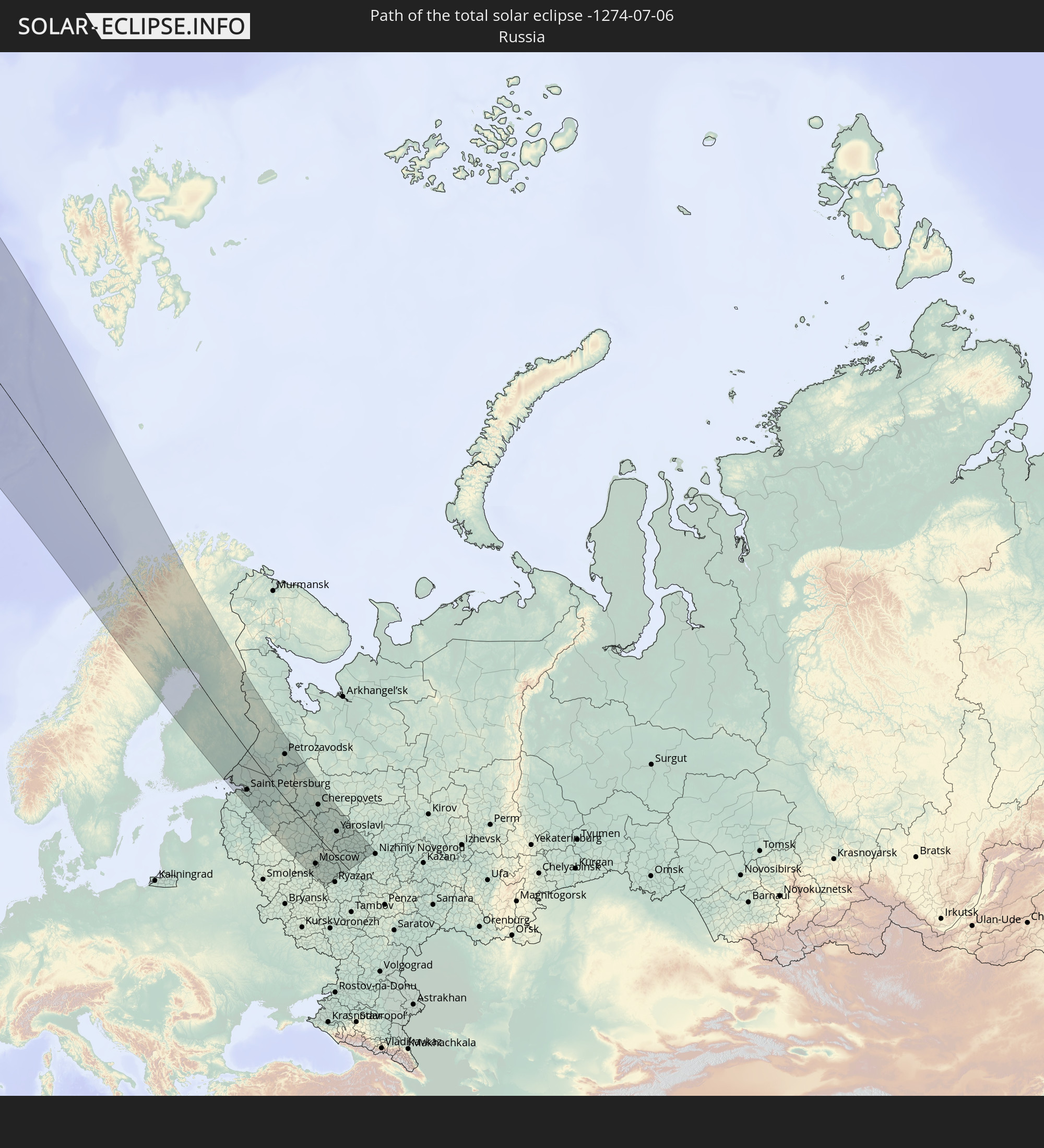 Russia
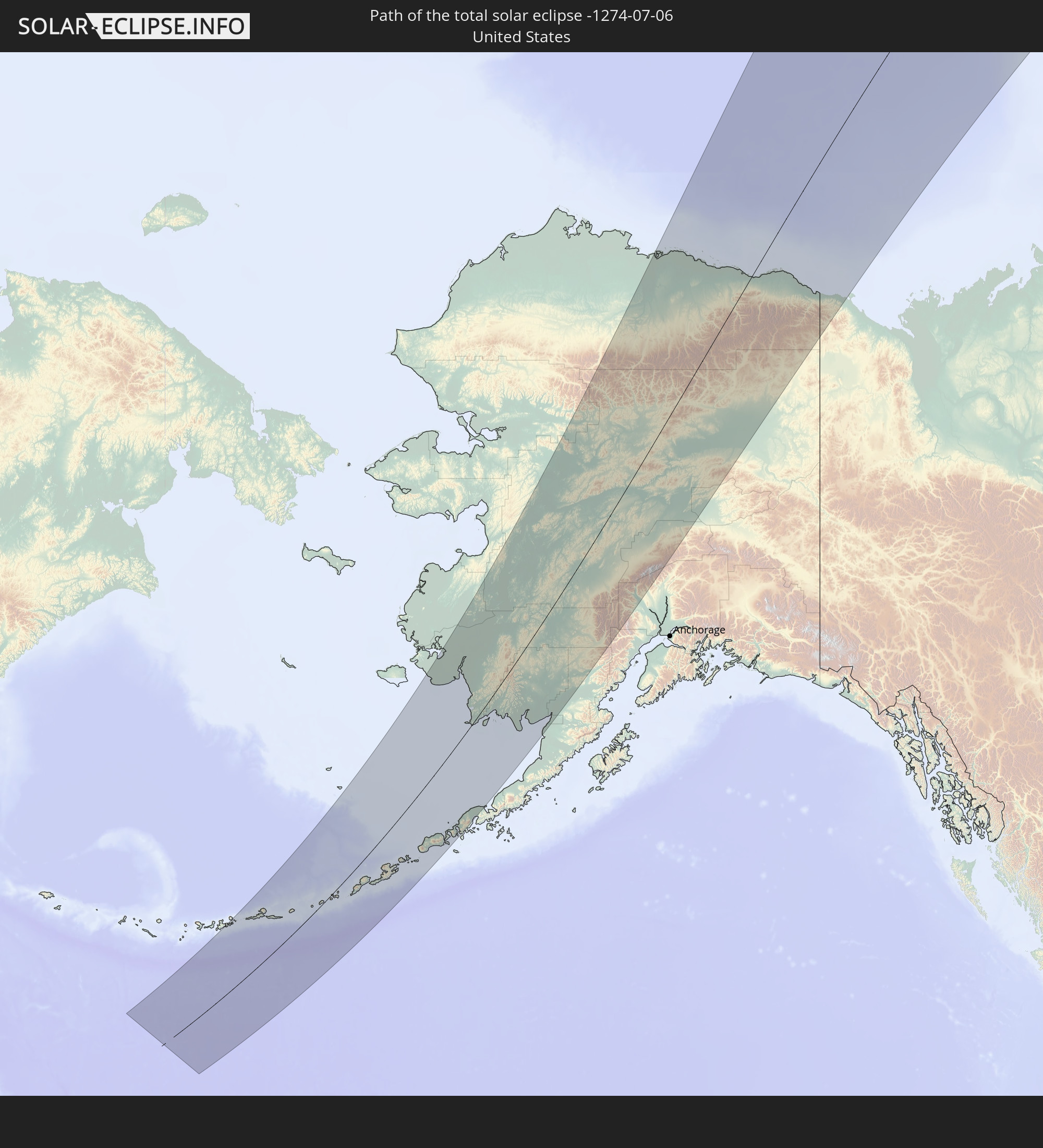 United States
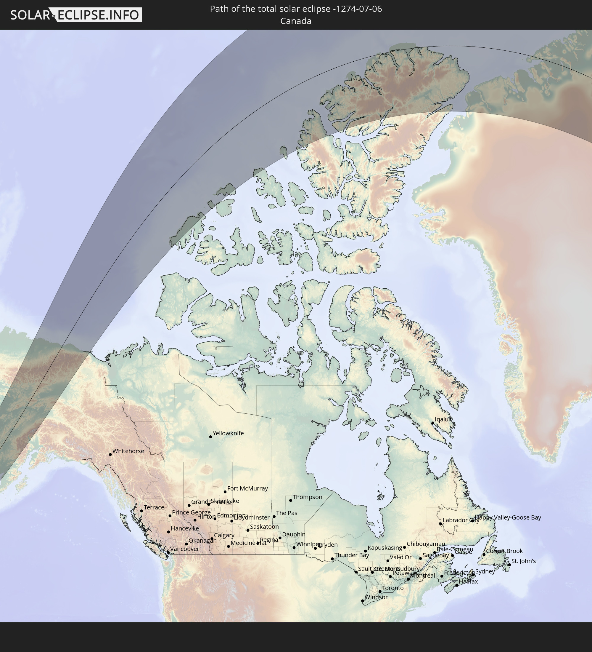 Canada
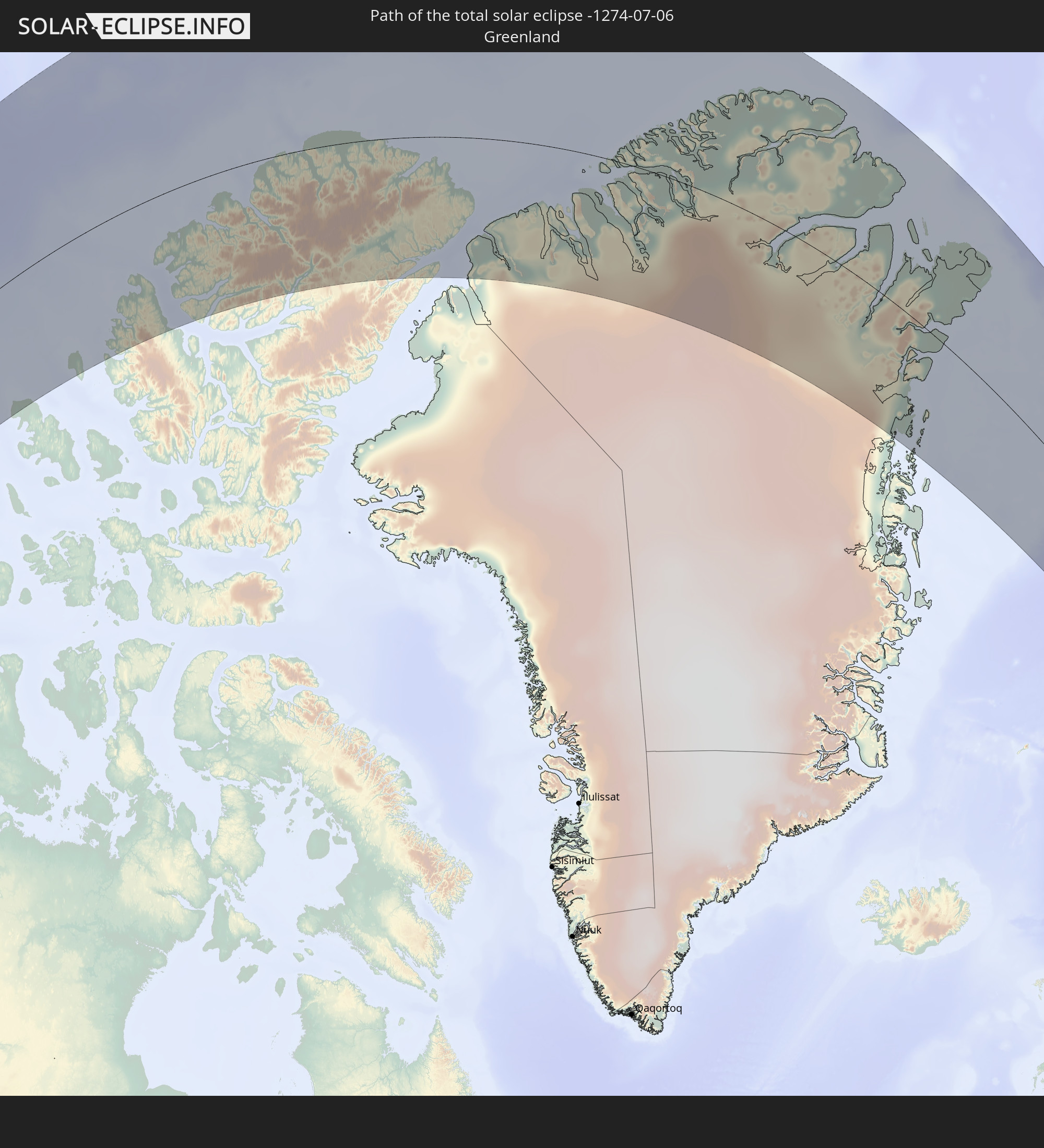 Greenland
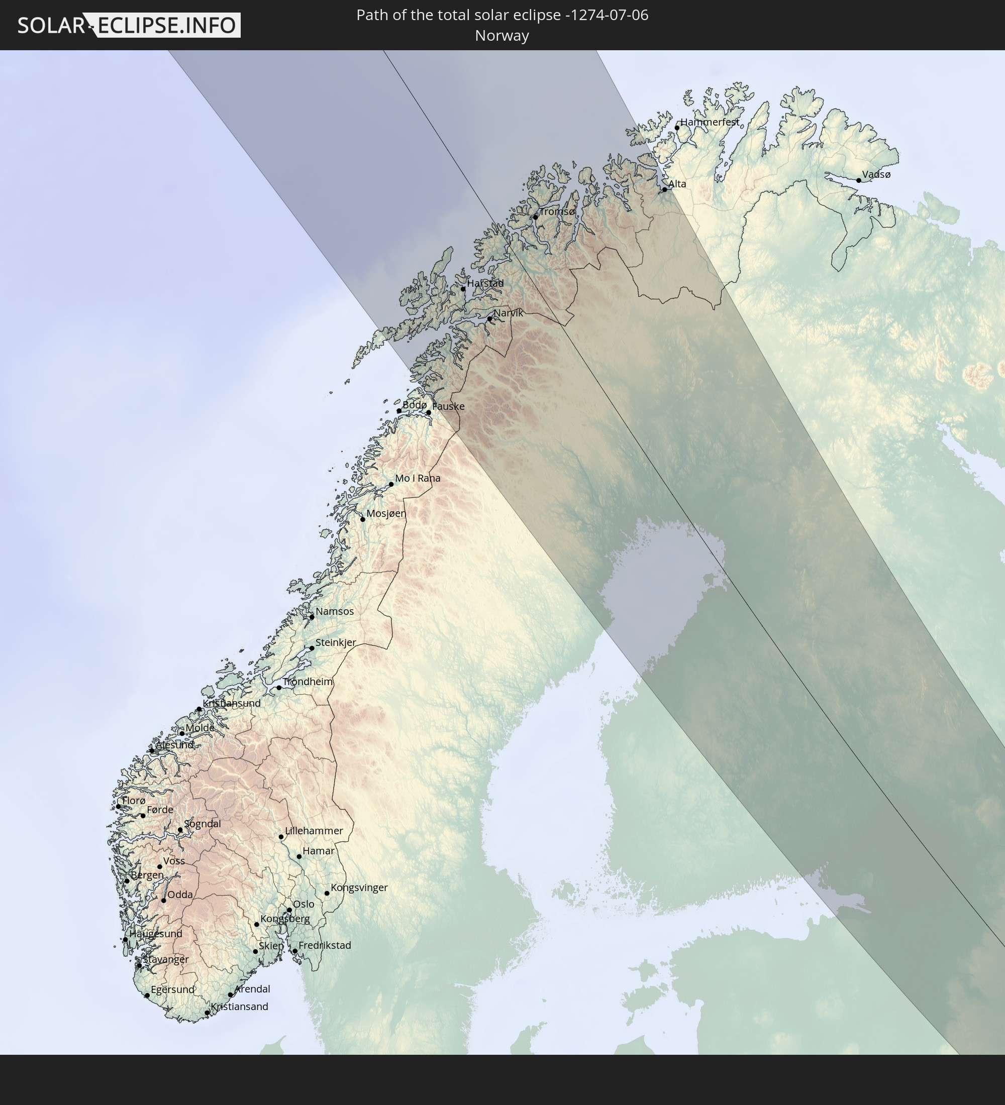 Norway
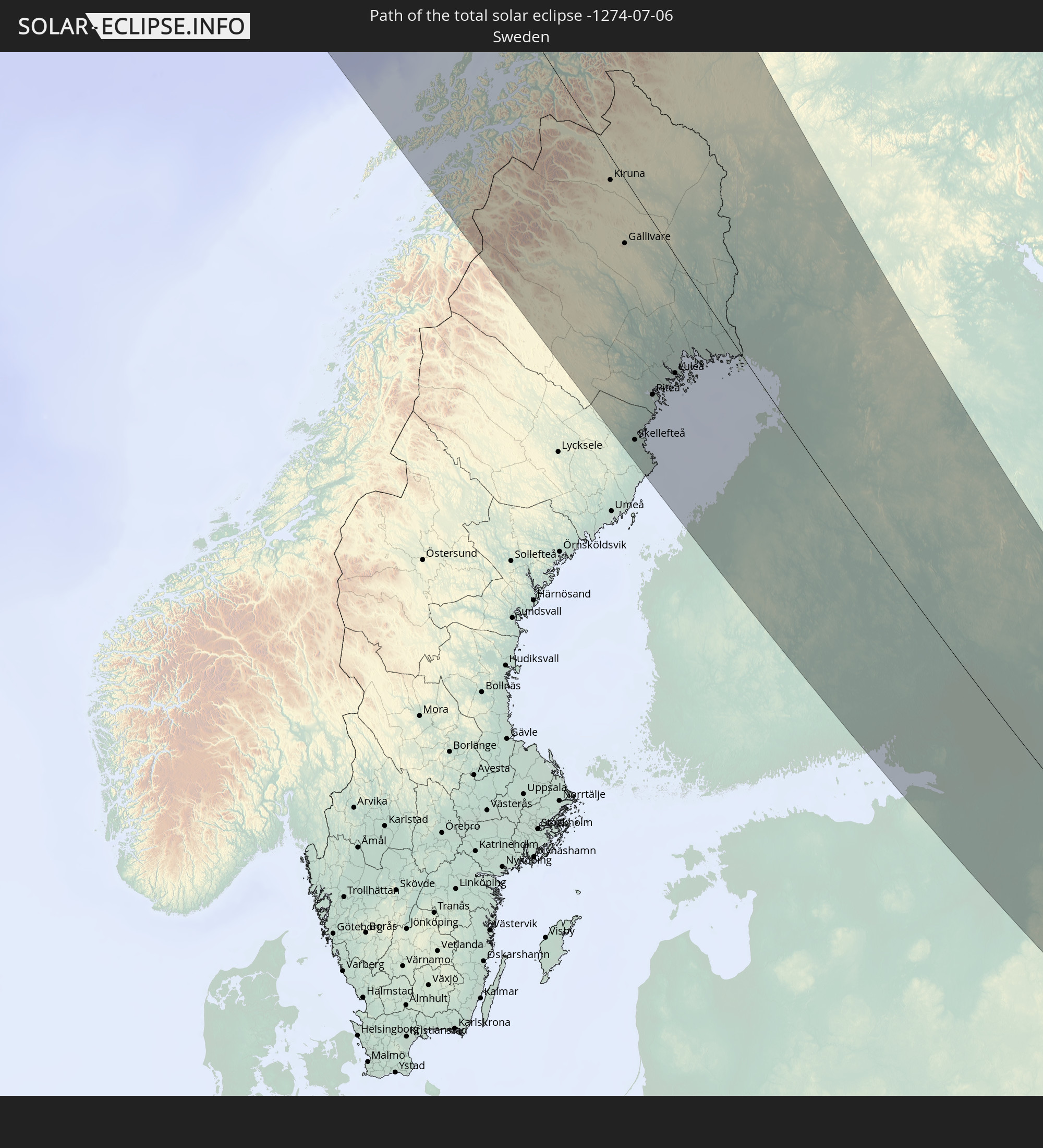 Sweden
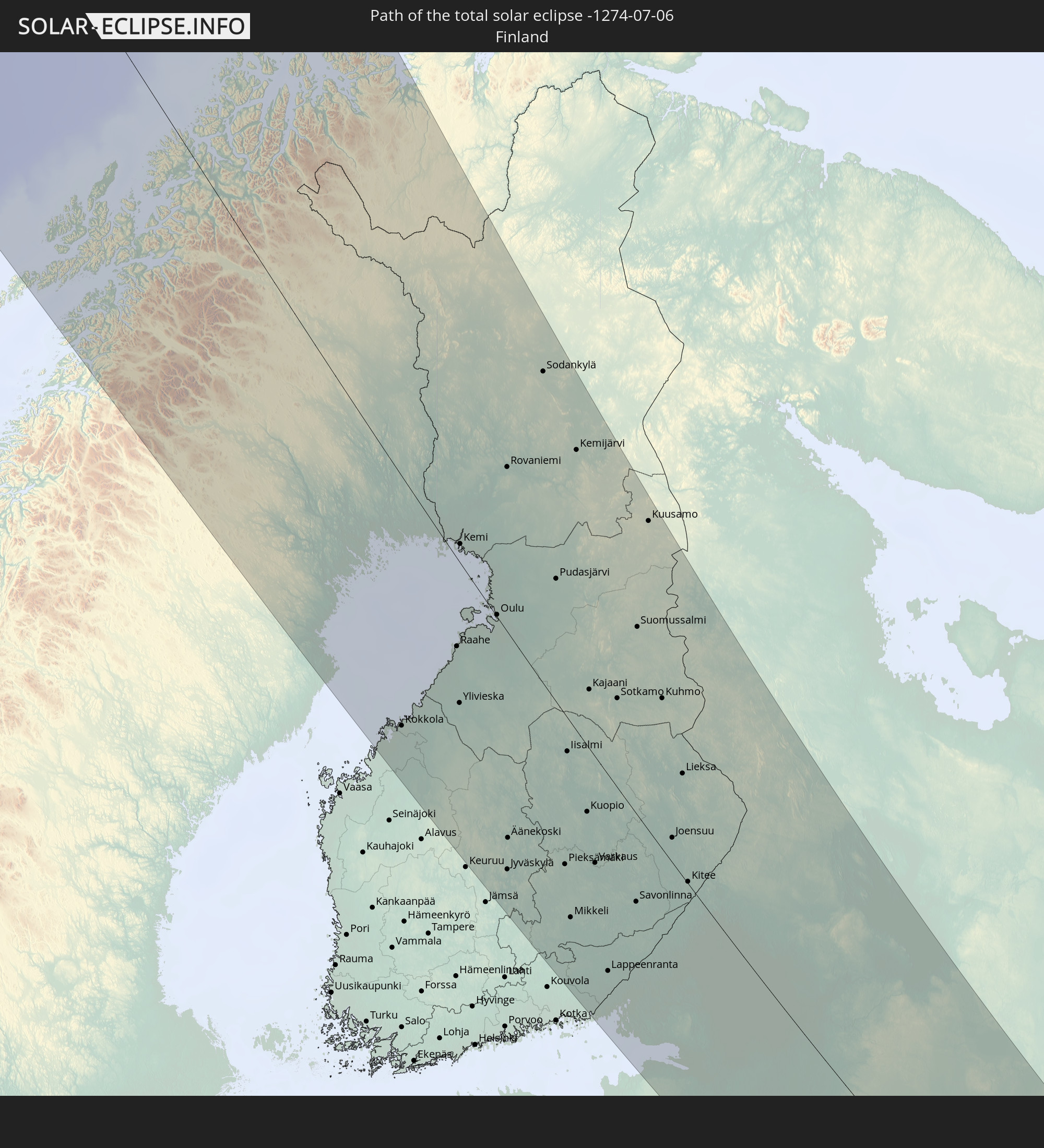 Finland
In den folgenden Ländern ist die Sonnenfinsternis partiell zu sehen
 Russia
 United States
 Canada
 Mexico
 Greenland
 Saint Pierre and Miquelon
 Portugal
 Iceland
 Spain
Spain
 Mauritania
 Morocco
 Mali
Mali
 Republic of Ireland
 Svalbard and Jan Mayen
 Algeria
 United Kingdom
 Faroe Islands
 Gibraltar
 France
 Isle of Man
 Guernsey
 Jersey
 Andorra
 Belgium
 Netherlands
 Norway
 Luxembourg
 Germany
 Switzerland
 Italy
Italy
 Monaco
 Tunisia
 Denmark
 Liechtenstein
 Austria
 Sweden
 Czechia
 San Marino
 Vatican City
 Slovenia
 Croatia
 Poland
 Bosnia and Herzegovina
 Hungary
 Slovakia
 Montenegro
 Serbia
 Åland Islands
 Romania
 Finland
 Lithuania
 Latvia
 Estonia
 Ukraine
 Belarus
 Moldova
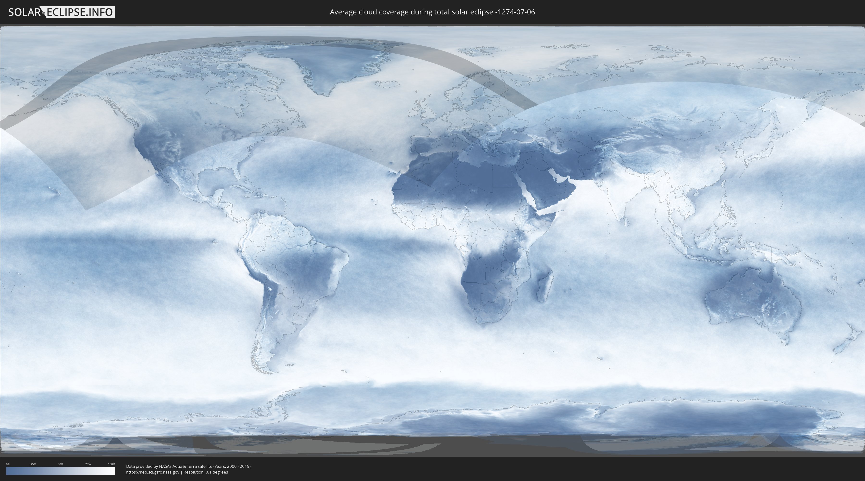
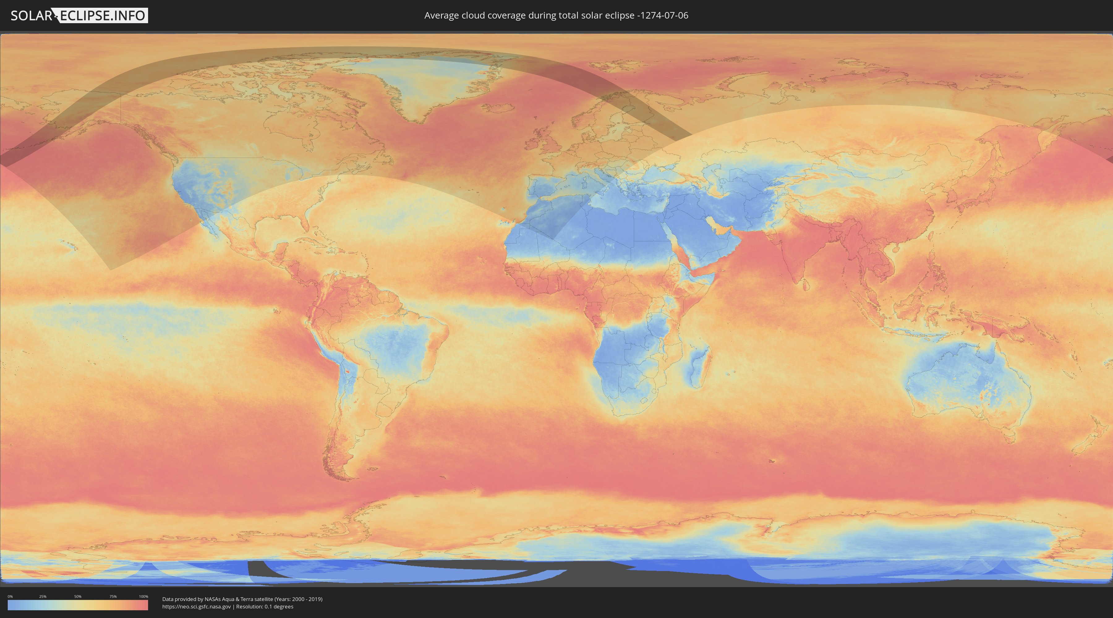
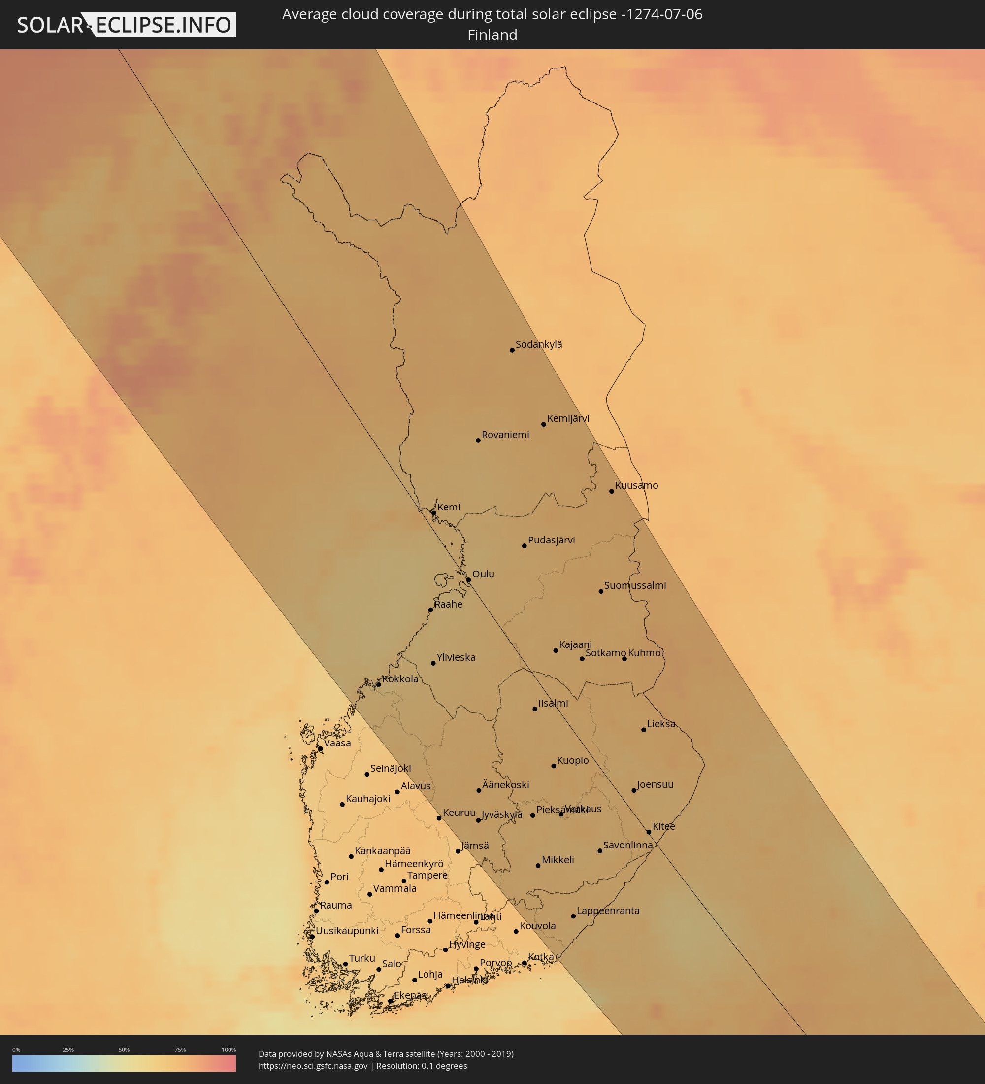
How will be the weather during the total solar eclipse on 07/06/-1274?
Where is the best place to see the total solar eclipse of 07/06/-1274?
The following maps show the average cloud coverage for the day of the total solar eclipse.
With the help of these maps, it is possible to find the place along the eclipse path, which has the best
chance of a cloudless sky.
Nevertheless, you should consider local circumstances and inform about the weather of your chosen
observation site.
The data is provided by NASAs satellites
AQUA and TERRA.
The cloud maps are averaged over a period of 19 years (2000 - 2019).
Detailed country maps
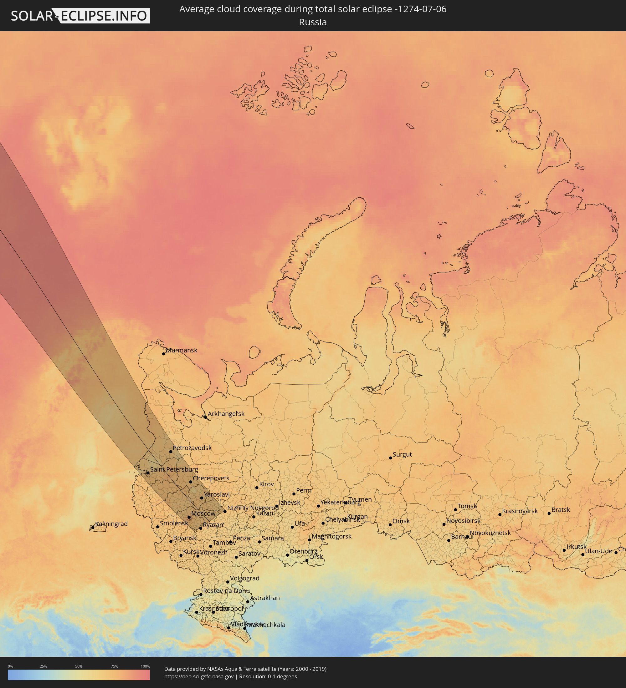 Russia
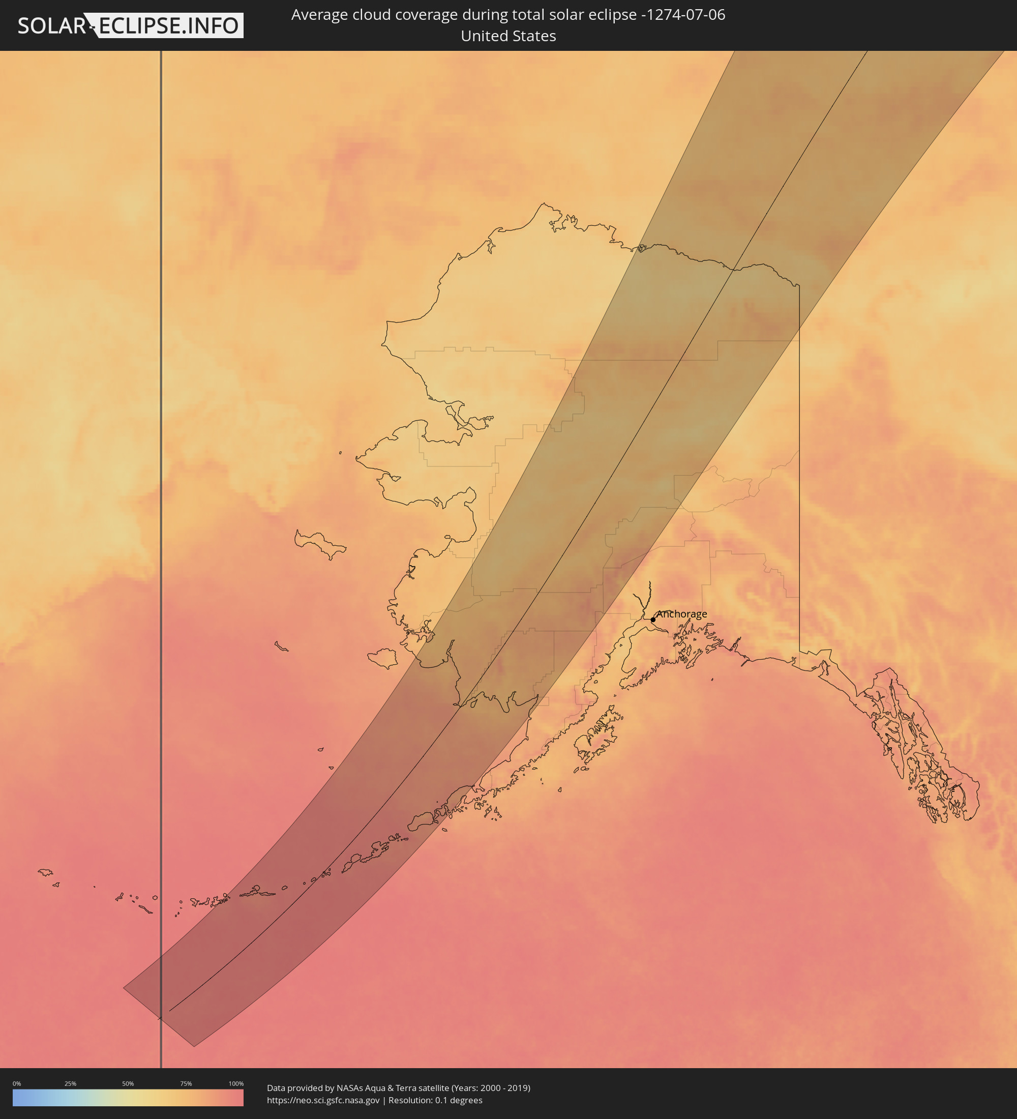 United States
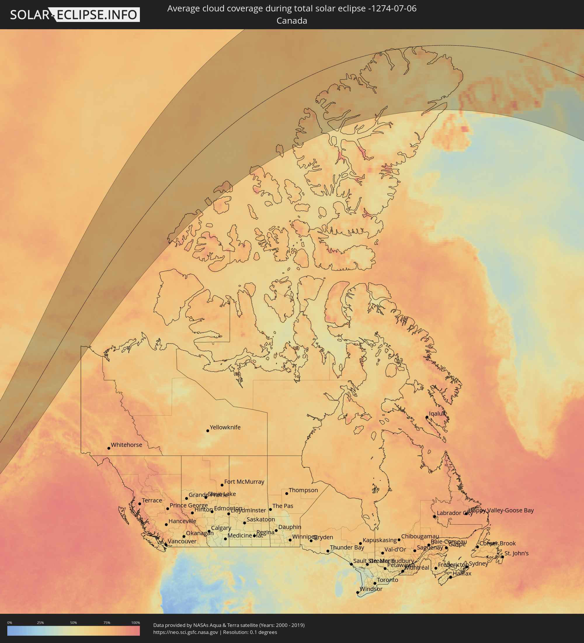 Canada
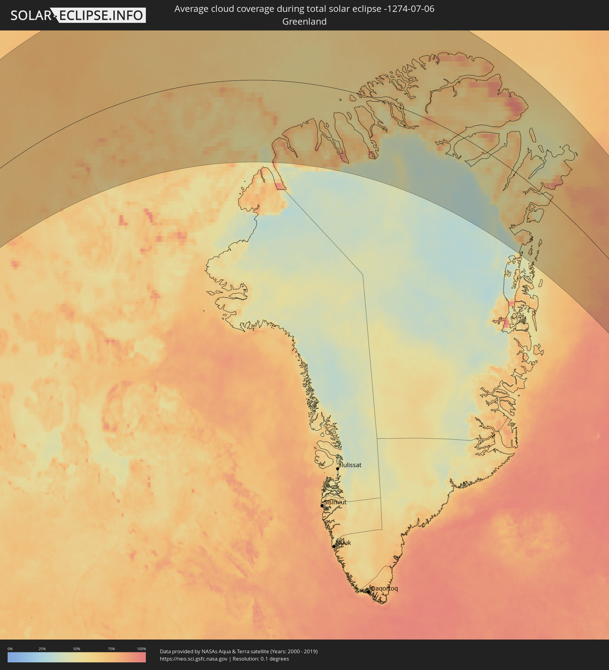 Greenland
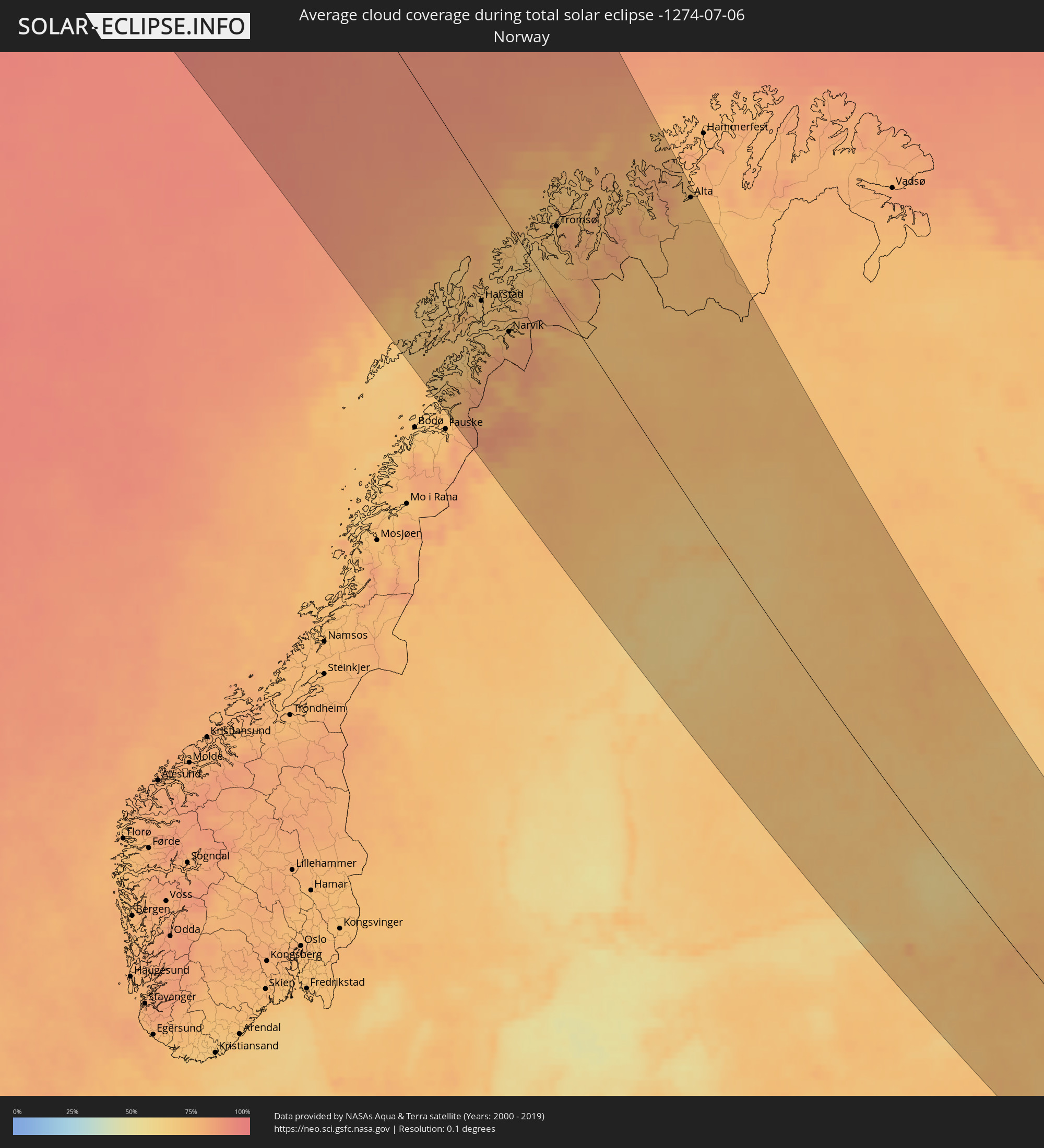 Norway
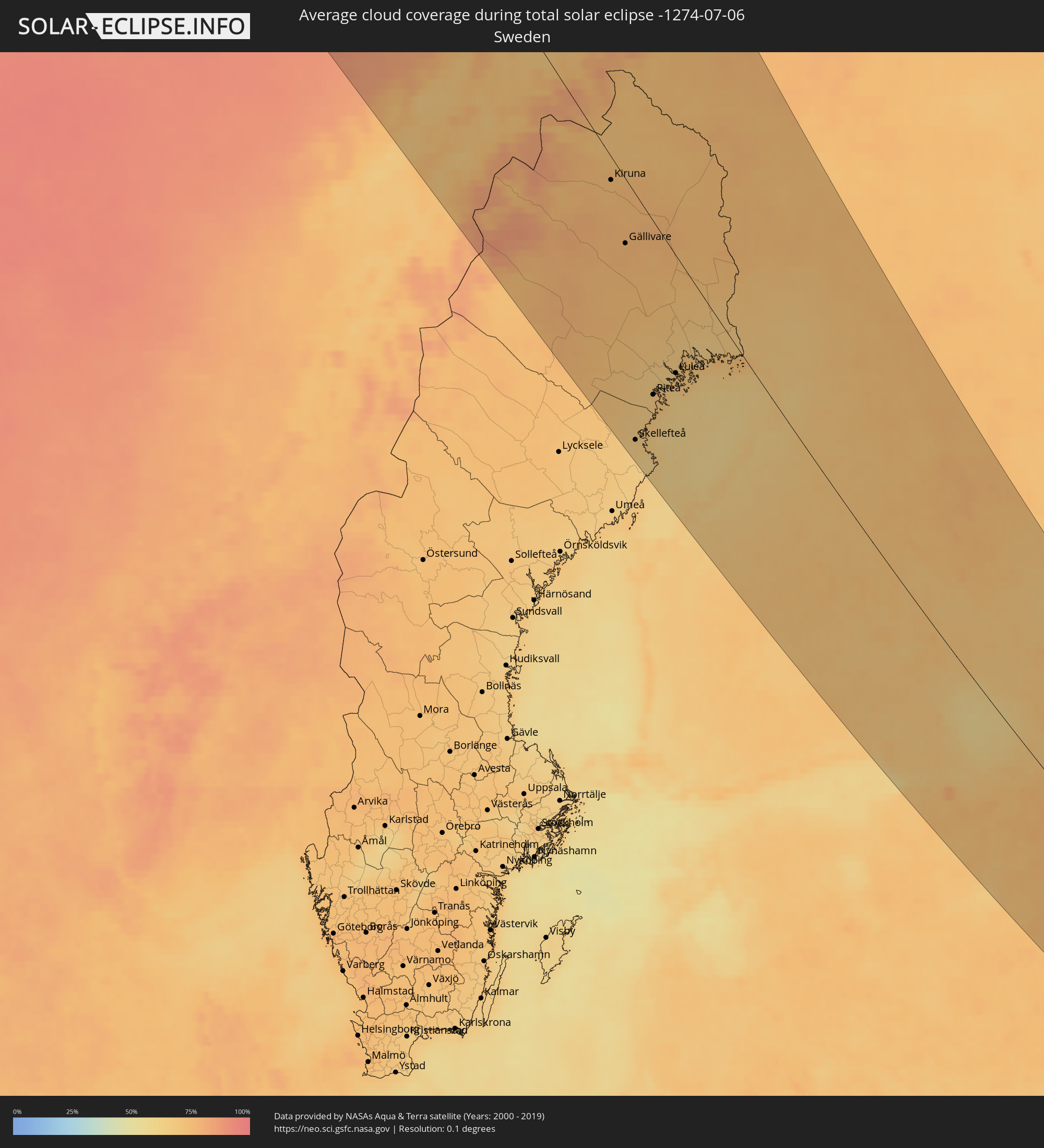 Sweden
 Finland
Cities inside the path of the eclipse
The following table shows all locations with a population of more than 5,000 inside the eclipse path. Cities which have more than 100,000 inhabitants are marked bold. A click at the locations opens a detailed map.
| City | Type | Eclipse duration | Local time of max. eclipse | Distance to central line | Ø Cloud coverage |
|
Bethel, Alaska
|
total | - | 06:14:34 UTC-10:00 | 142 km | 77% |
|
College, Alaska
|
total | - | 06:20:45 UTC-10:00 | 206 km | 69% |
|
Fairbanks, Alaska
|
total | - | 06:20:43 UTC-10:00 | 210 km | 68% |
|
Harstad, Troms
|
total | - | 18:41:06 UTC+01:00 | 85 km | 70% |
|
Narvik, Nordland
|
total | - | 18:41:33 UTC+01:00 | 76 km | 76% |
|
Tromsø, Troms
|
total | - | 18:39:26 UTC+01:00 | 49 km | 74% |
|
Kiruna, Norrbotten
|
total | - | 18:41:59 UTC+01:00 | 16 km | 74% |
|
Gällivare, Norrbotten
|
total | - | 18:42:59 UTC+01:00 | 45 km | 76% |
|
Malmberget, Norrbotten
|
total | - | 18:42:56 UTC+01:00 | 43 km | 76% |
|
Skellefteå, Västerbotten
|
total | - | 18:46:26 UTC+01:00 | 190 km | 65% |
|
Älvsbyn, Norrbotten
|
total | - | 18:45:05 UTC+01:00 | 127 km | 70% |
|
Piteå, Norrbotten
|
total | - | 18:45:30 UTC+01:00 | 132 km | 67% |
|
Boden, Norrbotten
|
total | - | 18:44:43 UTC+01:00 | 91 km | 67% |
|
Luleå, Norrbotten
|
total | - | 18:44:57 UTC+01:00 | 91 km | 68% |
|
Jakobstad, Ostrobothnia
|
total | - | 19:27:22 UTC+01:39 | 194 km | 65% |
|
Kokkola, Central Ostrobothnia
|
total | - | 19:27:02 UTC+01:39 | 166 km | 63% |
|
Kalix, Norrbotten
|
total | - | 18:44:20 UTC+01:00 | 39 km | 65% |
|
Alta, Finnmark Fylke
|
total | - | 18:38:13 UTC+01:00 | 210 km | 73% |
|
Kalajoki, Northern Ostrobothnia
|
total | - | 19:26:14 UTC+01:39 | 109 km | 62% |
|
Tornio, Lapland
|
total | - | 19:23:55 UTC+01:39 | 8 km | 74% |
|
Raahe, Northern Ostrobothnia
|
total | - | 19:25:29 UTC+01:39 | 58 km | 64% |
|
Ylivieska, Northern Ostrobothnia
|
total | - | 19:26:18 UTC+01:39 | 95 km | 66% |
|
Kemi, Lapland
|
total | - | 19:23:58 UTC+01:39 | 18 km | 70% |
|
Nivala, Northern Ostrobothnia
|
total | - | 19:26:25 UTC+01:39 | 89 km | 66% |
|
Saarijärvi, Central Finland
|
total | - | 19:28:00 UTC+01:39 | 160 km | 72% |
|
Haukipudas, Northern Ostrobothnia
|
total | - | 19:24:34 UTC+01:39 | 20 km | 65% |
|
Oulu, Northern Ostrobothnia
|
total | - | 19:24:45 UTC+01:39 | 5 km | 65% |
|
Rovaniemi, Lapland
|
total | - | 19:22:36 UTC+01:39 | 103 km | 69% |
|
Jyväskylä, Central Finland
|
total | - | 19:28:28 UTC+01:39 | 172 km | 72% |
|
Äänekoski, Central Finland
|
total | - | 19:27:59 UTC+01:39 | 146 km | 71% |
|
Kiiminki, Northern Ostrobothnia
|
total | - | 19:24:30 UTC+01:39 | 23 km | 66% |
|
Laukaa, Central Finland
|
total | - | 19:28:10 UTC+01:39 | 151 km | 71% |
|
Sodankylä, Lapland
|
total | - | 19:21:04 UTC+01:39 | 188 km | 73% |
|
Kiuruvesi, Northern Savo
|
total | - | 19:26:18 UTC+01:39 | 45 km | 68% |
|
Pudasjärvi, Northern Ostrobothnia
|
total | - | 19:23:51 UTC+01:39 | 81 km | 70% |
|
Pieksämäki, Southern Savonia
|
total | - | 19:27:57 UTC+01:39 | 111 km | 70% |
|
Iisalmi, Northern Savo
|
total | - | 19:26:15 UTC+01:39 | 25 km | 70% |
|
Mikkeli, Southern Savonia
|
total | - | 19:28:42 UTC+01:39 | 146 km | 71% |
|
Kemijärvi, Lapland
|
total | - | 19:21:55 UTC+01:39 | 176 km | 74% |
|
Siilinjärvi, Northern Savo
|
total | - | 19:26:44 UTC+01:39 | 41 km | 72% |
|
Kuopio, Northern Savo
|
total | - | 19:26:59 UTC+01:39 | 48 km | 73% |
|
Kajaani, Kainuu
|
total | - | 19:25:11 UTC+01:39 | 41 km | 70% |
|
Leppävirta, Northern Savo
|
total | - | 19:27:29 UTC+01:39 | 71 km | 71% |
|
Varkaus, Northern Savo
|
total | - | 19:27:41 UTC+01:39 | 79 km | 70% |
|
Lappeenranta, South Karelia
|
total | - | 19:29:12 UTC+01:39 | 152 km | 69% |
|
Sotkamo, Kainuu
|
total | - | 19:25:06 UTC+01:39 | 63 km | 72% |
|
Imatra, South Karelia
|
total | - | 19:28:51 UTC+01:39 | 120 km | 70% |
|
Vyborg, Leningradskaya Oblast'
|
total | - | 20:19:55 UTC+02:30 | 153 km | 68% |
|
Savonlinna, Southern Savonia
|
total | - | 19:27:55 UTC+01:39 | 67 km | 68% |
|
Suomussalmi, Kainuu
|
total | - | 19:23:56 UTC+01:39 | 129 km | 72% |
|
Sosnovyy Bor, Leningradskaya Oblast'
|
total | - | 20:20:48 UTC+02:30 | 196 km | 70% |
|
Kuusamo, Northern Ostrobothnia
|
total | - | 19:22:24 UTC+01:39 | 203 km | 75% |
|
Liperi, North Karelia
|
total | - | 19:26:54 UTC+01:39 | 2 km | 71% |
|
Kuhmo, Kainuu
|
total | - | 19:24:45 UTC+01:39 | 108 km | 74% |
|
Joensuu, North Karelia
|
total | - | 19:26:40 UTC+01:39 | 19 km | 70% |
|
Kontiolahti, North Karelia
|
total | - | 19:26:26 UTC+01:39 | 33 km | 70% |
|
Peterhof, St.-Petersburg
|
total | - | 20:20:31 UTC+02:30 | 162 km | 71% |
|
Kurortnyy, Leningradskaya Oblast'
|
total | - | 20:20:10 UTC+02:30 | 142 km | 68% |
|
Lieksa, North Karelia
|
total | - | 19:25:39 UTC+01:39 | 77 km | 72% |
|
Gatchina, Leningradskaya Oblast'
|
total | - | 20:20:48 UTC+02:30 | 175 km | 72% |
|
Kitee, North Karelia
|
total | - | 19:27:10 UTC+01:39 | 2 km | 70% |
|
Saint Petersburg, St.-Petersburg
|
total | - | 20:20:17 UTC+02:30 | 142 km | 79% |
|
Kolpino, St.-Petersburg
|
total | - | 20:20:24 UTC+02:30 | 142 km | 74% |
|
Velikiy Novgorod, Novgorod
|
total | - | 20:21:36 UTC+02:30 | 202 km | 67% |
|
Petrozavodsk, Republic of Karelia
|
total | - | 20:16:26 UTC+02:30 | 158 km | 69% |
|
Tver, Tverskaya
|
total | - | 20:21:22 UTC+02:30 | 123 km | 74% |
|
Naro-Fominsk, Moscow Oblast
|
total | - | 20:22:31 UTC+02:30 | 199 km | 75% |
|
Klin, Moscow Oblast
|
total | - | 20:21:31 UTC+02:30 | 127 km | 71% |
|
Zelenograd, Moscow
|
total | - | 20:21:39 UTC+02:30 | 134 km | 75% |
|
Odintsovo, Moscow Oblast
|
total | - | 20:21:56 UTC+02:30 | 152 km | 79% |
|
Khimki, Moscow Oblast
|
total | - | 20:21:37 UTC+02:30 | 128 km | 81% |
|
Chekhov, Moscow Oblast
|
total | - | 20:22:22 UTC+02:30 | 184 km | 75% |
|
Yasenevo, Moscow
|
total | - | 20:21:52 UTC+02:30 | 148 km | 78% |
|
Podolsk, Moscow Oblast
|
total | - | 20:22:03 UTC+02:30 | 159 km | 76% |
|
Moscow, Moscow
|
total | - | 20:21:40 UTC+02:30 | 131 km | 84% |
|
Mytishchi, Moscow Oblast
|
total | - | 20:21:27 UTC+02:30 | 113 km | 81% |
|
Lyubertsy, Moscow Oblast
|
total | - | 20:21:36 UTC+02:30 | 125 km | 79% |
|
Cherepovets, Vologda
|
total | - | 20:17:56 UTC+02:30 | 134 km | 71% |
|
Balashikha, Moscow Oblast
|
total | - | 20:21:26 UTC+02:30 | 113 km | 78% |
|
Zhukovskiy, Moscow Oblast
|
total | - | 20:21:34 UTC+02:30 | 120 km | 75% |
|
Sergiyev Posad, Moscow Oblast
|
total | - | 20:20:50 UTC+02:30 | 66 km | 72% |
|
Elektrostal’, Moscow Oblast
|
total | - | 20:21:12 UTC+02:30 | 90 km | 75% |
|
Voskresensk, Moscow Oblast
|
total | - | 20:21:34 UTC+02:30 | 118 km | 71% |
|
Aleksandrov, Vladimir
|
total | - | 20:20:26 UTC+02:30 | 33 km | 71% |
|
Kolomna, Moscow Oblast
|
total | - | 20:21:44 UTC+02:30 | 133 km | 69% |
|
Rybinsk, Jaroslavl
|
total | - | 20:18:38 UTC+02:30 | 97 km | 70% |
|
Orekhovo-Zuyevo, Moscow Oblast
|
total | - | 20:20:54 UTC+02:30 | 69 km | 70% |
|
Yegor’yevsk, Moscow Oblast
|
total | - | 20:21:18 UTC+02:30 | 96 km | 71% |
|
Yaroslavl, Jaroslavl
|
total | - | 20:18:33 UTC+02:30 | 113 km | 74% |
|
Vladimir, Vladimir
|
total | - | 20:19:48 UTC+02:30 | 26 km | 69% |
|
Gus’-Khrustal’nyy, Vladimir
|
total | - | 20:20:11 UTC+02:30 | 20 km | 70% |
|
Kostroma, Kostroma
|
total | - | 20:17:52 UTC+02:30 | 171 km | 70% |
|
Ivanovo, Ivanovo
|
total | - | 20:18:37 UTC+02:30 | 115 km | 73% |
|
Kovrov, Vladimir
|
total | - | 20:19:04 UTC+02:30 | 83 km | 70% |
|
Kineshma, Ivanovo
|
total | - | 20:17:34 UTC+02:30 | 201 km | 69% |
|
Novaya Balakhna, Nizjnij Novgorod
|
total | - | 20:17:41 UTC+02:30 | 196 km | 67% |