Total solar eclipse of 03/06/-1640
| Day of week: | Saturday |
| Maximum duration of eclipse: | 04m13s |
| Maximum width of eclipse path: | 182 km |
| Saros cycle: | 23 |
| Coverage: | 100% |
| Magnitude: | 1.0488 |
| Gamma: | 0.4746 |
Wo kann man die Sonnenfinsternis vom 03/06/-1640 sehen?
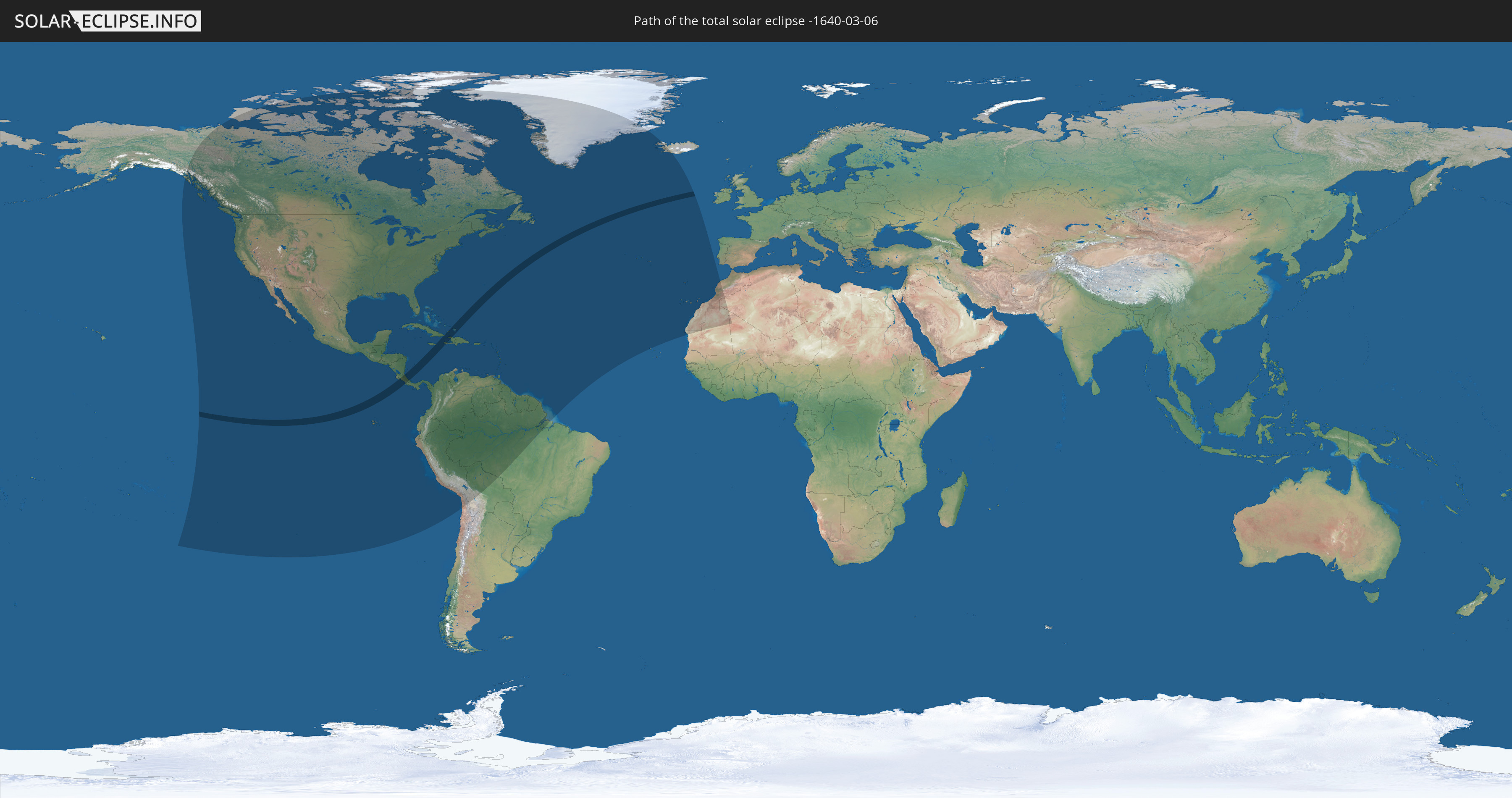
Die Sonnenfinsternis am 03/06/-1640 kann man in 59 Ländern als partielle Sonnenfinsternis beobachten.
Der Finsternispfad verläuft durch 10 Länder. Nur in diesen Ländern ist sie als total Sonnenfinsternis zu sehen.
In den folgenden Ländern ist die Sonnenfinsternis total zu sehen
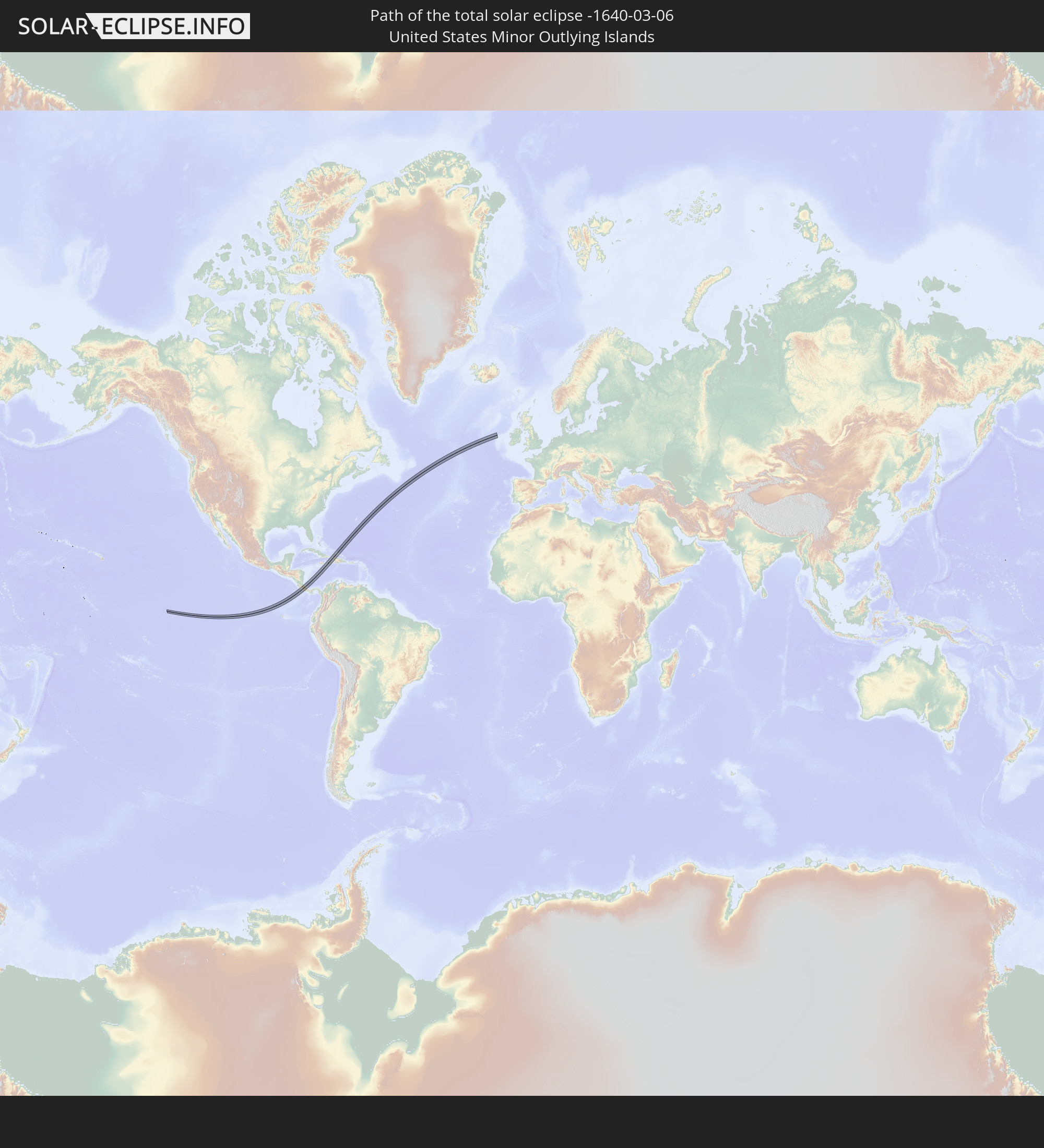 United States Minor Outlying Islands
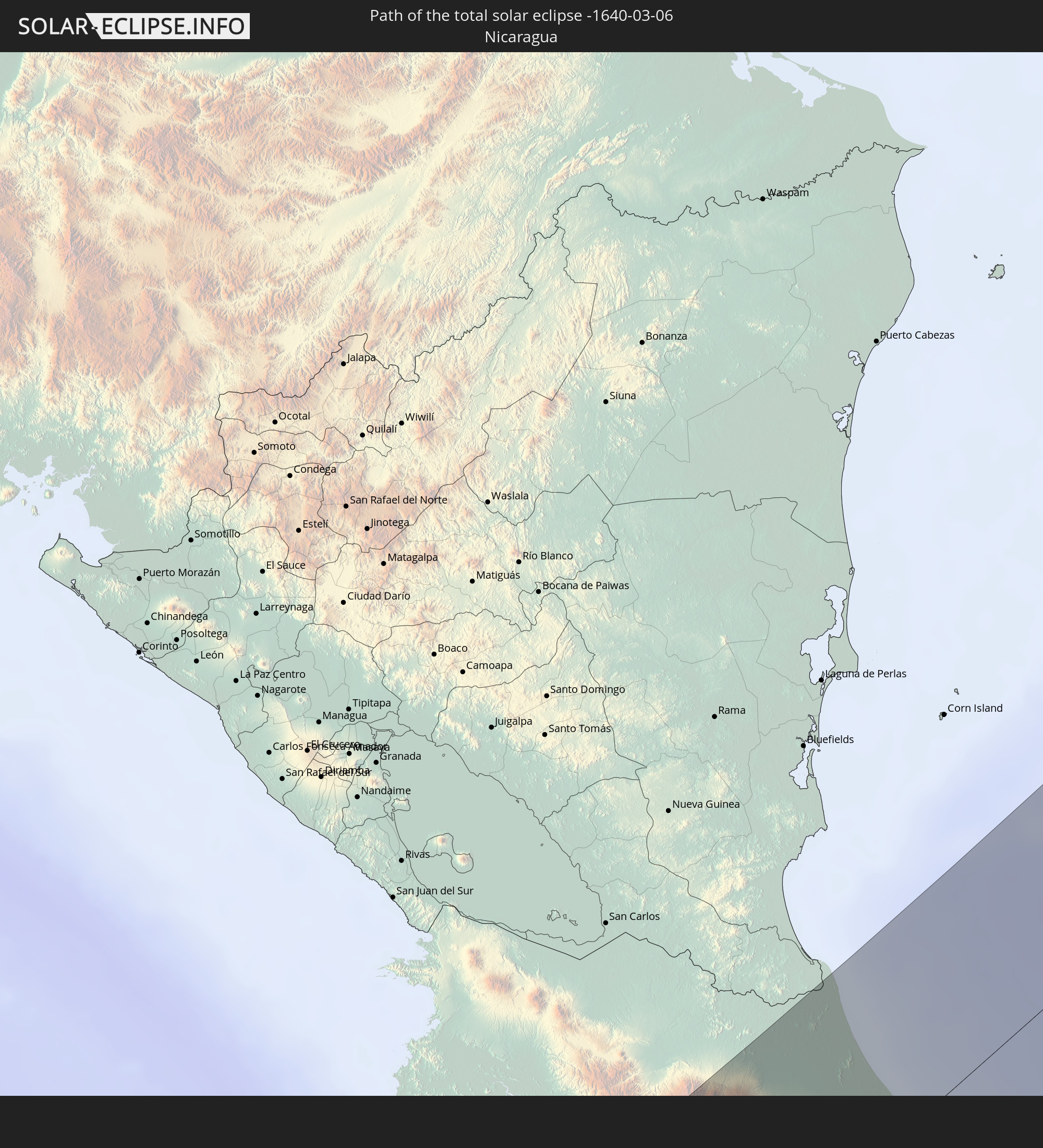 Nicaragua
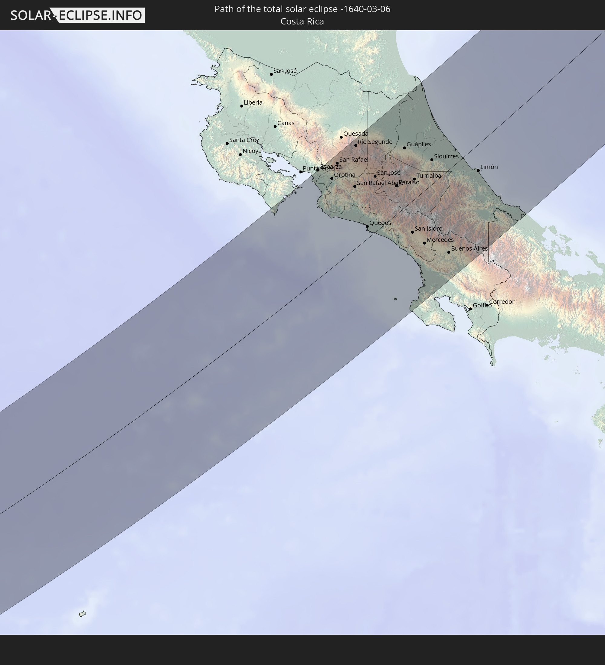 Costa Rica
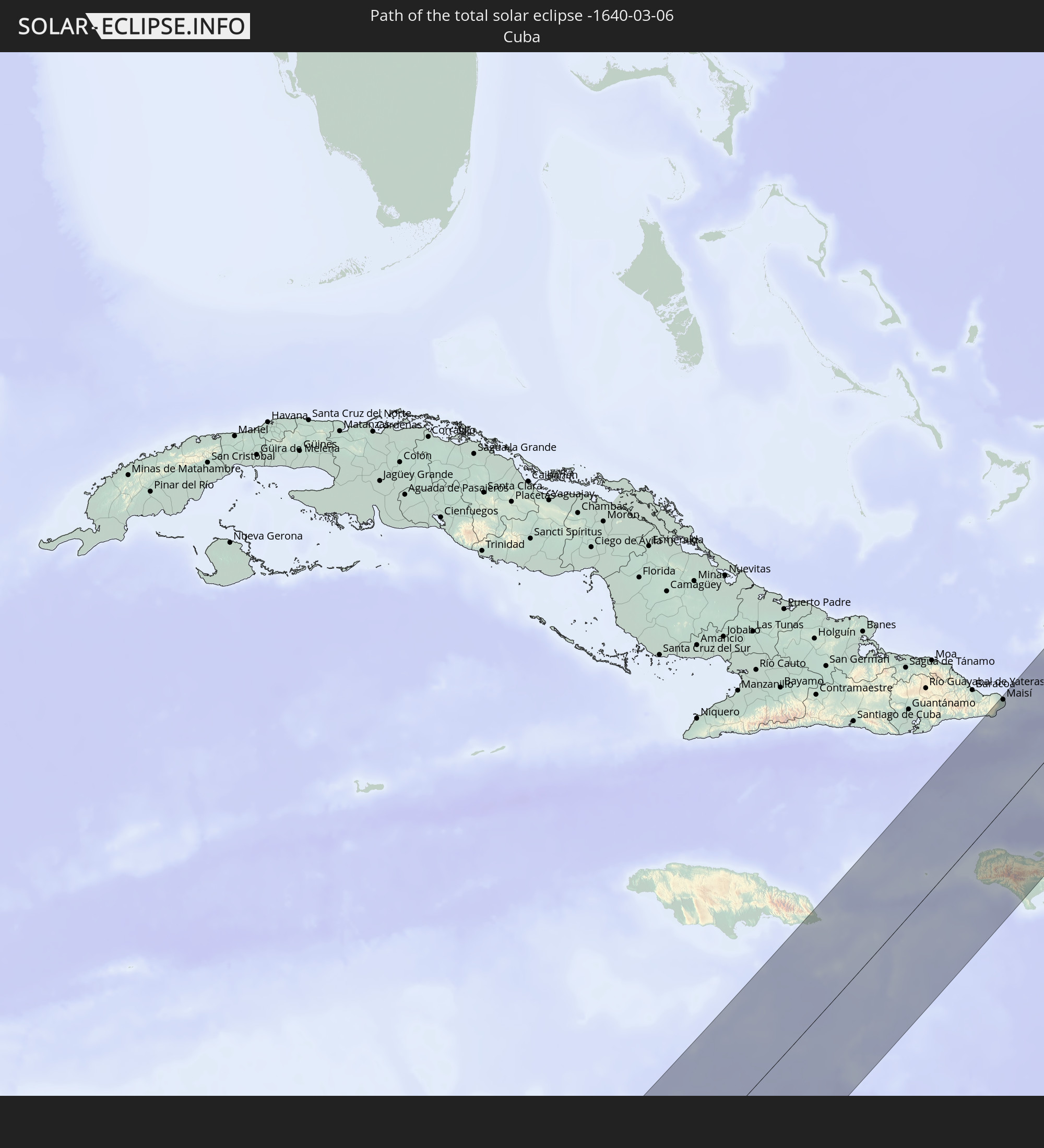 Cuba
Cuba
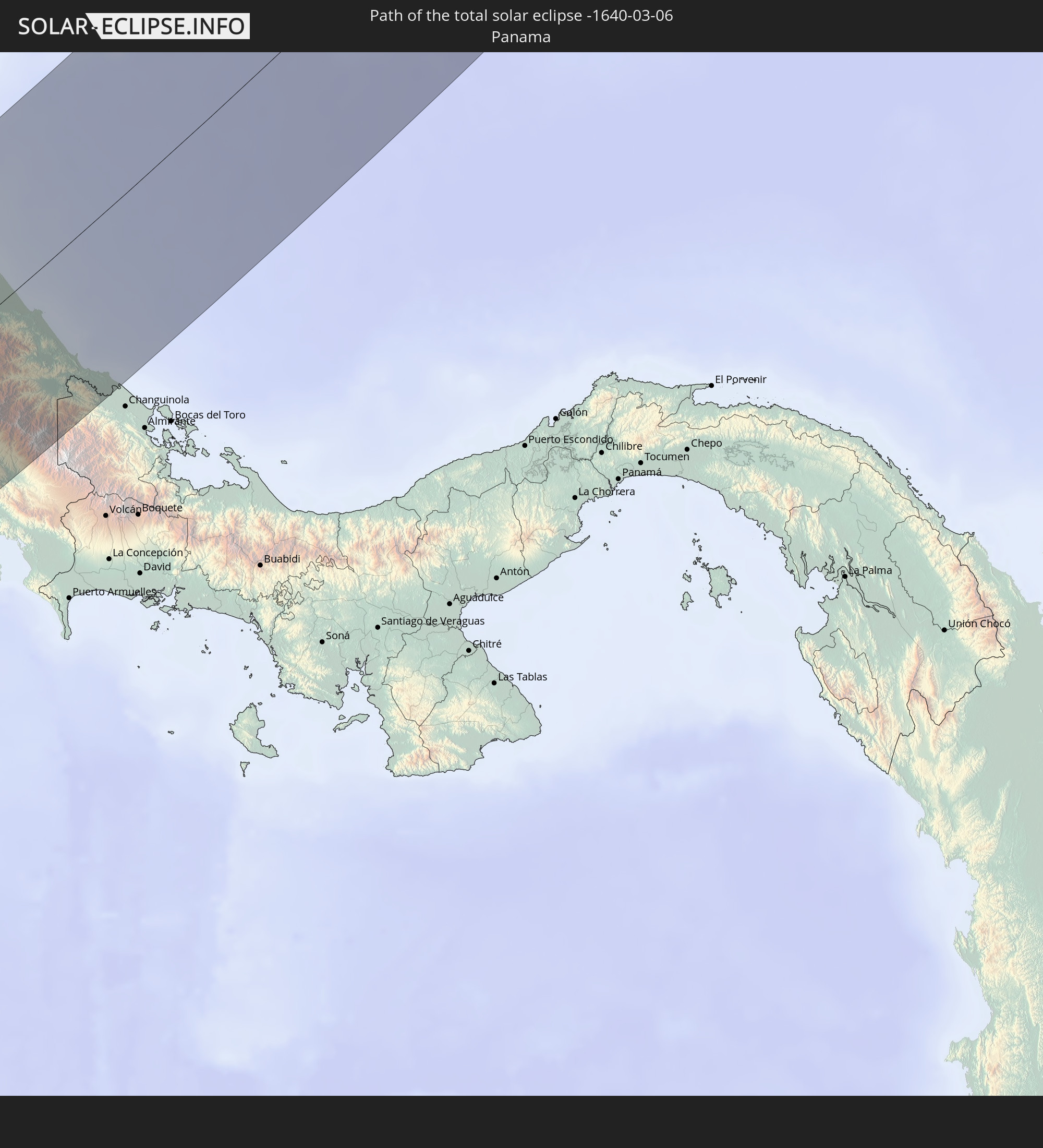 Panama
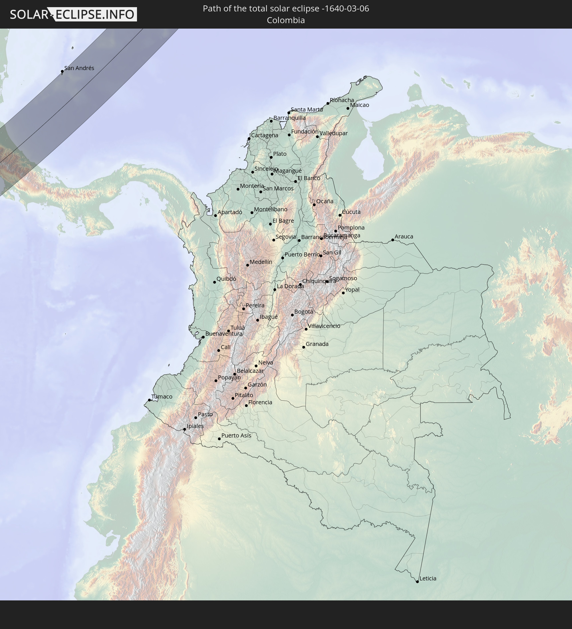 Colombia
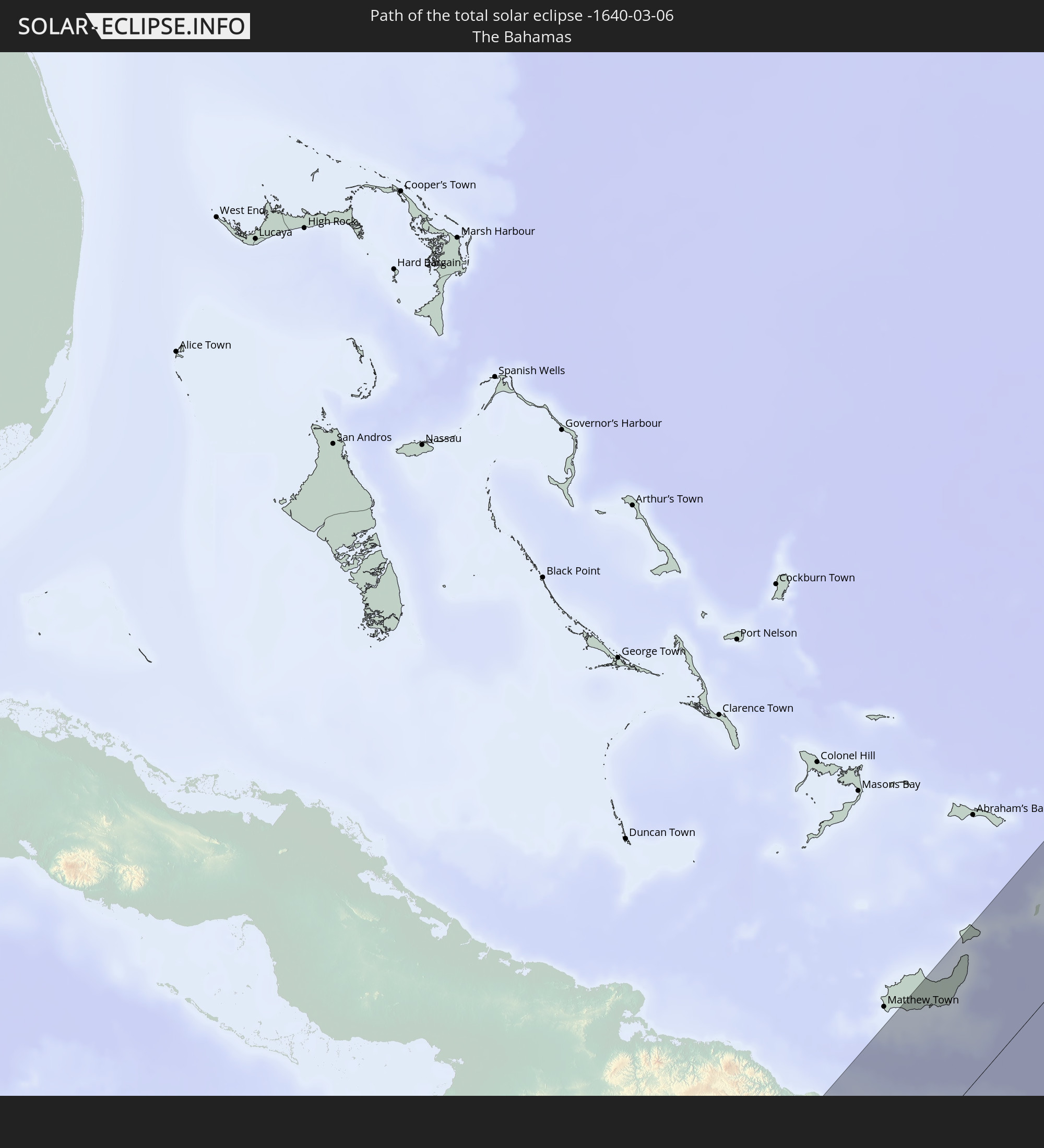 The Bahamas
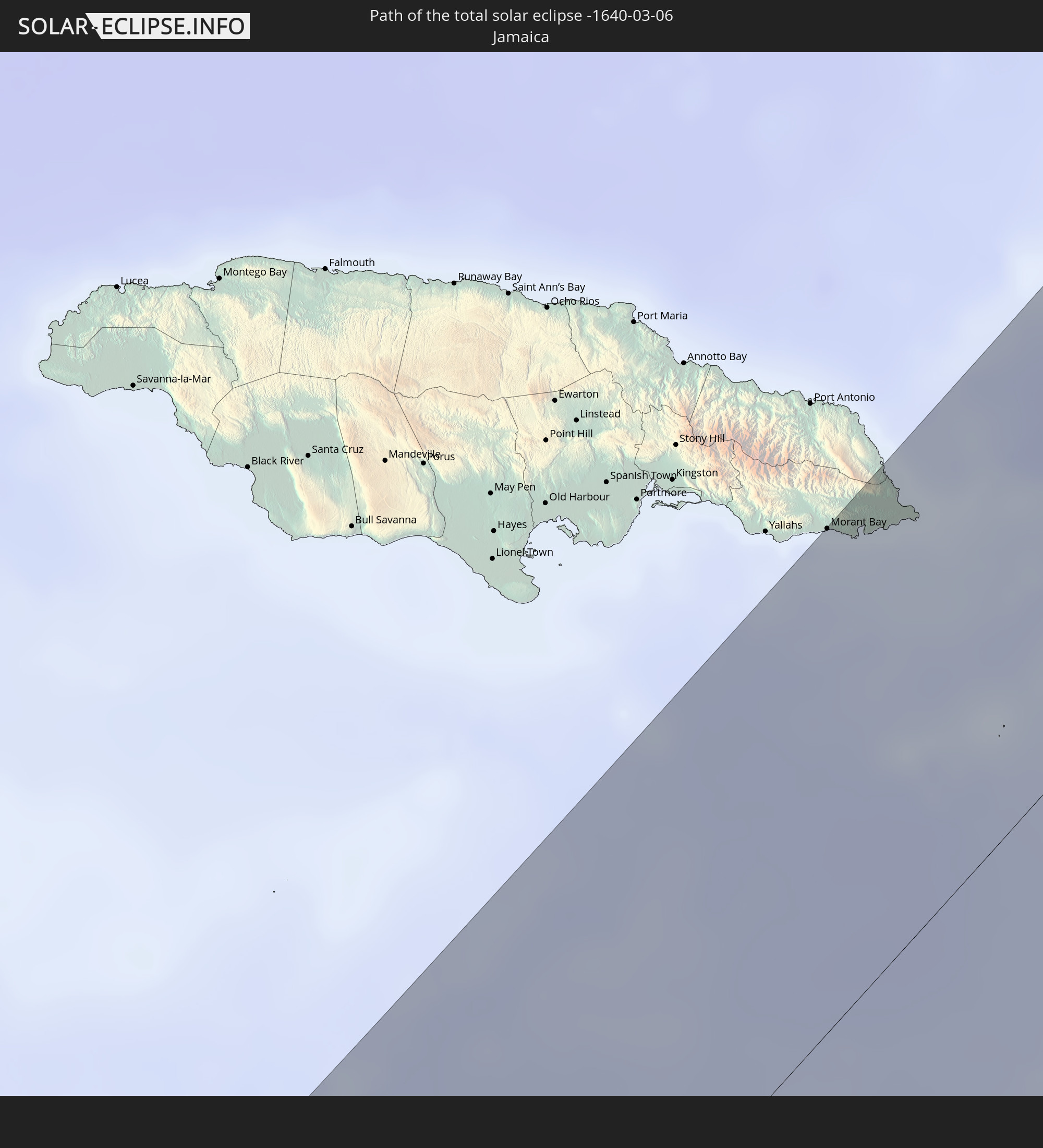 Jamaica
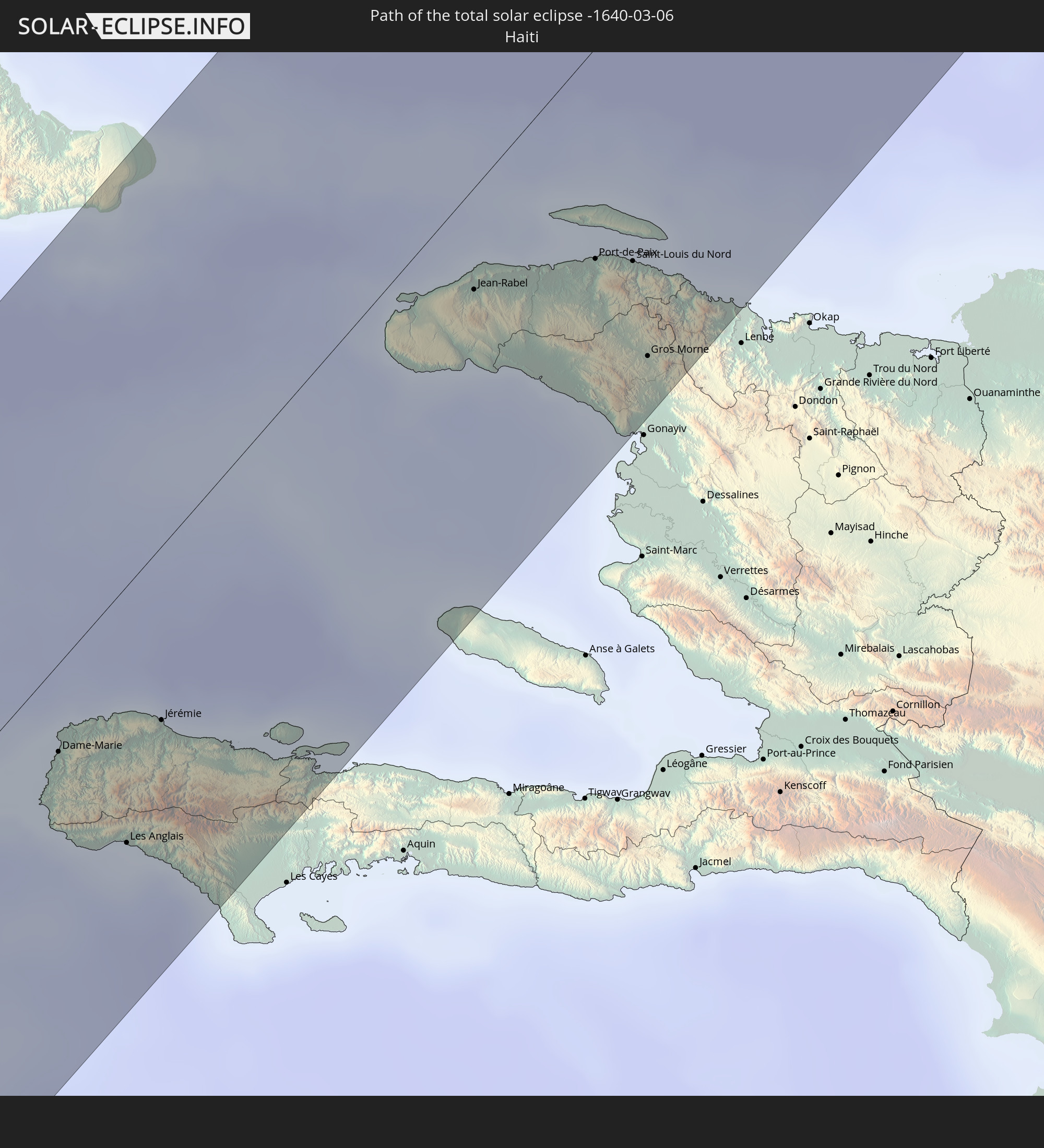 Haiti
Haiti
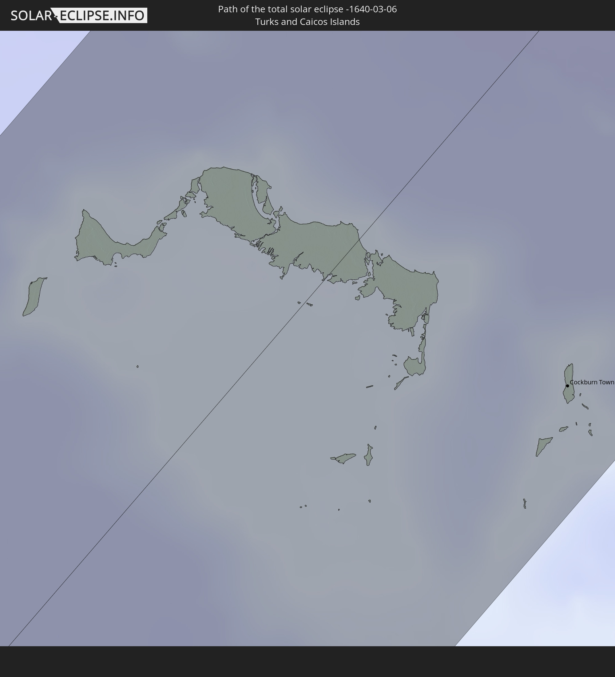 Turks and Caicos Islands
In den folgenden Ländern ist die Sonnenfinsternis partiell zu sehen
 United States
 United States Minor Outlying Islands
 French Polynesia
 Canada
 Pitcairn Islands
 Mexico
 Chile
Chile
 Greenland
 Guatemala
 Ecuador
 El Salvador
 Honduras
 Belize
 Nicaragua
 Costa Rica
 Cuba
Cuba
 Panama
 Colombia
 Cayman Islands
 Peru
Peru
 The Bahamas
 Jamaica
 Haiti
Haiti
 Brazil
 Venezuela
 Turks and Caicos Islands
 Dominican Republic
 Aruba
Aruba
 Bolivia
 Puerto Rico
 United States Virgin Islands
 Bermuda
 British Virgin Islands
 Anguilla
 Collectivity of Saint Martin
 Saint Barthélemy
 Saint Kitts and Nevis
 Antigua and Barbuda
 Montserrat
 Trinidad and Tobago
 Guadeloupe
 Grenada
 Dominica
 Saint Vincent and the Grenadines
 Guyana
 Martinique
 Saint Lucia
 Barbados
 Suriname
 Saint Pierre and Miquelon
 French Guiana
 Portugal
 Cabo Verde
 Iceland
 Spain
Spain
 Mauritania
 Morocco
 Mali
Mali
 Algeria
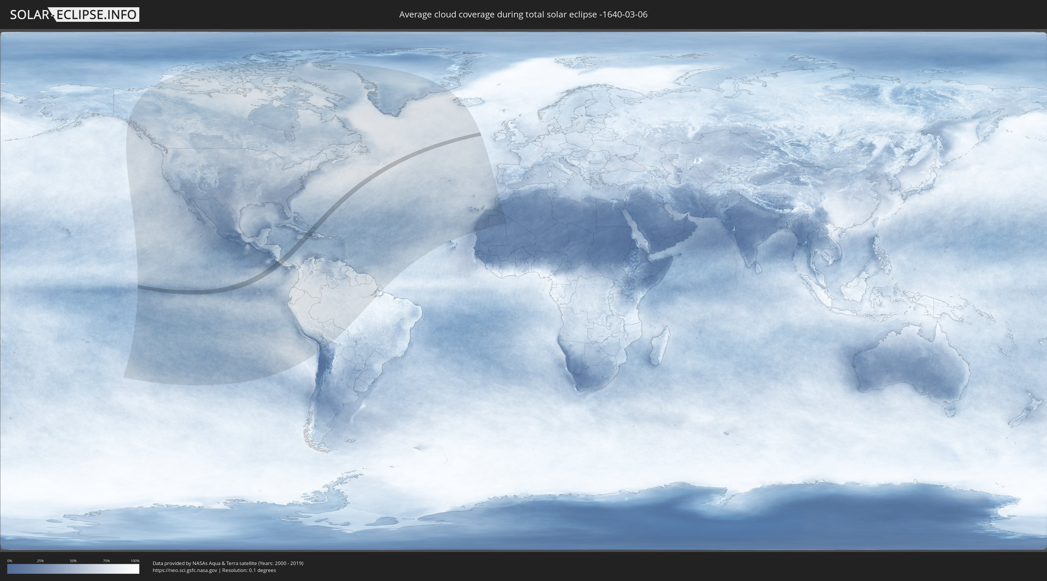
How will be the weather during the total solar eclipse on 03/06/-1640?
Where is the best place to see the total solar eclipse of 03/06/-1640?
The following maps show the average cloud coverage for the day of the total solar eclipse.
With the help of these maps, it is possible to find the place along the eclipse path, which has the best
chance of a cloudless sky.
Nevertheless, you should consider local circumstances and inform about the weather of your chosen
observation site.
The data is provided by NASAs satellites
AQUA and TERRA.
The cloud maps are averaged over a period of 19 years (2000 - 2019).

Detailed country maps
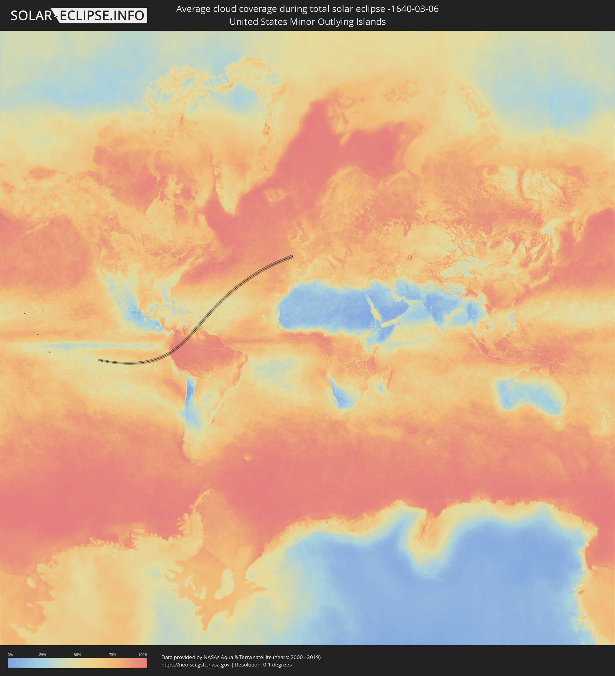 United States Minor Outlying Islands
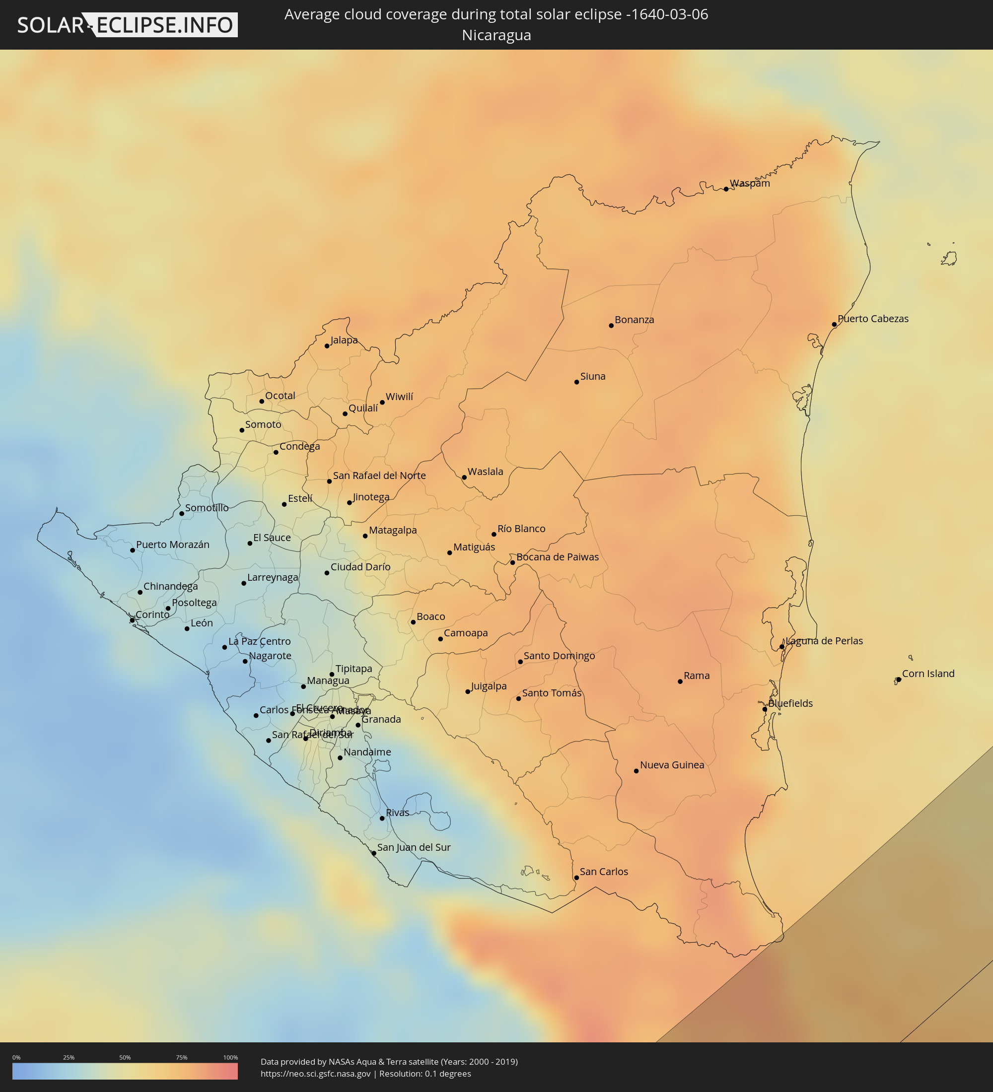 Nicaragua
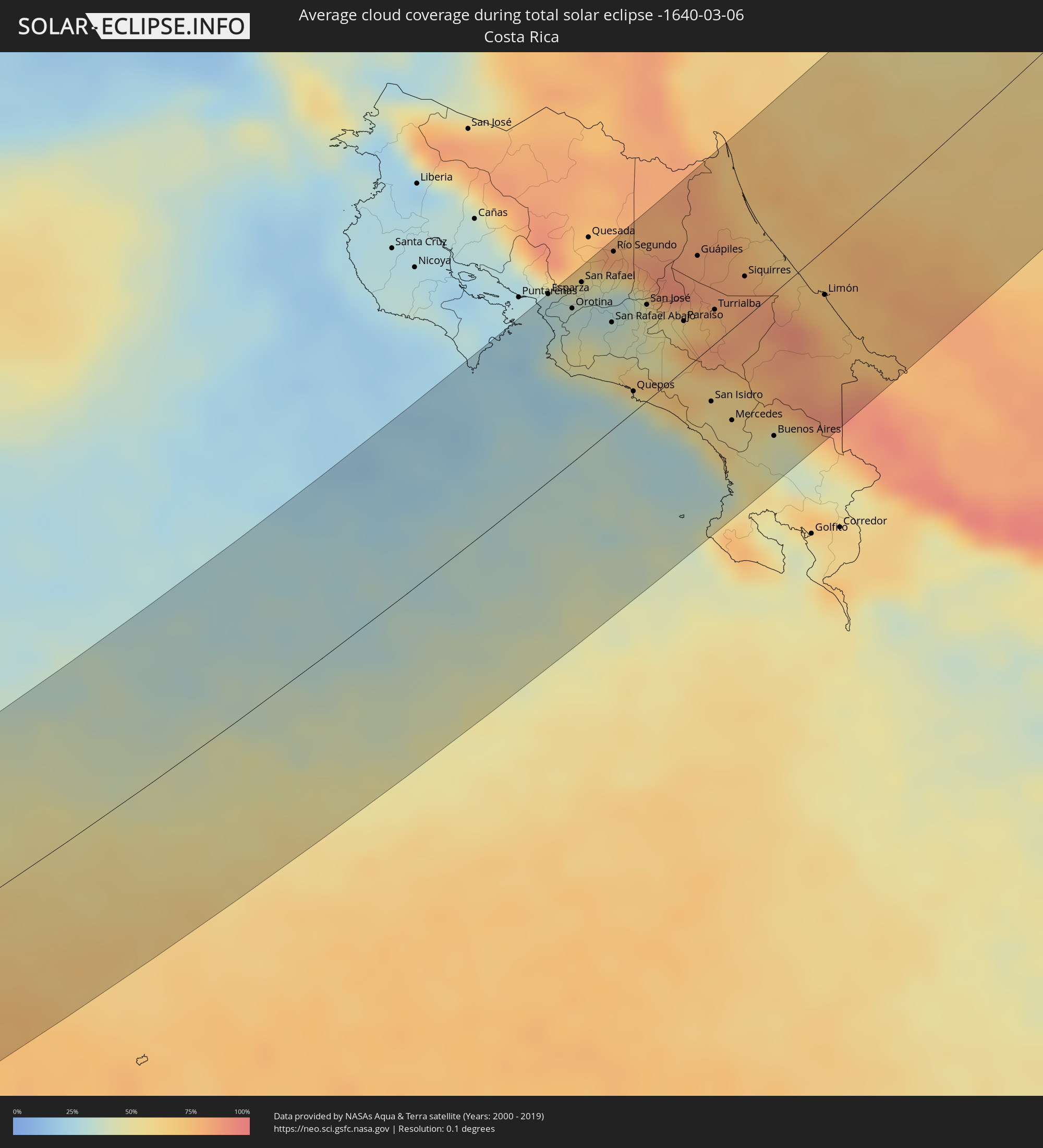 Costa Rica
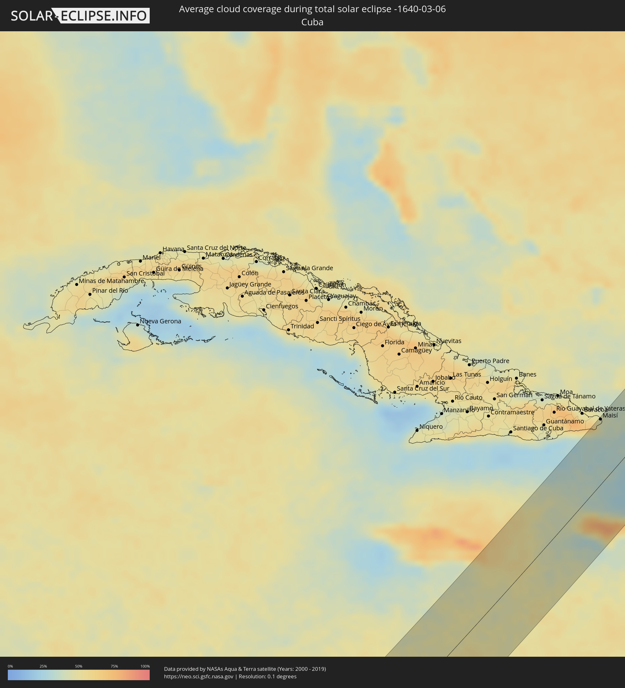 Cuba
Cuba
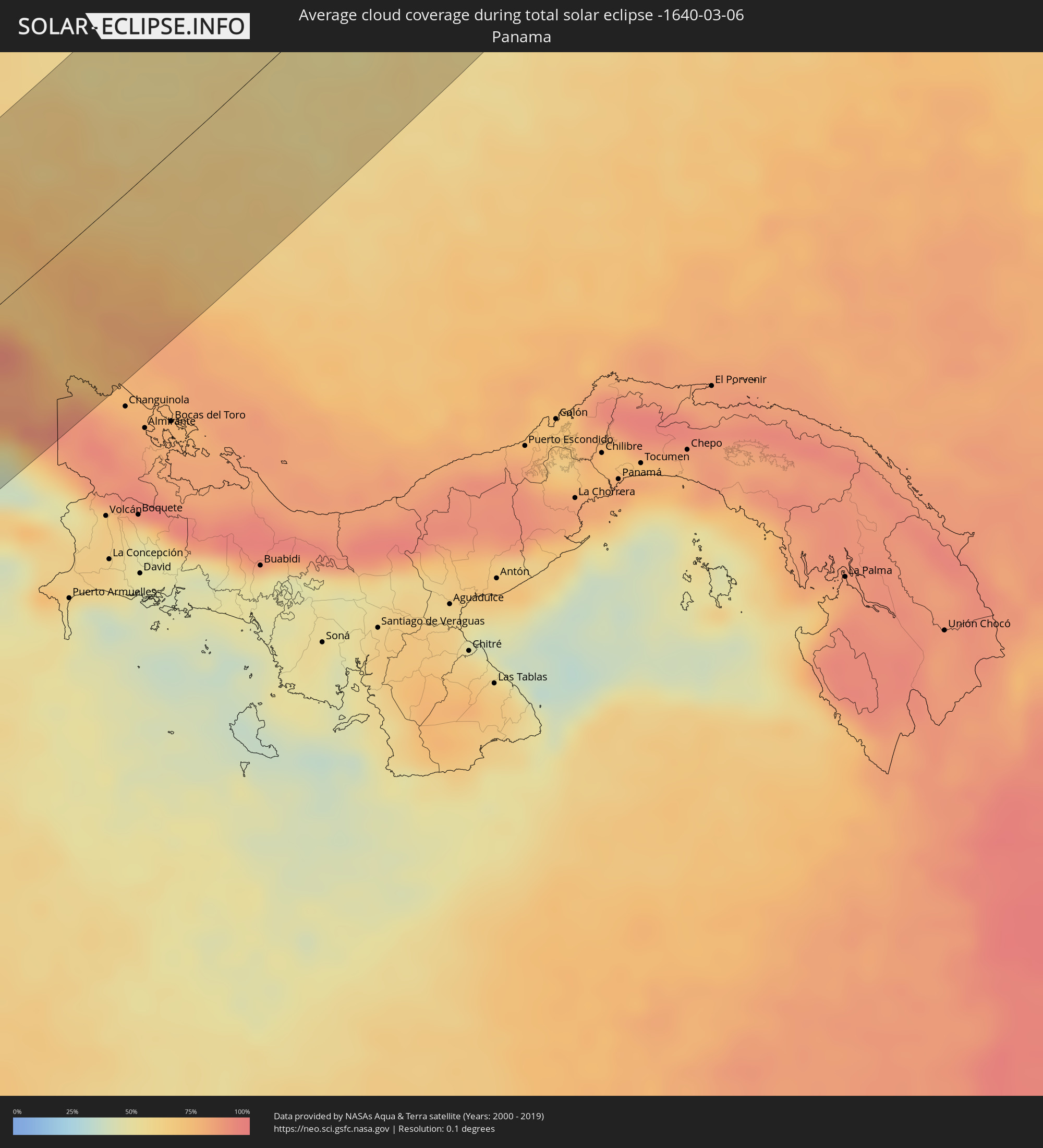 Panama
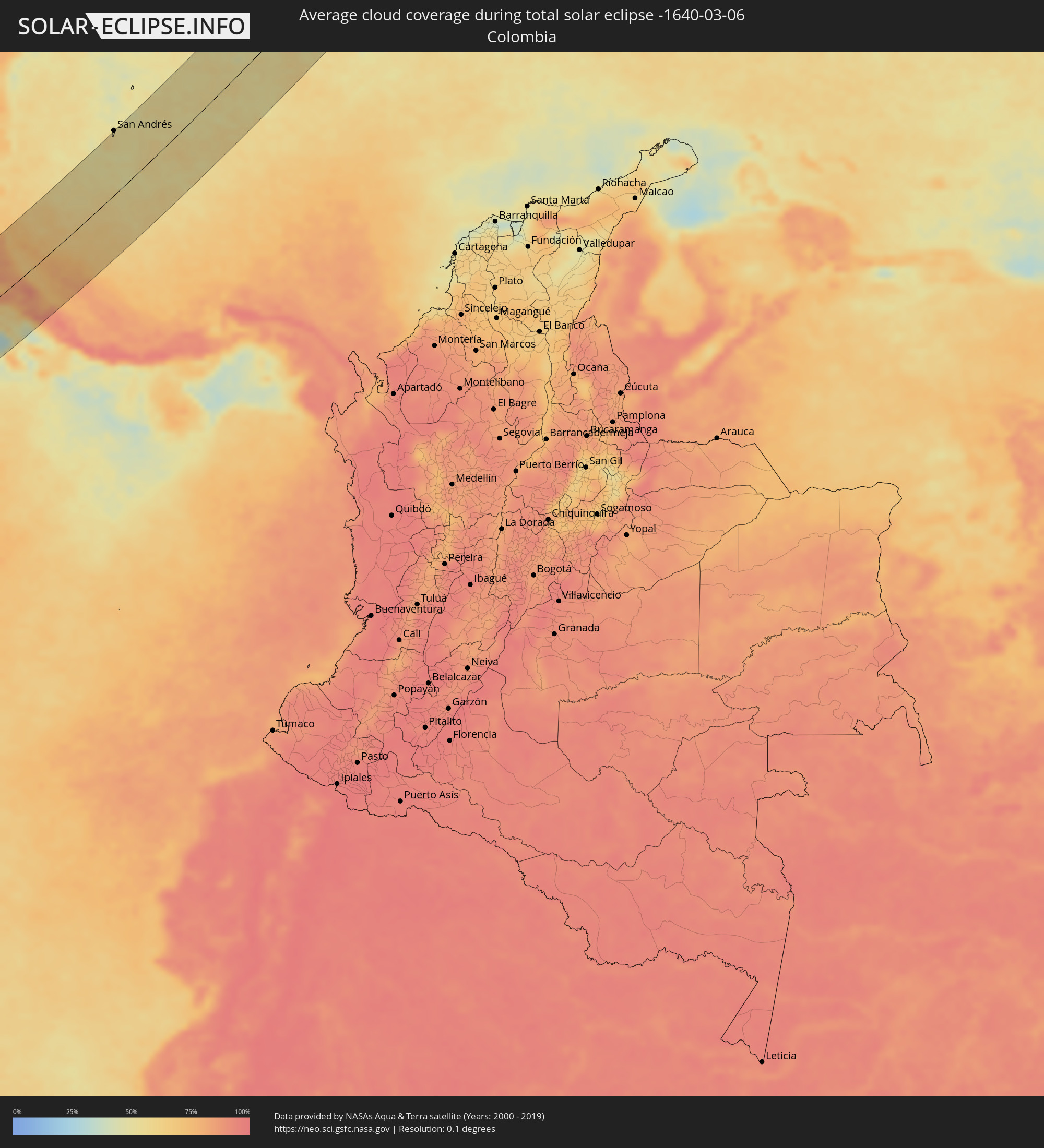 Colombia
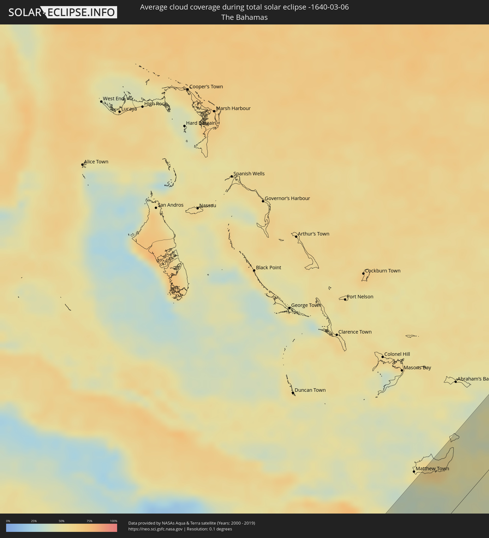 The Bahamas
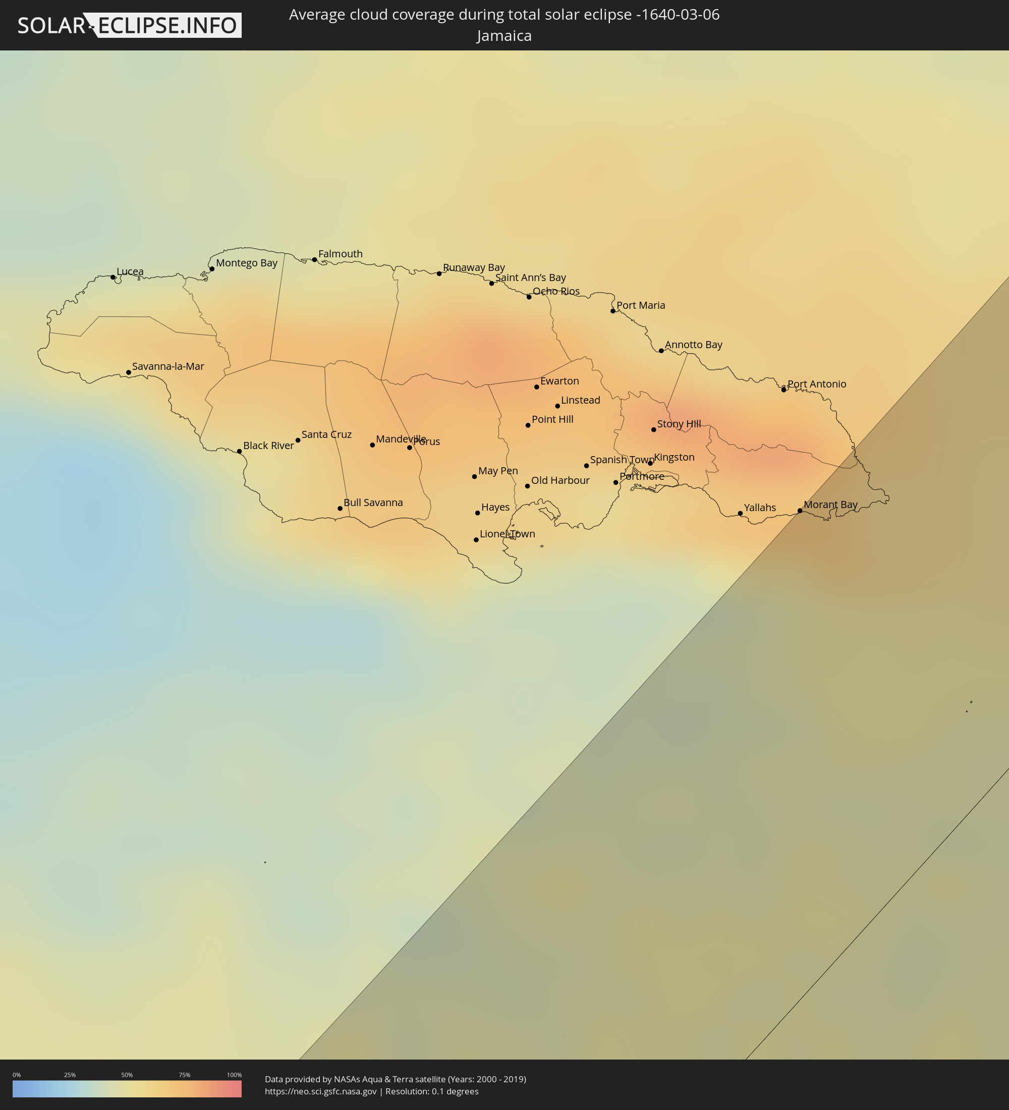 Jamaica
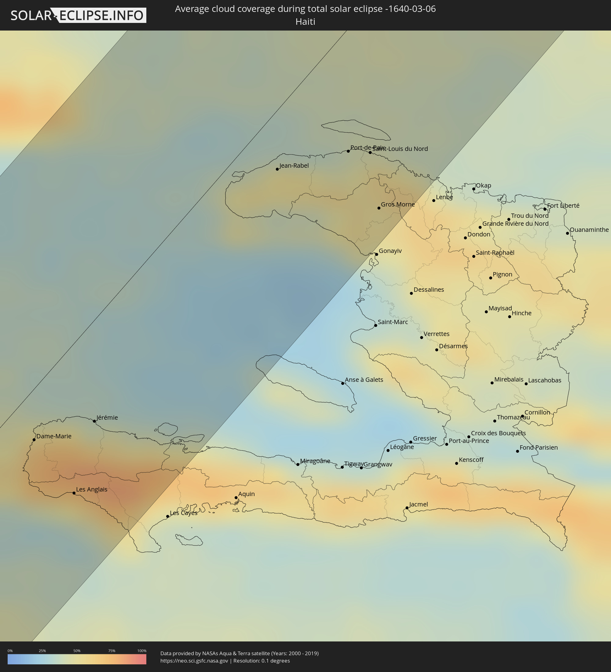 Haiti
Haiti
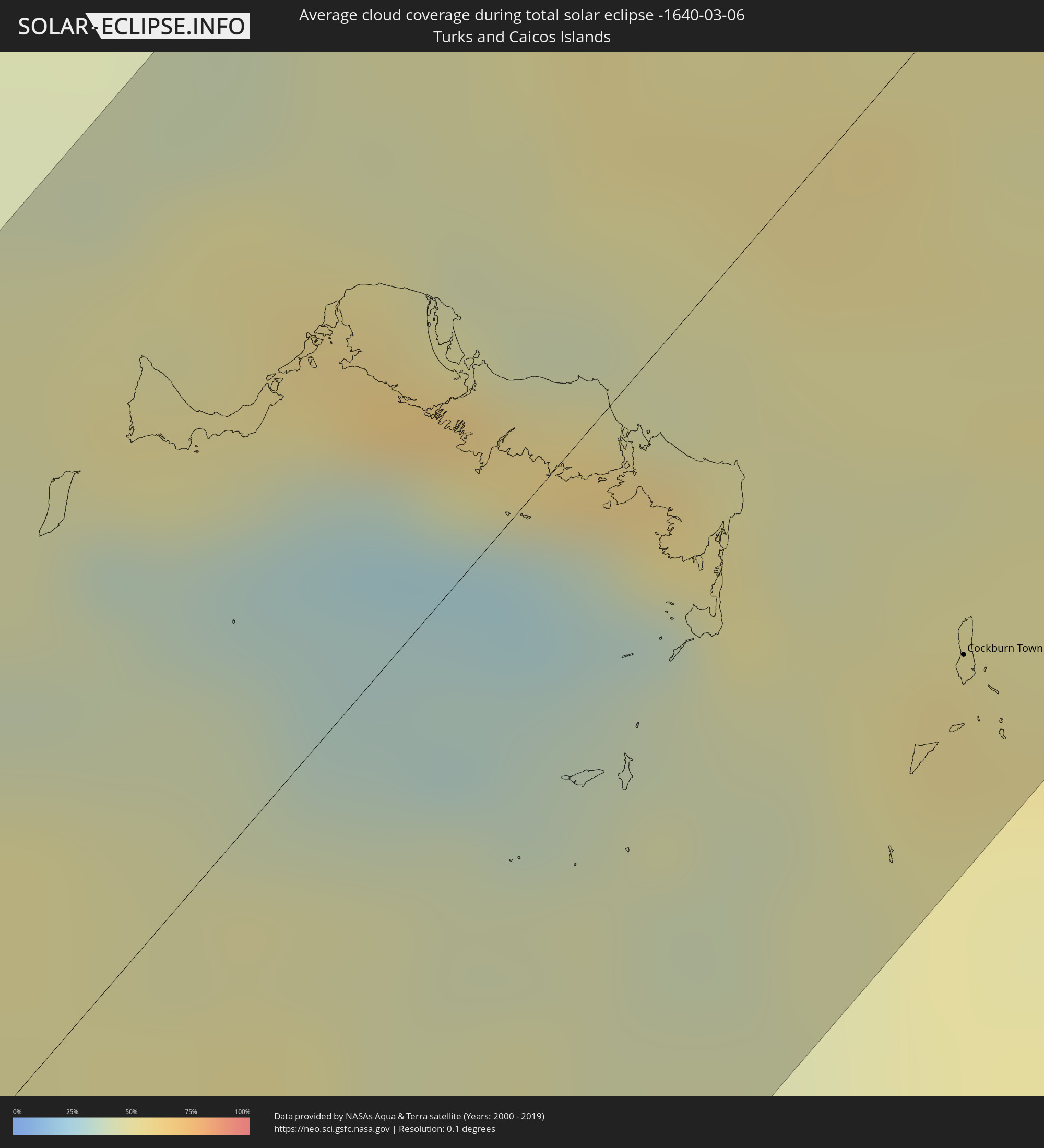 Turks and Caicos Islands
Cities inside the path of the eclipse
The following table shows all locations with a population of more than 5,000 inside the eclipse path. Cities which have more than 100,000 inhabitants are marked bold. A click at the locations opens a detailed map.
| City | Type | Eclipse duration | Local time of max. eclipse | Distance to central line | Ø Cloud coverage |
|
Esparza, Puntarenas
|
total | - | 10:44:51 UTC-05:36 | 94 km | 28% |
|
Desamparados, Alajuela
|
total | - | 10:45:05 UTC-05:36 | 79 km | 36% |
|
San Ramón, Alajuela
|
total | - | 10:45:26 UTC-05:36 | 88 km | 40% |
|
San Rafael, Alajuela
|
total | - | 10:45:24 UTC-05:36 | 86 km | 40% |
|
Naranjo, Alajuela
|
total | - | 10:45:39 UTC-05:36 | 82 km | 38% |
|
San Juan, Alajuela
|
total | - | 10:45:47 UTC-05:36 | 78 km | 33% |
|
Santiago, San José
|
total | - | 10:45:18 UTC-05:36 | 56 km | 42% |
|
San Rafael Abajo, San José
|
total | - | 10:45:20 UTC-05:36 | 53 km | 42% |
|
Río Segundo, Alajuela
|
total | - | 10:46:08 UTC-05:36 | 88 km | 50% |
|
Colón, Heredia
|
total | - | 10:45:35 UTC-05:36 | 57 km | 39% |
|
Alajuela, Alajuela
|
total | - | 10:45:51 UTC-05:36 | 64 km | 34% |
|
San Antonio, Heredia
|
total | - | 10:45:51 UTC-05:36 | 59 km | 34% |
|
Santa Ana, San José
|
total | - | 10:45:45 UTC-05:36 | 54 km | 39% |
|
Quepos, Puntarenas
|
total | - | 10:44:50 UTC-05:36 | 10 km | 31% |
|
Escazú, San José
|
total | - | 10:45:49 UTC-05:36 | 50 km | 44% |
|
Alajuelita, San José
|
total | - | 10:45:52 UTC-05:36 | 46 km | 44% |
|
San Rafael, Heredia
|
total | - | 10:46:05 UTC-05:36 | 55 km | 44% |
|
San Josecito, Heredia
|
total | - | 10:46:05 UTC-05:36 | 56 km | 44% |
|
Colima, San José
|
total | - | 10:45:59 UTC-05:36 | 49 km | 44% |
|
San Juan de Dios, San José
|
total | - | 10:45:51 UTC-05:36 | 43 km | 44% |
|
San José, San José
|
total | - | 10:45:58 UTC-05:36 | 47 km | 44% |
|
San Rafael Arriba, San José
|
total | - | 10:45:52 UTC-05:36 | 42 km | 44% |
|
Sabanilla, San José
|
total | - | 10:46:05 UTC-05:36 | 45 km | 49% |
|
Granadilla, San José
|
total | - | 10:46:06 UTC-05:36 | 43 km | 49% |
|
Concepción, Cartago
|
total | - | 10:46:08 UTC-05:36 | 42 km | 49% |
|
Tres Ríos, Cartago
|
total | - | 10:46:07 UTC-05:36 | 38 km | 49% |
|
Paraíso, Cartago
|
total | - | 10:46:14 UTC-05:36 | 24 km | 70% |
|
Guápiles, Limón
|
total | - | 10:47:08 UTC-05:36 | 50 km | 84% |
|
San Isidro, San José
|
total | - | 10:45:41 UTC-05:36 | 27 km | 56% |
|
Turrialba, Cartago
|
total | - | 10:46:45 UTC-05:36 | 17 km | 73% |
|
Daniel Flores, San José
|
total | - | 10:45:41 UTC-05:36 | 33 km | 59% |
|
Siquirres, Limón
|
total | - | 10:47:30 UTC-05:36 | 20 km | 82% |
|
Buenos Aires, Puntarenas
|
total | - | 10:46:05 UTC-05:36 | 70 km | 44% |
|
Limón, Limón
|
total | - | 10:48:17 UTC-05:36 | 22 km | 68% |
|
San Andrés, Archipiélago de San Andrés, Providencia y Santa Catalina
|
total | - | 11:36:03 UTC-04:56 | 93 km | 55% |
|
Morant Bay, St. Thomas
|
total | - | 11:46:02 UTC-05:07 | 89 km | 56% |
|
Dame-Marie, GrandʼAnse
|
total | - | 12:09:22 UTC-04:49 | 18 km | 64% |
|
Les Anglais, Sud
|
total | - | 12:09:18 UTC-04:49 | 53 km | 51% |
|
Maisí, Guantánamo
|
total | - | 11:32:13 UTC-05:29 | 84 km | 55% |
|
Jérémie, GrandʼAnse
|
total | - | 12:10:07 UTC-04:49 | 36 km | 43% |
|
Jean-Rabel, Nord-Ouest
|
total | - | 12:14:00 UTC-04:49 | 21 km | 49% |
|
Ti Port-de-Paix, Nord-Ouest
|
total | - | 12:14:49 UTC-04:49 | 43 km | 48% |
|
Port-de-Paix, Nord-Ouest
|
total | - | 12:14:50 UTC-04:49 | 43 km | 48% |
|
Saint-Louis du Nord, Nord-Ouest
|
total | - | 12:15:02 UTC-04:49 | 52 km | 55% |
|
Gros Morne, Artibonite
|
total | - | 12:14:40 UTC-04:49 | 75 km | 51% |
|
Cockburn Town
|
total | - | 12:02:23 UTC-05:07 | 65 km | 50% |