Total solar eclipse of 08/07/-1760
| Day of week: | Wednesday |
| Maximum duration of eclipse: | 05m54s |
| Maximum width of eclipse path: | 210 km |
| Saros cycle: | 17 |
| Coverage: | 100% |
| Magnitude: | 1.0638 |
| Gamma: | -0.0834 |
Wo kann man die Sonnenfinsternis vom 08/07/-1760 sehen?
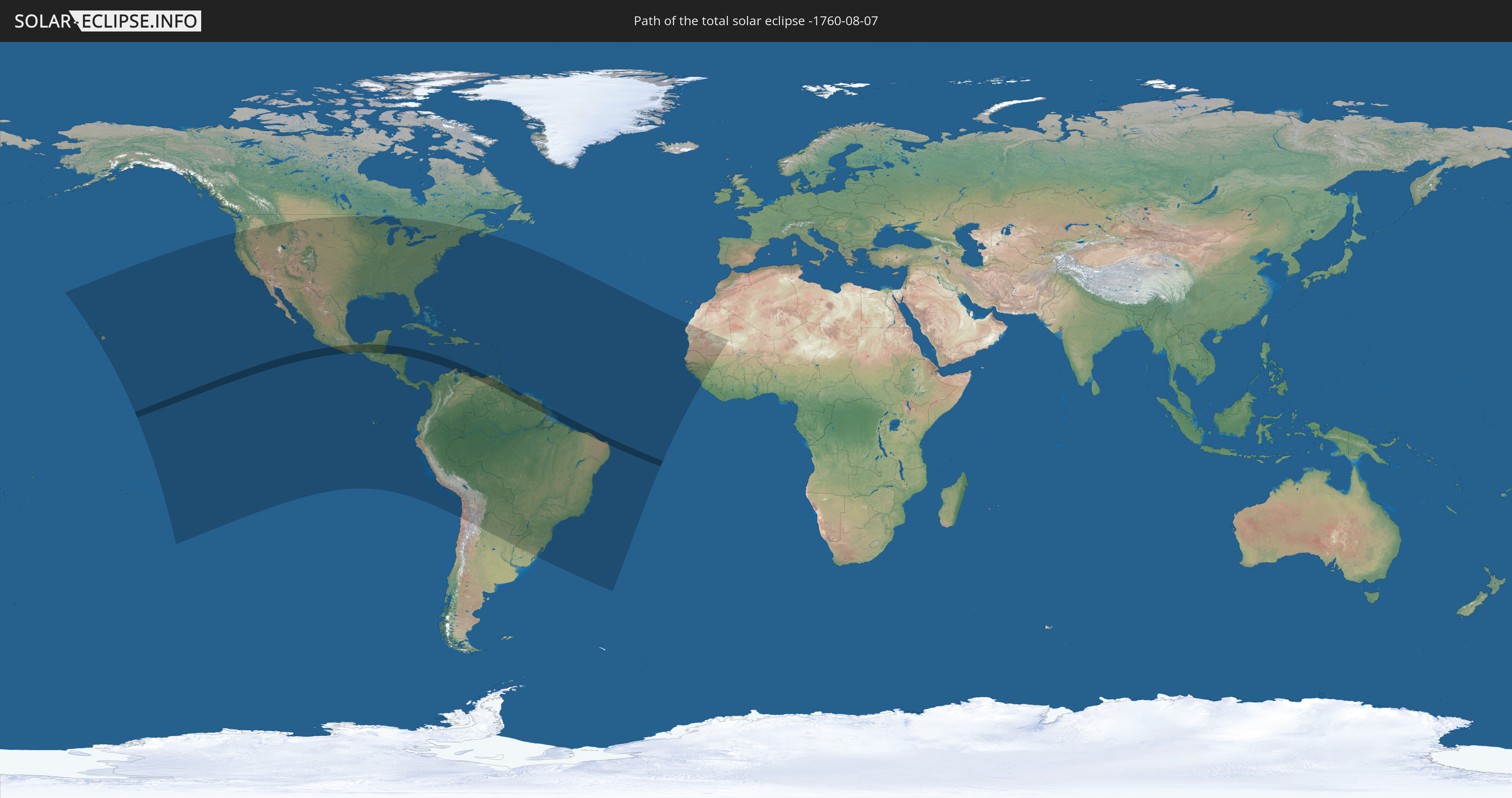
Die Sonnenfinsternis am 08/07/-1760 kann man in 60 Ländern als partielle Sonnenfinsternis beobachten.
Der Finsternispfad verläuft durch 13 Länder. Nur in diesen Ländern ist sie als total Sonnenfinsternis zu sehen.
In den folgenden Ländern ist die Sonnenfinsternis total zu sehen
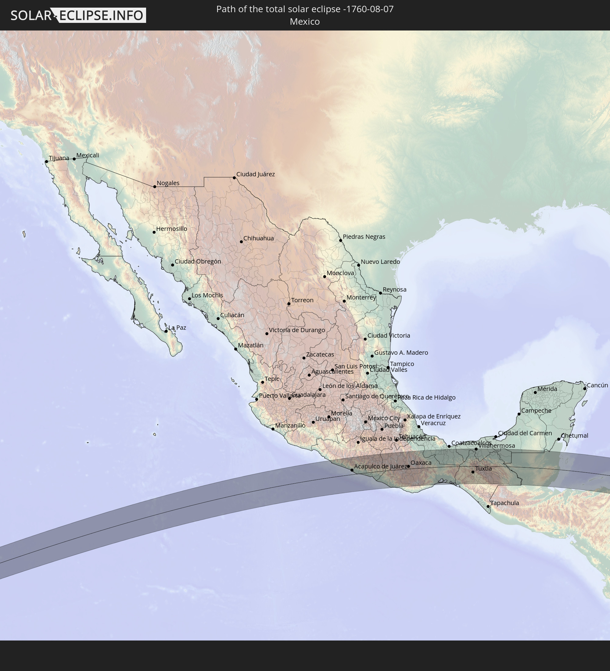 Mexico
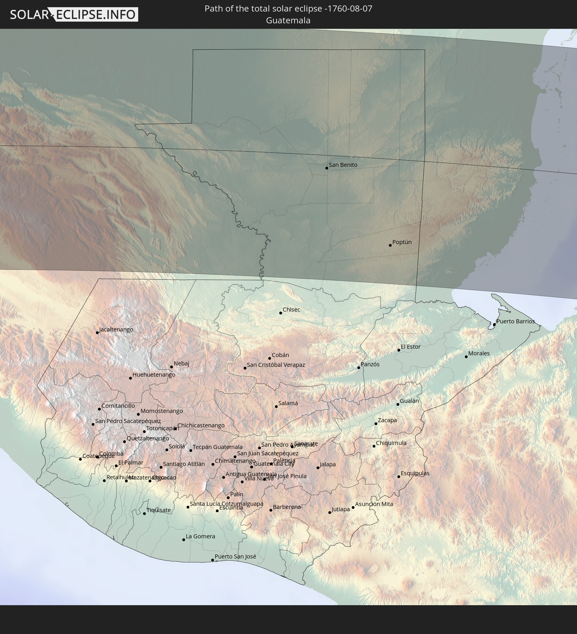 Guatemala
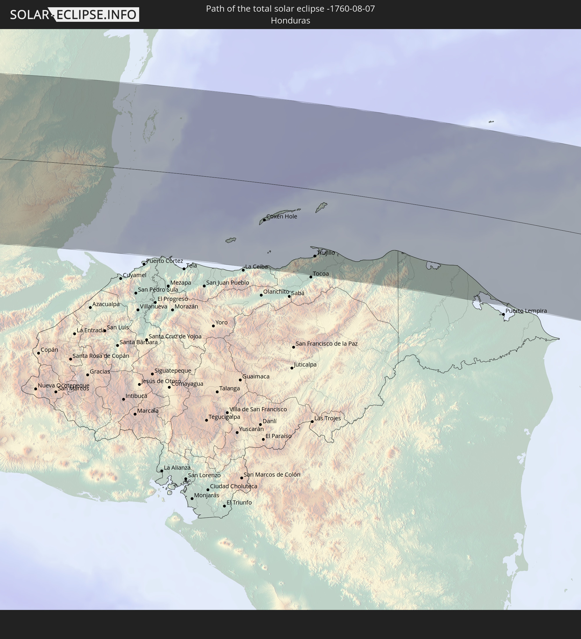 Honduras
 Belize
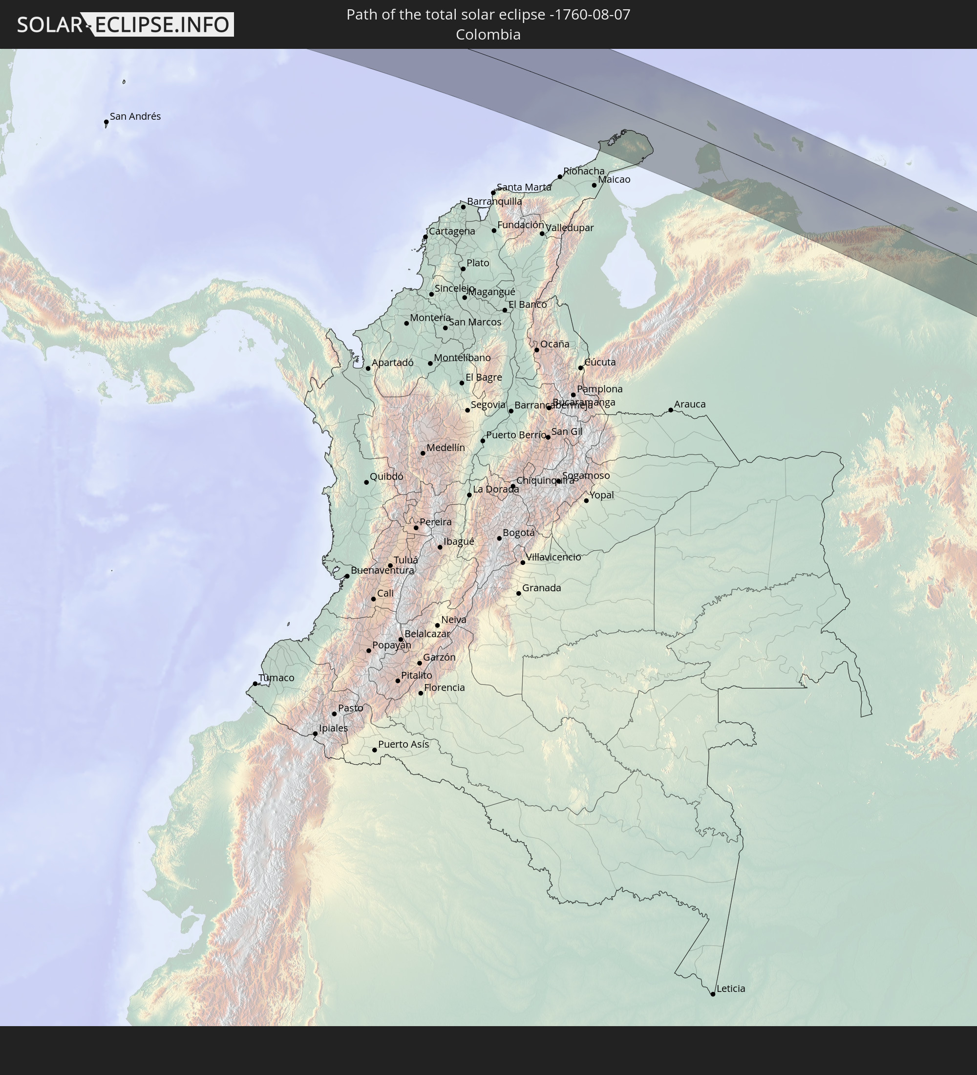 Colombia
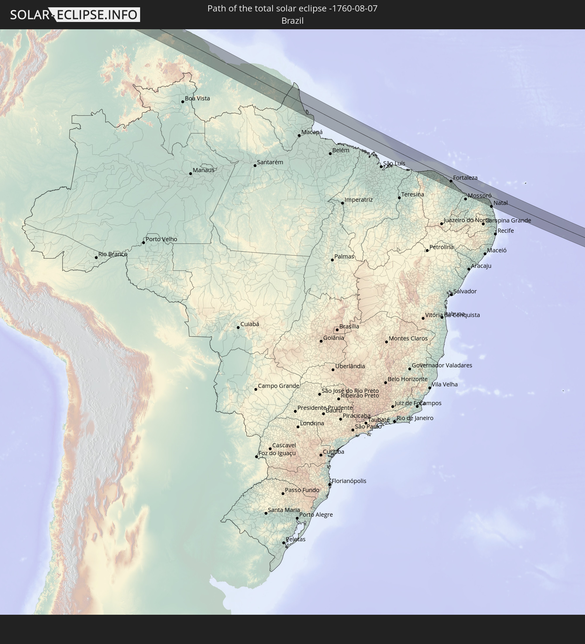 Brazil
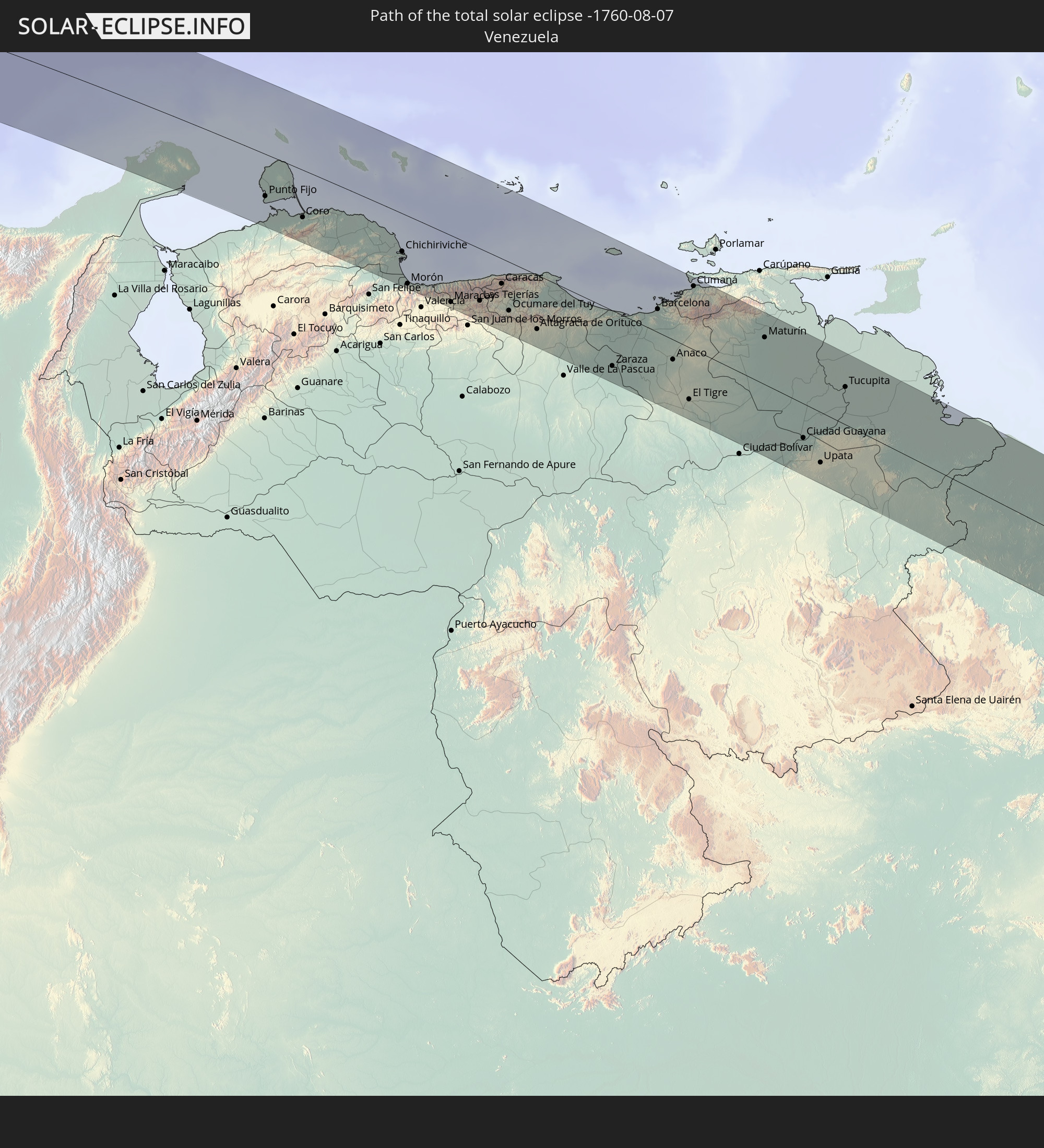 Venezuela
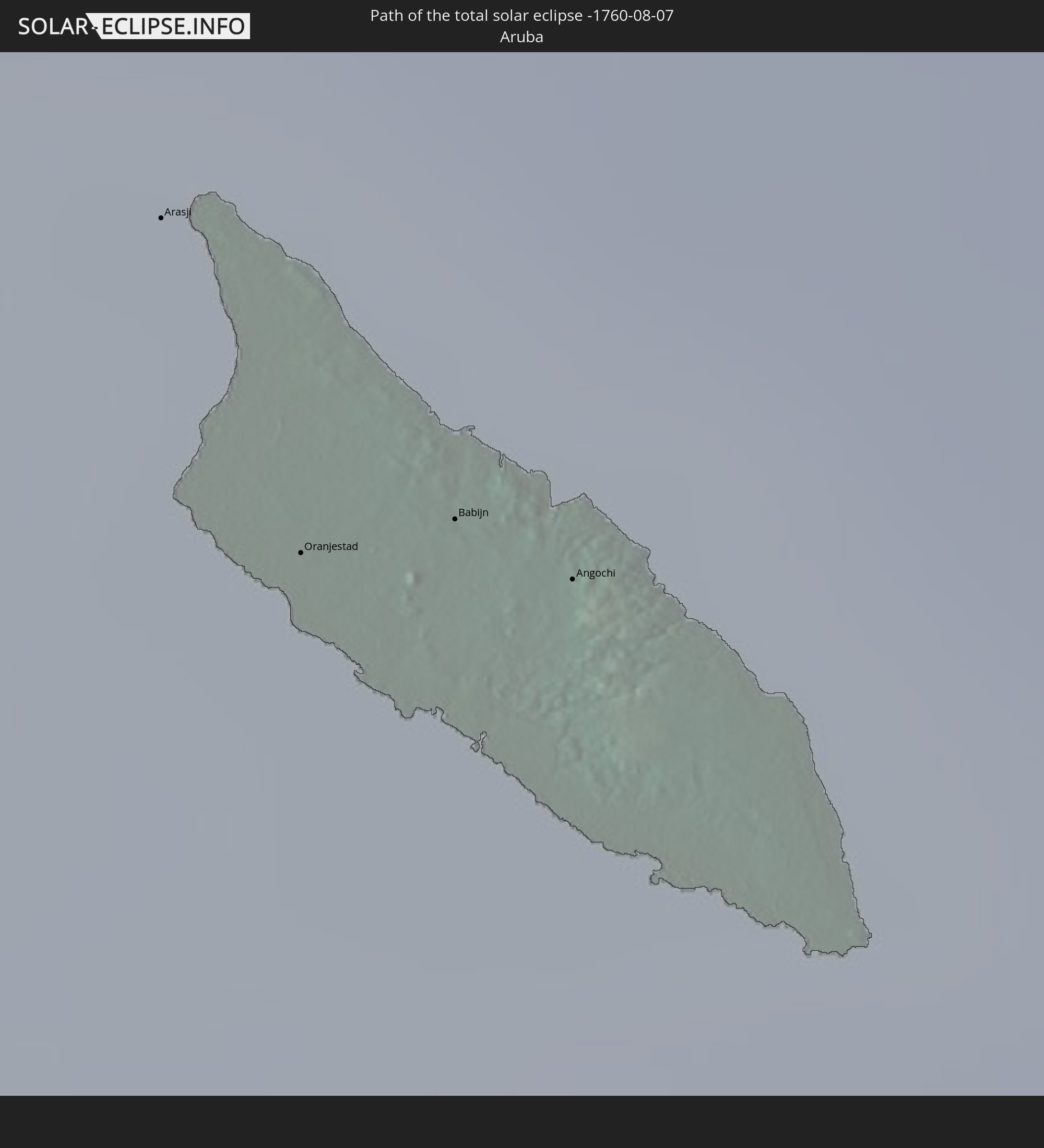 Aruba
Aruba
 Curaçao
 Guyana
 Suriname
 French Guiana
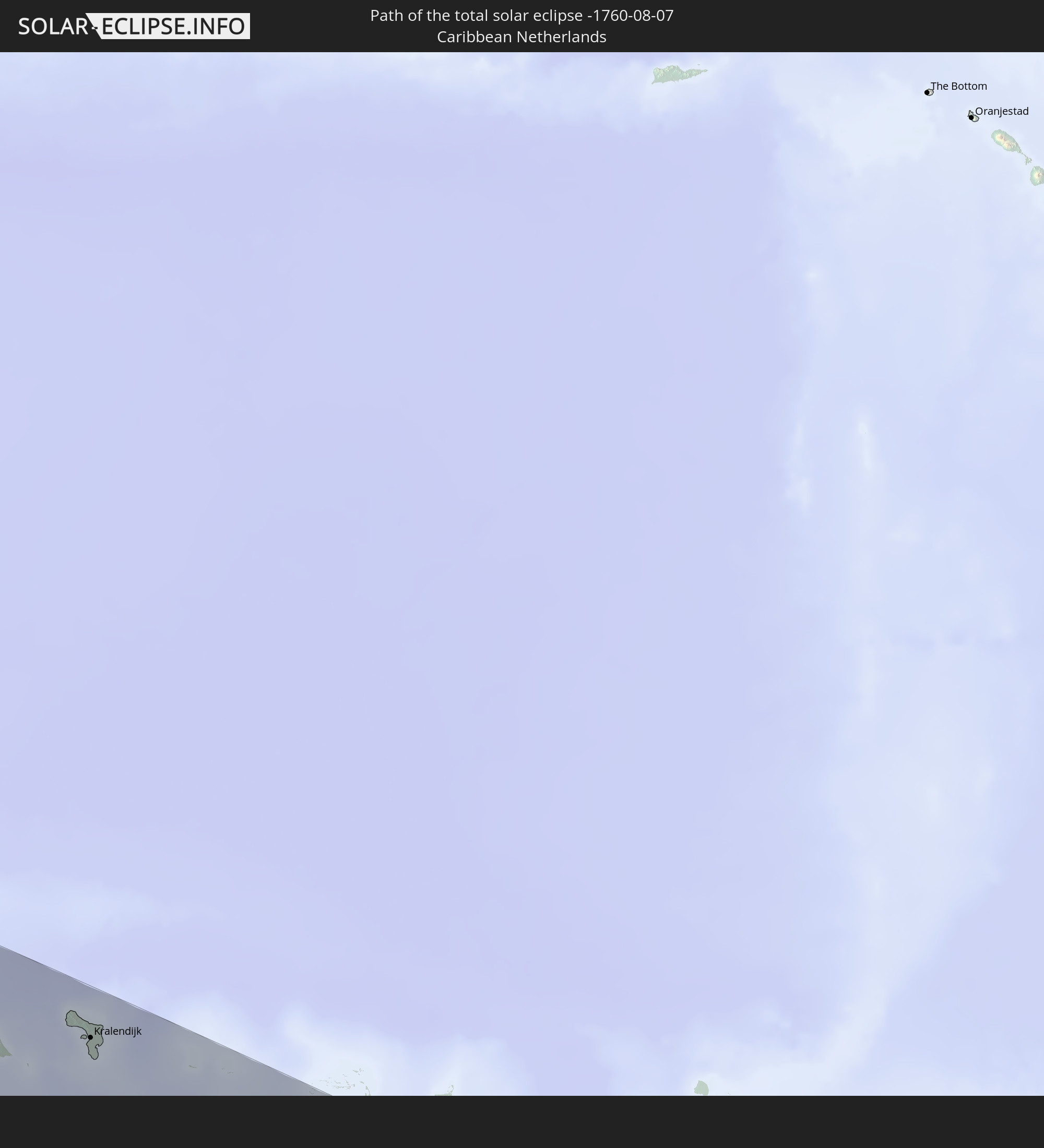 Caribbean Netherlands
In den folgenden Ländern ist die Sonnenfinsternis partiell zu sehen
 United States
 United States Minor Outlying Islands
 French Polynesia
 Canada
 Pitcairn Islands
 Mexico
 Chile
Chile
 Guatemala
 Ecuador
 El Salvador
 Honduras
 Belize
 Nicaragua
 Costa Rica
 Cuba
Cuba
 Panama
 Colombia
 Cayman Islands
 Peru
Peru
 The Bahamas
 Jamaica
 Haiti
Haiti
 Brazil
 Argentina
 Venezuela
 Turks and Caicos Islands
 Dominican Republic
 Aruba
Aruba
 Bolivia
 Puerto Rico
 United States Virgin Islands
 Bermuda
 British Virgin Islands
 Anguilla
 Collectivity of Saint Martin
 Saint Barthélemy
 Saint Kitts and Nevis
 Paraguay
 Antigua and Barbuda
 Montserrat
 Trinidad and Tobago
 Guadeloupe
 Grenada
 Dominica
 Saint Vincent and the Grenadines
 Guyana
 Martinique
 Saint Lucia
 Barbados
 Uruguay
 Suriname
 French Guiana
 Cabo Verde
 Senegal
 Mauritania
 The Gambia
 Guinea-Bissau
 Guinea
 Sierra Leone
 Mali
Mali
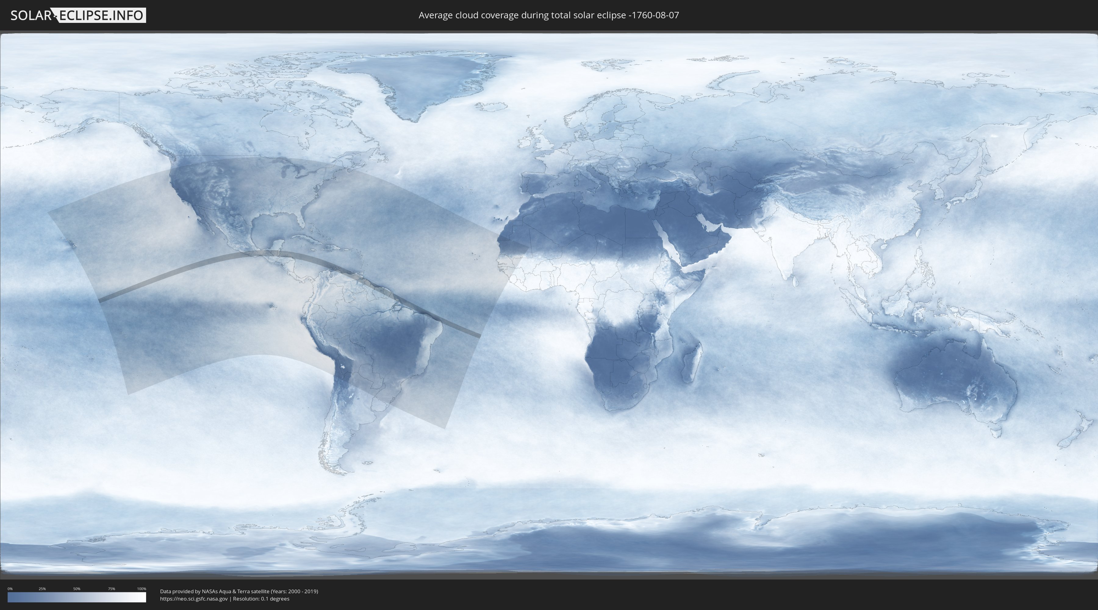
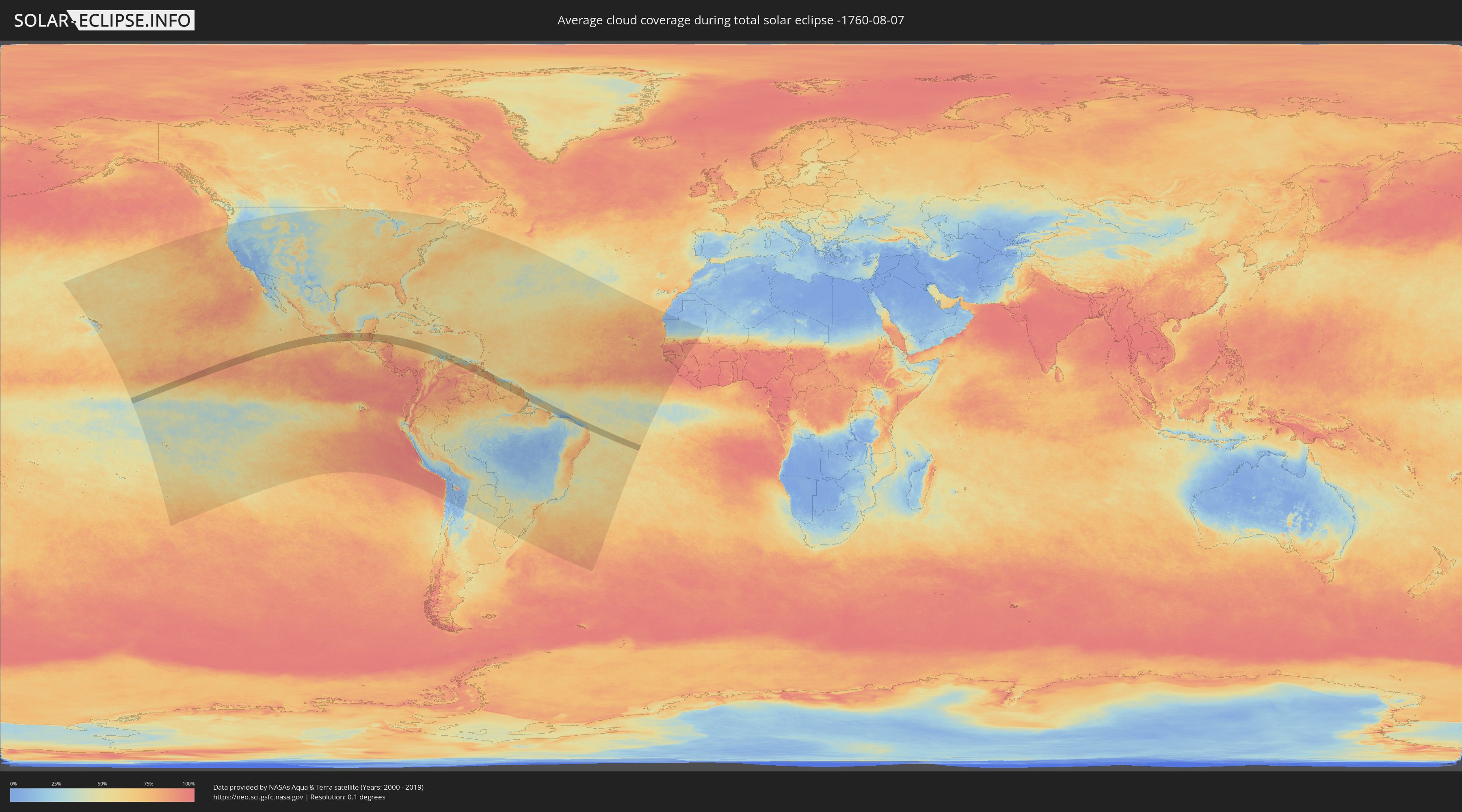
How will be the weather during the total solar eclipse on 08/07/-1760?
Where is the best place to see the total solar eclipse of 08/07/-1760?
The following maps show the average cloud coverage for the day of the total solar eclipse.
With the help of these maps, it is possible to find the place along the eclipse path, which has the best
chance of a cloudless sky.
Nevertheless, you should consider local circumstances and inform about the weather of your chosen
observation site.
The data is provided by NASAs satellites
AQUA and TERRA.
The cloud maps are averaged over a period of 19 years (2000 - 2019).
Detailed country maps
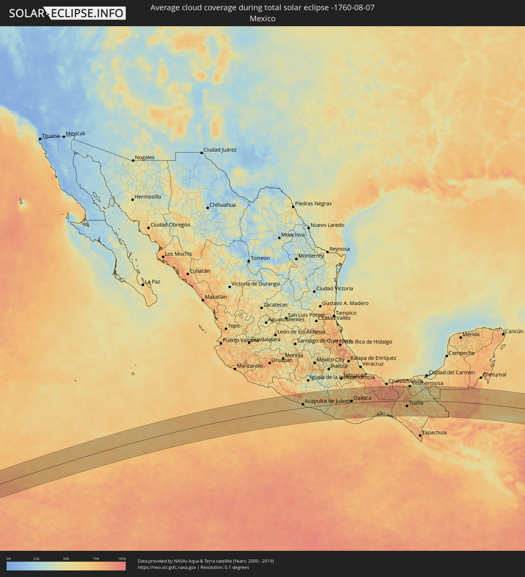 Mexico
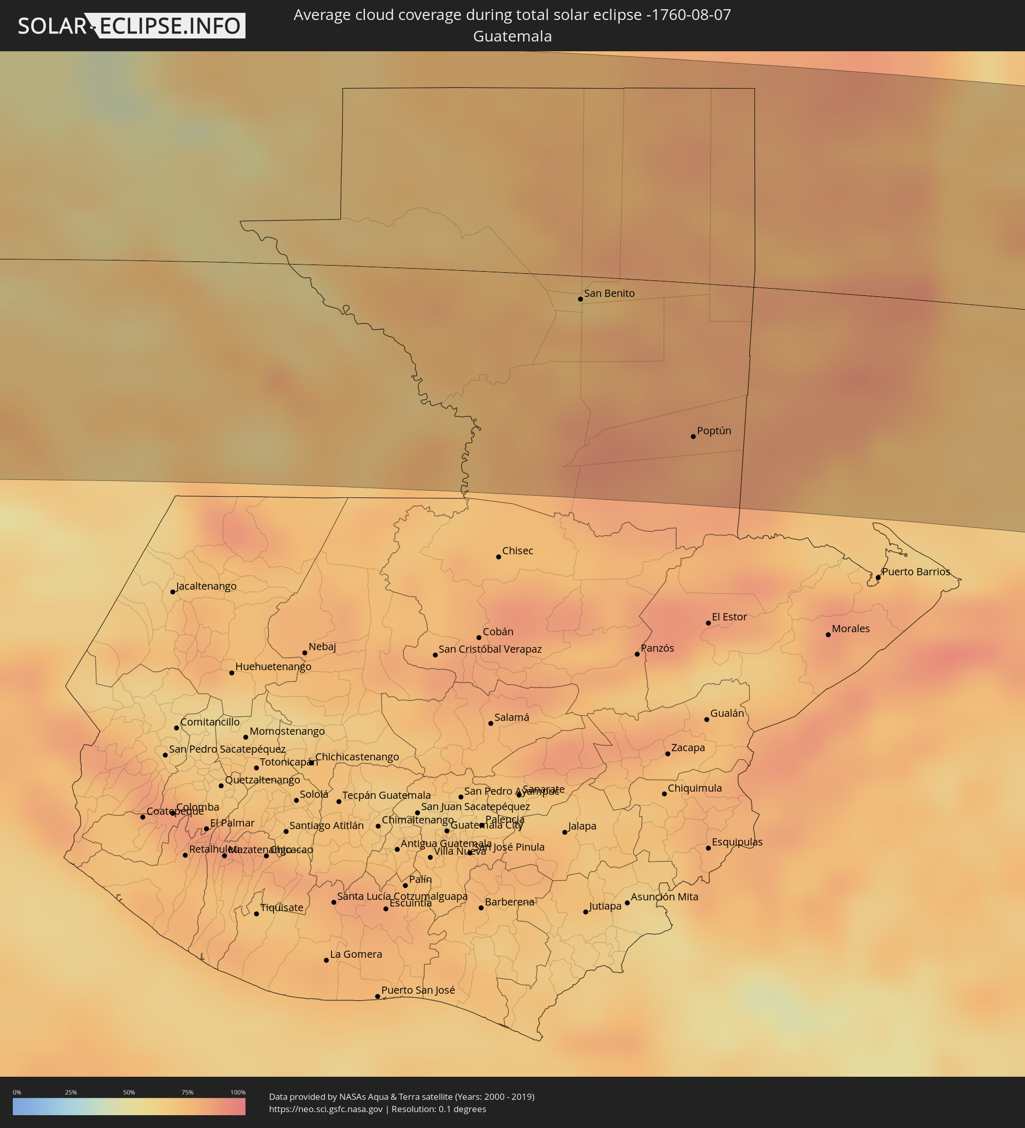 Guatemala
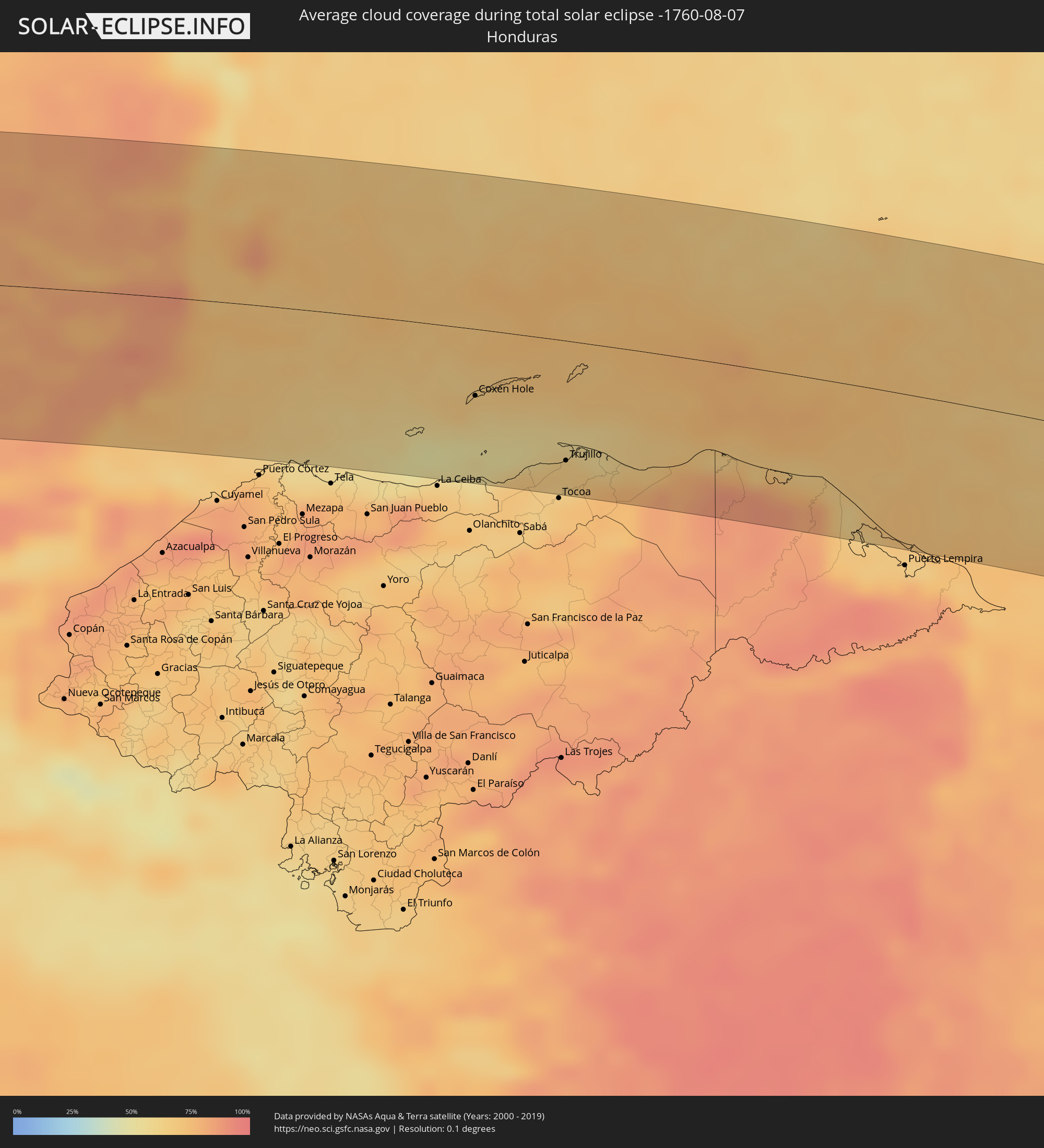 Honduras
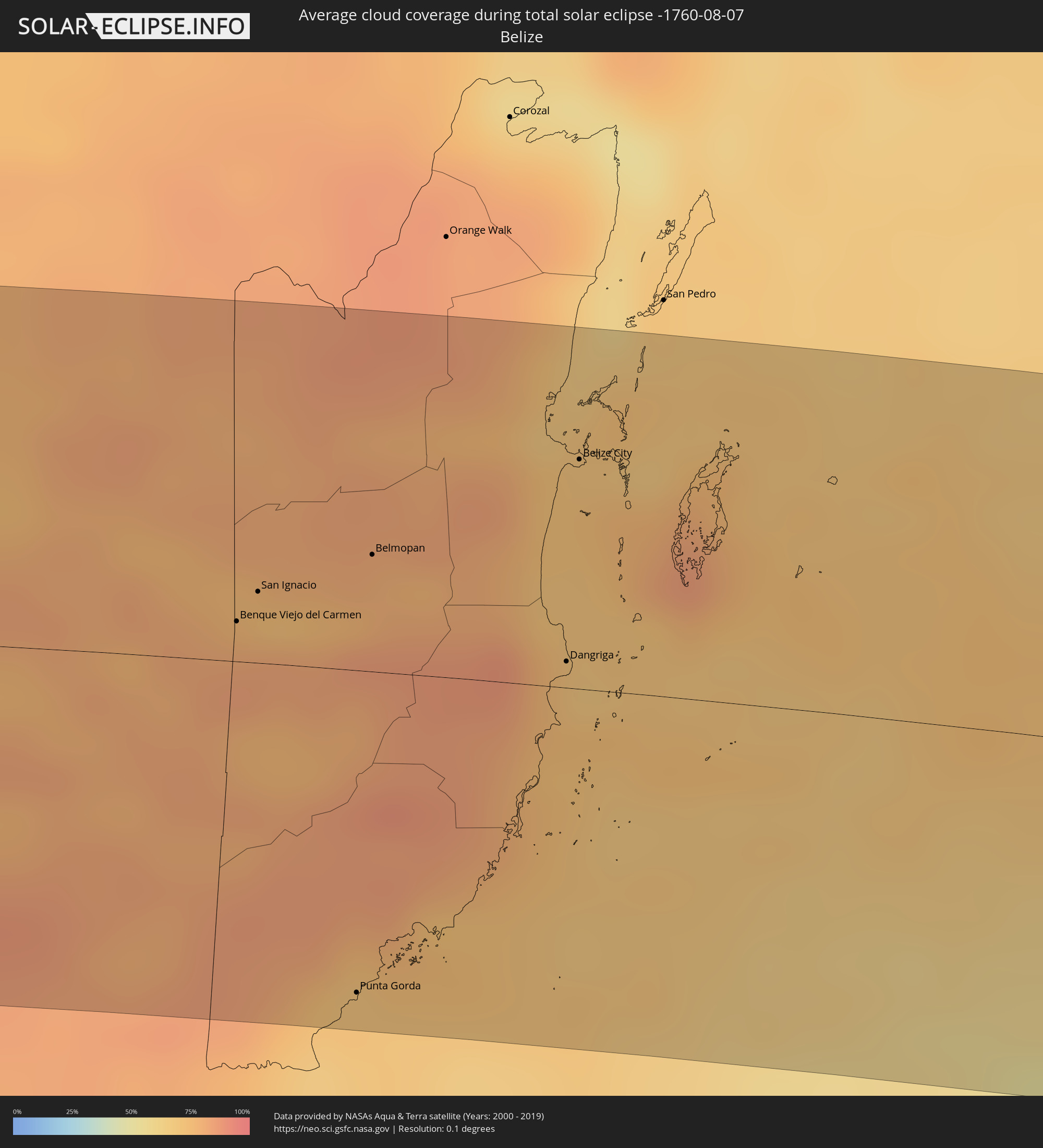 Belize
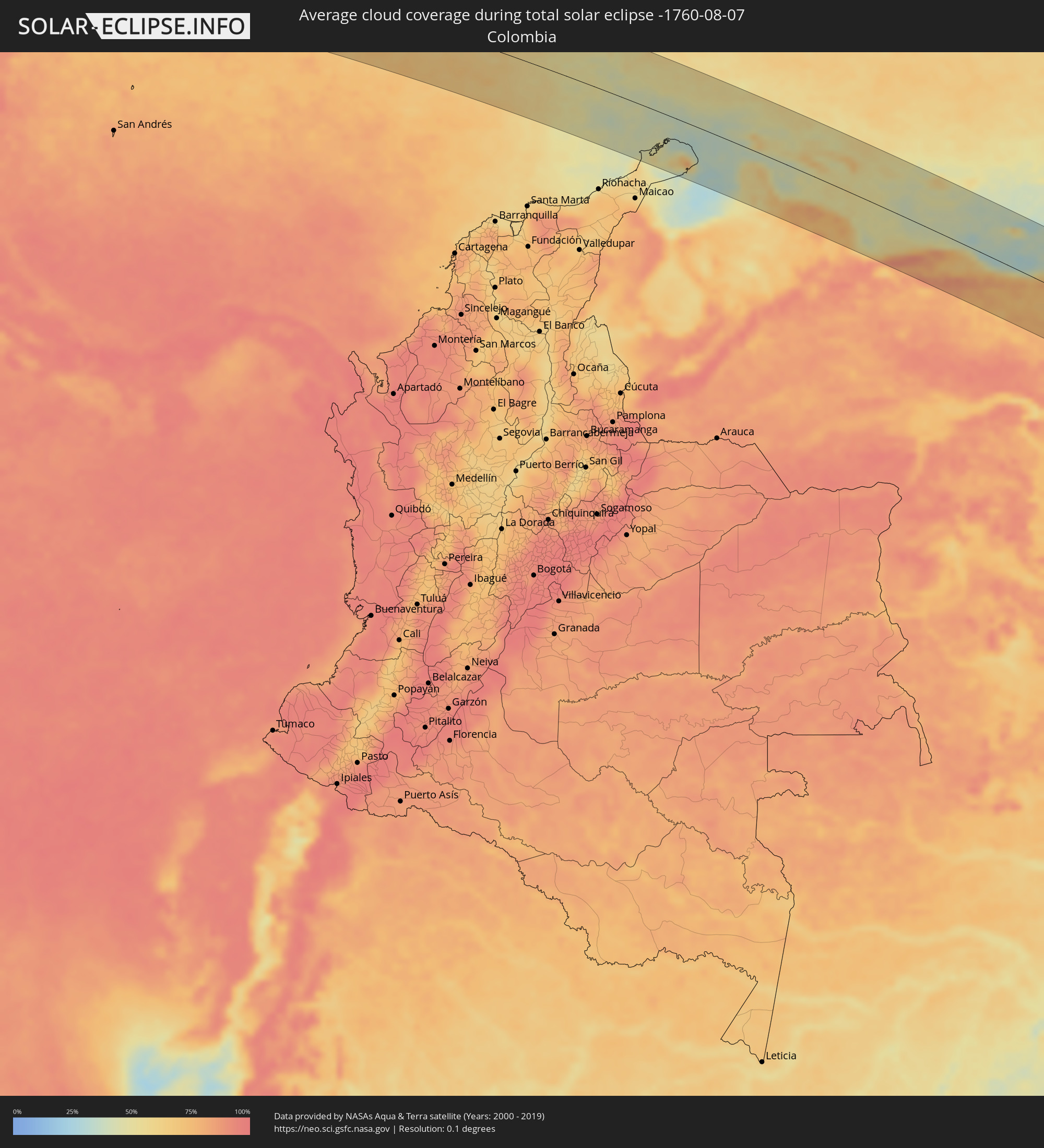 Colombia
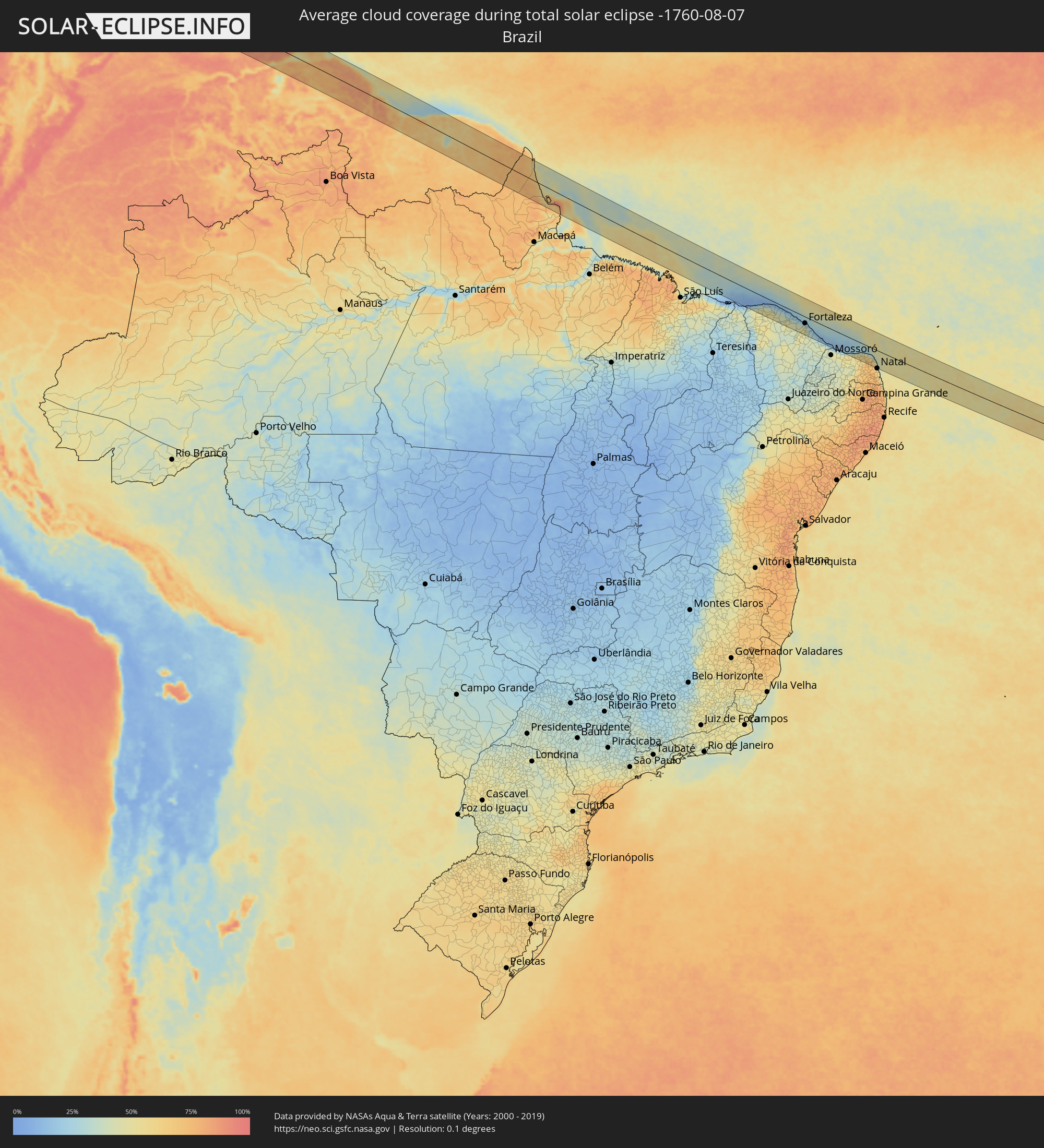 Brazil
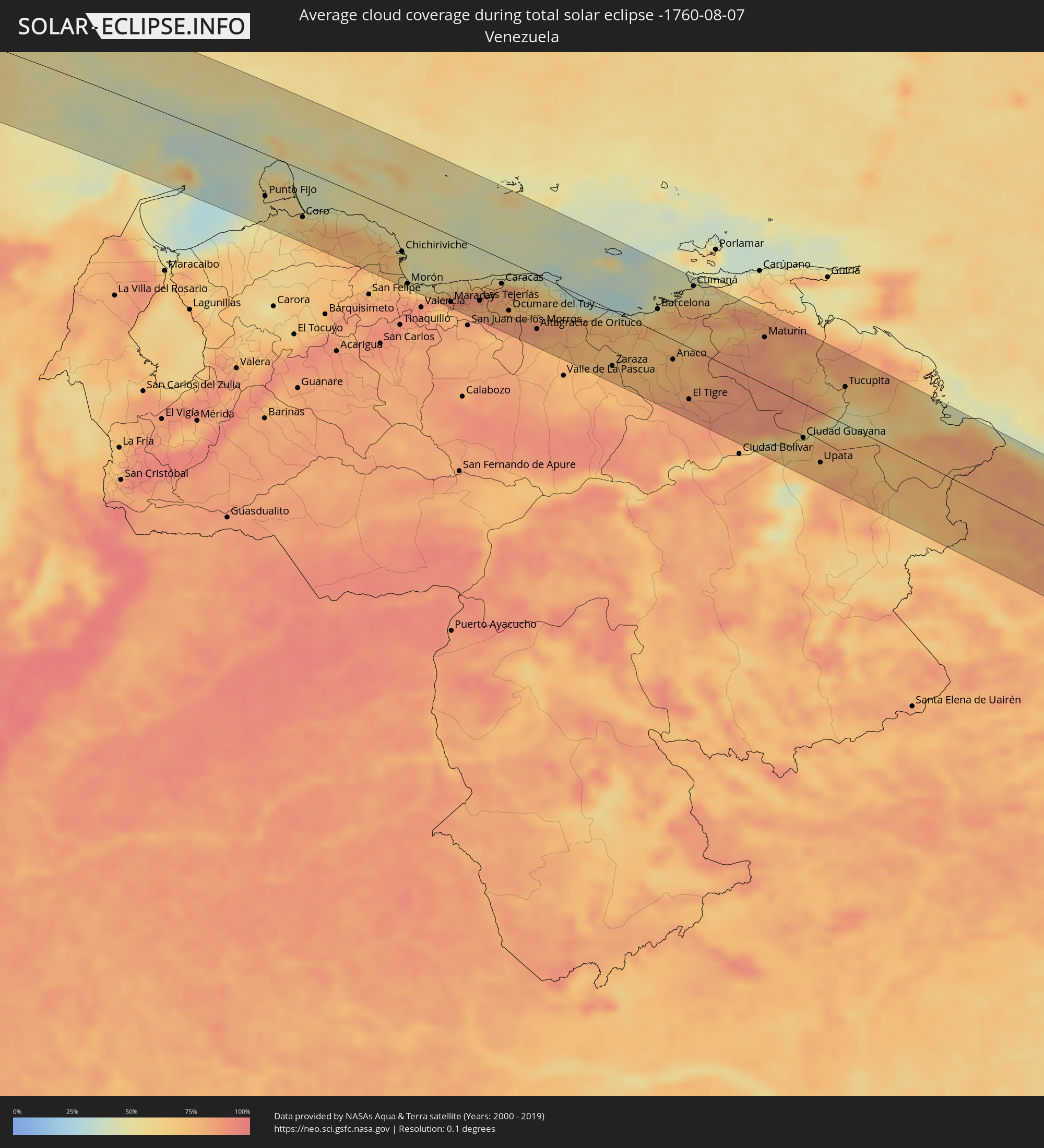 Venezuela
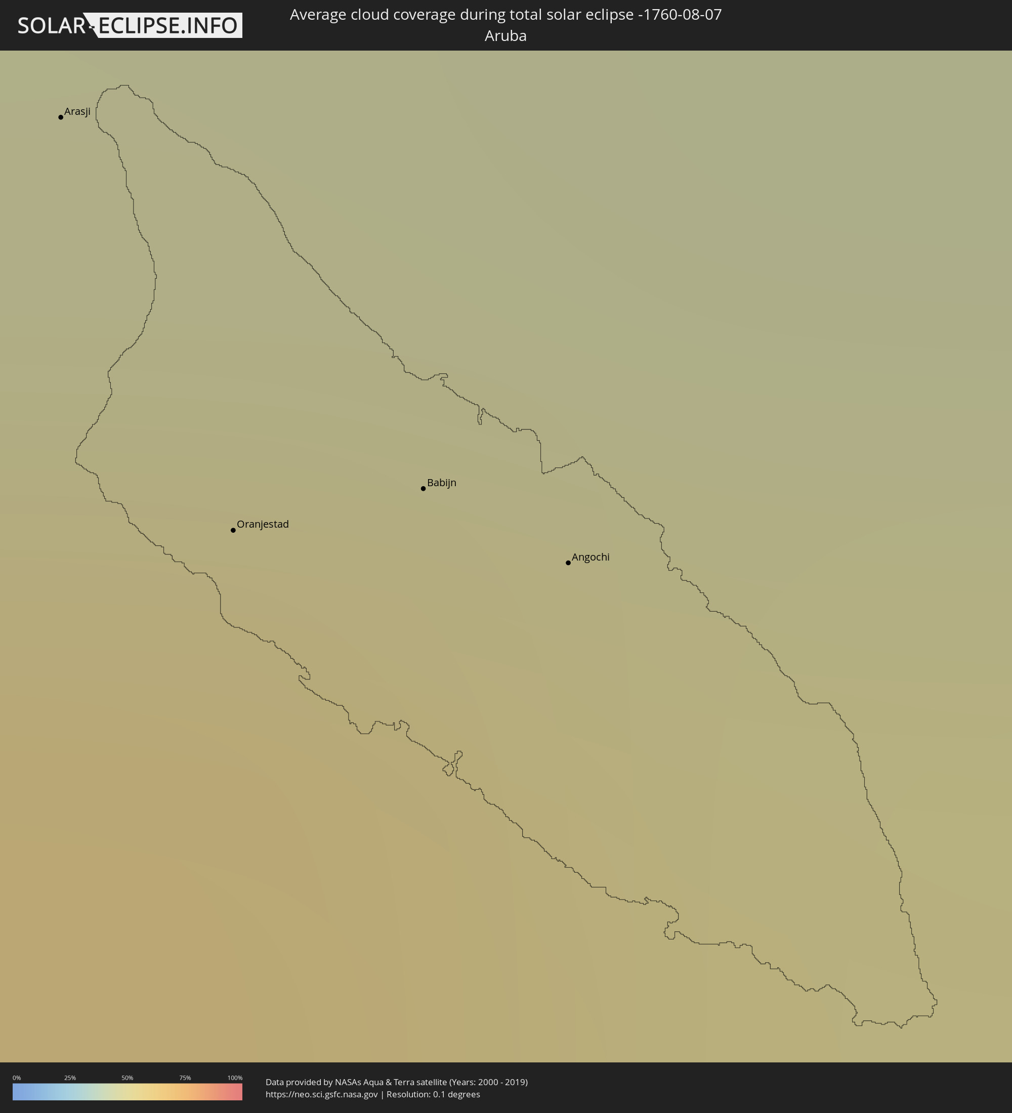 Aruba
Aruba
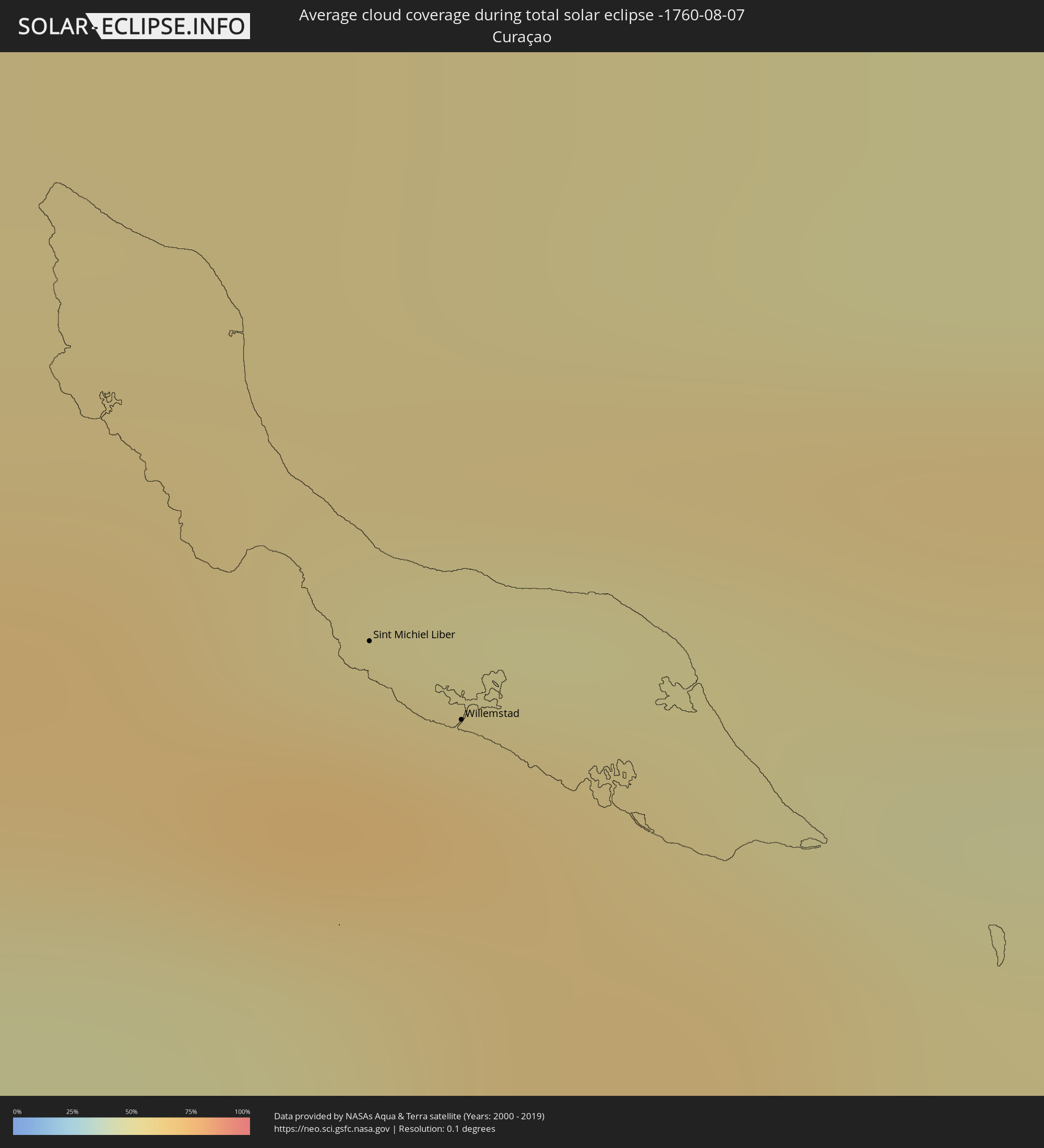 Curaçao
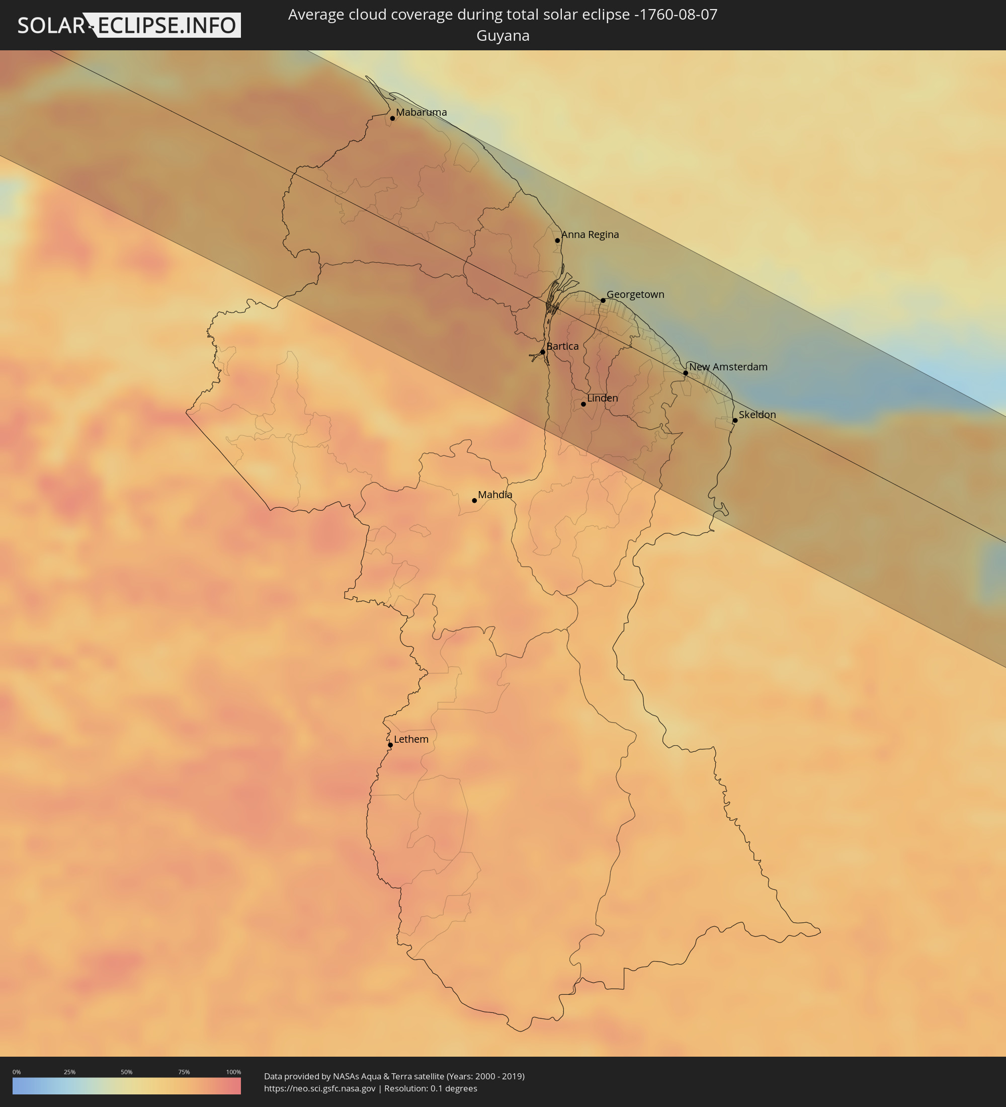 Guyana
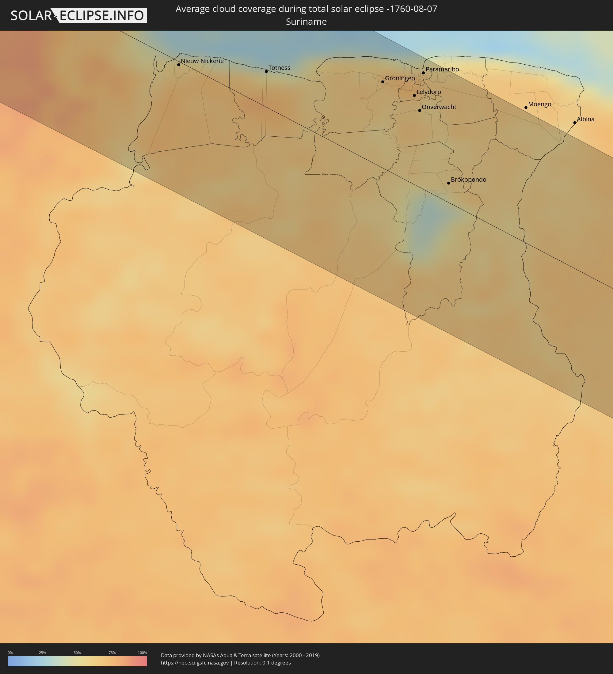 Suriname
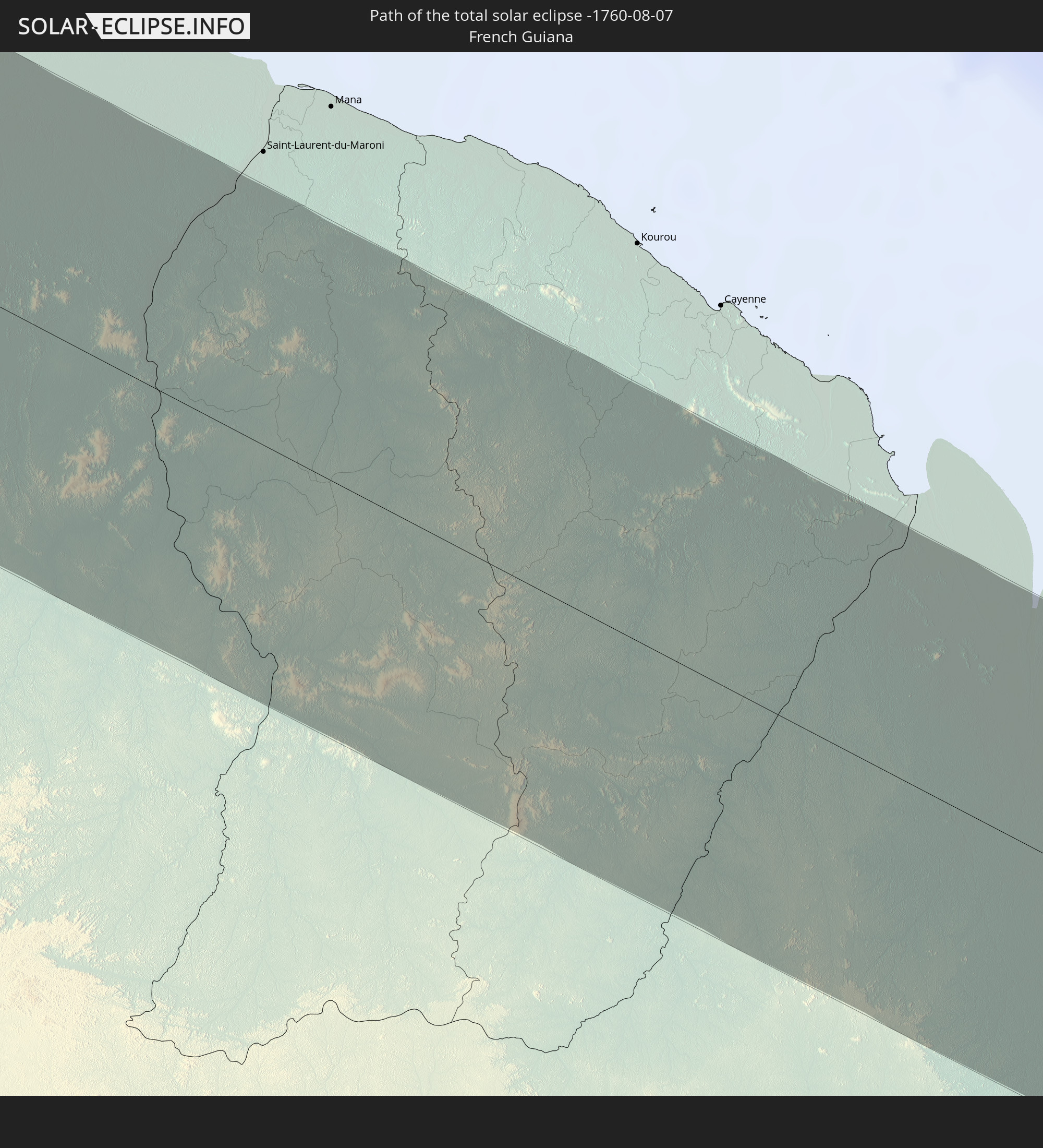
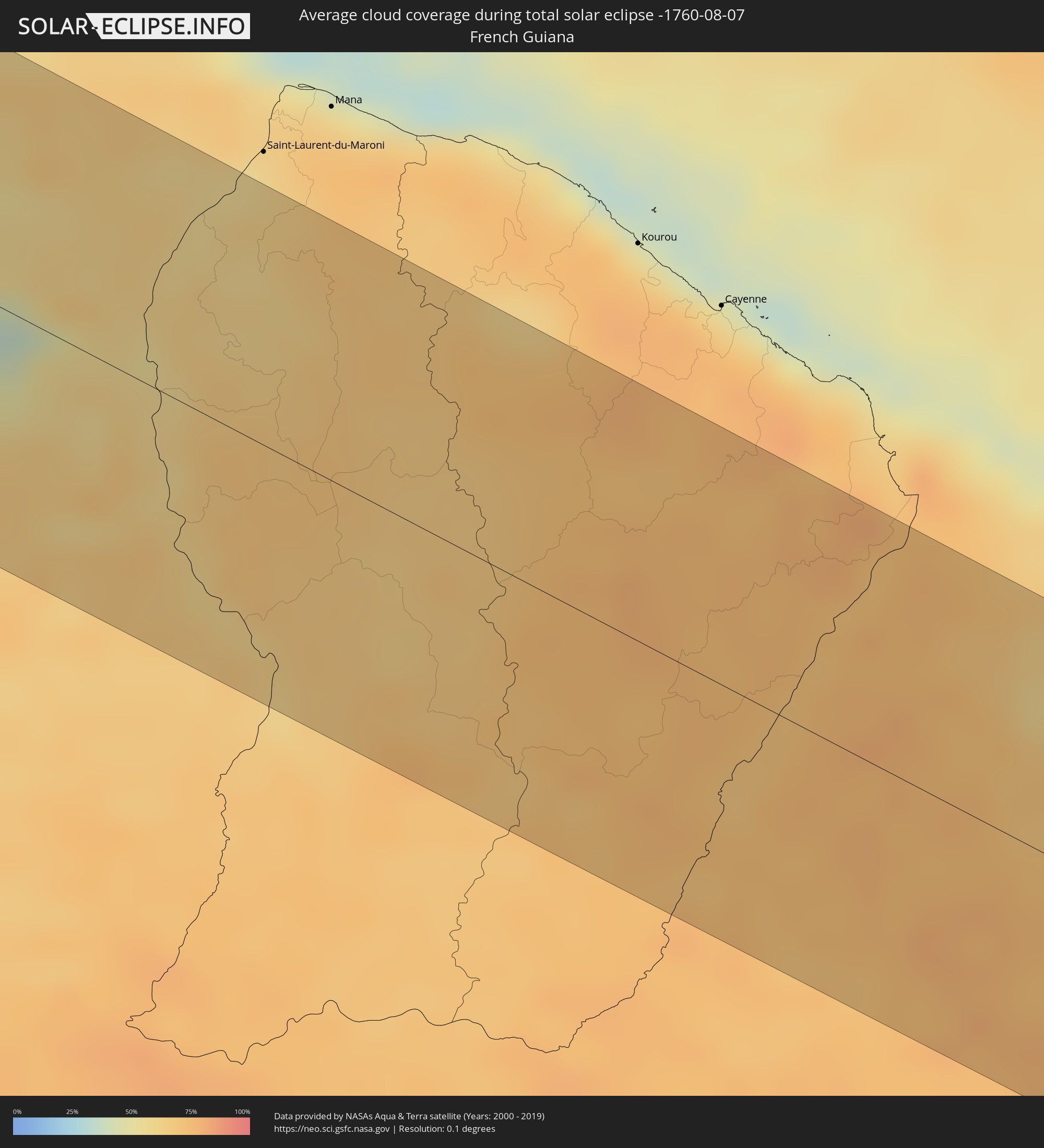 French Guiana
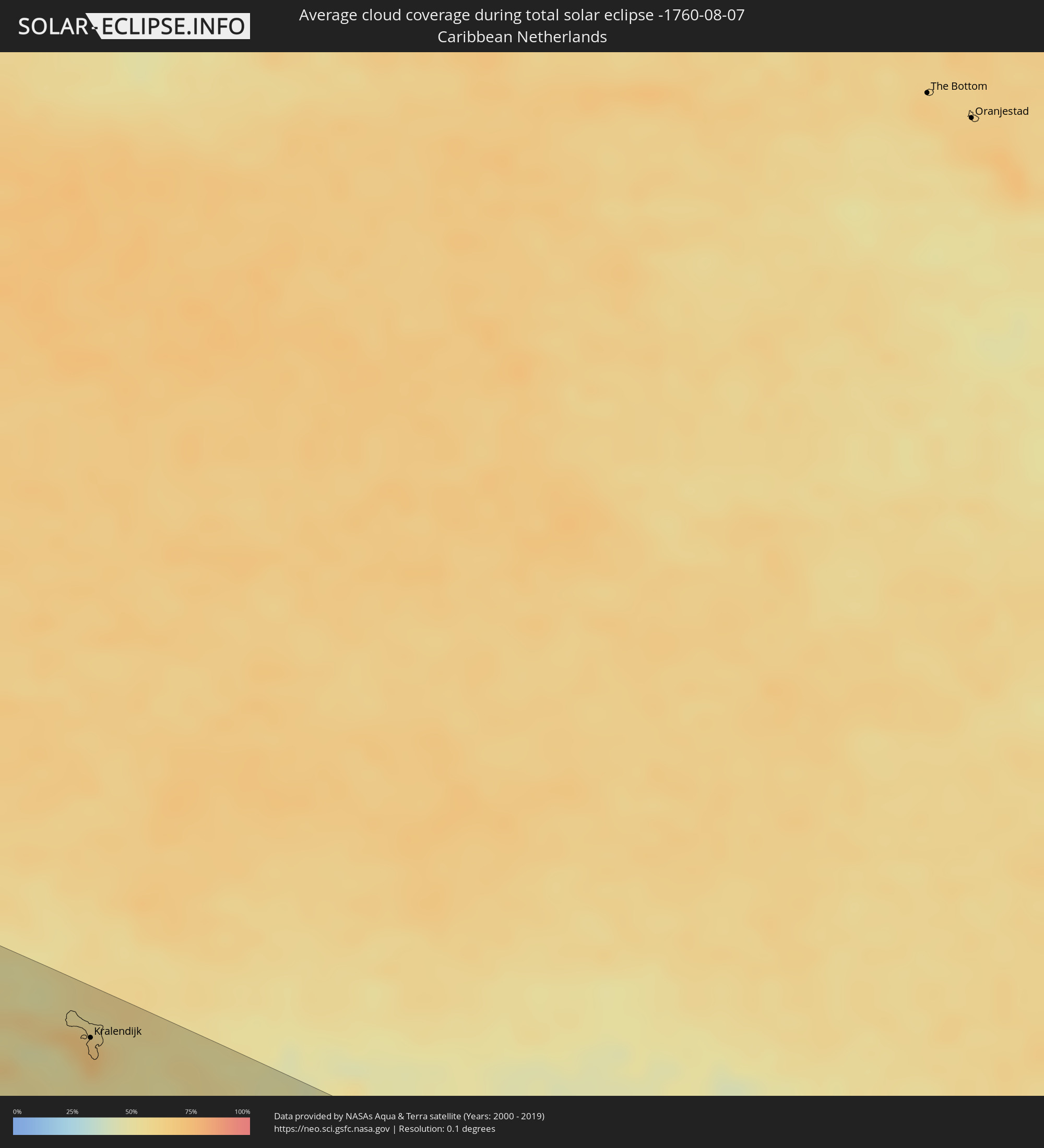 Caribbean Netherlands
Cities inside the path of the eclipse
The following table shows all locations with a population of more than 5,000 inside the eclipse path. Cities which have more than 100,000 inhabitants are marked bold. A click at the locations opens a detailed map.
| City | Type | Eclipse duration | Local time of max. eclipse | Distance to central line | Ø Cloud coverage |
|
Acapulco de Juárez, Guerrero
|
total | - | 10:09:40 UTC-06:36 | 24 km | 59% |
|
Chilpancingo, Guerrero
|
total | - | 10:10:47 UTC-06:36 | 95 km | 62% |
|
Tlapa de Comonfort, Guerrero
|
total | - | 10:13:06 UTC-06:36 | 83 km | 53% |
|
Oaxaca, Oaxaca
|
total | - | 10:17:48 UTC-06:36 | 13 km | 69% |
|
Santo Domingo Tehuantepec, Oaxaca
|
total | - | 10:21:45 UTC-06:36 | 79 km | 72% |
|
Salina Cruz, Oaxaca
|
total | - | 10:21:51 UTC-06:36 | 95 km | 66% |
|
Juchitán de Zaragoza, Oaxaca
|
total | - | 10:22:21 UTC-06:36 | 68 km | 61% |
|
Acayucan, Veracruz
|
total | - | 10:22:43 UTC-06:36 | 100 km | 87% |
|
Las Choapas, Veracruz
|
total | - | 10:24:56 UTC-06:36 | 93 km | 88% |
|
Cintalapa de Figueroa, Chiapas
|
total | - | 10:25:59 UTC-06:36 | 44 km | 76% |
|
Cárdenas, Tabasco
|
total | - | 10:26:54 UTC-06:36 | 102 km | 74% |
|
Ocozocoautla de Espinosa, Chiapas
|
total | - | 10:26:57 UTC-06:36 | 36 km | 74% |
|
Tuxtla, Chiapas
|
total | - | 10:27:41 UTC-06:36 | 37 km | 75% |
|
Villahermosa, Tabasco
|
total | - | 10:28:08 UTC-06:36 | 100 km | 62% |
|
San Cristóbal de las Casas, Chiapas
|
total | - | 10:29:02 UTC-06:36 | 40 km | 74% |
|
Comitán, Chiapas
|
total | - | 10:30:32 UTC-06:36 | 94 km | 63% |
|
Palenque, Chiapas
|
total | - | 10:30:50 UTC-06:36 | 47 km | 55% |
|
Las Margaritas, Chiapas
|
total | - | 10:30:58 UTC-06:36 | 86 km | 62% |
|
Tenosique de Pino Suárez, Tabasco
|
total | - | 10:32:25 UTC-06:36 | 44 km | 60% |
|
Sayaxché, Petén
|
total | - | 11:10:46 UTC-06:02 | 57 km | 75% |
|
La Libertad, Petén
|
total | - | 11:10:51 UTC-06:02 | 27 km | 74% |
|
San Benito, Petén
|
total | - | 11:11:24 UTC-06:02 | 11 km | 78% |
|
San Andrés, Petén
|
total | - | 11:11:24 UTC-06:02 | 6 km | 67% |
|
Flores, Petén
|
total | - | 11:11:27 UTC-06:02 | 10 km | 78% |
|
Santa Ana, Petén
|
total | - | 11:11:41 UTC-06:02 | 24 km | 78% |
|
San Luis, Petén
|
total | - | 11:12:59 UTC-06:02 | 88 km | 81% |
|
Poptún, Petén
|
total | - | 11:13:01 UTC-06:02 | 73 km | 79% |
|
Dolores, Petén
|
total | - | 11:12:58 UTC-06:02 | 53 km | 83% |
|
Melchor de Mencos, Petén
|
total | - | 11:13:36 UTC-06:02 | 11 km | 81% |
|
Benque Viejo del Carmen, Cayo
|
total | - | 11:22:55 UTC-05:52 | 12 km | 81% |
|
San Ignacio, Cayo
|
total | - | 11:23:04 UTC-05:52 | 21 km | 75% |
|
Punta Gorda, Toledo
|
total | - | 11:24:09 UTC-05:52 | 94 km | 70% |
|
Belmopan, Cayo
|
total | - | 11:23:57 UTC-05:52 | 34 km | 80% |
|
Dangriga, Stann Creek
|
total | - | 11:25:36 UTC-05:52 | 8 km | 68% |
|
Belize City, Belize
|
total | - | 11:25:33 UTC-05:52 | 67 km | 72% |
|
Coxen Hole, Bay Islands
|
total | - | 11:34:49 UTC-05:48 | 45 km | 62% |
|
Trujillo, Colón
|
total | - | 11:36:44 UTC-05:48 | 82 km | 66% |
|
Punto Fijo, Falcón
|
total | - | 13:46:01 UTC-04:27 | 59 km | 54% |
|
Arasji
|
total | - | 13:37:17 UTC-04:35 | 41 km | 64% |
|
Oranjestad
|
total | - | 13:37:29 UTC-04:35 | 33 km | 62% |
|
Babijn
|
total | - | 13:37:35 UTC-04:35 | 36 km | 62% |
|
Angochi
|
total | - | 13:37:40 UTC-04:35 | 35 km | 62% |
|
Coro, Falcón
|
total | - | 13:47:36 UTC-04:27 | 67 km | 65% |
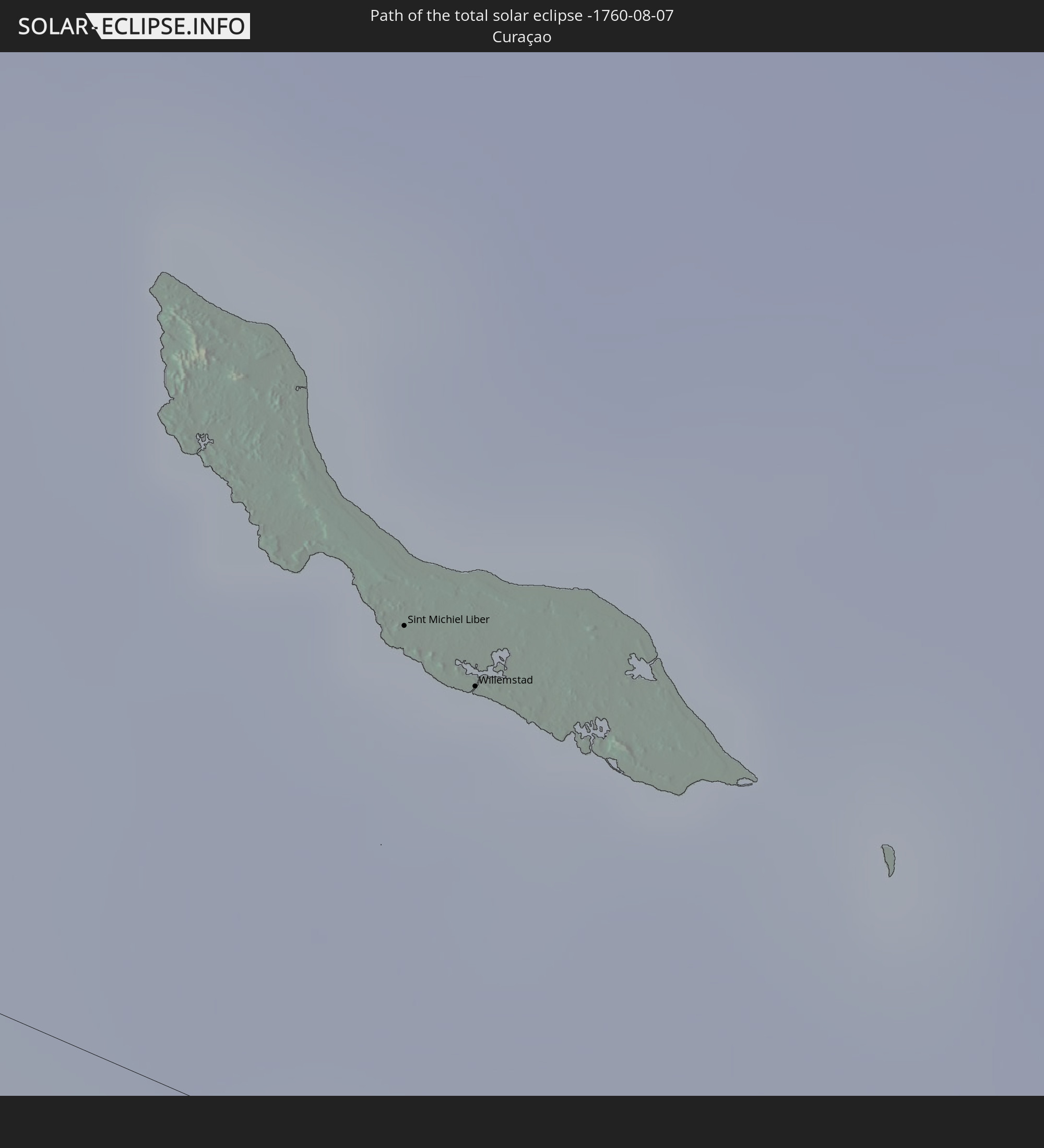
 Sint Michiel Liber
|
total | - | 13:40:22 UTC-04:35 | 39 km | 68% |
|
Willemstad
|
total | - | 13:40:32 UTC-04:35 | 37 km | 61% |
 Kralendijk, Bonaire
|
total | - | 13:42:02 UTC-04:35 | 71 km | 69% |
|
Puerto Cabello, Carabobo
|
total | - | 13:52:27 UTC-04:27 | 89 km | 71% |
|
Mariara, Carabobo
|
total | - | 13:53:21 UTC-04:27 | 93 km | 72% |
|
Maracay, Aragua
|
total | - | 13:53:42 UTC-04:27 | 93 km | 73% |
|
Cagua, Aragua
|
total | - | 13:54:03 UTC-04:27 | 92 km | 80% |
|
Los Teques, Miranda
|
total | - | 13:54:49 UTC-04:27 | 57 km | 79% |
|
Catia La Mar, Vargas
|
total | - | 13:54:35 UTC-04:27 | 30 km | 77% |
|
Cúa, Miranda
|
total | - | 13:55:22 UTC-04:27 | 69 km | 78% |
|
Caracas, Capital
|
total | - | 13:55:02 UTC-04:27 | 35 km | 81% |
|
Caucaguita, Miranda
|
total | - | 13:55:21 UTC-04:27 | 45 km | 77% |
|
Santa Teresa, Miranda
|
total | - | 13:55:47 UTC-04:27 | 51 km | 79% |
|
Guatire, Miranda
|
total | - | 13:55:48 UTC-04:27 | 21 km | 74% |
|
Barcelona, Anzoátegui
|
total | - | 14:00:07 UTC-04:27 | 32 km | 70% |
|
Anaco, Anzoátegui
|
total | - | 14:01:17 UTC-04:27 | 28 km | 76% |
|
El Tigre, Anzoátegui
|
total | - | 14:02:19 UTC-04:27 | 72 km | 85% |
|
Cumaná, Sucre
|
total | - | 14:00:49 UTC-04:27 | 88 km | 58% |
|
Maturín, Monagas
|
total | - | 14:03:33 UTC-04:27 | 65 km | 85% |
|
Ciudad Guayana, Bolívar
|
total | - | 14:06:02 UTC-04:27 | 47 km | 72% |
|
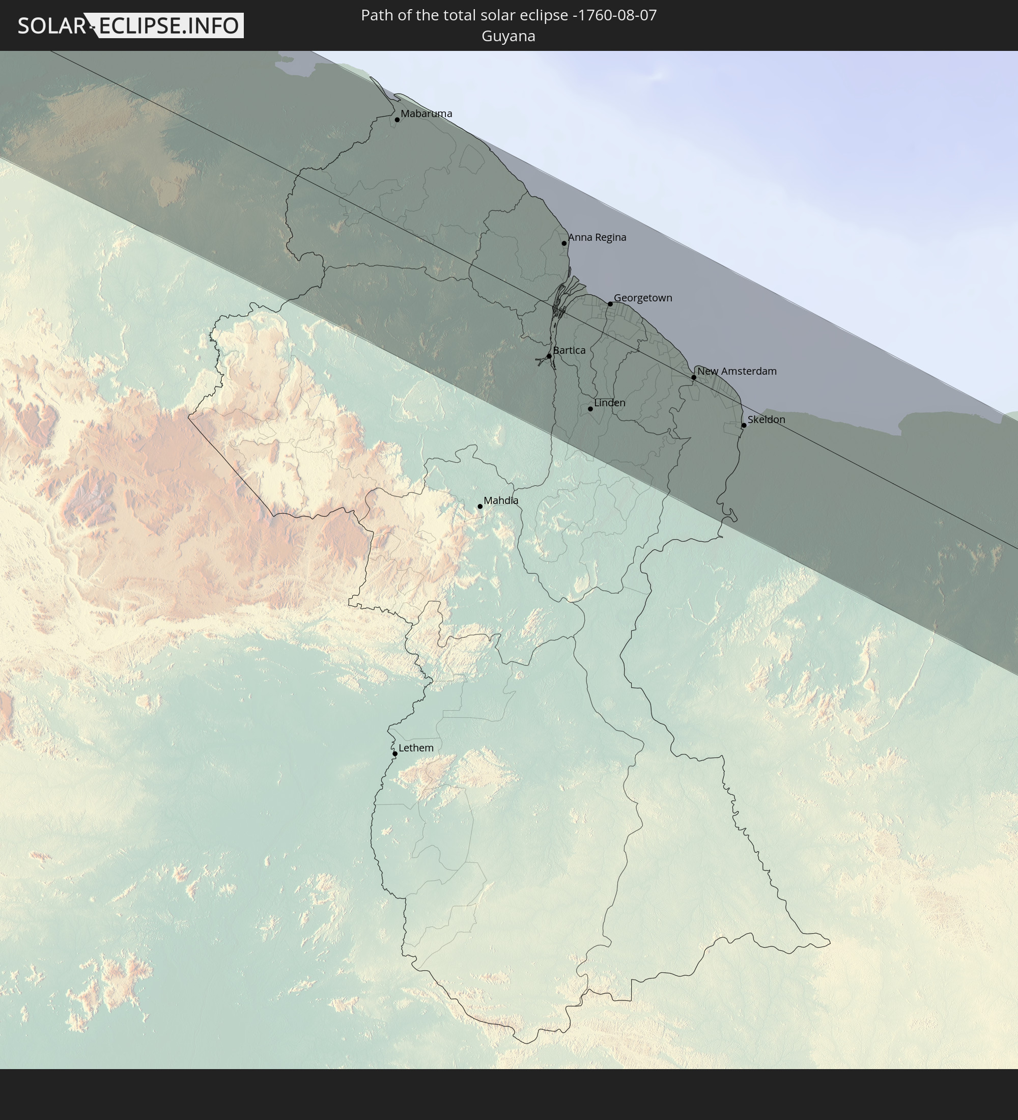
Mabaruma, Barima-Waini
|
total | - | 14:46:25 UTC-03:52 | 80 km | 81% |
|
Bartica, Cuyuni-Mazaruni
|
total | - | 14:50:07 UTC-03:52 | 39 km | 75% |
|
Anna Regina, Pomeroon-Supenaam
|
total | - | 14:49:29 UTC-03:52 | 51 km | 61% |
|
Linden, Upper Demerara-Berbice
|
total | - | 14:51:01 UTC-03:52 | 63 km | 84% |
|
Vreed-en-Hoop, Essequibo Islands-West Demerara
|
total | - | 14:50:26 UTC-03:52 | 22 km | 76% |
|
Georgetown, Demerara-Mahaica
|
total | - | 14:50:30 UTC-03:52 | 24 km | 76% |
|
Fort Wellington, Mahaica-Berbice
|
total | - | 14:51:47 UTC-03:52 | 11 km | 50% |
|
Rosignol, Mahaica-Berbice
|
total | - | 14:52:00 UTC-03:52 | 3 km | 64% |
|
New Amsterdam, East Berbice-Corentyne
|
total | - | 14:52:03 UTC-03:52 | 1 km | 67% |
|
Skeldon, East Berbice-Corentyne
|
total | - | 14:52:59 UTC-03:52 | 15 km | 58% |
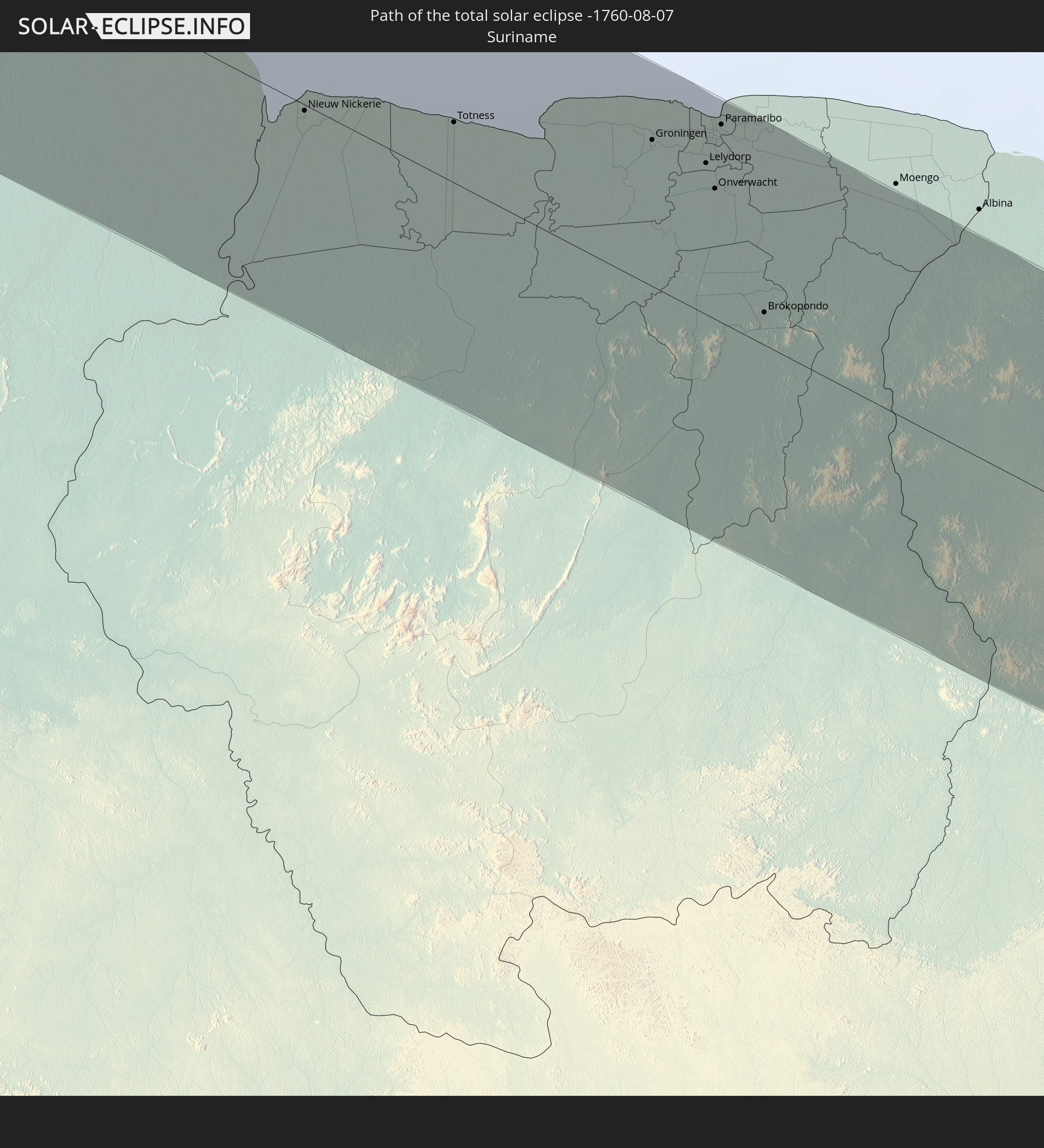
|
Nieuw Nickerie, Nickerie
|
total | - | 15:05:12 UTC-03:40 | 3 km | 63% |
|
Totness, Coronie
|
total | - | 15:06:14 UTC-03:40 | 26 km | 52% |
|
Groningen, Saramacca
|
total | - | 15:07:33 UTC-03:40 | 62 km | 64% |
|
Lelydorp, Wanica
|
total | - | 15:07:59 UTC-03:40 | 64 km | 63% |
|
Onverwacht, Para
|
total | - | 15:08:08 UTC-03:40 | 56 km | 64% |
|
Paramaribo, Paramaribo
|
total | - | 15:07:56 UTC-03:40 | 84 km | 67% |
|
Nieuw Amsterdam, Commewijne
|
total | - | 15:08:01 UTC-03:40 | 90 km | 62% |
|
Brokopondo, Brokopondo
|
total | - | 15:08:55 UTC-03:40 | 14 km | 57% |
|
Camocim, Ceará
|
total | - | 16:35:04 UTC-02:34 | 60 km | 43% |
|
Granja, Ceará
|
total | - | 16:35:10 UTC-02:34 | 81 km | 47% |
|
Acaraú, Ceará
|
total | - | 16:35:29 UTC-02:34 | 23 km | 39% |
|
Itapagé, Ceará
|
total | - | 16:36:10 UTC-02:34 | 78 km | 45% |
|
Itapipoca, Ceará
|
total | - | 16:36:05 UTC-02:34 | 58 km | 41% |
|
Pentecoste, Ceará
|
total | - | 16:36:23 UTC-02:34 | 73 km | 43% |
|
Trairi, Ceará
|
total | - | 16:36:09 UTC-02:34 | 21 km | 30% |
|
Paraipaba, Ceará
|
total | - | 16:36:17 UTC-02:34 | 32 km | 30% |
|
Paracuru, Ceará
|
total | - | 16:36:20 UTC-02:34 | 23 km | 29% |
|
São Gonçalo do Amarante, Ceará
|
total | - | 16:36:28 UTC-02:34 | 40 km | 44% |
|
Guaiúba, Ceará
|
total | - | 16:36:50 UTC-02:34 | 68 km | 46% |
|
Maracanaú, Ceará
|
total | - | 16:36:46 UTC-02:34 | 51 km | 47% |
|
Fortaleza, Ceará
|
total | - | 16:36:44 UTC-02:34 | 31 km | 31% |
|
Horizonte, Ceará
|
total | - | 16:36:56 UTC-02:34 | 66 km | 41% |
|
Aquiraz, Ceará
|
total | - | 16:36:54 UTC-02:34 | 42 km | 33% |
|
Cascavel, Ceará
|
total | - | 16:37:04 UTC-02:34 | 58 km | 28% |
|
Aracati, Ceará
|
total | - | 16:37:29 UTC-02:34 | 79 km | 41% |
|
Macau, Rio Grande do Norte
|
total | - | 16:38:13 UTC-02:34 | 81 km | 56% |
|
Ceará Mirim, Rio Grande do Norte
|
total | - | 16:38:54 UTC-02:34 | 78 km | 66% |