Total solar eclipse of 10/29/0338
| Day of week: | Saturday |
| Maximum duration of eclipse: | 02m39s |
| Maximum width of eclipse path: | 92 km |
| Saros cycle: | 87 |
| Coverage: | 100% |
| Magnitude: | 1.0266 |
| Gamma: | 0.219 |
Wo kann man die Sonnenfinsternis vom 10/29/0338 sehen?
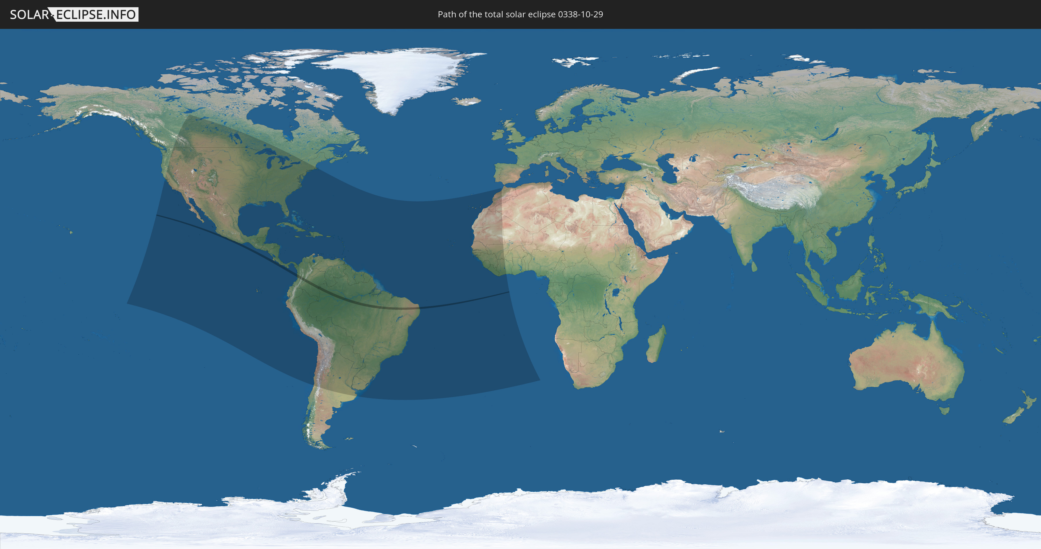
Die Sonnenfinsternis am 10/29/0338 kann man in 65 Ländern als partielle Sonnenfinsternis beobachten.
Der Finsternispfad verläuft durch 5 Länder. Nur in diesen Ländern ist sie als total Sonnenfinsternis zu sehen.
In den folgenden Ländern ist die Sonnenfinsternis total zu sehen
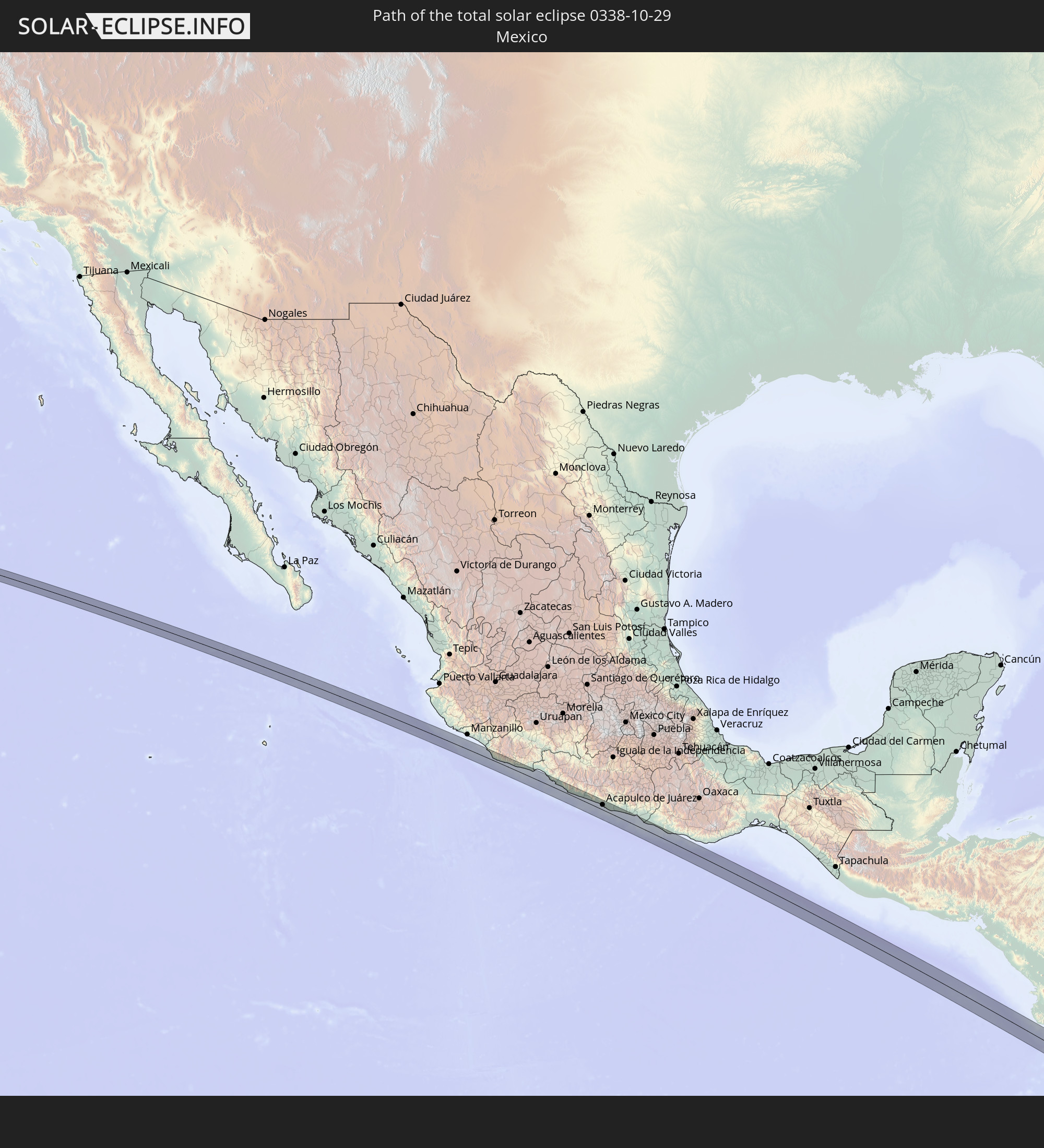 Mexico
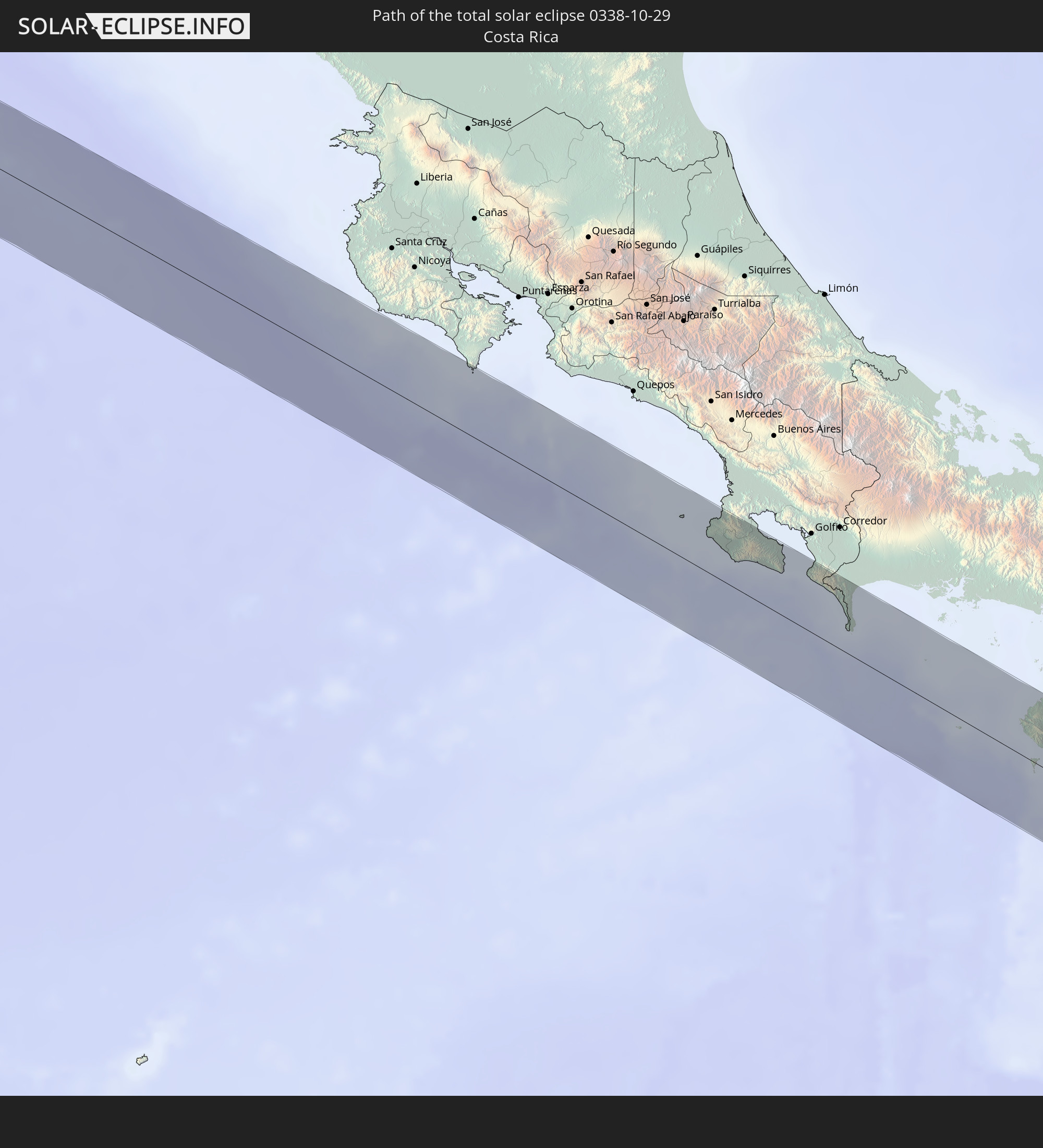 Costa Rica
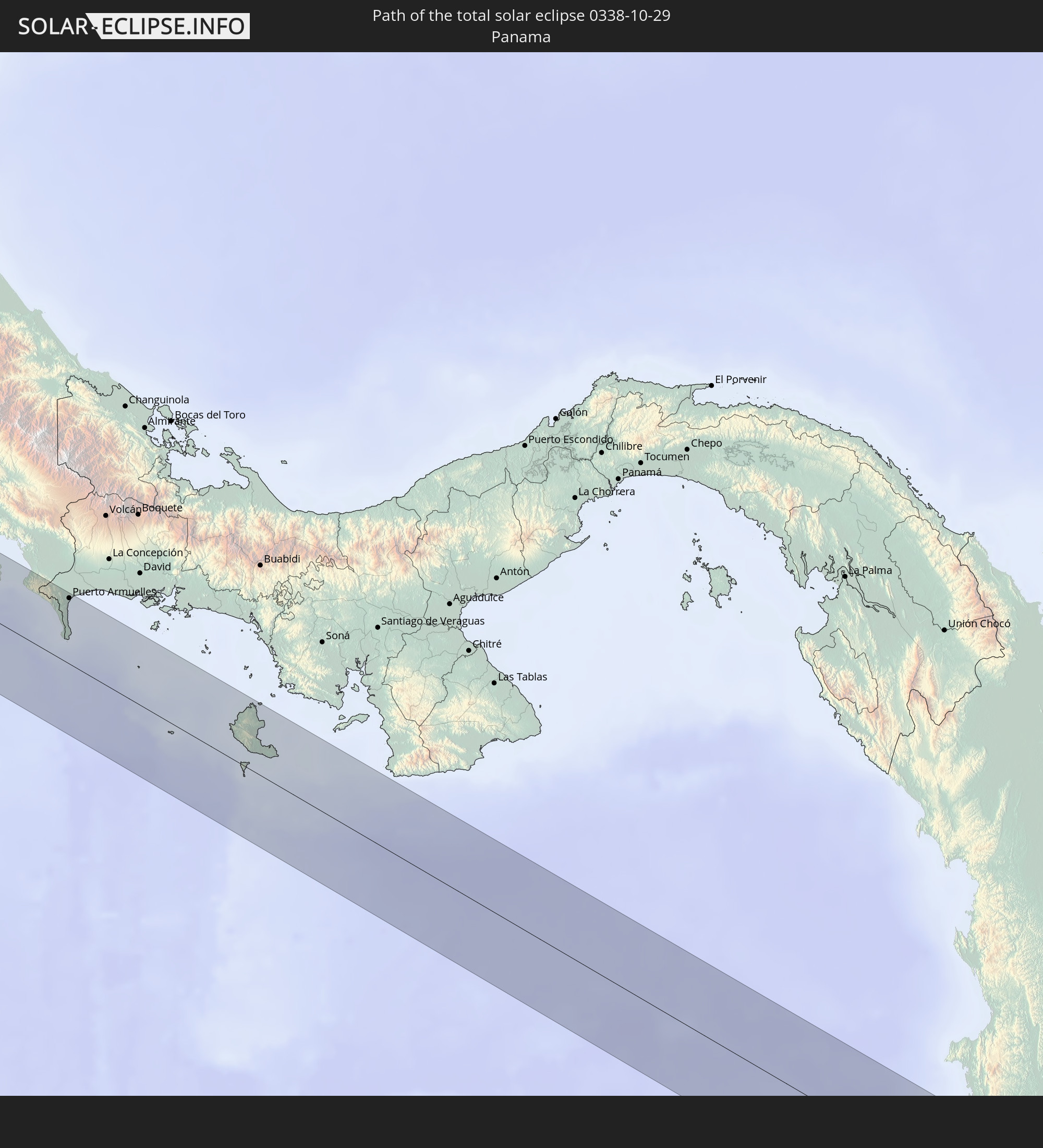 Panama
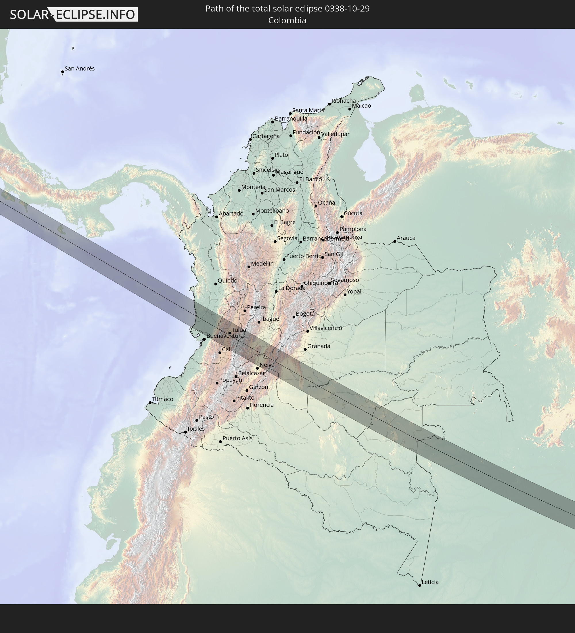 Colombia
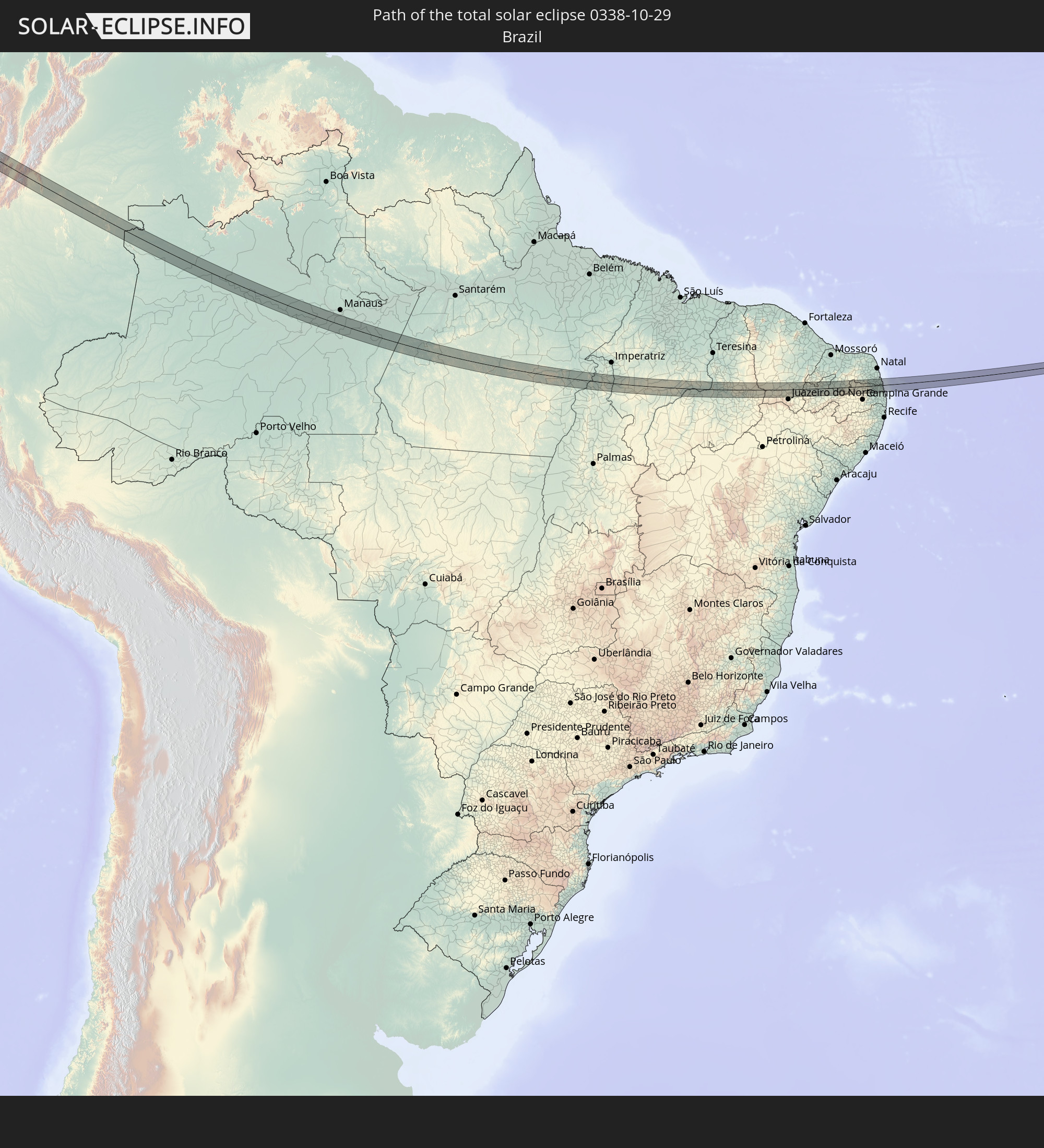 Brazil
In den folgenden Ländern ist die Sonnenfinsternis partiell zu sehen
 United States
 United States Minor Outlying Islands
 Canada
 Mexico
 Chile
Chile
 Guatemala
 Ecuador
 El Salvador
 Honduras
 Belize
 Nicaragua
 Costa Rica
 Cuba
Cuba
 Panama
 Colombia
 Cayman Islands
 Peru
Peru
 The Bahamas
 Jamaica
 Haiti
Haiti
 Brazil
 Argentina
 Venezuela
 Turks and Caicos Islands
 Dominican Republic
 Aruba
Aruba
 Bolivia
 Puerto Rico
 United States Virgin Islands
 Bermuda
 British Virgin Islands
 Anguilla
 Collectivity of Saint Martin
 Saint Barthélemy
 Saint Kitts and Nevis
 Paraguay
 Antigua and Barbuda
 Montserrat
 Trinidad and Tobago
 Guadeloupe
 Grenada
 Dominica
 Saint Vincent and the Grenadines
 Guyana
 Martinique
 Saint Lucia
 Barbados
 Uruguay
 Suriname
 French Guiana
 Portugal
 Cabo Verde
 Spain
Spain
 Senegal
 Mauritania
 The Gambia
 Guinea-Bissau
 Guinea
 Saint Helena, Ascension and Tristan da Cunha
 Sierra Leone
 Morocco
 Mali
Mali
 Liberia
 Algeria
 Ivory Coast
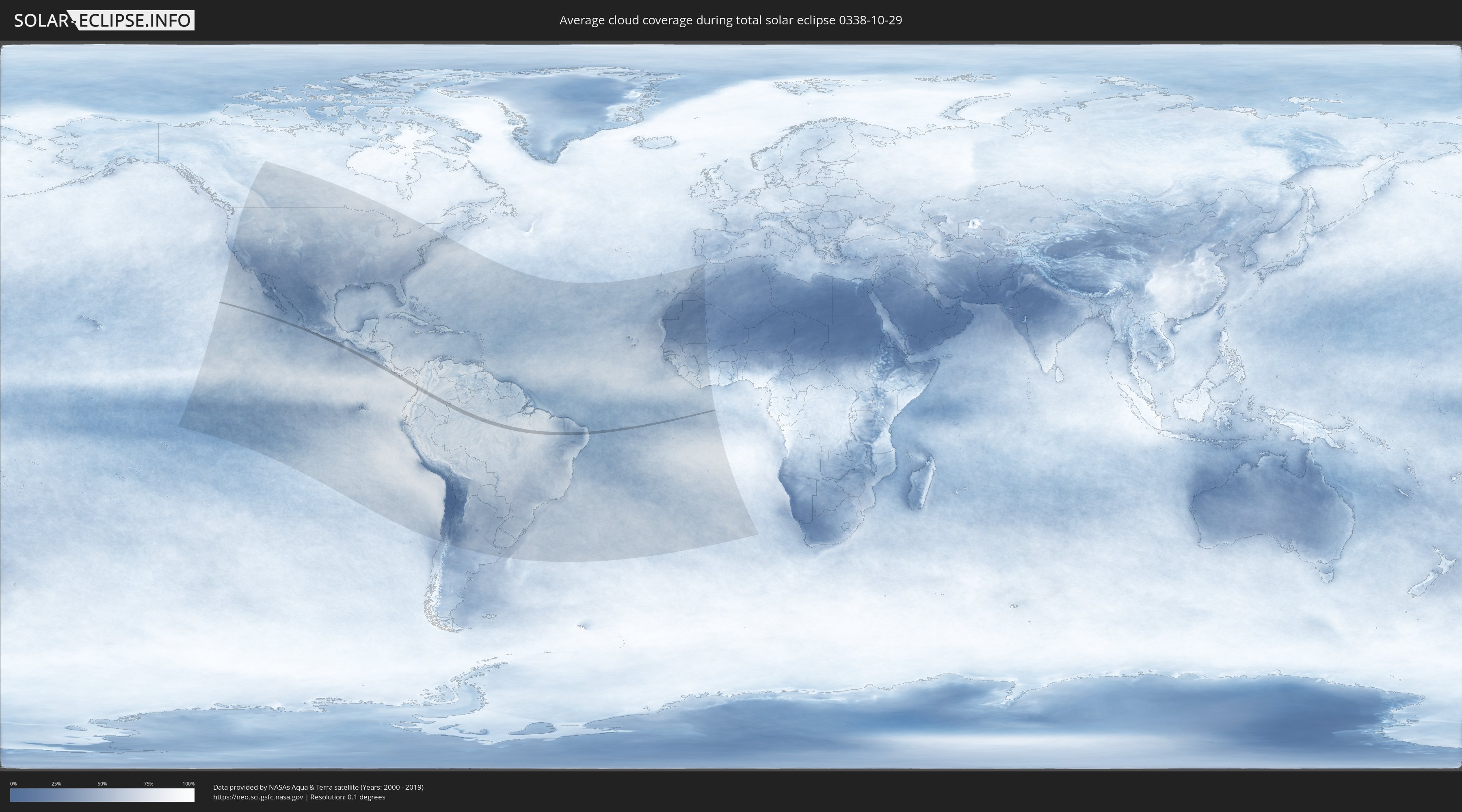
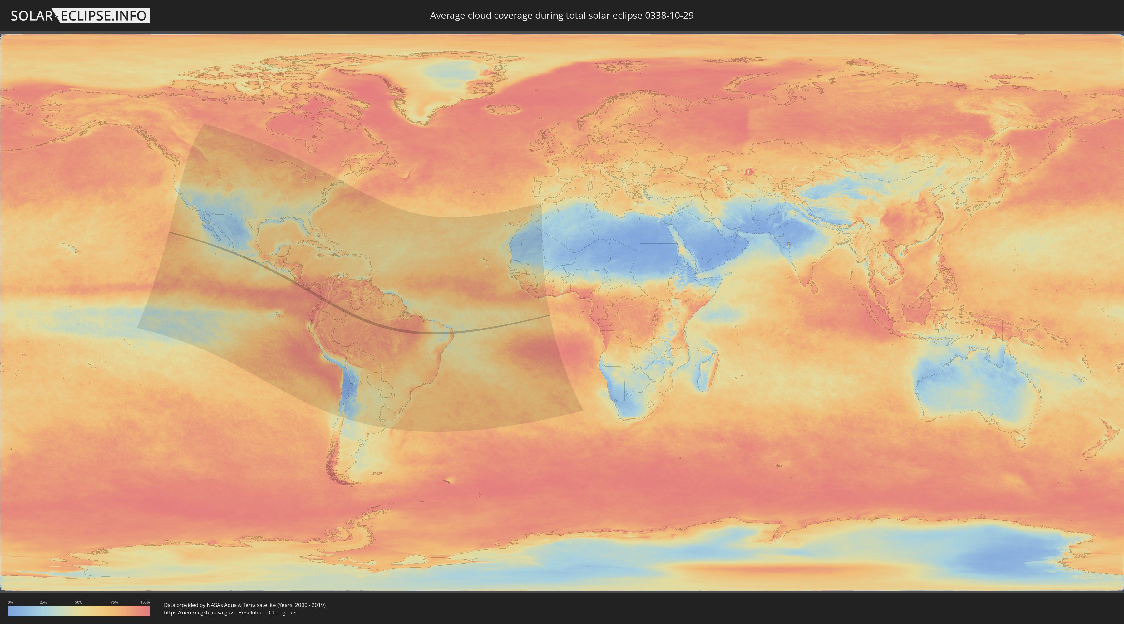
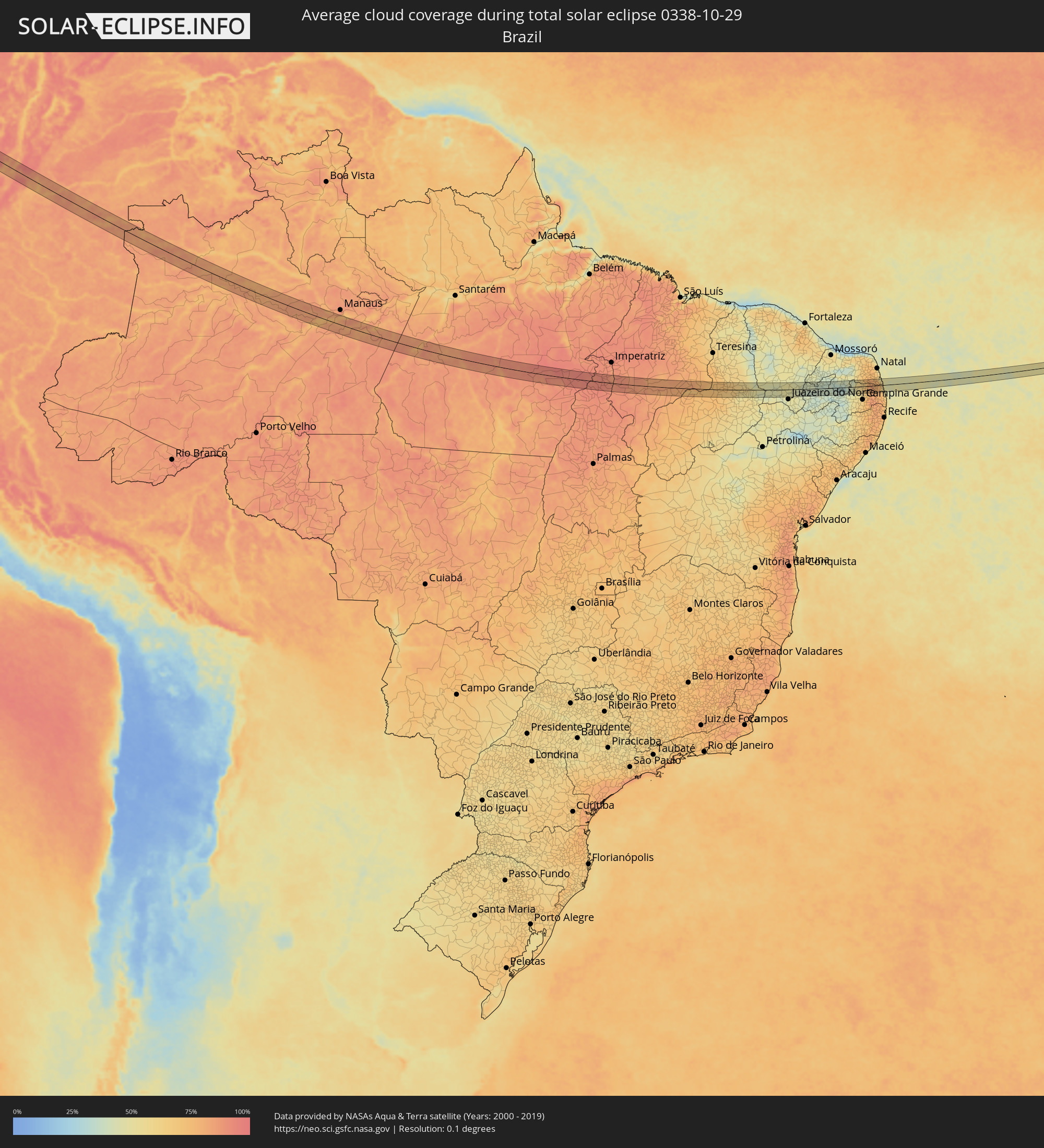
How will be the weather during the total solar eclipse on 10/29/0338?
Where is the best place to see the total solar eclipse of 10/29/0338?
The following maps show the average cloud coverage for the day of the total solar eclipse.
With the help of these maps, it is possible to find the place along the eclipse path, which has the best
chance of a cloudless sky.
Nevertheless, you should consider local circumstances and inform about the weather of your chosen
observation site.
The data is provided by NASAs satellites
AQUA and TERRA.
The cloud maps are averaged over a period of 19 years (2000 - 2019).
Detailed country maps
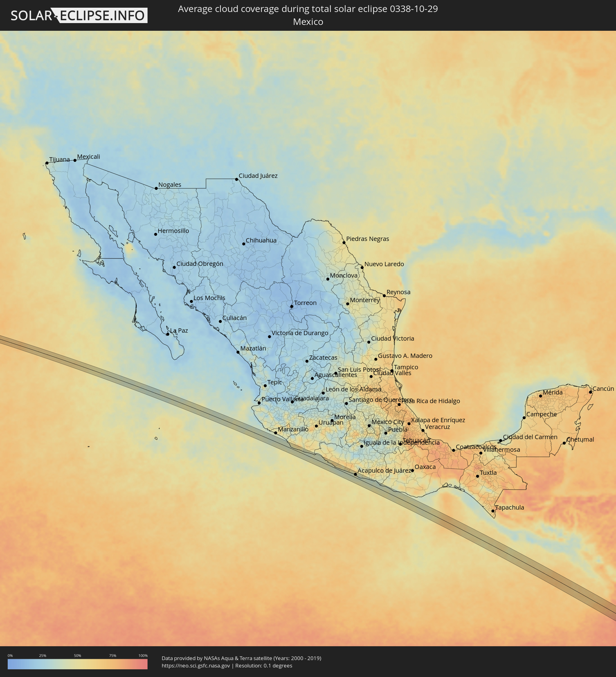 Mexico
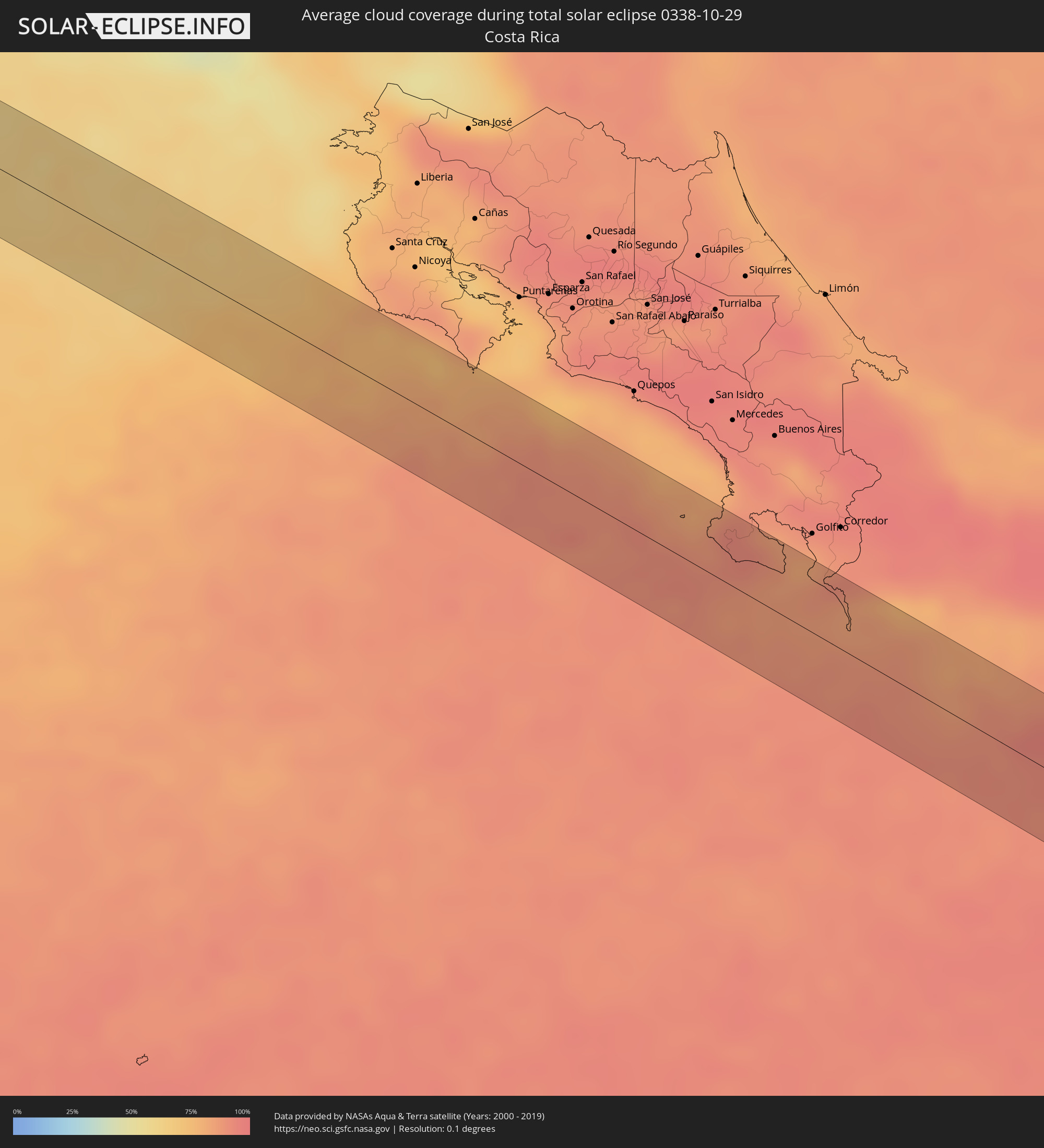 Costa Rica
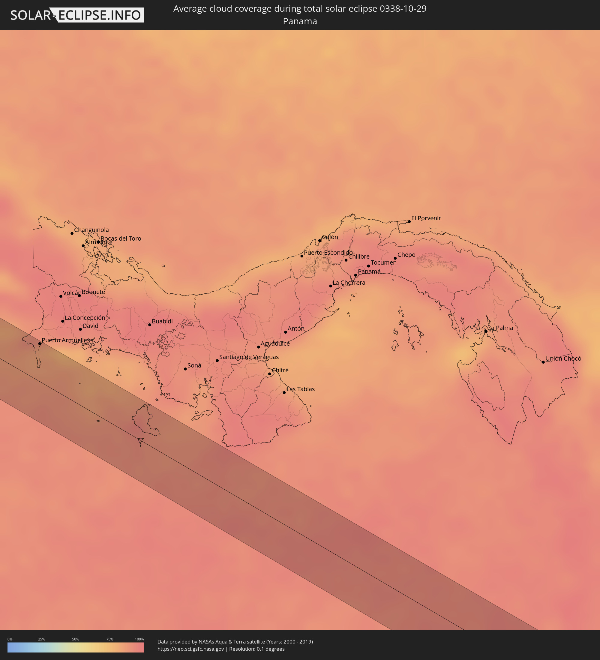 Panama
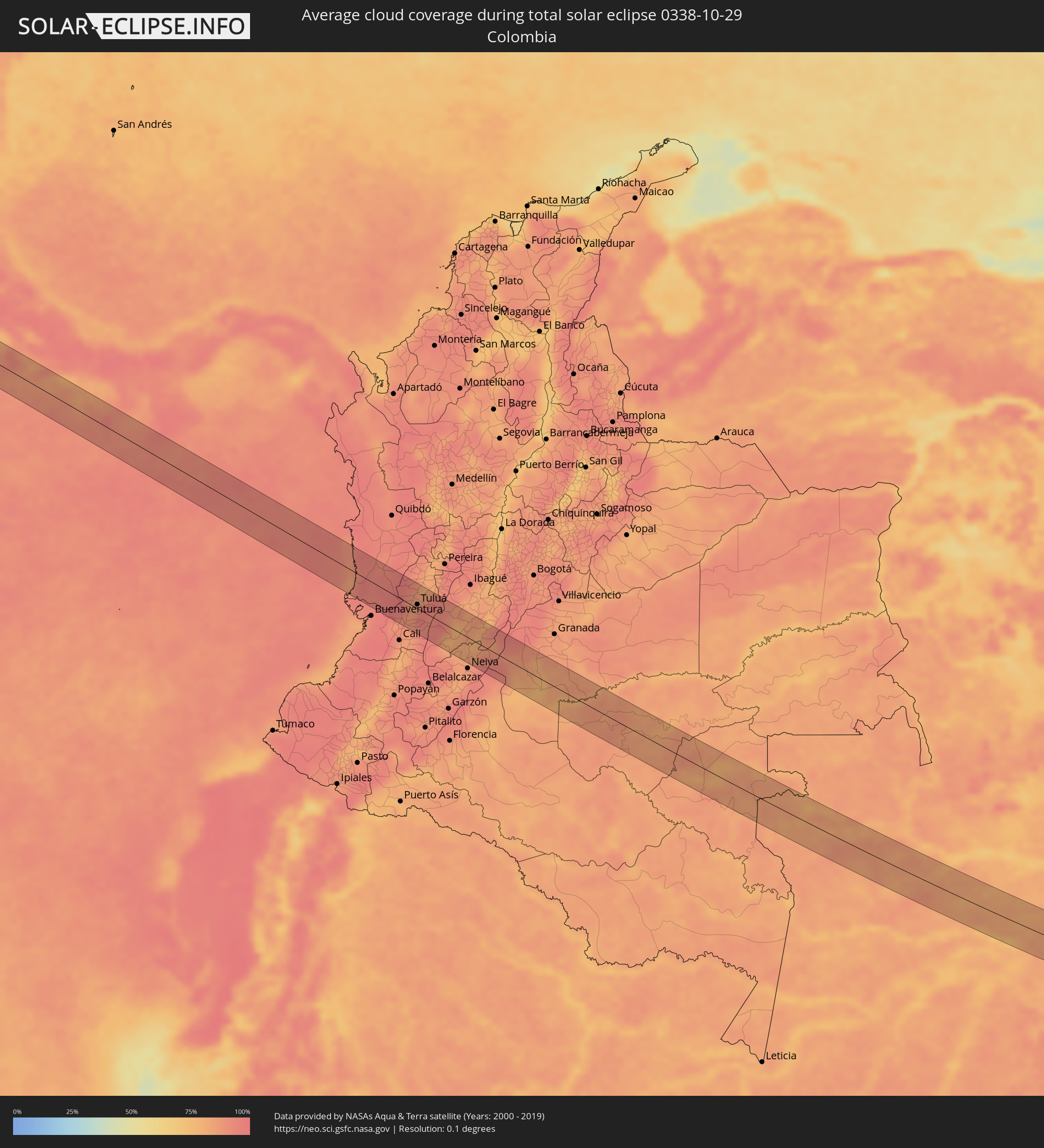 Colombia
 Brazil
Cities inside the path of the eclipse
The following table shows all locations with a population of more than 5,000 inside the eclipse path. Cities which have more than 100,000 inhabitants are marked bold. A click at the locations opens a detailed map.
| City | Type | Eclipse duration | Local time of max. eclipse | Distance to central line | Ø Cloud coverage |
|
Buenos Aires, Michoacán
|
total | - | 08:10:57 UTC-06:36 | 28 km | 41% |
|
La Orilla, Michoacán
|
total | - | 08:11:01 UTC-06:36 | 27 km | 43% |
|
Ciudad Lázaro Cárdenas, Michoacán
|
total | - | 08:11:01 UTC-06:36 | 25 km | 43% |
|
Ixtapa, Guerrero
|
total | - | 08:11:39 UTC-06:36 | 19 km | 42% |
|
San José Ixtapa (Barrio Viejo), Guerrero
|
total | - | 08:11:40 UTC-06:36 | 24 km | 42% |
|
Ixtapa-Zihuatanejo, Guerrero
|
total | - | 08:11:44 UTC-06:36 | 21 km | 43% |
|
El Coacoyul, Guerrero
|
total | - | 08:11:49 UTC-06:36 | 24 km | 44% |
|
San Jeronimito, Guerrero
|
total | - | 08:11:58 UTC-06:36 | 22 km | 47% |
|
Petatlán, Guerrero
|
total | - | 08:12:03 UTC-06:36 | 23 km | 42% |
|
El Súchil, Guerrero
|
total | - | 08:12:46 UTC-06:36 | 19 km | 40% |
|
Técpan de Galeana, Guerrero
|
total | - | 08:12:46 UTC-06:36 | 19 km | 40% |
|
San Jerónimo de Juárez, Guerrero
|
total | - | 08:12:57 UTC-06:36 | 18 km | 39% |
|
Atoyac de Álvarez, Guerrero
|
total | - | 08:12:58 UTC-06:36 | 26 km | 44% |
|
Coyuca de Benítez, Guerrero
|
total | - | 08:13:23 UTC-06:36 | 22 km | 38% |
|
Bajos del Ejido, Guerrero
|
total | - | 08:13:31 UTC-06:36 | 22 km | 42% |
|
Acapulco de Juárez, Guerrero
|
total | - | 08:13:39 UTC-06:36 | 16 km | 46% |
|
Copala, Guerrero
|
total | - | 08:14:42 UTC-06:36 | 31 km | 35% |
|
Puerto Armuelles, Chiriquí
|
total | - | 10:02:33 UTC-05:19 | 38 km | 85% |
|
Pizarro, Chocó
|
total | - | 10:42:02 UTC-04:56 | 25 km | 87% |
|
Restrepo, Valle del Cauca
|
total | - | 10:45:31 UTC-04:56 | 36 km | 90% |
|
Yotoco, Valle del Cauca
|
total | - | 10:45:50 UTC-04:56 | 25 km | 88% |
|
Guacarí, Valle del Cauca
|
total | - | 10:46:04 UTC-04:56 | 32 km | 86% |
|
Trujillo, Valle del Cauca
|
total | - | 10:45:33 UTC-04:56 | 12 km | 85% |
|
El Cerrito, Valle del Cauca
|
total | - | 10:46:13 UTC-04:56 | 38 km | 87% |
|
Buga, Valle del Cauca
|
total | - | 10:45:59 UTC-04:56 | 16 km | 86% |
|
Riofrío, Valle del Cauca
|
total | - | 10:45:42 UTC-04:56 | 9 km | 85% |
|
Ginebra, Valle del Cauca
|
total | - | 10:46:17 UTC-04:56 | 32 km | 87% |
|
San Pedro, Valle del Cauca
|
total | - | 10:46:03 UTC-04:56 | 4 km | 90% |
|
Tuluá, Valle del Cauca
|
total | - | 10:46:01 UTC-04:56 | 7 km | 86% |
|
Andalucía, Valle del Cauca
|
total | - | 10:45:59 UTC-04:56 | 17 km | 84% |
|
Bugalagrande, Valle del Cauca
|
total | - | 10:45:58 UTC-04:56 | 21 km | 84% |
|
Roldanillo, Valle del Cauca
|
total | - | 10:45:43 UTC-04:56 | 41 km | 88% |
|
Zarzal, Valle del Cauca
|
total | - | 10:45:57 UTC-04:56 | 44 km | 82% |
|
Sevilla, Valle del Cauca
|
total | - | 10:46:28 UTC-04:56 | 39 km | 92% |
|
Rioblanco, Tolima
|
total | - | 10:48:02 UTC-04:56 | 18 km | 80% |
|
Chaparral, Tolima
|
total | - | 10:48:17 UTC-04:56 | 12 km | 78% |
|
San Antonio, Tolima
|
total | - | 10:48:03 UTC-04:56 | 30 km | 83% |
|
Aipe, Huila
|
total | - | 10:49:34 UTC-04:56 | 23 km | 84% |
|
Natagaima, Tolima
|
total | - | 10:49:25 UTC-04:56 | 23 km | 80% |
|
Manacapuru, Amazonas
|
total | - | 12:33:55 UTC-04:02 | 28 km | 77% |
|
Manaquiri, Amazonas
|
total | - | 12:34:45 UTC-04:02 | 37 km | 76% |
|
Iranduba, Amazonas
|
total | - | 12:35:12 UTC-04:02 | 46 km | 78% |
|
Nova Olinda do Norte, Amazonas
|
total | - | 12:39:10 UTC-04:02 | 20 km | 78% |
|
São Geraldo do Araguaia, Pará
|
total | - | 13:59:27 UTC-03:13 | 5 km | 91% |
|
Porto Franco, Maranhão
|
total | - | 14:42:11 UTC-02:34 | 16 km | 85% |
|
Raposa, Maranhão
|
total | - | 14:49:44 UTC-02:34 | 21 km | 82% |
|
Pastos Bons, Maranhão
|
total | - | 14:50:01 UTC-02:34 | 12 km | 79% |
|
Paraibano, Maranhão
|
total | - | 14:50:08 UTC-02:34 | 31 km | 79% |
|
São João dos Patos, Maranhão
|
total | - | 14:50:47 UTC-02:34 | 26 km | 81% |
|
Floriano, Piauí
|
total | - | 14:52:22 UTC-02:34 | 2 km | 73% |
|
Oeiras, Piauí
|
total | - | 14:54:21 UTC-02:34 | 28 km | 65% |
|
Picos, Piauí
|
total | - | 14:55:43 UTC-02:34 | 33 km | 54% |
|
Ipueiras, Ceará
|
total | - | 14:57:42 UTC-02:34 | 28 km | 44% |
|
Campos Sales, Ceará
|
total | - | 14:57:52 UTC-02:34 | 33 km | 44% |
|
Assaré, Ceará
|
total | - | 14:58:45 UTC-02:34 | 11 km | 45% |
|
Farias Brito, Ceará
|
total | - | 14:59:21 UTC-02:34 | 18 km | 48% |
|
Jucás, Ceará
|
total | - | 14:59:16 UTC-02:34 | 27 km | 52% |
|
Caririaçu, Ceará
|
total | - | 14:59:55 UTC-02:34 | 31 km | 48% |
|
Cedro, Ceará
|
total | - | 15:00:10 UTC-02:34 | 17 km | 47% |
|
Aurora, Ceará
|
total | - | 15:00:28 UTC-02:34 | 21 km | 45% |
|
Lavras da Mangabeira, Ceará
|
total | - | 15:00:24 UTC-02:34 | 0 km | 45% |
|
Barro, Ceará
|
total | - | 15:00:34 UTC-02:34 | 4 km | 43% |
|
Cajazeiras, Paraíba
|
total | - | 15:01:12 UTC-02:34 | 16 km | 39% |
|
Uiraúna, Paraíba
|
total | - | 15:01:20 UTC-02:34 | 24 km | 42% |
|
Serra Branca, Paraíba
|
total | - | 15:01:36 UTC-02:34 | 22 km | 41% |
|
Sousa, Paraíba
|
total | - | 15:01:45 UTC-02:34 | 3 km | 36% |
|
Juàzeirinho, Paraíba
|
total | - | 15:02:05 UTC-02:34 | 10 km | 37% |
|
Alexandria, Rio Grande do Norte
|
total | - | 15:02:00 UTC-02:34 | 35 km | 37% |
|
Coremas, Paraíba
|
total | - | 15:02:20 UTC-02:34 | 33 km | 40% |
|
Pombal, Paraíba
|
total | - | 15:02:31 UTC-02:34 | 6 km | 38% |
|
Caicó, Rio Grande do Norte
|
total | - | 15:03:38 UTC-02:34 | 25 km | 35% |
|
Santa Luzia, Paraíba
|
total | - | 15:04:04 UTC-02:34 | 22 km | 37% |
|
Jardim do Seridó, Rio Grande do Norte
|
total | - | 15:04:13 UTC-02:34 | 9 km | 31% |
|
Parelhas, Rio Grande do Norte
|
total | - | 15:04:27 UTC-02:34 | 3 km | 36% |
|
Picuí, Paraíba
|
total | - | 15:04:55 UTC-02:34 | 15 km | 49% |
|
Nova Floresta, Paraíba
|
total | - | 15:05:08 UTC-02:34 | 20 km | 54% |
|
Cuité, Paraíba
|
total | - | 15:05:14 UTC-02:34 | 17 km | 54% |
|
Araruna, Paraíba
|
total | - | 15:05:56 UTC-02:34 | 6 km | 75% |
|
São José do Campestre, Rio Grande do Norte
|
total | - | 15:05:54 UTC-02:34 | 33 km | 73% |
|
Solânea, Paraíba
|
total | - | 15:06:19 UTC-02:34 | 17 km | 81% |
|
Belém, Paraíba
|
total | - | 15:06:18 UTC-02:34 | 10 km | 80% |
|
Pirpirituba, Paraíba
|
total | - | 15:06:23 UTC-02:34 | 21 km | 81% |
|
Guarabira, Paraíba
|
total | - | 15:06:25 UTC-02:34 | 29 km | 80% |
|
Santo Antônio, Rio Grande do Norte
|
total | - | 15:06:17 UTC-02:34 | 31 km | 79% |
|
Nova Cruz, Rio Grande do Norte
|
total | - | 15:06:24 UTC-02:34 | 13 km | 81% |
|
Montanhas, Rio Grande do Norte
|
total | - | 15:06:38 UTC-02:34 | 11 km | 77% |
|
Canguaretama, Rio Grande do Norte
|
total | - | 15:06:52 UTC-02:34 | 21 km | 73% |
|
Mamanguape, Paraíba
|
total | - | 15:07:00 UTC-02:34 | 30 km | 74% |
|
Rio Tinto, Paraíba
|
total | - | 15:07:03 UTC-02:34 | 26 km | 74% |