Total solar eclipse of 08/31/0490
| Day of week: | Thursday |
| Maximum duration of eclipse: | 02m19s |
| Maximum width of eclipse path: | 81 km |
| Saros cycle: | 91 |
| Coverage: | 100% |
| Magnitude: | 1.0235 |
| Gamma: | 0.1232 |
Wo kann man die Sonnenfinsternis vom 08/31/0490 sehen?
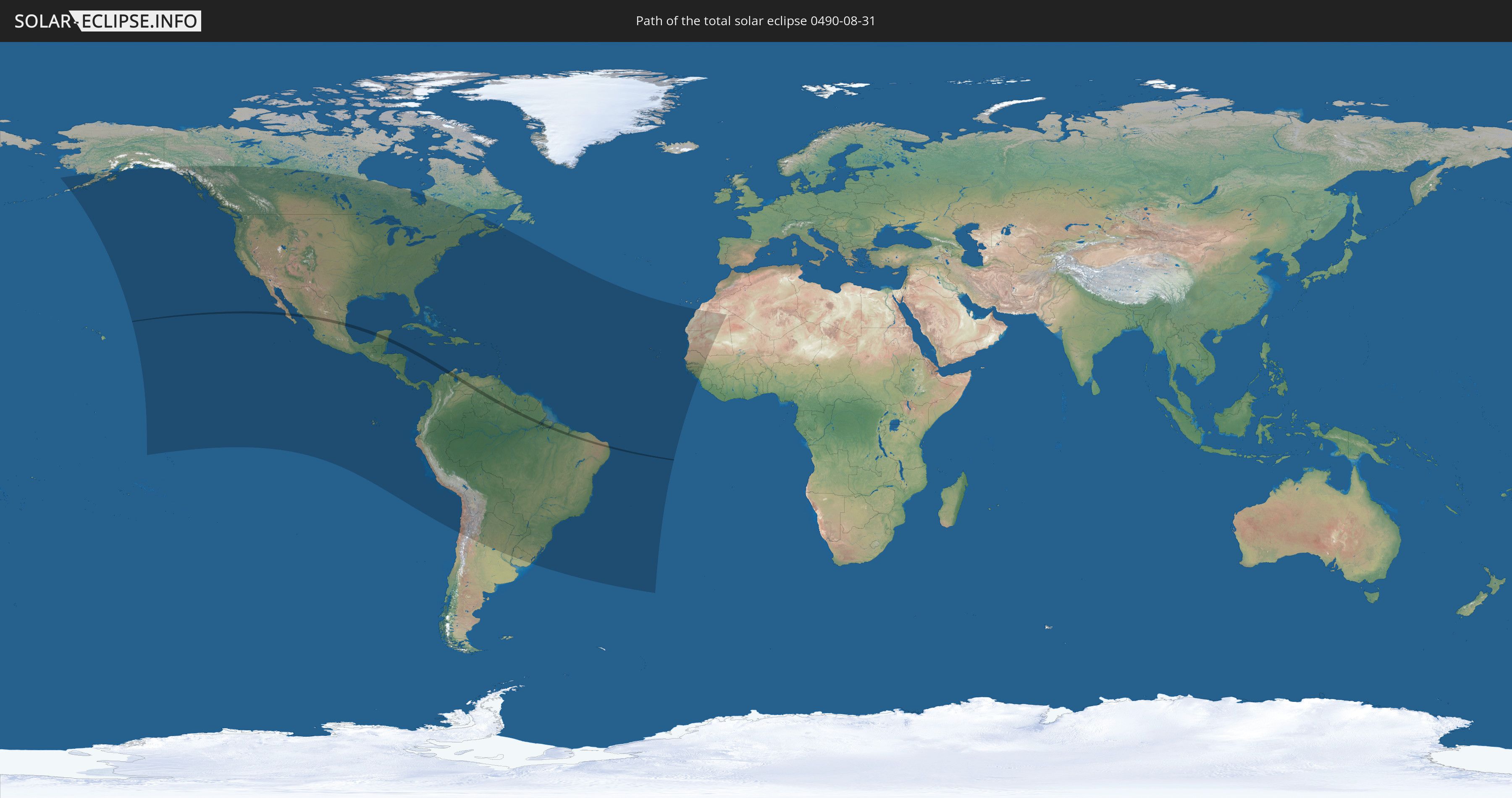
Die Sonnenfinsternis am 08/31/0490 kann man in 58 Ländern als partielle Sonnenfinsternis beobachten.
Der Finsternispfad verläuft durch 7 Länder. Nur in diesen Ländern ist sie als total Sonnenfinsternis zu sehen.
In den folgenden Ländern ist die Sonnenfinsternis total zu sehen
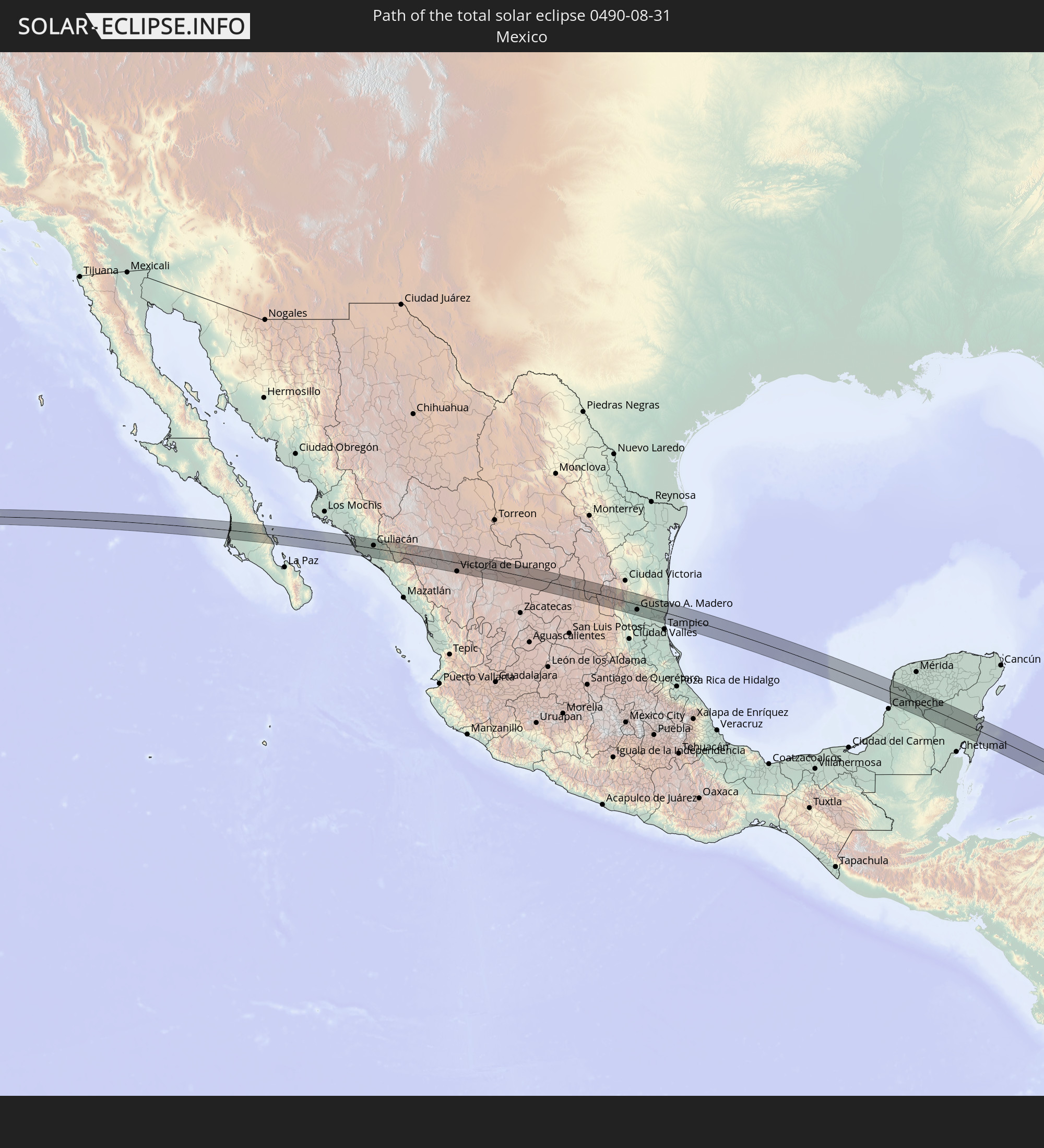 Mexico
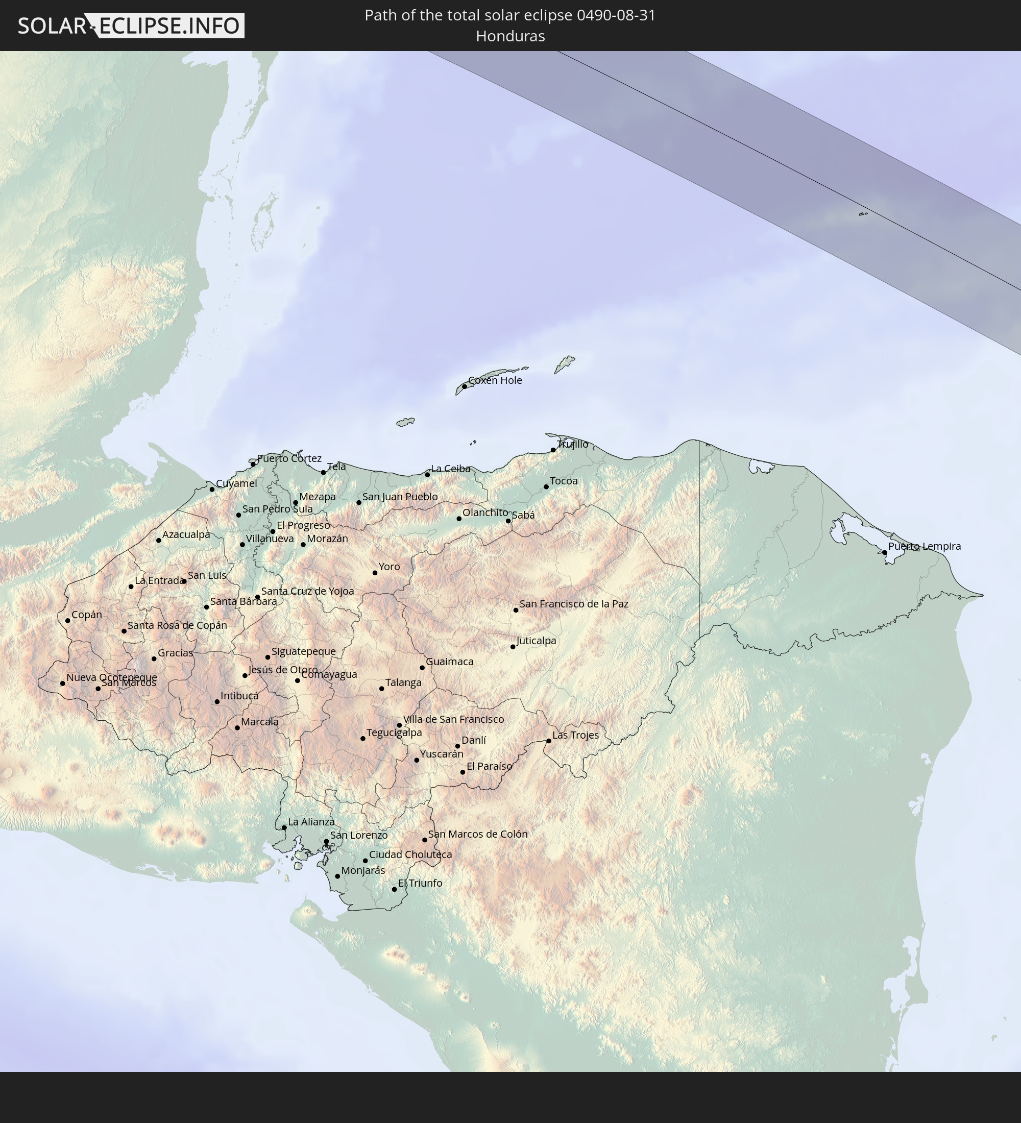 Honduras
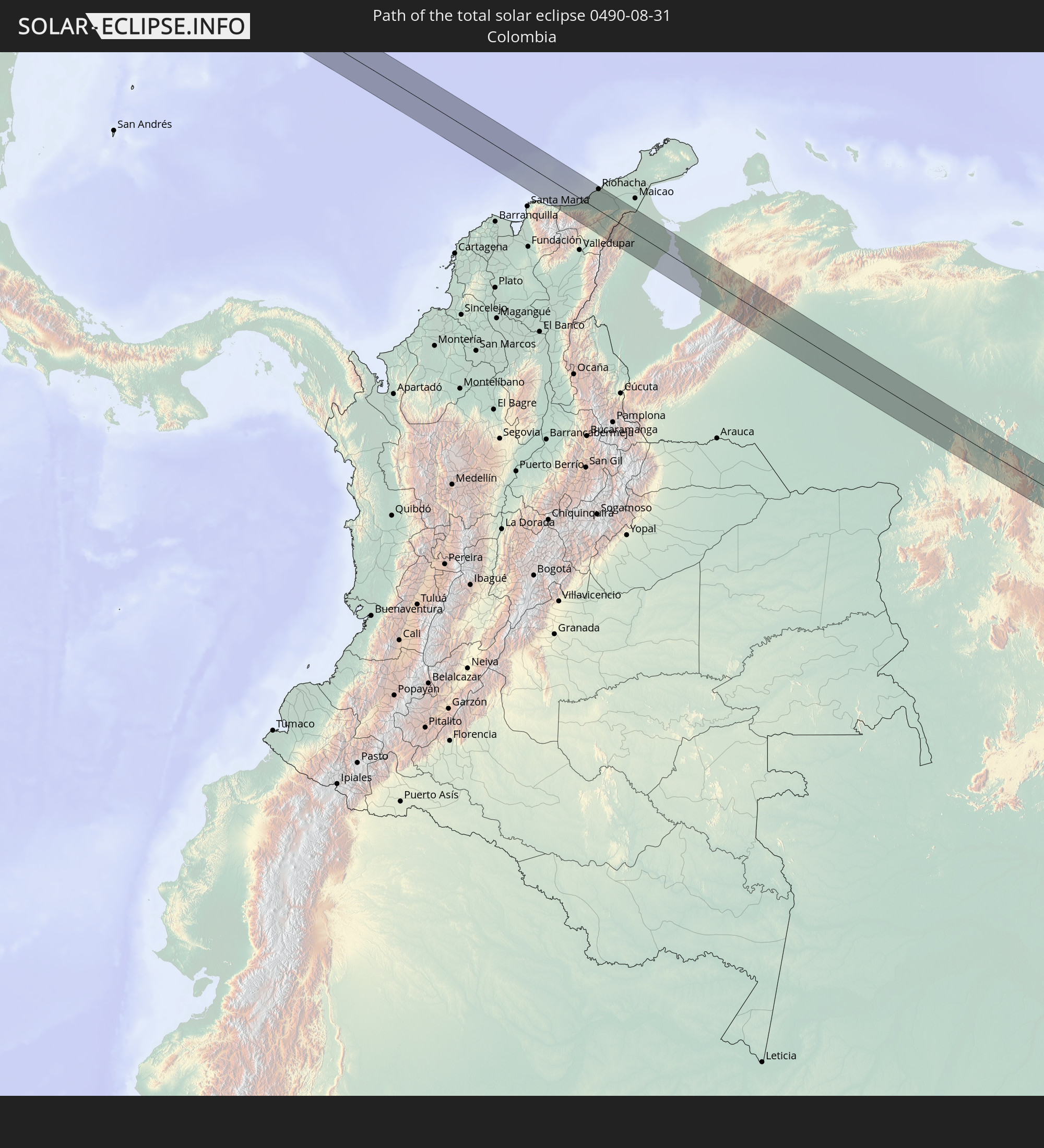 Colombia
 Brazil
 Venezuela
 Guyana
 Suriname
In den folgenden Ländern ist die Sonnenfinsternis partiell zu sehen
 United States
 United States Minor Outlying Islands
 Canada
 Mexico
 Chile
Chile
 Greenland
 Guatemala
 Ecuador
 El Salvador
 Honduras
 Belize
 Nicaragua
 Costa Rica
 Cuba
Cuba
 Panama
 Colombia
 Cayman Islands
 Peru
Peru
 The Bahamas
 Jamaica
 Haiti
Haiti
 Brazil
 Argentina
 Venezuela
 Turks and Caicos Islands
 Dominican Republic
 Aruba
Aruba
 Bolivia
 Puerto Rico
 United States Virgin Islands
 Bermuda
 British Virgin Islands
 Anguilla
 Collectivity of Saint Martin
 Saint Barthélemy
 Saint Kitts and Nevis
 Paraguay
 Antigua and Barbuda
 Montserrat
 Trinidad and Tobago
 Guadeloupe
 Grenada
 Dominica
 Saint Vincent and the Grenadines
 Guyana
 Martinique
 Saint Lucia
 Barbados
 Uruguay
 Suriname
 French Guiana
 Cabo Verde
 Senegal
 Mauritania
 The Gambia
 Guinea-Bissau
 Guinea
 Mali
Mali
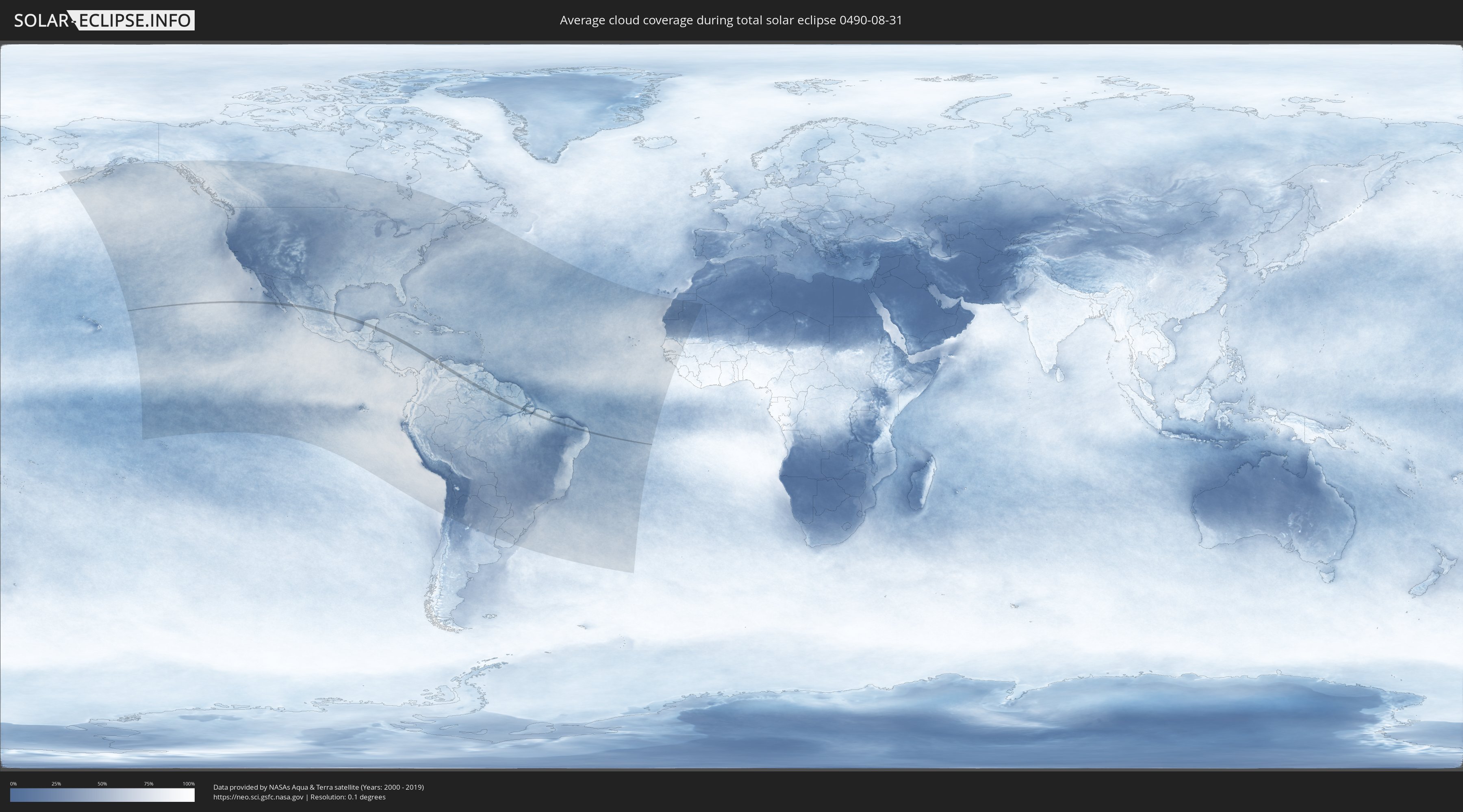
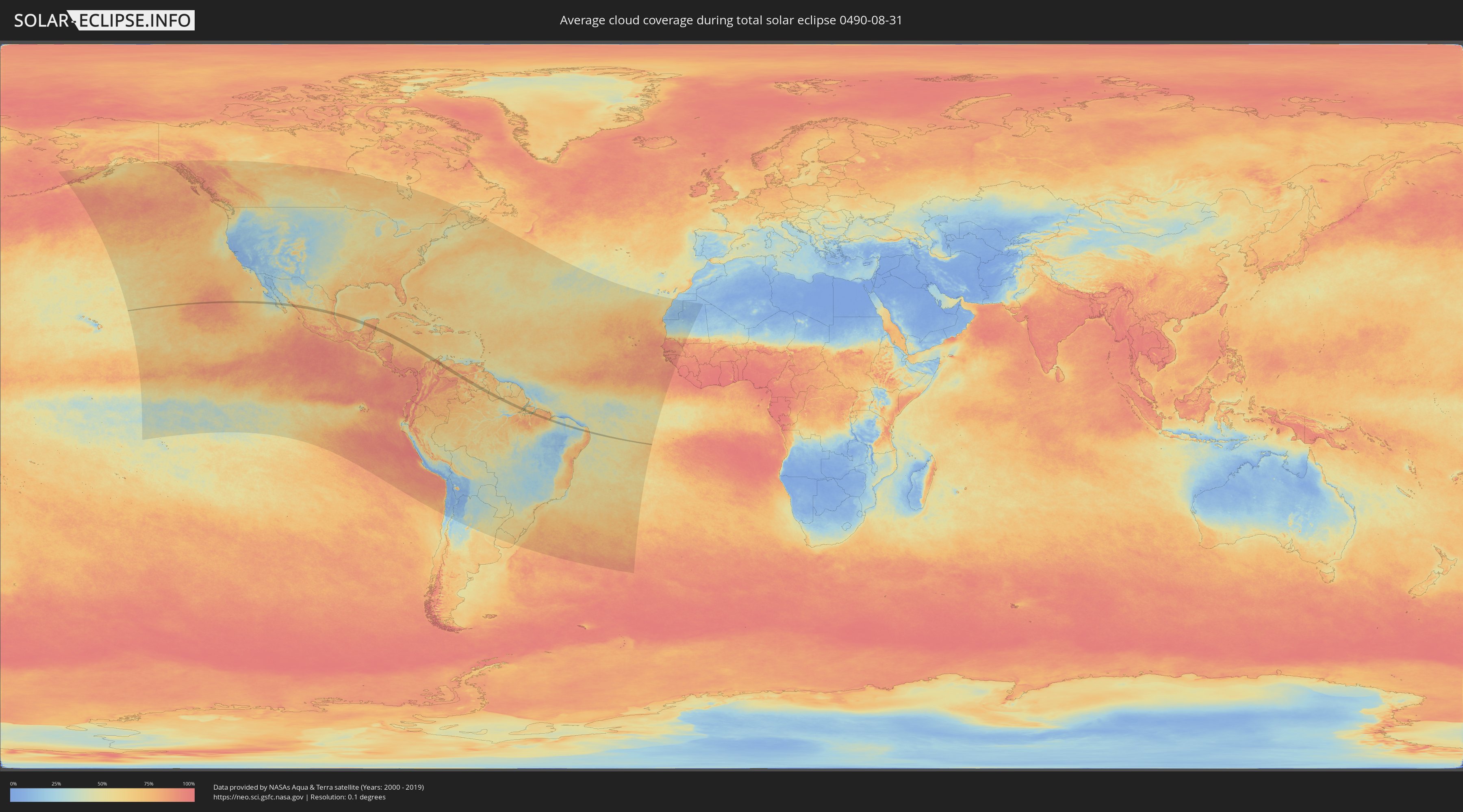
How will be the weather during the total solar eclipse on 08/31/0490?
Where is the best place to see the total solar eclipse of 08/31/0490?
The following maps show the average cloud coverage for the day of the total solar eclipse.
With the help of these maps, it is possible to find the place along the eclipse path, which has the best
chance of a cloudless sky.
Nevertheless, you should consider local circumstances and inform about the weather of your chosen
observation site.
The data is provided by NASAs satellites
AQUA and TERRA.
The cloud maps are averaged over a period of 19 years (2000 - 2019).
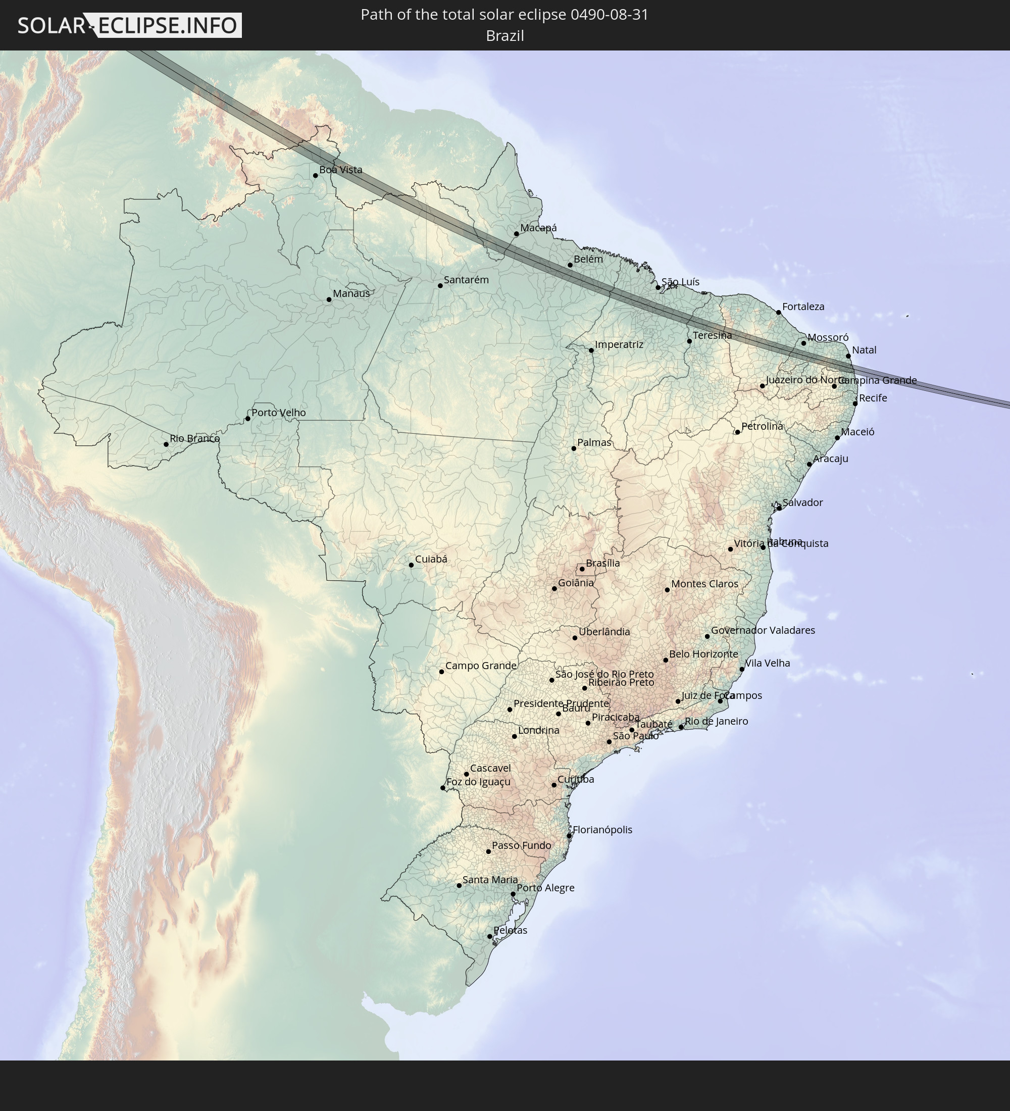
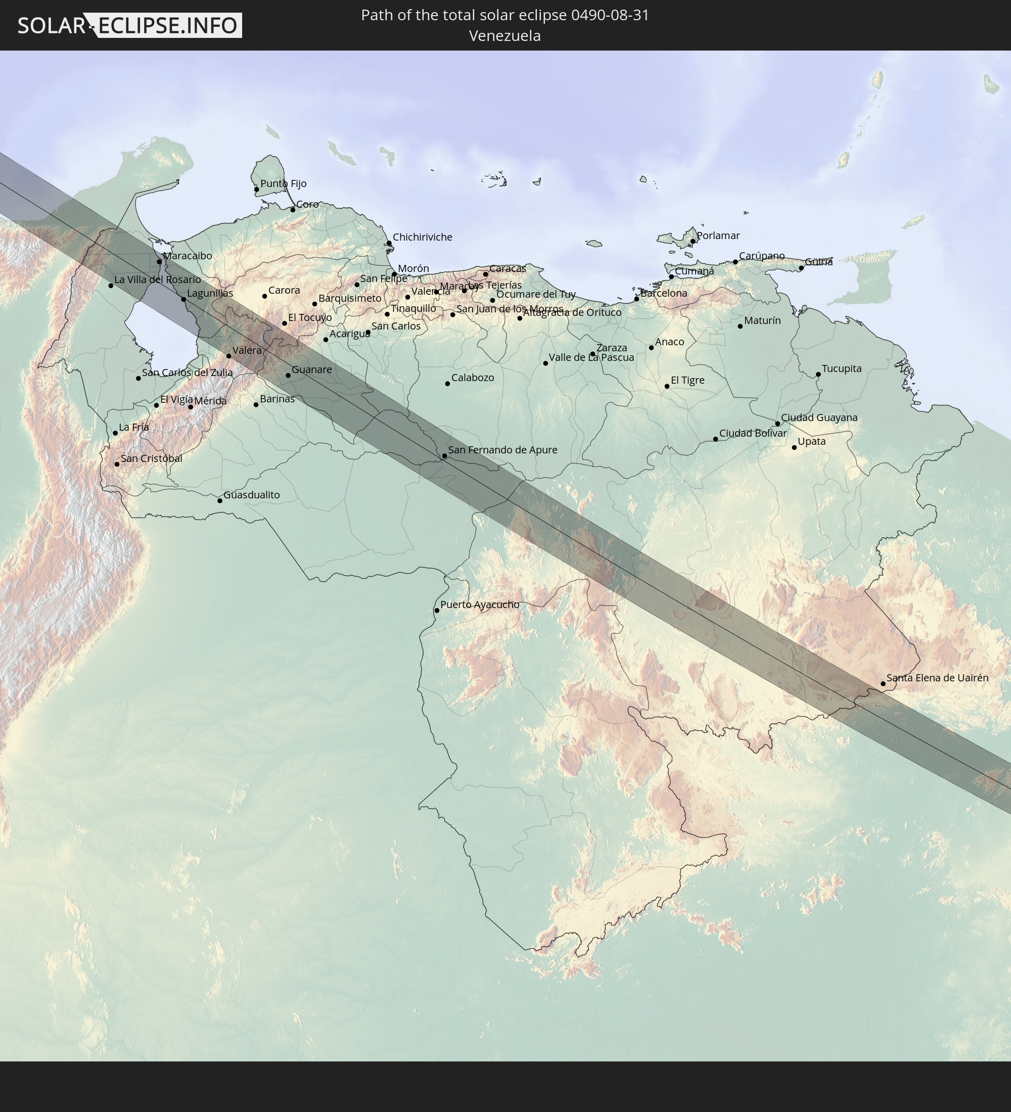
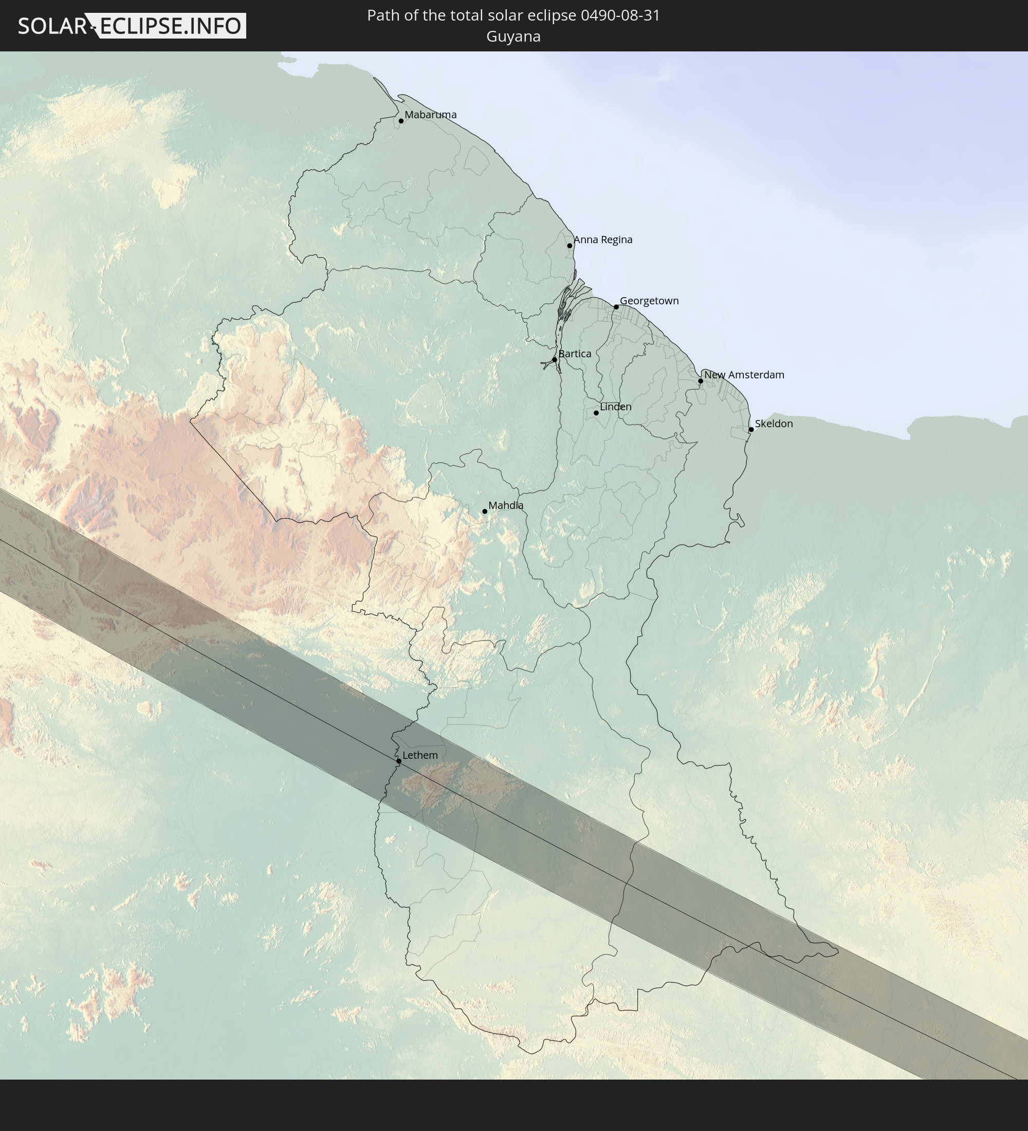
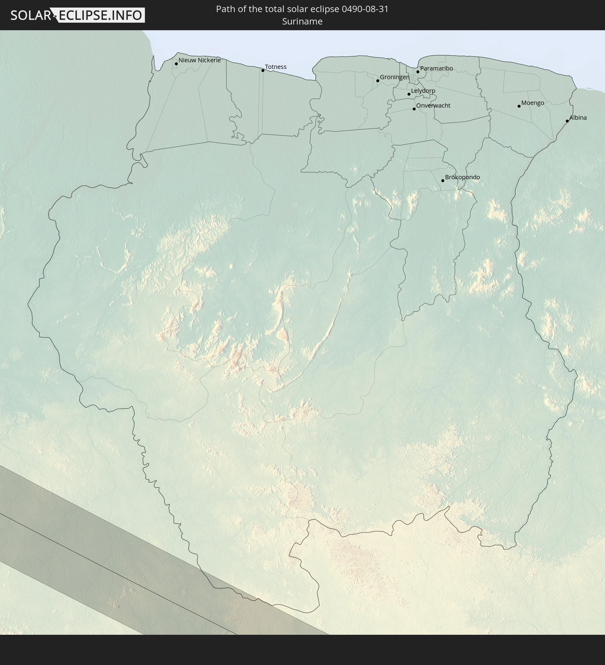
Detailed country maps
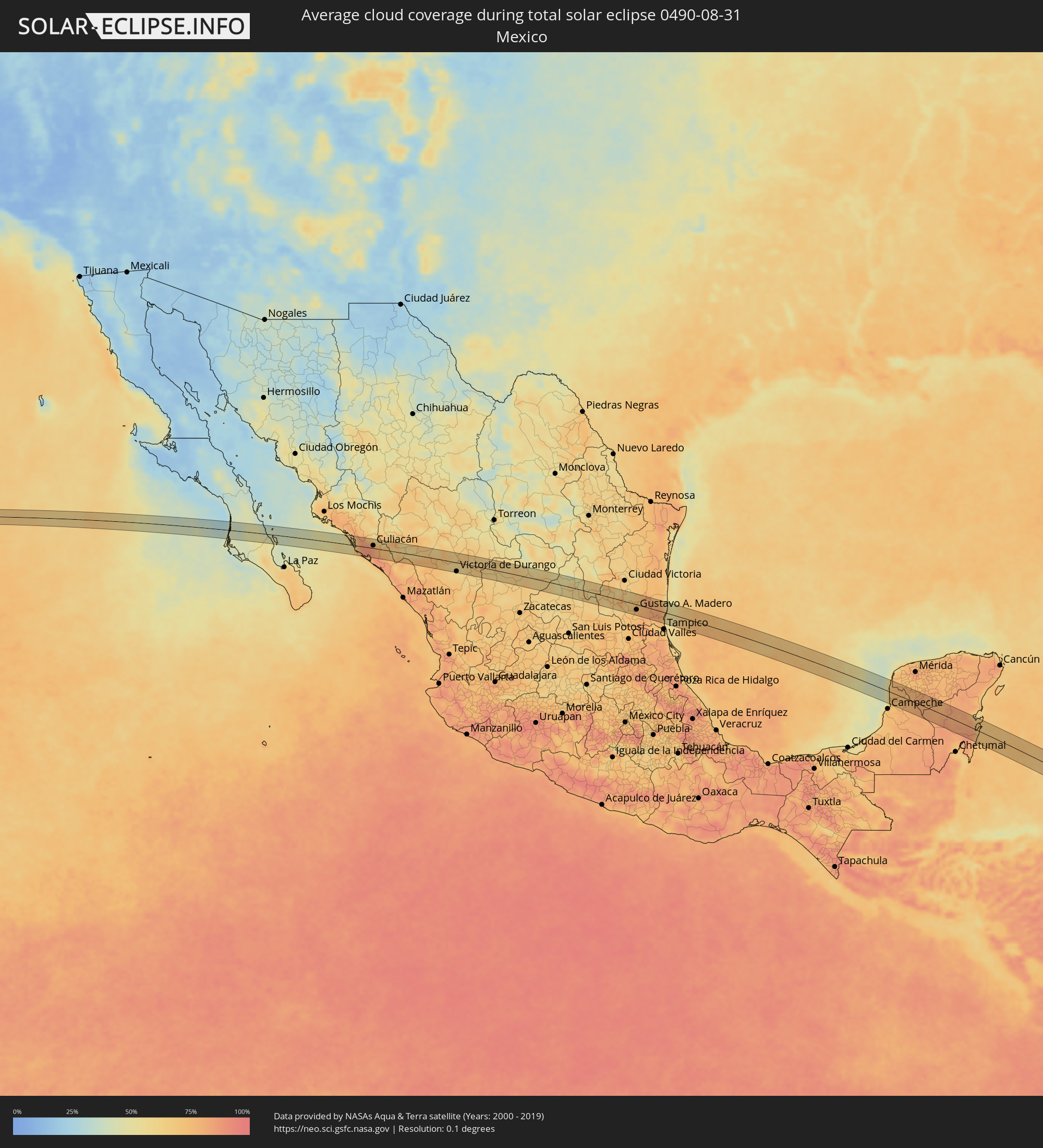 Mexico
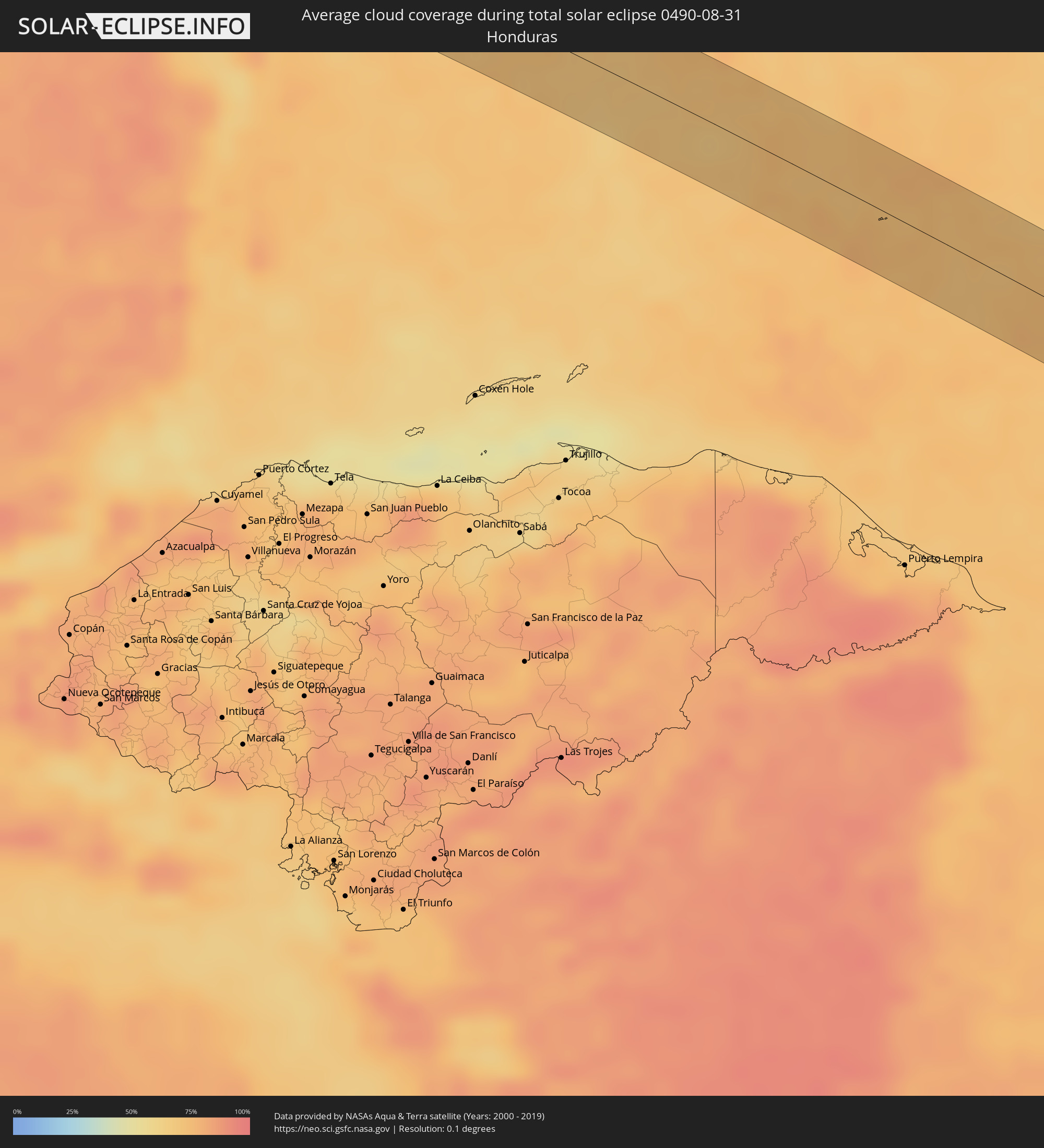 Honduras
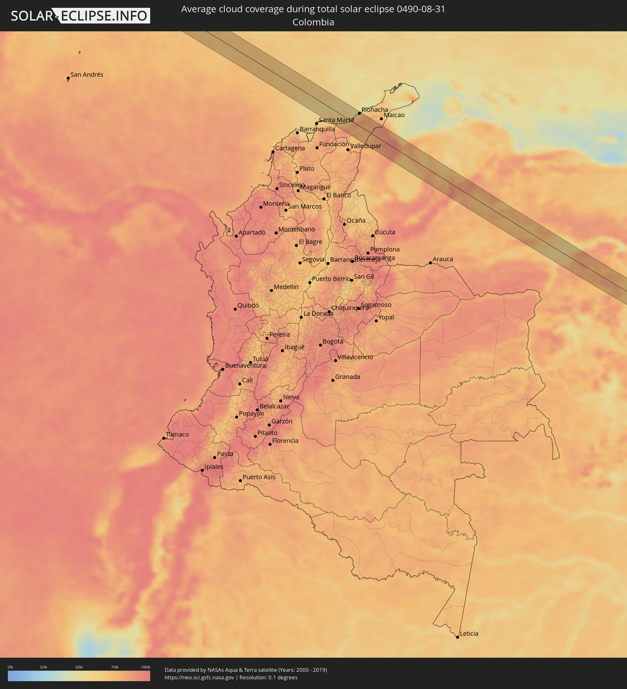 Colombia
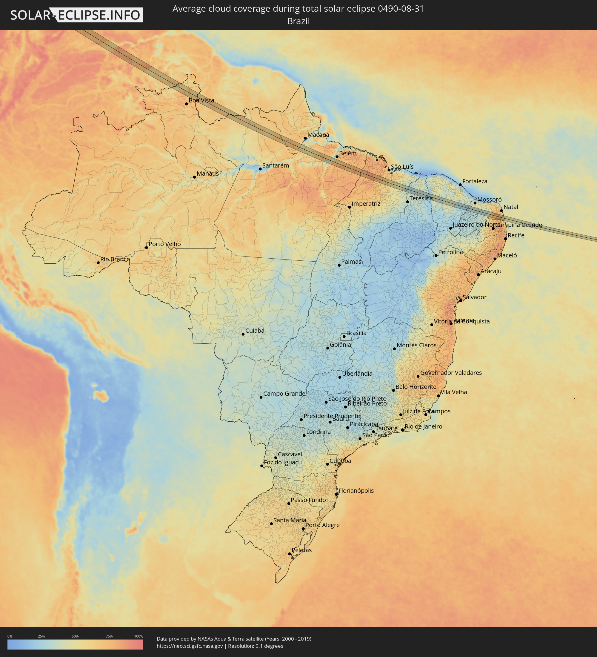 Brazil
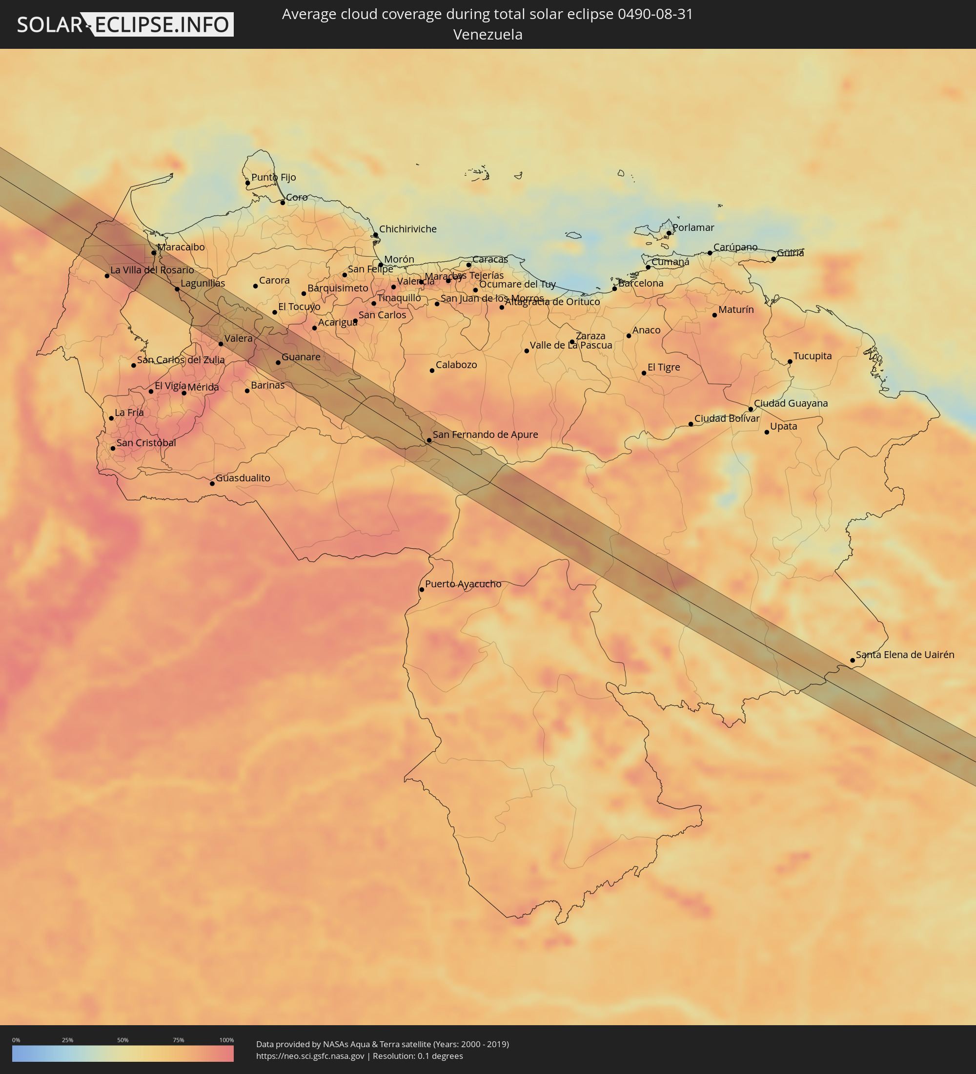 Venezuela
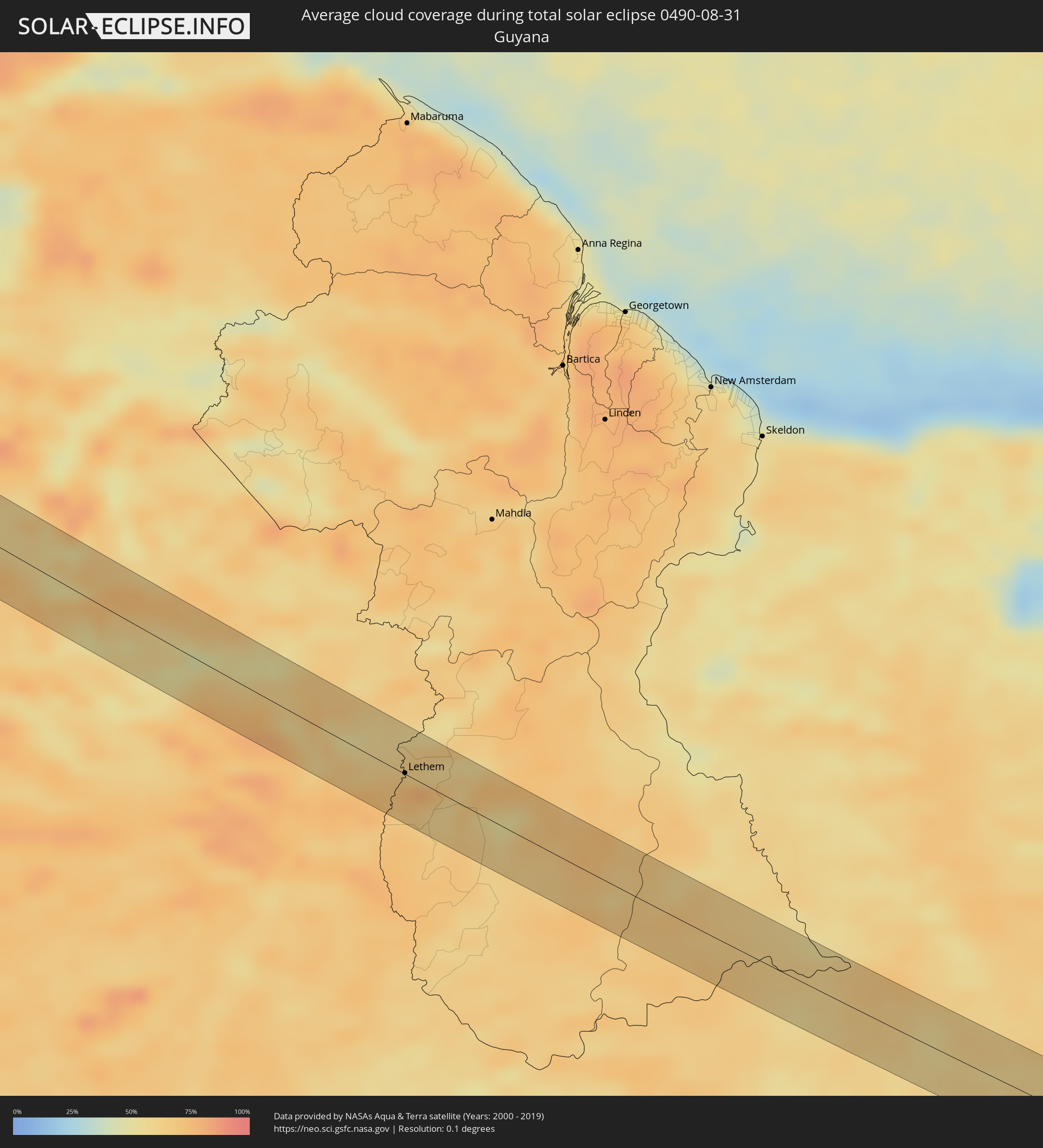 Guyana
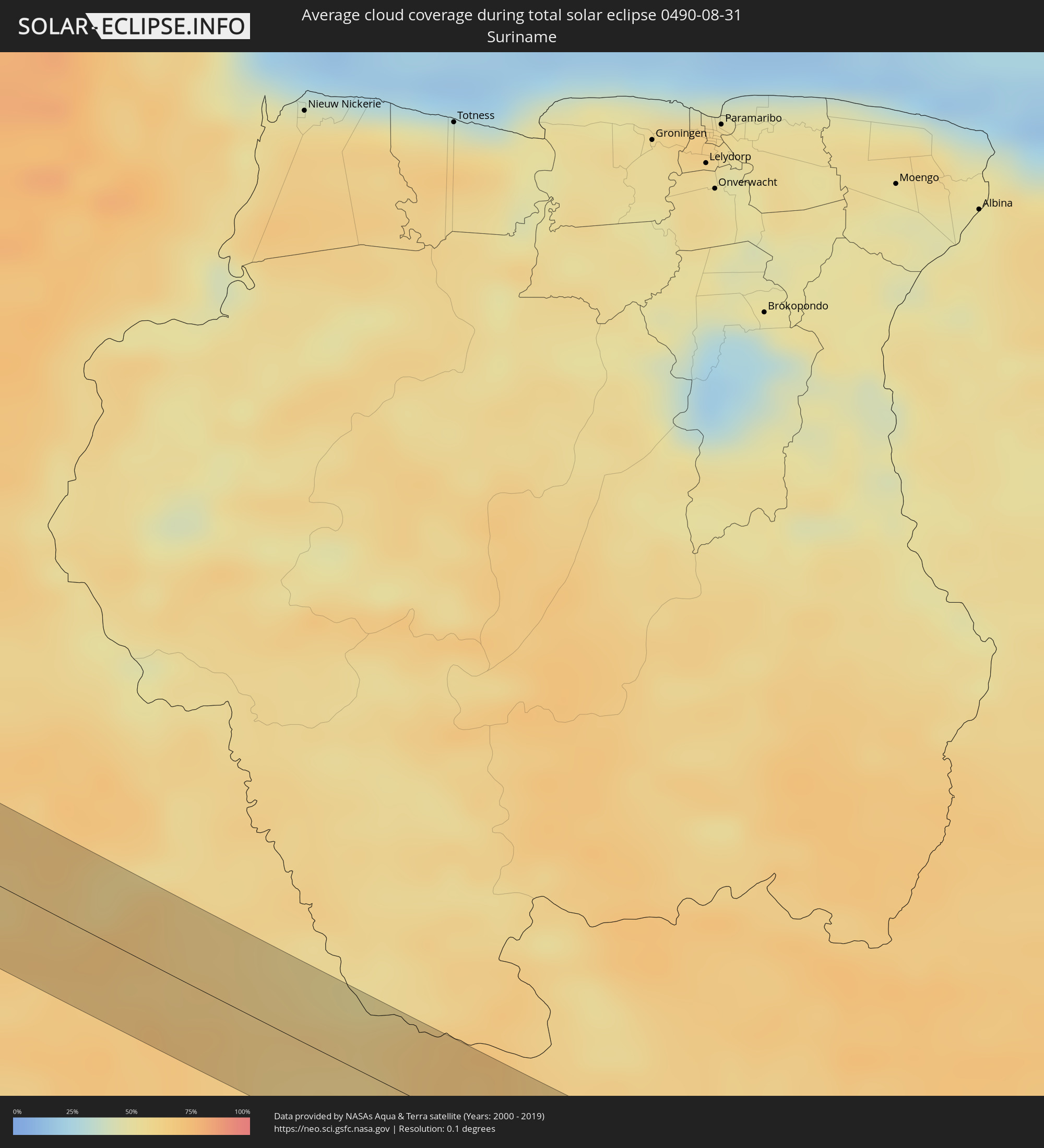 Suriname
Cities inside the path of the eclipse
The following table shows all locations with a population of more than 5,000 inside the eclipse path. Cities which have more than 100,000 inhabitants are marked bold. A click at the locations opens a detailed map.
| City | Type | Eclipse duration | Local time of max. eclipse | Distance to central line | Ø Cloud coverage |
|
Ciudad Insurgentes, Baja California Sur
|
total | - | 08:56:59 UTC-07:05 | 5 km | 37% |
|
Ciudad Constitución, Baja California Sur
|
total | - | 08:57:09 UTC-07:05 | 20 km | 40% |
|
Navolato, Sinaloa
|
total | - | 09:03:27 UTC-07:05 | 1 km | 88% |
|
General Ángel Flores (La Palma), Sinaloa
|
total | - | 09:03:31 UTC-07:05 | 8 km | 88% |
|
Adolfo López Mateos (El Tamarindo), Sinaloa
|
total | - | 09:03:33 UTC-07:05 | 17 km | 84% |
|
Licenciado Benito Juárez (Campo Gobierno), Sinaloa
|
total | - | 09:03:44 UTC-07:05 | 9 km | 88% |
|
Villa Juárez, Sinaloa
|
total | - | 09:03:45 UTC-07:05 | 8 km | 88% |
|
El Diez, Sinaloa
|
total | - | 09:03:53 UTC-07:05 | 0 km | 88% |
|
Villa de Costa Rica, Sinaloa
|
total | - | 09:04:01 UTC-07:05 | 13 km | 85% |
|
Culiacán, Sinaloa
|
total | - | 09:03:59 UTC-07:05 | 9 km | 81% |
|
Quila, Sinaloa
|
total | - | 09:04:19 UTC-07:05 | 29 km | 88% |
|
Cosalá, Sinaloa
|
total | - | 09:05:15 UTC-07:05 | 22 km | 74% |
|
Canatlán, Durango
|
total | - | 09:37:45 UTC-06:36 | 24 km | 62% |
|
Victoria de Durango, Durango
|
total | - | 09:38:06 UTC-06:36 | 29 km | 61% |
|
Guadalupe Victoria, Durango
|
total | - | 09:38:59 UTC-06:36 | 28 km | 60% |
|
Miguel Auza, Zacatecas
|
total | - | 09:40:18 UTC-06:36 | 25 km | 63% |
|
Juan Aldama, Zacatecas
|
total | - | 09:40:25 UTC-06:36 | 26 km | 66% |
|
Río Grande, Zacatecas
|
total | - | 09:41:16 UTC-06:36 | 17 km | 63% |
|
Matehuala, San Luis Potosí
|
total | - | 09:46:09 UTC-06:36 | 18 km | 59% |
|
Doctor Arroyo, Nuevo León
|
total | - | 09:47:06 UTC-06:36 | 32 km | 62% |
|
Tula, Tamaulipas
|
total | - | 09:48:25 UTC-06:36 | 29 km | 56% |
|
Xicoténcatl, Tamaulipas
|
total | - | 09:50:05 UTC-06:36 | 8 km | 71% |
|
Gustavo A. Madero, Tamaulipas
|
total | - | 09:50:33 UTC-06:36 | 17 km | 75% |
|
Ursulo Galván, Tamaulipas
|
total | - | 09:51:35 UTC-06:36 | 20 km | 81% |
|
Cuauhtémoc, Tamaulipas
|
total | - | 09:52:05 UTC-06:36 | 35 km | 68% |
|
Aldama, Tamaulipas
|
total | - | 09:52:01 UTC-06:36 | 8 km | 83% |
|
Tenabo, Campeche
|
total | - | 10:13:16 UTC-06:36 | 24 km | 71% |
|
Pomuch, Campeche
|
total | - | 10:13:17 UTC-06:36 | 12 km | 72% |
|
Nunkiní, Campeche
|
total | - | 10:13:05 UTC-06:36 | 16 km | 76% |
|
Hecelchakán, Campeche
|
total | - | 10:13:21 UTC-06:36 | 7 km | 74% |
|
Halachó, Yucatán
|
total | - | 10:13:10 UTC-06:36 | 26 km | 76% |
|
Dzitbalché, Campeche
|
total | - | 10:13:24 UTC-06:36 | 11 km | 74% |
|
Calkiní, Campeche
|
total | - | 10:13:22 UTC-06:36 | 16 km | 76% |
|
Bécal, Campeche
|
total | - | 10:13:21 UTC-06:36 | 25 km | 76% |
|
Oxkutzkab, Yucatán
|
total | - | 10:15:03 UTC-06:36 | 36 km | 79% |
|
Akil, Yucatán
|
total | - | 10:15:17 UTC-06:36 | 35 km | 80% |
|
Tecax, Yucatán
|
total | - | 10:15:30 UTC-06:36 | 31 km | 79% |
|
Tzucacab, Yucatán
|
total | - | 10:16:15 UTC-06:36 | 27 km | 78% |
|
Peto, Yucatán
|
total | - | 10:16:31 UTC-06:36 | 38 km | 77% |
|
Felipe Carrillo Puerto, Quintana Roo
|
total | - | 11:08:58 UTC-05:47 | 20 km | 79% |
|
Ríohacha, La Guajira
|
total | - | 12:52:13 UTC-04:56 | 35 km | 85% |
|
Fonseca, La Guajira
|
total | - | 12:53:30 UTC-04:56 | 24 km | 76% |
|
Barrancas, La Guajira
|
total | - | 12:53:32 UTC-04:56 | 13 km | 75% |
|
Albania, La Guajira
|
total | - | 12:53:40 UTC-04:56 | 17 km | 81% |
|
Maracaibo, Zulia
|
total | - | 13:25:33 UTC-04:27 | 28 km | 79% |
|
Santa Rita, Zulia
|
total | - | 13:26:01 UTC-04:27 | 21 km | 75% |
|
Cabimas, Zulia
|
total | - | 13:26:27 UTC-04:27 | 12 km | 77% |
|
Lagunillas, Zulia
|
total | - | 13:27:20 UTC-04:27 | 2 km | 67% |
|
Trujillo, Trujillo
|
total | - | 13:30:38 UTC-04:27 | 26 km | 78% |
|
Guanare, Portuguesa
|
total | - | 13:32:51 UTC-04:27 | 16 km | 82% |
|
San Fernando de Apure, Apure
|
total | - | 13:40:02 UTC-04:27 | 6 km | 76% |
|
Lethem, Upper Takutu-Upper Essequibo
|
total | - | 14:37:34 UTC-03:52 | 1 km | 64% |
|
Muaná, Pará
|
total | - | 15:37:55 UTC-03:13 | 13 km | 49% |
|
Igarapé Miri, Pará
|
total | - | 15:38:40 UTC-03:13 | 22 km | 71% |
|
Abaetetuba, Pará
|
total | - | 15:38:30 UTC-03:13 | 8 km | 67% |
|
Moju, Pará
|
total | - | 15:38:48 UTC-03:13 | 4 km | 72% |
|
Acará, Pará
|
total | - | 15:39:31 UTC-03:13 | 11 km | 79% |
|
Penalva, Maranhão
|
total | - | 16:23:48 UTC-02:34 | 8 km | 59% |
|
Matinha, Maranhão
|
total | - | 16:23:45 UTC-02:34 | 18 km | 69% |
|
Viana, Maranhão
|
total | - | 16:23:53 UTC-02:34 | 7 km | 68% |
|
Vitória do Mearim, Maranhão
|
total | - | 16:24:14 UTC-02:34 | 14 km | 67% |
|
Arari, Maranhão
|
total | - | 16:24:18 UTC-02:34 | 9 km | 63% |
|
Cantanhede, Maranhão
|
total | - | 16:24:50 UTC-02:34 | 13 km | 55% |
|
Itapecuru Mirim, Maranhão
|
total | - | 16:24:38 UTC-02:34 | 13 km | 60% |
|
Pirapemas, Maranhão
|
total | - | 16:25:03 UTC-02:34 | 17 km | 55% |
|
Vargem Grande, Maranhão
|
total | - | 16:25:10 UTC-02:34 | 13 km | 54% |
|
Santa Rita, Maranhão
|
total | - | 16:25:29 UTC-02:34 | 18 km | 48% |
|
Chapadinha, Maranhão
|
total | - | 16:25:49 UTC-02:34 | 13 km | 47% |
|
Miguel Alves, Piauí
|
total | - | 16:26:33 UTC-02:34 | 15 km | 39% |
|
Porto, Piauí
|
total | - | 16:26:29 UTC-02:34 | 20 km | 30% |
|
Barras, Piauí
|
total | - | 16:27:07 UTC-02:34 | 2 km | 33% |
|
Piripiri, Piauí
|
total | - | 16:27:33 UTC-02:34 | 13 km | 39% |
|
Pedro II, Piauí
|
total | - | 16:27:54 UTC-02:34 | 8 km | 29% |
|
Nova Russas, Ceará
|
total | - | 16:28:47 UTC-02:34 | 8 km | 40% |
|
Tamboril, Ceará
|
total | - | 16:29:03 UTC-02:34 | 3 km | 33% |
|
Boa Viagem, Ceará
|
total | - | 16:29:41 UTC-02:34 | 9 km | 43% |
|
Quixeramobim, Ceará
|
total | - | 16:30:02 UTC-02:34 | 3 km | 42% |
|
Apodi, Rio Grande do Norte
|
total | - | 16:31:18 UTC-02:34 | 6 km | 29% |
|
Caraúbas, Rio Grande do Norte
|
total | - | 16:31:31 UTC-02:34 | 12 km | 29% |
|
Upanema, Rio Grande do Norte
|
total | - | 16:31:36 UTC-02:34 | 13 km | 34% |
|
Jucurutu, Rio Grande do Norte
|
total | - | 16:31:59 UTC-02:34 | 22 km | 36% |
|
Santana do Matos, Rio Grande do Norte
|
total | - | 16:32:09 UTC-02:34 | 3 km | 37% |
|
Monte Alegre, Rio Grande do Norte
|
total | - | 16:32:17 UTC-02:34 | 15 km | 47% |
|
Santa Cruz, Rio Grande do Norte
|
total | - | 16:32:39 UTC-02:34 | 13 km | 68% |
|
Tangará, Rio Grande do Norte
|
total | - | 16:32:45 UTC-02:34 | 4 km | 70% |
|
São José do Campestre, Rio Grande do Norte
|
total | - | 16:32:52 UTC-02:34 | 14 km | 70% |
|
Santo Antônio, Rio Grande do Norte
|
total | - | 16:32:59 UTC-02:34 | 6 km | 76% |
|
Brejinho, Rio Grande do Norte
|
total | - | 16:32:58 UTC-02:34 | 10 km | 73% |
|
Montanhas, Rio Grande do Norte
|
total | - | 16:33:11 UTC-02:34 | 20 km | 75% |
|
Goianinha, Rio Grande do Norte
|
total | - | 16:33:05 UTC-02:34 | 6 km | 68% |
|
Arês, Rio Grande do Norte
|
total | - | 16:33:04 UTC-02:34 | 15 km | 66% |
|
Canguaretama, Rio Grande do Norte
|
total | - | 16:33:12 UTC-02:34 | 4 km | 63% |