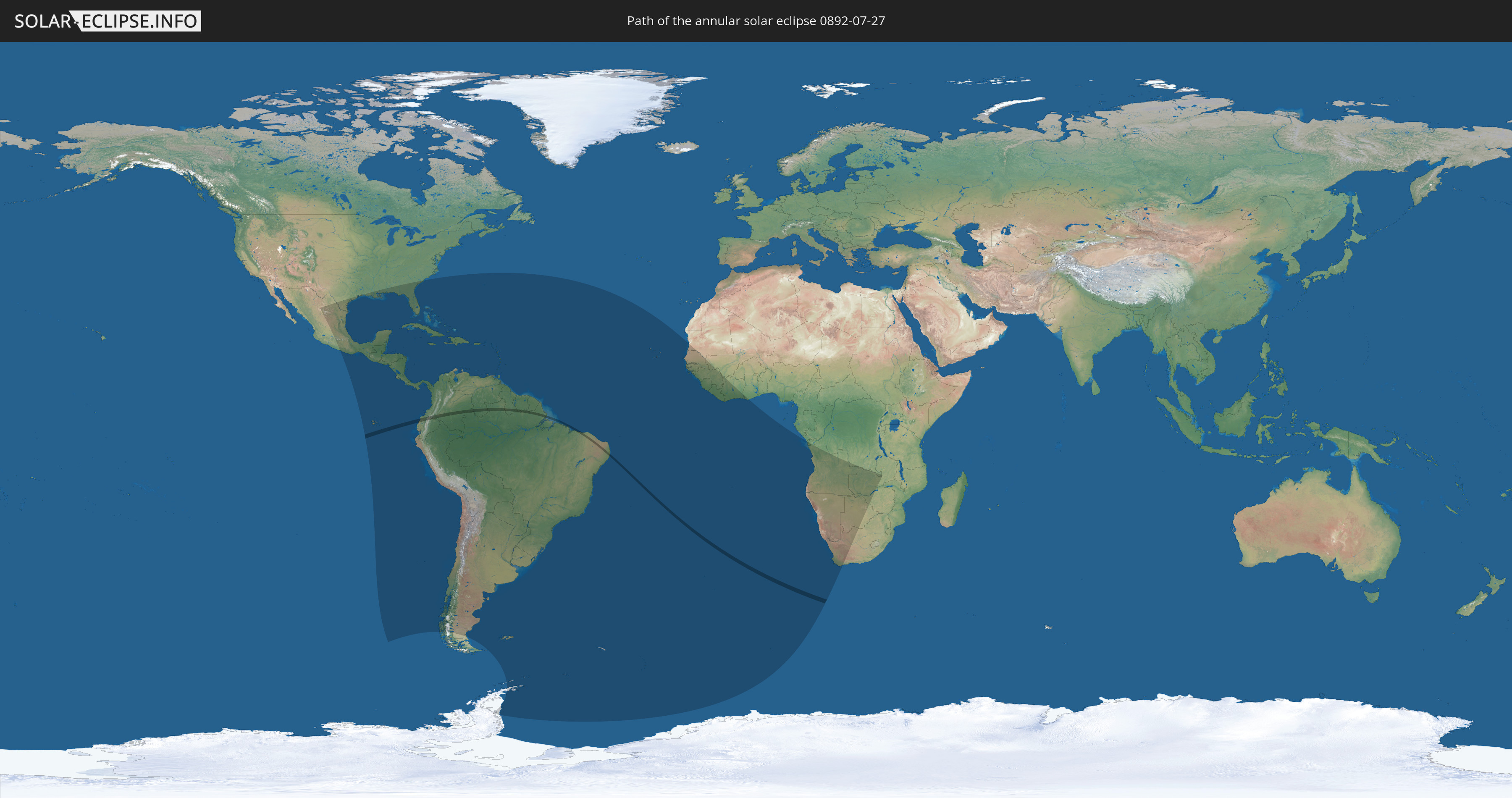
Annular solar eclipse of 07/27/0892
| Day of week: | Sunday |
| Maximum duration of eclipse: | 01m22s |
| Maximum width of eclipse path: | 48 km |
| Saros cycle: | 108 |
| Coverage: | 98.8% |
| Magnitude: | 0.9877 |
| Gamma: | -0.4218 |
Wo kann man die Sonnenfinsternis vom 07/27/0892 sehen?
Die Sonnenfinsternis am 07/27/0892 kann man in 73 Ländern als partielle Sonnenfinsternis beobachten.
Der Finsternispfad verläuft durch 7 Länder. Nur in diesen Ländern ist sie als annular Sonnenfinsternis zu sehen.
In den folgenden Ländern ist die Sonnenfinsternis annular zu sehen
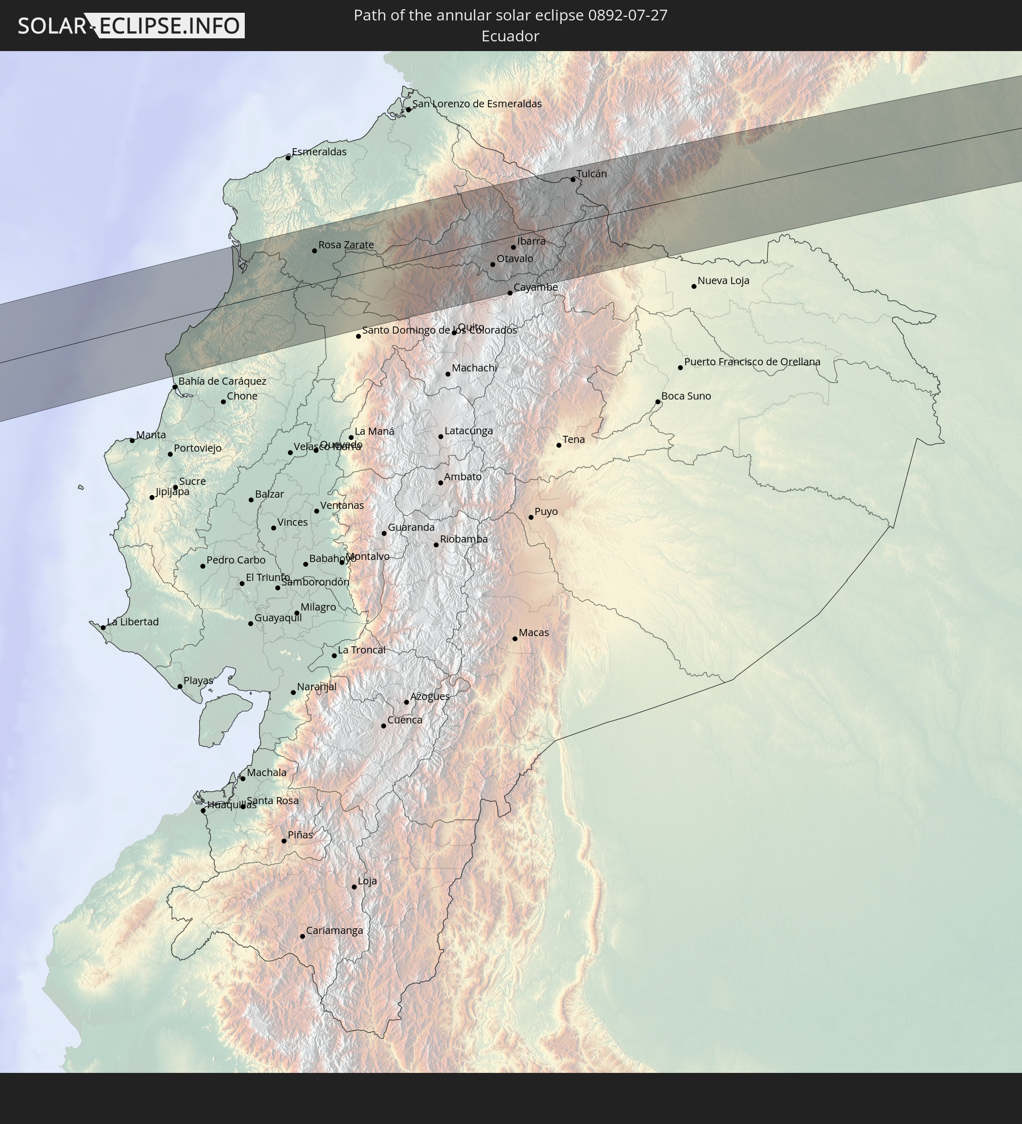 Ecuador
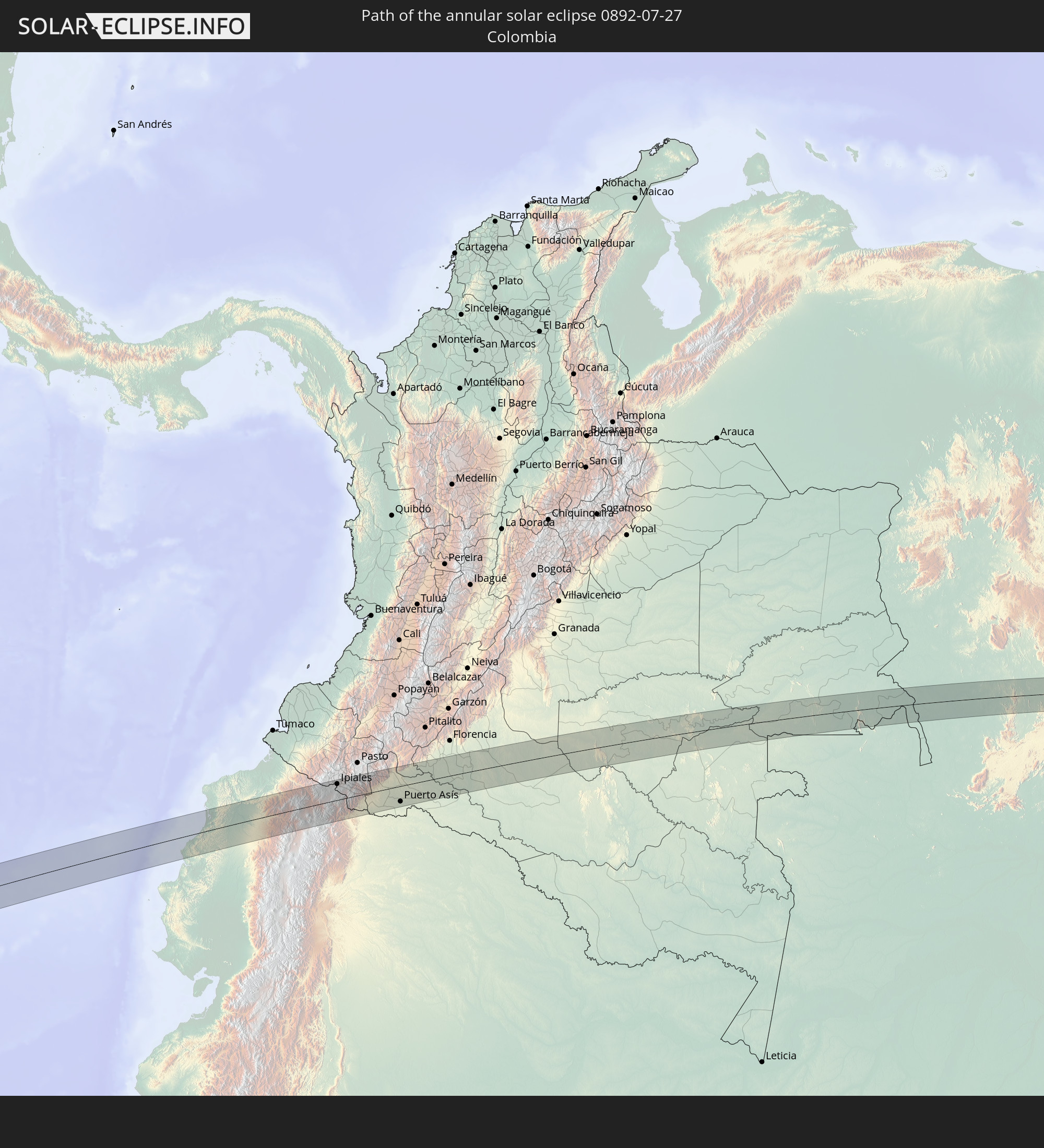 Colombia
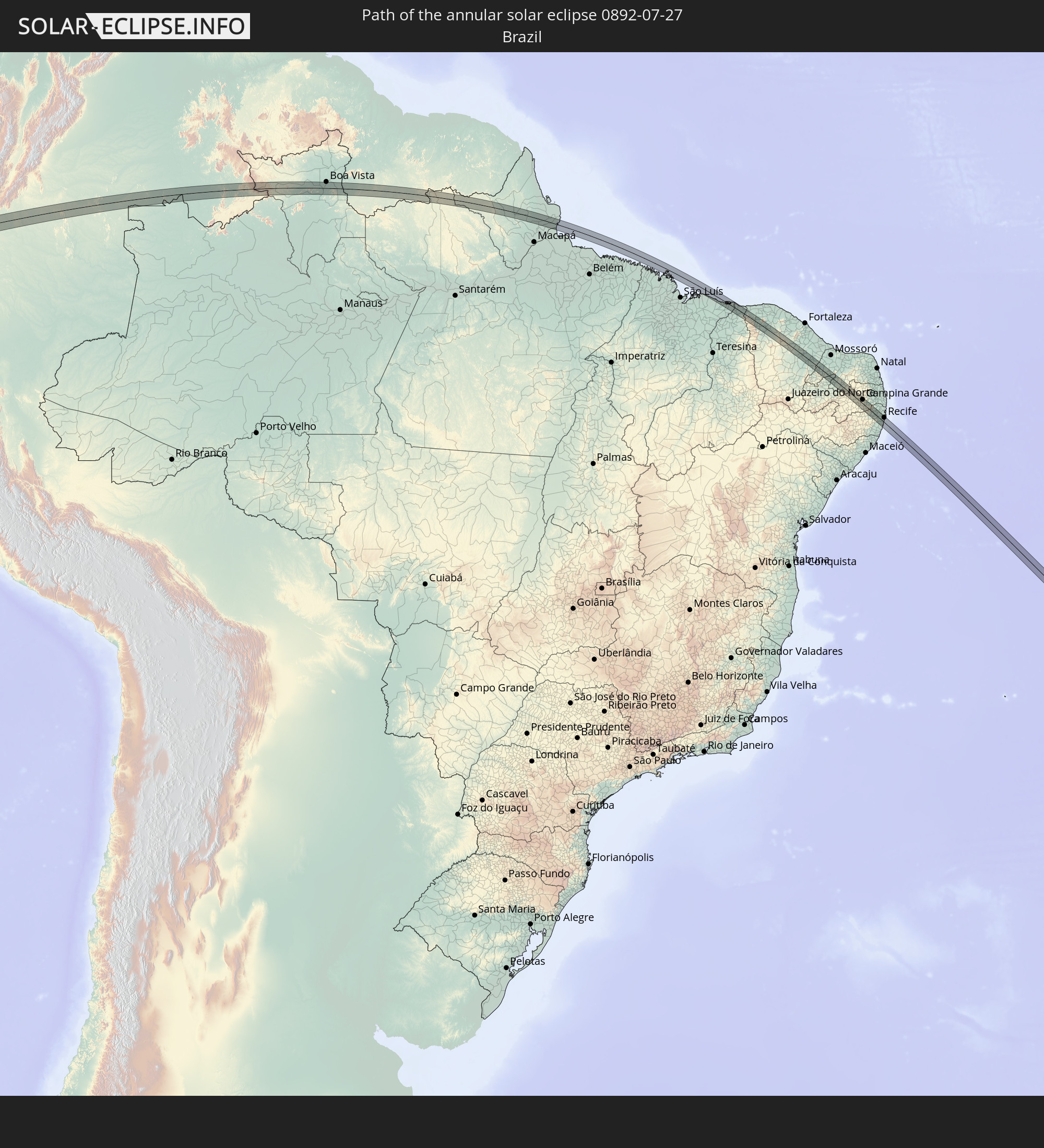 Brazil
 Venezuela
 Guyana
 Suriname
 French Guiana
In den folgenden Ländern ist die Sonnenfinsternis partiell zu sehen
 Antarctica
 United States
 United States Minor Outlying Islands
 Mexico
 Chile
Chile
 Guatemala
 Ecuador
 El Salvador
 Honduras
 Belize
 Nicaragua
 Costa Rica
 Cuba
Cuba
 Panama
 Colombia
 Cayman Islands
 Peru
Peru
 The Bahamas
 Jamaica
 Haiti
Haiti
 Brazil
 Argentina
 Venezuela
 Turks and Caicos Islands
 Dominican Republic
 Aruba
Aruba
 Bolivia
 Puerto Rico
 United States Virgin Islands
 Bermuda
 British Virgin Islands
 Anguilla
 Collectivity of Saint Martin
 Saint Barthélemy
 Saint Kitts and Nevis
 Paraguay
 Antigua and Barbuda
 Montserrat
 Trinidad and Tobago
 Guadeloupe
 Grenada
 Dominica
 Saint Vincent and the Grenadines
 Falkland Islands
 Guyana
 Martinique
 Saint Lucia
 Barbados
 Uruguay
 Suriname
 French Guiana
 South Georgia and the South Sandwich Islands
 Cabo Verde
 Senegal
 Mauritania
 The Gambia
 Guinea-Bissau
 Guinea
 Saint Helena, Ascension and Tristan da Cunha
 Sierra Leone
 Mali
Mali
 Liberia
 Ivory Coast
 Ghana
Ghana
 Bouvet Island
 Equatorial Guinea
 Angola
 Namibia
 Democratic Republic of the Congo
 South Africa
 Botswana
 Zambia
 Zimbabwe
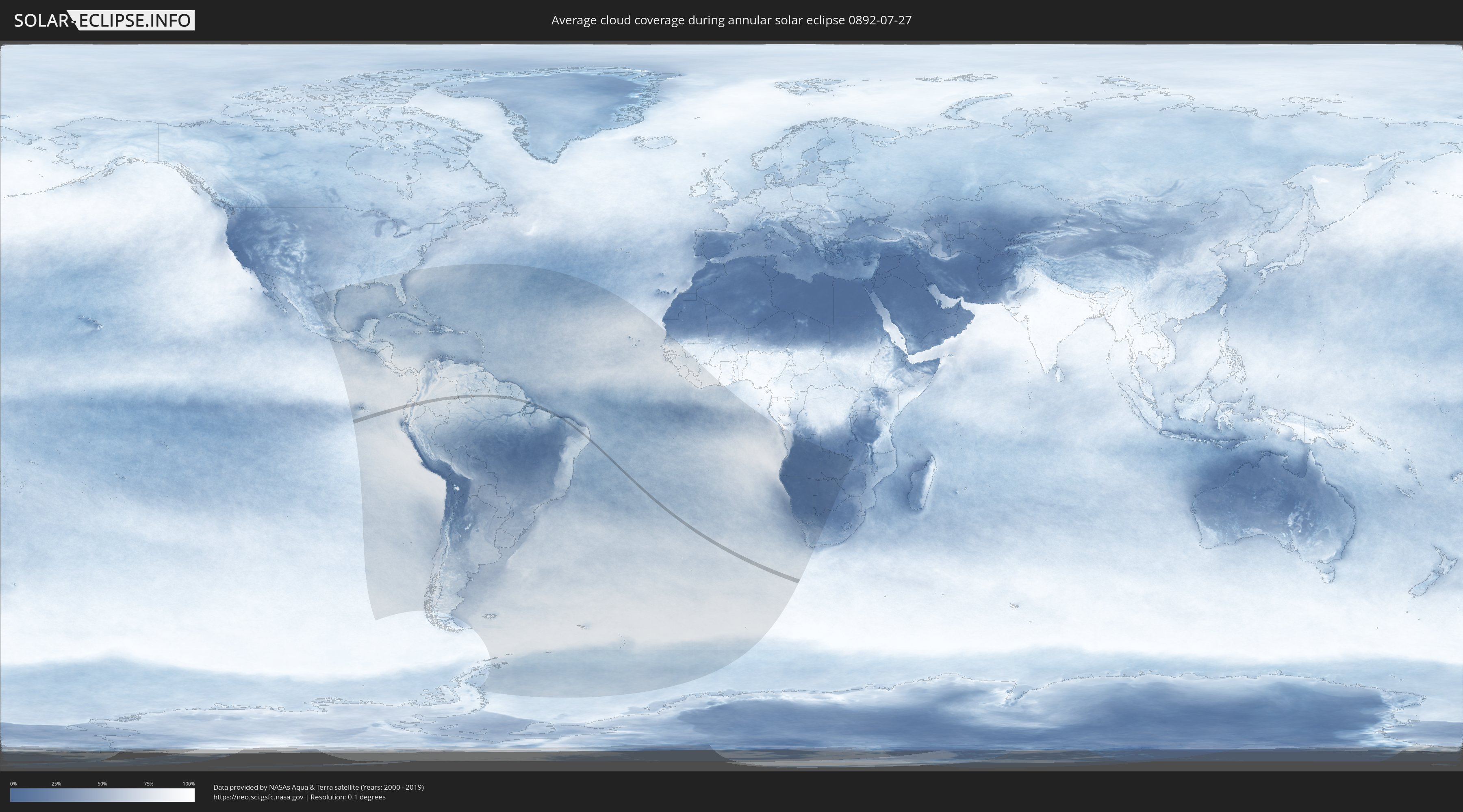
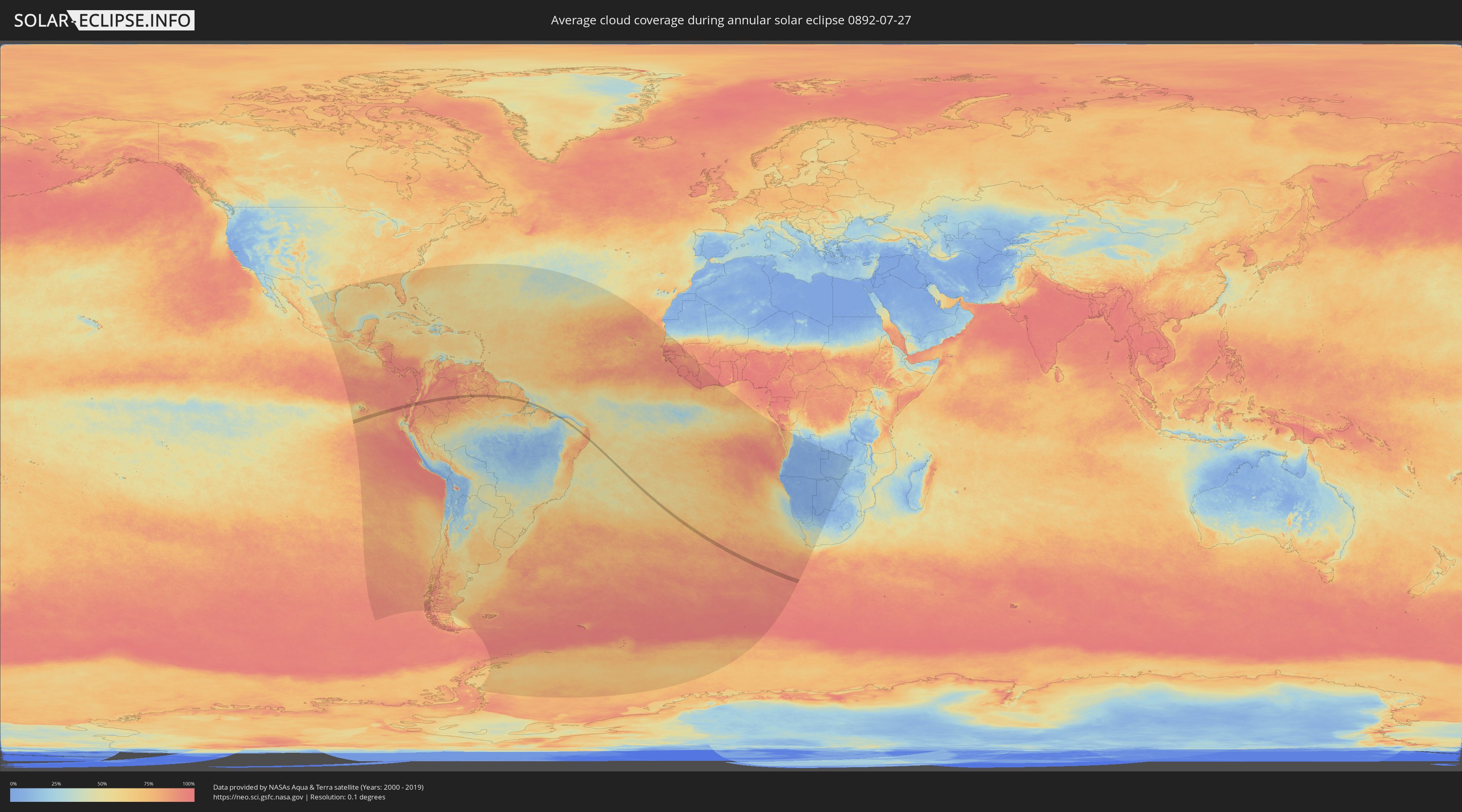
How will be the weather during the annular solar eclipse on 07/27/0892?
Where is the best place to see the annular solar eclipse of 07/27/0892?
The following maps show the average cloud coverage for the day of the annular solar eclipse.
With the help of these maps, it is possible to find the place along the eclipse path, which has the best
chance of a cloudless sky.
Nevertheless, you should consider local circumstances and inform about the weather of your chosen
observation site.
The data is provided by NASAs satellites
AQUA and TERRA.
The cloud maps are averaged over a period of 19 years (2000 - 2019).
Detailed country maps
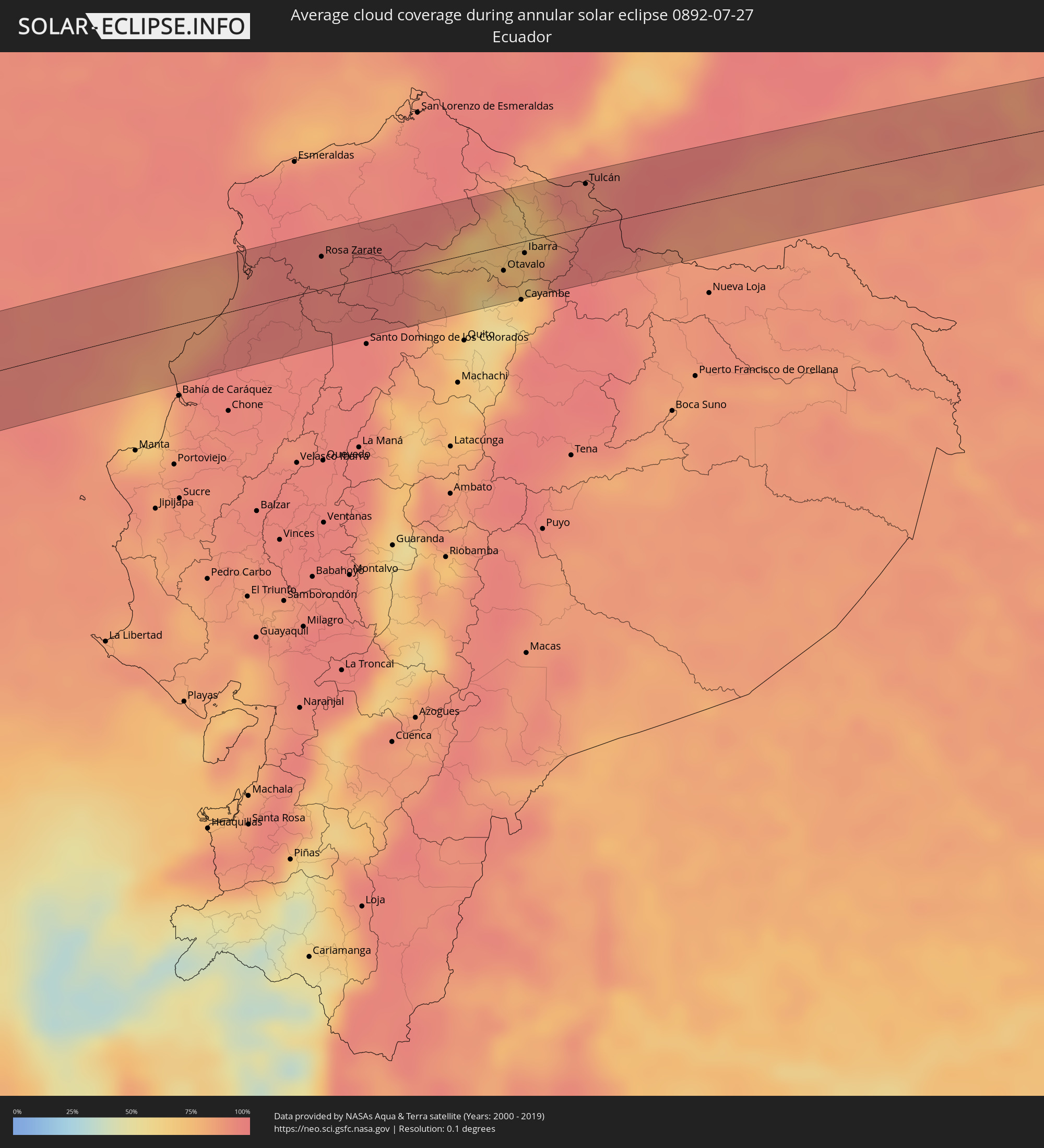 Ecuador
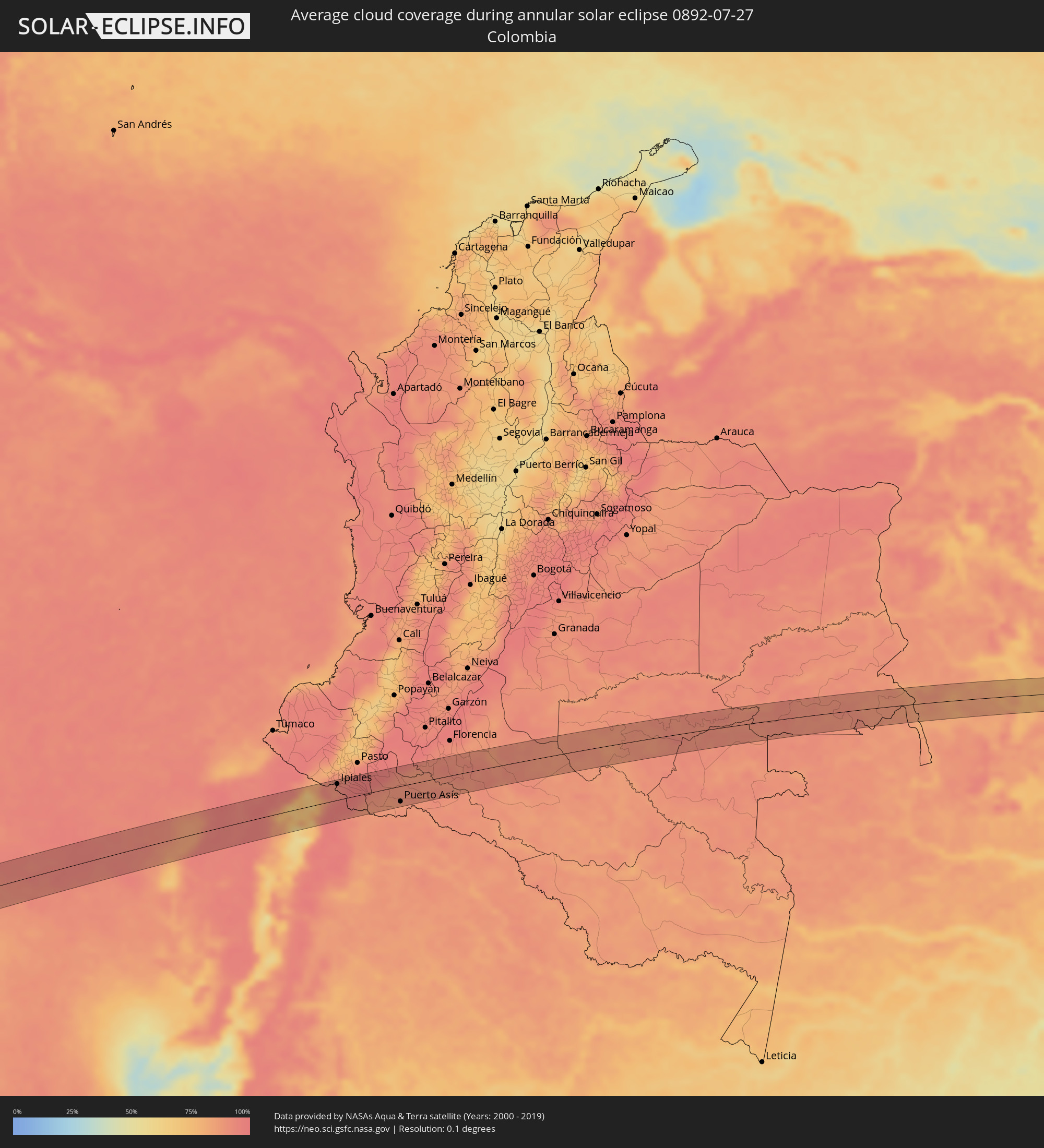 Colombia
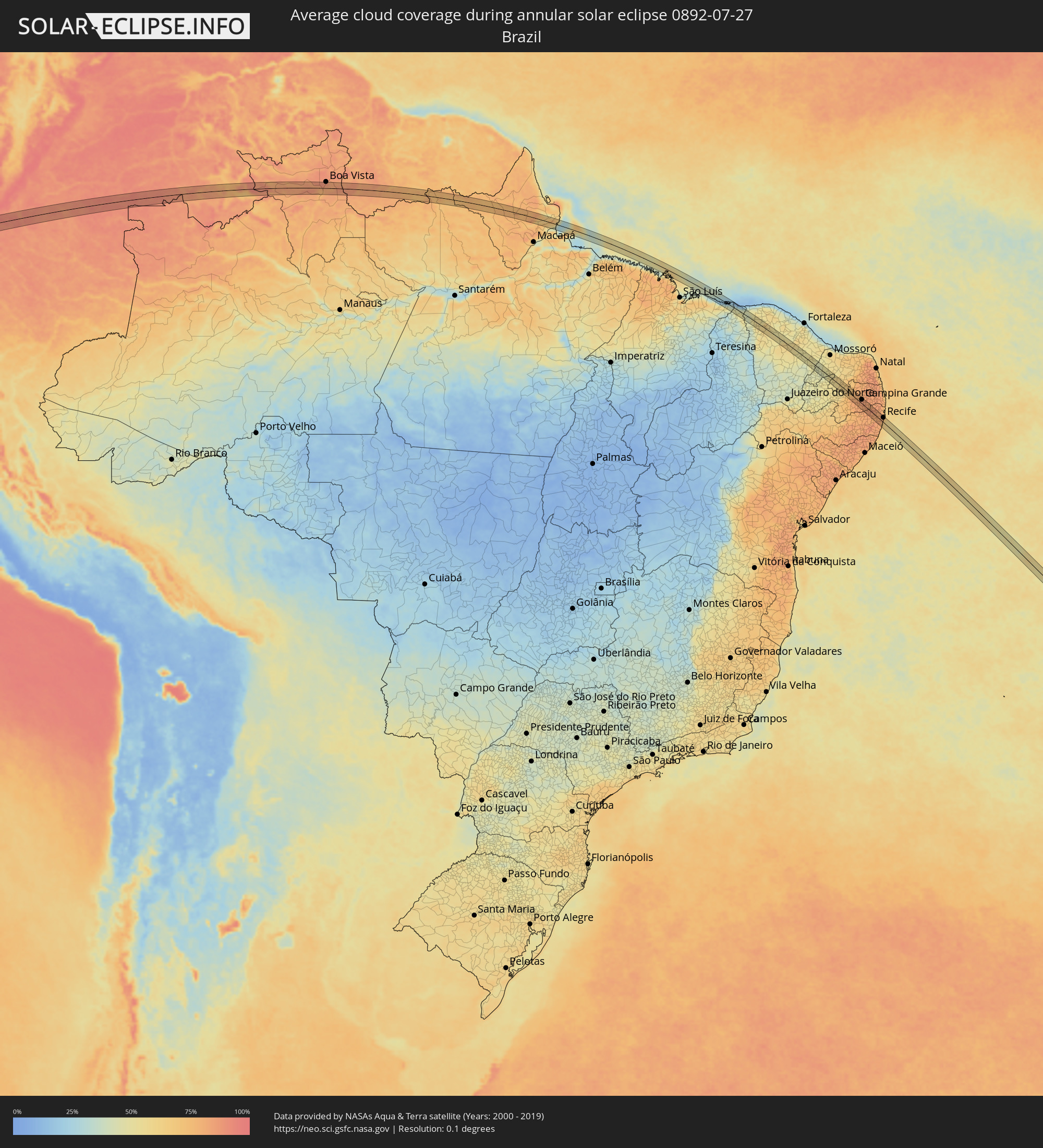 Brazil
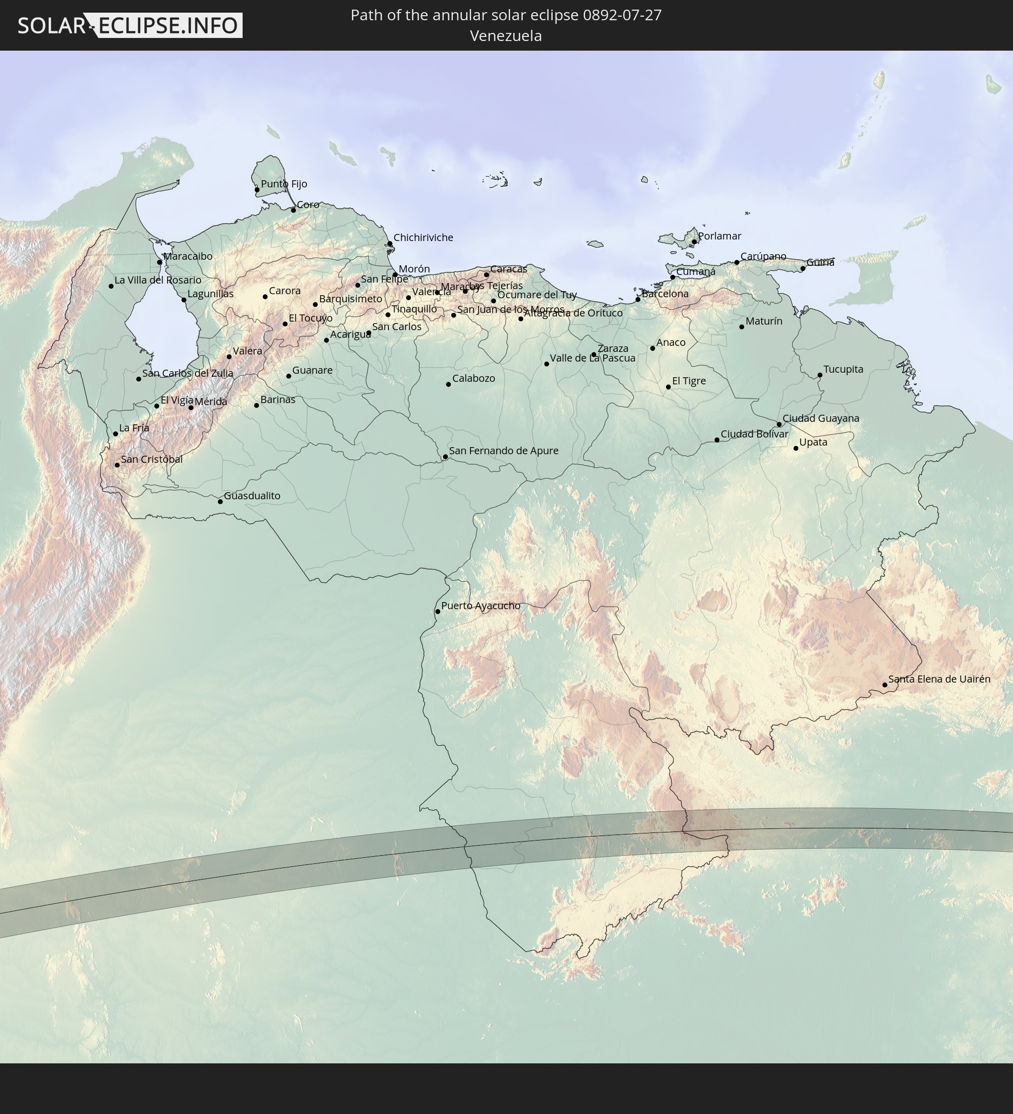
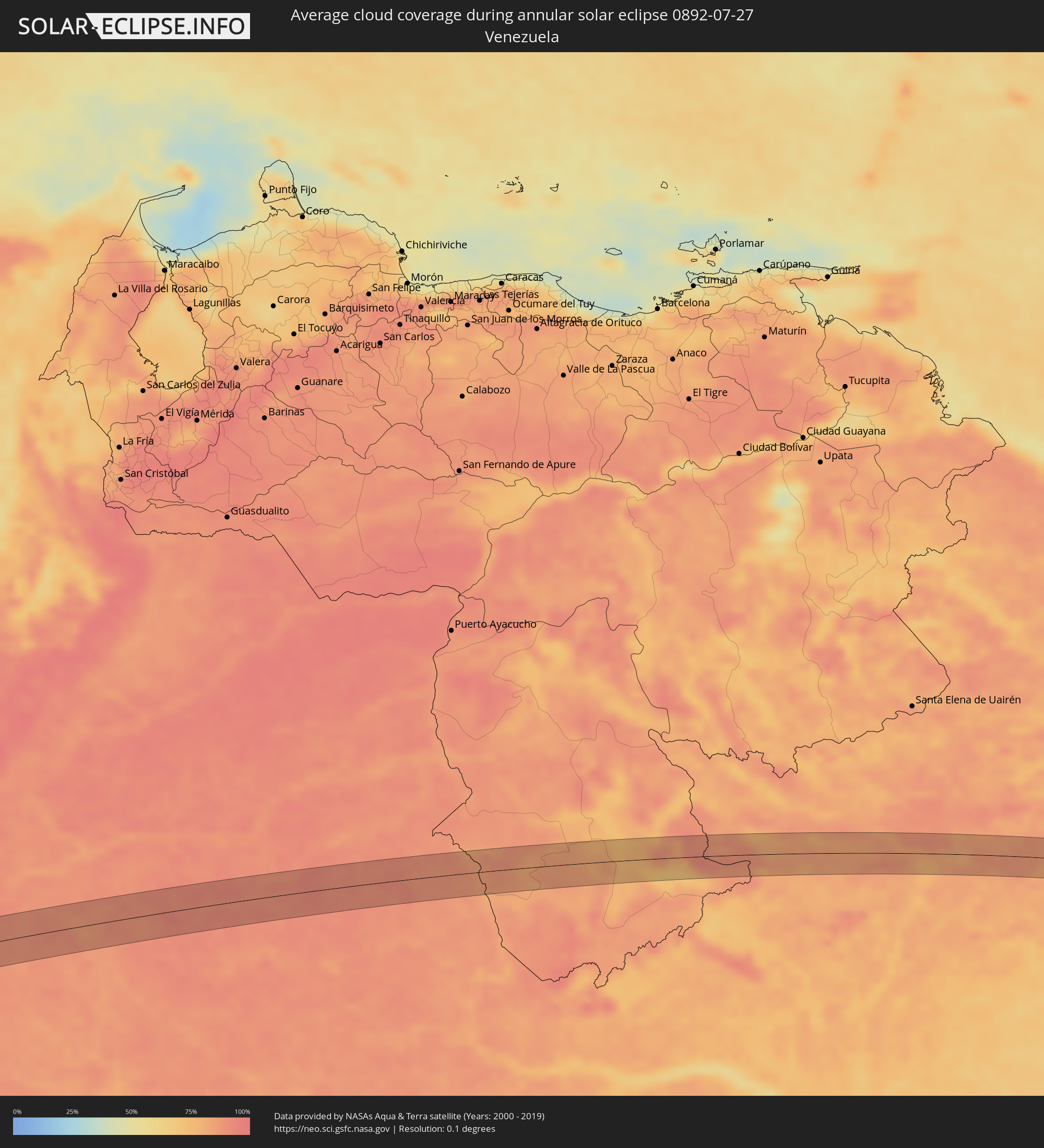 Venezuela
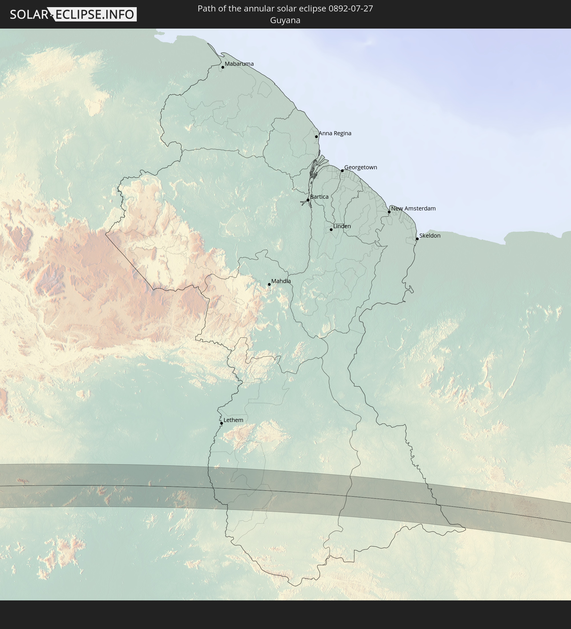
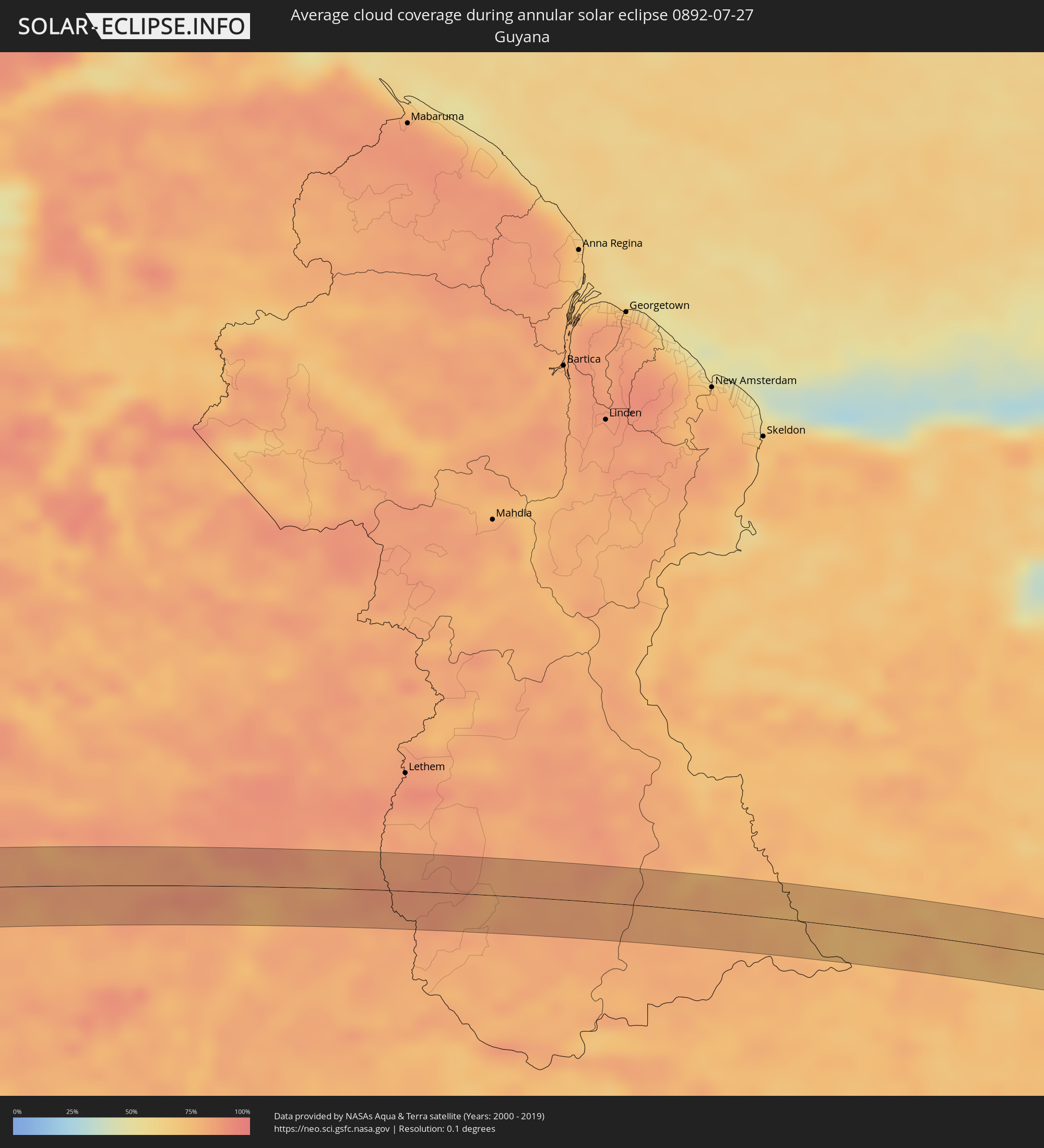 Guyana
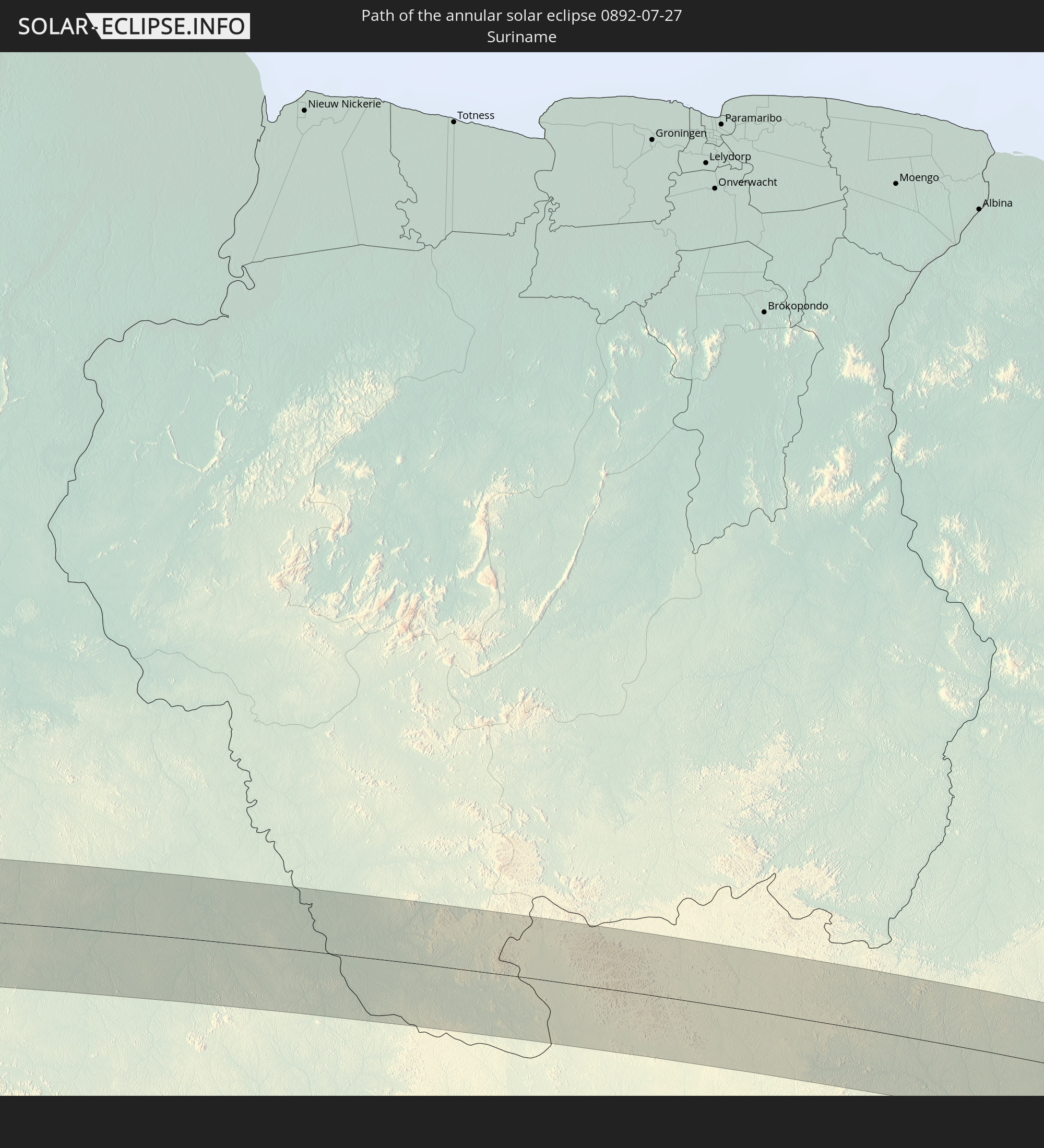
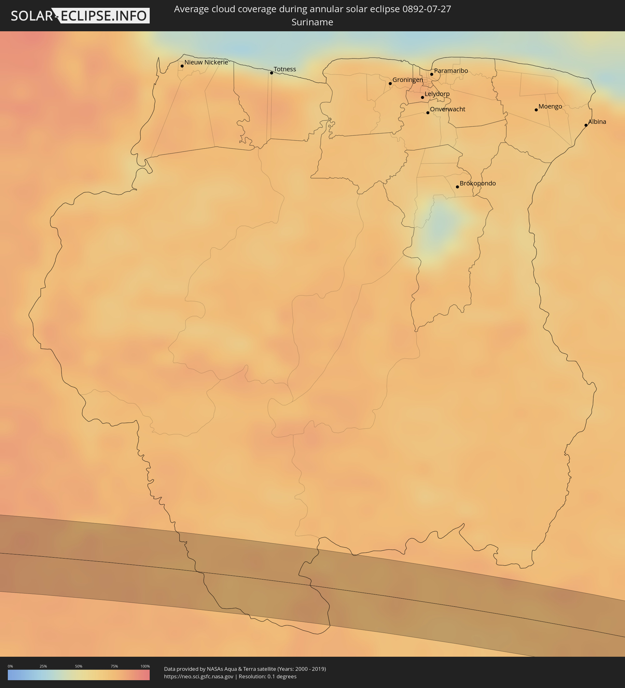 Suriname
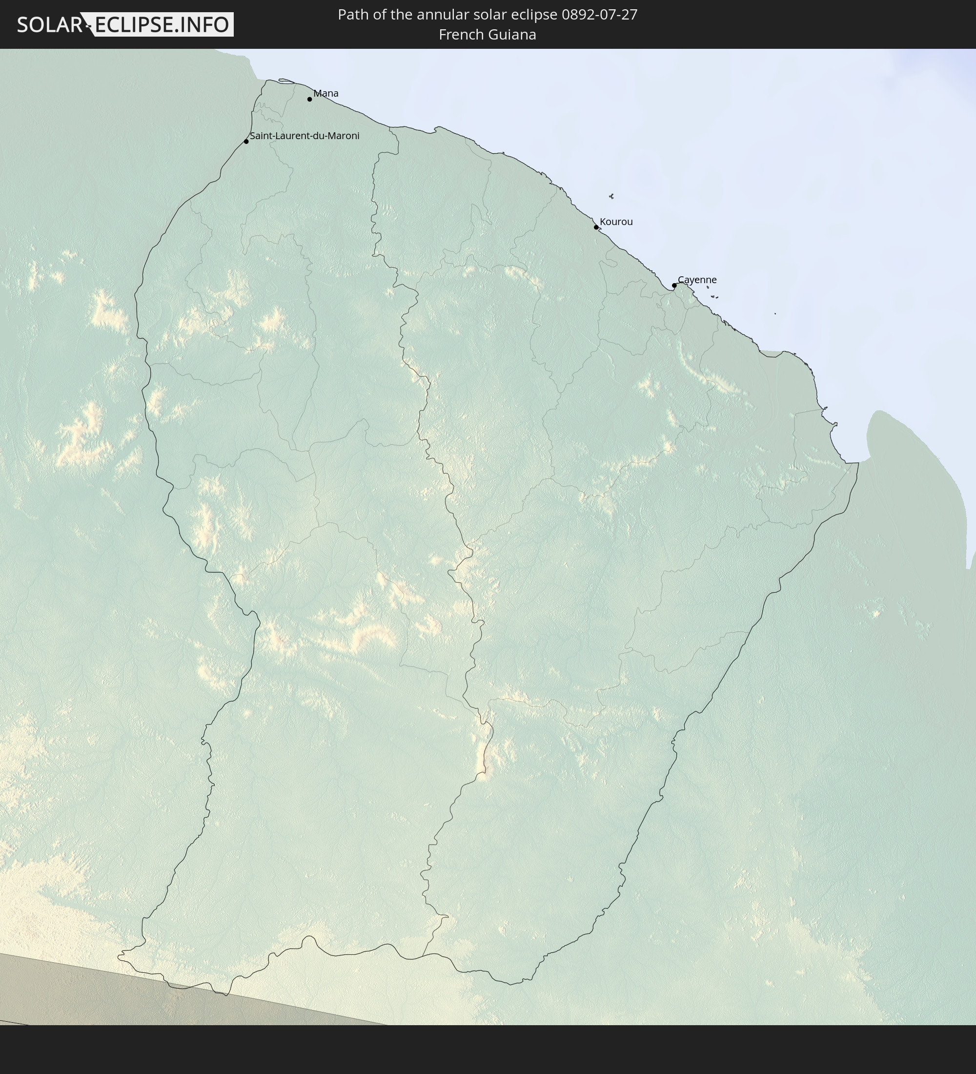
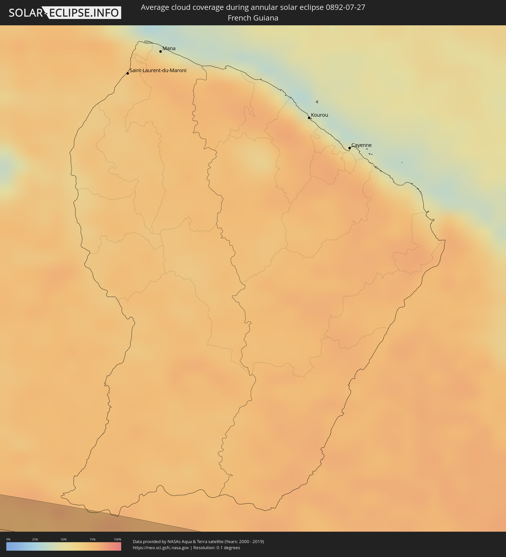 French Guiana
Cities inside the path of the eclipse
The following table shows all locations with a population of more than 5,000 inside the eclipse path. Cities which have more than 100,000 inhabitants are marked bold. A click at the locations opens a detailed map.
| City | Type | Eclipse duration | Local time of max. eclipse | Distance to central line | Ø Cloud coverage |
|
Pedernales, Manabí
|
annular | - | 07:11:45 UTC-05:14 | 11 km | 89% |
|
Rosa Zarate, Esmeraldas
|
annular | - | 07:12:04 UTC-05:14 | 23 km | 95% |
|
Cotacachi, Imbabura
|
annular | - | 07:13:07 UTC-05:14 | 11 km | 72% |
|
Otavalo, Imbabura
|
annular | - | 07:13:09 UTC-05:14 | 18 km | 80% |
|
Atuntaqui, Imbabura
|
annular | - | 07:13:09 UTC-05:14 | 8 km | 72% |
|
Ibarra, Imbabura
|
annular | - | 07:13:13 UTC-05:14 | 9 km | 75% |
|
Pimampiro, Imbabura
|
annular | - | 07:13:21 UTC-05:14 | 9 km | 89% |
|
San Gabriel, Carchi
|
annular | - | 07:13:20 UTC-05:14 | 10 km | 90% |
|
Tulcán, Carchi
|
annular | - | 07:13:19 UTC-05:14 | 31 km | 90% |
|
Ipiales, Nariño
|
annular | - | 07:31:06 UTC-04:56 | 32 km | 93% |
|
Pupiales, Nariño
|
annular | - | 07:31:05 UTC-04:56 | 36 km | 94% |
|
Valle del Guamuez, Putumayo
|
annular | - | 07:32:00 UTC-04:56 | 27 km | 89% |
|
San Miguel, Putumayo
|
annular | - | 07:32:05 UTC-04:56 | 39 km | 87% |
|
Orito, Putumayo
|
annular | - | 07:31:55 UTC-04:56 | 5 km | 91% |
|
Villagarzón, Putumayo
|
annular | - | 07:31:57 UTC-04:56 | 30 km | 91% |
|
Puerto Asís, Putumayo
|
annular | - | 07:32:23 UTC-04:56 | 30 km | 87% |
|
Curillo, Caquetá
|
annular | - | 07:32:39 UTC-04:56 | 13 km | 88% |
|
Cartagena del Chairá, Caquetá
|
annular | - | 07:33:37 UTC-04:56 | 22 km | 86% |
|
Boa Vista, Roraima
|
annular | - | 08:48:21 UTC-04:02 | 32 km | 87% |
|
Tutóia, Maranhão
|
annular | - | 11:14:29 UTC-02:34 | 6 km | 53% |
|
Araioses, Maranhão
|
annular | - | 11:15:50 UTC-02:34 | 4 km | 47% |
|
Buriti dos Lopes, Piauí
|
annular | - | 11:16:28 UTC-02:34 | 21 km | 39% |
|
Parnaíba, Piauí
|
annular | - | 11:16:14 UTC-02:34 | 10 km | 46% |
|
Luís Correia, Piauí
|
annular | - | 11:16:30 UTC-02:34 | 19 km | 45% |
|
Viçosa do Ceará, Ceará
|
annular | - | 11:19:30 UTC-02:34 | 10 km | 45% |
|
Tianguá, Ceará
|
annular | - | 11:20:07 UTC-02:34 | 20 km | 42% |
|
Coreaú, Ceará
|
annular | - | 11:20:43 UTC-02:34 | 19 km | 55% |
|
Cariré, Ceará
|
annular | - | 11:22:03 UTC-02:34 | 8 km | 59% |
|
Forquilha, Ceará
|
annular | - | 11:22:23 UTC-02:34 | 20 km | 56% |
|
Santa Quitéria, Ceará
|
annular | - | 11:23:43 UTC-02:34 | 22 km | 51% |
|
Quixadá, Ceará
|
annular | - | 11:28:16 UTC-02:34 | 6 km | 53% |
|
Umarizal, Rio Grande do Norte
|
annular | - | 11:33:41 UTC-02:34 | 14 km | 44% |
|
Apodi, Rio Grande do Norte
|
annular | - | 11:33:06 UTC-02:34 | 15 km | 47% |
|
Patu, Rio Grande do Norte
|
annular | - | 11:34:26 UTC-02:34 | 12 km | 46% |
|
Caraúbas, Rio Grande do Norte
|
annular | - | 11:34:02 UTC-02:34 | 21 km | 48% |
|
Belém do Brejo do Cruz, Paraíba
|
annular | - | 11:34:52 UTC-02:34 | 12 km | 49% |
|
Jardim de Piranhas, Rio Grande do Norte
|
annular | - | 11:35:45 UTC-02:34 | 16 km | 52% |
|
Caicó, Rio Grande do Norte
|
annular | - | 11:36:37 UTC-02:34 | 5 km | 55% |
|
Jardim do Seridó, Rio Grande do Norte
|
annular | - | 11:37:46 UTC-02:34 | 7 km | 60% |
|
Parelhas, Rio Grande do Norte
|
annular | - | 11:38:18 UTC-02:34 | 6 km | 62% |
|
Soledade, Paraíba
|
annular | - | 11:39:50 UTC-02:34 | 4 km | 81% |
|
Pocinhos, Paraíba
|
annular | - | 11:40:42 UTC-02:34 | 15 km | 80% |
|
Campina Grande, Paraíba
|
annular | - | 11:41:29 UTC-02:34 | 15 km | 85% |
|
Lagoa Seca, Paraíba
|
annular | - | 11:41:27 UTC-02:34 | 22 km | 85% |
|
Fagundes, Paraíba
|
annular | - | 11:42:01 UTC-02:34 | 12 km | 83% |
|
Aroeiras, Paraíba
|
annular | - | 11:42:34 UTC-02:34 | 1 km | 82% |
|
Orobó, Pernambuco
|
annular | - | 11:57:38 UTC-02:19 | 8 km | 83% |
|
João Alfredo, Pernambuco
|
annular | - | 11:57:53 UTC-02:19 | 16 km | 81% |
|
Bom Jardim, Pernambuco
|
annular | - | 11:57:47 UTC-02:19 | 11 km | 84% |
|
Macaparana, Pernambuco
|
annular | - | 11:57:41 UTC-02:19 | 19 km | 88% |
|
Limoeiro, Pernambuco
|
annular | - | 11:58:18 UTC-02:19 | 8 km | 81% |
|
Feira Nova, Pernambuco
|
annular | - | 11:58:37 UTC-02:19 | 10 km | 79% |
|
Vicência, Pernambuco
|
annular | - | 11:58:13 UTC-02:19 | 19 km | 82% |
|
Glória do Goitá, Pernambuco
|
annular | - | 11:58:58 UTC-02:19 | 7 km | 81% |
|
Vitória de Santo Antão, Pernambuco
|
annular | - | 11:59:12 UTC-02:19 | 17 km | 82% |
|
Lagoa do Itaenga, Pernambuco
|
annular | - | 11:58:51 UTC-02:19 | 1 km | 81% |
|
Carpina, Pernambuco
|
annular | - | 11:58:47 UTC-02:19 | 8 km | 81% |
|
Nazaré da Mata, Pernambuco
|
annular | - | 11:58:39 UTC-02:19 | 19 km | 80% |
|
Moreno, Pernambuco
|
annular | - | 11:59:44 UTC-02:19 | 2 km | 81% |
|
Ipojuca, Pernambuco
|
annular | - | 12:00:21 UTC-02:19 | 24 km | 80% |
|
Cabo, Pernambuco
|
annular | - | 12:00:13 UTC-02:19 | 12 km | 72% |
|
São Lourenço da Mata, Pernambuco
|
annular | - | 11:59:43 UTC-02:19 | 13 km | 81% |
|
Jaboatão dos Guararapes, Pernambuco
|
annular | - | 11:59:56 UTC-02:19 | 4 km | 78% |
|
Jaboatão, Pernambuco
|
annular | - | 12:00:06 UTC-02:19 | 1 km | 73% |
|
Recife, Pernambuco
|
annular | - | 12:00:11 UTC-02:19 | 18 km | 66% |