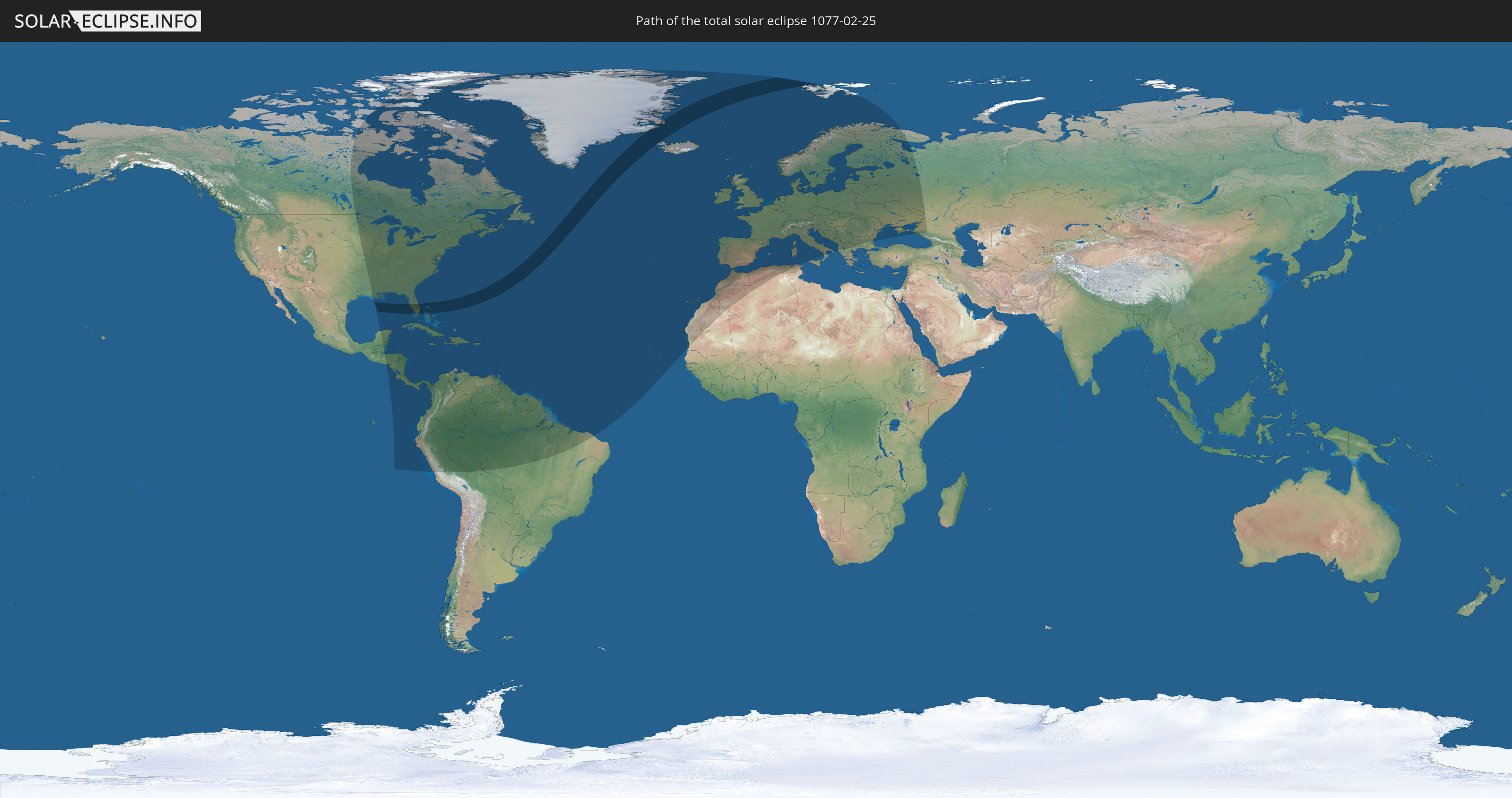
Total solar eclipse of 02/25/1077
| Day of week: | Sunday |
| Maximum duration of eclipse: | 03m40s |
| Maximum width of eclipse path: | 290 km |
| Saros cycle: | 115 |
| Coverage: | 100% |
| Magnitude: | 1.051 |
| Gamma: | 0.8214 |
Wo kann man die Sonnenfinsternis vom 02/25/1077 sehen?
Die Sonnenfinsternis am 02/25/1077 kann man in 103 Ländern als partielle Sonnenfinsternis beobachten.
Der Finsternispfad verläuft durch 5 Länder. Nur in diesen Ländern ist sie als total Sonnenfinsternis zu sehen.
In den folgenden Ländern ist die Sonnenfinsternis total zu sehen
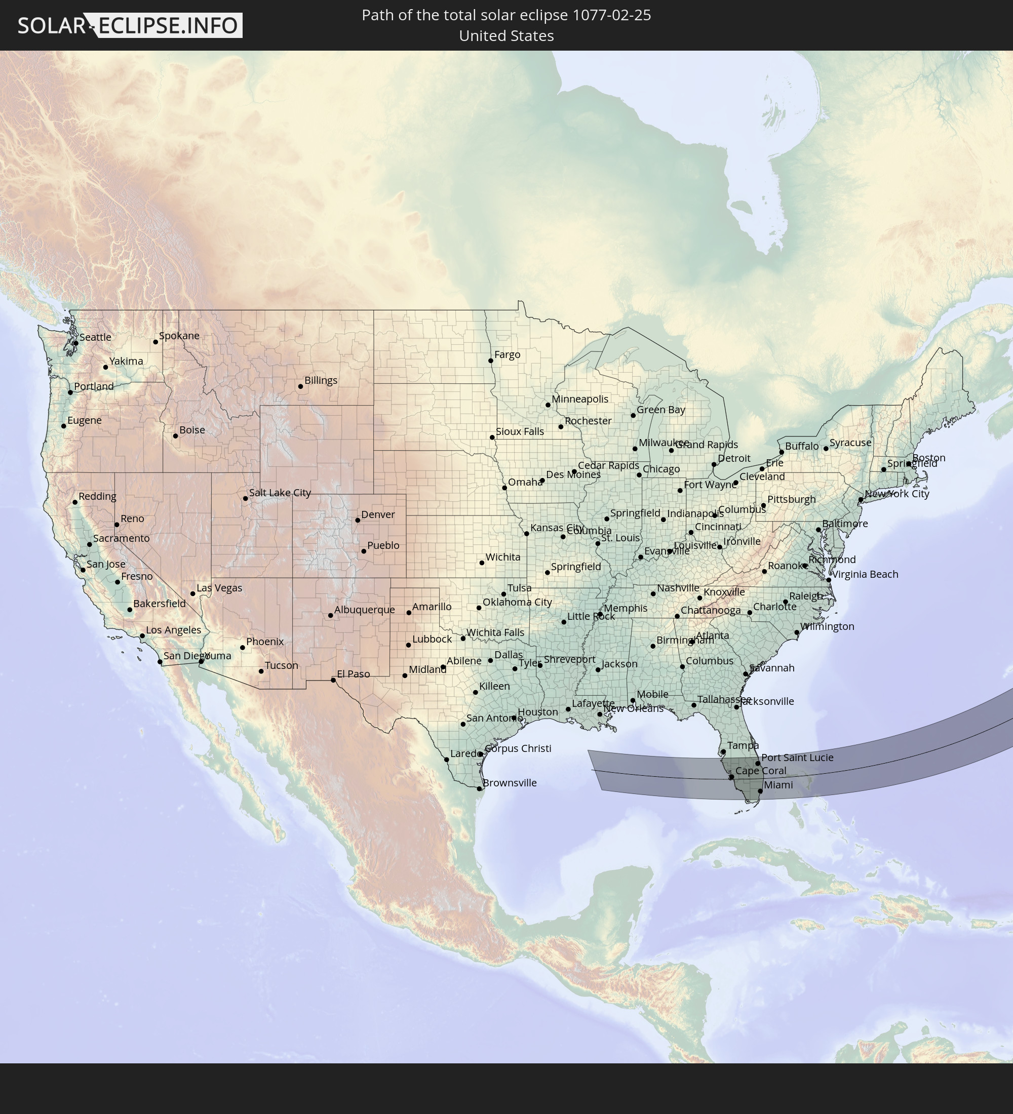 United States
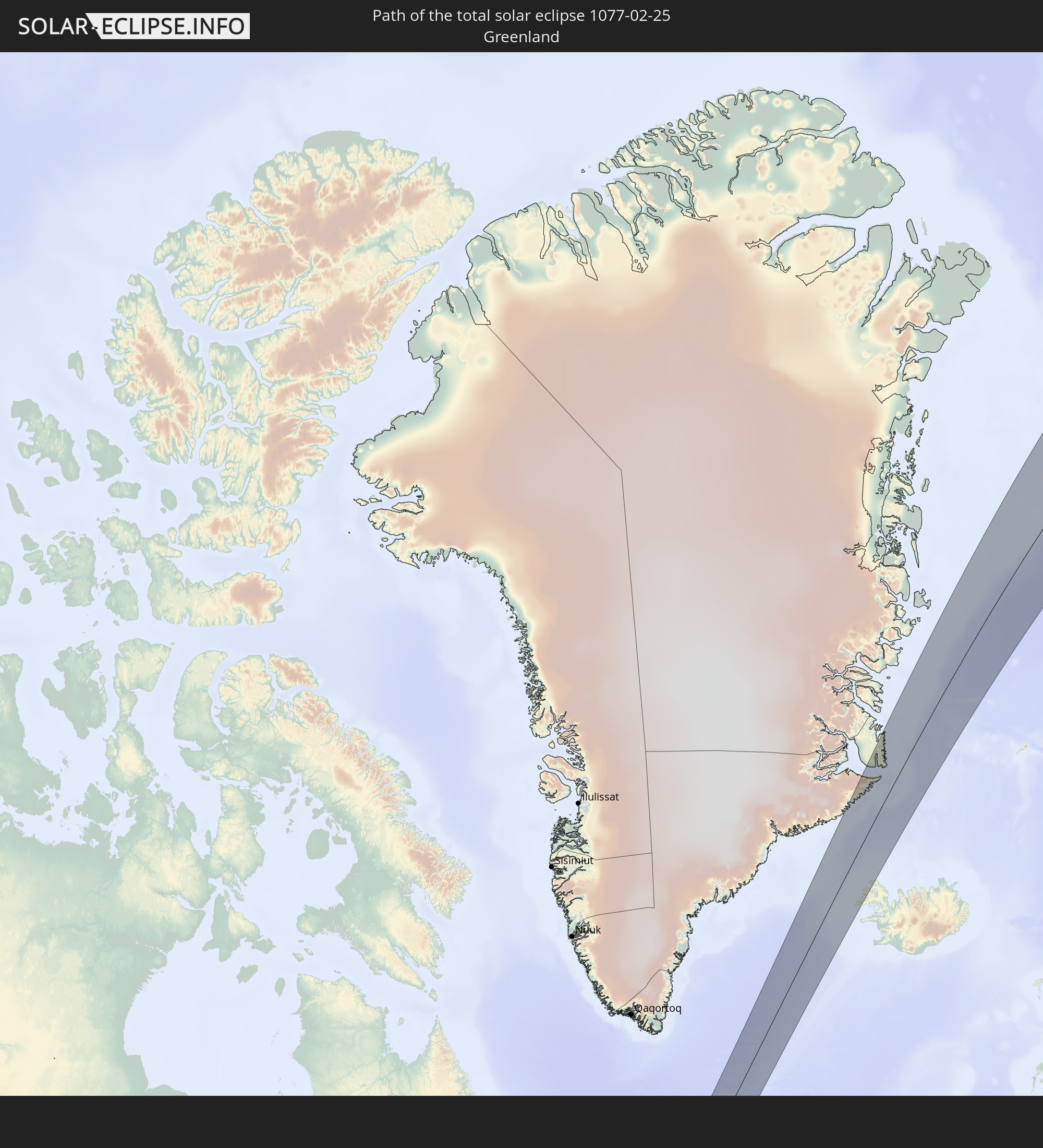 Greenland
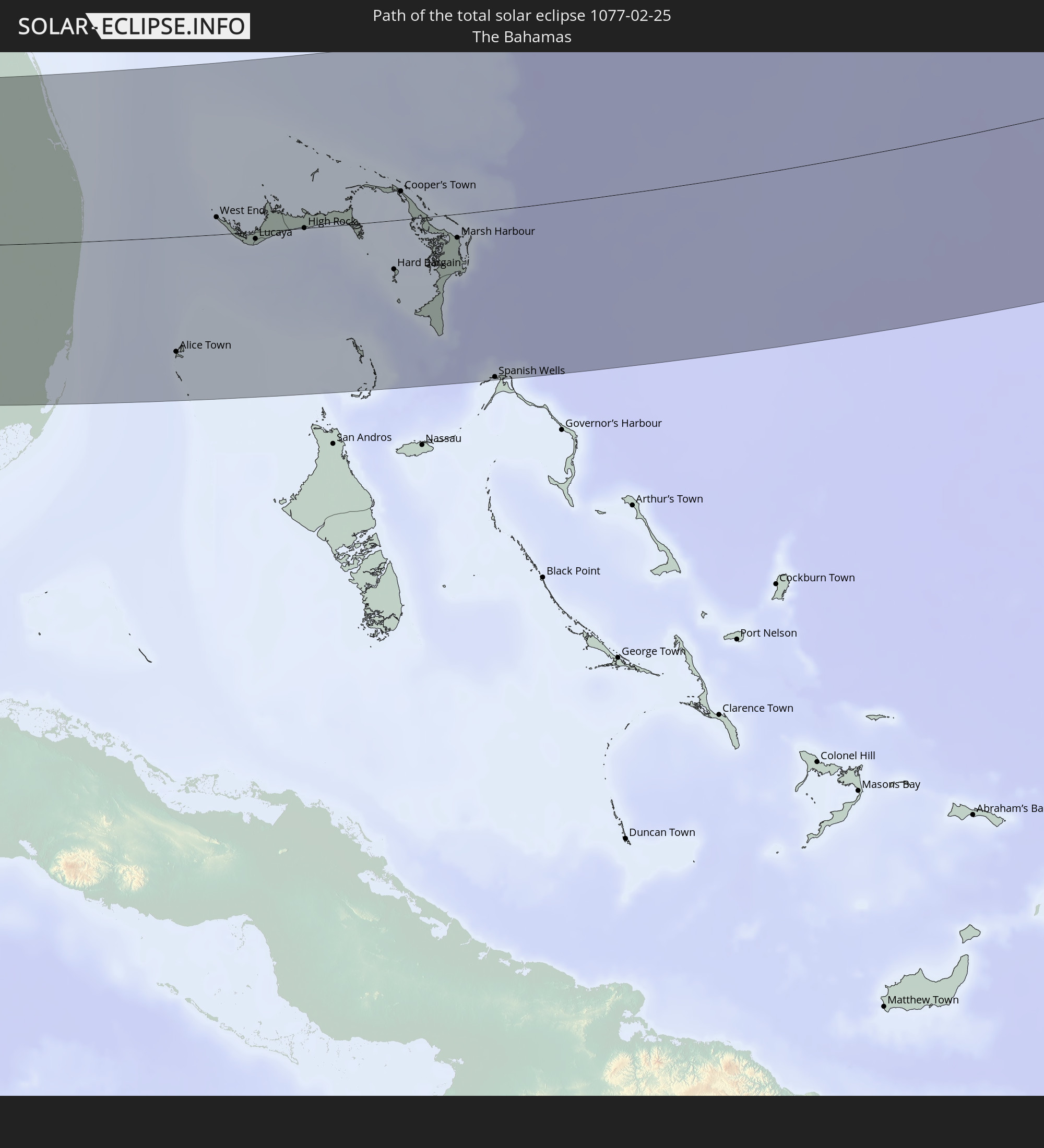 The Bahamas
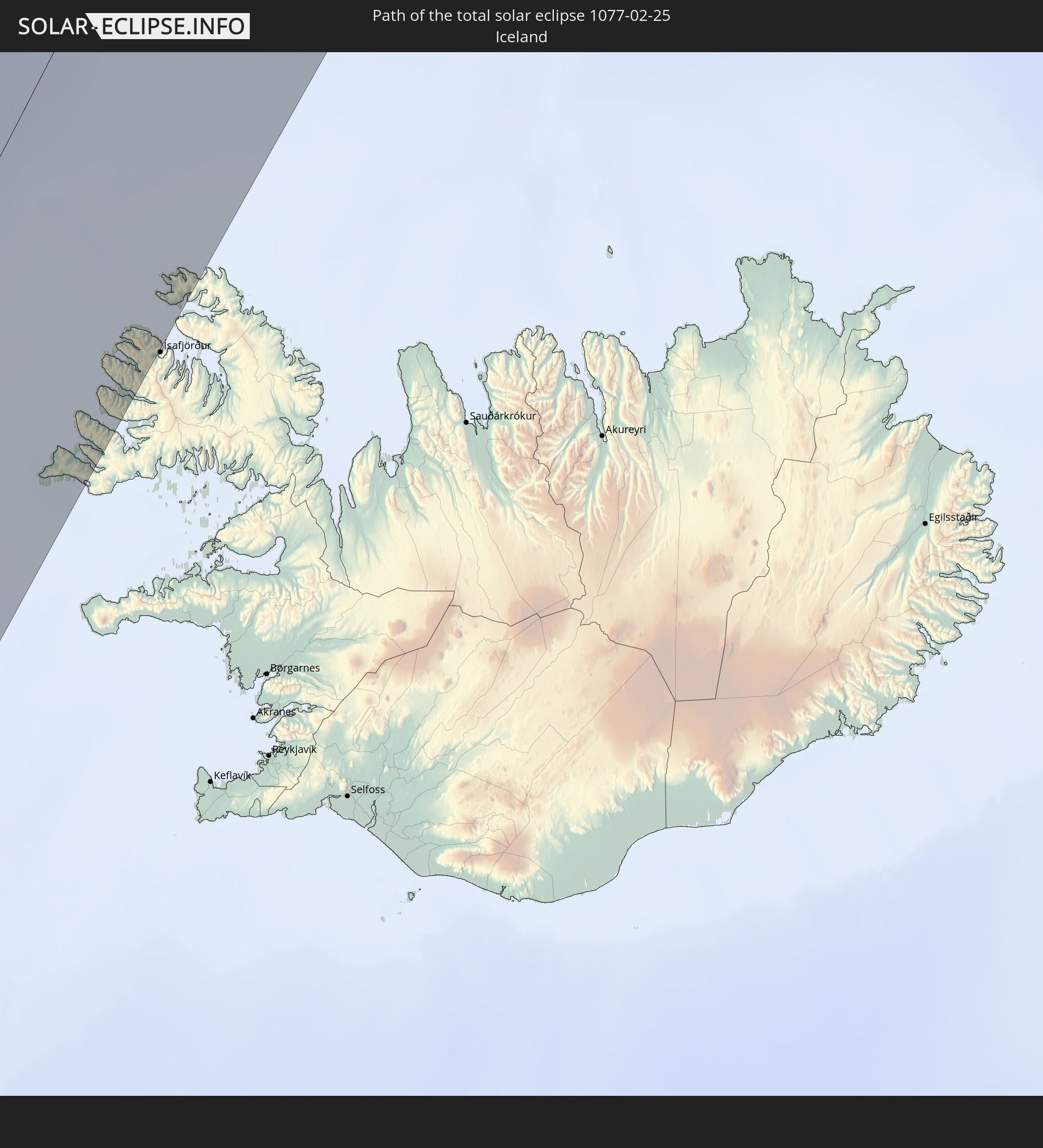 Iceland
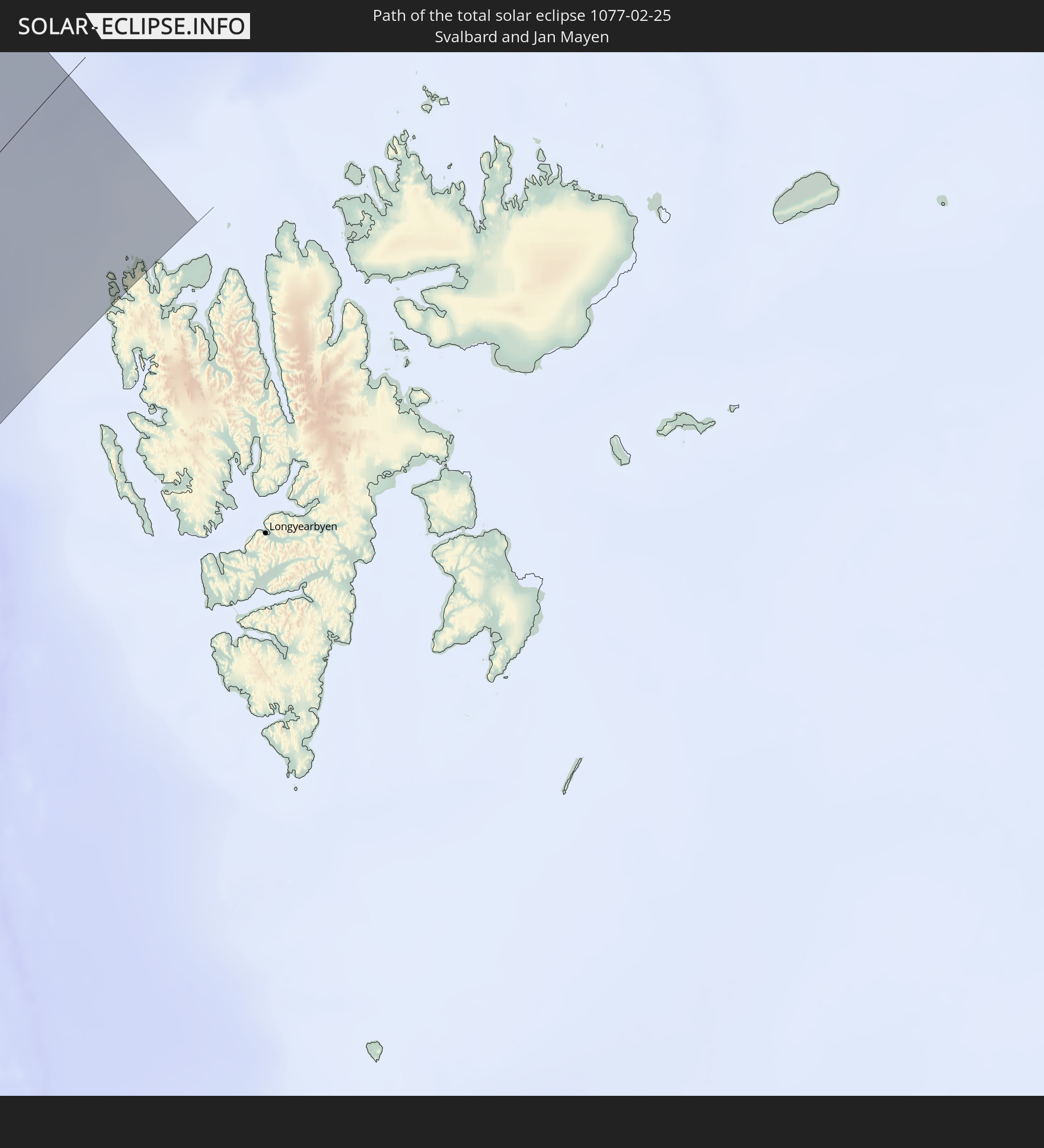 Svalbard and Jan Mayen
In den folgenden Ländern ist die Sonnenfinsternis partiell zu sehen
 Russia
 United States
 United States Minor Outlying Islands
 Canada
 Mexico
 Greenland
 Guatemala
 Ecuador
 El Salvador
 Honduras
 Belize
 Nicaragua
 Costa Rica
 Cuba
Cuba
 Panama
 Colombia
 Cayman Islands
 Peru
Peru
 The Bahamas
 Jamaica
 Haiti
Haiti
 Brazil
 Venezuela
 Turks and Caicos Islands
 Dominican Republic
 Aruba
Aruba
 Bolivia
 Puerto Rico
 United States Virgin Islands
 Bermuda
 British Virgin Islands
 Anguilla
 Collectivity of Saint Martin
 Saint Barthélemy
 Saint Kitts and Nevis
 Antigua and Barbuda
 Montserrat
 Trinidad and Tobago
 Guadeloupe
 Grenada
 Dominica
 Saint Vincent and the Grenadines
 Guyana
 Martinique
 Saint Lucia
 Barbados
 Suriname
 Saint Pierre and Miquelon
 French Guiana
 Portugal
 Cabo Verde
 Iceland
 Spain
Spain
 Mauritania
 Morocco
 Republic of Ireland
 Svalbard and Jan Mayen
 Algeria
 United Kingdom
 Faroe Islands
 Gibraltar
 France
 Isle of Man
 Guernsey
 Jersey
 Andorra
 Belgium
 Netherlands
 Norway
 Luxembourg
 Germany
 Switzerland
 Italy
Italy
 Monaco
 Tunisia
 Denmark
 Liechtenstein
 Austria
 Sweden
 Czechia
 San Marino
 Vatican City
 Slovenia
 Croatia
 Poland
 Bosnia and Herzegovina
 Hungary
 Slovakia
 Montenegro
 Serbia
 Albania
 Åland Islands
 Greece
 Romania
 Republic of Macedonia
 Finland
 Lithuania
 Latvia
 Estonia
 Ukraine
 Bulgaria
 Belarus
 Moldova
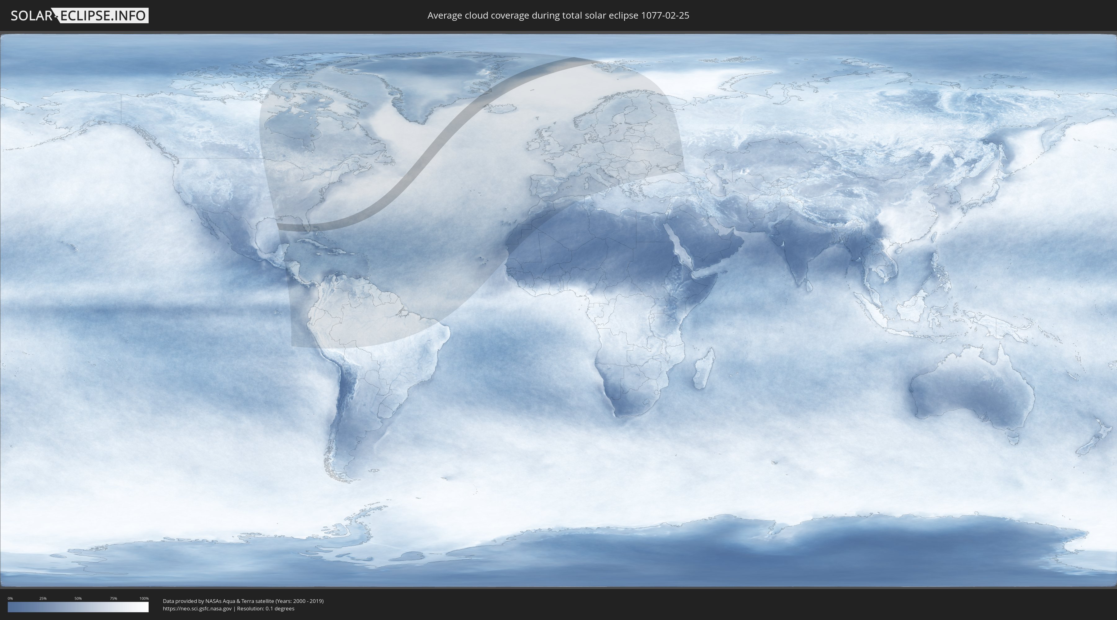
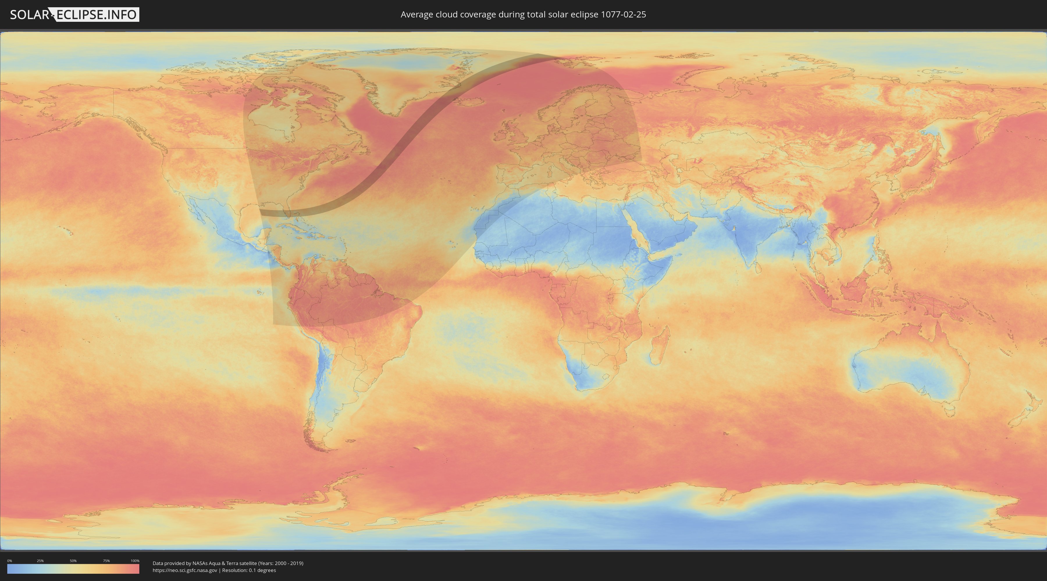
How will be the weather during the total solar eclipse on 02/25/1077?
Where is the best place to see the total solar eclipse of 02/25/1077?
The following maps show the average cloud coverage for the day of the total solar eclipse.
With the help of these maps, it is possible to find the place along the eclipse path, which has the best
chance of a cloudless sky.
Nevertheless, you should consider local circumstances and inform about the weather of your chosen
observation site.
The data is provided by NASAs satellites
AQUA and TERRA.
The cloud maps are averaged over a period of 19 years (2000 - 2019).
Detailed country maps
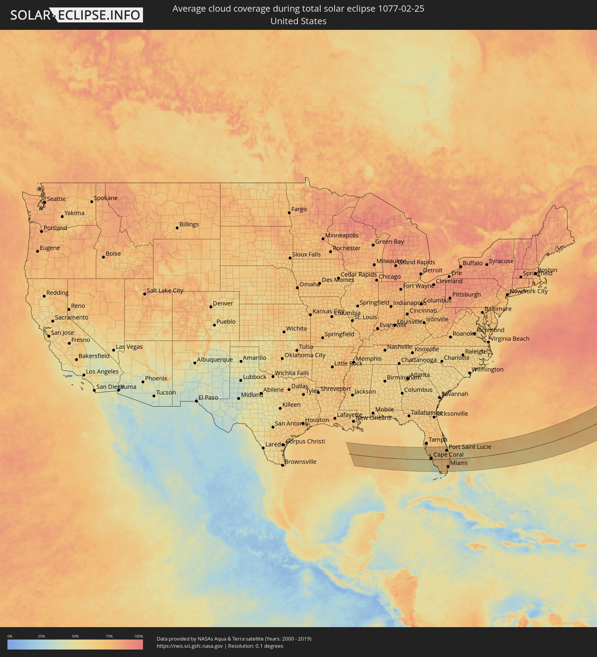 United States
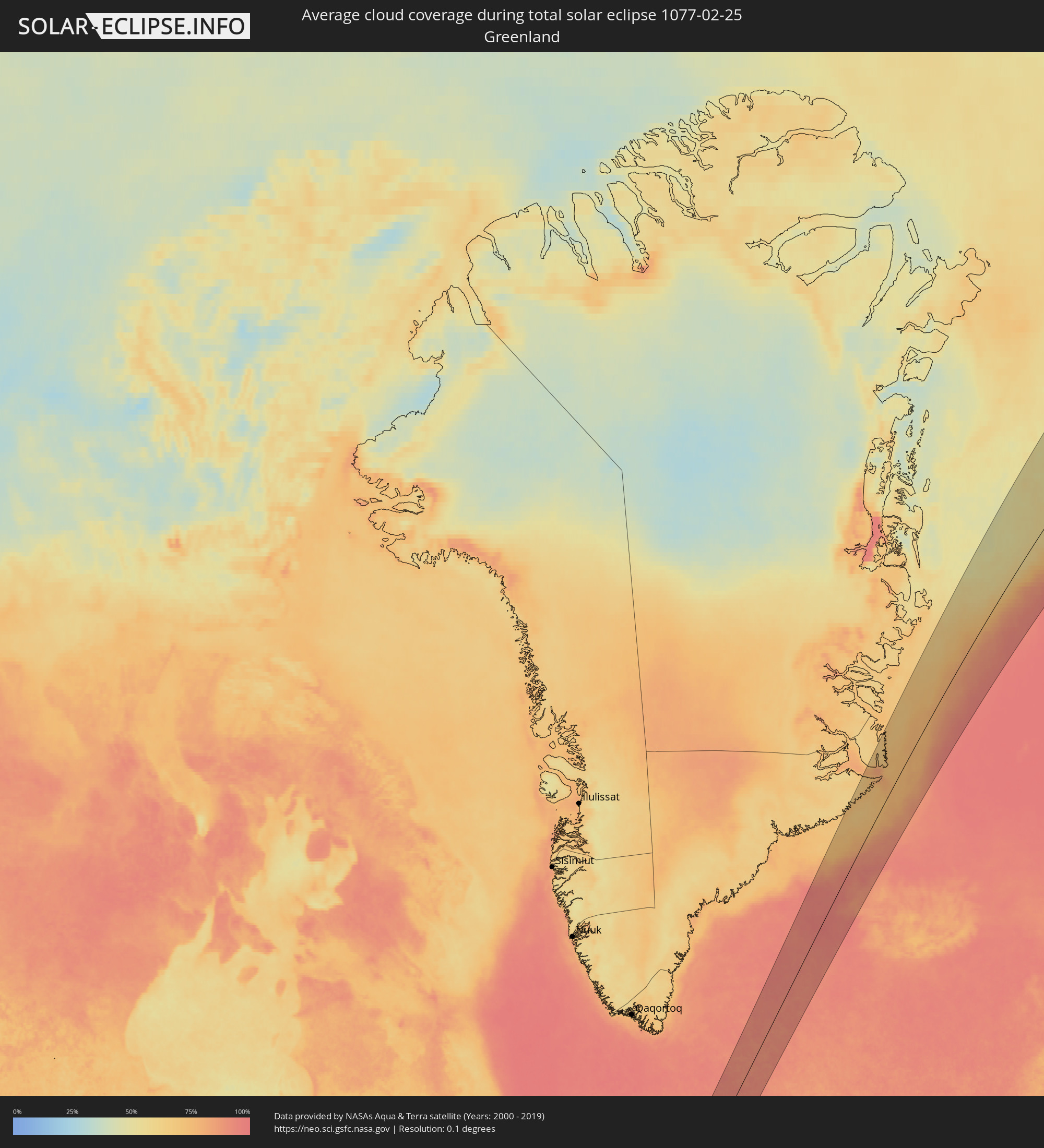 Greenland
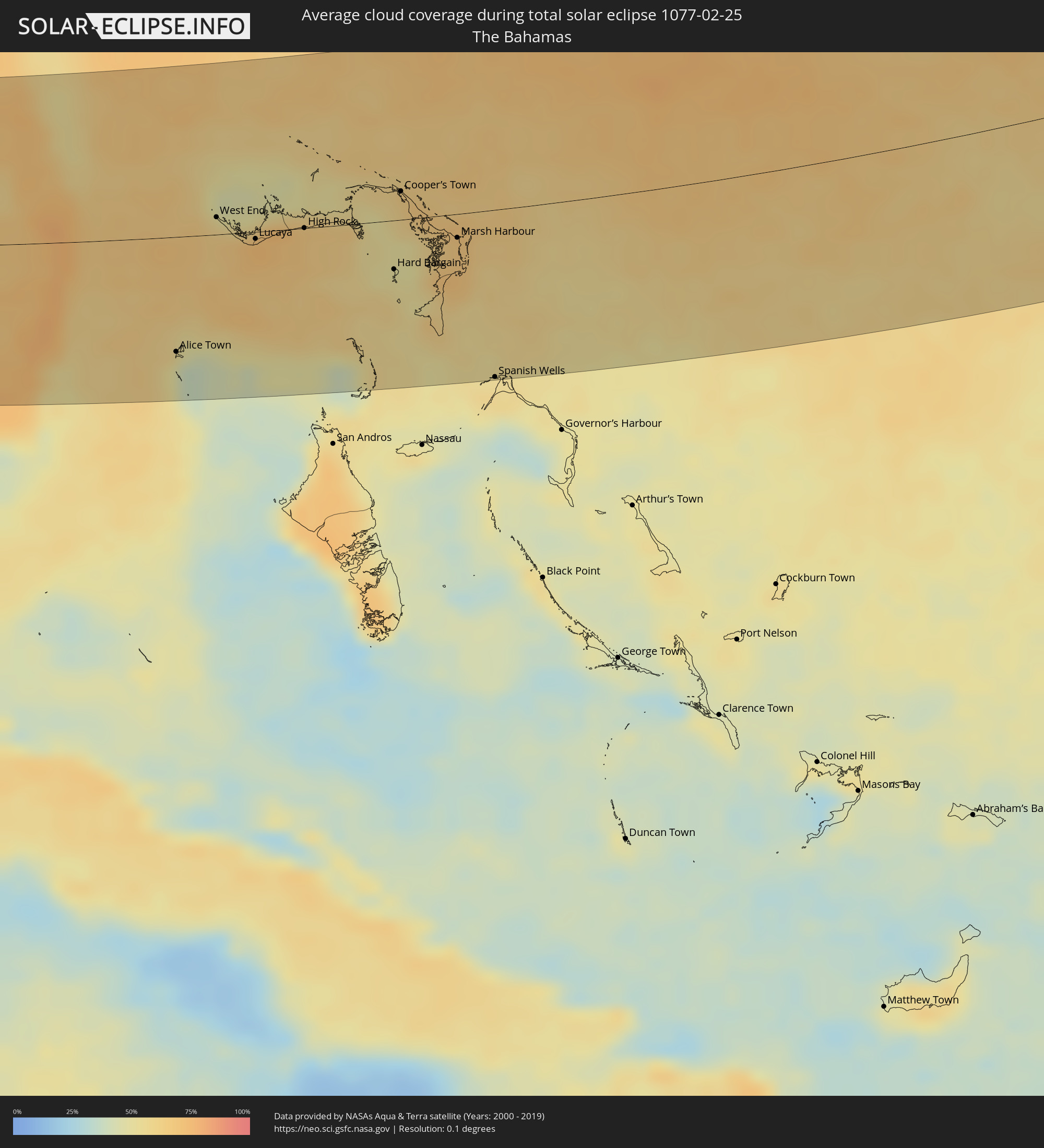 The Bahamas
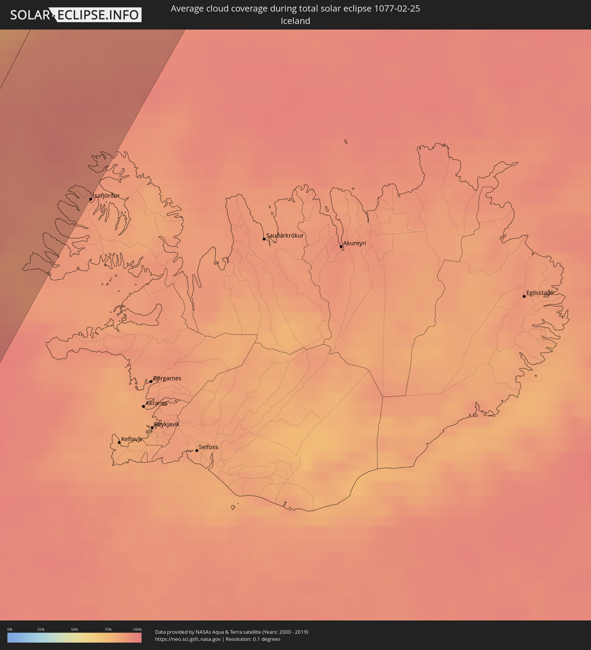 Iceland
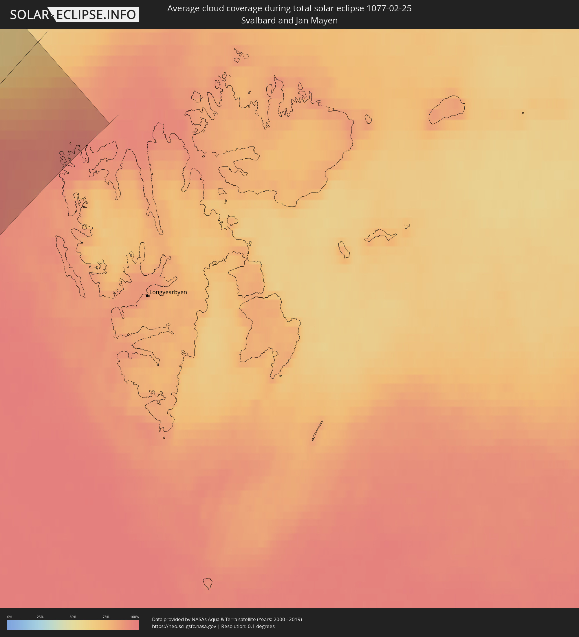 Svalbard and Jan Mayen
Cities inside the path of the eclipse
The following table shows all locations with a population of more than 5,000 inside the eclipse path. Cities which have more than 100,000 inhabitants are marked bold. A click at the locations opens a detailed map.
| City | Type | Eclipse duration | Local time of max. eclipse | Distance to central line | Ø Cloud coverage |
|
Longboat Key, Florida
|
total | - | 07:32:14 UTC-05:00 | 105 km | 56% |
|
Bradenton, Florida
|
total | - | 07:32:24 UTC-05:00 | 114 km | 62% |
|
Palmetto, Florida
|
total | - | 07:32:27 UTC-05:00 | 117 km | 62% |
|
Memphis, Florida
|
total | - | 07:32:28 UTC-05:00 | 118 km | 62% |
|
Siesta Key, Florida
|
total | - | 07:32:03 UTC-05:00 | 89 km | 64% |
|
Sarasota, Florida
|
total | - | 07:32:10 UTC-05:00 | 96 km | 64% |
|
North Sarasota, Florida
|
total | - | 07:32:14 UTC-05:00 | 100 km | 67% |
|
Gulf Gate Estates, Florida
|
total | - | 07:32:02 UTC-05:00 | 87 km | 64% |
|
Southgate, Florida
|
total | - | 07:32:08 UTC-05:00 | 93 km | 64% |
|
Bee Ridge, Florida
|
total | - | 07:32:06 UTC-05:00 | 90 km | 64% |
|
Sarasota Springs, Florida
|
total | - | 07:32:09 UTC-05:00 | 93 km | 64% |
|
Laurel, Florida
|
total | - | 07:31:53 UTC-05:00 | 75 km | 53% |
|
Fruitville, Florida
|
total | - | 07:32:11 UTC-05:00 | 96 km | 64% |
|
Venice, Florida
|
total | - | 07:31:49 UTC-05:00 | 70 km | 53% |
|
South Venice, Florida
|
total | - | 07:31:45 UTC-05:00 | 65 km | 61% |
|
Venice Gardens, Florida
|
total | - | 07:31:48 UTC-05:00 | 67 km | 61% |
|
Englewood, Florida
|
total | - | 07:31:39 UTC-05:00 | 55 km | 57% |
|
Rotonda, Florida
|
total | - | 07:31:33 UTC-05:00 | 46 km | 55% |
|
North Port, Florida
|
total | - | 07:31:49 UTC-05:00 | 64 km | 59% |
|
Port Charlotte, Florida
|
total | - | 07:31:47 UTC-05:00 | 56 km | 62% |
|
Iona, Florida
|
total | - | 07:31:07 UTC-05:00 | 5 km | 51% |
|
Cape Coral, Florida
|
total | - | 07:31:11 UTC-05:00 | 10 km | 60% |
|
McGregor, Florida
|
total | - | 07:31:12 UTC-05:00 | 10 km | 60% |
|
Cypress Lake, Florida
|
total | - | 07:31:10 UTC-05:00 | 7 km | 58% |
|
Villas, Florida
|
total | - | 07:31:12 UTC-05:00 | 9 km | 60% |
|
Arcadia, Florida
|
total | - | 07:32:16 UTC-05:00 | 83 km | 70% |
|
Southeast Arcadia, Florida
|
total | - | 07:32:13 UTC-05:00 | 79 km | 70% |
|
Bonita Springs, Florida
|
total | - | 07:30:54 UTC-05:00 | 15 km | 58% |
|
Gateway, Florida
|
total | - | 07:31:18 UTC-05:00 | 12 km | 65% |
|
Marco, Florida
|
total | - | 07:30:21 UTC-05:00 | 56 km | 53% |
|
Golden Gate, Florida
|
total | - | 07:30:42 UTC-05:00 | 32 km | 65% |
|
Lehigh Acres, Florida
|
total | - | 07:31:26 UTC-05:00 | 17 km | 65% |
|
Avon Park, Florida
|
total | - | 07:33:02 UTC-05:00 | 125 km | 68% |
|
Sebring, Florida
|
total | - | 07:32:55 UTC-05:00 | 113 km | 69% |
|
Immokalee, Florida
|
total | - | 07:31:12 UTC-05:00 | 7 km | 68% |
|
Clewiston, Florida
|
total | - | 07:31:57 UTC-05:00 | 30 km | 57% |
|
Belle Glade, Florida
|
total | - | 07:31:58 UTC-05:00 | 21 km | 65% |
|
West Vero Corridor, Florida
|
total | - | 07:33:36 UTC-05:00 | 127 km | 71% |
|
Florida City, Florida
|
total | - | 07:30:05 UTC-05:00 | 117 km | 69% |
|
Homestead, Florida
|
total | - | 07:30:07 UTC-05:00 | 114 km | 71% |
|
Naranja, Florida
|
total | - | 07:30:14 UTC-05:00 | 109 km | 67% |
|
Vero Beach South, Florida
|
total | - | 07:33:36 UTC-05:00 | 124 km | 66% |
|
Gifford, Florida
|
total | - | 07:33:42 UTC-05:00 | 131 km | 65% |
|
Lakewood Park, Florida
|
total | - | 07:33:29 UTC-05:00 | 116 km | 71% |
|
Weston, Florida
|
total | - | 07:31:10 UTC-05:00 | 45 km | 73% |
|
Three Lakes, Florida
|
total | - | 07:30:26 UTC-05:00 | 95 km | 69% |
|
Vero Beach, Florida
|
total | - | 07:33:39 UTC-05:00 | 127 km | 66% |
|
Goulds, Florida
|
total | - | 07:30:19 UTC-05:00 | 104 km | 69% |
|
Lakewood Park, Florida
|
total | - | 07:33:24 UTC-05:00 | 109 km | 71% |
|
Sweetwater, Florida
|
total | - | 07:30:38 UTC-05:00 | 82 km | 75% |
|
Westwood Lake, Florida
|
total | - | 07:30:35 UTC-05:00 | 86 km | 73% |
|
Richmond Heights, Florida
|
total | - | 07:30:26 UTC-05:00 | 97 km | 69% |
|
West Perrine, Florida
|
total | - | 07:30:24 UTC-05:00 | 100 km | 69% |
|
Palmetto Estates, Florida
|
total | - | 07:30:25 UTC-05:00 | 98 km | 69% |
|
Fort Pierce North, Florida
|
total | - | 07:33:24 UTC-05:00 | 108 km | 71% |
|
Olympia Heights, Florida
|
total | - | 07:30:35 UTC-05:00 | 86 km | 73% |
|
Doral, Florida
|
total | - | 07:30:44 UTC-05:00 | 76 km | 75% |
|
Port Saint Lucie, Florida
|
total | - | 07:33:07 UTC-05:00 | 88 km | 70% |
|
East Perrine, Florida
|
total | - | 07:30:25 UTC-05:00 | 99 km | 55% |
|
Southwest Ranches, Florida
|
total | - | 07:31:08 UTC-05:00 | 49 km | 76% |
|
Fort Pierce, Florida
|
total | - | 07:33:22 UTC-05:00 | 105 km | 67% |
|
Lakes by the Bay, Florida
|
total | - | 07:30:22 UTC-05:00 | 104 km | 55% |
|
Kendall, Florida
|
total | - | 07:30:32 UTC-05:00 | 92 km | 63% |
|
South Miami, Florida
|
total | - | 07:30:35 UTC-05:00 | 89 km | 63% |
|
Miami Springs, Florida
|
total | - | 07:30:46 UTC-05:00 | 76 km | 71% |
|
Coral Springs, Florida
|
total | - | 07:31:30 UTC-05:00 | 26 km | 74% |
|
Palm City, Florida
|
total | - | 07:32:57 UTC-05:00 | 74 km | 70% |
|
Opa-locka, Florida
|
total | - | 07:30:55 UTC-05:00 | 67 km | 75% |
|
Westview, Florida
|
total | - | 07:30:53 UTC-05:00 | 69 km | 71% |
|
Lake Lucerne, Florida
|
total | - | 07:31:01 UTC-05:00 | 60 km | 72% |
|
Wellington, Florida
|
total | - | 07:32:08 UTC-05:00 | 17 km | 78% |
|
Brownsville, Florida
|
total | - | 07:30:48 UTC-05:00 | 76 km | 65% |
|
Gladeview, Florida
|
total | - | 07:30:50 UTC-05:00 | 74 km | 65% |
|
Scott Lake, Florida
|
total | - | 07:30:59 UTC-05:00 | 63 km | 71% |
|
Jensen Beach, Florida
|
total | - | 07:33:06 UTC-05:00 | 83 km | 61% |
|
Pembroke Pines, Florida
|
total | - | 07:31:06 UTC-05:00 | 56 km | 72% |
|
Andover, Florida
|
total | - | 07:31:03 UTC-05:00 | 60 km | 72% |
|
Broadview Park, Florida
|
total | - | 07:31:15 UTC-05:00 | 45 km | 74% |
|
Port Salerno, Florida
|
total | - | 07:32:56 UTC-05:00 | 71 km | 67% |
|
West Park, Florida
|
total | - | 07:31:05 UTC-05:00 | 58 km | 72% |
|
Miami, Florida
|
total | - | 07:30:45 UTC-05:00 | 82 km | 65% |
|
Melrose Park, Florida
|
total | - | 07:31:17 UTC-05:00 | 44 km | 74% |
|
Miami Shores, Florida
|
total | - | 07:30:53 UTC-05:00 | 72 km | 71% |
|
Key Biscayne, Florida
|
total | - | 07:30:38 UTC-05:00 | 91 km | 55% |
|
North Bay Village, Florida
|
total | - | 07:30:53 UTC-05:00 | 74 km | 65% |
|
North Andrews Gardens, Florida
|
total | - | 07:31:26 UTC-05:00 | 35 km | 65% |
|
Fort Lauderdale, Florida
|
total | - | 07:31:19 UTC-05:00 | 43 km | 63% |
|
Kings Point, Florida
|
total | - | 07:31:51 UTC-05:00 | 7 km | 70% |
|
Wilton Manors, Florida
|
total | - | 07:31:23 UTC-05:00 | 39 km | 65% |
|
Hobe Sound, Florida
|
total | - | 07:32:50 UTC-05:00 | 61 km | 59% |
|
Pompano Beach Highlands, Florida
|
total | - | 07:31:36 UTC-05:00 | 25 km | 67% |
|
Jupiter, Florida
|
total | - | 07:32:39 UTC-05:00 | 47 km | 72% |
|
Lighthouse Point, Florida
|
total | - | 07:31:36 UTC-05:00 | 26 km | 67% |
|
Boca Raton, Florida
|
total | - | 07:31:44 UTC-05:00 | 17 km | 70% |
|
North Palm Beach, Florida
|
total | - | 07:32:28 UTC-05:00 | 34 km | 74% |
|
Lake Park, Florida
|
total | - | 07:32:27 UTC-05:00 | 32 km | 74% |
|
Boynton Beach, Florida
|
total | - | 07:32:01 UTC-05:00 | 2 km | 74% |
|
West Palm Beach, Florida
|
total | - | 07:32:19 UTC-05:00 | 23 km | 73% |
|
Lantana, Florida
|
total | - | 07:32:07 UTC-05:00 | 8 km | 75% |
|
Palm Beach, Florida
|
total | - | 07:32:19 UTC-05:00 | 21 km | 68% |
|
Alice Town, Bimini
|
total | - | 07:21:37 UTC-05:09 | 91 km | 49% |
|
West End, West Grand Bahama
|
total | - | 07:23:20 UTC-05:09 | 14 km | 62% |
|
Freeport, Freeport
|
total | - | 07:23:14 UTC-05:09 | 5 km | 69% |
|
Lucaya, Freeport
|
total | - | 07:23:15 UTC-05:09 | 6 km | 69% |
|
High Rock, East Grand Bahama
|
total | - | 12:33:06 UTC+00:00 | 0 km | 67% |
|
Hard Bargain, Moore’s Island
|
total | - | 07:23:31 UTC-05:09 | 39 km | 56% |
|
Cooper’s Town, North Abaco
|
total | - | 07:24:28 UTC-05:09 | 22 km | 63% |
|
Marsh Harbour, Central Abaco
|
total | - | 07:24:11 UTC-05:09 | 19 km | 68% |
|
Spanish Wells, Spanish Wells
|
total | - | 07:22:44 UTC-05:09 | 132 km | 55% |