Total solar eclipse of 05/15/-0751
| Day of week: | Thursday |
| Maximum duration of eclipse: | 03m37s |
| Maximum width of eclipse path: | 130 km |
| Saros cycle: | 45 |
| Coverage: | 100% |
| Magnitude: | 1.0386 |
| Gamma: | -0.0809 |
Wo kann man die Sonnenfinsternis vom 05/15/-0751 sehen?
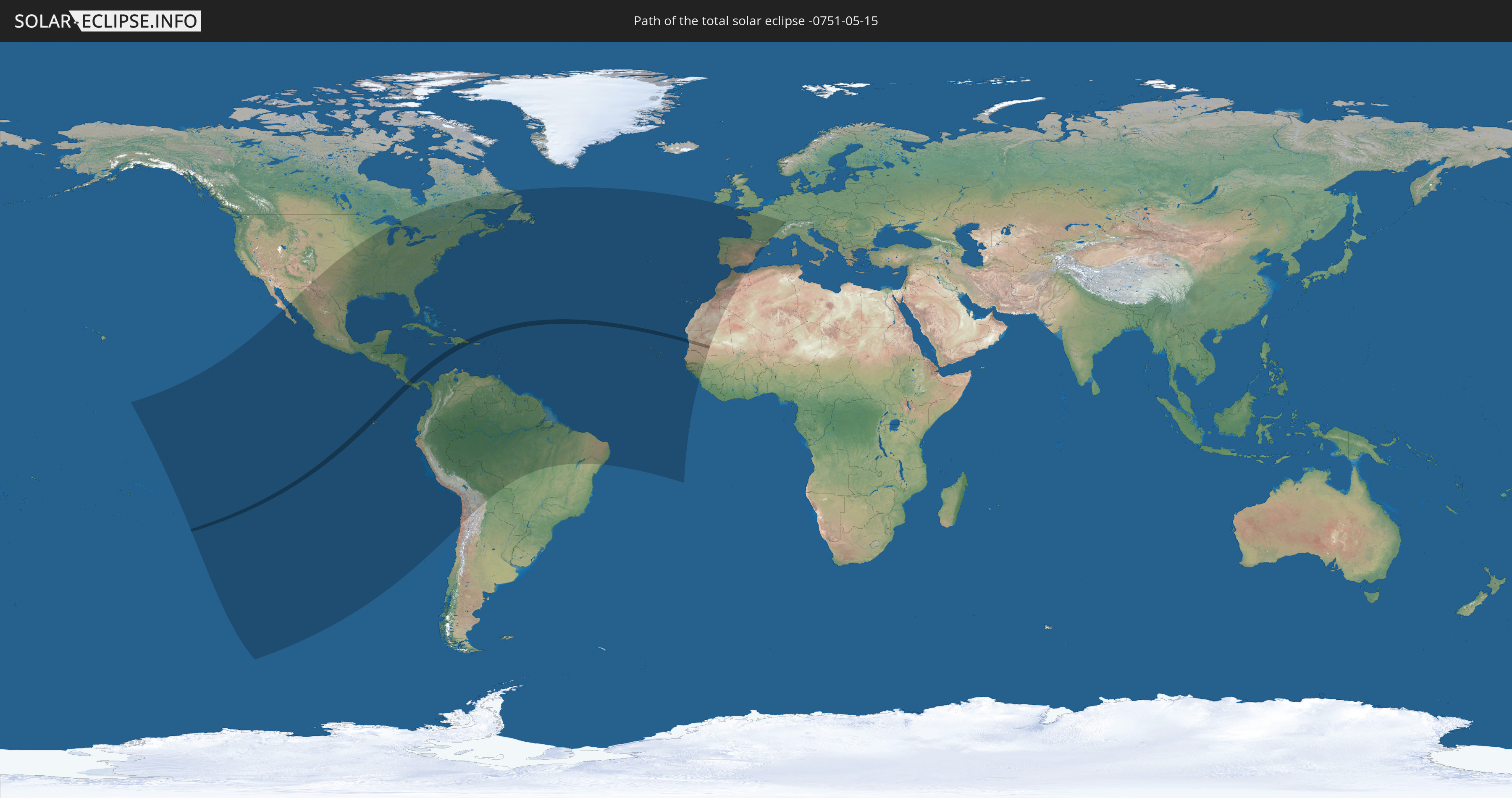
Die Sonnenfinsternis am 05/15/-0751 kann man in 69 Ländern als partielle Sonnenfinsternis beobachten.
Der Finsternispfad verläuft durch 6 Länder. Nur in diesen Ländern ist sie als total Sonnenfinsternis zu sehen.
In den folgenden Ländern ist die Sonnenfinsternis total zu sehen
 Pitcairn Islands
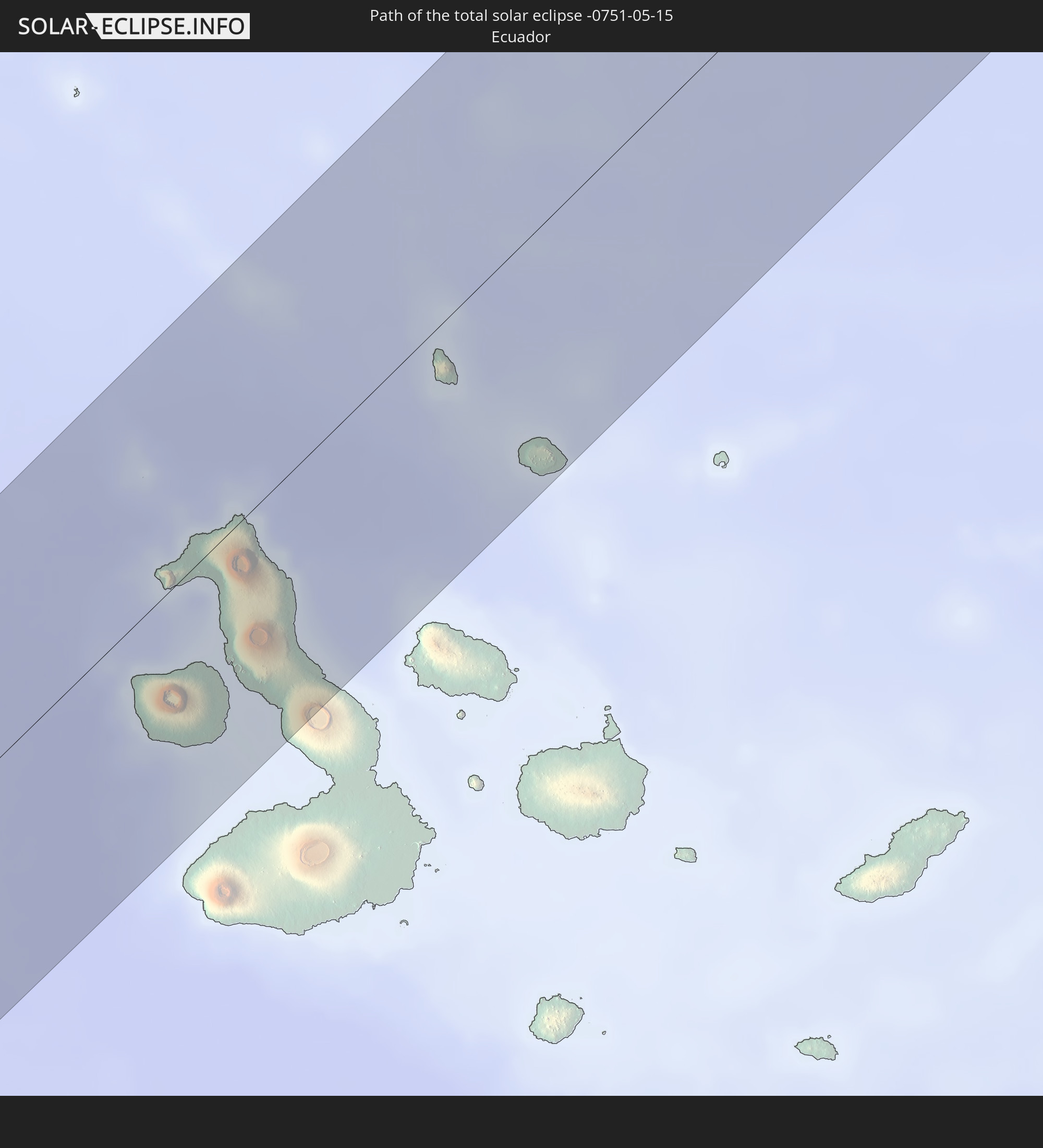 Ecuador
 Costa Rica
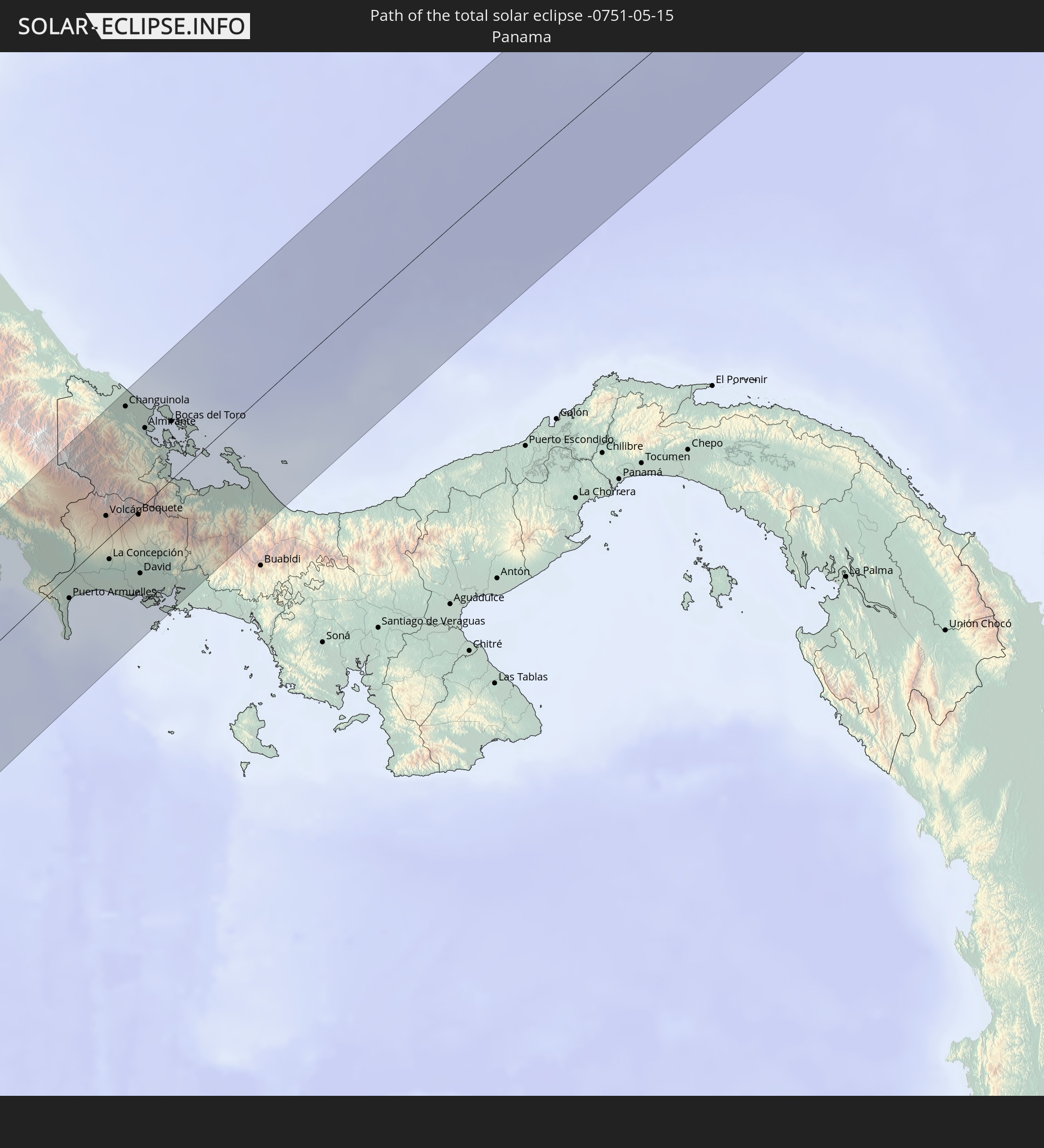 Panama
 Dominican Republic
 Mauritania
In den folgenden Ländern ist die Sonnenfinsternis partiell zu sehen
 United States
 United States Minor Outlying Islands
 French Polynesia
 Canada
 Pitcairn Islands
 Mexico
 Chile
Chile
 Guatemala
 Ecuador
 El Salvador
 Honduras
 Belize
 Nicaragua
 Costa Rica
 Cuba
Cuba
 Panama
 Colombia
 Cayman Islands
 Peru
Peru
 The Bahamas
 Jamaica
 Haiti
Haiti
 Brazil
 Venezuela
 Turks and Caicos Islands
 Dominican Republic
 Aruba
Aruba
 Bolivia
 Puerto Rico
 United States Virgin Islands
 Bermuda
 British Virgin Islands
 Anguilla
 Collectivity of Saint Martin
 Saint Barthélemy
 Saint Kitts and Nevis
 Antigua and Barbuda
 Montserrat
 Trinidad and Tobago
 Guadeloupe
 Grenada
 Dominica
 Saint Vincent and the Grenadines
 Guyana
 Martinique
 Saint Lucia
 Barbados
 Suriname
 Saint Pierre and Miquelon
 French Guiana
 Portugal
 Cabo Verde
 Spain
Spain
 Senegal
 Mauritania
 The Gambia
 Guinea-Bissau
 Guinea
 Morocco
 Mali
Mali
 Republic of Ireland
 Algeria
 United Kingdom
 Gibraltar
 France
 Guernsey
 Jersey
 Andorra
 Switzerland
How will be the weather during the total solar eclipse on 05/15/-0751?
Where is the best place to see the total solar eclipse of 05/15/-0751?
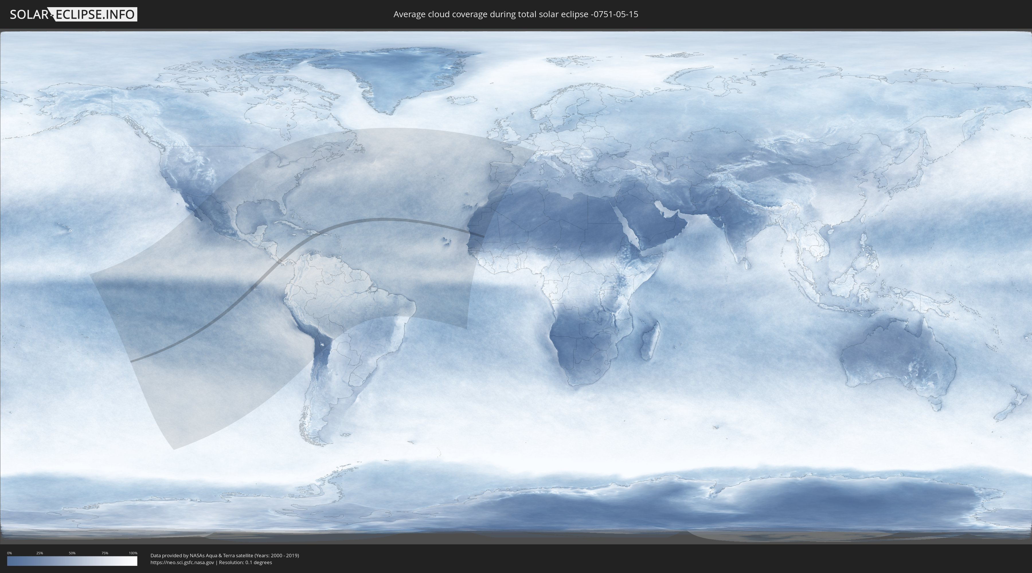
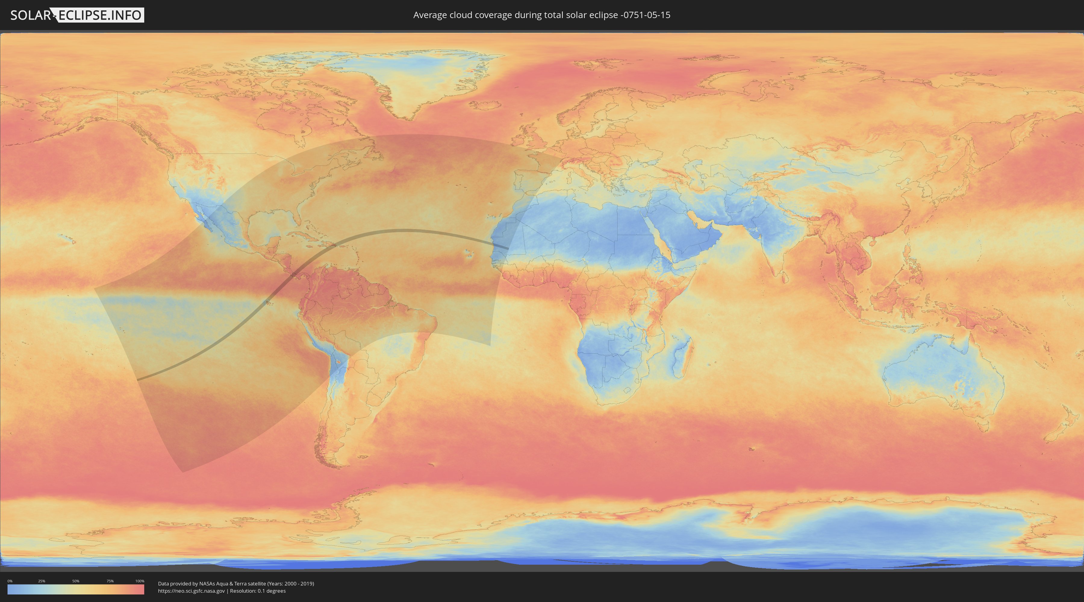
The following maps show the average cloud coverage for the day of the total solar eclipse.
With the help of these maps, it is possible to find the place along the eclipse path, which has the best
chance of a cloudless sky.
Nevertheless, you should consider local circumstances and inform about the weather of your chosen
observation site.
The data is provided by NASAs satellites
AQUA and TERRA.
The cloud maps are averaged over a period of 19 years (2000 - 2019).
Detailed country maps
 Pitcairn Islands
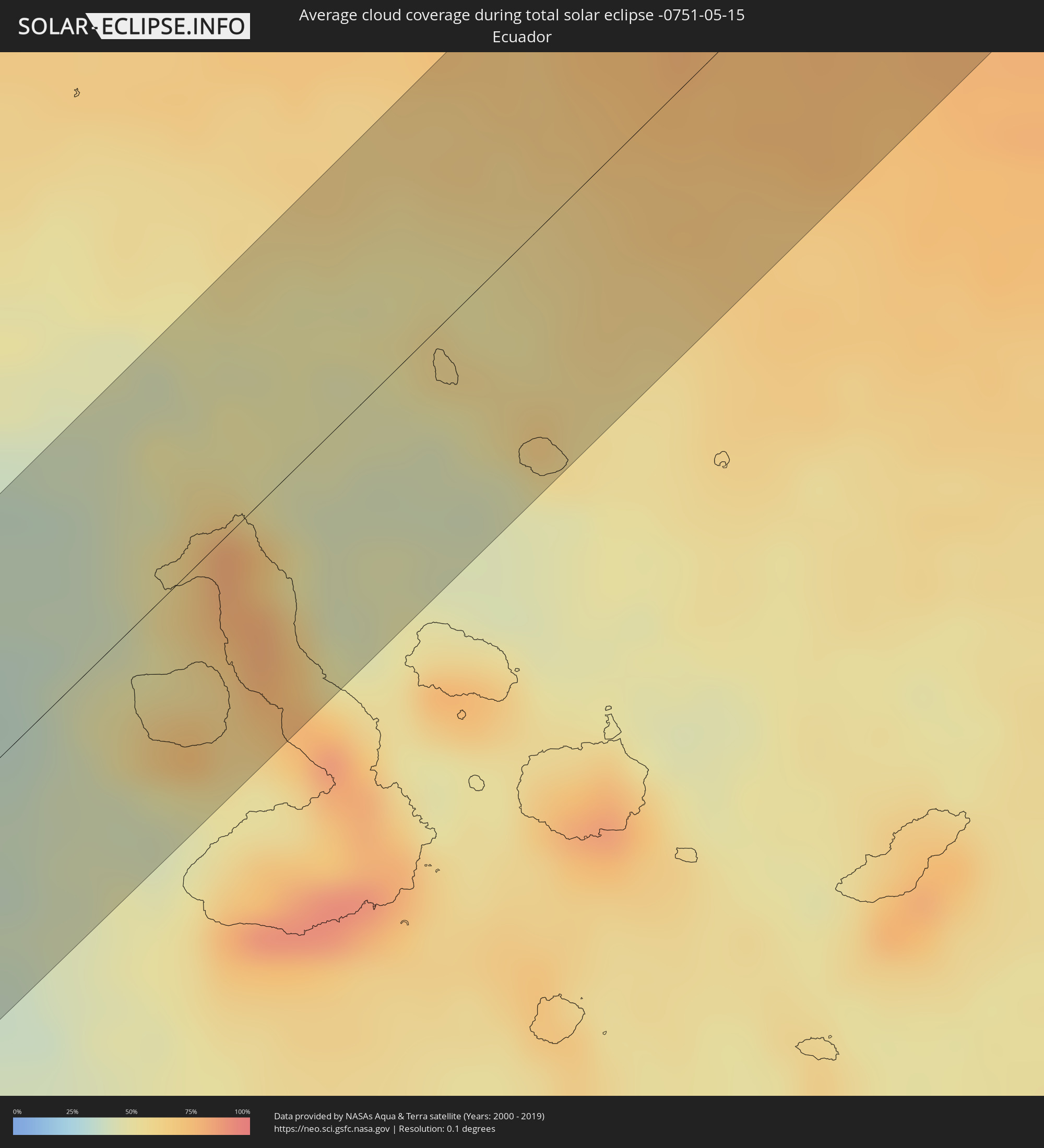 Ecuador
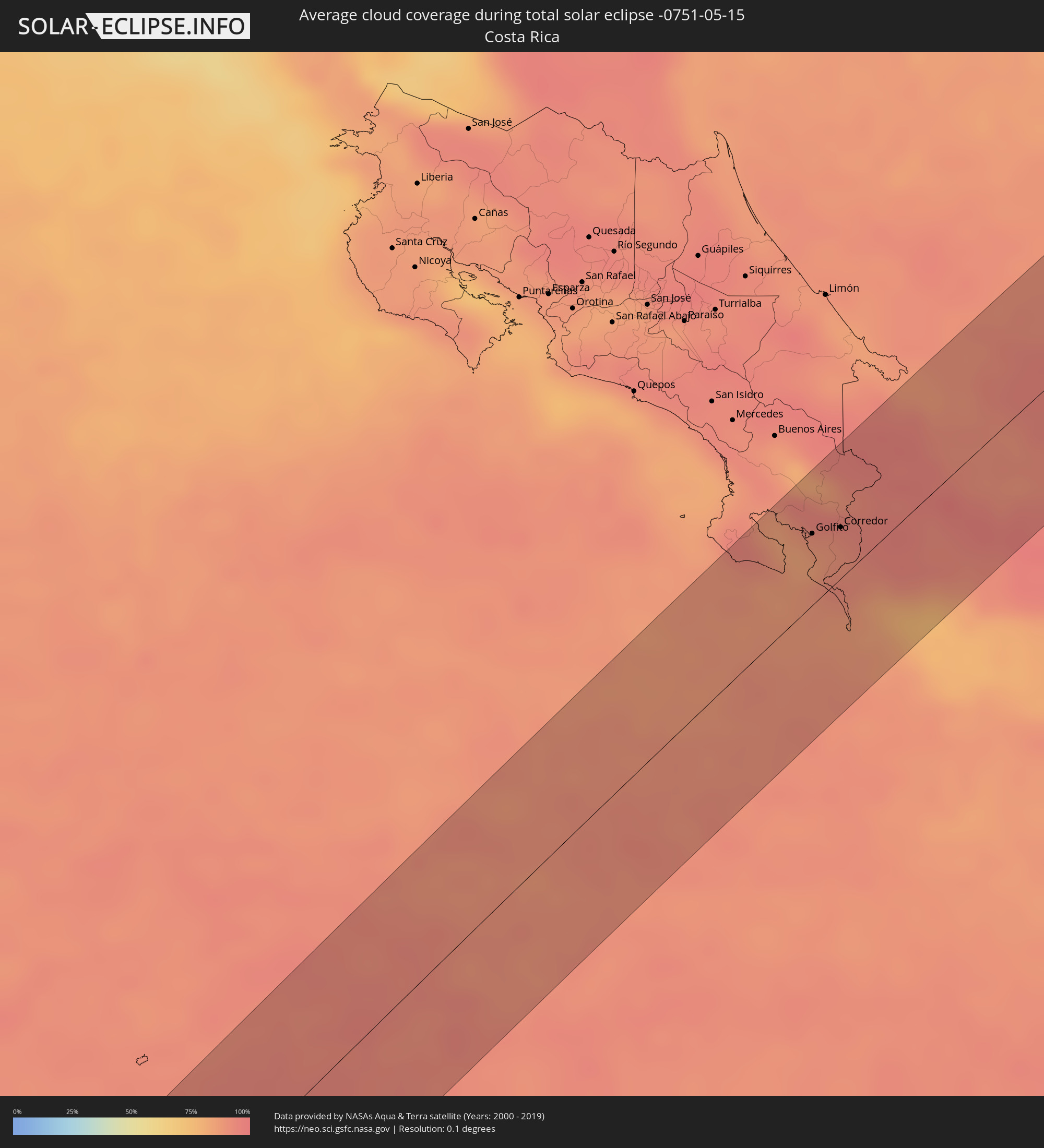 Costa Rica
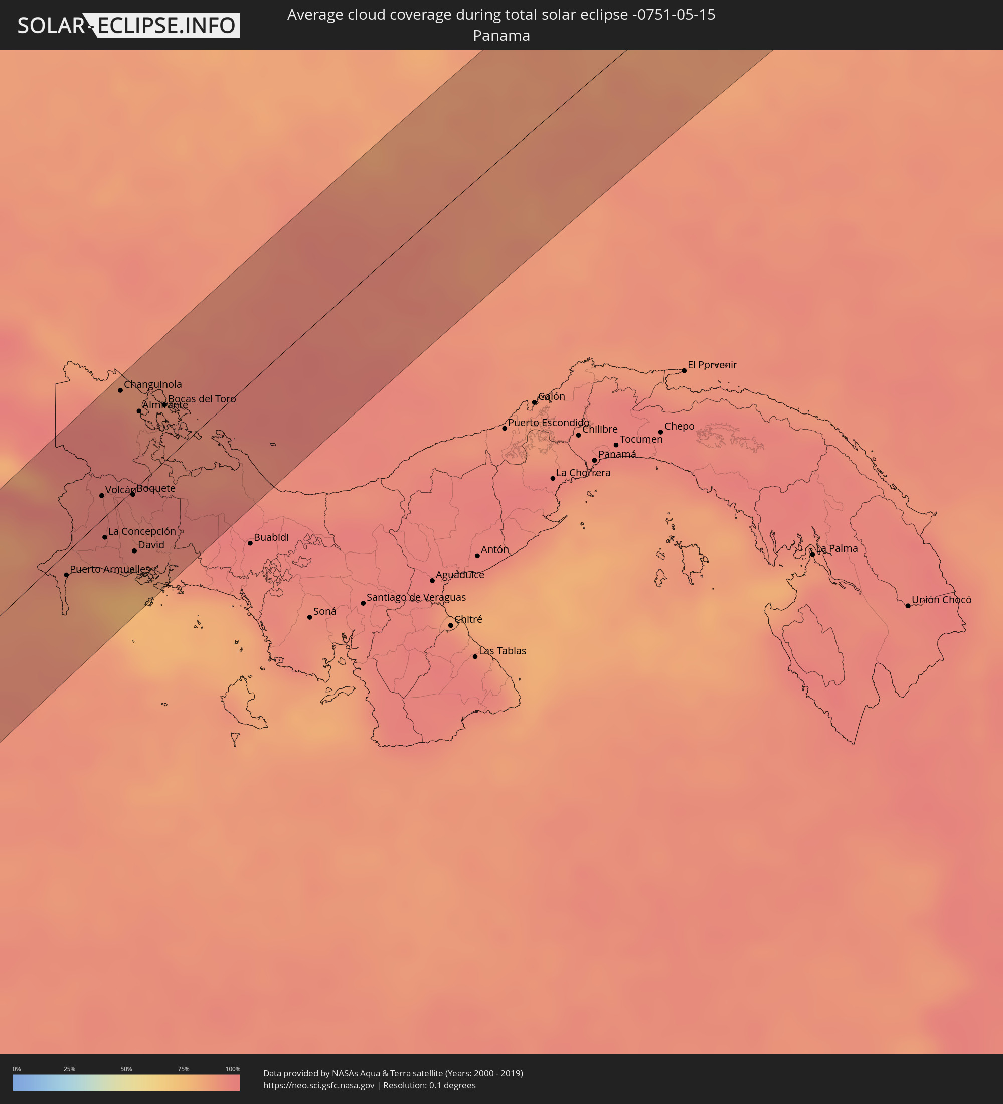 Panama
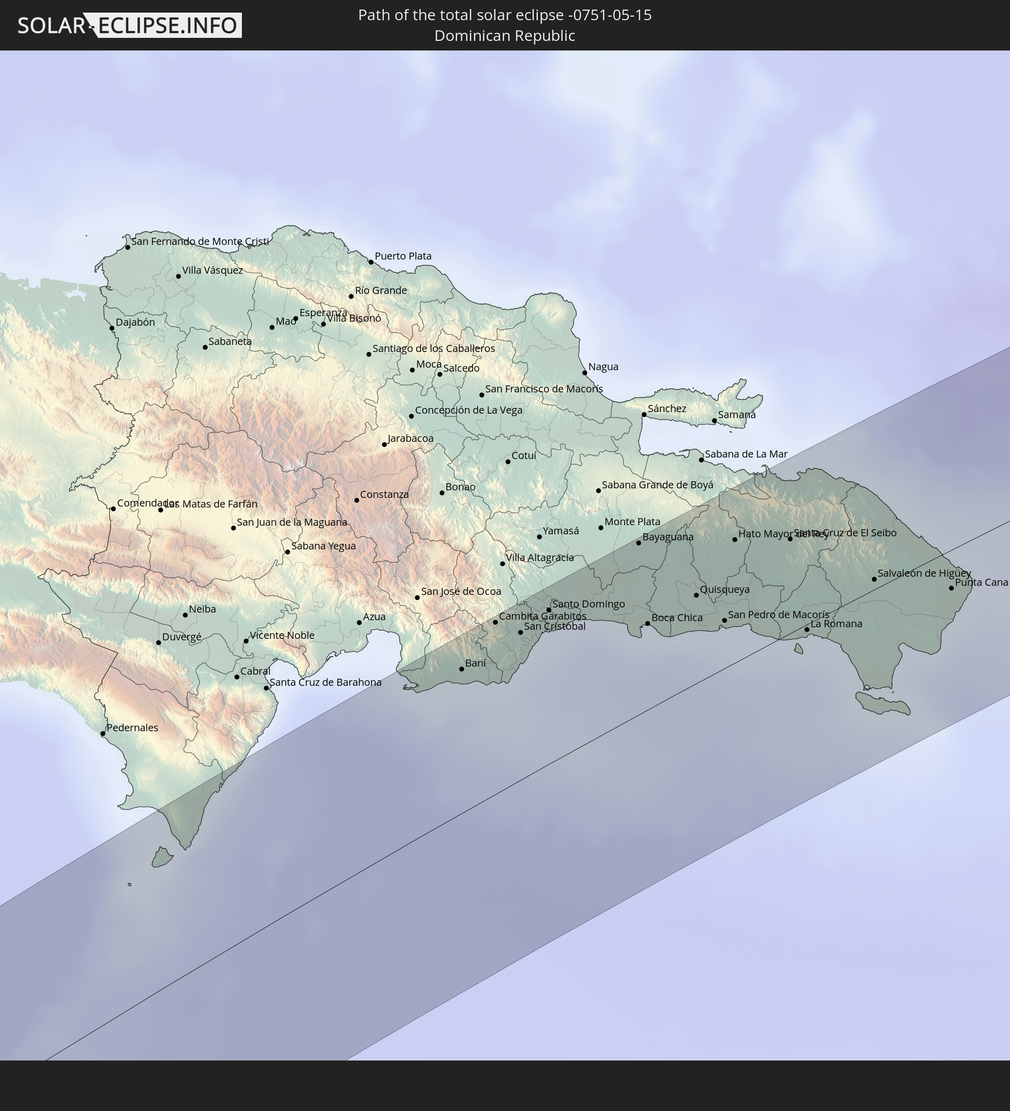
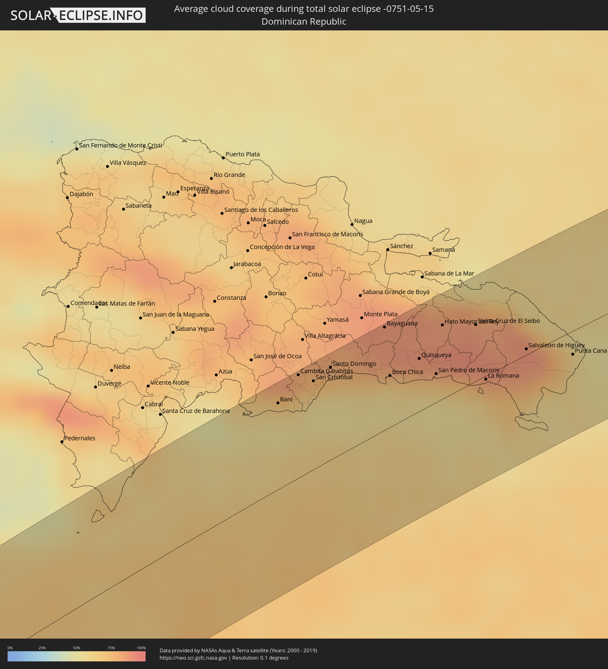 Dominican Republic
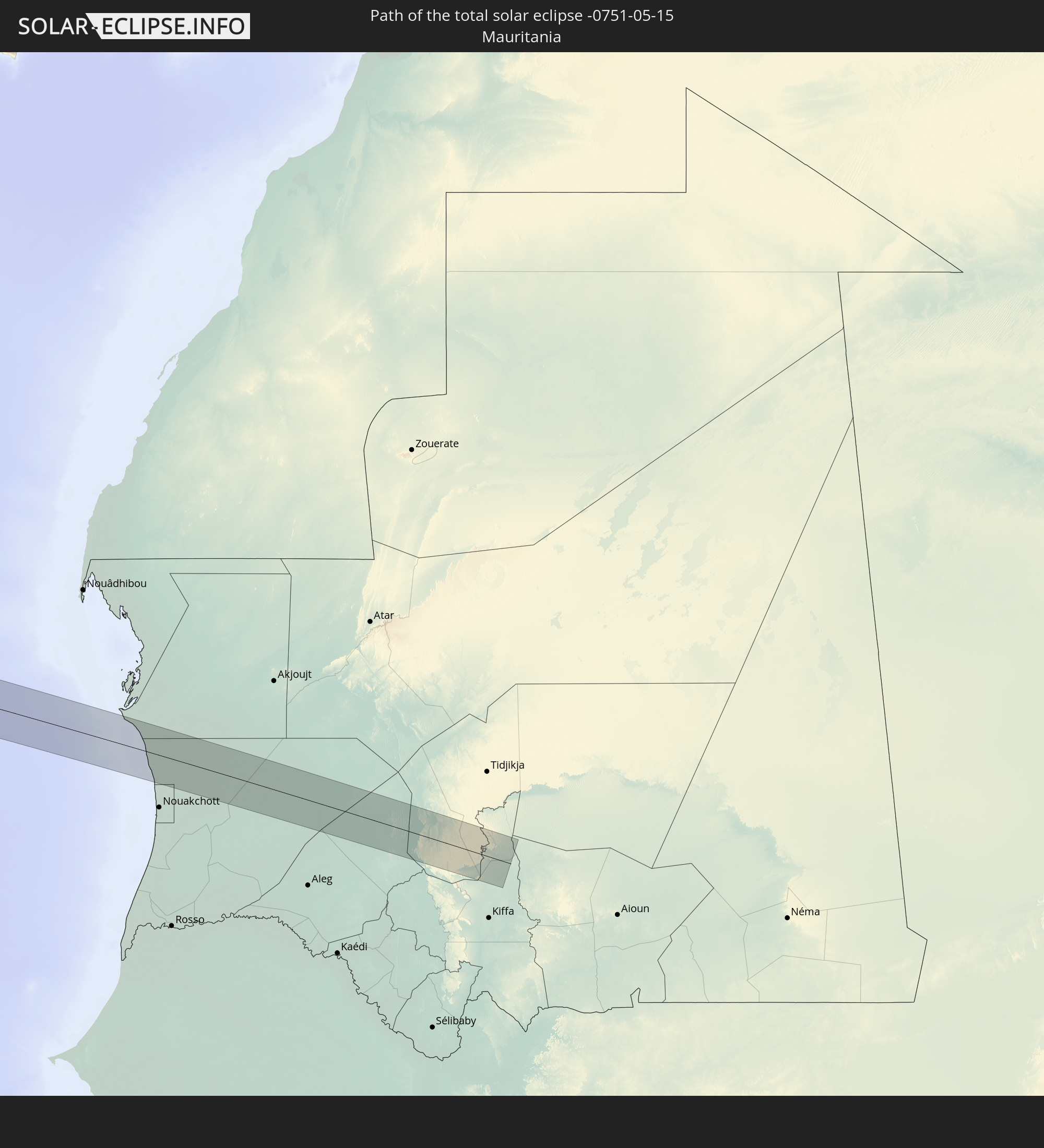
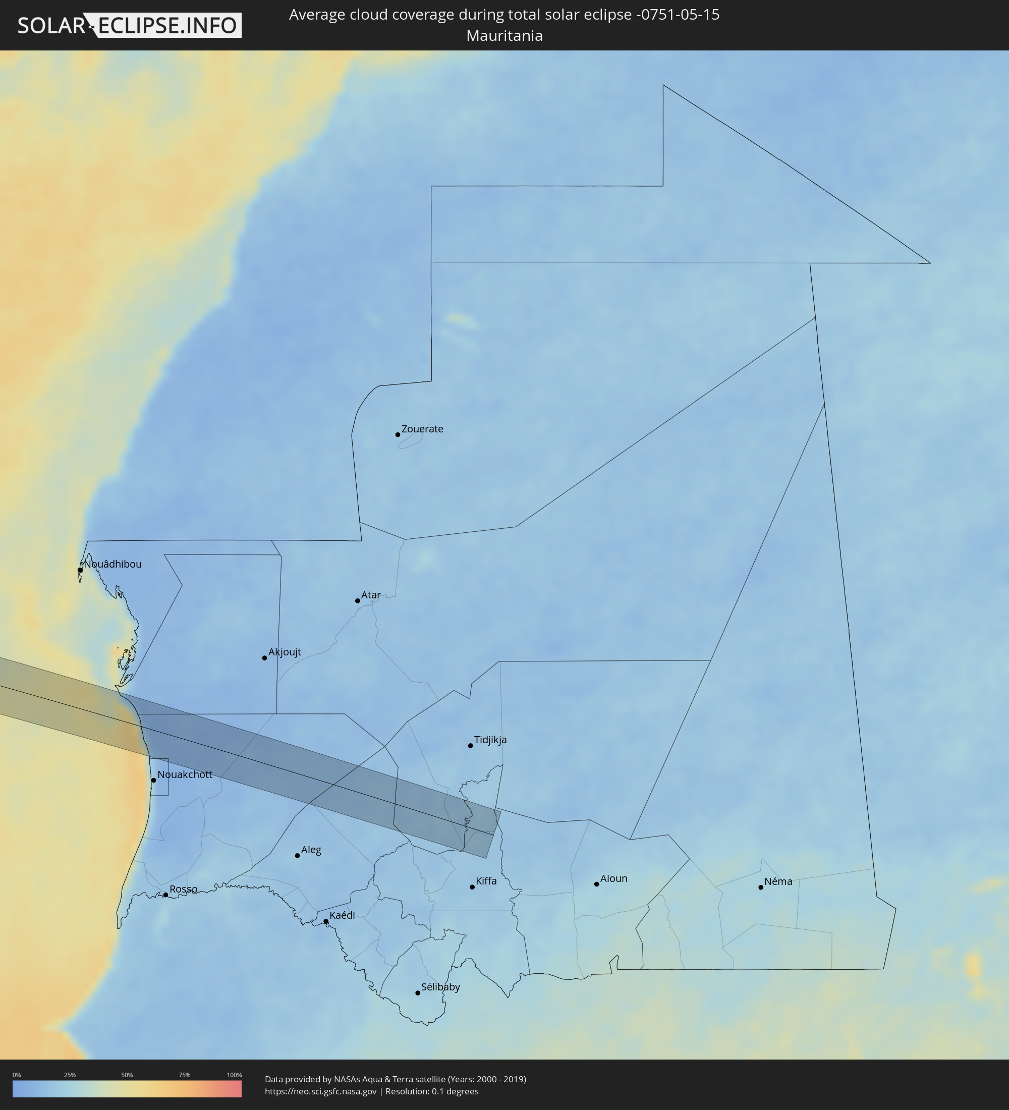 Mauritania
Cities inside the path of the eclipse
The following table shows all locations with a population of more than 5,000 inside the eclipse path. Cities which have more than 100,000 inhabitants are marked bold. A click at the locations opens a detailed map.
| City | Type | Eclipse duration | Local time of max. eclipse | Distance to central line | Ø Cloud coverage |
|
Adamstown
|
total | - | 06:54:36 UTC-08:30 | 29 km | 72% |
|
Golfito, Puntarenas
|
total | - | 11:15:19 UTC-05:36 | 34 km | 86% |
|
Corredor, Puntarenas
|
total | - | 11:15:45 UTC-05:36 | 24 km | 91% |
|
Puerto Armuelles, Chiriquí
|
total | - | 11:31:50 UTC-05:19 | 12 km | 90% |
|
Volcán, Chiriquí
|
total | - | 11:33:18 UTC-05:19 | 12 km | 95% |
|
La Concepción, Chiriquí
|
total | - | 11:32:50 UTC-05:19 | 11 km | 94% |
|
Changuinola, Bocas del Toro
|
total | - | 11:34:53 UTC-05:19 | 57 km | 93% |
|
Boquete, Chiriquí
|
total | - | 11:33:45 UTC-05:19 | 2 km | 94% |
|
Pedregal, Chiriquí
|
total | - | 11:32:56 UTC-05:19 | 37 km | 87% |
|
David, Chiriquí
|
total | - | 11:33:04 UTC-05:19 | 32 km | 87% |
|
Almirante, Bocas del Toro
|
total | - | 11:34:53 UTC-05:19 | 37 km | 92% |
|
Las Lomas, Chiriquí
|
total | - | 11:33:10 UTC-05:19 | 35 km | 87% |
|
Bocas del Toro, Bocas del Toro
|
total | - | 11:35:19 UTC-05:19 | 28 km | 92% |
|
Enriquillo, Barahona
|
total | - | 12:56:52 UTC-04:40 | 63 km | 61% |
|
Baní, Peravia
|
total | - | 12:59:39 UTC-04:40 | 52 km | 61% |
|
Paya, Peravia
|
total | - | 12:59:43 UTC-04:40 | 48 km | 61% |
|
Nizao, Peravia
|
total | - | 12:59:54 UTC-04:40 | 43 km | 54% |
|
Cambita Garabitos, San Cristóbal
|
total | - | 13:00:14 UTC-04:40 | 62 km | 80% |
|
Yaguate, San Cristóbal
|
total | - | 13:00:06 UTC-04:40 | 50 km | 59% |
|
San Cristóbal, San Cristóbal
|
total | - | 13:00:25 UTC-04:40 | 53 km | 61% |
|
San Gregorio de Nigua, San Cristóbal
|
total | - | 13:00:25 UTC-04:40 | 49 km | 61% |
|
Bajos de Haina, San Cristóbal
|
total | - | 13:00:35 UTC-04:40 | 50 km | 57% |
|
Santo Domingo Oeste, Santo Domingo
|
total | - | 13:00:47 UTC-04:40 | 56 km | 72% |
|
Santo Domingo, Nacional
|
total | - | 13:00:49 UTC-04:40 | 56 km | 72% |
|
Bella Vista, Nacional
|
total | - | 13:00:51 UTC-04:40 | 49 km | 69% |
|
La Julia, Nacional
|
total | - | 13:00:54 UTC-04:40 | 50 km | 69% |
|
Cristo Rey, Nacional
|
total | - | 13:00:57 UTC-04:40 | 53 km | 69% |
|
La Agustina, Nacional
|
total | - | 13:00:57 UTC-04:40 | 53 km | 69% |
|
Ensanche Luperón, Nacional
|
total | - | 13:01:02 UTC-04:40 | 51 km | 69% |
|
Villa Consuelo, Nacional
|
total | - | 13:01:00 UTC-04:40 | 50 km | 69% |
|
San Carlos, Nacional
|
total | - | 13:01:00 UTC-04:40 | 50 km | 69% |
|
Ciudad Nueva, Nacional
|
total | - | 13:00:59 UTC-04:40 | 48 km | 69% |
|
Villa Francisca, Nacional
|
total | - | 13:00:59 UTC-04:40 | 48 km | 69% |
|
Santo Domingo Este, Santo Domingo
|
total | - | 13:01:07 UTC-04:40 | 48 km | 69% |
|
Bayaguana, Monte Plata
|
total | - | 13:02:03 UTC-04:40 | 62 km | 86% |
|
Boca Chica, Santo Domingo
|
total | - | 13:01:41 UTC-04:40 | 31 km | 66% |
|
Los Llanos, San Pedro de Macorís
|
total | - | 13:02:11 UTC-04:40 | 43 km | 82% |
|
Quisqueya, San Pedro de Macorís
|
total | - | 13:02:18 UTC-04:40 | 32 km | 83% |
|
San Pedro de Macorís, San Pedro de Macorís
|
total | - | 13:02:26 UTC-04:40 | 17 km | 68% |
|
Hato Mayor del Rey, Hato Mayor
|
total | - | 13:02:58 UTC-04:40 | 45 km | 86% |
|
Miches, El Seíbo
|
total | - | 13:03:48 UTC-04:40 | 56 km | 77% |
|
Santa Cruz de El Seibo, El Seíbo
|
total | - | 13:03:30 UTC-04:40 | 34 km | 87% |
|
Guaymate, La Romana
|
total | - | 13:03:24 UTC-04:40 | 14 km | 88% |
|
La Romana, La Romana
|
total | - | 13:03:10 UTC-04:40 | 2 km | 64% |
|
Salvaleón de Higüey, La Altagracia
|
total | - | 13:04:05 UTC-04:40 | 4 km | 86% |
|
San Rafael del Yuma, La Altagracia
|
total | - | 13:03:54 UTC-04:40 | 16 km | 68% |
|
Otra Banda, La Altagracia
|
total | - | 13:04:15 UTC-04:40 | 5 km | 89% |
|
Punta Cana, La Altagracia
|
total | - | 13:04:47 UTC-04:40 | 14 km | 63% |