Total solar eclipse of 04/02/-0823
| Day of week: | Friday |
| Maximum duration of eclipse: | 03m51s |
| Maximum width of eclipse path: | 153 km |
| Saros cycle: | 45 |
| Coverage: | 100% |
| Magnitude: | 1.0451 |
| Gamma: | 0.2058 |
Wo kann man die Sonnenfinsternis vom 04/02/-0823 sehen?
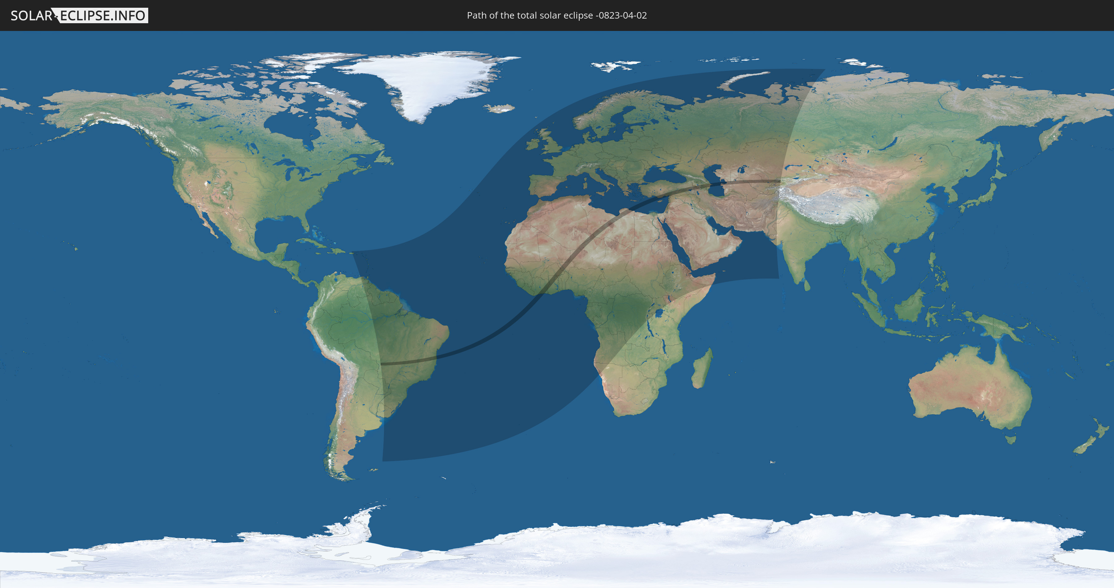
Die Sonnenfinsternis am 04/02/-0823 kann man in 142 Ländern als partielle Sonnenfinsternis beobachten.
Der Finsternispfad verläuft durch 18 Länder. Nur in diesen Ländern ist sie als total Sonnenfinsternis zu sehen.
In den folgenden Ländern ist die Sonnenfinsternis total zu sehen
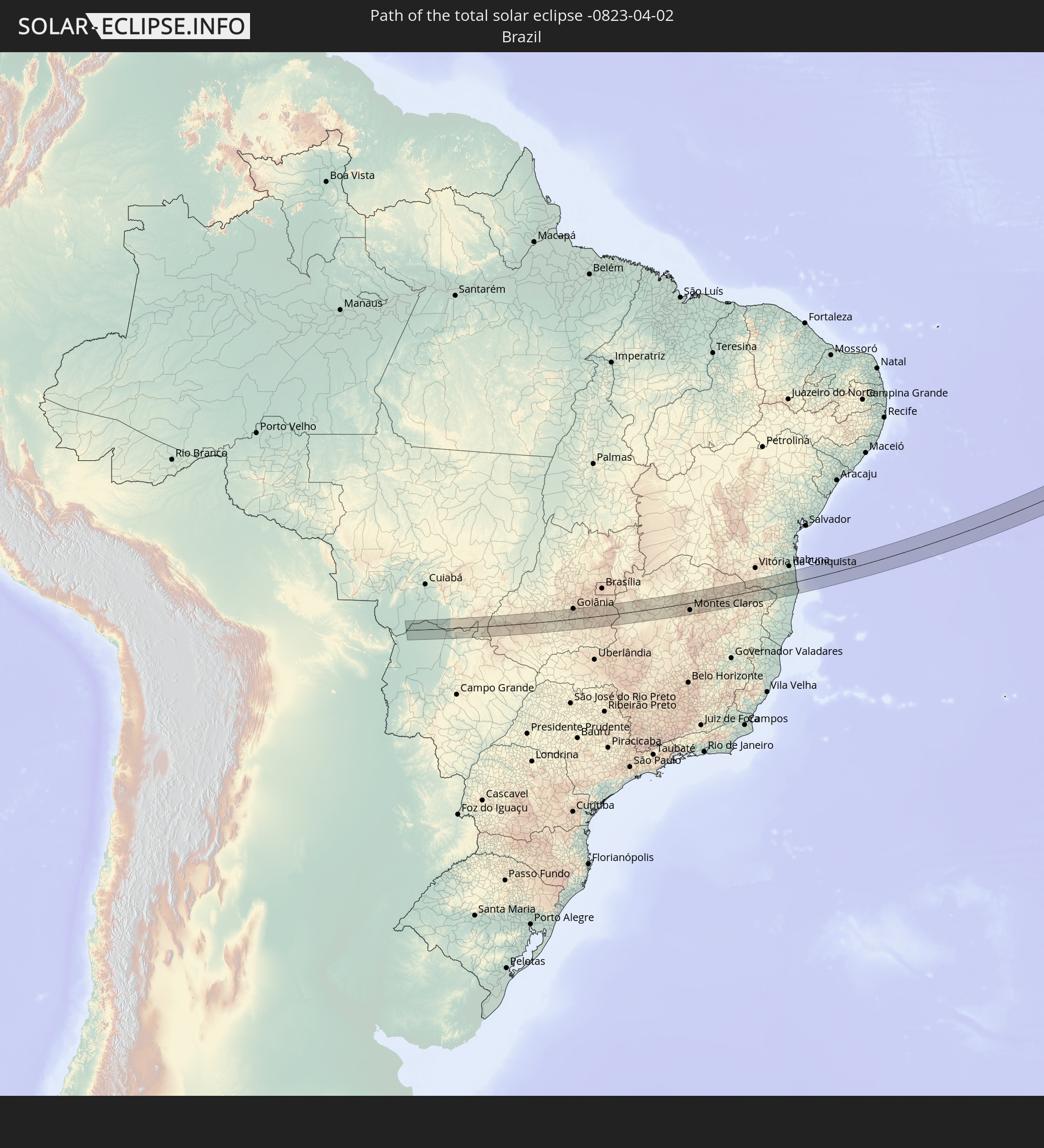 Brazil
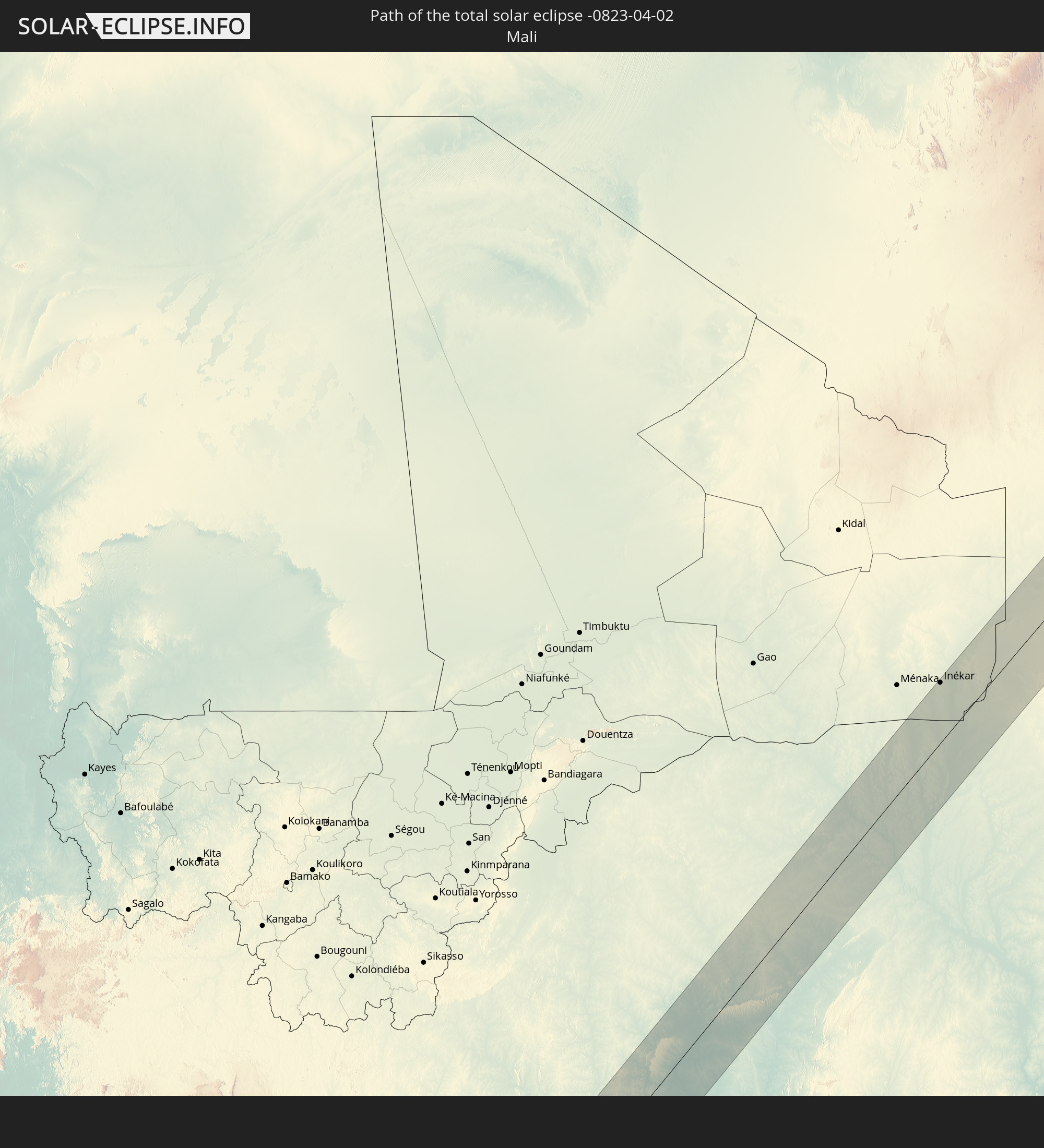 Mali
Mali
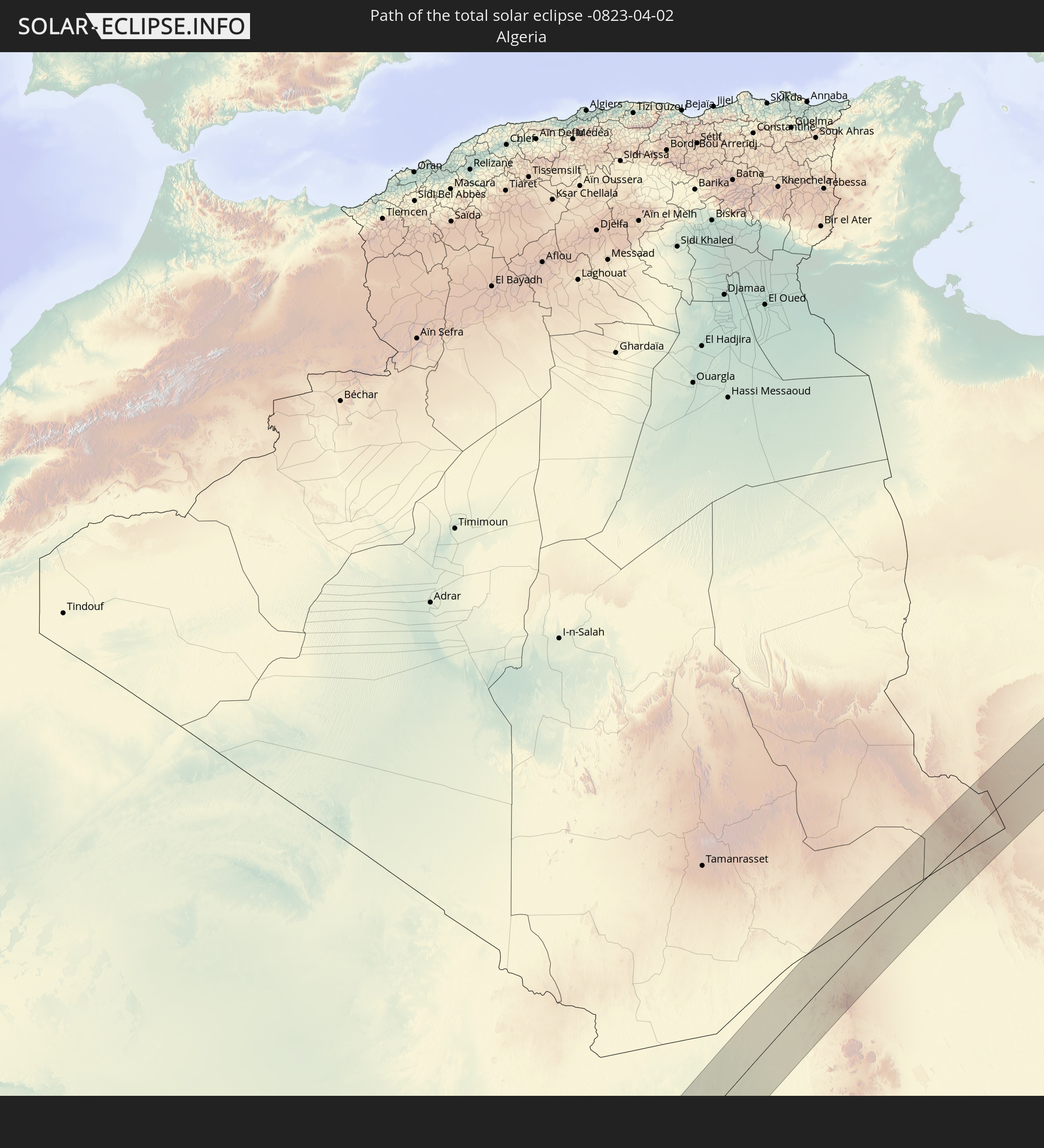 Algeria
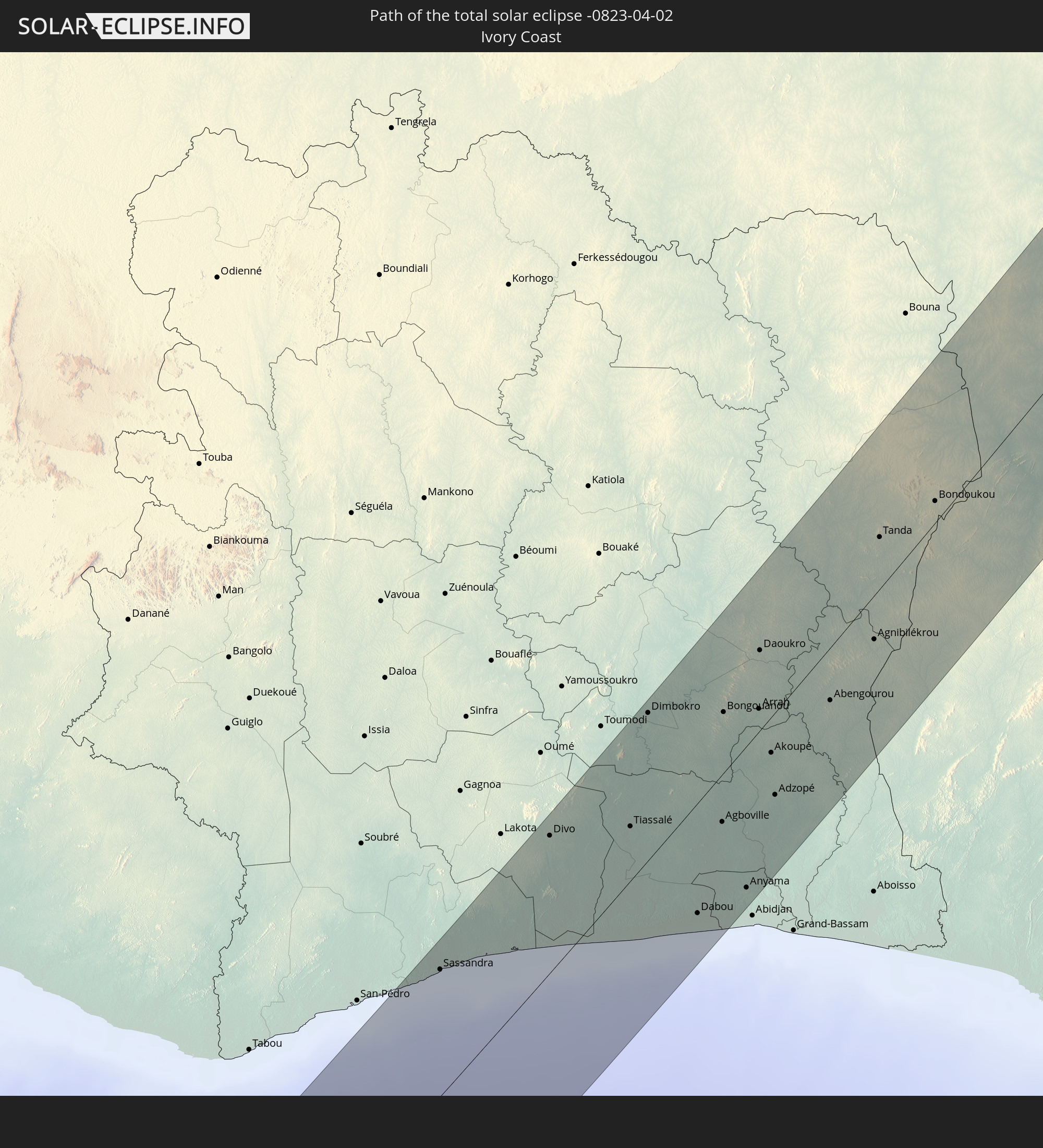 Ivory Coast
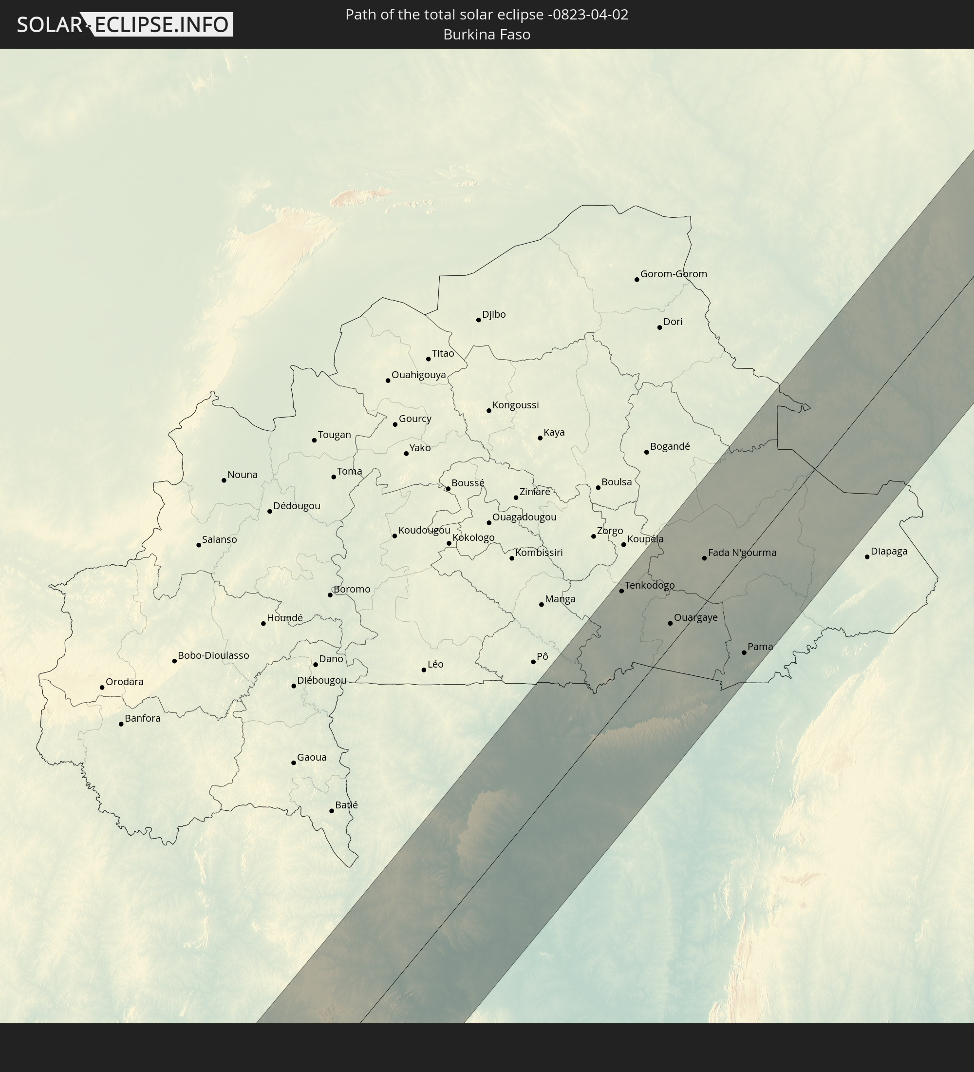 Burkina Faso
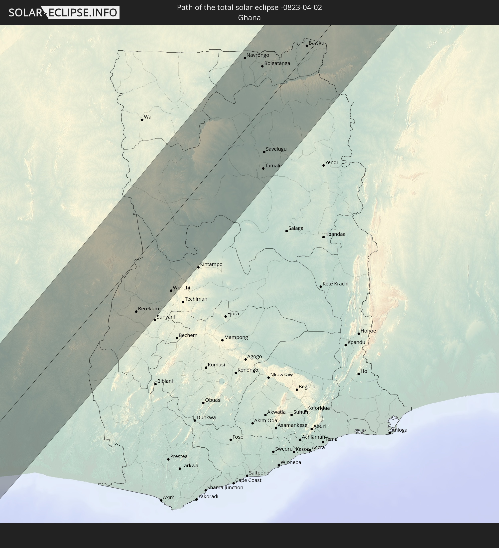 Ghana
Ghana
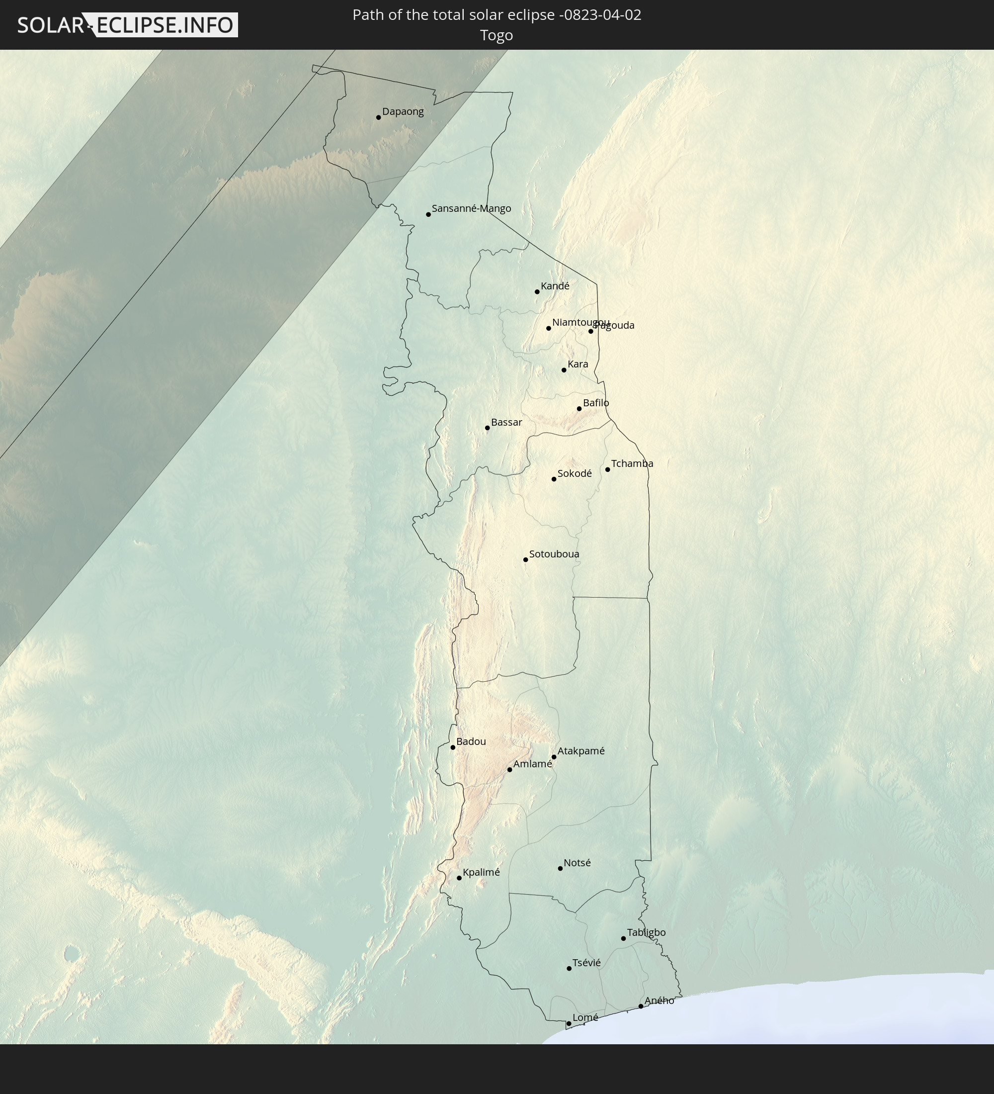 Togo
Togo
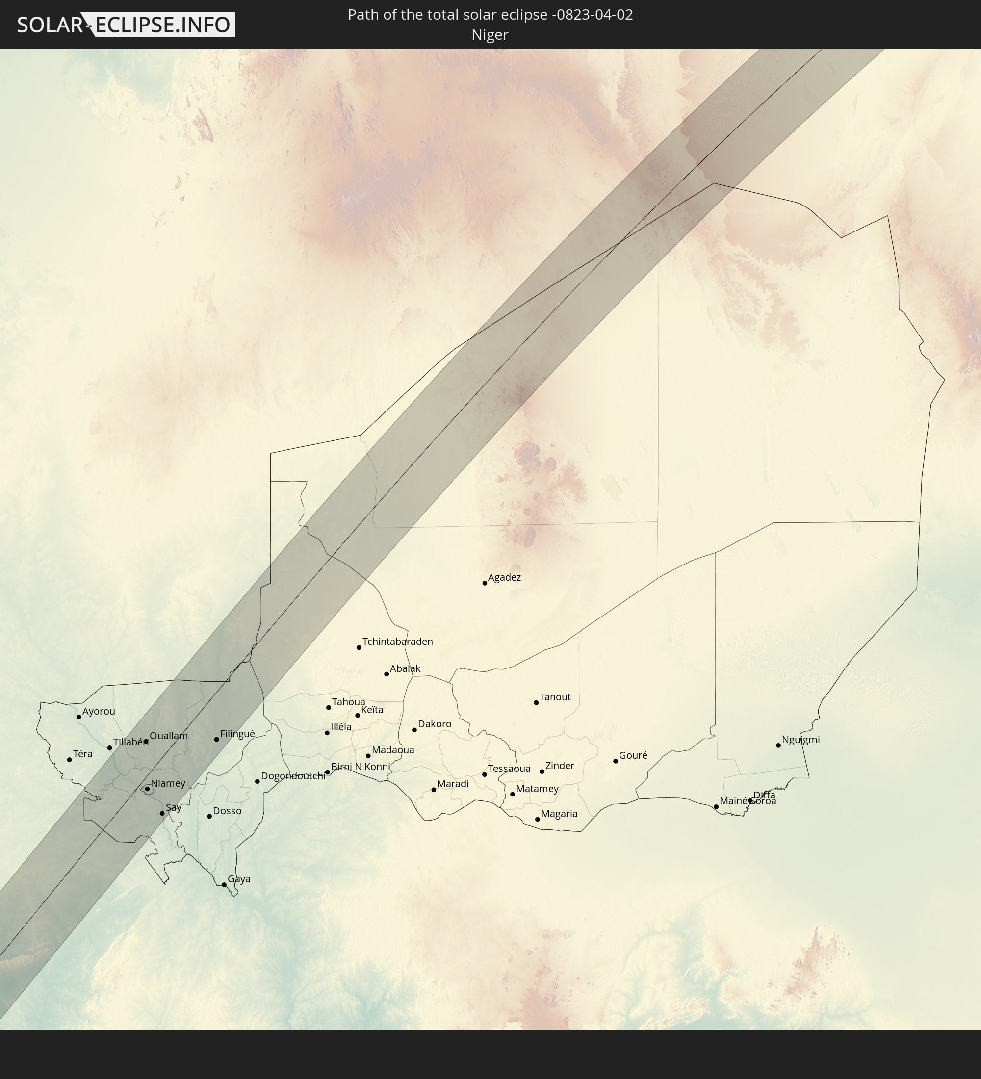 Niger
Niger
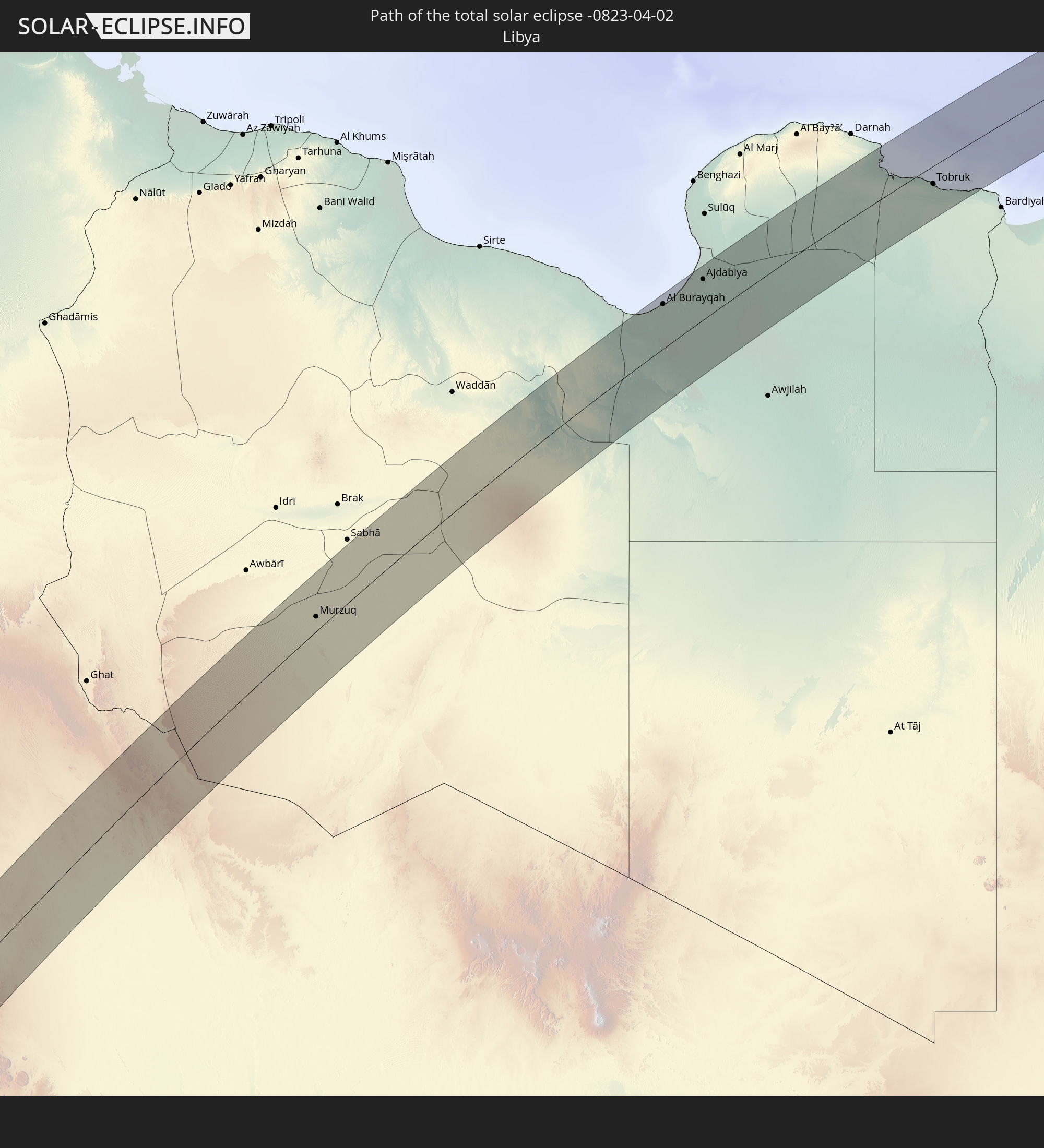 Libya
Libya
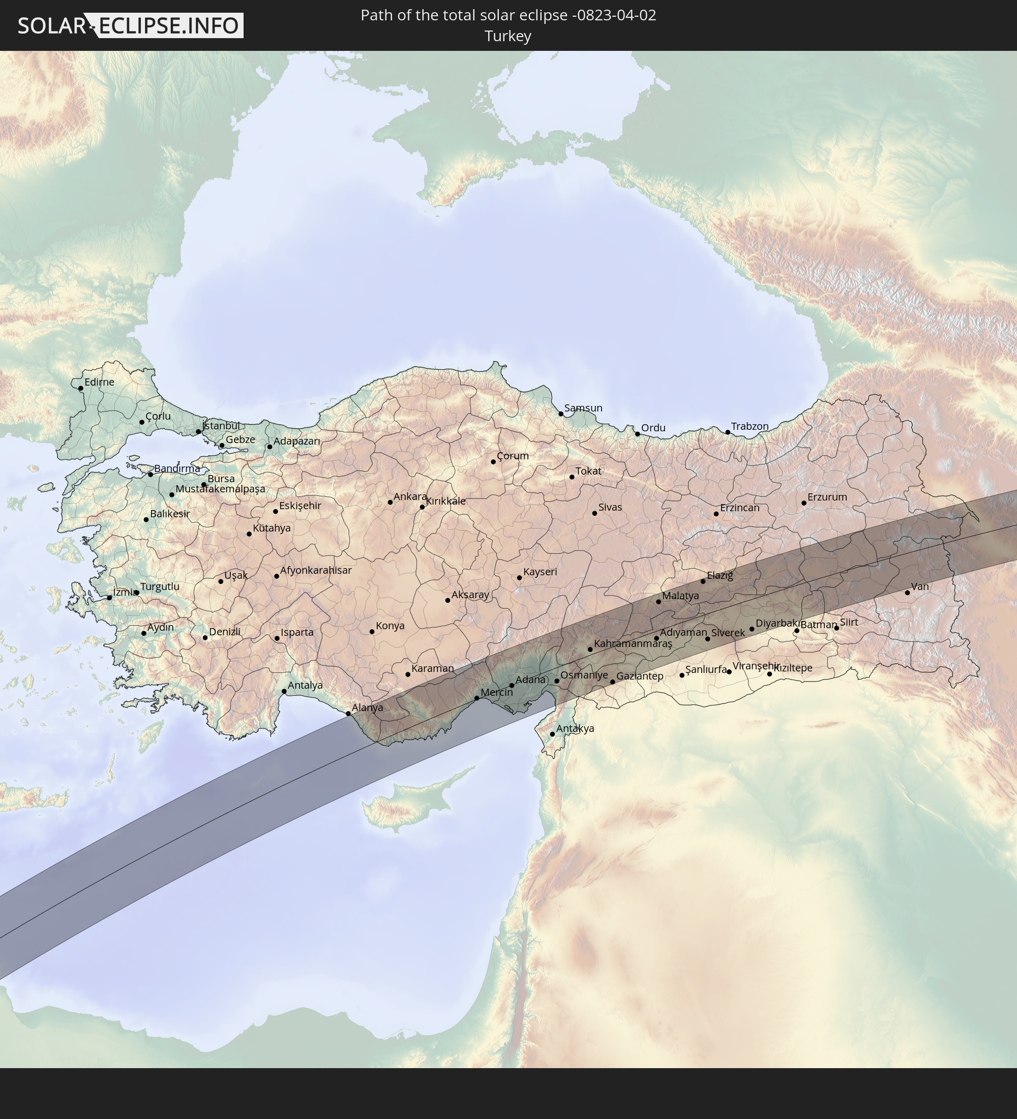 Turkey
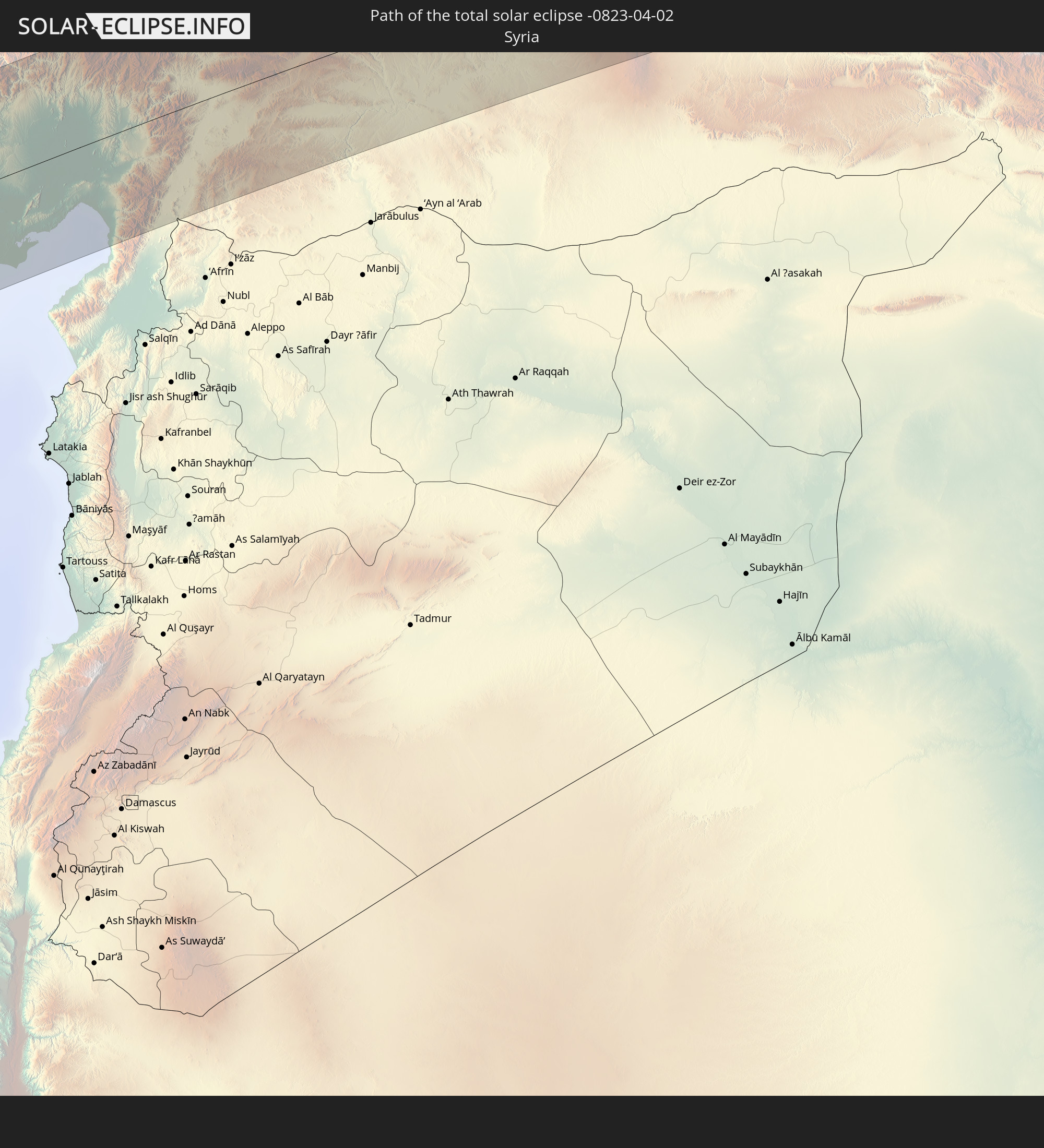 Syria
Syria
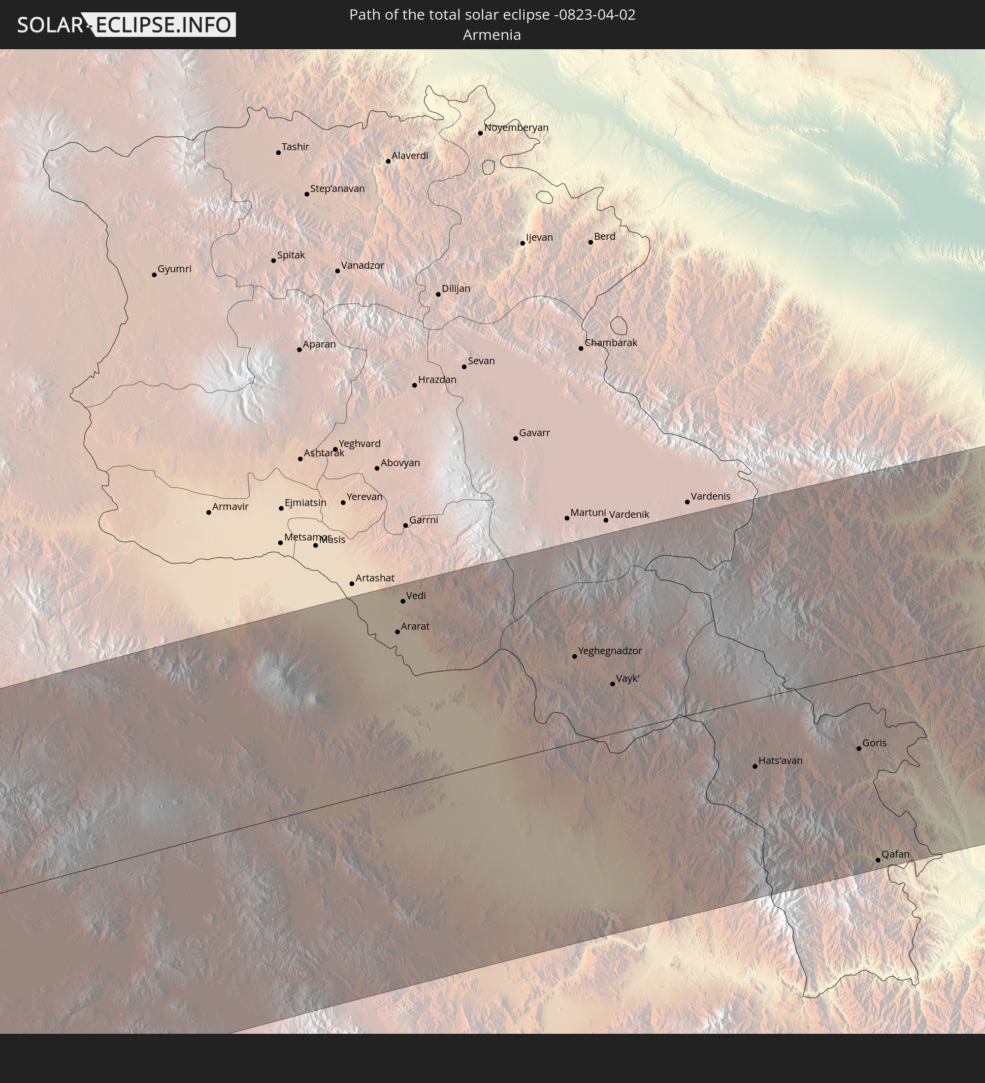 Armenia
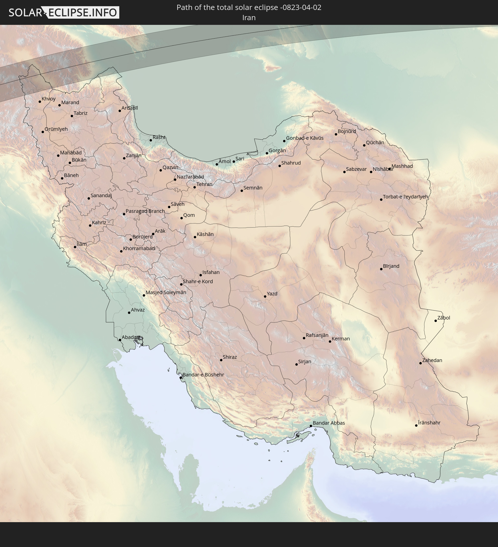 Iran
Iran
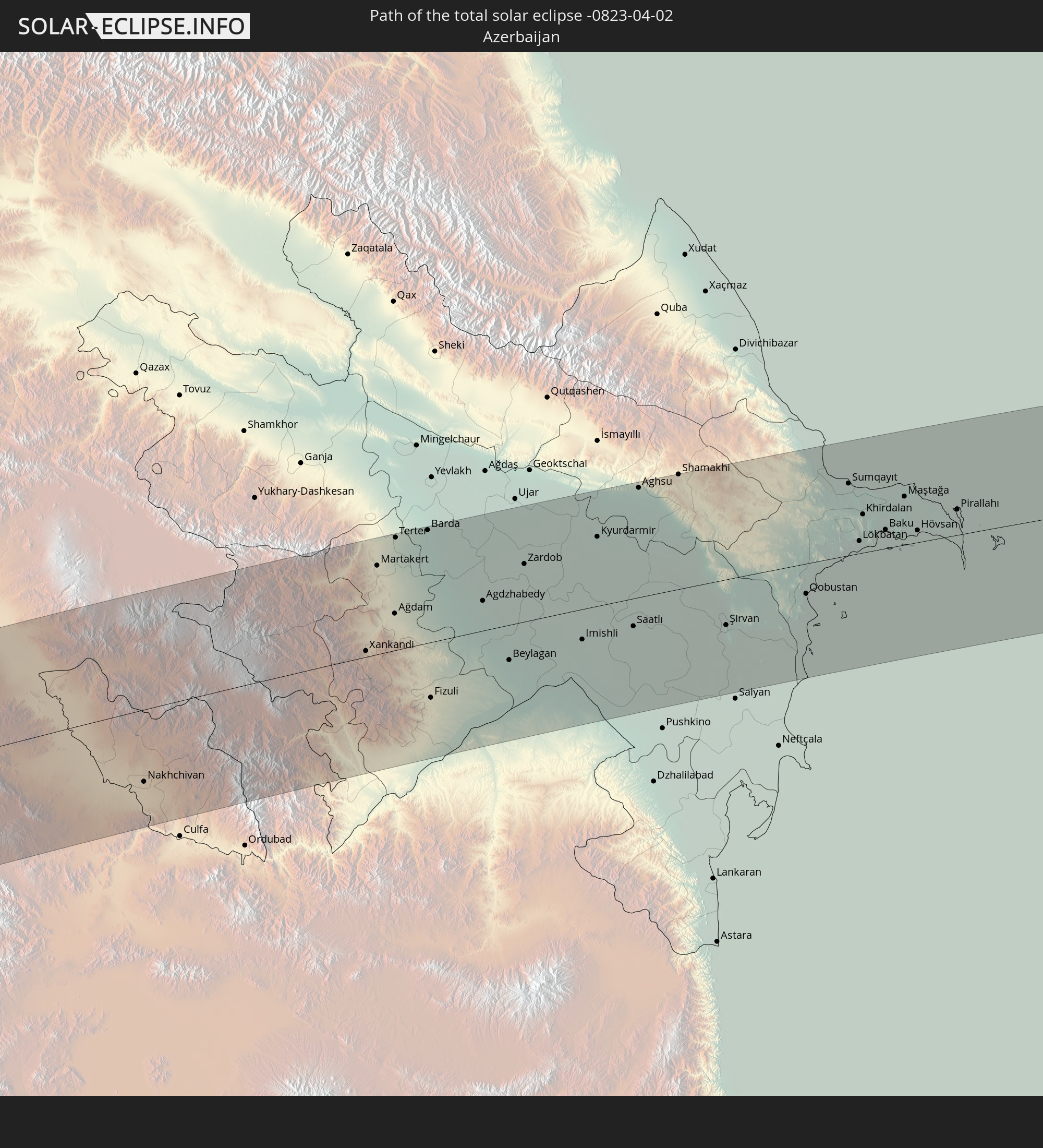 Azerbaijan
 Kazakhstan
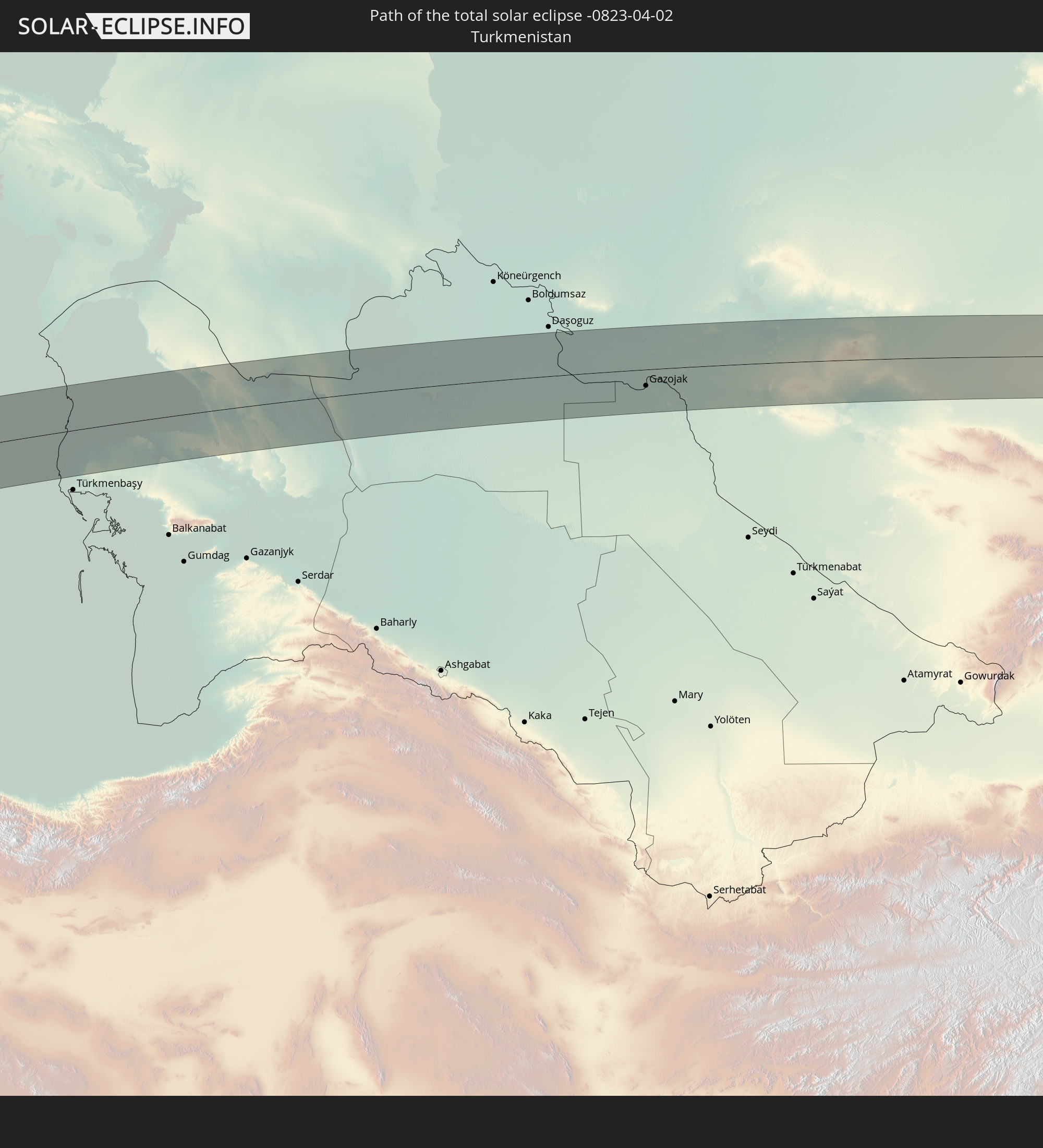 Turkmenistan
 Uzbekistan
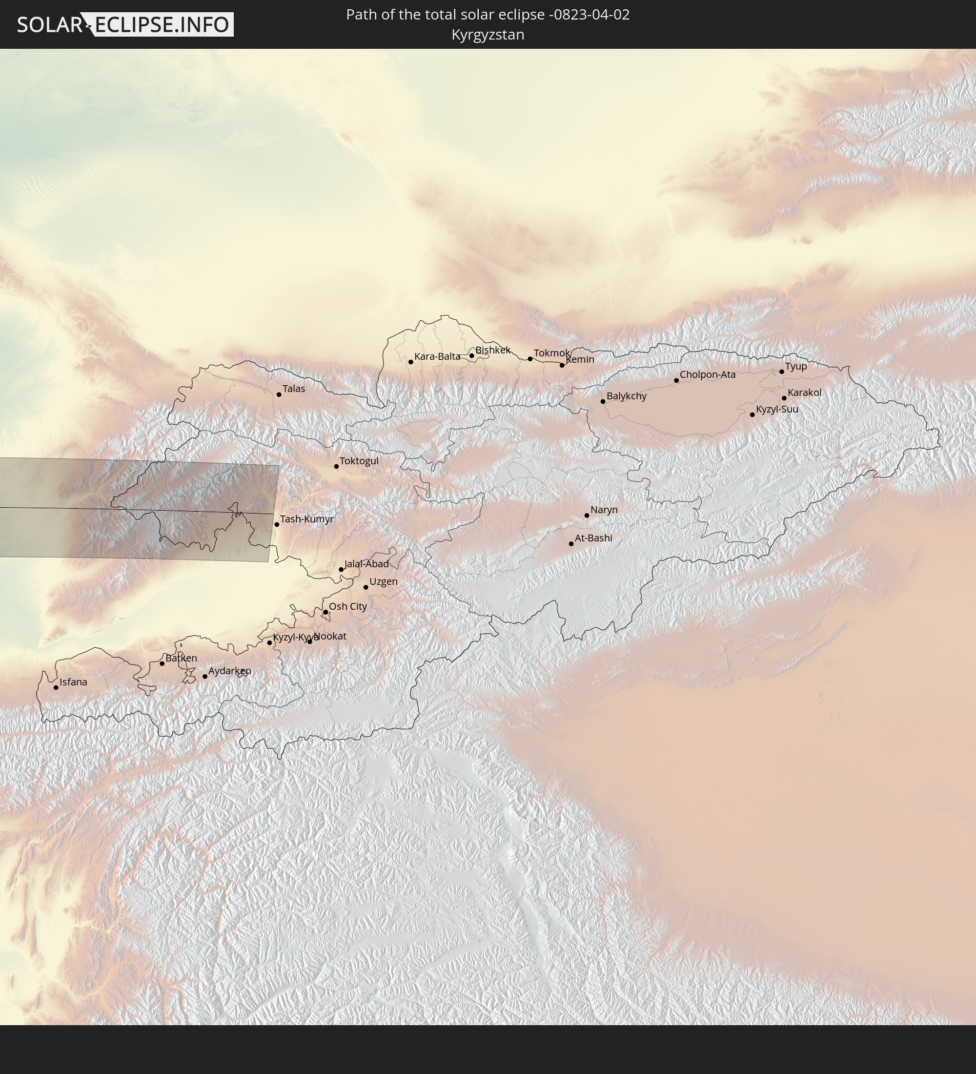 Kyrgyzstan
In den folgenden Ländern ist die Sonnenfinsternis partiell zu sehen
 Russia
 Brazil
 Argentina
 Venezuela
 Puerto Rico
 United States Virgin Islands
 British Virgin Islands
 Anguilla
 Collectivity of Saint Martin
 Saint Barthélemy
 Saint Kitts and Nevis
 Paraguay
 Antigua and Barbuda
 Montserrat
 Trinidad and Tobago
 Guadeloupe
 Grenada
 Dominica
 Saint Vincent and the Grenadines
 Guyana
 Martinique
 Saint Lucia
 Barbados
 Uruguay
 Suriname
 French Guiana
 Portugal
 Cabo Verde
 Spain
Spain
 Senegal
 Mauritania
 The Gambia
 Guinea-Bissau
 Guinea
 Saint Helena, Ascension and Tristan da Cunha
 Sierra Leone
 Morocco
 Mali
Mali
 Liberia
 Republic of Ireland
 Algeria
 United Kingdom
 Ivory Coast
 Burkina Faso
 Gibraltar
 France
 Isle of Man
 Ghana
Ghana
 Guernsey
 Jersey
 Togo
Togo
 Niger
Niger
 Benin
Benin
 Andorra
 Belgium
 Nigeria
 Netherlands
 Norway
 Equatorial Guinea
 Luxembourg
 Germany
 Switzerland
 São Tomé and Príncipe
 Italy
Italy
 Monaco
 Tunisia
 Denmark
 Cameroon
 Gabon
Gabon
 Libya
Libya
 Liechtenstein
 Austria
 Sweden
 Republic of the Congo
 Angola
 Namibia
 Czechia
 Democratic Republic of the Congo
 San Marino
 Vatican City
 Slovenia
 Chad
Chad
 Croatia
 Poland
 Malta
Malta
 Central African Republic
 Bosnia and Herzegovina
 Hungary
 Slovakia
 Montenegro
 Serbia
 Albania
 Åland Islands
 Greece
 Romania
 Republic of Macedonia
 Finland
 Lithuania
 Latvia
 Estonia
 Sudan
Sudan
 Ukraine
 Bulgaria
 Belarus
 Egypt
Egypt
 Turkey
 Moldova
 Rwanda
 Burundi
 Tanzania
 Uganda
 Cyprus
 Ethiopia
 Kenya
Kenya
 State of Palestine
 Israel
 Saudi Arabia
 Jordan
 Lebanon
 Syria
Syria
 Eritrea
 Iraq
Iraq
 Georgia
 Somalia
 Djibouti
 Yemen
Yemen
 Armenia
 Iran
Iran
 Azerbaijan
 Kazakhstan
 Kuwait
 Bahrain
 Qatar
Qatar
 United Arab Emirates
 Oman
Oman
 Turkmenistan
 Uzbekistan
 Afghanistan
 Pakistan
 Tajikistan
 India
India
 Kyrgyzstan
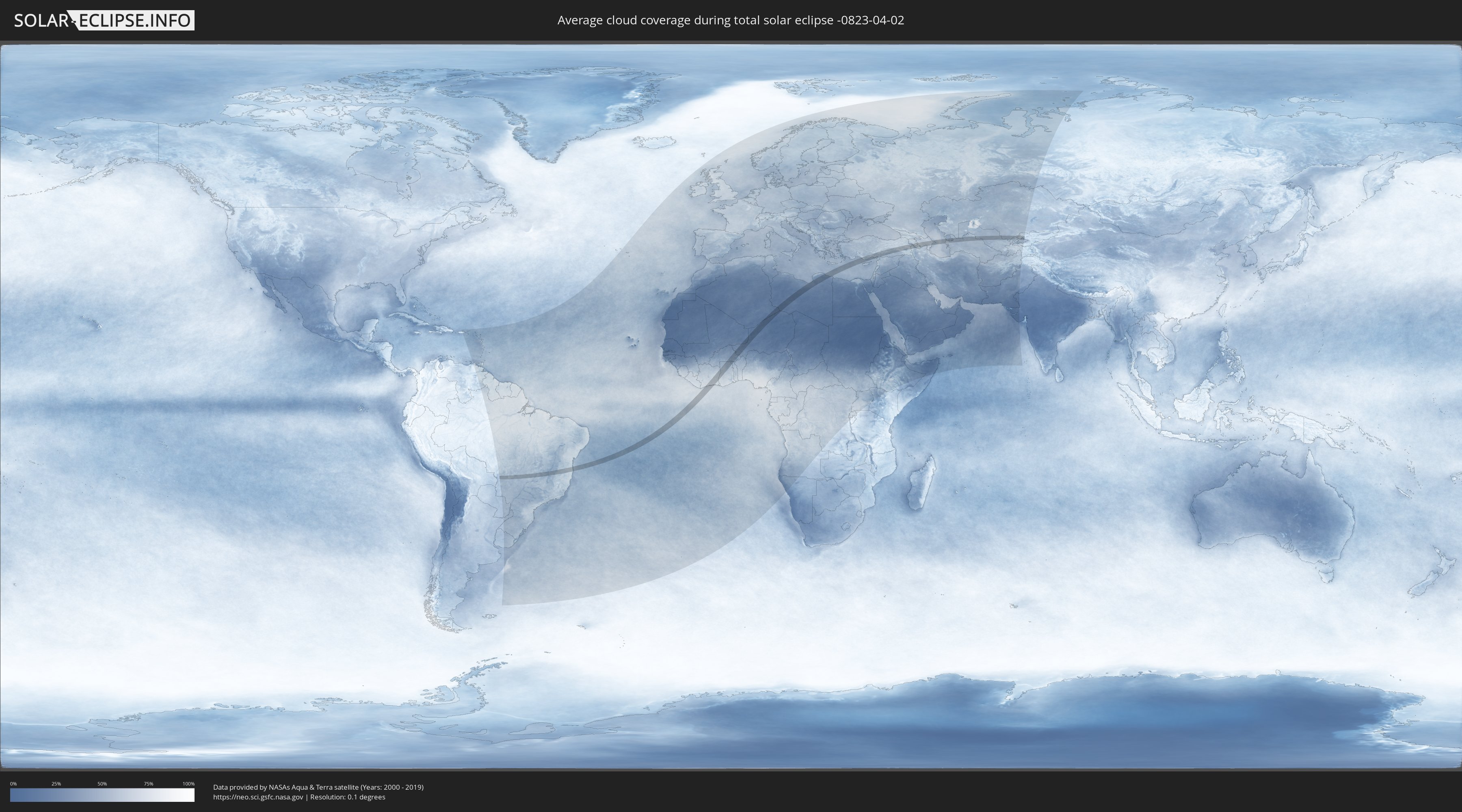
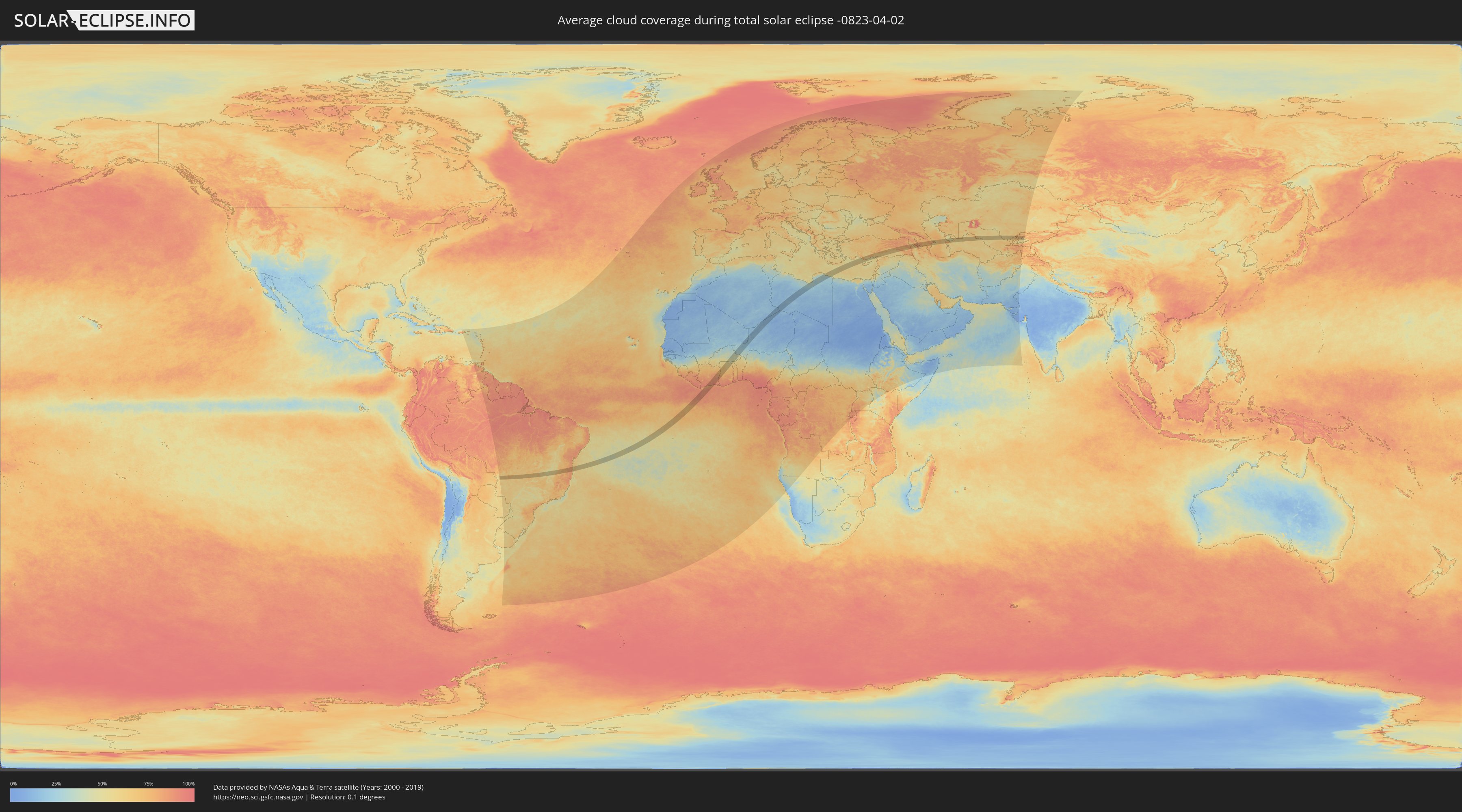
How will be the weather during the total solar eclipse on 04/02/-0823?
Where is the best place to see the total solar eclipse of 04/02/-0823?
The following maps show the average cloud coverage for the day of the total solar eclipse.
With the help of these maps, it is possible to find the place along the eclipse path, which has the best
chance of a cloudless sky.
Nevertheless, you should consider local circumstances and inform about the weather of your chosen
observation site.
The data is provided by NASAs satellites
AQUA and TERRA.
The cloud maps are averaged over a period of 19 years (2000 - 2019).
Detailed country maps
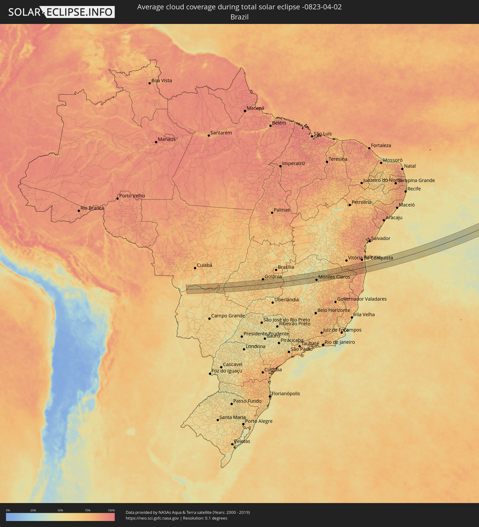 Brazil
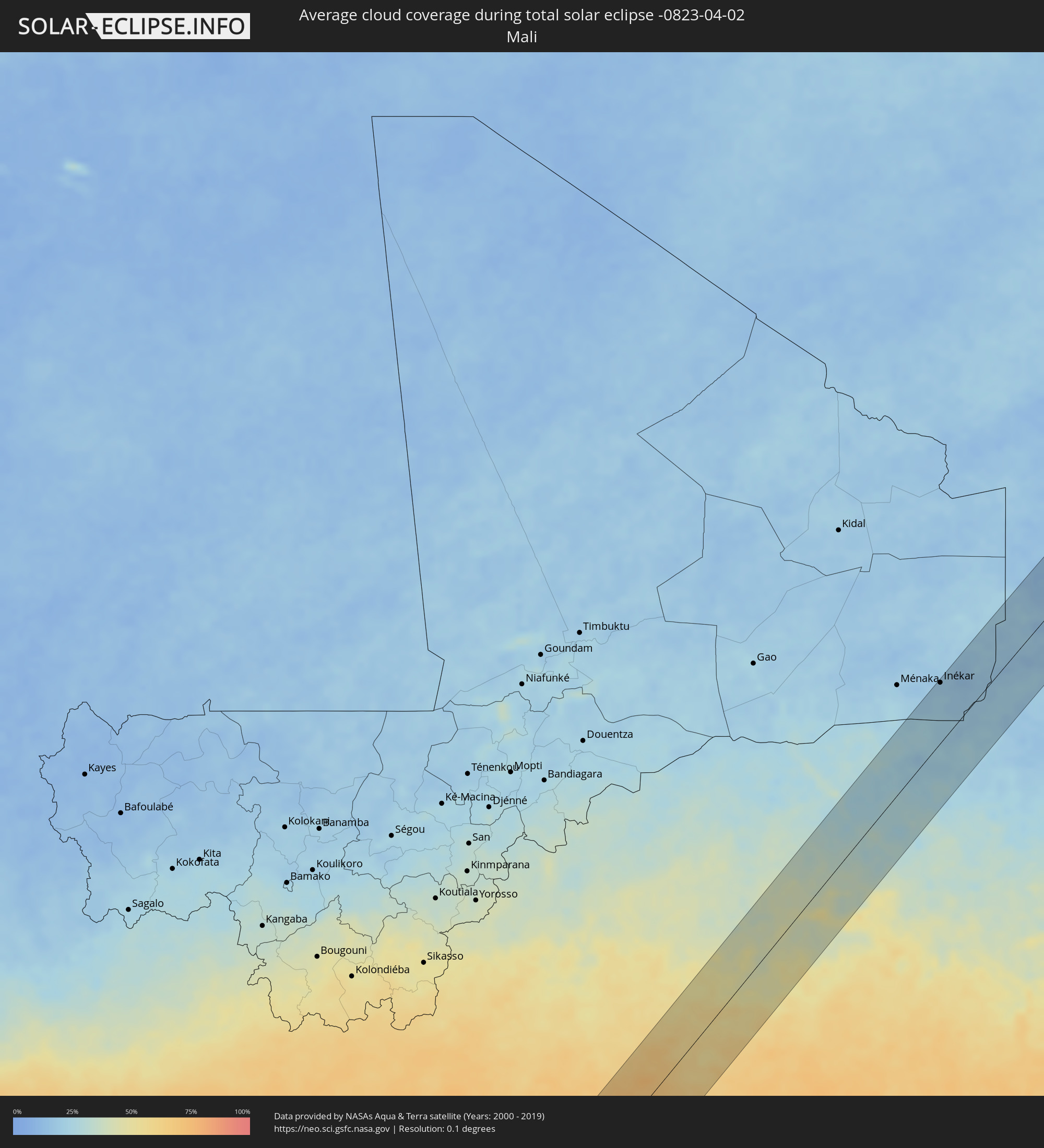 Mali
Mali
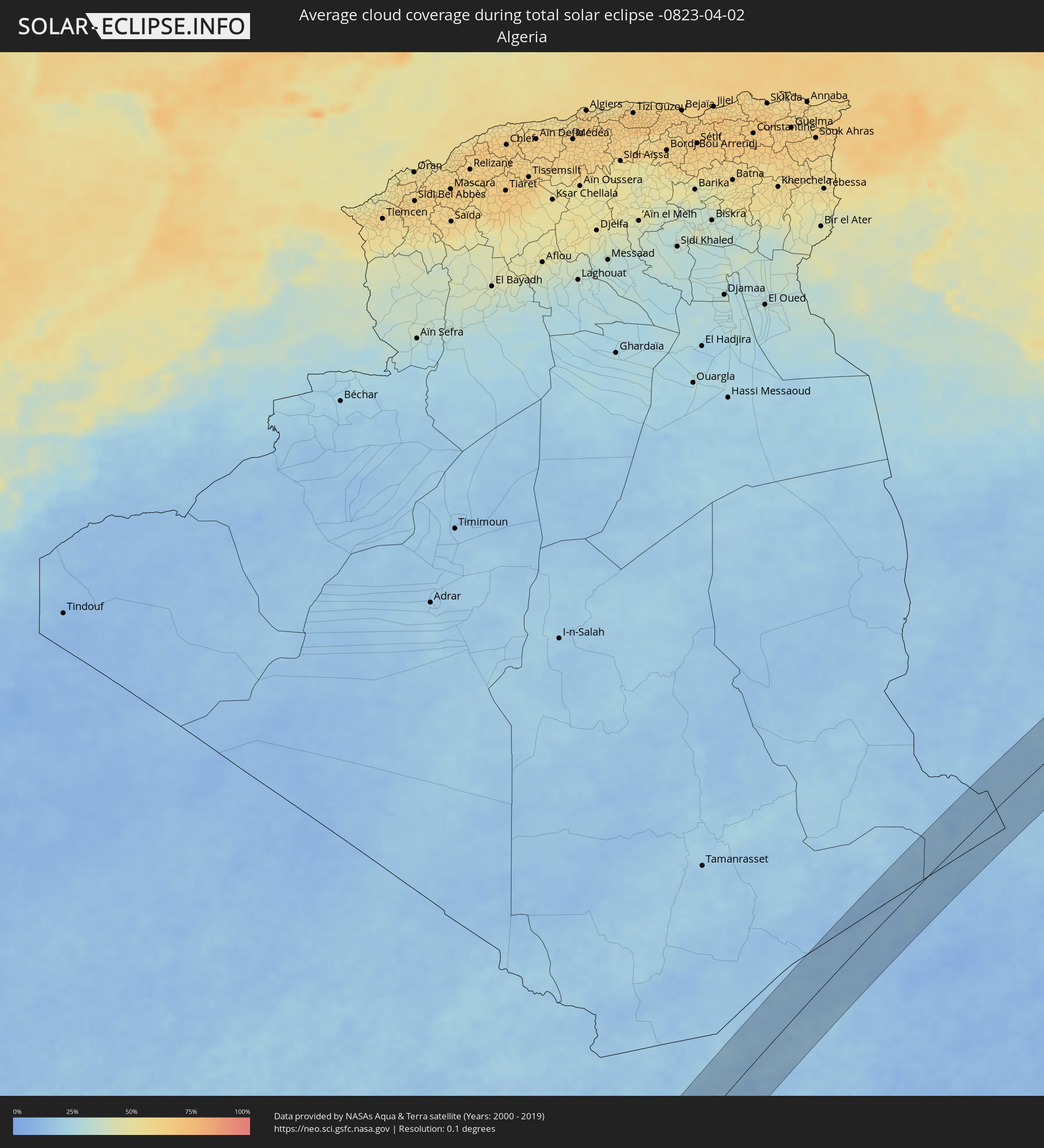 Algeria
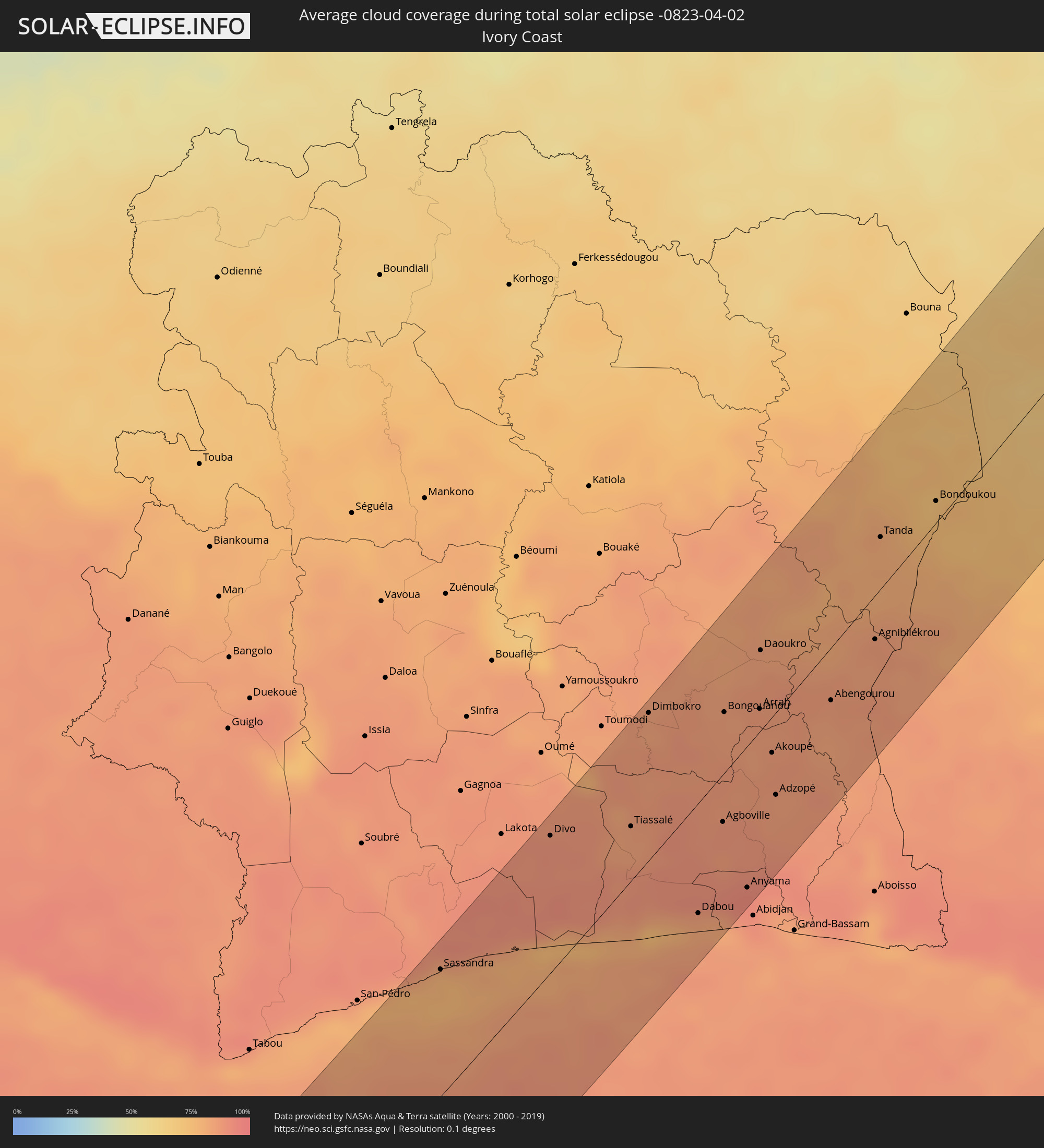 Ivory Coast
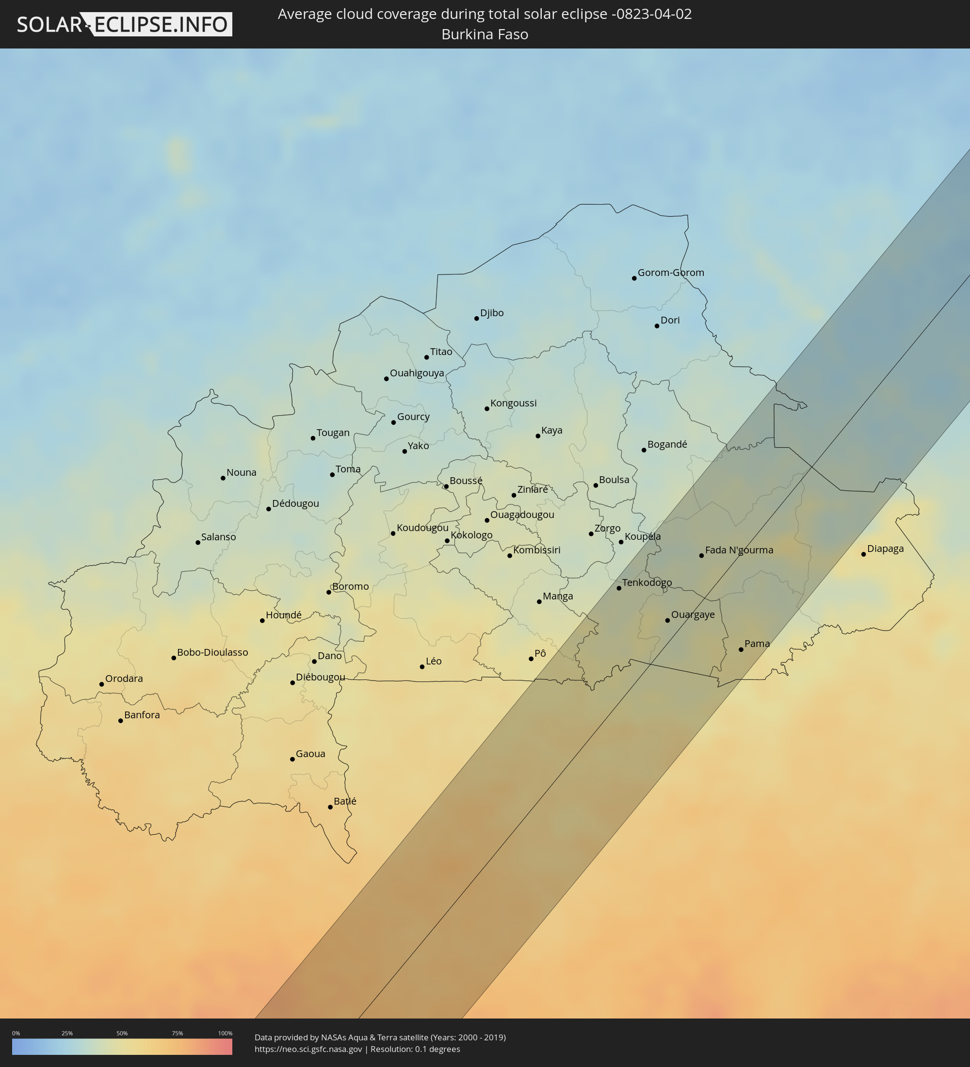 Burkina Faso
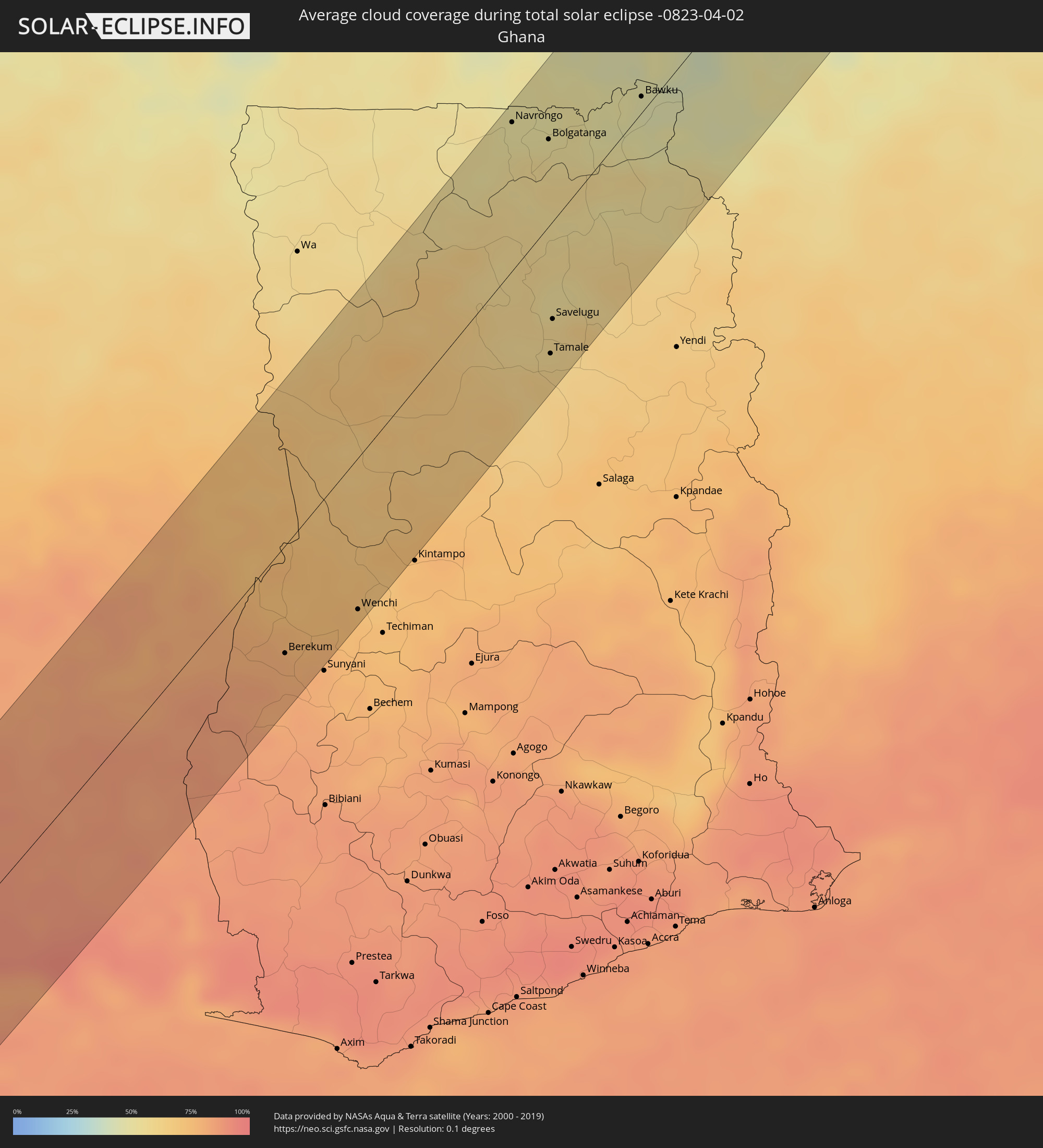 Ghana
Ghana
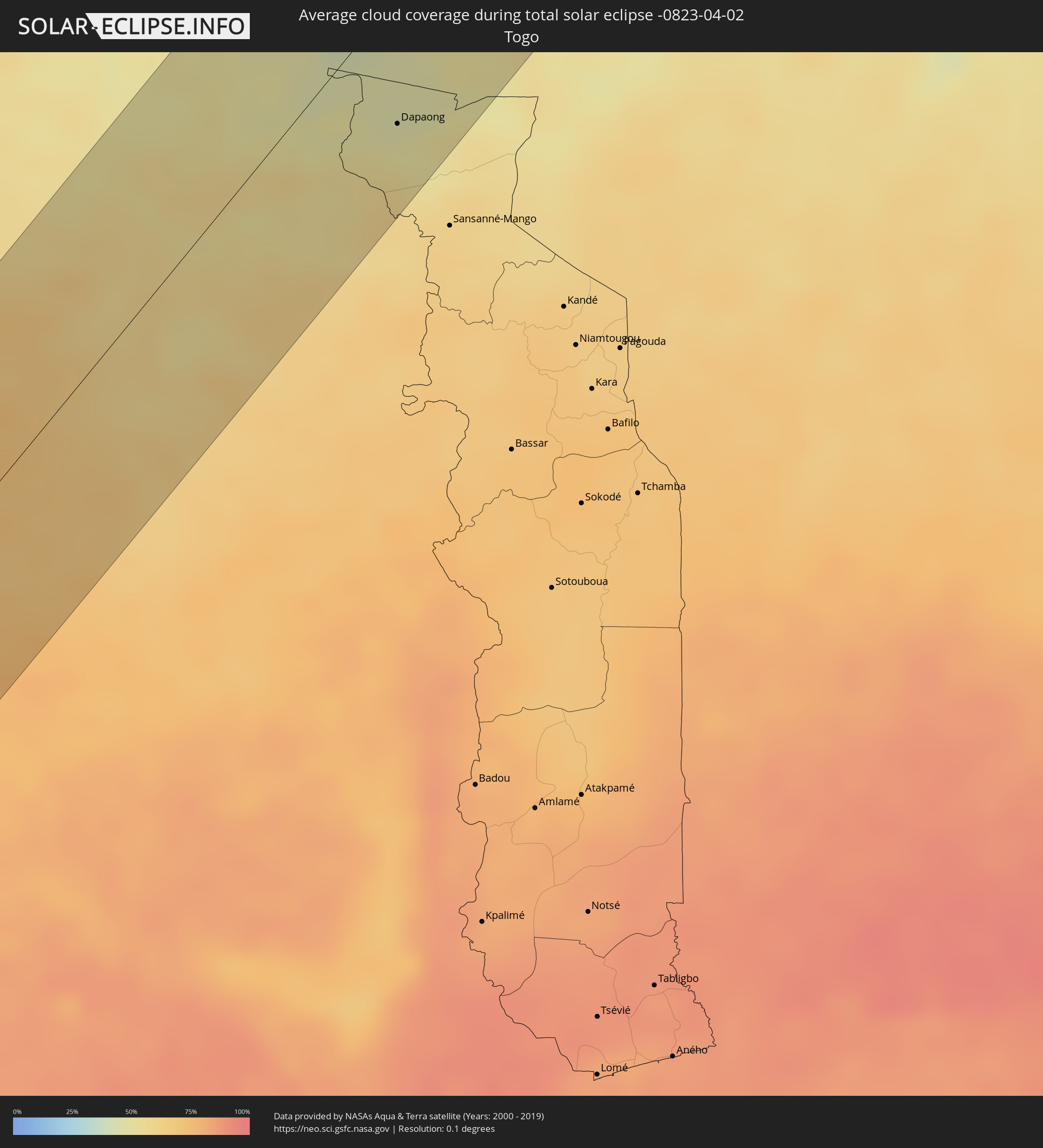 Togo
Togo
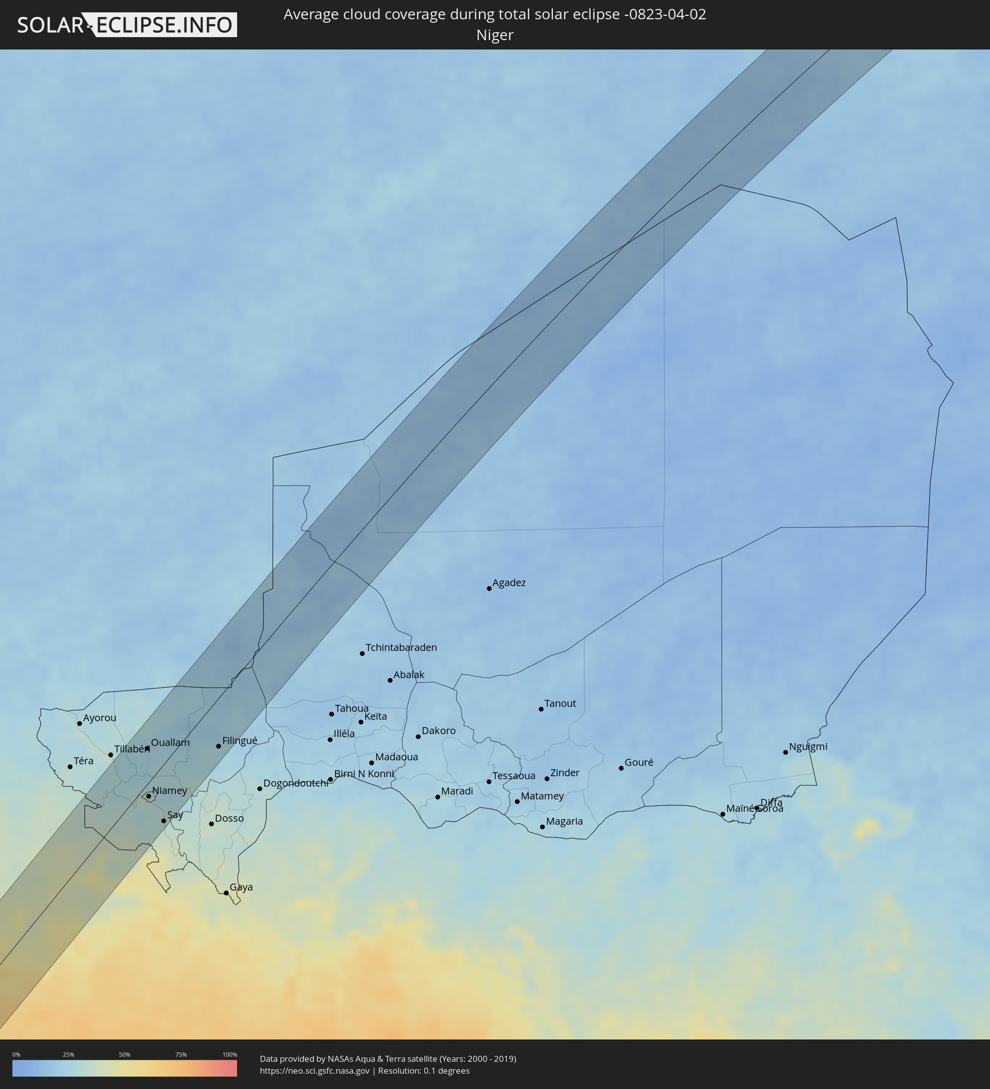 Niger
Niger
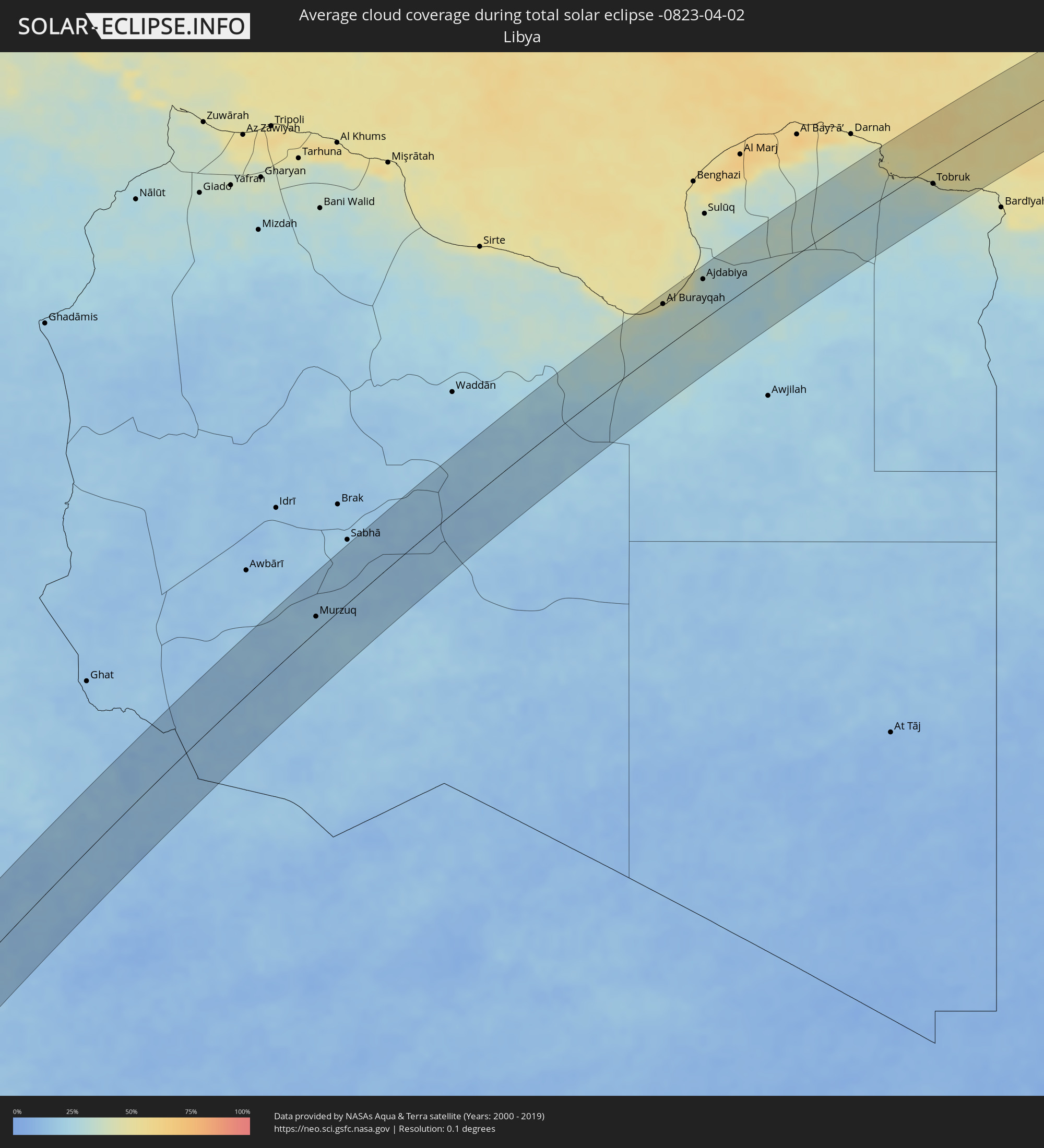 Libya
Libya
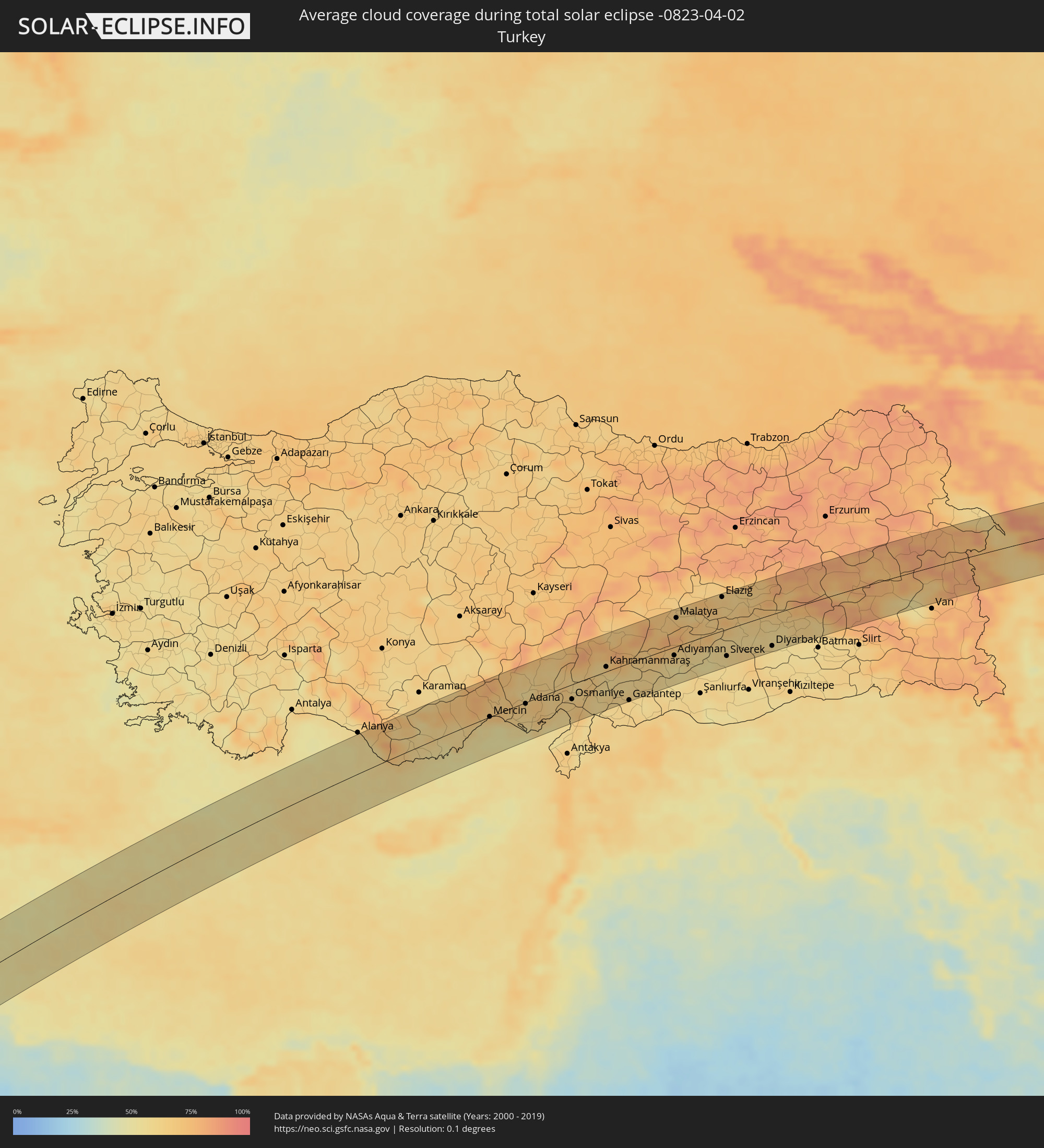 Turkey
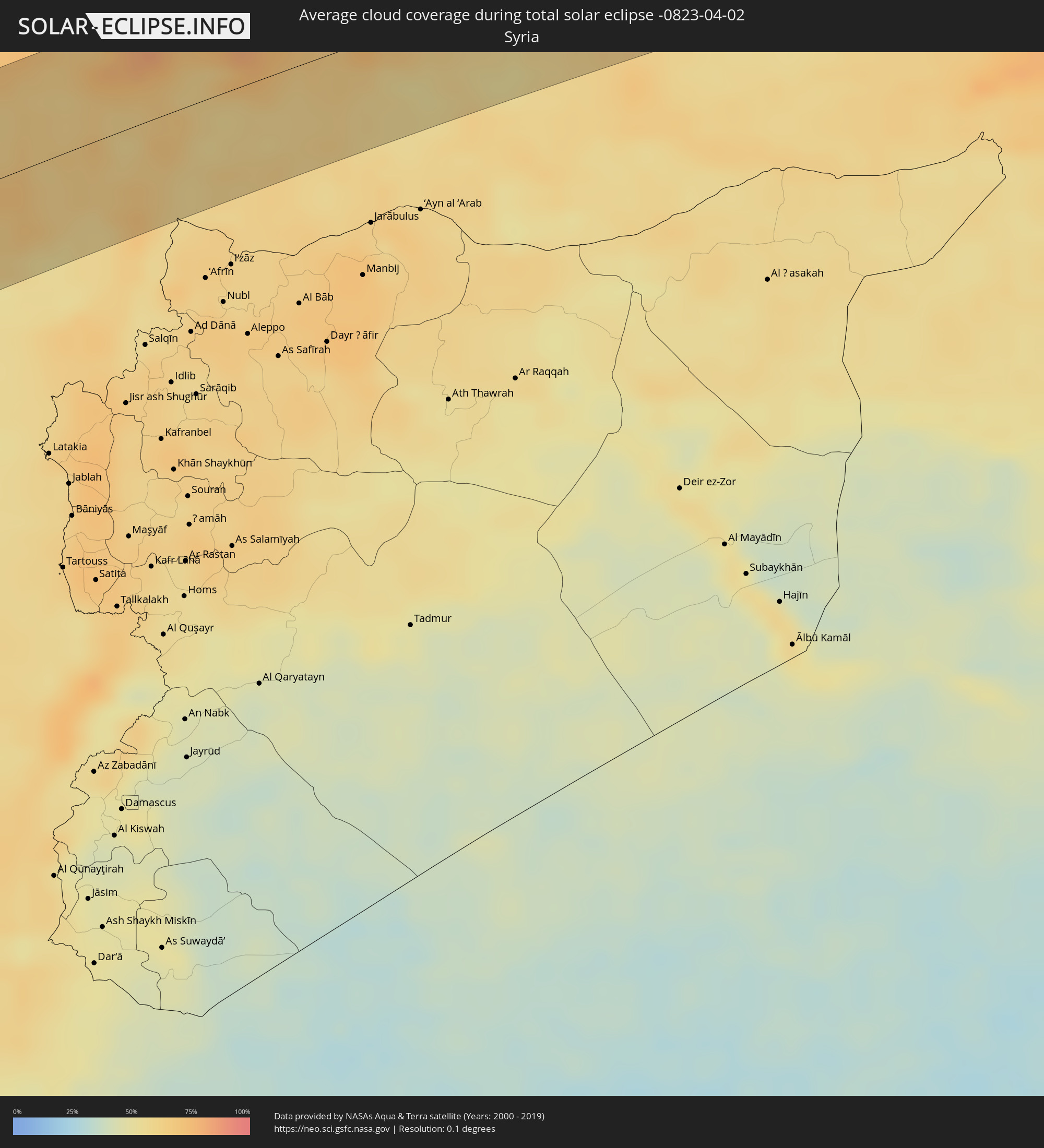 Syria
Syria
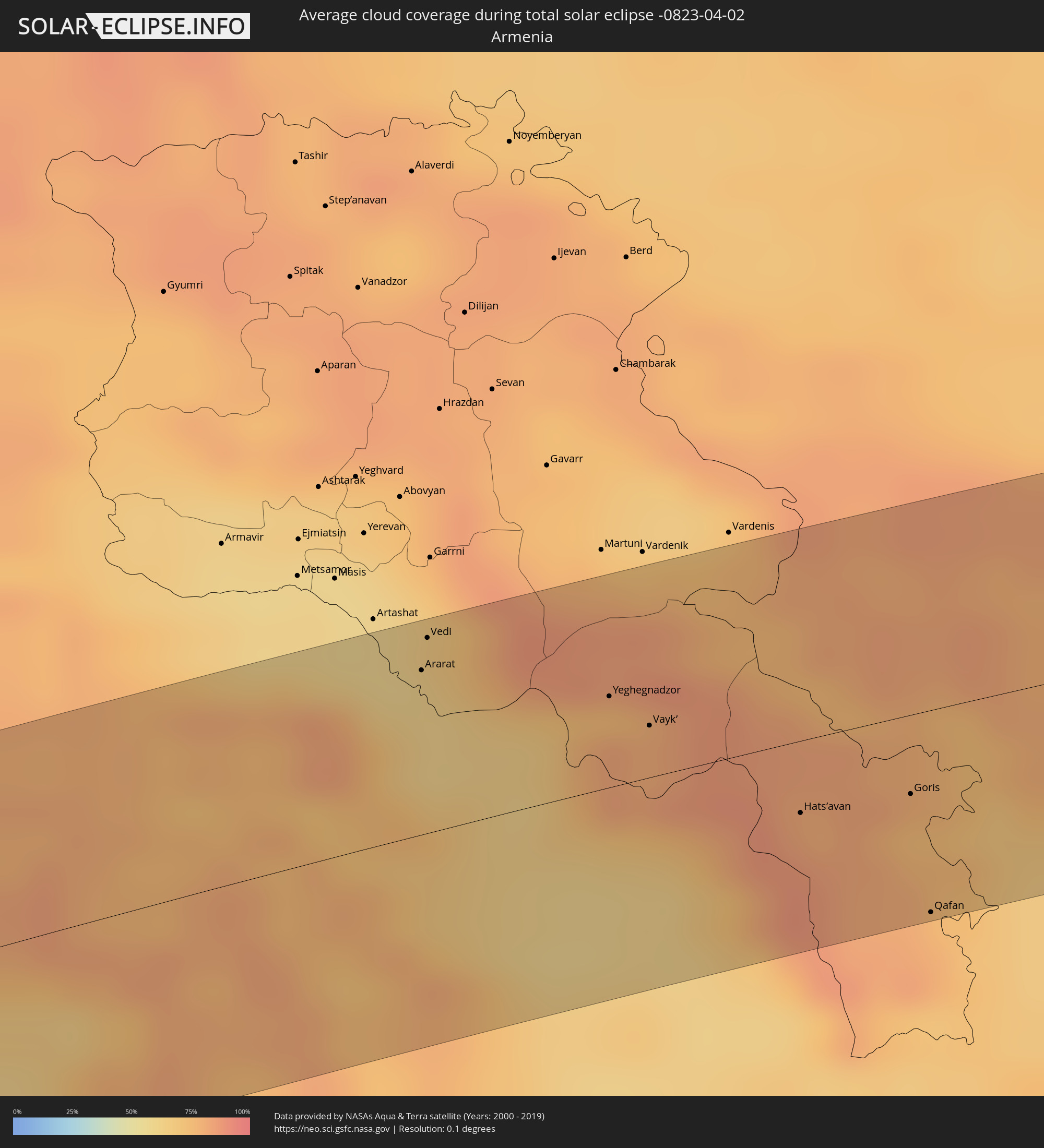 Armenia
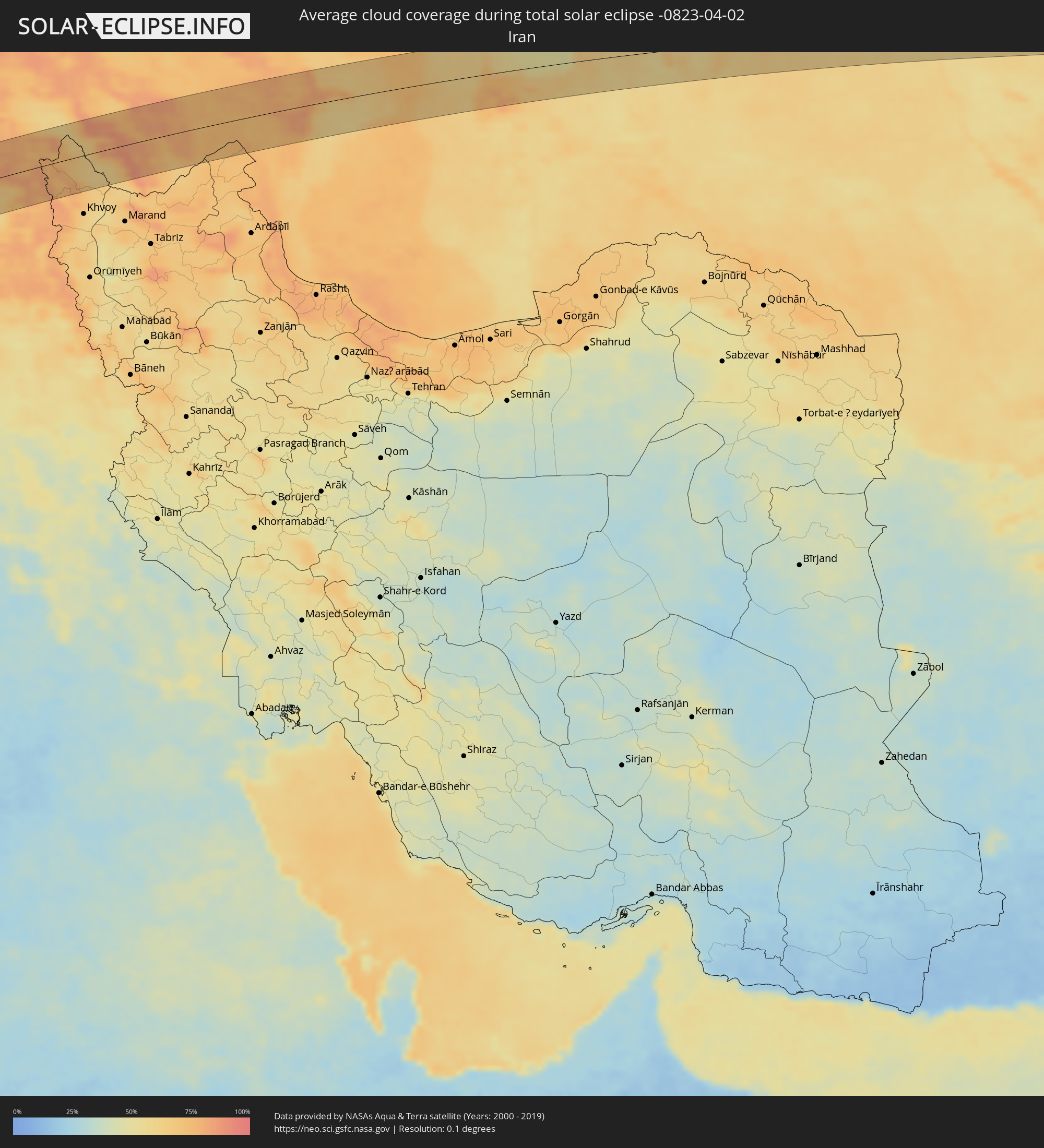 Iran
Iran
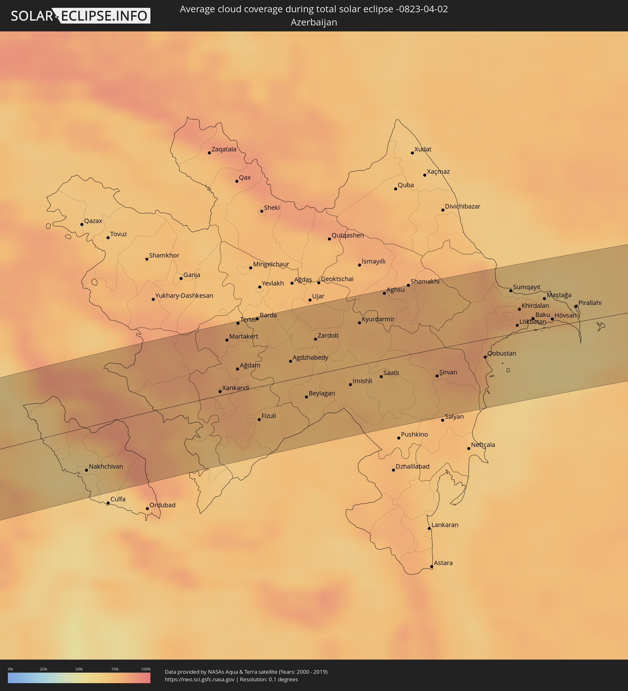 Azerbaijan
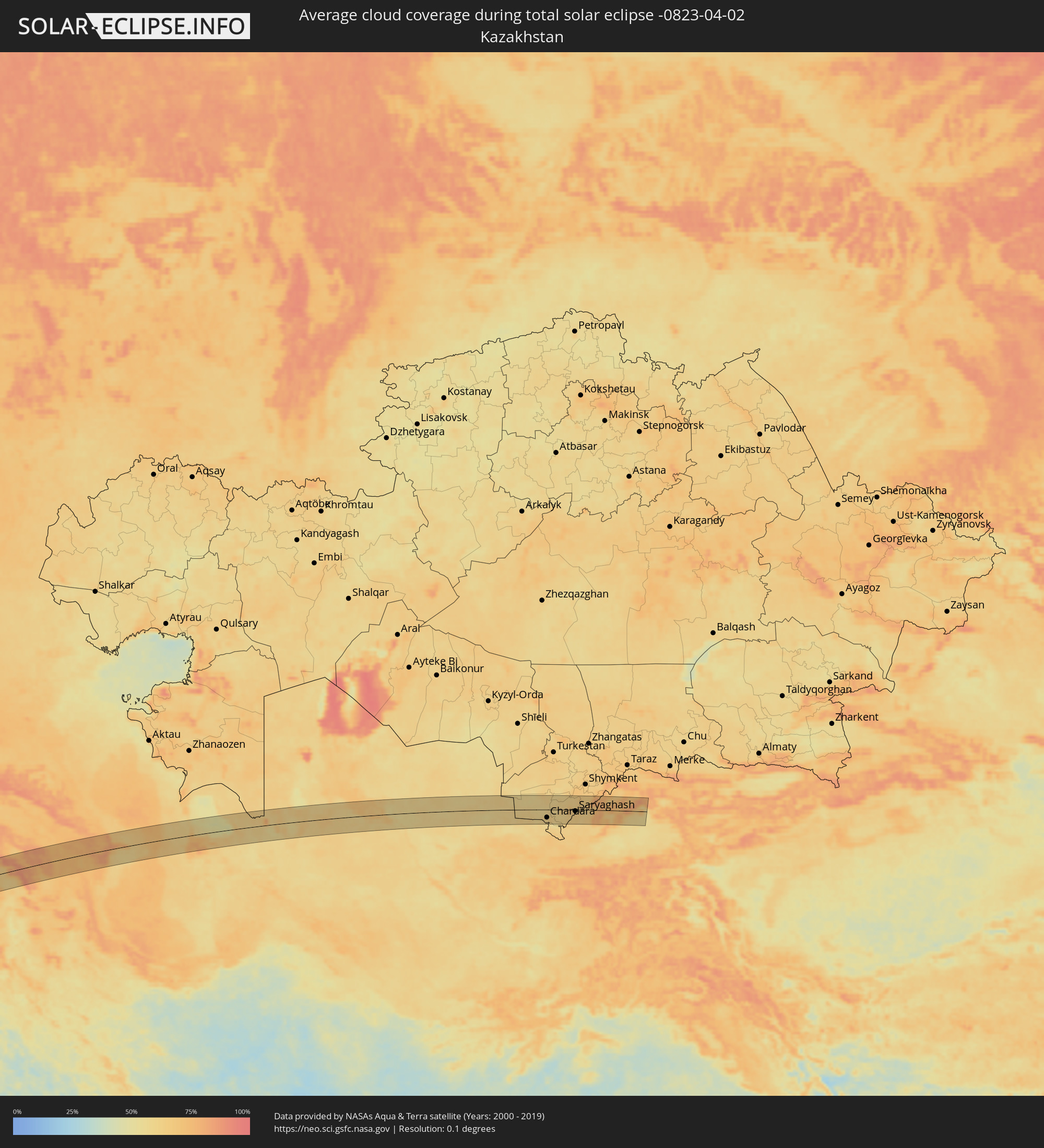 Kazakhstan
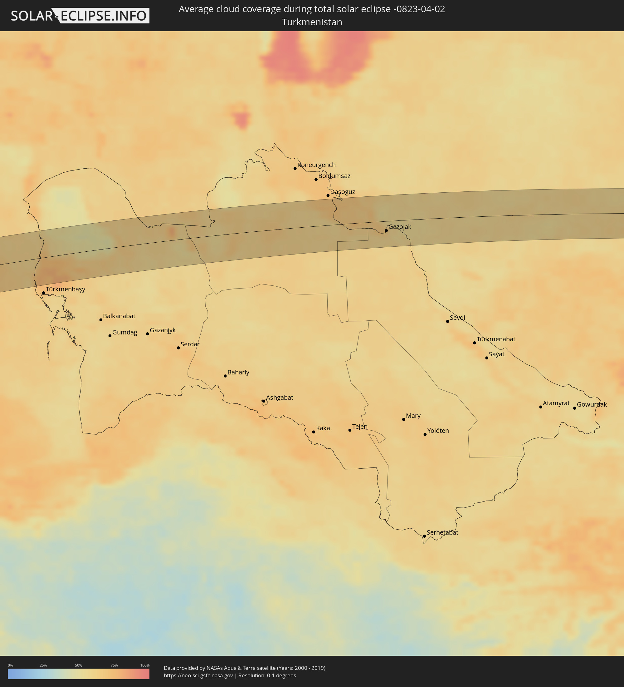 Turkmenistan
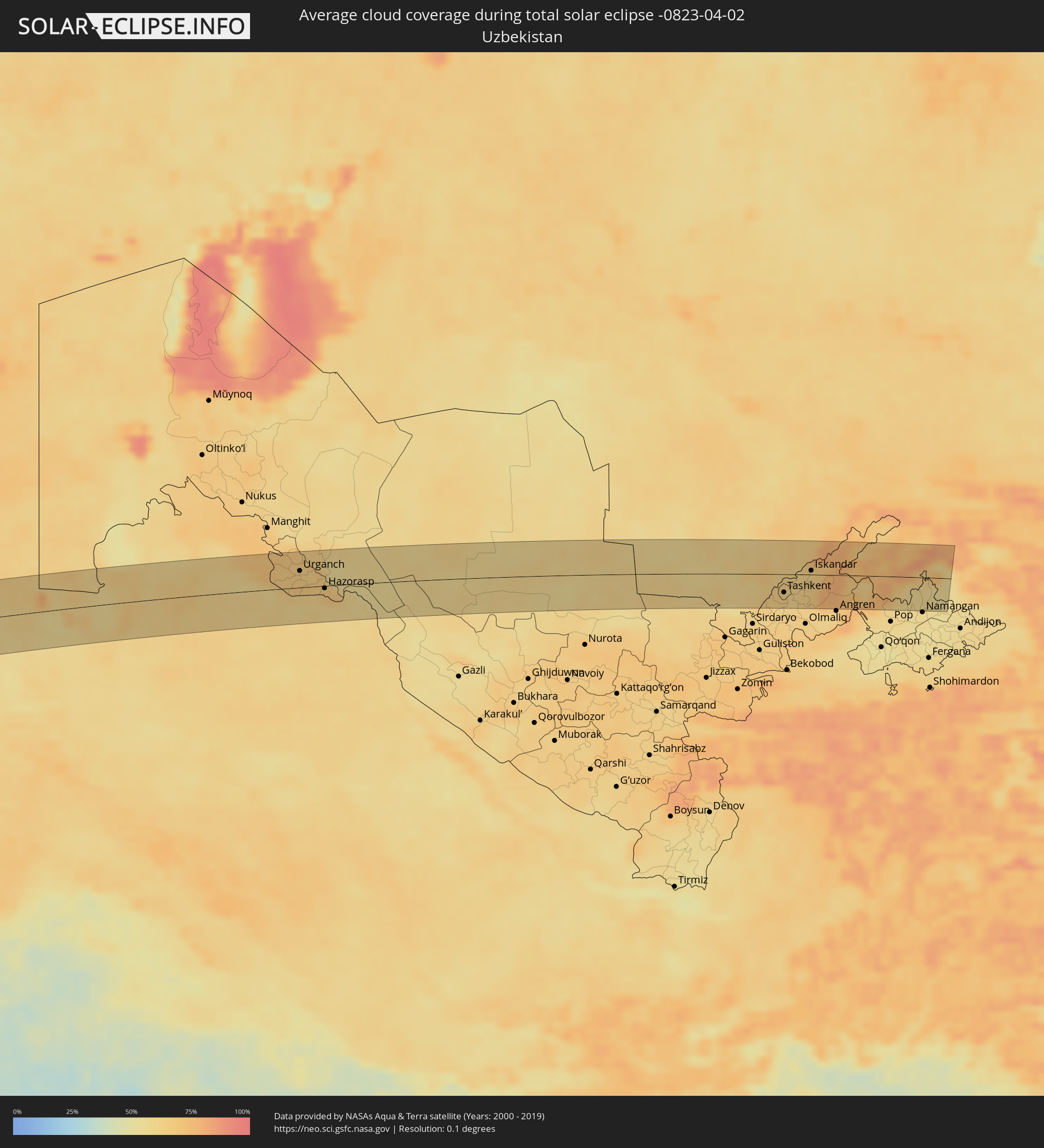 Uzbekistan
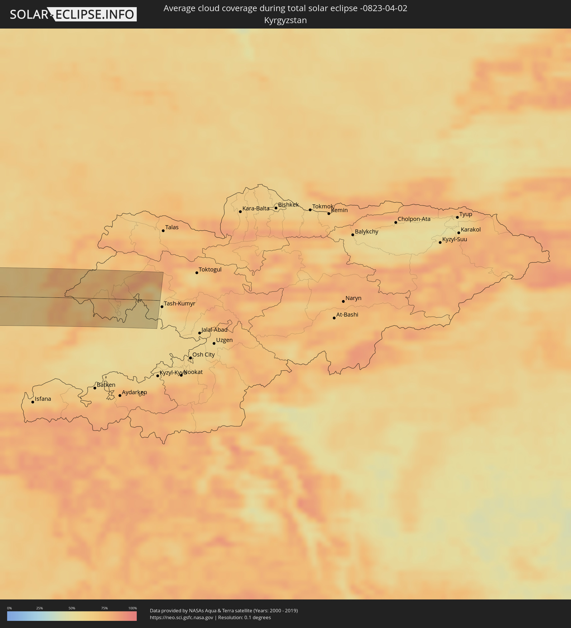 Kyrgyzstan
Cities inside the path of the eclipse
The following table shows all locations with a population of more than 5,000 inside the eclipse path. Cities which have more than 100,000 inhabitants are marked bold. A click at the locations opens a detailed map.
| City | Type | Eclipse duration | Local time of max. eclipse | Distance to central line | Ø Cloud coverage |
|
Mineiros, Goiás
|
total | - | 06:49:37 UTC-03:06 | 18 km | 62% |
|
Goiânia, Goiás
|
total | - | 06:50:34 UTC-03:06 | 50 km | 72% |
|
Aparecida de Goiânia, Goiás
|
total | - | 06:50:30 UTC-03:06 | 34 km | 64% |
|
Senador Canedo, Goiás
|
total | - | 06:50:35 UTC-03:06 | 45 km | 64% |
|
Pires do Rio, Goiás
|
total | - | 06:50:28 UTC-03:06 | 31 km | 56% |
|
Cristalina, Goiás
|
total | - | 06:50:54 UTC-03:06 | 20 km | 73% |
|
Paracatu, Minas Gerais
|
total | - | 06:50:52 UTC-03:06 | 40 km | 59% |
|
Montes Claros, Minas Gerais
|
total | - | 06:52:06 UTC-03:06 | 35 km | 60% |
|
Salinas, Minas Gerais
|
total | - | 06:53:04 UTC-03:06 | 2 km | 68% |
|
Taiobeiras, Minas Gerais
|
total | - | 06:53:20 UTC-03:06 | 36 km | 71% |
|
Almenara, Minas Gerais
|
total | - | 06:53:47 UTC-03:06 | 37 km | 77% |
|
Itapetinga, Bahia
|
total | - | 07:27:06 UTC-02:34 | 55 km | 78% |
|
Una, Bahia
|
total | - | 07:27:41 UTC-02:34 | 22 km | 76% |
|
Canavieiras, Bahia
|
total | - | 07:27:29 UTC-02:34 | 22 km | 59% |
|
Divo, Gôh-Djiboua
|
total | - | 10:59:12 UTC-00:16 | 66 km | 90% |
|
Tiassalé, Lagunes
|
total | - | 11:00:16 UTC-00:16 | 26 km | 85% |
|
Dimbokro, Lacs
|
total | - | 11:02:05 UTC-00:16 | 71 km | 84% |
|
Dabou, Lagunes
|
total | - | 10:59:48 UTC-00:16 | 53 km | 82% |
|
Agboville, Lagunes
|
total | - | 11:01:23 UTC-00:16 | 23 km | 88% |
|
Bongouanou, Lacs
|
total | - | 11:02:58 UTC-00:16 | 29 km | 85% |
|
Abobo, Abidjan
|
total | - | 11:00:38 UTC-00:16 | 77 km | 91% |
|
Arrah, Lacs
|
total | - | 11:03:26 UTC-00:16 | 11 km | 87% |
|
Daoukro, Lacs
|
total | - | 11:04:17 UTC-00:16 | 38 km | 85% |
|
Akoupé, Lagunes
|
total | - | 11:02:57 UTC-00:16 | 17 km | 86% |
|
Adzopé, Lagunes
|
total | - | 11:02:24 UTC-00:16 | 39 km | 86% |
|
Abengourou, Comoé
|
total | - | 11:04:23 UTC-00:16 | 25 km | 85% |
|
Agnibilékrou, Comoé
|
total | - | 11:05:46 UTC-00:16 | 21 km | 85% |
|
Bondoukou, Zanzan
|
total | - | 11:08:28 UTC-00:16 | 10 km | 74% |
|
Berekum, Brong-Ahafo
|
total | - | 11:22:50 UTC-00:00 | 50 km | 79% |
|
Wenchi, Brong-Ahafo
|
total | - | 11:24:18 UTC-00:00 | 70 km | 74% |
|
Navrongo, Upper East
|
total | - | 11:32:59 UTC-00:00 | 68 km | 51% |
|
Bolgatanga, Upper East
|
total | - | 11:33:10 UTC-00:00 | 40 km | 55% |
|
Tamale, Northern
|
total | - | 11:30:11 UTC-00:00 | 59 km | 61% |
|
Savelugu, Northern
|
total | - | 11:30:42 UTC-00:00 | 45 km | 59% |
|
Tenkodogo, Centre-Est
|
total | - | 11:20:55 UTC-00:16 | 69 km | 43% |
|
Bawku, Upper East
|
total | - | 11:34:52 UTC-00:00 | 7 km | 45% |
|
Ouargaye, Centre-Est
|
total | - | 11:21:05 UTC-00:16 | 13 km | 40% |
|
Dapaong, Savanes
|
total | - | 11:19:58 UTC-00:16 | 45 km | 47% |
|
Fada N'gourma, Est
|
total | - | 11:22:50 UTC-00:16 | 27 km | 43% |
|
Pama, Est
|
total | - | 11:21:43 UTC-00:16 | 60 km | 51% |
|
Ouallam, Tillabéri
|
total | - | 12:00:28 UTC+00:13 | 41 km | 24% |
|
Niamey, Niamey
|
total | - | 11:58:49 UTC+00:13 | 18 km | 33% |
|
Kollo, Tillabéri
|
total | - | 11:58:47 UTC+00:13 | 51 km | 31% |
|
Say, Tillabéri
|
total | - | 11:58:24 UTC+00:13 | 68 km | 31% |
|
Inékar, Gao
|
total | - | 11:36:04 UTC-00:16 | 71 km | 18% |
|
Filingué, Tillabéri
|
total | - | 12:02:46 UTC+00:13 | 58 km | 28% |
|
Murzuq, Murzuq
|
total | - | 13:21:30 UTC+00:52 | 18 km | 18% |
|
Al Burayqah, Sha‘bīyat al Wāḩāt
|
total | - | 13:35:55 UTC+00:52 | 57 km | 34% |
|
Ajdabiya, Sha‘bīyat al Wāḩāt
|
total | - | 13:37:13 UTC+00:52 | 52 km | 32% |
|
Tobruk, Sha‘bīyat al Buţnān
|
total | - | 13:43:39 UTC+00:52 | 23 km | 39% |
|
Mercin, Mersin
|
total | - | 15:02:54 UTC+01:56 | 0 km | 60% |
|
Tarsus, Mersin
|
total | - | 15:03:13 UTC+01:56 | 3 km | 66% |
|
Adana, Adana
|
total | - | 15:03:39 UTC+01:56 | 2 km | 64% |
|
Kozan, Adana
|
total | - | 15:04:14 UTC+01:56 | 29 km | 62% |
|
Ceyhan, Adana
|
total | - | 15:04:08 UTC+01:56 | 16 km | 63% |
|
Osmaniye, Osmaniye
|
total | - | 15:04:33 UTC+01:56 | 24 km | 63% |
|
Kahramanmaraş, Kahramanmaraş
|
total | - | 15:05:17 UTC+01:56 | 8 km | 62% |
|
Gaziantep, Gaziantep
|
total | - | 15:05:35 UTC+01:56 | 61 km | 61% |
|
Adıyaman, Adıyaman
|
total | - | 15:06:31 UTC+01:56 | 14 km | 59% |
|
Malatya, Malatya
|
total | - | 15:06:39 UTC+01:56 | 47 km | 68% |
|
Elazığ, Elazığ
|
total | - | 15:07:27 UTC+01:56 | 55 km | 65% |
|
Siverek, Şanlıurfa
|
total | - | 15:07:25 UTC+01:56 | 44 km | 57% |
|
Diyarbakır, Diyarbakır
|
total | - | 15:08:11 UTC+01:56 | 52 km | 58% |
|
Erciş, Van
|
total | - | 15:10:39 UTC+01:56 | 11 km | 66% |
|
Ararat, Ararat Province
|
total | - | 16:12:38 UTC+02:58 | 46 km | 62% |
|
Vedi, Ararat Province
|
total | - | 16:12:38 UTC+02:58 | 54 km | 64% |
|
Yeghegnadzor, Vayots Dzor Province
|
total | - | 16:13:03 UTC+02:58 | 25 km | 76% |
|
Nakhchivan, Nakhichevan
|
total | - | 16:34:32 UTC+03:19 | 36 km | 62% |
|
Vayk’, Vayots Dzor Province
|
total | - | 16:13:08 UTC+02:58 | 14 km | 82% |
|
Hats’avan, Syunik Province
|
total | - | 16:13:29 UTC+02:58 | 20 km | 80% |
|
Goris, Syunik Province
|
total | - | 16:13:43 UTC+02:58 | 22 km | 75% |
|
Qafan, Syunik Province
|
total | - | 16:13:47 UTC+02:58 | 56 km | 78% |
|
Xankandi, Xankǝndi
|
total | - | 16:35:20 UTC+03:19 | 3 km | 79% |
|
Ağdam, Ağdam
|
total | - | 16:35:26 UTC+03:19 | 18 km | 79% |
|
Barda, Bǝrdǝ
|
total | - | 16:35:30 UTC+03:19 | 57 km | 73% |
|
Fizuli, Füzuli
|
total | - | 16:35:36 UTC+03:19 | 28 km | 76% |
|
Agdzhabedy, Ağcabǝdi
|
total | - | 16:35:45 UTC+03:19 | 15 km | 74% |
|
Pārsābād, Ardabīl
|
total | - | 16:42:24 UTC+03:25 | 37 km | 74% |
|
Imishli, İmişli
|
total | - | 16:36:07 UTC+03:19 | 15 km | 73% |
|
Saatlı, Saatlı
|
total | - | 16:36:17 UTC+03:19 | 14 km | 72% |
|
Shamakhi, Şamaxı
|
total | - | 16:36:20 UTC+03:19 | 58 km | 79% |
|
Şirvan, Shirvan
|
total | - | 16:36:36 UTC+03:19 | 23 km | 76% |
|
Sumqayıt, Sumqayit
|
total | - | 16:36:54 UTC+03:19 | 36 km | 75% |
|
Baku, Baki
|
total | - | 16:37:03 UTC+03:19 | 9 km | 68% |
|
Maştağa, Baki
|
total | - | 16:37:05 UTC+03:19 | 24 km | 77% |
|
Hövsan, Baki
|
total | - | 16:37:10 UTC+03:19 | 6 km | 71% |
|
Tagta, Daşoguz
|
total | - | 17:14:48 UTC+03:53 | 40 km | 70% |
|
Khiwa, Xorazm
|
total | - | 17:49:22 UTC+04:27 | 7 km | 66% |
|
Urganch, Xorazm
|
total | - | 17:49:22 UTC+04:27 | 25 km | 66% |
|
Beruniy, Karakalpakstan
|
total | - | 17:49:21 UTC+04:27 | 40 km | 67% |
|
Novyy Turtkul’, Karakalpakstan
|
total | - | 17:49:28 UTC+04:27 | 22 km | 70% |
|
Gazojak, Lebap
|
total | - | 17:15:20 UTC+03:53 | 20 km | 61% |
|
Chardara, Ongtüstik Qazaqstan
|
total | - | 17:44:40 UTC+04:21 | 28 km | 61% |
|
Yangiyŭl, Toshkent
|
total | - | 17:50:49 UTC+04:27 | 44 km | 62% |
|
Saryaghash, Ongtüstik Qazaqstan
|
total | - | 17:44:40 UTC+04:21 | 5 km | 64% |
|
Tashkent, Toshkent Shahri
|
total | - | 17:50:46 UTC+04:27 | 27 km | 64% |
|
Leninskoye, Ongtüstik Qazaqstan
|
total | - | 17:44:34 UTC+04:21 | 28 km | 64% |
|
Qibray, Toshkent
|
total | - | 17:50:44 UTC+04:27 | 13 km | 62% |
|
Chirchiq, Toshkent
|
total | - | 17:50:42 UTC+04:27 | 4 km | 62% |
|
Parkent, Toshkent
|
total | - | 17:50:46 UTC+04:27 | 23 km | 64% |
|
Kosonsoy, Namangan
|
total | - | 17:50:50 UTC+04:27 | 23 km | 57% |
|
Yangiqo‘rg‘on, Namangan
|
total | - | 17:50:52 UTC+04:27 | 30 km | 57% |
|
Chortoq, Namangan
|
total | - | 17:50:54 UTC+04:27 | 45 km | 57% |
|
Uychi, Namangan
|
total | - | 17:50:54 UTC+04:27 | 42 km | 56% |
|
Uchqŭrghon Shahri, Namangan
|
total | - | 17:50:53 UTC+04:27 | 38 km | 55% |