Annular solar eclipse of 03/16/-1185
| Day of week: | Saturday |
| Maximum duration of eclipse: | 00m59s |
| Maximum width of eclipse path: | 31 km |
| Saros cycle: | 30 |
| Coverage: | 99.1% |
| Magnitude: | 0.9912 |
| Gamma: | -0.0023 |
Wo kann man die Sonnenfinsternis vom 03/16/-1185 sehen?
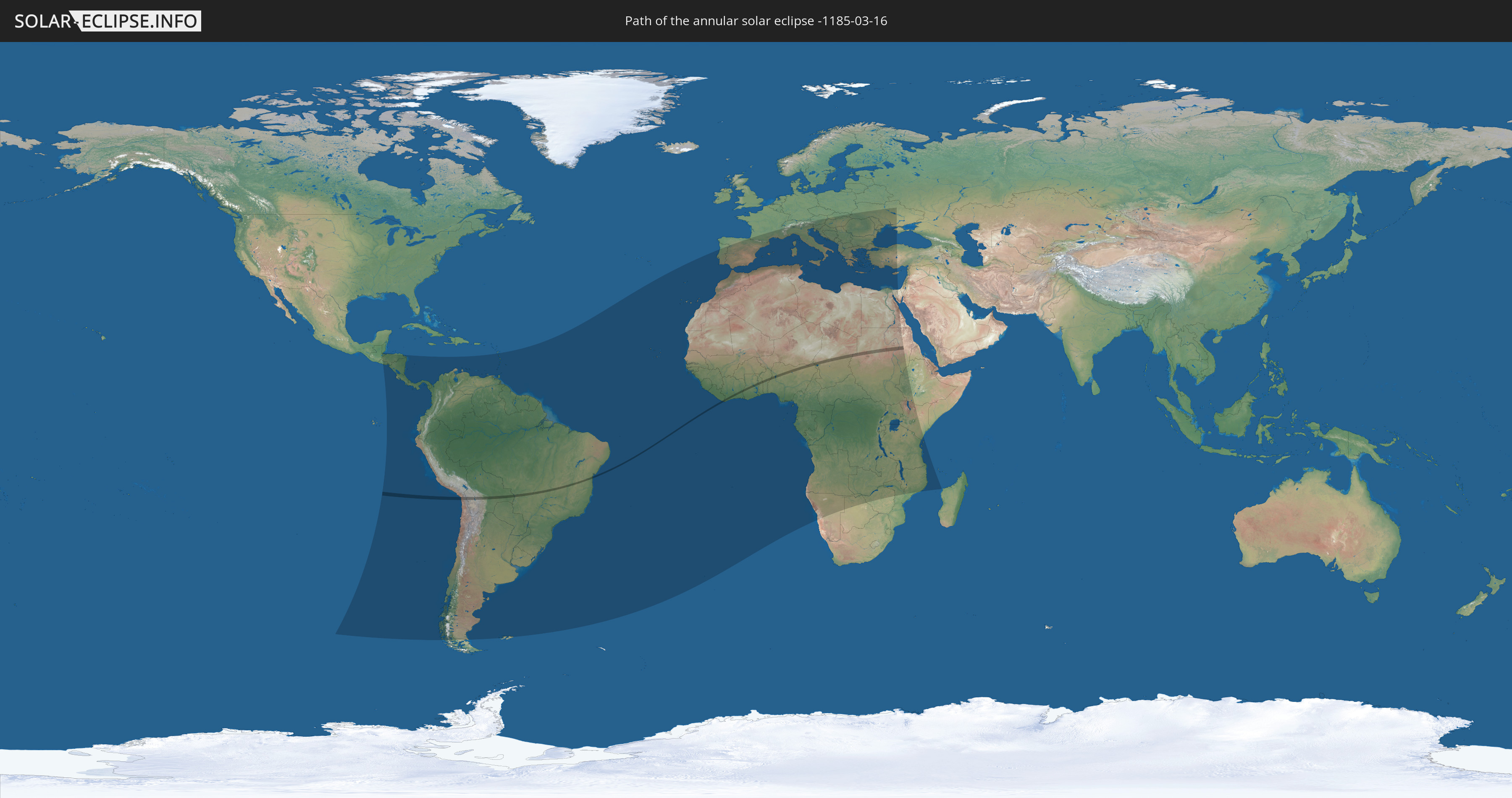
Die Sonnenfinsternis am 03/16/-1185 kann man in 103 Ländern als partielle Sonnenfinsternis beobachten.
Der Finsternispfad verläuft durch 13 Länder. Nur in diesen Ländern ist sie als annular Sonnenfinsternis zu sehen.
In den folgenden Ländern ist die Sonnenfinsternis annular zu sehen
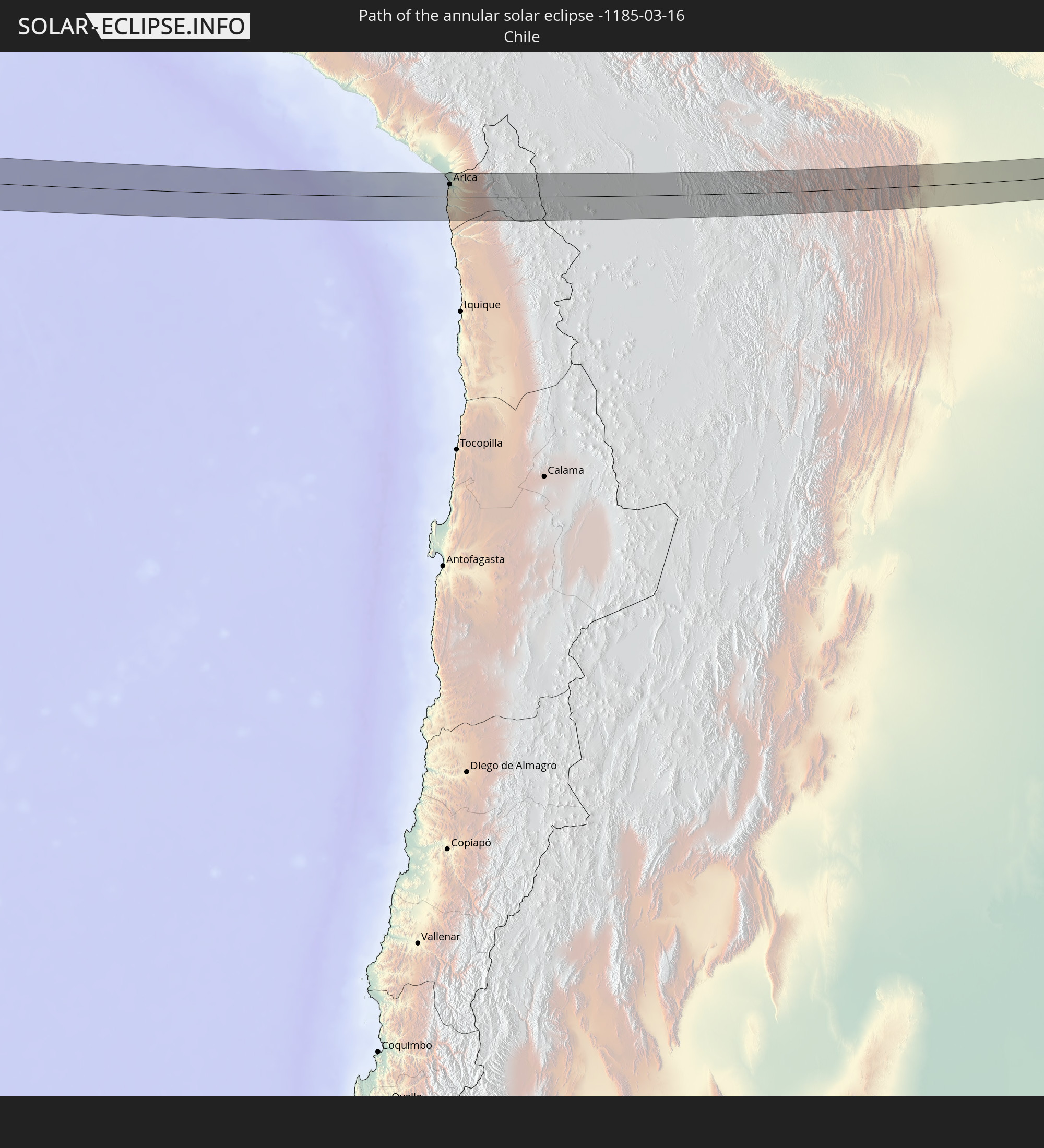 Chile
Chile
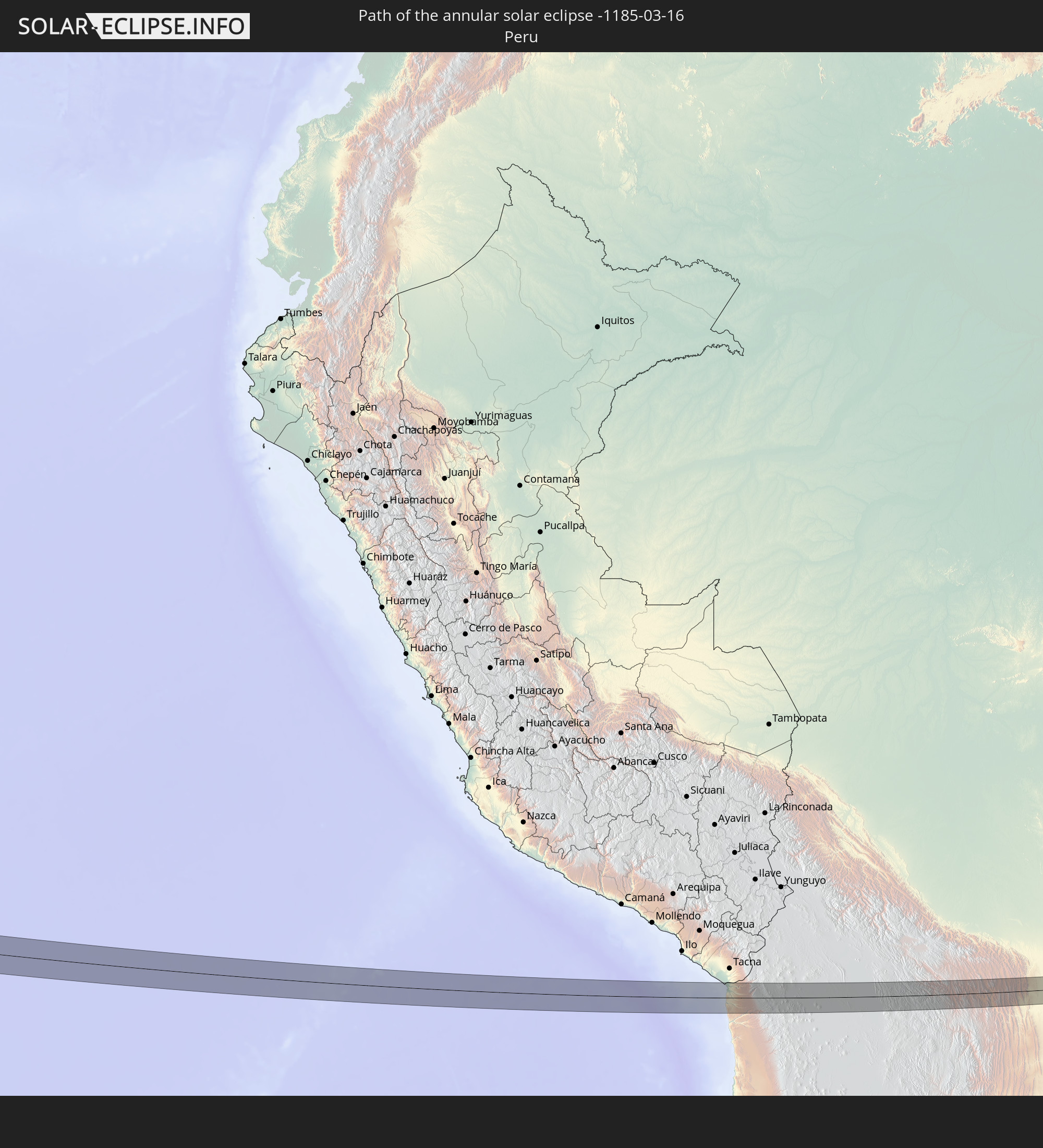 Peru
Peru
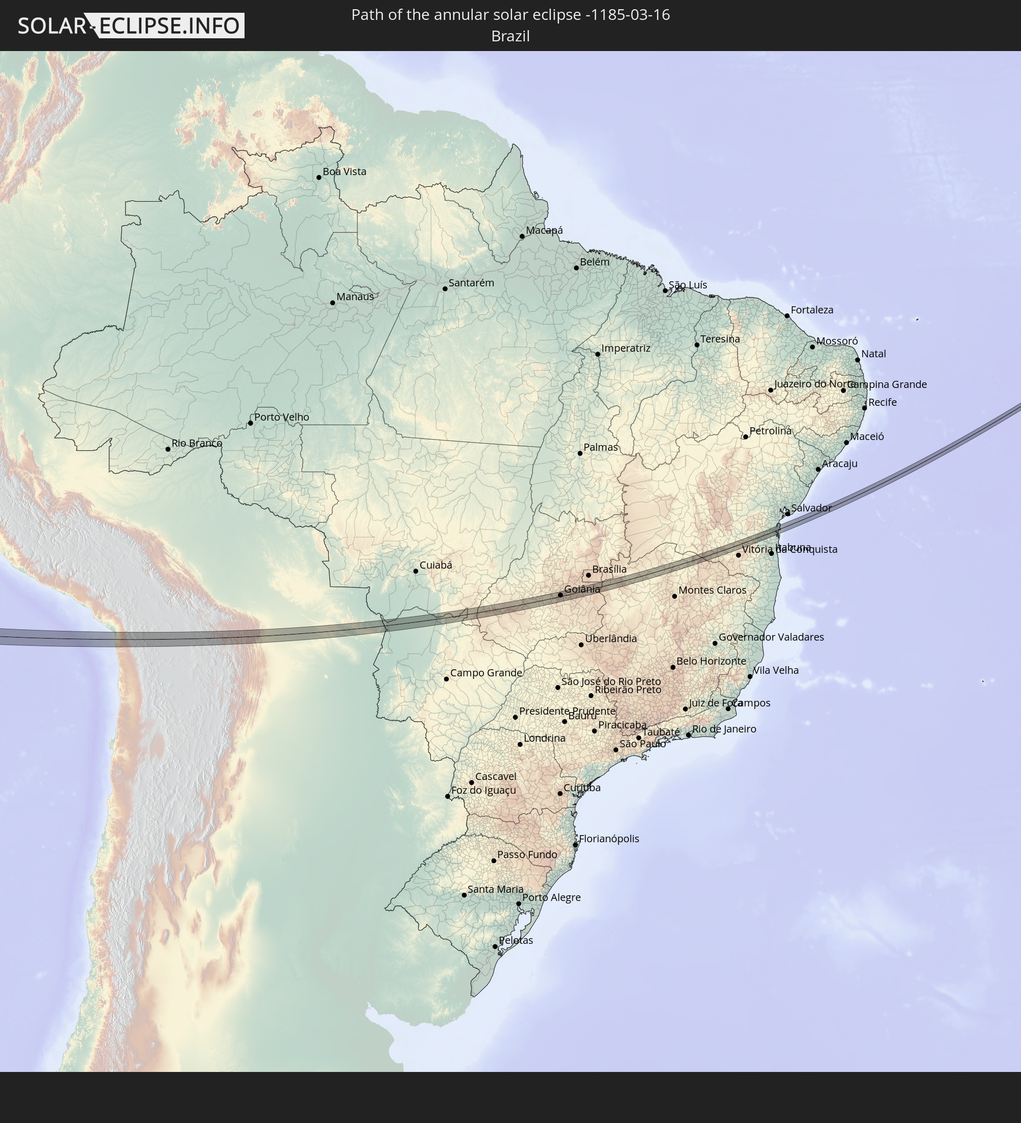 Brazil
 Bolivia
 Liberia
 Ivory Coast
 Ghana
Ghana
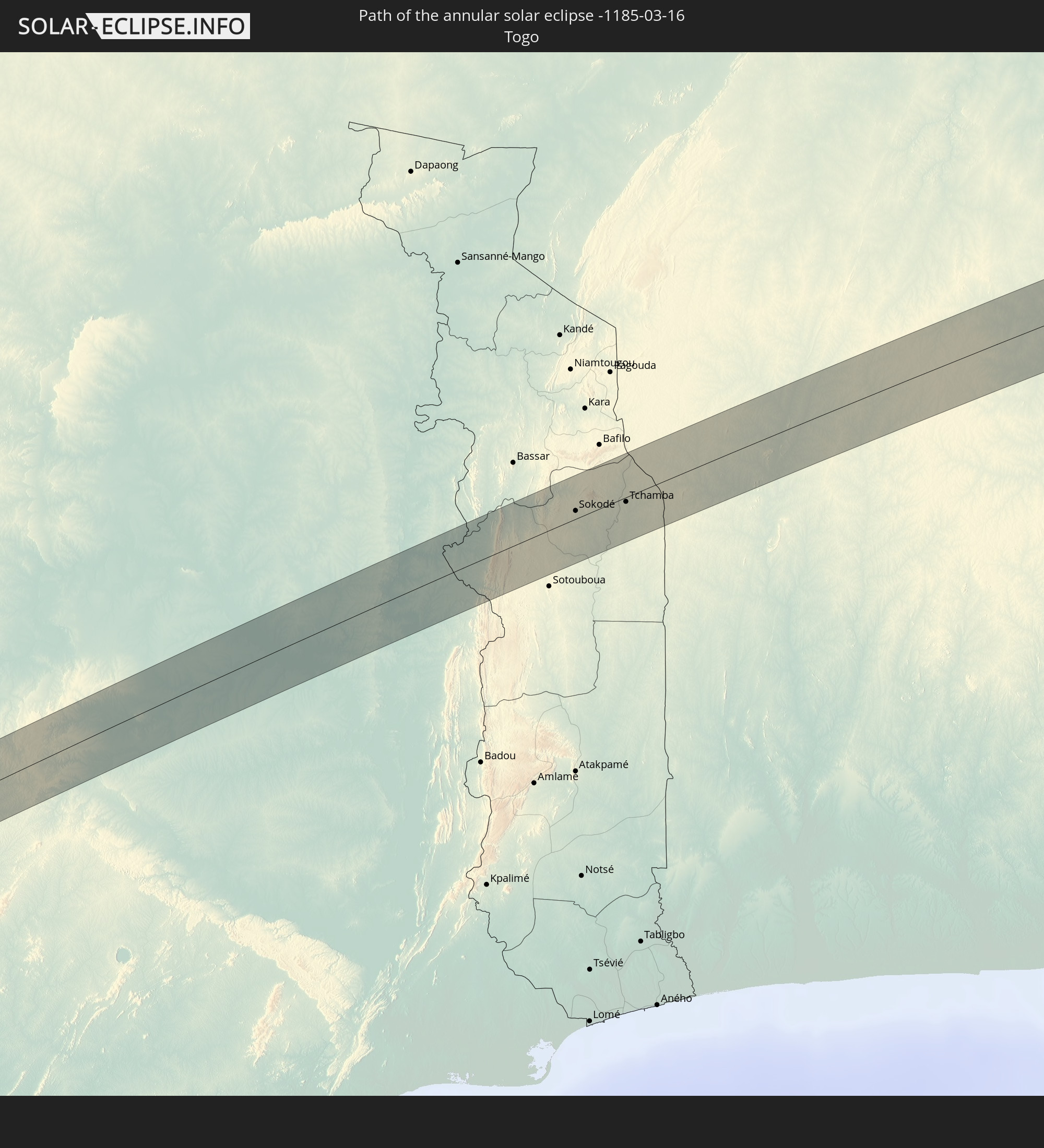 Togo
Togo
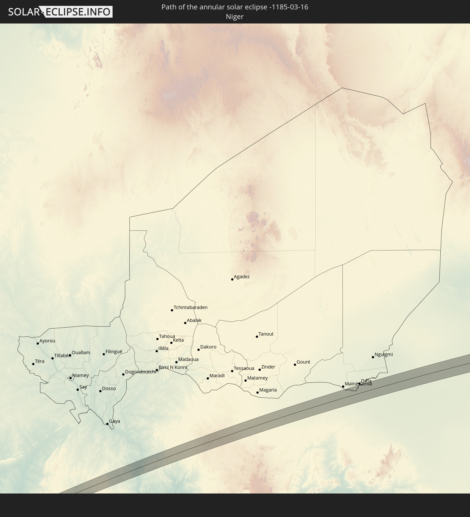 Niger
Niger
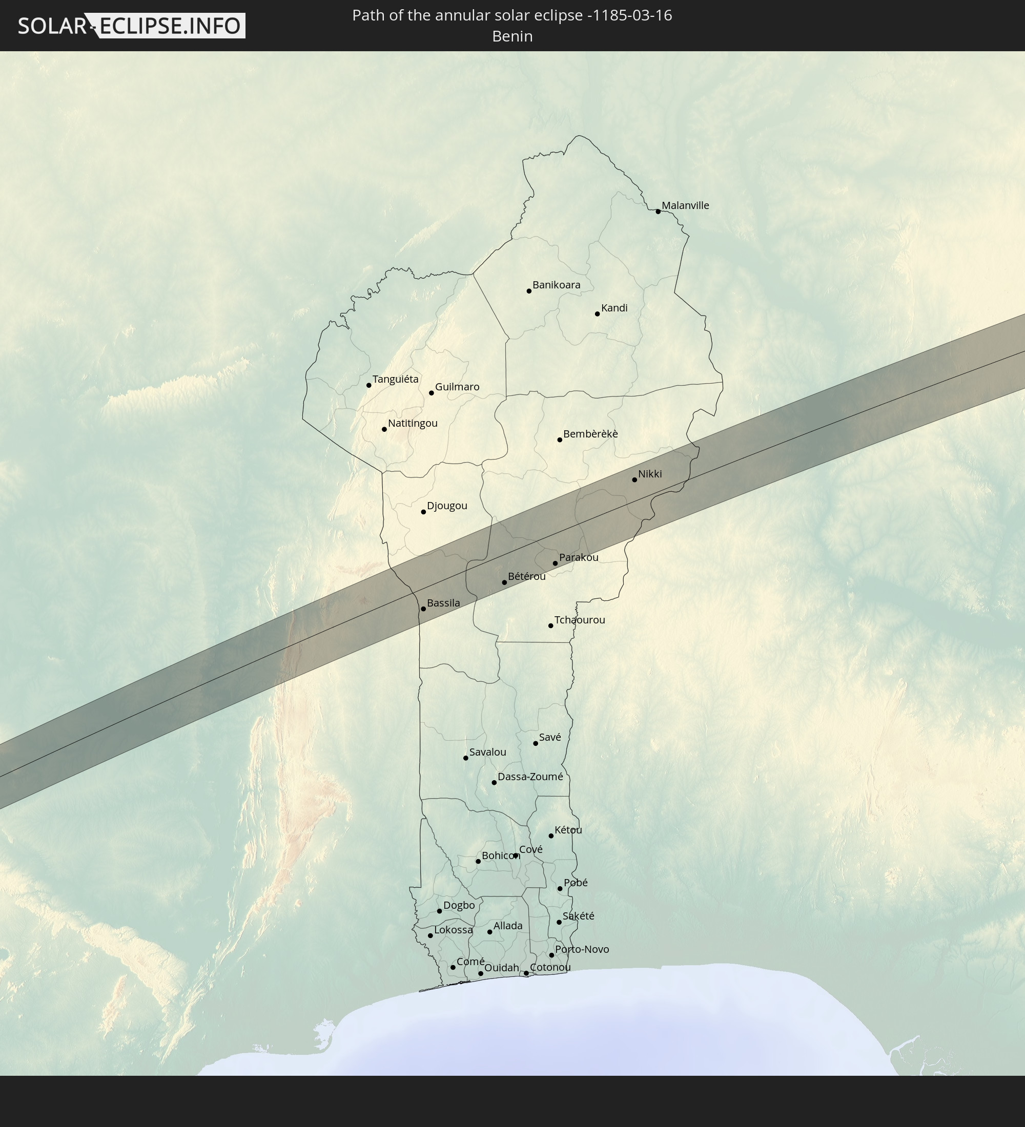 Benin
Benin
 Nigeria
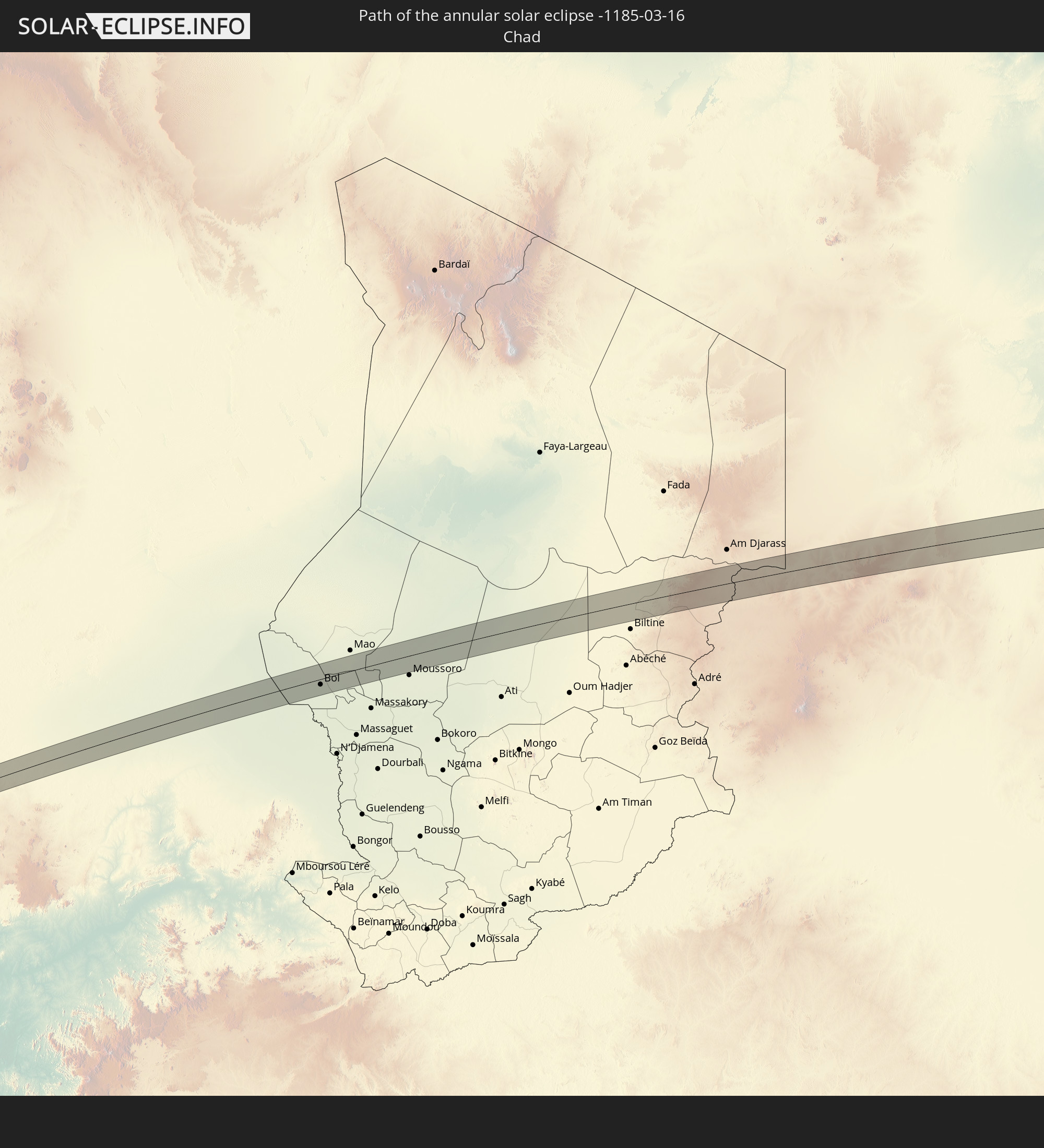 Chad
Chad
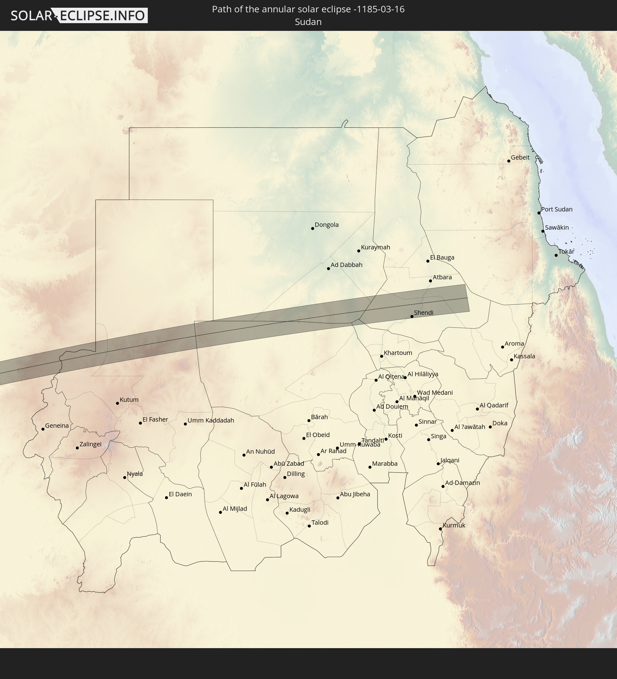 Sudan
Sudan
In den folgenden Ländern ist die Sonnenfinsternis partiell zu sehen
 Chile
Chile
 Guatemala
 Ecuador
 El Salvador
 Honduras
 Belize
 Nicaragua
 Costa Rica
 Panama
 Colombia
 Peru
Peru
 Brazil
 Argentina
 Venezuela
 Aruba
Aruba
 Bolivia
 Paraguay
 Trinidad and Tobago
 Guadeloupe
 Grenada
 Dominica
 Saint Vincent and the Grenadines
 Falkland Islands
 Guyana
 Martinique
 Saint Lucia
 Barbados
 Uruguay
 Suriname
 French Guiana
 Portugal
 Cabo Verde
 Spain
Spain
 Senegal
 Mauritania
 The Gambia
 Guinea-Bissau
 Guinea
 Saint Helena, Ascension and Tristan da Cunha
 Sierra Leone
 Morocco
 Mali
Mali
 Liberia
 Algeria
 Ivory Coast
 Burkina Faso
 Gibraltar
 France
 Ghana
Ghana
 Togo
Togo
 Niger
Niger
 Benin
Benin
 Andorra
 Nigeria
 Equatorial Guinea
 Switzerland
 São Tomé and Príncipe
 Italy
Italy
 Monaco
 Tunisia
 Cameroon
 Gabon
Gabon
 Libya
Libya
 Austria
 Republic of the Congo
 Angola
 Namibia
 Democratic Republic of the Congo
 San Marino
 Vatican City
 Slovenia
 Chad
Chad
 Croatia
 Poland
 Malta
Malta
 Central African Republic
 Bosnia and Herzegovina
 Hungary
 Slovakia
 Montenegro
 Serbia
 Albania
 Greece
 Botswana
 Romania
 Republic of Macedonia
 Sudan
Sudan
 Zambia
 Ukraine
 Bulgaria
 Egypt
Egypt
 Zimbabwe
 Turkey
 Moldova
 Rwanda
 Burundi
 Tanzania
 Uganda
 Mozambique
 Cyprus
 Malawi
 Ethiopia
 Kenya
Kenya
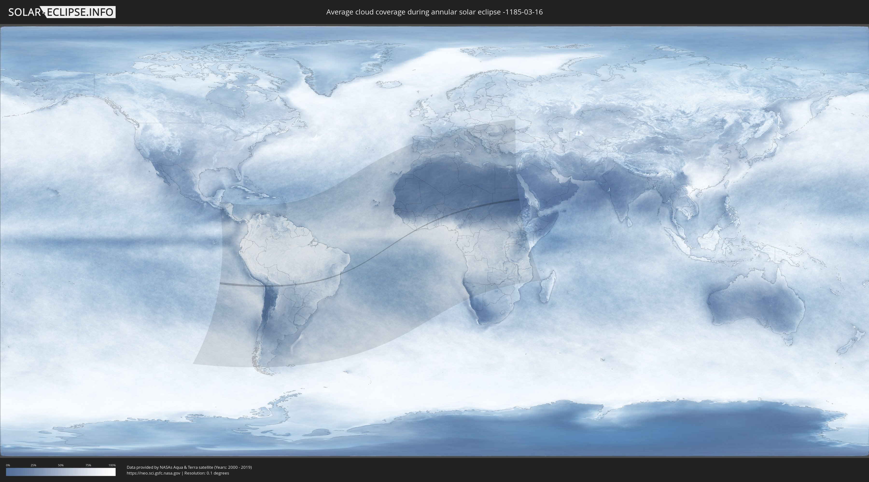
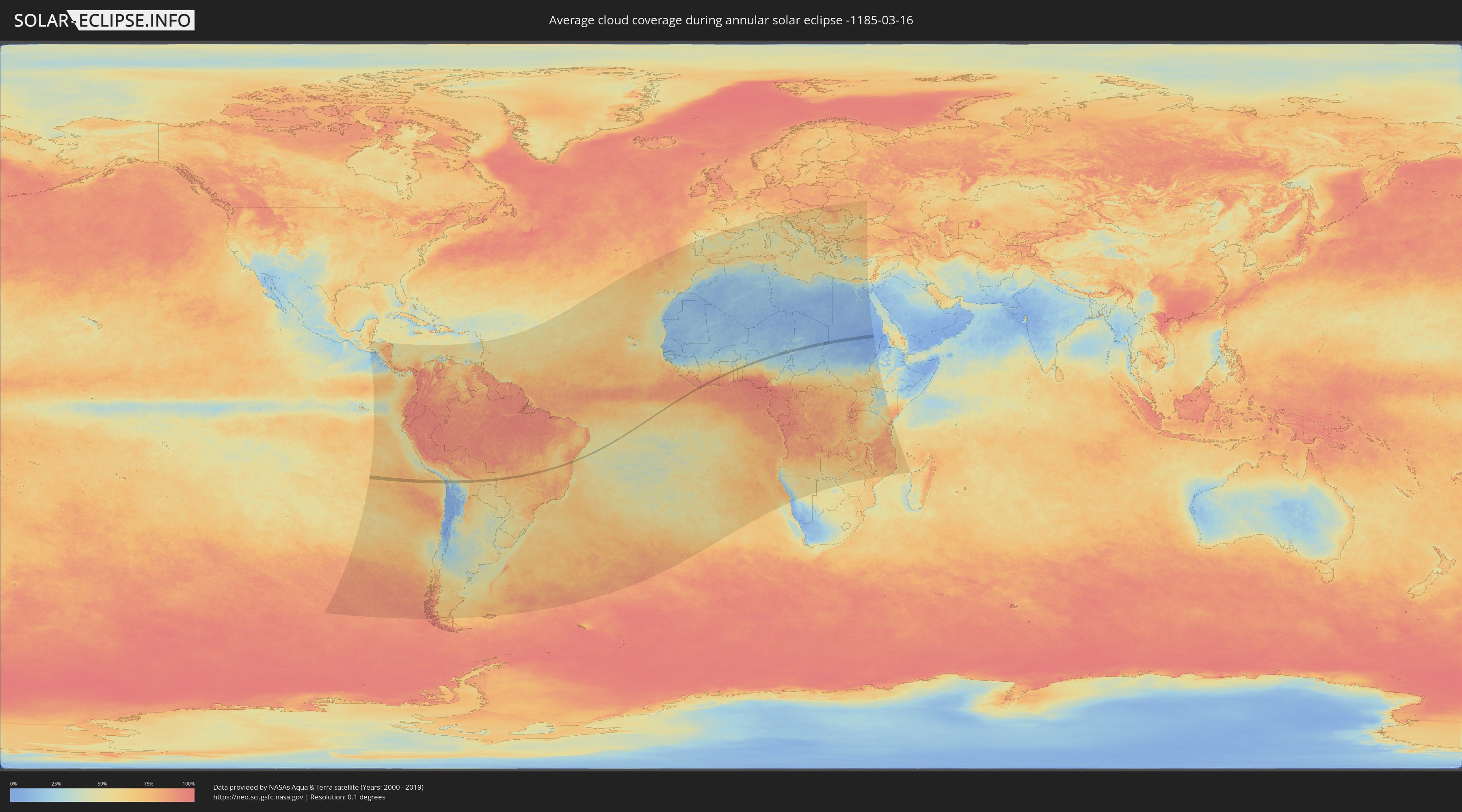
How will be the weather during the annular solar eclipse on 03/16/-1185?
Where is the best place to see the annular solar eclipse of 03/16/-1185?
The following maps show the average cloud coverage for the day of the annular solar eclipse.
With the help of these maps, it is possible to find the place along the eclipse path, which has the best
chance of a cloudless sky.
Nevertheless, you should consider local circumstances and inform about the weather of your chosen
observation site.
The data is provided by NASAs satellites
AQUA and TERRA.
The cloud maps are averaged over a period of 19 years (2000 - 2019).
Detailed country maps
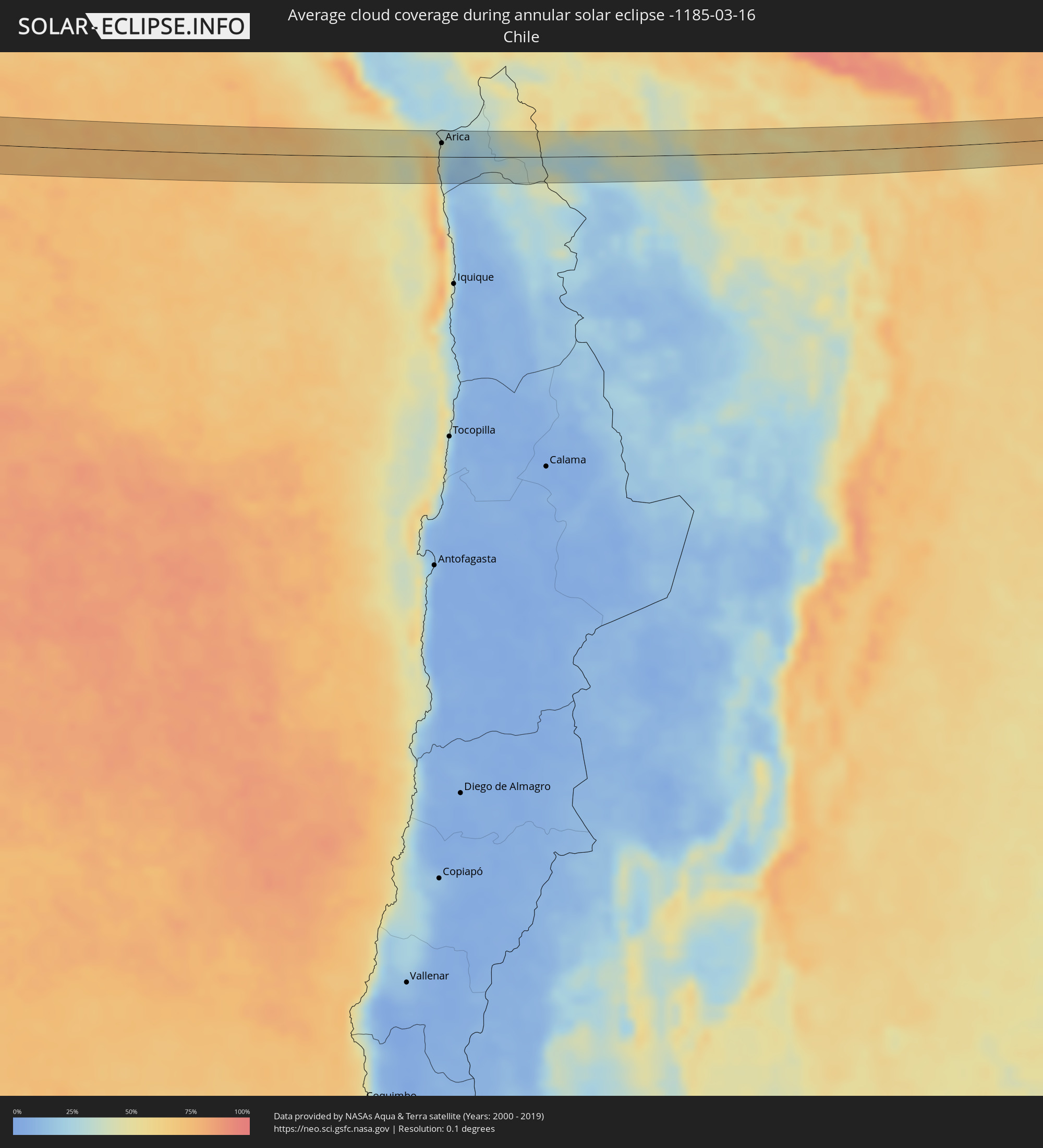 Chile
Chile
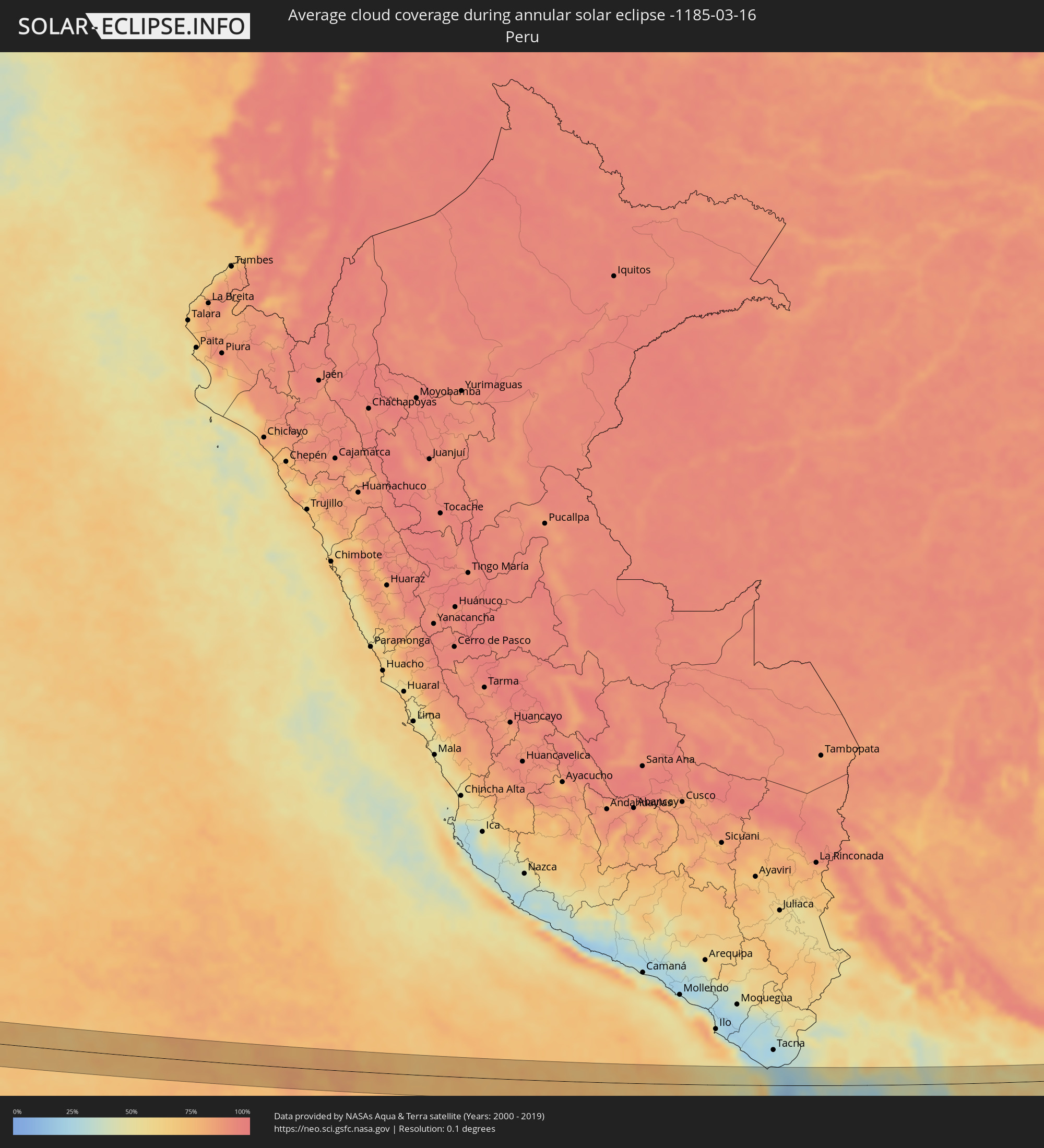 Peru
Peru
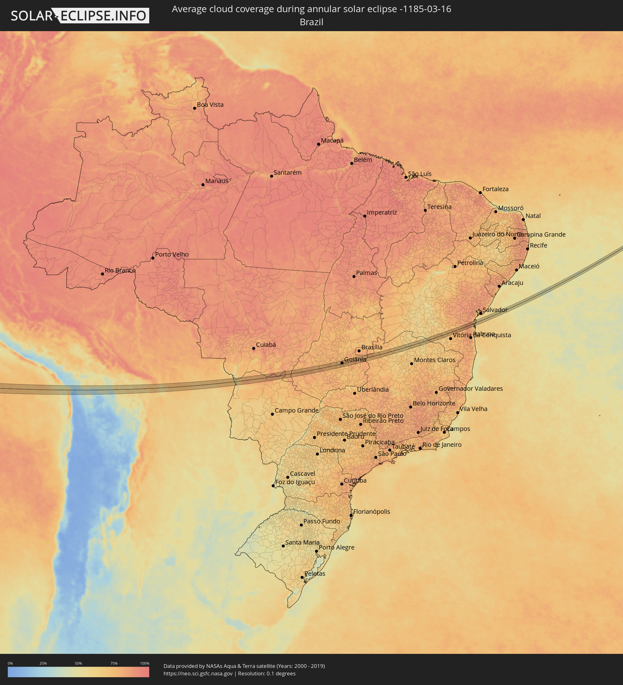 Brazil
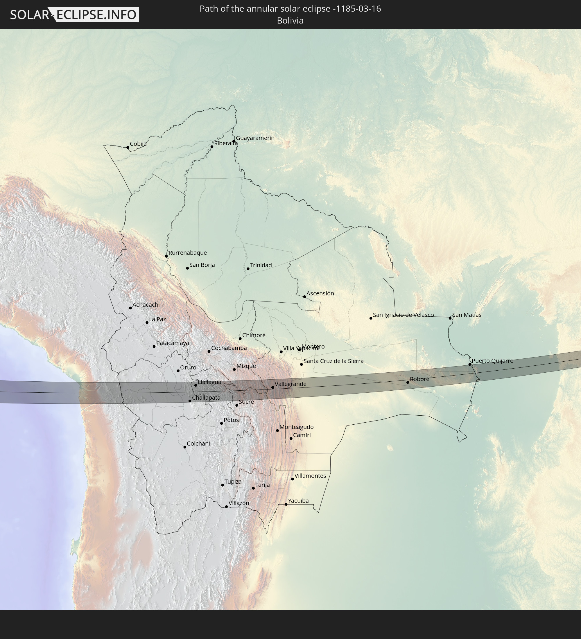
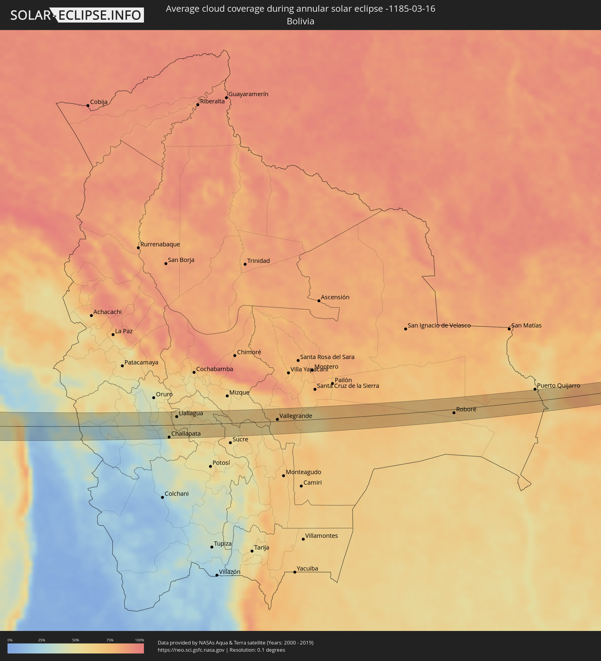 Bolivia
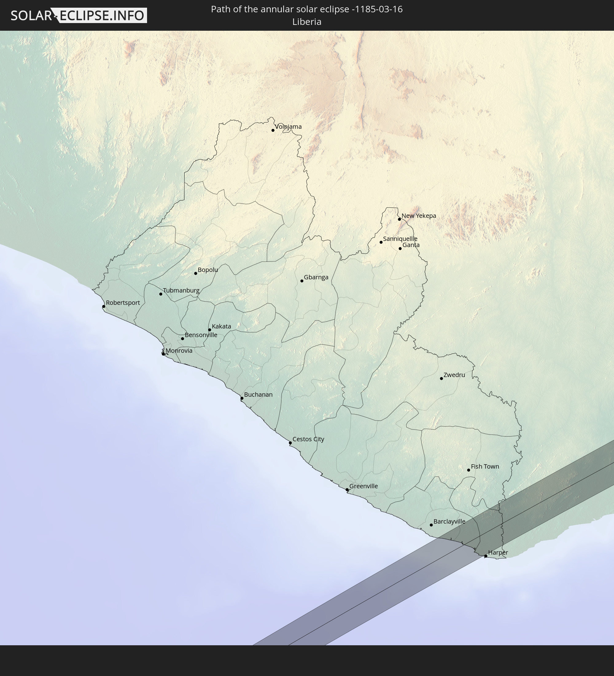
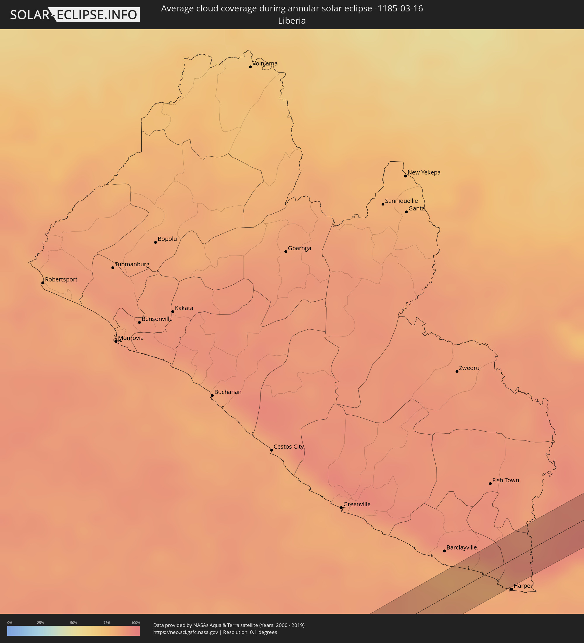 Liberia
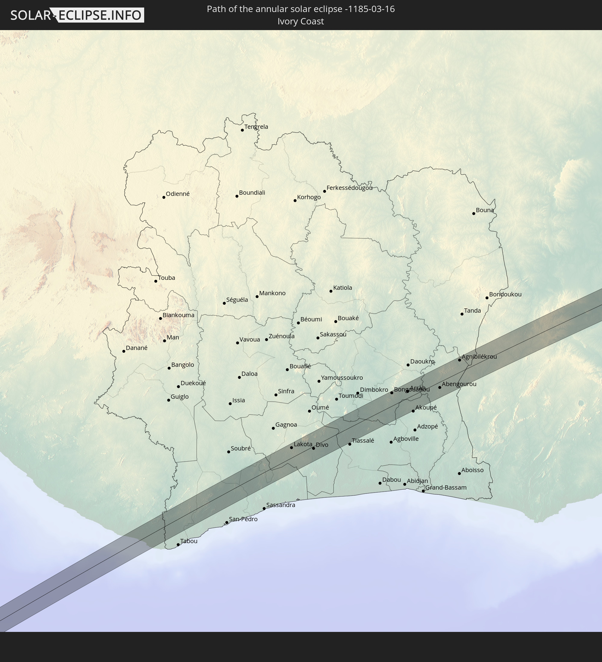
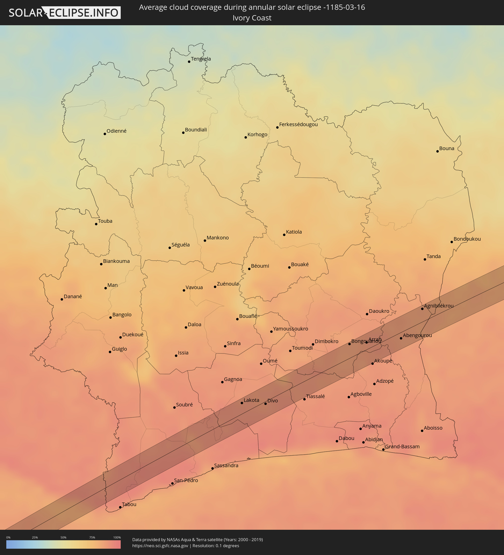 Ivory Coast
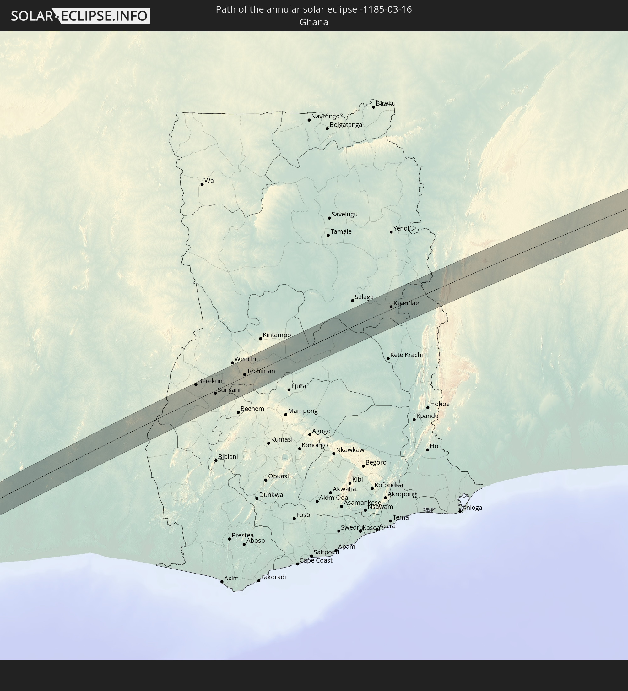
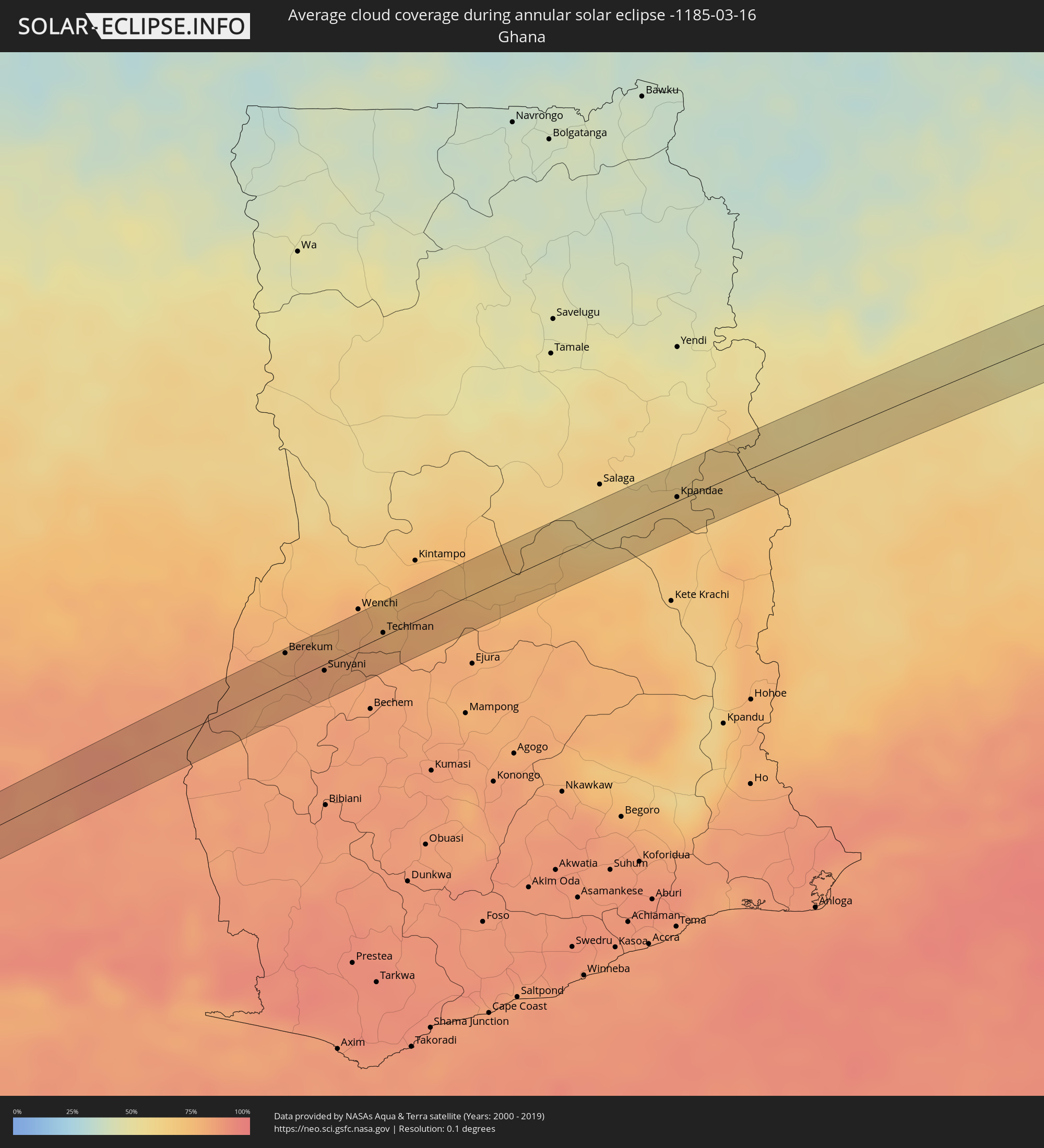 Ghana
Ghana
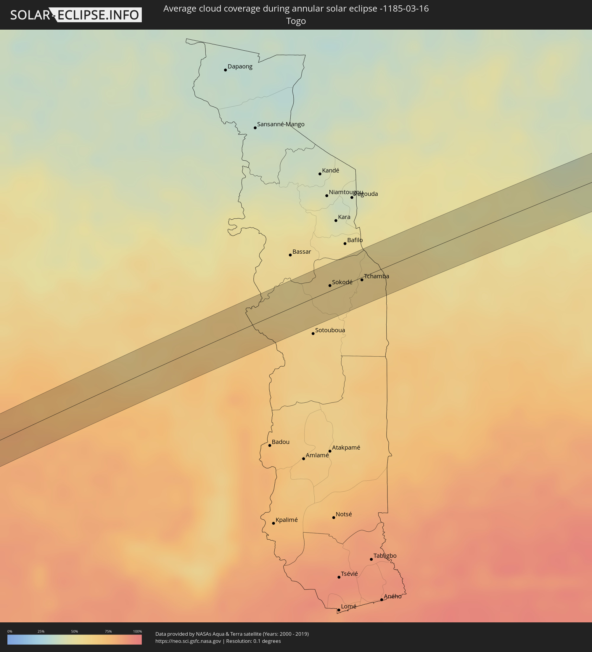 Togo
Togo
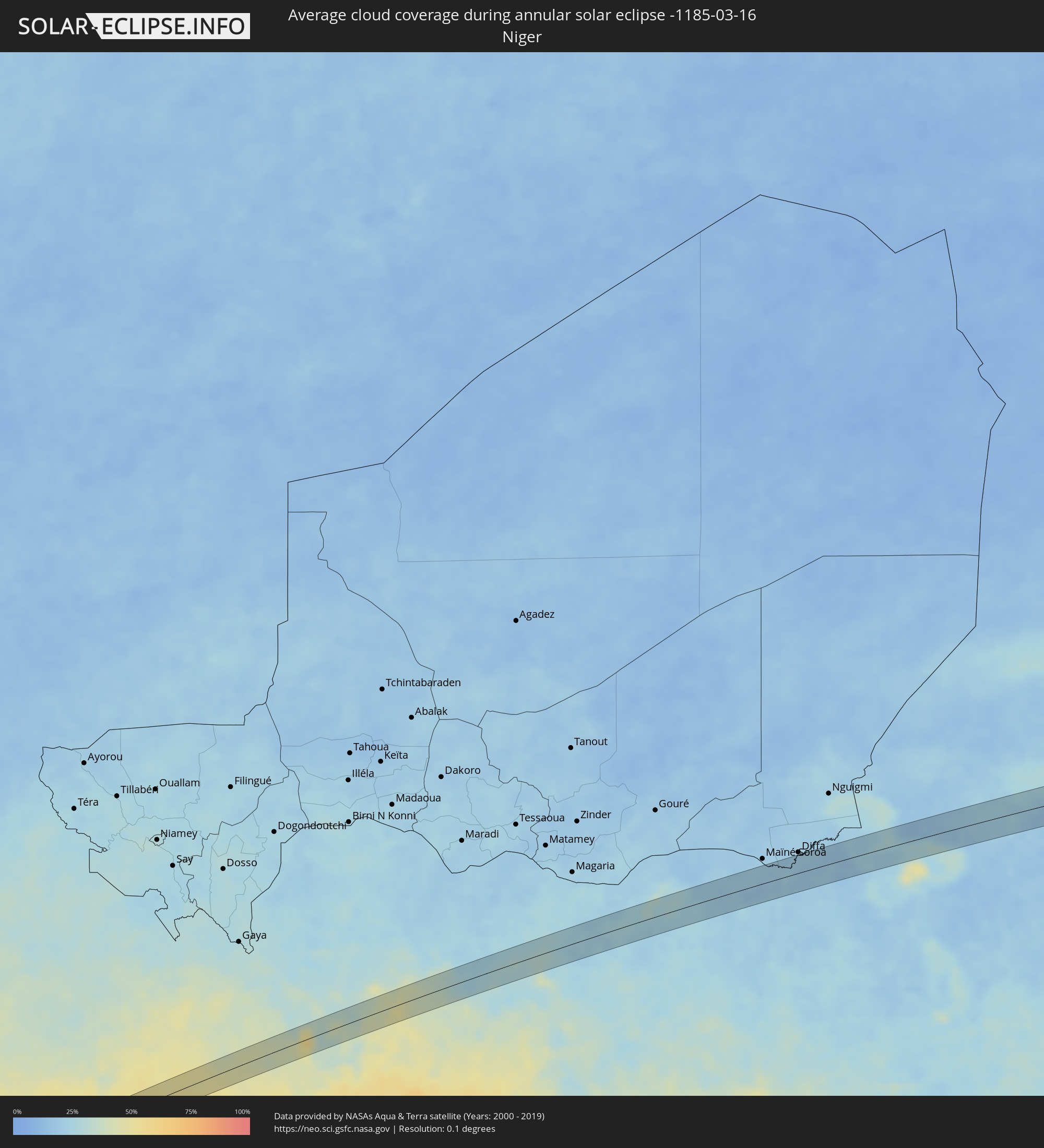 Niger
Niger
 Benin
Benin
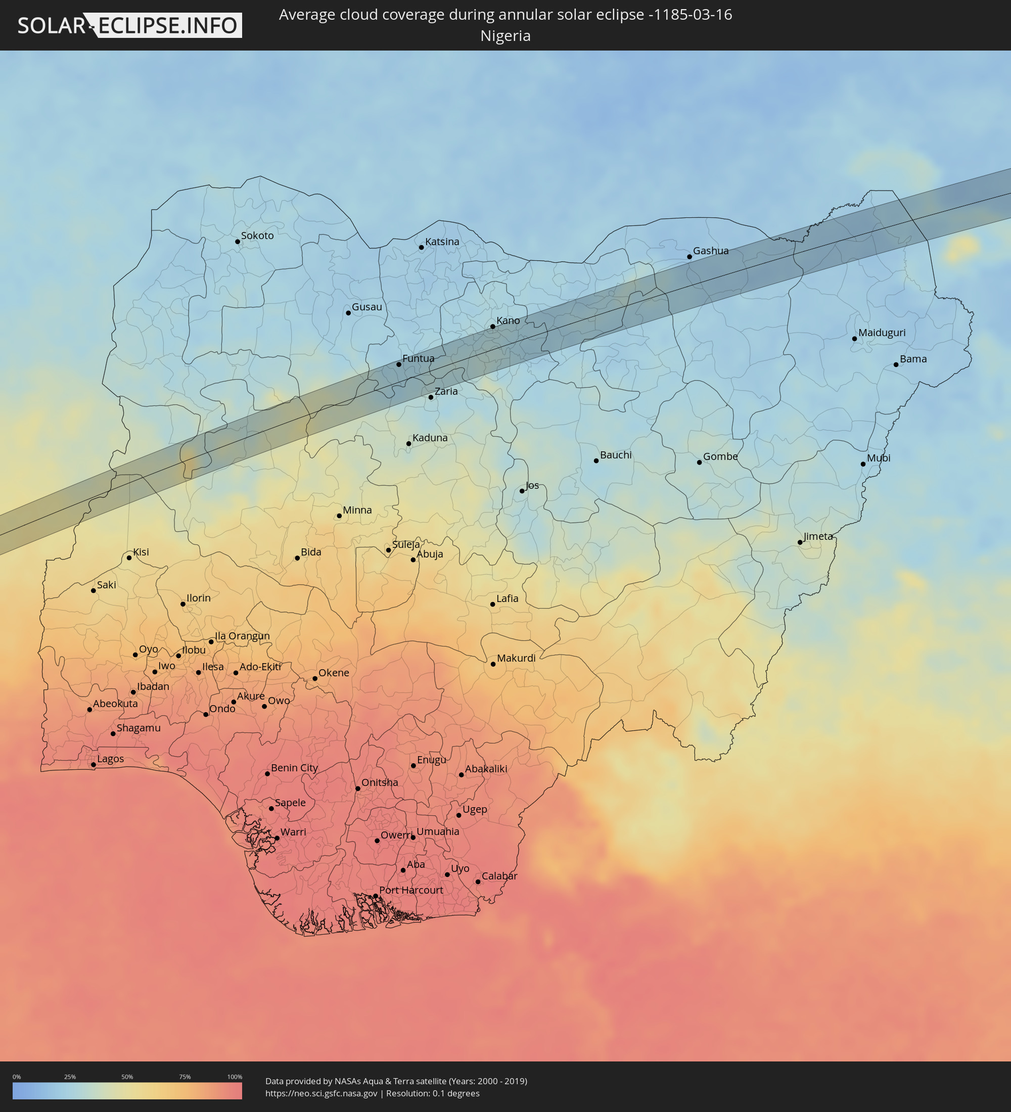 Nigeria
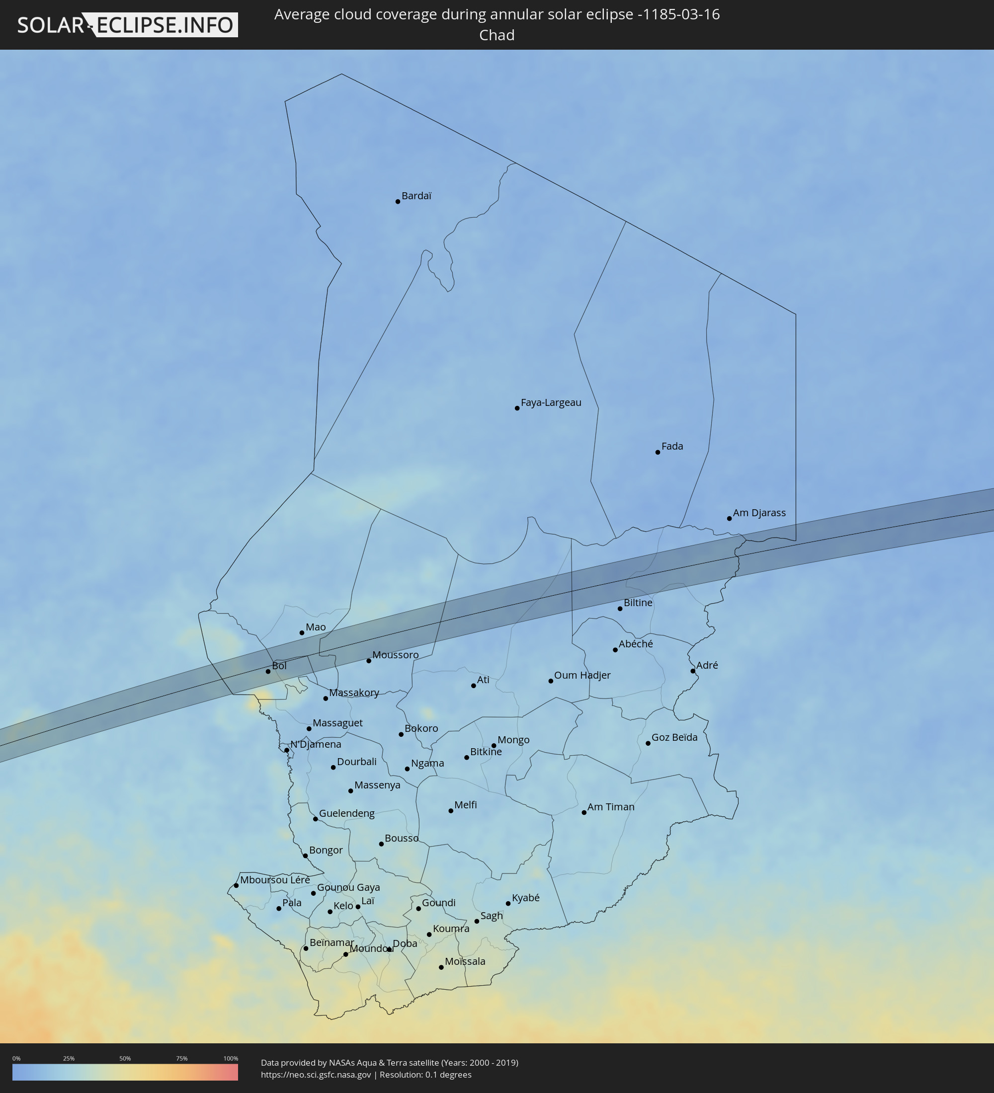 Chad
Chad
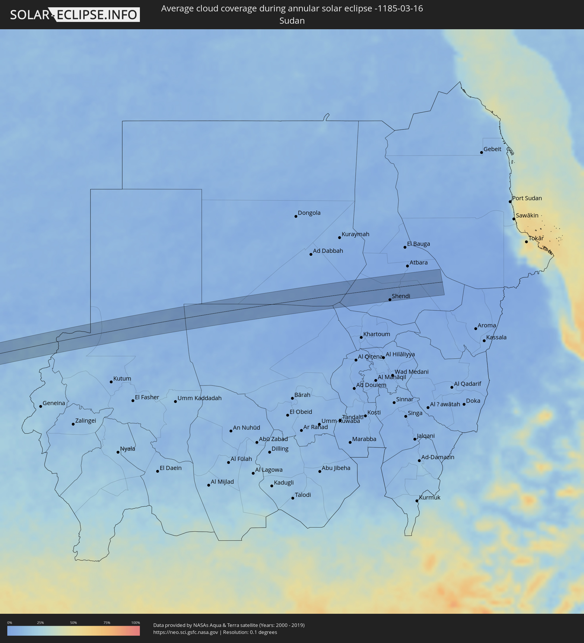 Sudan
Sudan
Cities inside the path of the eclipse
The following table shows all locations with a population of more than 5,000 inside the eclipse path. Cities which have more than 100,000 inhabitants are marked bold. A click at the locations opens a detailed map.
| City | Type | Eclipse duration | Local time of max. eclipse | Distance to central line | Ø Cloud coverage |
|
Arica, Arica y Parinacota
|
annular | - | 07:25:15 UTC-04:42 | 19 km | 32% |
|
Challapata, Oruro
|
annular | - | 07:38:16 UTC-04:32 | 32 km | 45% |
|
Llallagua, Potosí
|
annular | - | 07:38:28 UTC-04:32 | 21 km | 53% |
|
Vallegrande, Santa Cruz
|
annular | - | 07:40:52 UTC-04:32 | 4 km | 68% |
|
Roboré, Santa Cruz
|
annular | - | 07:45:55 UTC-04:32 | 10 km | 61% |
|
Mineiros, Goiás
|
annular | - | 09:23:05 UTC-03:06 | 25 km | 79% |
|
Palmeiras de Goiás, Goiás
|
annular | - | 09:28:13 UTC-03:06 | 5 km | 75% |
|
Trindade, Goiás
|
annular | - | 09:29:08 UTC-03:06 | 12 km | 73% |
|
Goiânia, Goiás
|
annular | - | 09:29:34 UTC-03:06 | 3 km | 77% |
|
Aparecida de Goiânia, Goiás
|
annular | - | 09:29:30 UTC-03:06 | 13 km | 72% |
|
Senador Canedo, Goiás
|
annular | - | 09:29:52 UTC-03:06 | 4 km | 74% |
|
Goianápolis, Goiás
|
annular | - | 09:30:07 UTC-03:06 | 16 km | 75% |
|
Silvânia, Goiás
|
annular | - | 09:30:51 UTC-03:06 | 10 km | 79% |
|
Luziânia, Goiás
|
annular | - | 09:32:26 UTC-03:06 | 18 km | 77% |
|
Unaí, Minas Gerais
|
annular | - | 09:34:30 UTC-03:06 | 21 km | 74% |
|
Arinos, Minas Gerais
|
annular | - | 09:36:31 UTC-03:06 | 5 km | 68% |
|
Januária, Minas Gerais
|
annular | - | 09:40:43 UTC-03:06 | 1 km | 57% |
|
Monte Azul, Minas Gerais
|
annular | - | 09:44:26 UTC-03:06 | 13 km | 59% |
|
Espinosa, Minas Gerais
|
annular | - | 09:44:46 UTC-03:06 | 9 km | 58% |
|
Itagi, Bahia
|
annular | - | 10:24:53 UTC-02:34 | 12 km | 77% |
|
Jitaúna, Bahia
|
annular | - | 10:25:19 UTC-02:34 | 0 km | 78% |
|
Ipiaú, Bahia
|
annular | - | 10:25:35 UTC-02:34 | 19 km | 81% |
|
Ibirataia, Bahia
|
annular | - | 10:25:55 UTC-02:34 | 16 km | 82% |
|
Gandu, Bahia
|
annular | - | 10:26:41 UTC-02:34 | 12 km | 83% |
|
Ituberá, Bahia
|
annular | - | 10:27:33 UTC-02:34 | 0 km | 65% |
|
Lakota, Gôh-Djiboua
|
annular | - | 14:47:24 UTC-00:16 | 14 km | 89% |
|
Divo, Gôh-Djiboua
|
annular | - | 14:48:01 UTC-00:16 | 4 km | 90% |
|
Bongouanou, Lacs
|
annular | - | 14:51:14 UTC-00:16 | 19 km | 84% |
|
Arrah, Lacs
|
annular | - | 14:51:41 UTC-00:16 | 9 km | 86% |
|
Abengourou, Comoé
|
annular | - | 14:52:37 UTC-00:16 | 9 km | 86% |
|
Agnibilékrou, Comoé
|
annular | - | 14:53:37 UTC-00:16 | 17 km | 83% |
|
Berekum, Brong-Ahafo
|
annular | - | 15:10:22 UTC-00:00 | 19 km | 81% |
|
Sunyani, Brong-Ahafo
|
annular | - | 15:10:41 UTC-00:00 | 4 km | 82% |
|
Techiman, Brong-Ahafo
|
annular | - | 15:11:37 UTC-00:00 | 2 km | 78% |
|
Kpandae
|
annular | - | 15:15:44 UTC-00:00 | 3 km | 64% |
|
Sokodé, Centrale
|
annular | - | 15:02:45 UTC-00:16 | 5 km | 59% |
|
Tchamba, Centrale
|
annular | - | 15:03:14 UTC-00:16 | 3 km | 60% |
|
Bassila, Donga
|
annular | - | 15:33:17 UTC+00:13 | 16 km | 60% |
|
Bétérou, Borgou
|
annular | - | 15:34:20 UTC+00:13 | 22 km | 51% |
|
Parakou, Borgou
|
annular | - | 15:35:00 UTC+00:13 | 23 km | 54% |
|
Nikki, Borgou
|
annular | - | 15:36:21 UTC+00:13 | 15 km | 46% |
|
Yashikera, Kwara
|
annular | - | 15:36:27 UTC+00:13 | 11 km | 45% |
|
Ibeto, Niger
|
annular | - | 15:39:22 UTC+00:13 | 5 km | 36% |
|
Kontagora, Niger
|
annular | - | 15:39:42 UTC+00:13 | 27 km | 38% |
|
Sofo-Birnin-Gwari, Kaduna
|
annular | - | 15:41:46 UTC+00:13 | 12 km | 39% |
|
Funtua, Katsina
|
annular | - | 15:42:45 UTC+00:13 | 22 km | 25% |
|
Bakori, Katsina
|
annular | - | 15:42:54 UTC+00:13 | 21 km | 25% |
|
Bebeji, Kano
|
annular | - | 15:43:54 UTC+00:13 | 3 km | 31% |
|
Kano, Kano
|
annular | - | 15:44:24 UTC+00:13 | 29 km | 28% |
|
Rano, Kano
|
annular | - | 15:44:11 UTC+00:13 | 20 km | 24% |
|
Wudil, Kano
|
annular | - | 15:44:38 UTC+00:13 | 2 km | 26% |
|
Gaya, Kano
|
annular | - | 15:44:50 UTC+00:13 | 2 km | 22% |
|
Ringim, Jigawa
|
annular | - | 15:45:11 UTC+00:13 | 23 km | 24% |
|
Dutse, Jigawa
|
annular | - | 15:45:07 UTC+00:13 | 25 km | 23% |
|
Kafin Hausa, Jigawa
|
annular | - | 15:46:00 UTC+00:13 | 7 km | 24% |
|
Hadejia, Jigawa
|
annular | - | 15:46:15 UTC+00:13 | 25 km | 25% |
|
Gamawa, Bauchi
|
annular | - | 15:46:33 UTC+00:13 | 25 km | 24% |
|
Gorgoram, Yobe
|
annular | - | 15:47:01 UTC+00:13 | 23 km | 27% |
|
Dapchi, Yobe
|
annular | - | 15:47:41 UTC+00:13 | 18 km | 19% |
|
Geidam, Yobe
|
annular | - | 15:48:17 UTC+00:13 | 12 km | 21% |
|
Damasak, Borno
|
annular | - | 15:48:55 UTC+00:13 | 16 km | 21% |
|
Bol, Lac
|
annular | - | 16:37:30 UTC+01:00 | 11 km | 28% |
|
El Matama, River Nile
|
annular | - | 17:55:27 UTC+02:10 | 37 km | 2% |
|
Shendi, River Nile
|
annular | - | 17:55:27 UTC+02:10 | 40 km | 2% |