Total solar eclipse of 04/12/0237
| Day of week: | Wednesday |
| Maximum duration of eclipse: | 05m18s |
| Maximum width of eclipse path: | 232 km |
| Saros cycle: | 81 |
| Coverage: | 100% |
| Magnitude: | 1.0677 |
| Gamma: | 0.3138 |
Wo kann man die Sonnenfinsternis vom 04/12/0237 sehen?
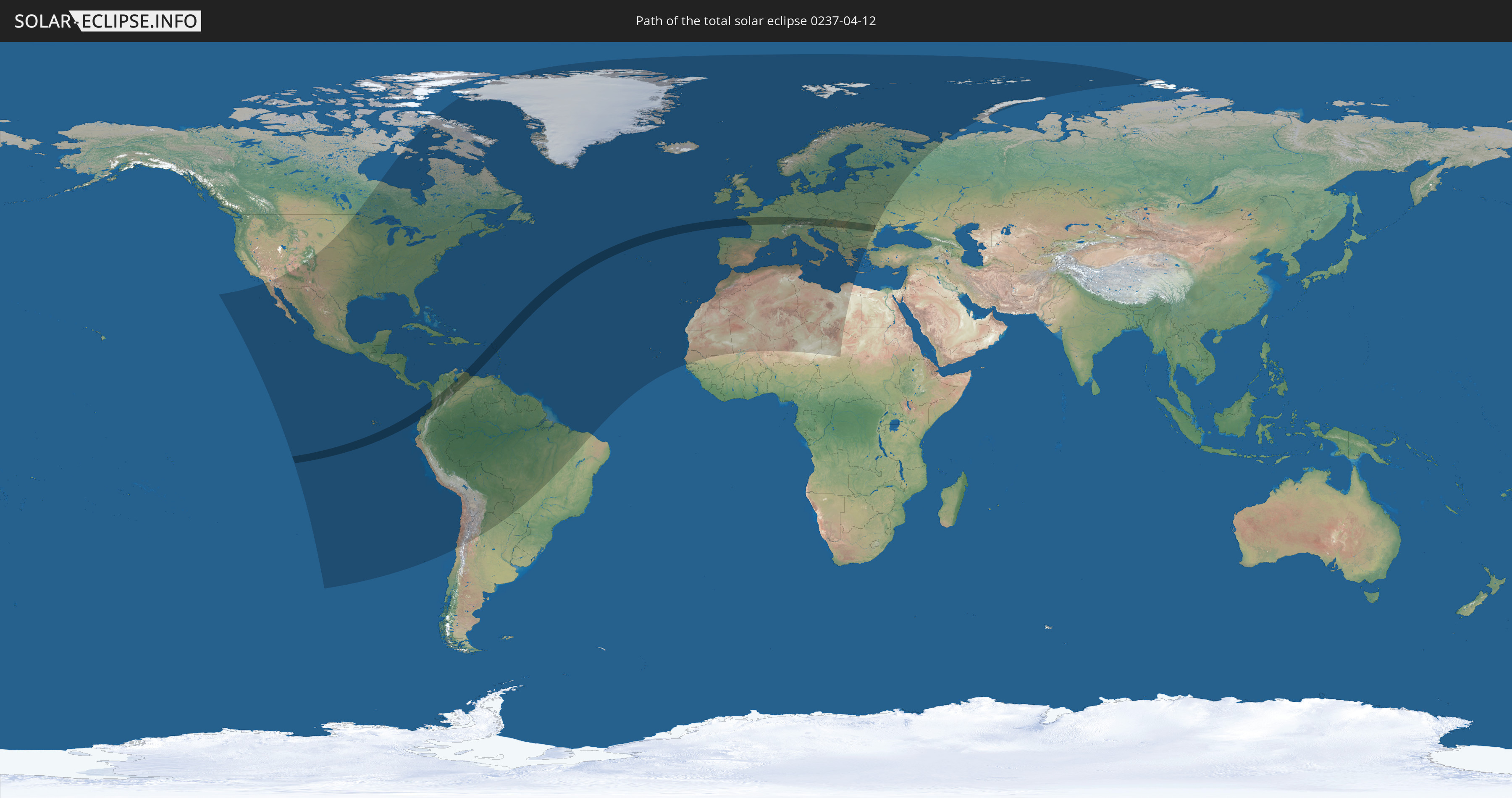
Die Sonnenfinsternis am 04/12/0237 kann man in 114 Ländern als partielle Sonnenfinsternis beobachten.
Der Finsternispfad verläuft durch 25 Länder. Nur in diesen Ländern ist sie als total Sonnenfinsternis zu sehen.
In den folgenden Ländern ist die Sonnenfinsternis total zu sehen
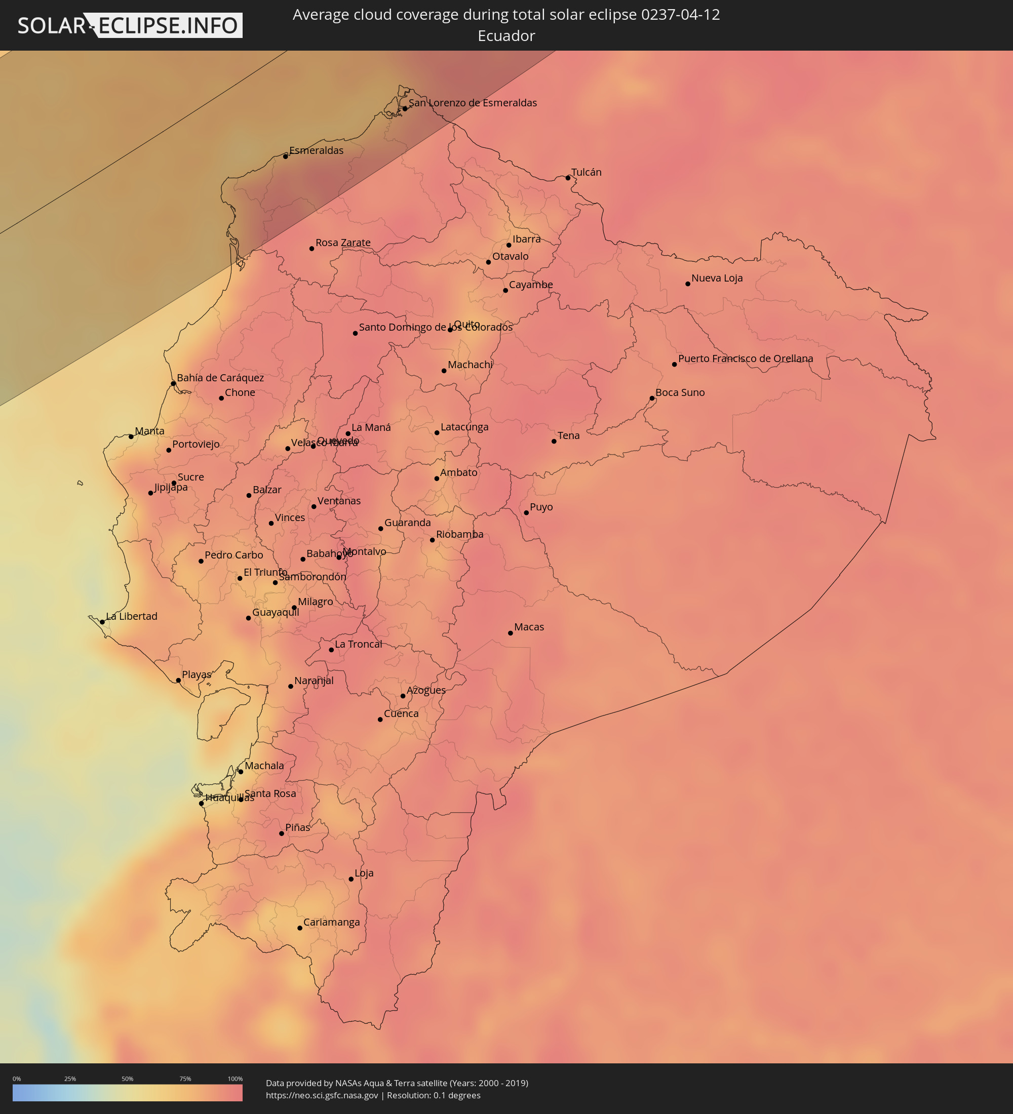
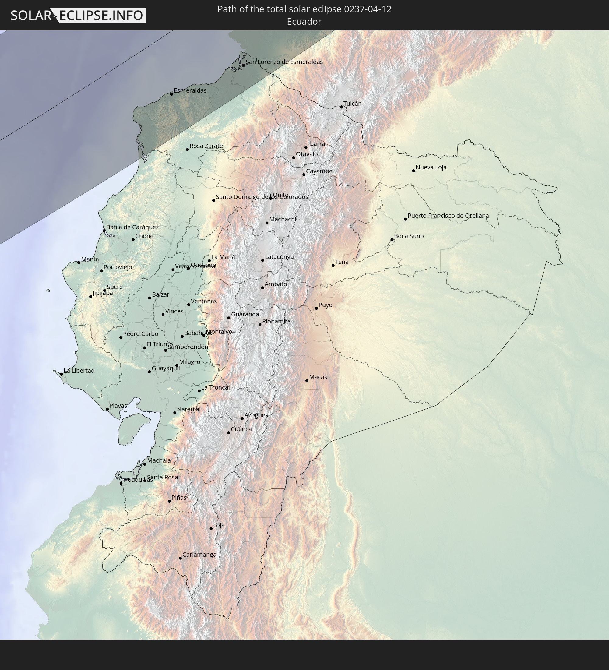 Ecuador
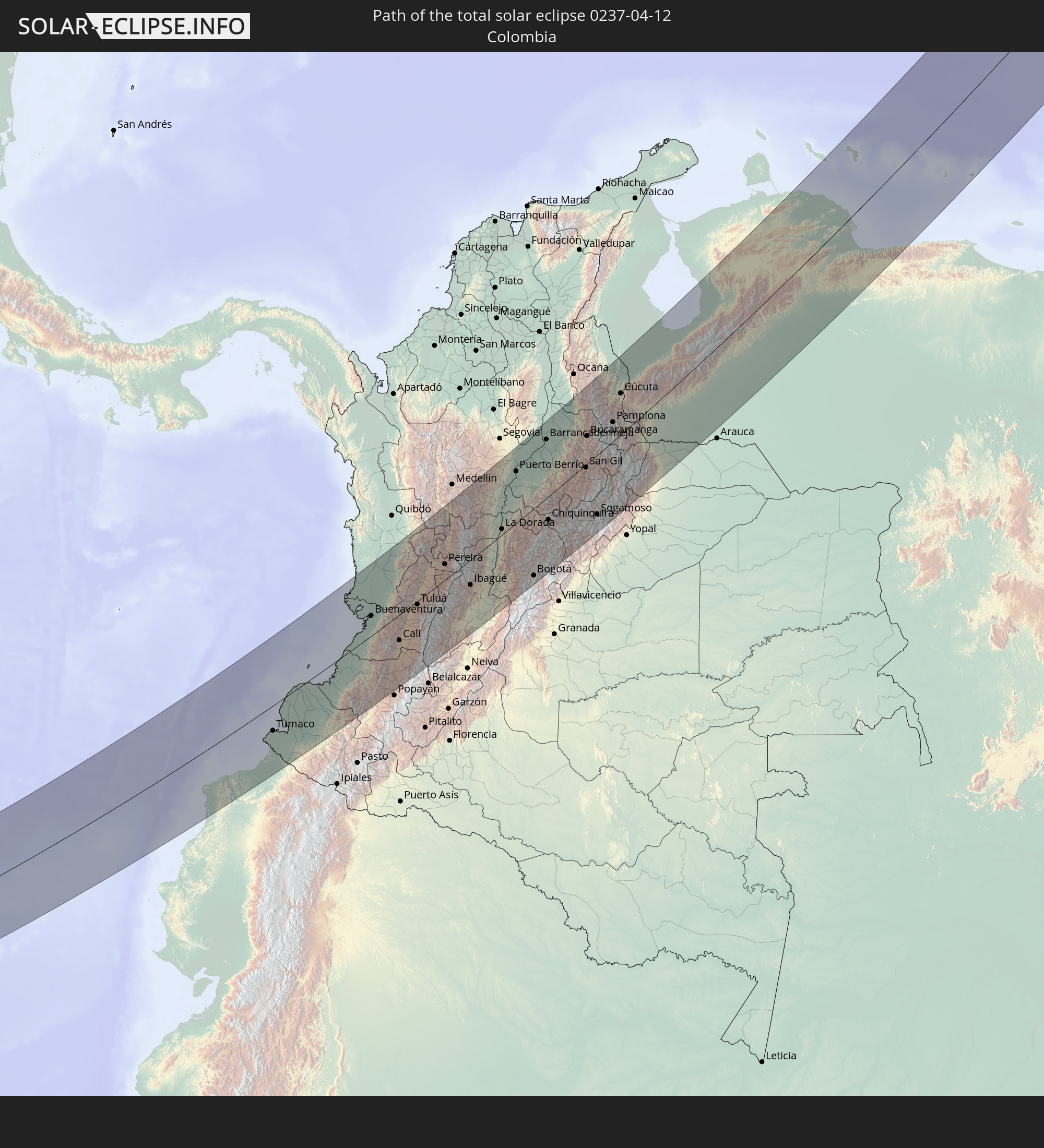 Colombia
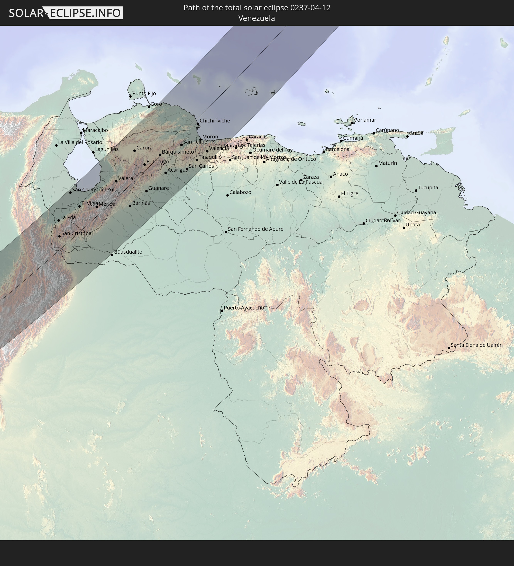 Venezuela
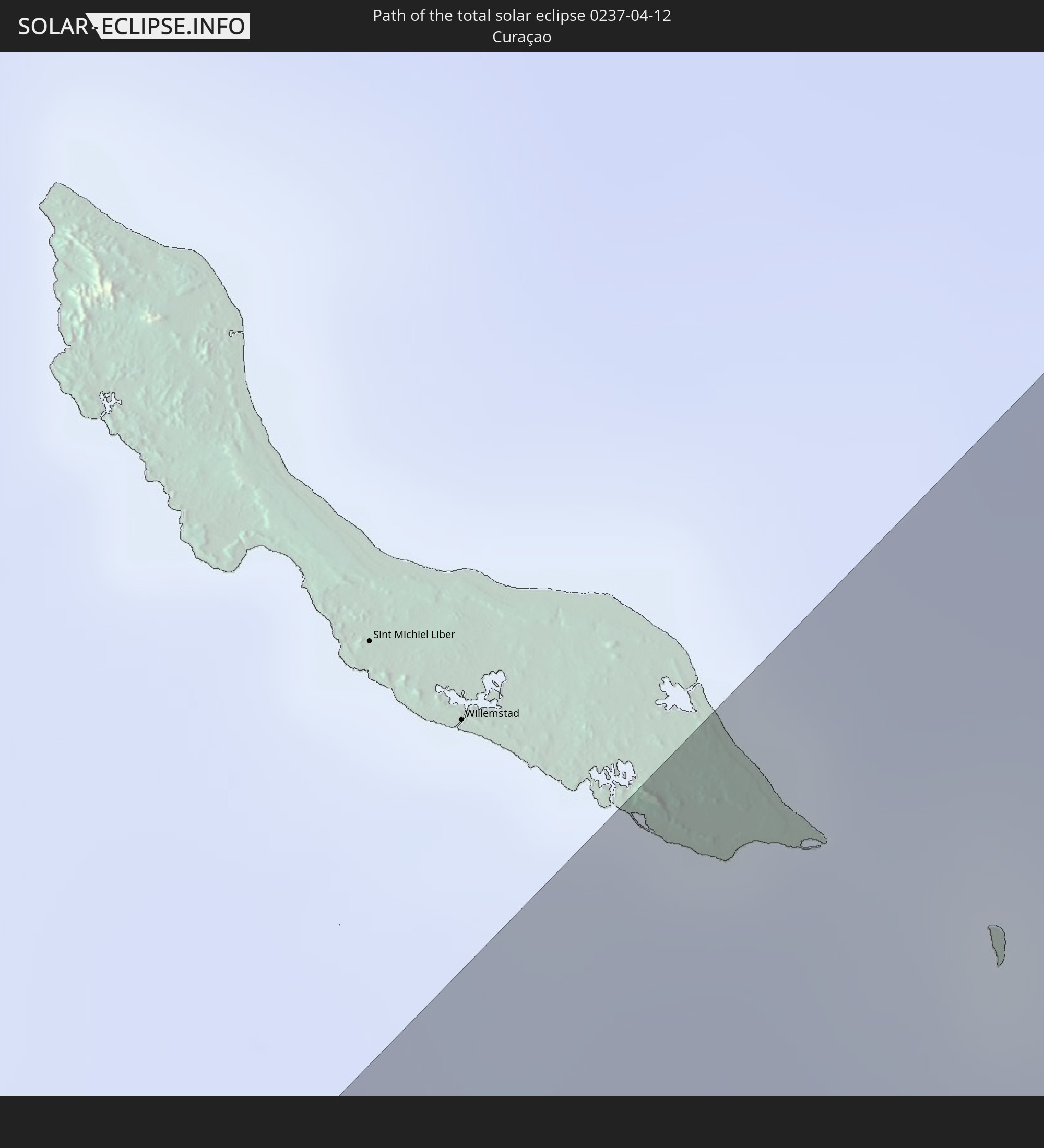 Curaçao
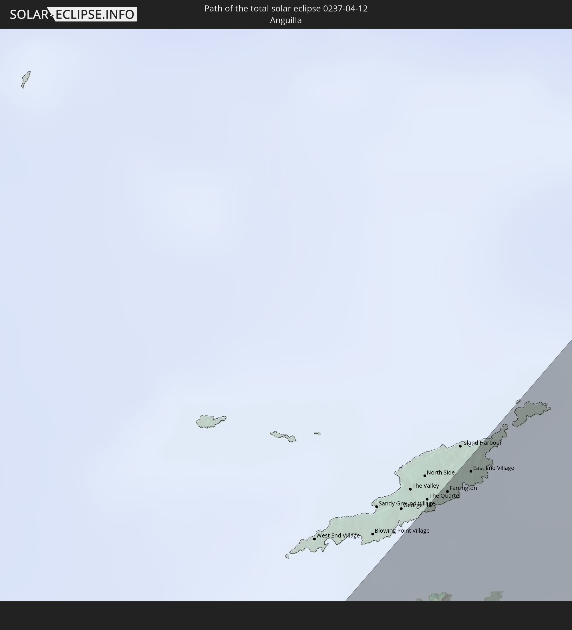 Anguilla
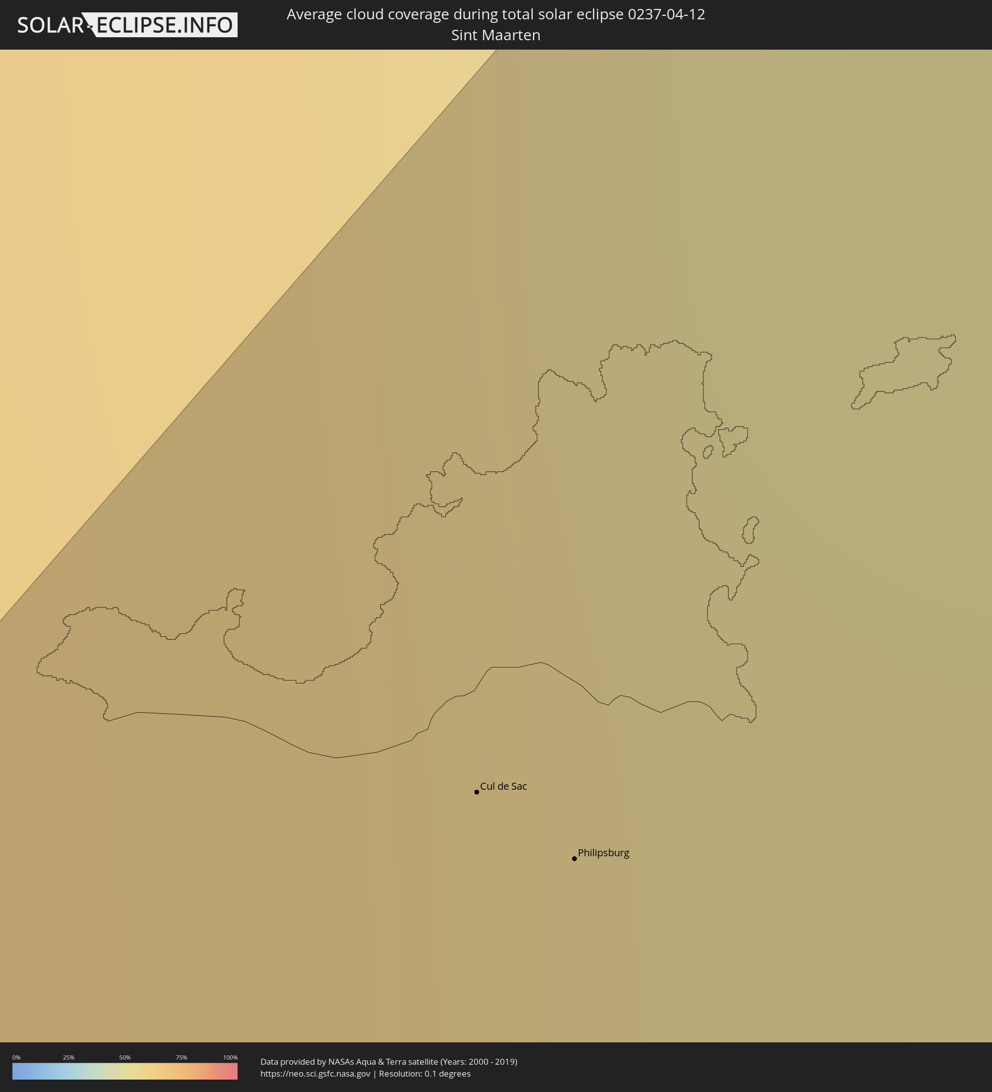
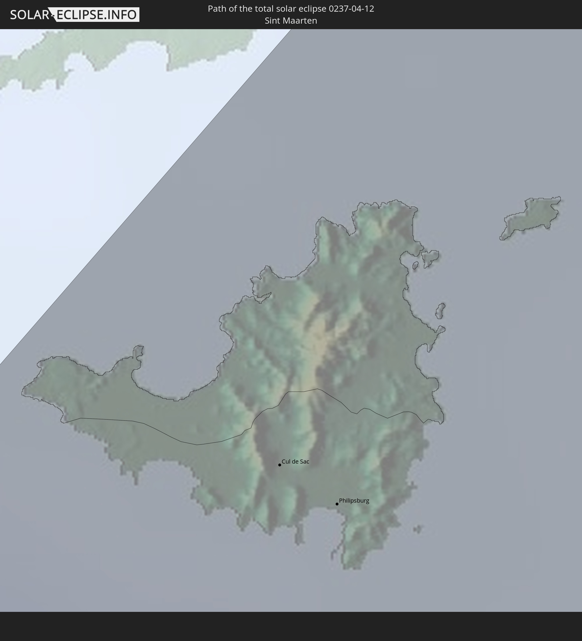 Sint Maarten
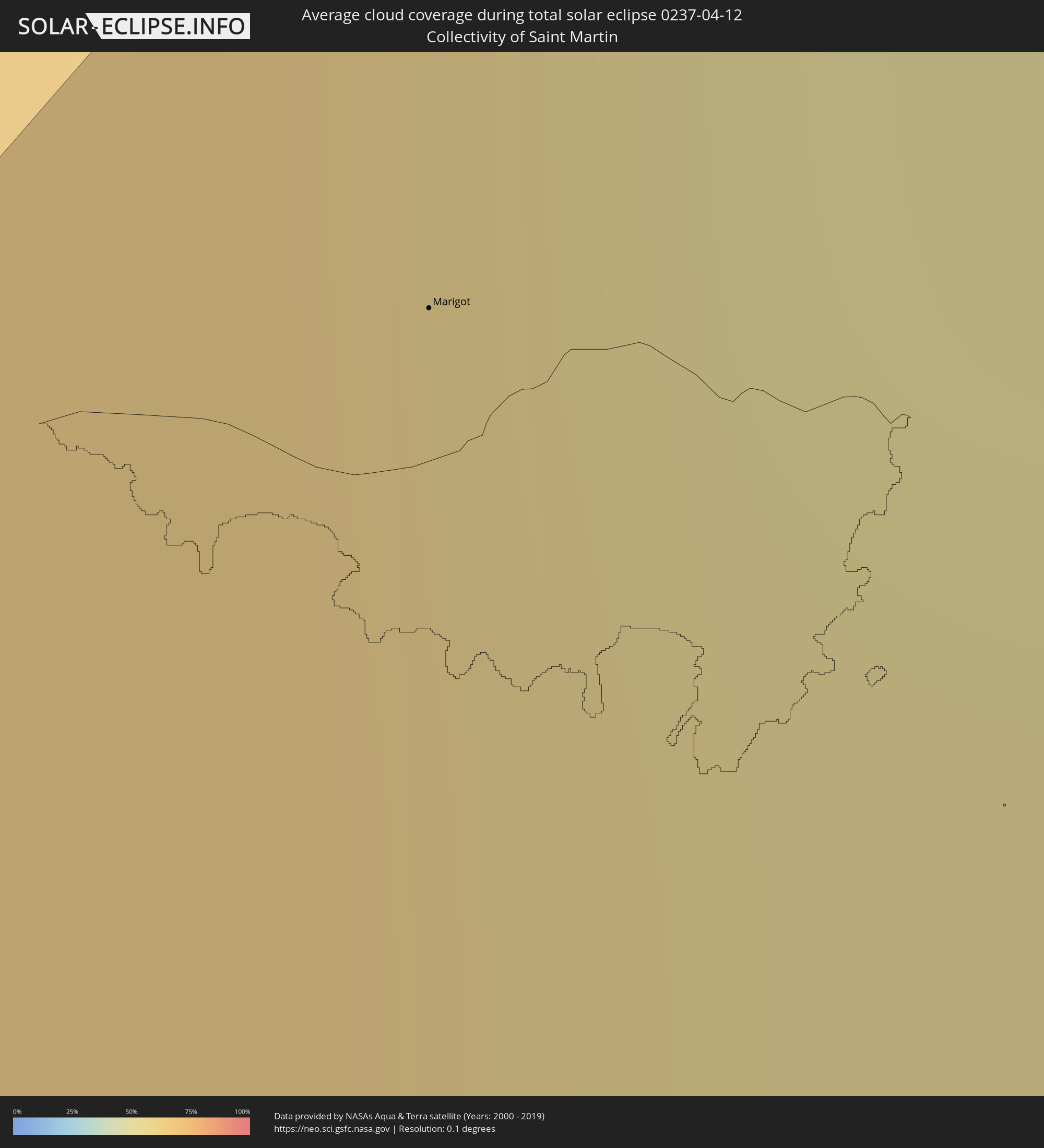
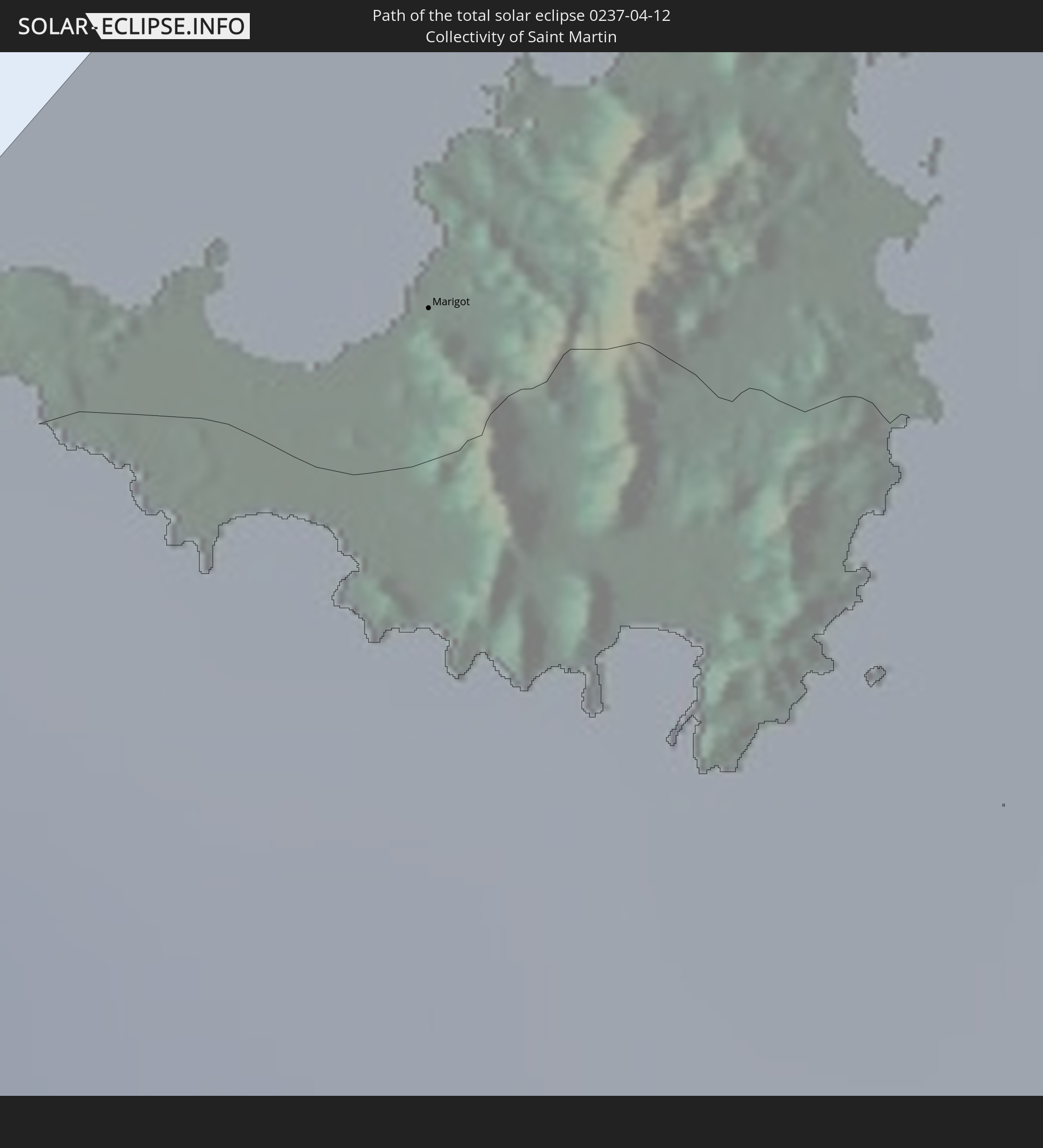 Collectivity of Saint Martin
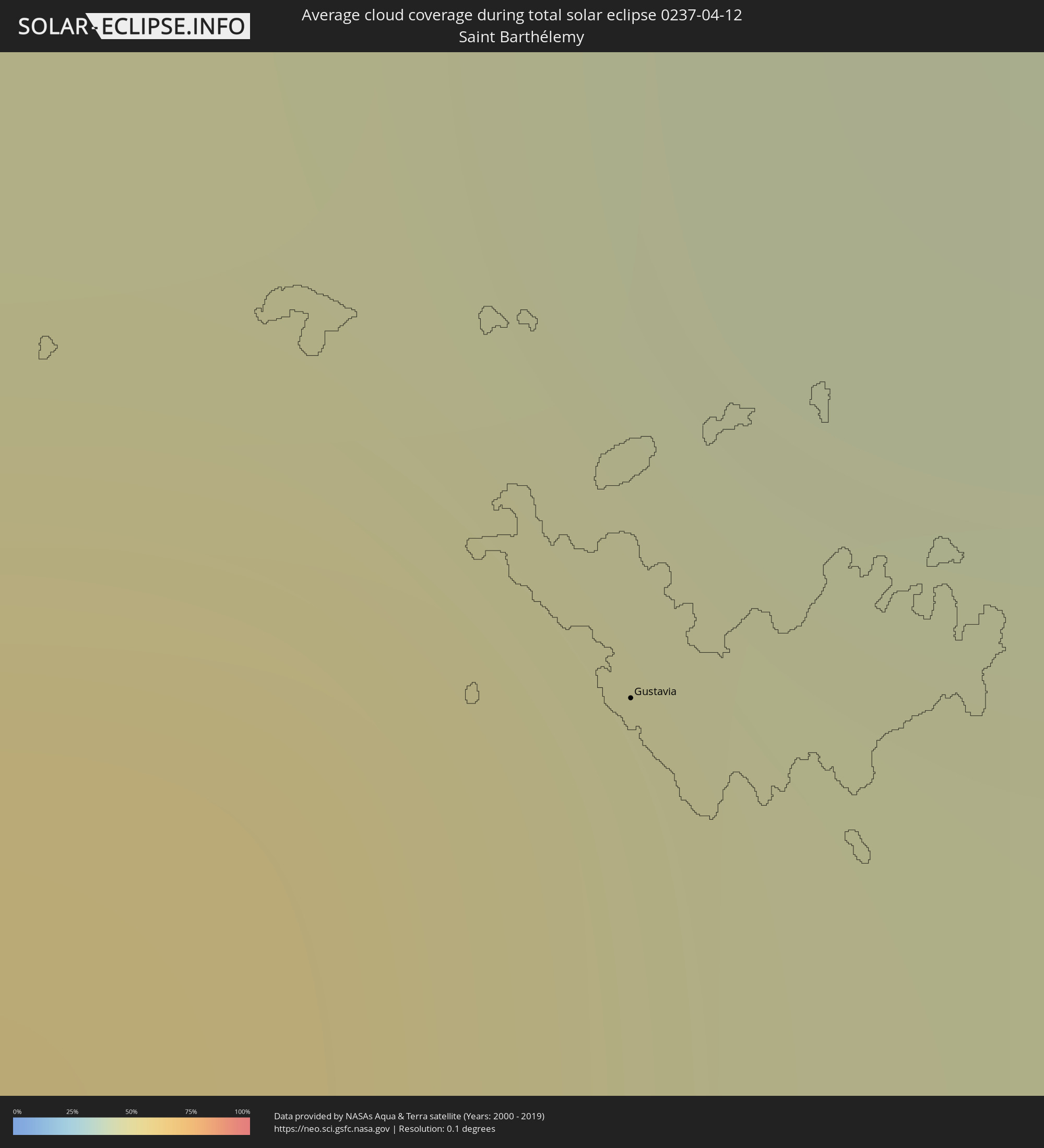
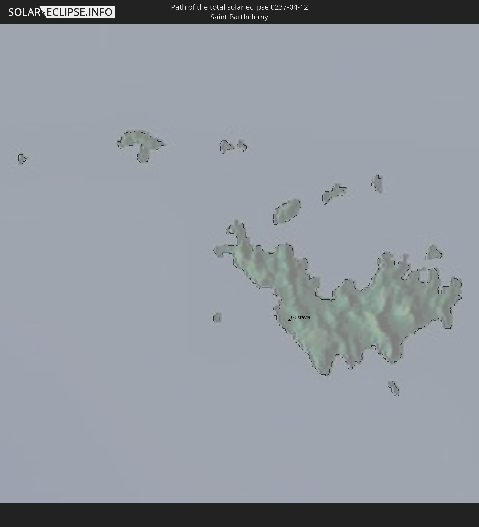 Saint Barthélemy
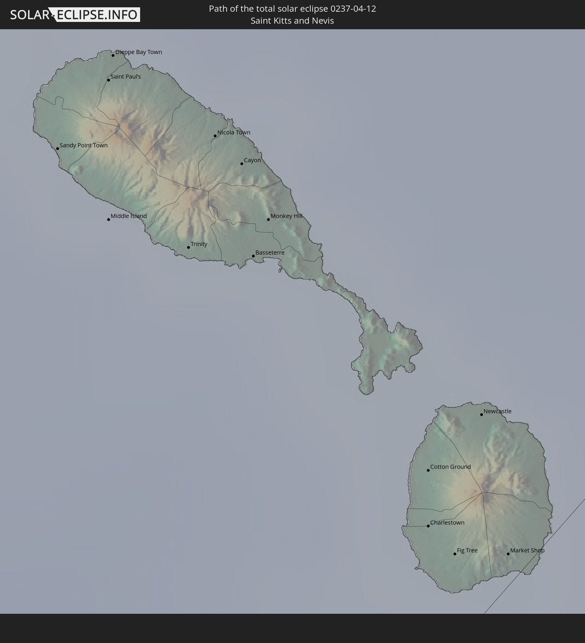 Saint Kitts and Nevis
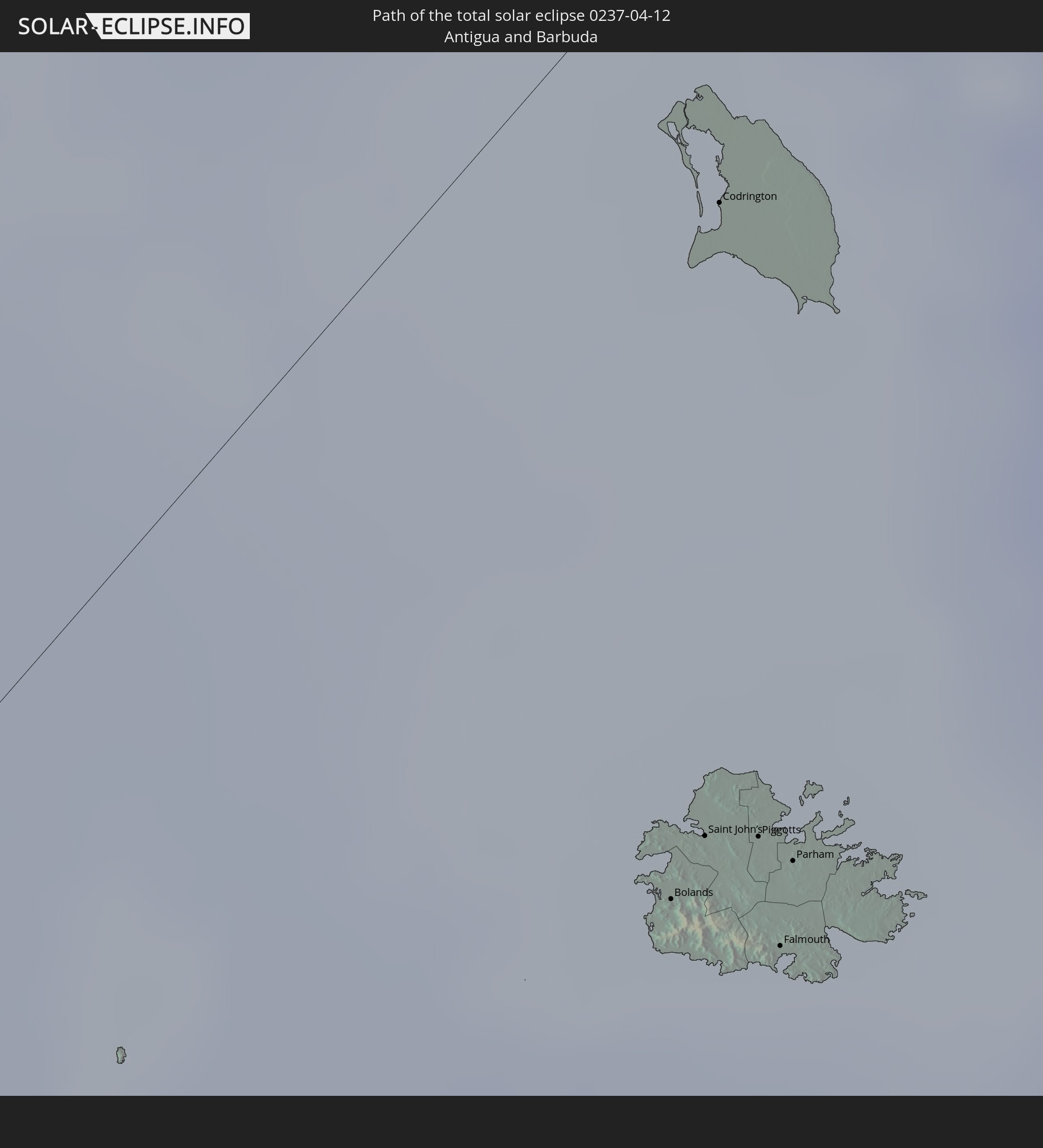 Antigua and Barbuda
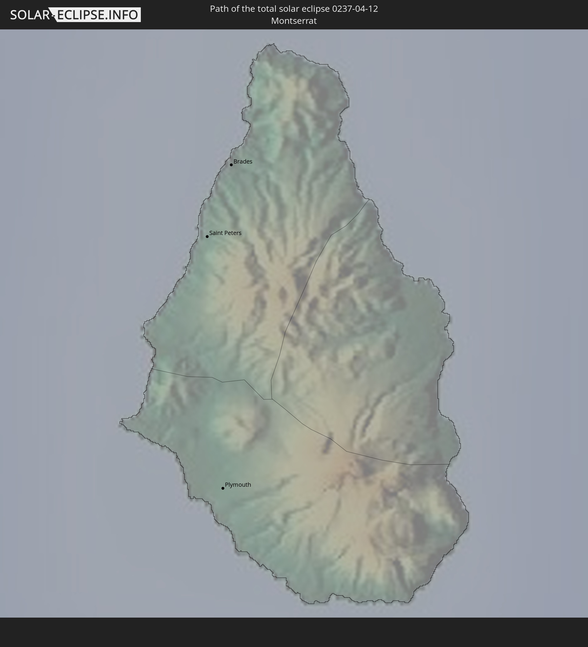 Montserrat
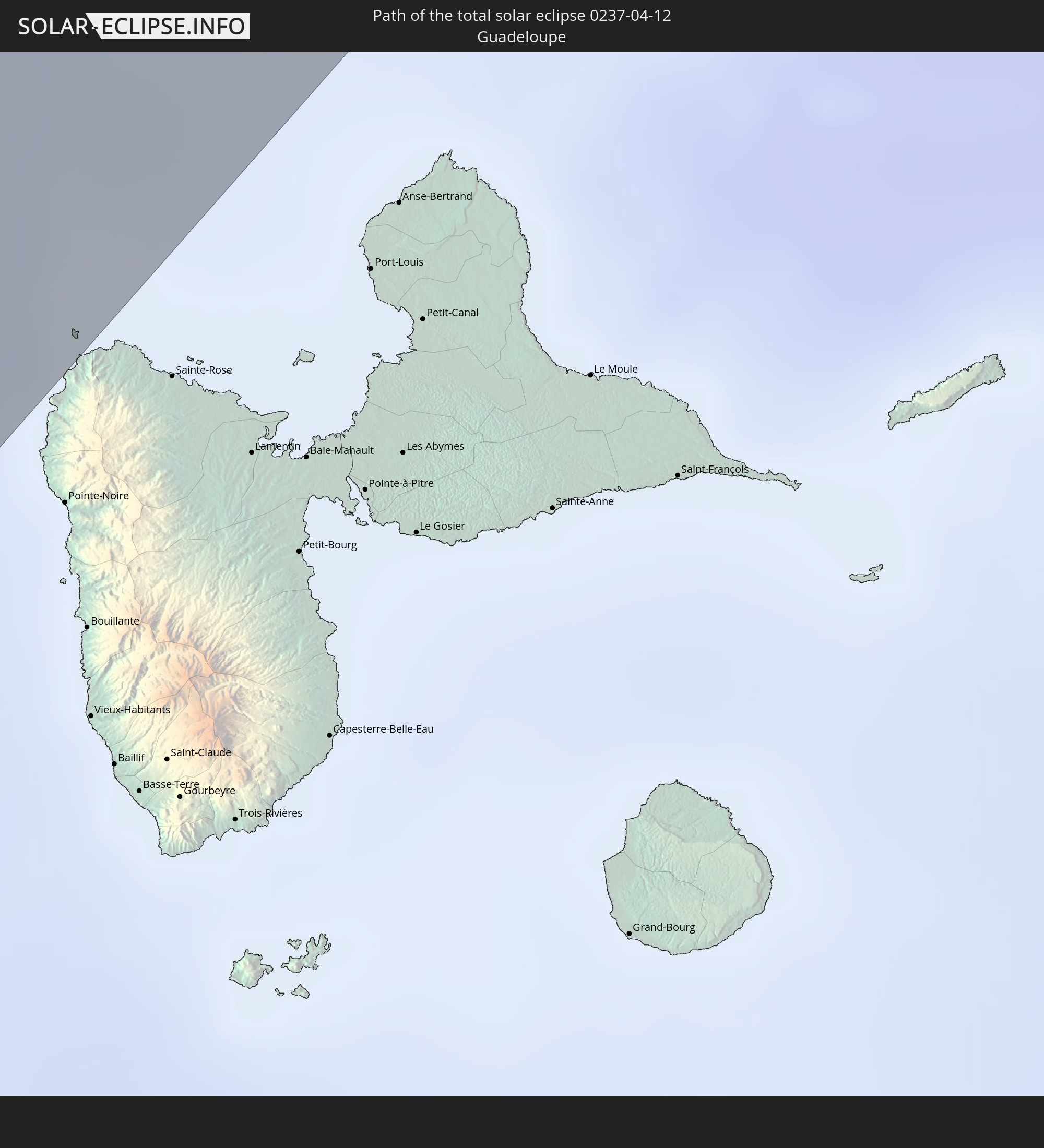 Guadeloupe
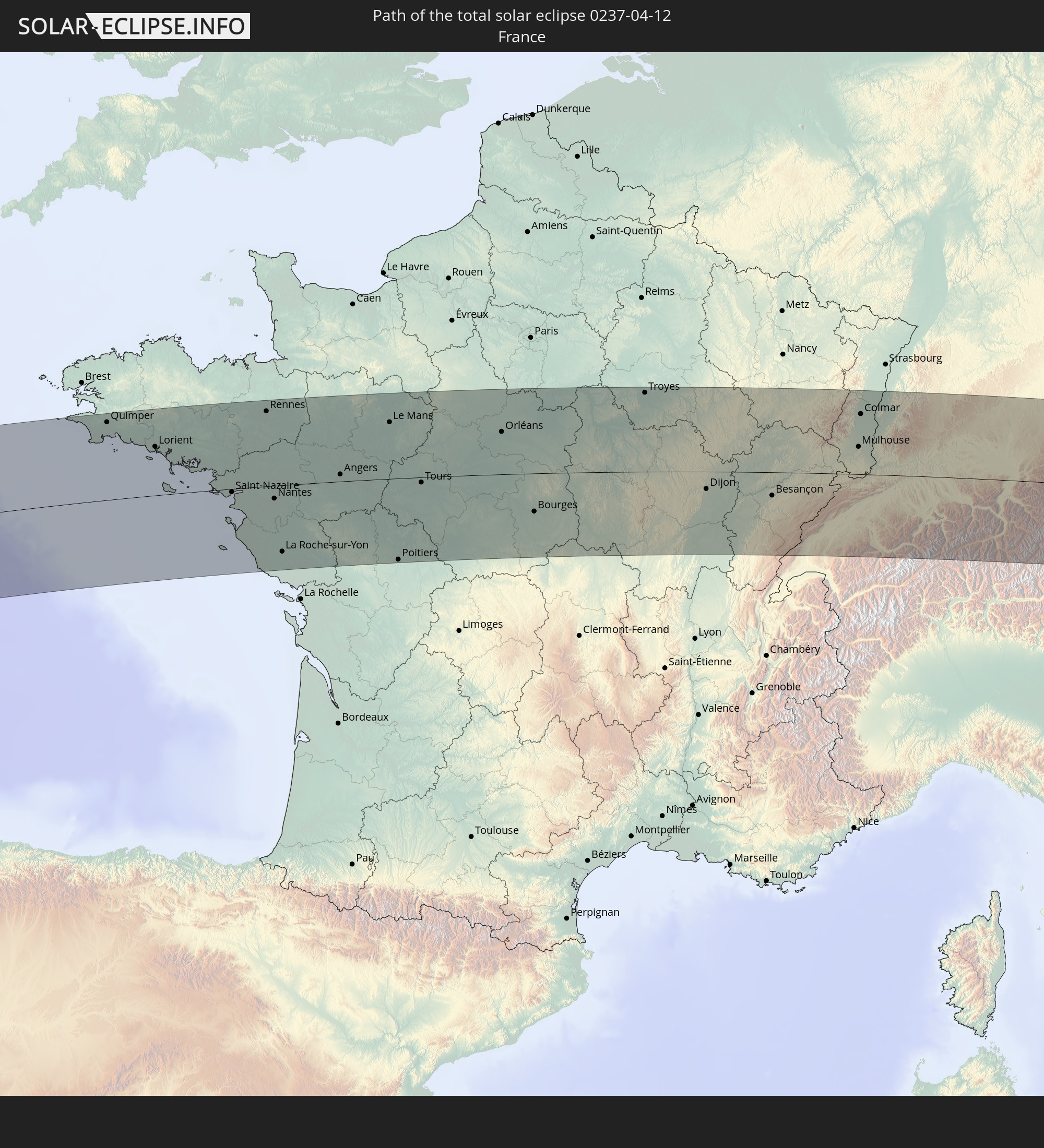 France
 Caribbean Netherlands
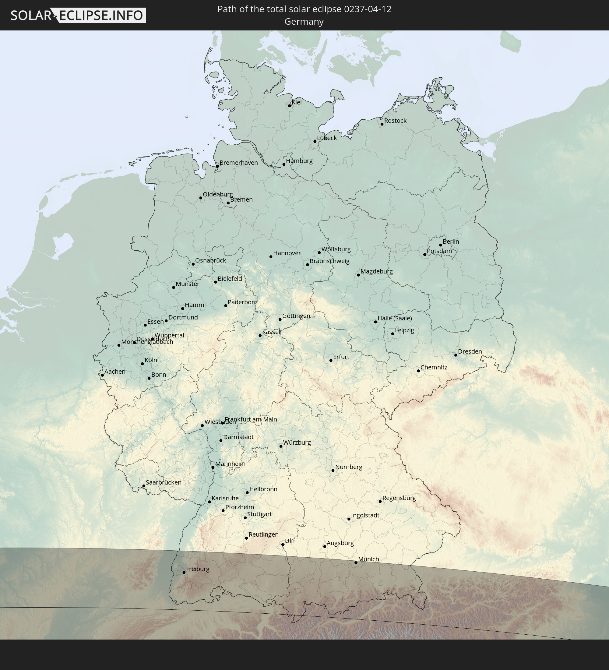 Germany
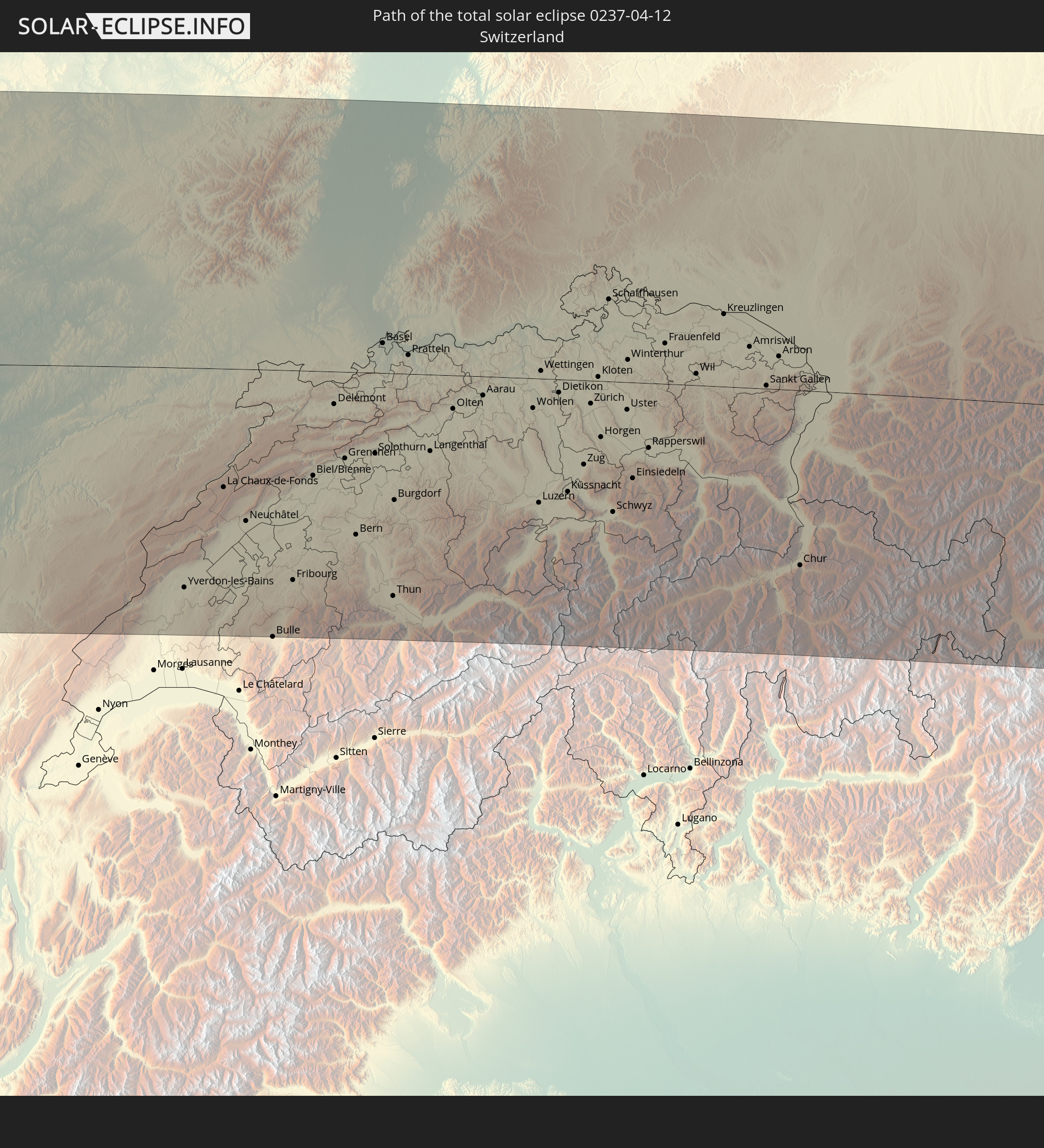 Switzerland
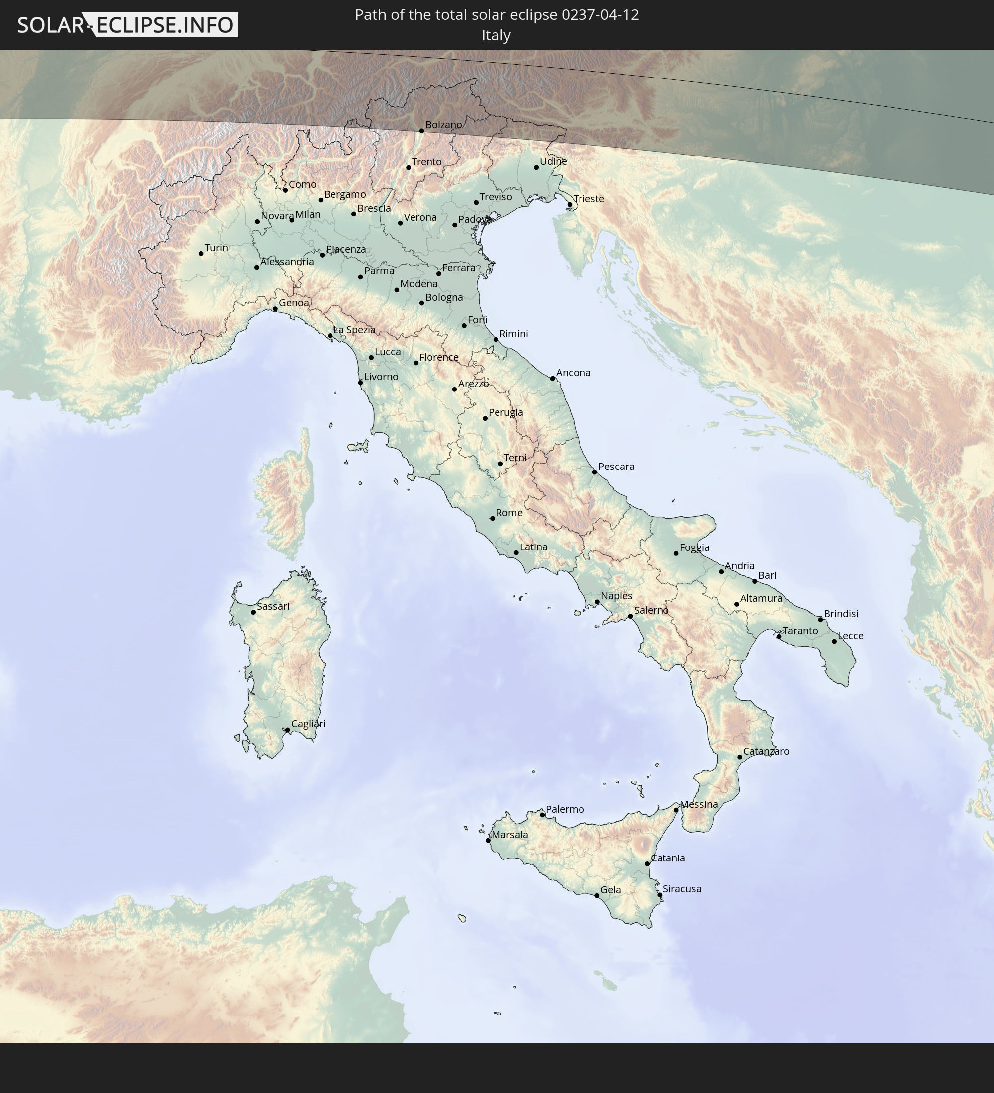 Italy
Italy
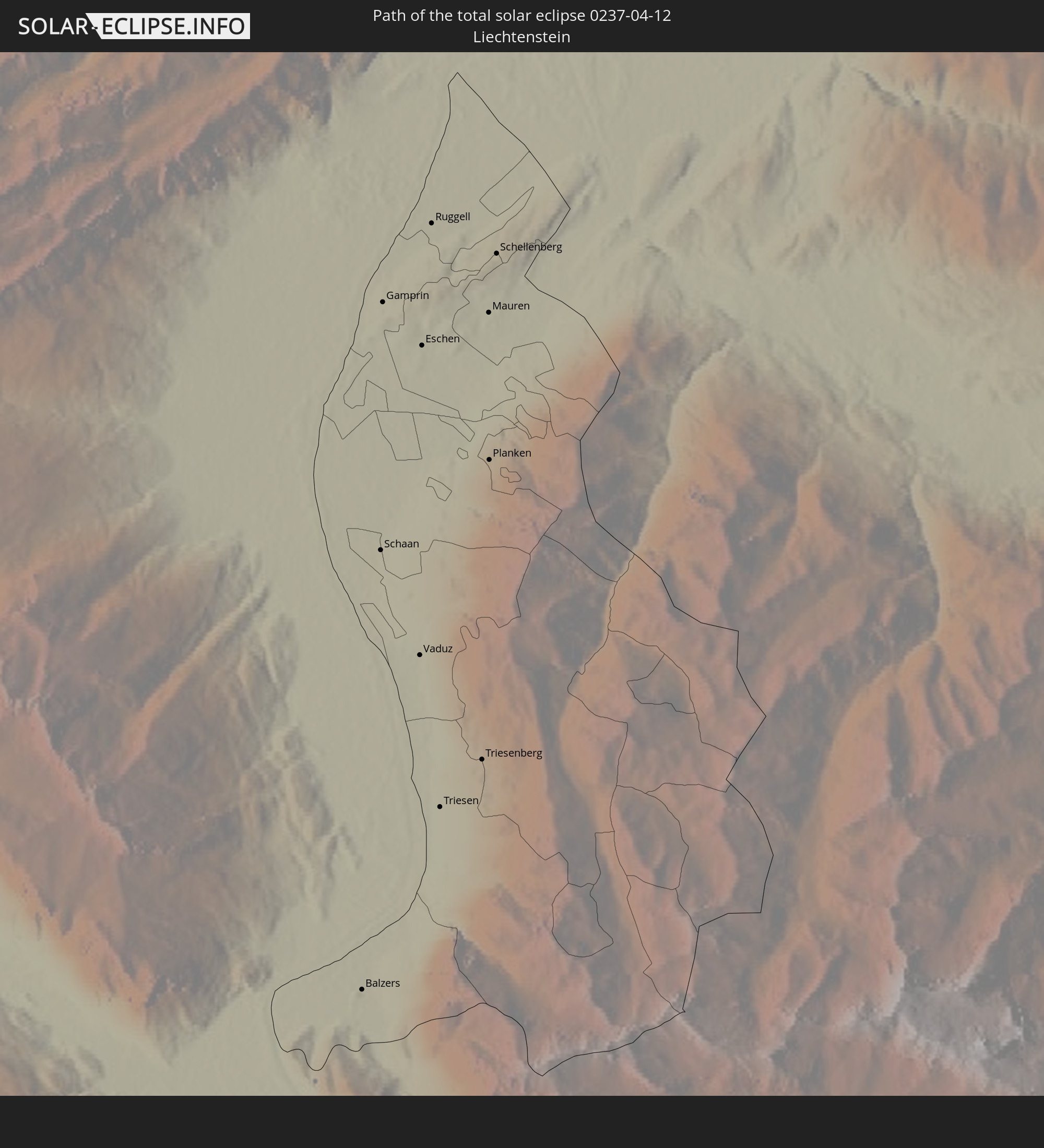 Liechtenstein
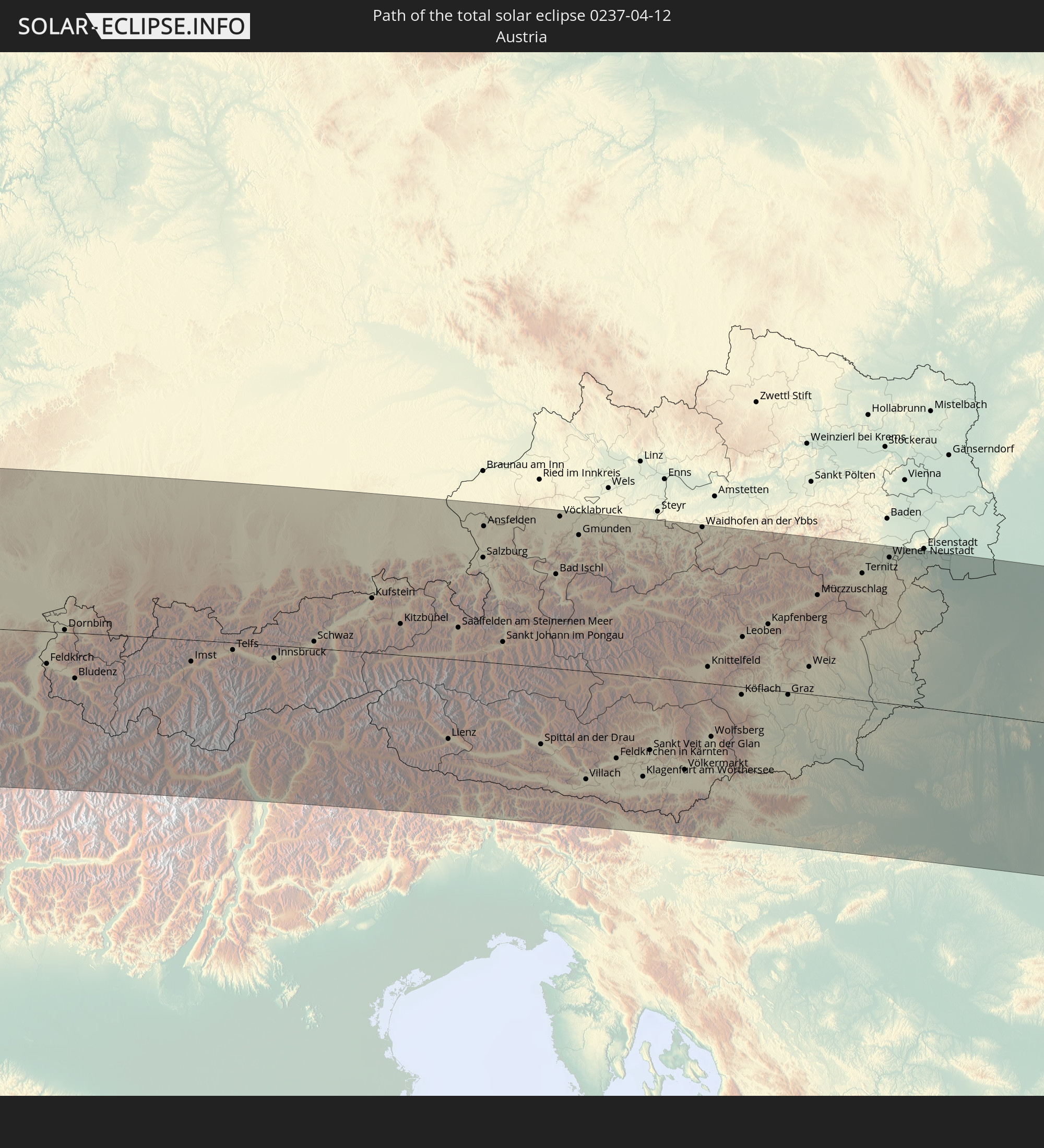 Austria
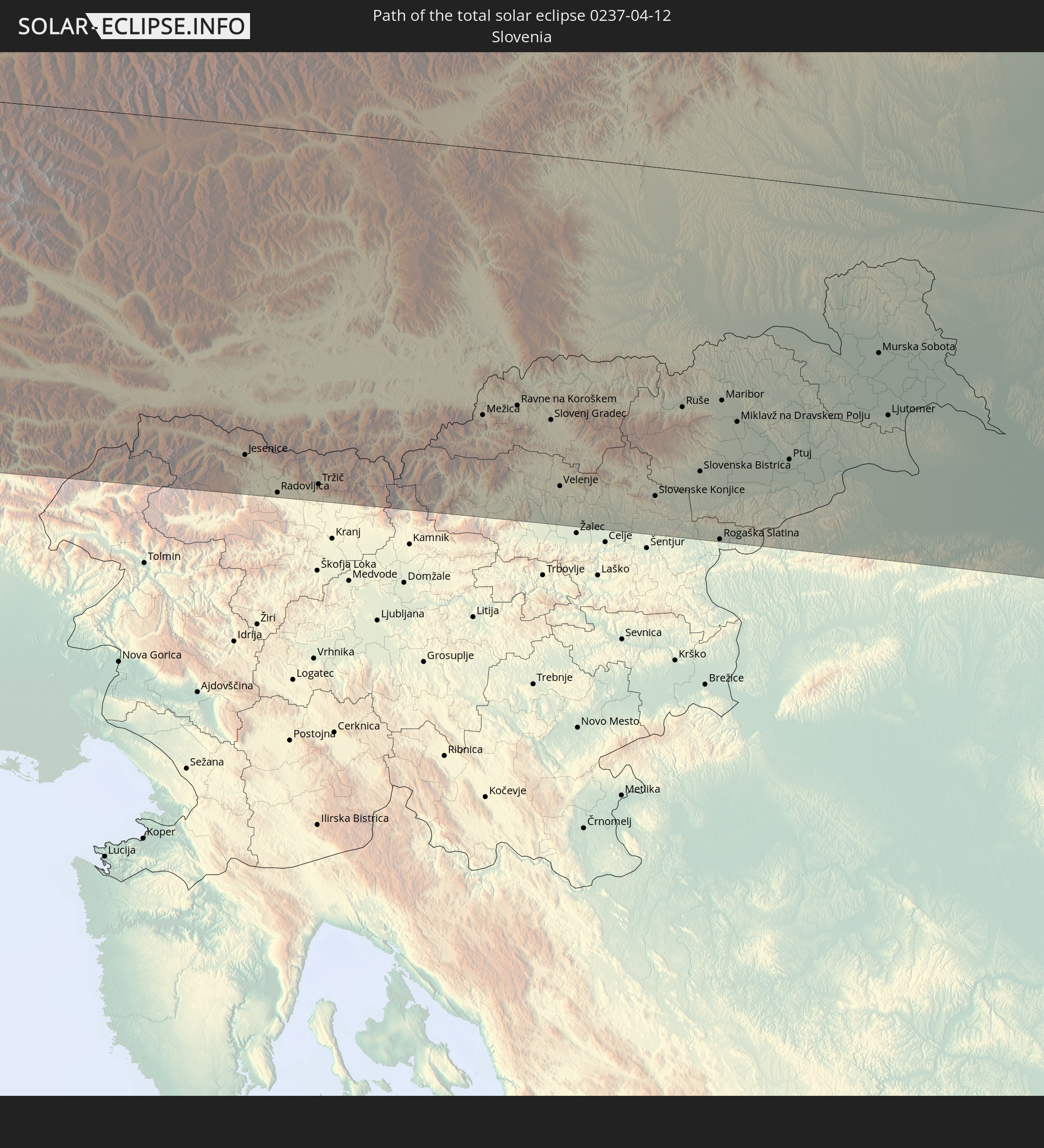 Slovenia
 Croatia
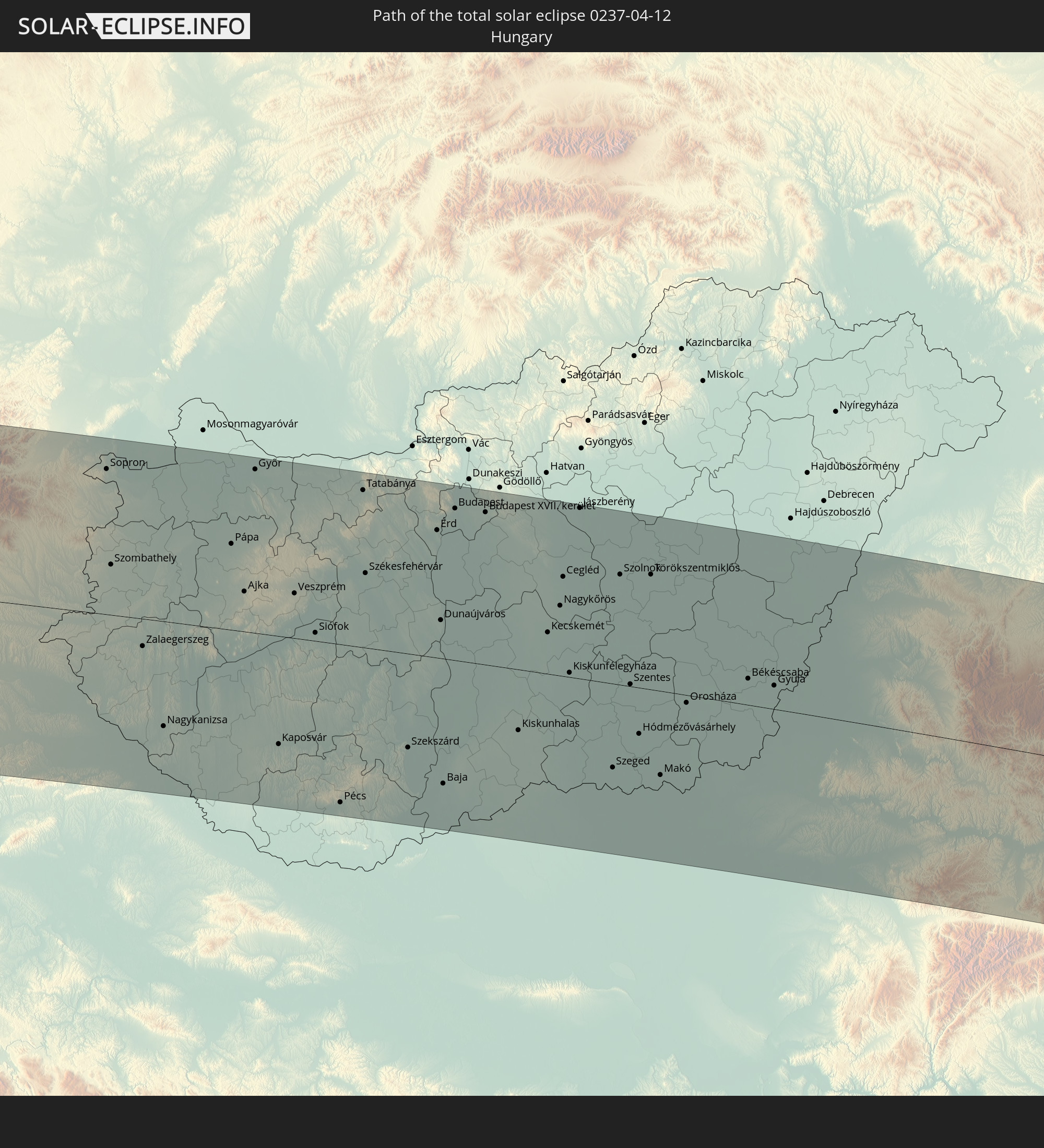 Hungary
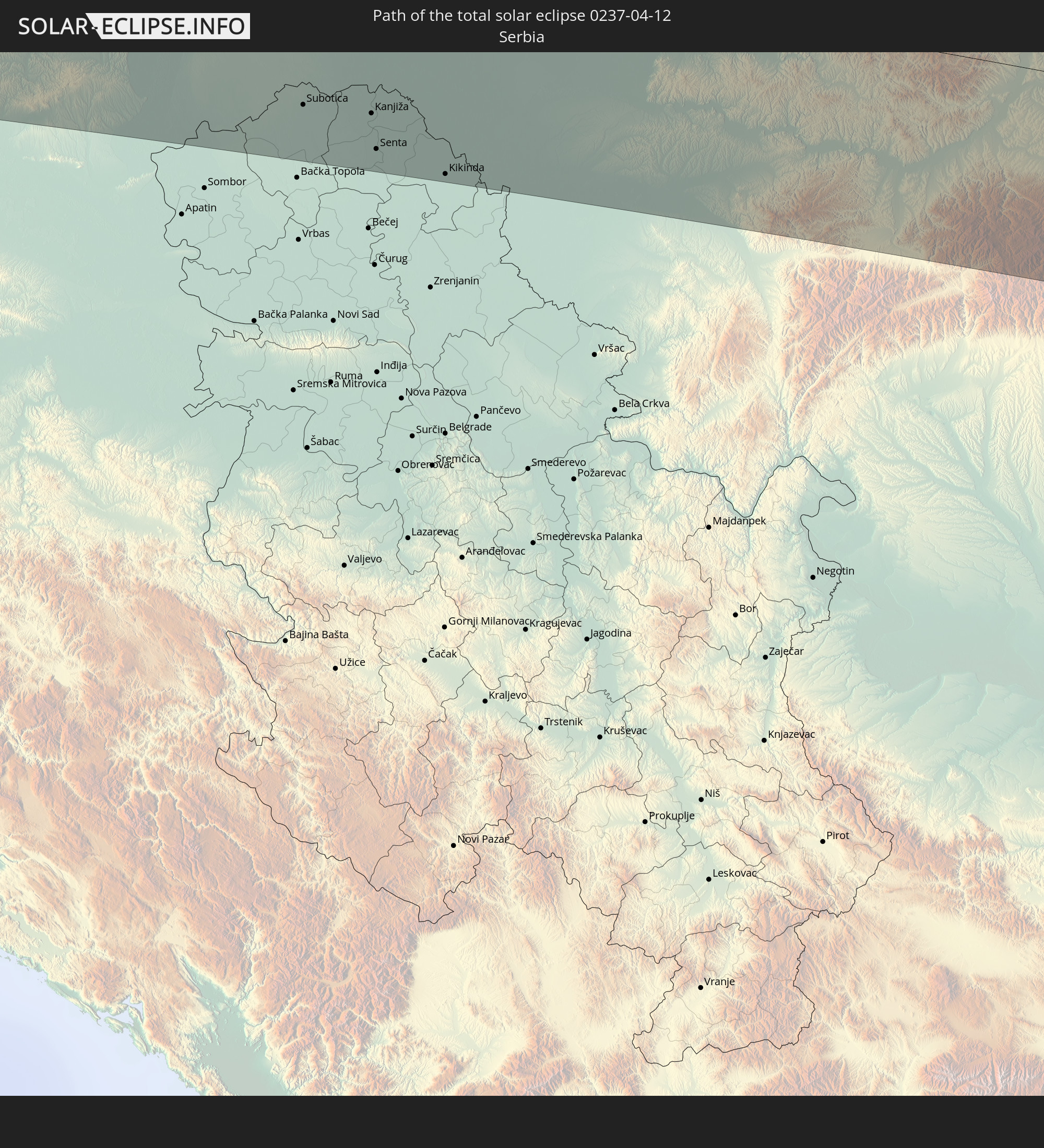 Serbia
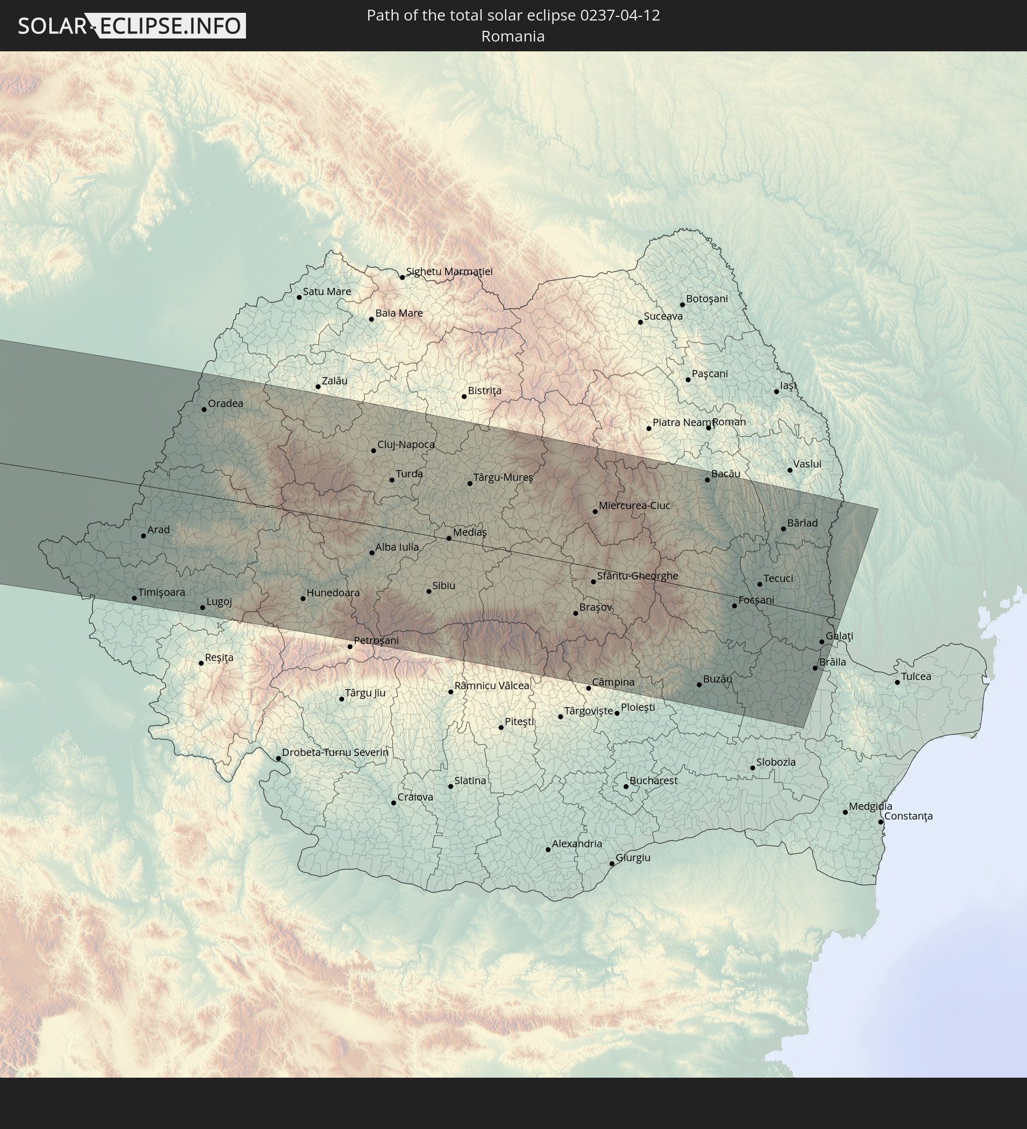 Romania
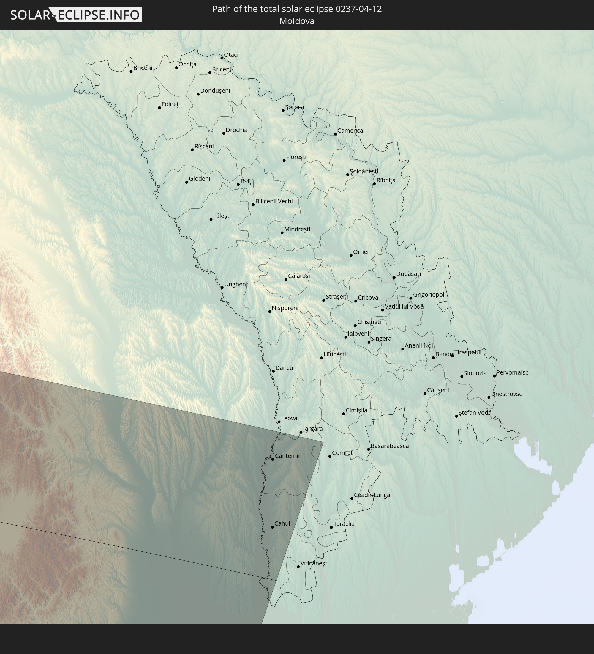 Moldova
In den folgenden Ländern ist die Sonnenfinsternis partiell zu sehen
 Russia
 United States
 United States Minor Outlying Islands
 Canada
 Mexico
 Chile
Chile
 Greenland
 Guatemala
 Ecuador
 El Salvador
 Honduras
 Belize
 Nicaragua
 Costa Rica
 Cuba
Cuba
 Panama
 Colombia
 Cayman Islands
 Peru
Peru
 The Bahamas
 Jamaica
 Haiti
Haiti
 Brazil
 Argentina
 Venezuela
 Turks and Caicos Islands
 Dominican Republic
 Aruba
Aruba
 Bolivia
 Puerto Rico
 United States Virgin Islands
 Bermuda
 British Virgin Islands
 Anguilla
 Collectivity of Saint Martin
 Saint Barthélemy
 Saint Kitts and Nevis
 Paraguay
 Antigua and Barbuda
 Montserrat
 Trinidad and Tobago
 Guadeloupe
 Grenada
 Dominica
 Saint Vincent and the Grenadines
 Guyana
 Martinique
 Saint Lucia
 Barbados
 Suriname
 Saint Pierre and Miquelon
 French Guiana
 Portugal
 Cabo Verde
 Iceland
 Spain
Spain
 Senegal
 Mauritania
 The Gambia
 Morocco
 Mali
Mali
 Republic of Ireland
 Svalbard and Jan Mayen
 Algeria
 United Kingdom
 Faroe Islands
 Gibraltar
 France
 Isle of Man
 Guernsey
 Jersey
 Niger
Niger
 Andorra
 Belgium
 Netherlands
 Norway
 Luxembourg
 Germany
 Switzerland
 Italy
Italy
 Monaco
 Tunisia
 Denmark
 Libya
Libya
 Liechtenstein
 Austria
 Sweden
 Czechia
 San Marino
 Vatican City
 Slovenia
 Chad
Chad
 Croatia
 Poland
 Malta
Malta
 Bosnia and Herzegovina
 Hungary
 Slovakia
 Montenegro
 Serbia
 Albania
 Åland Islands
 Greece
 Romania
 Republic of Macedonia
 Finland
 Lithuania
 Latvia
 Estonia
 Ukraine
 Bulgaria
 Belarus
 Turkey
 Moldova
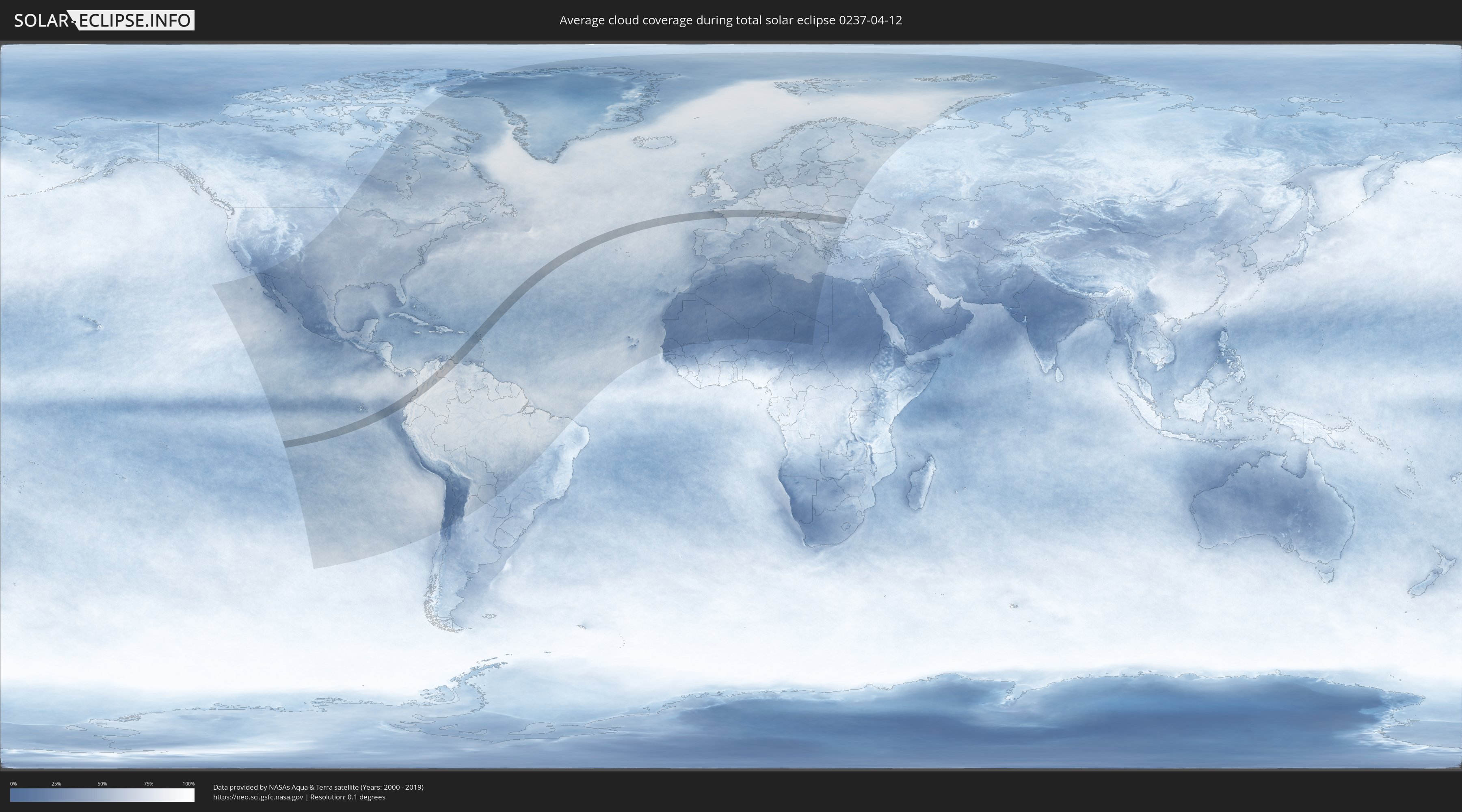
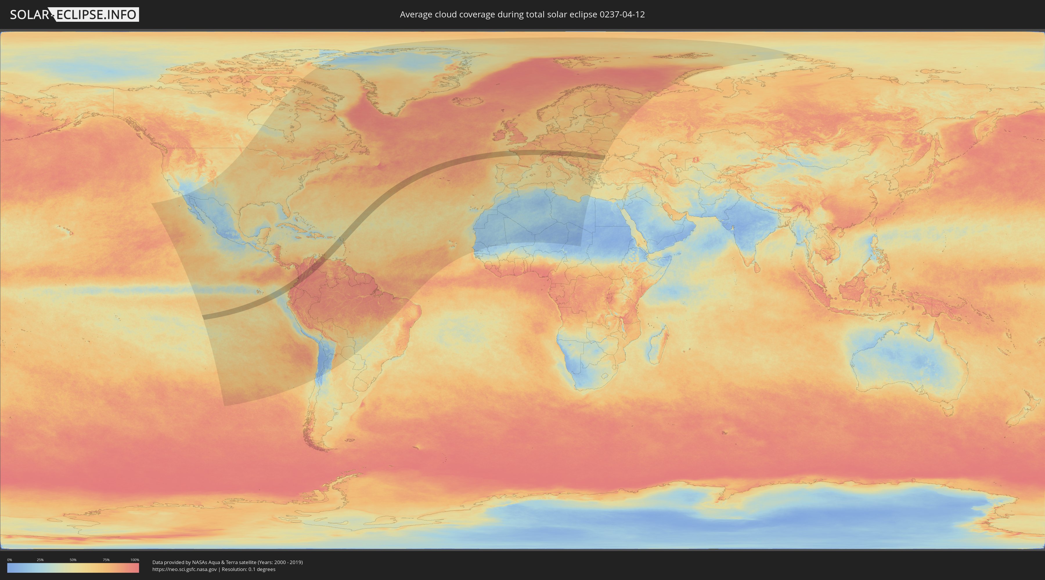
How will be the weather during the total solar eclipse on 04/12/0237?
Where is the best place to see the total solar eclipse of 04/12/0237?
The following maps show the average cloud coverage for the day of the total solar eclipse.
With the help of these maps, it is possible to find the place along the eclipse path, which has the best
chance of a cloudless sky.
Nevertheless, you should consider local circumstances and inform about the weather of your chosen
observation site.
The data is provided by NASAs satellites
AQUA and TERRA.
The cloud maps are averaged over a period of 19 years (2000 - 2019).
Detailed country maps
 Ecuador
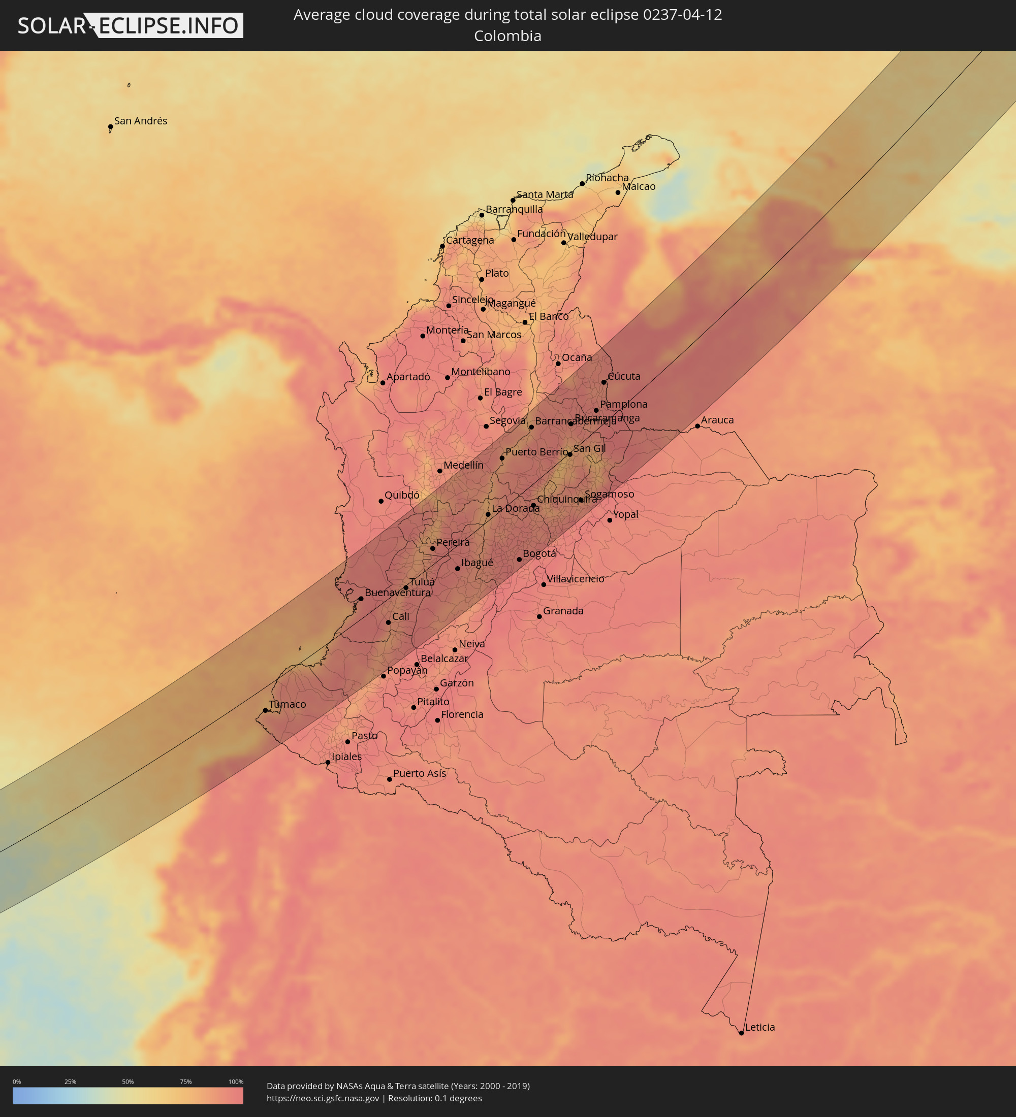 Colombia
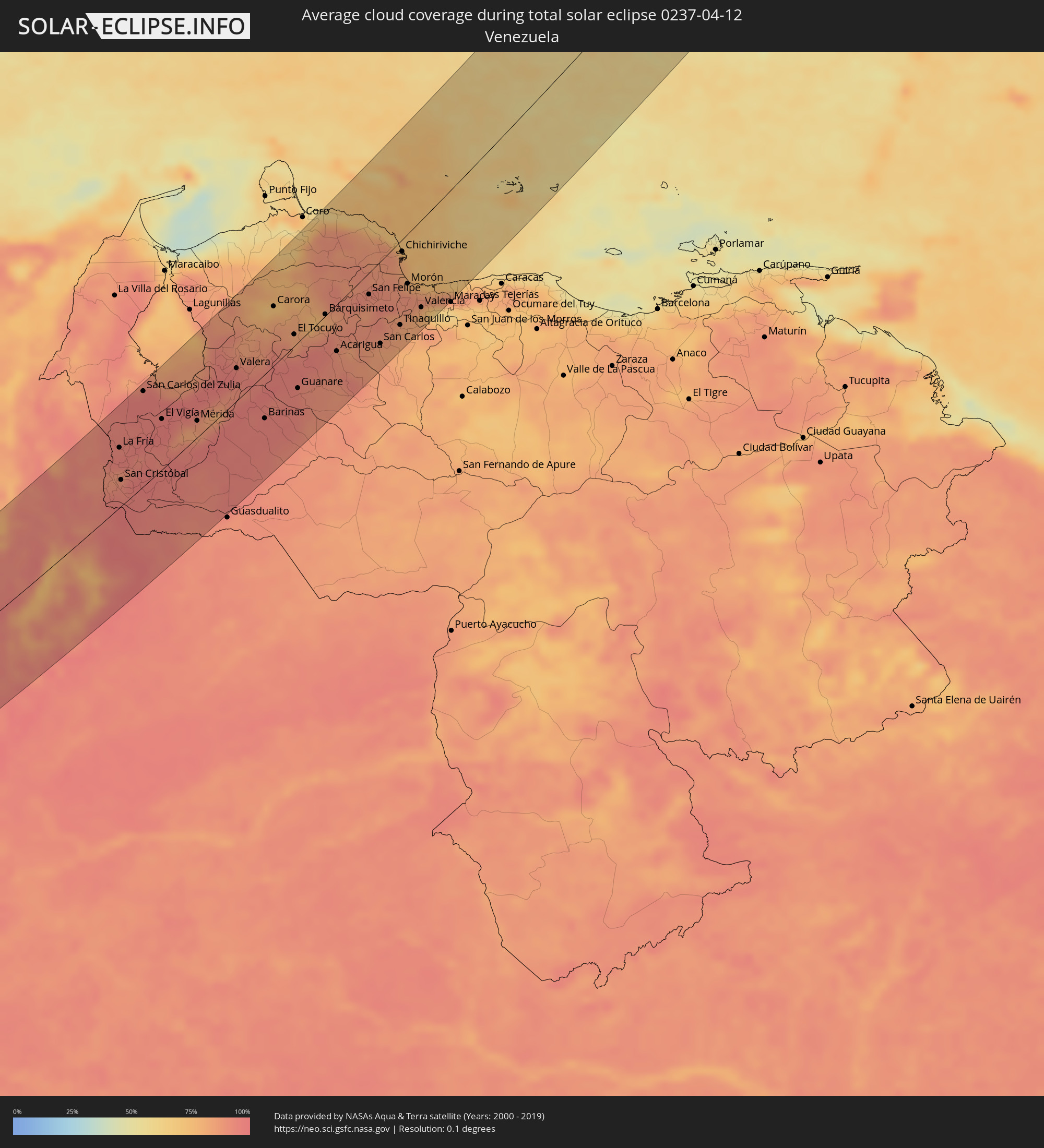 Venezuela
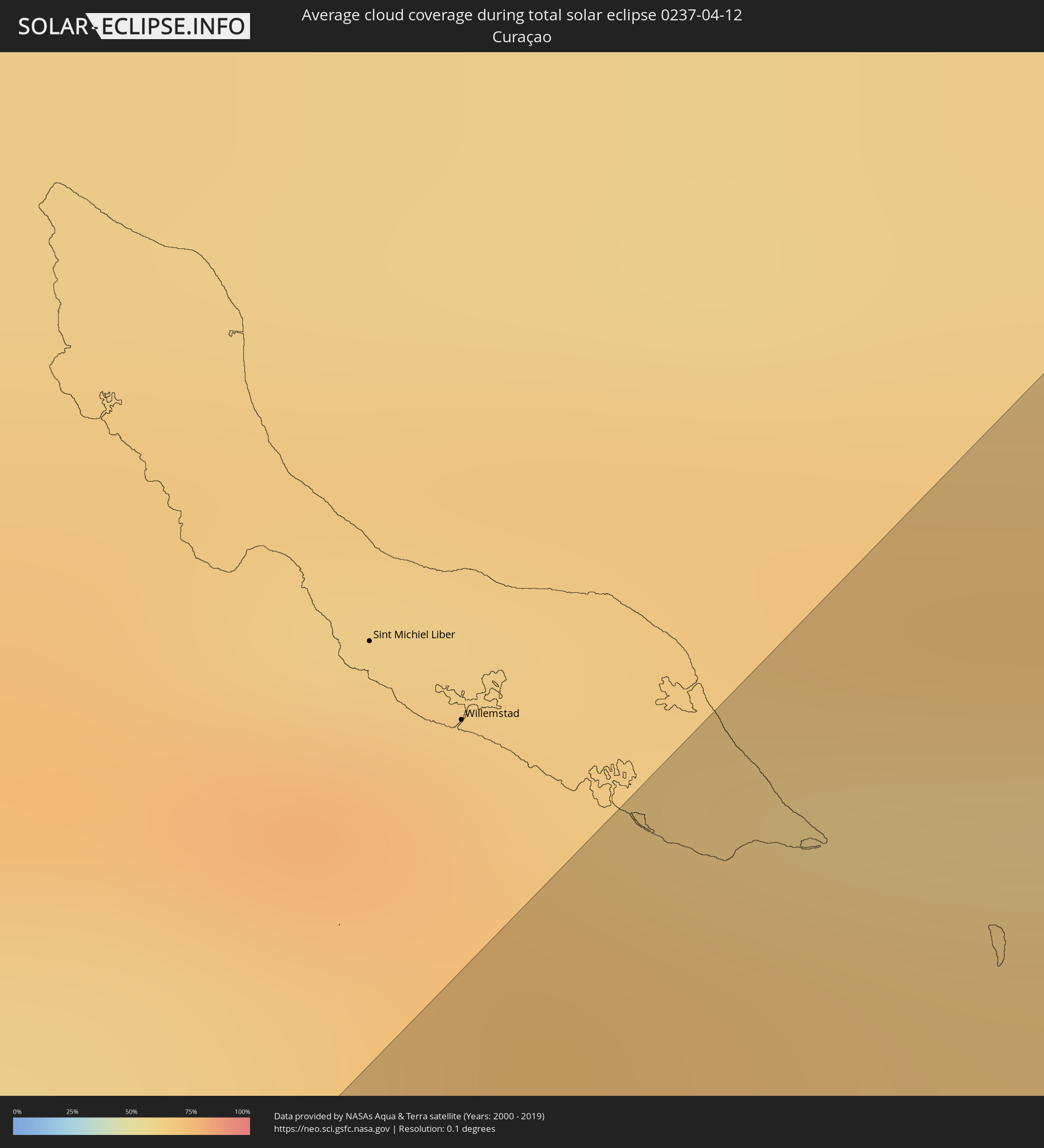 Curaçao
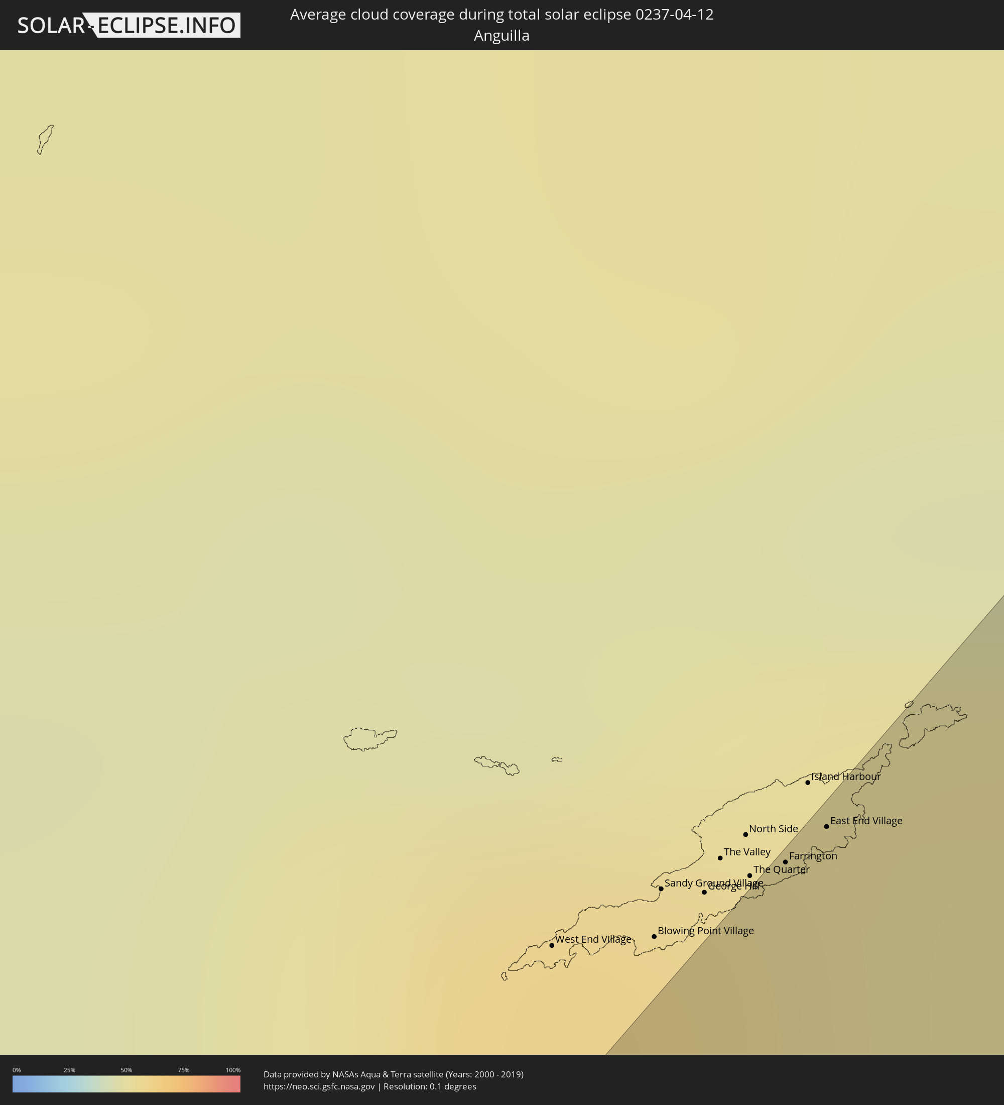 Anguilla
 Sint Maarten
 Collectivity of Saint Martin
 Saint Barthélemy
 Saint Kitts and Nevis
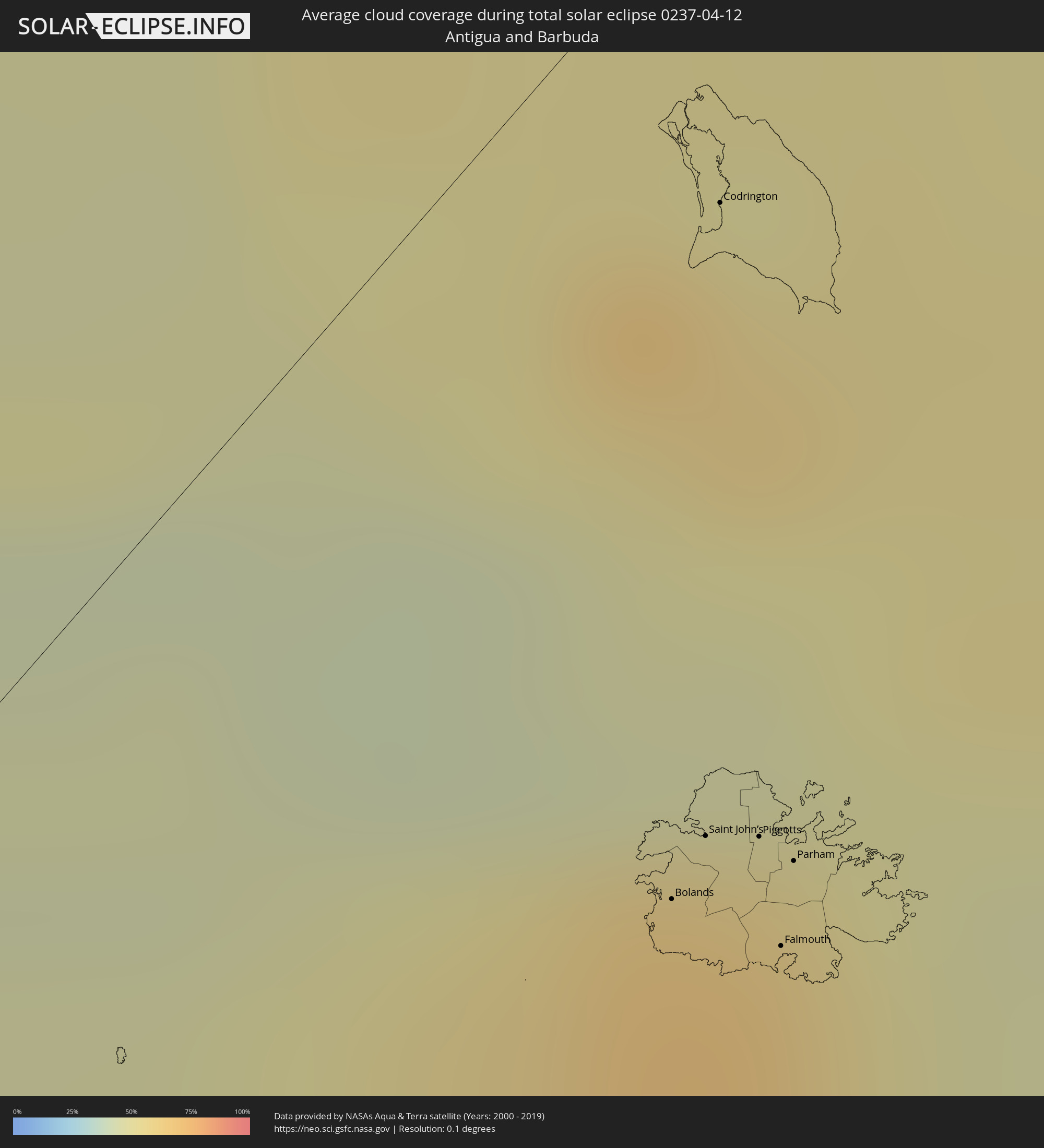 Antigua and Barbuda
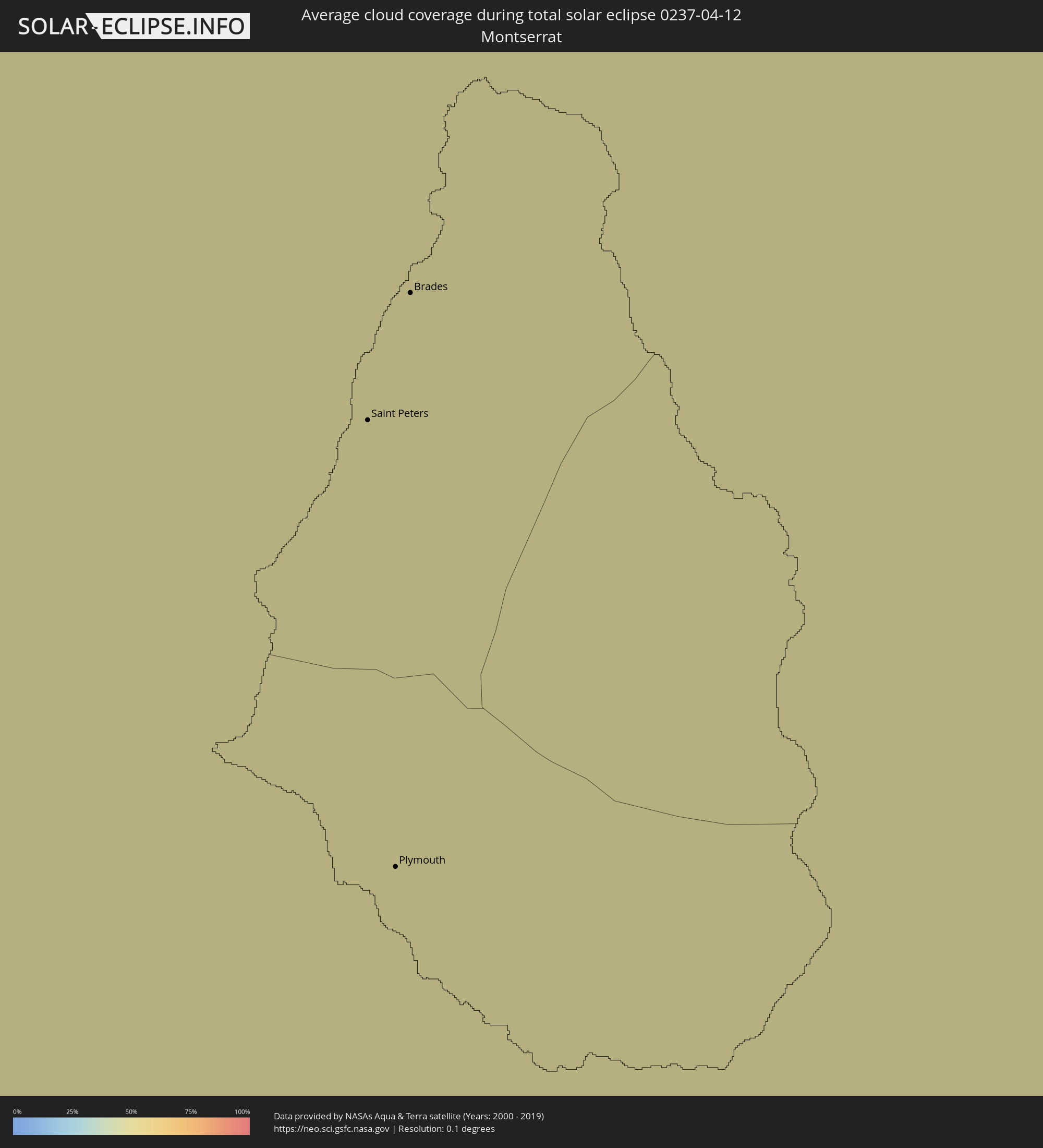 Montserrat
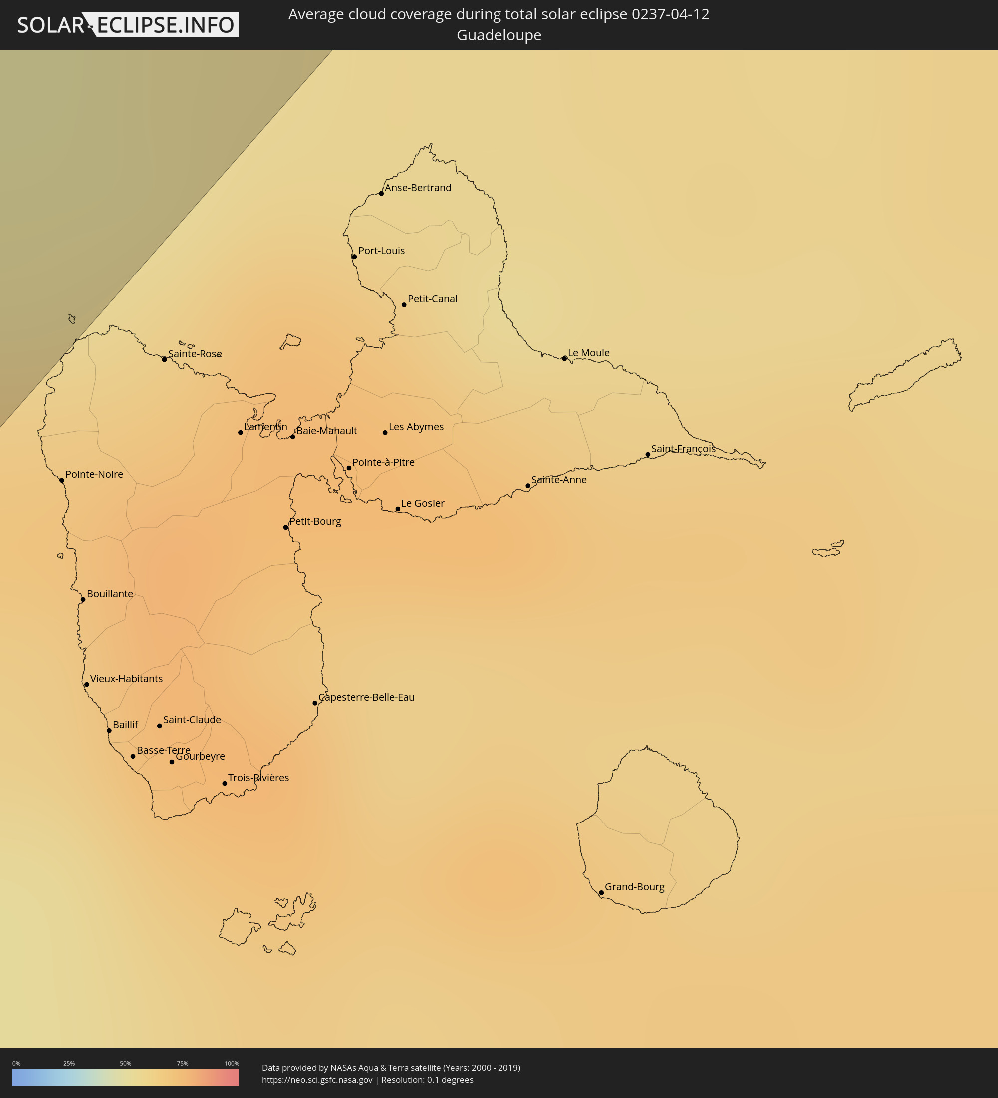 Guadeloupe
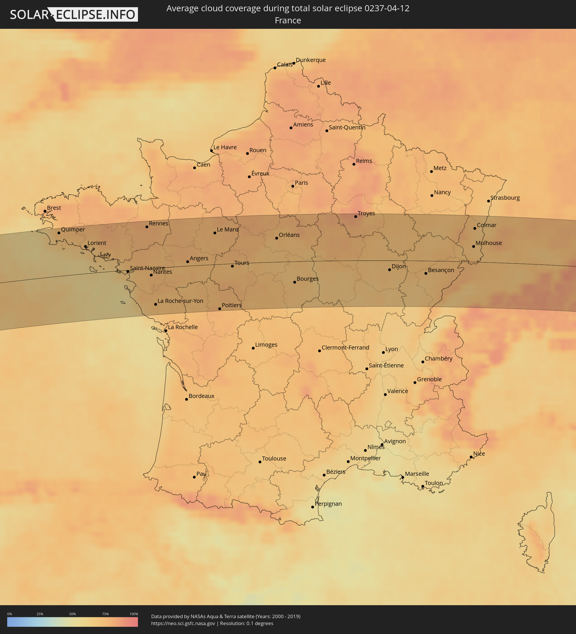 France
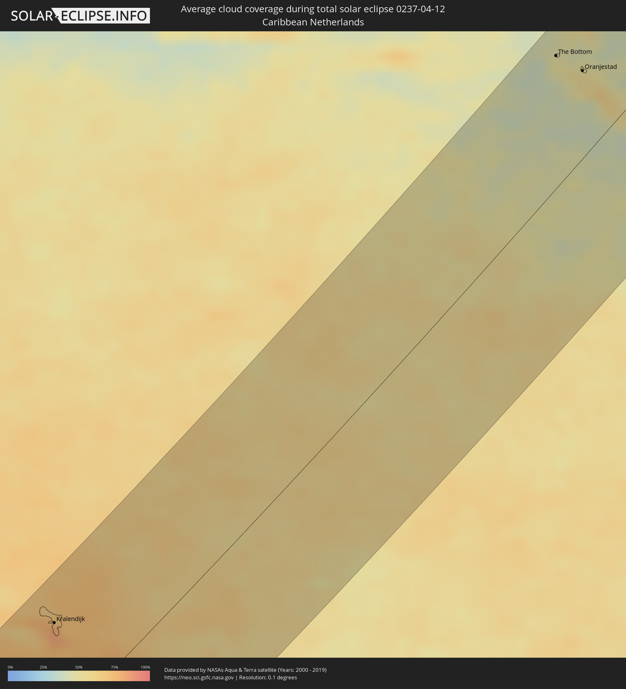 Caribbean Netherlands
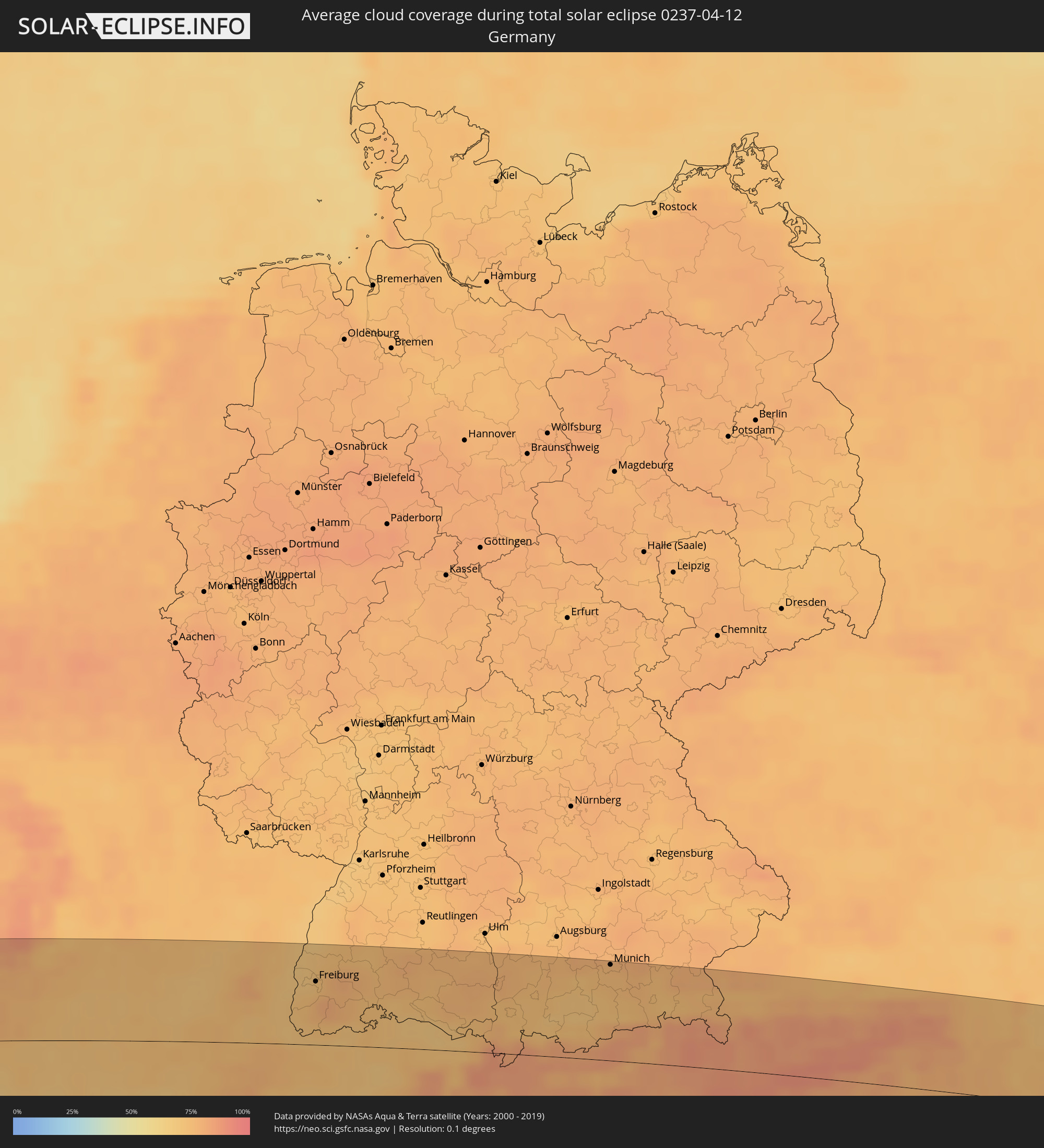 Germany
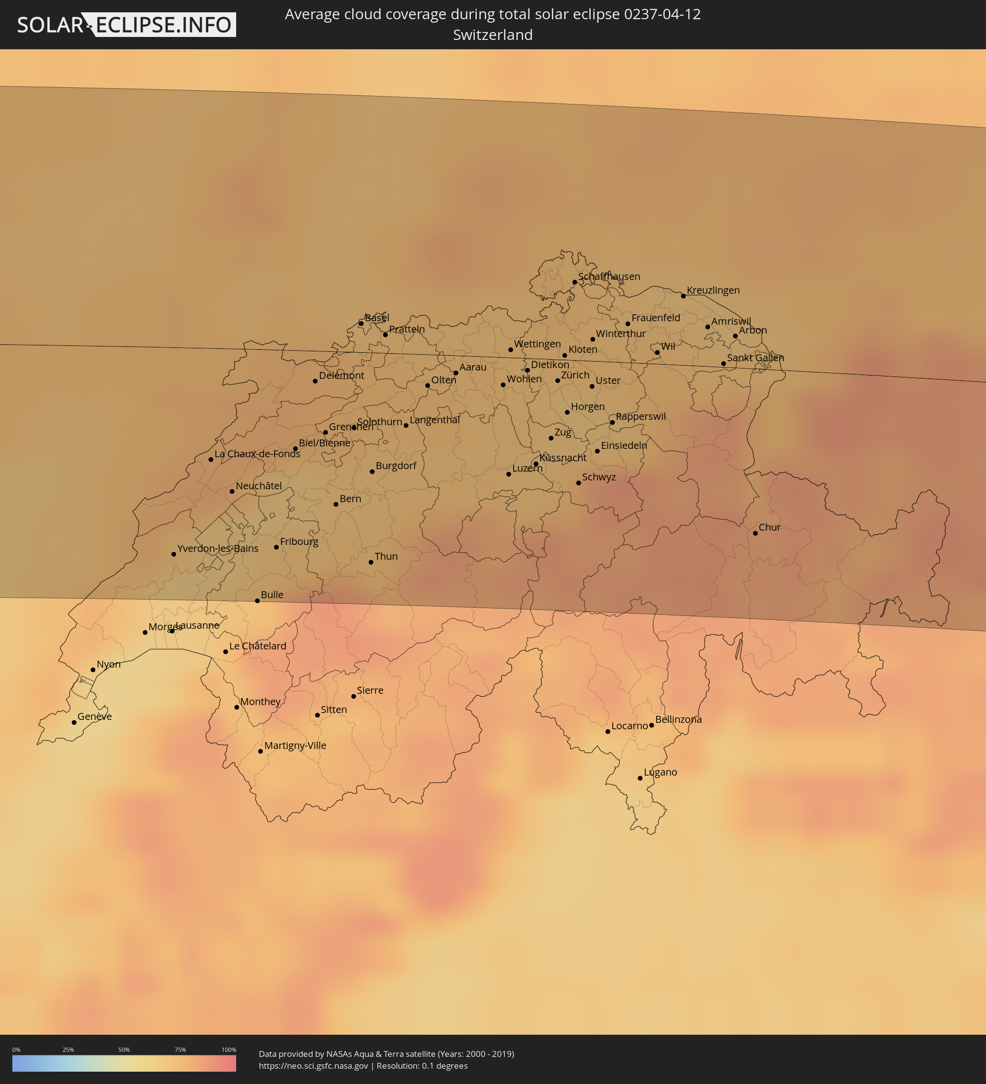 Switzerland
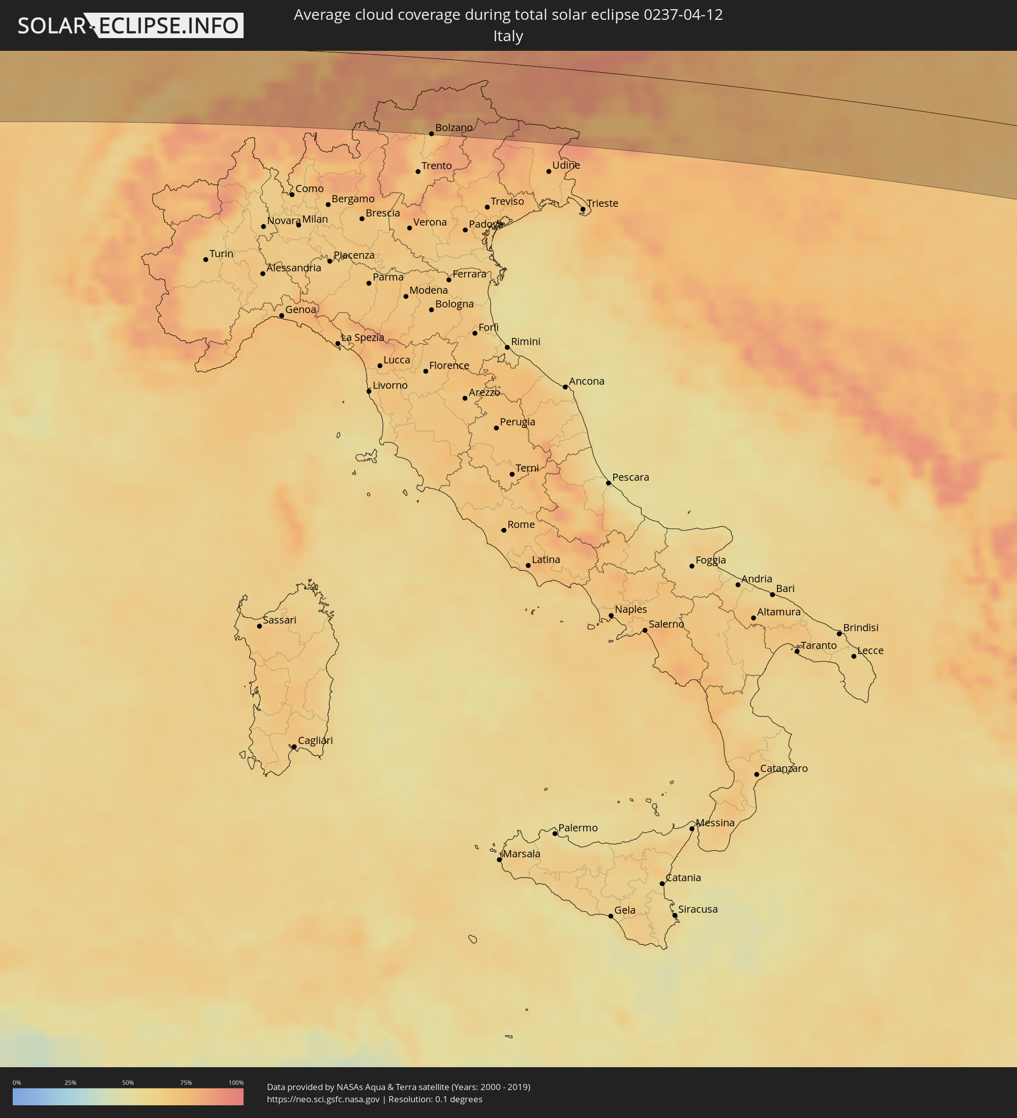 Italy
Italy
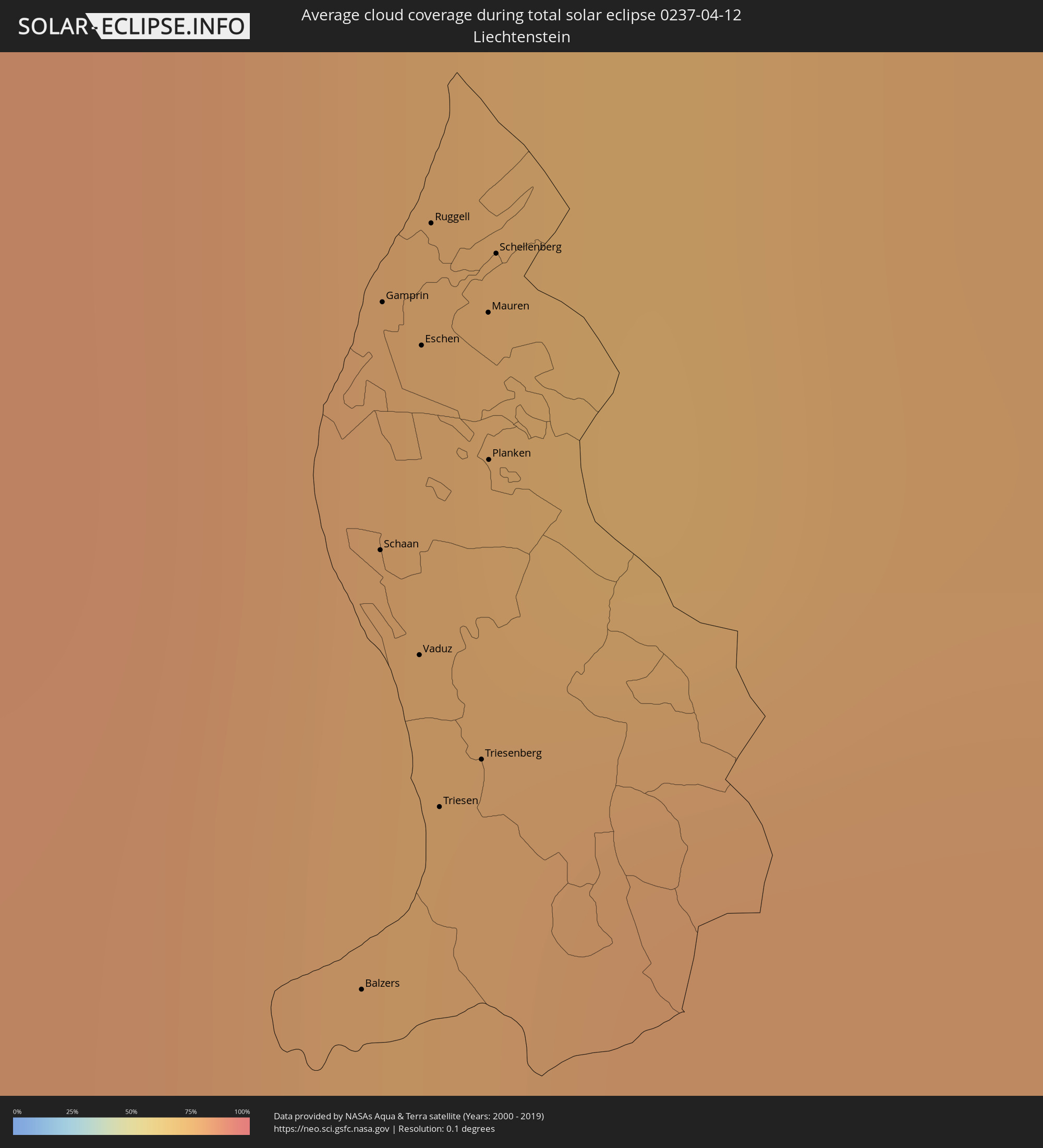 Liechtenstein
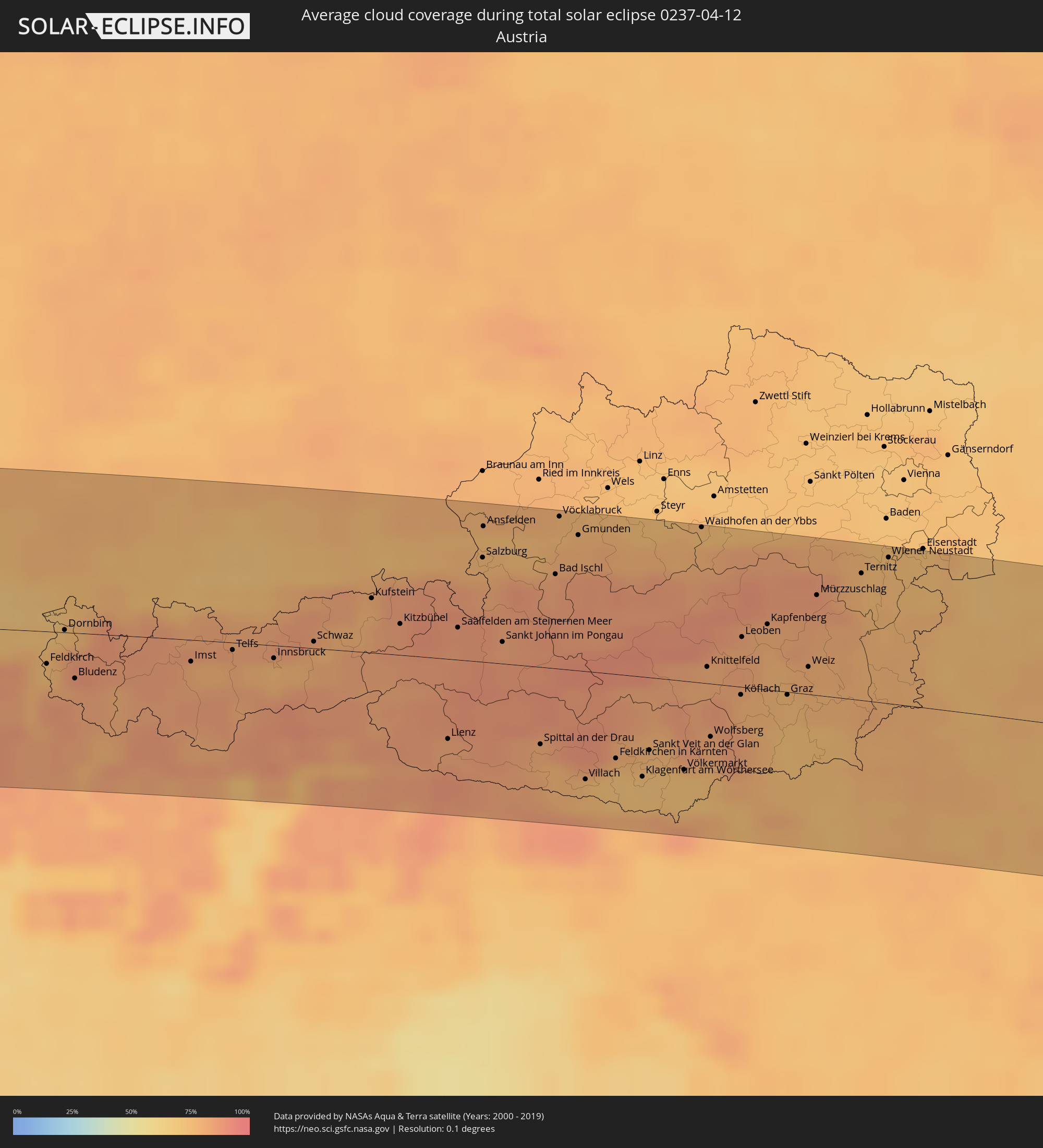 Austria
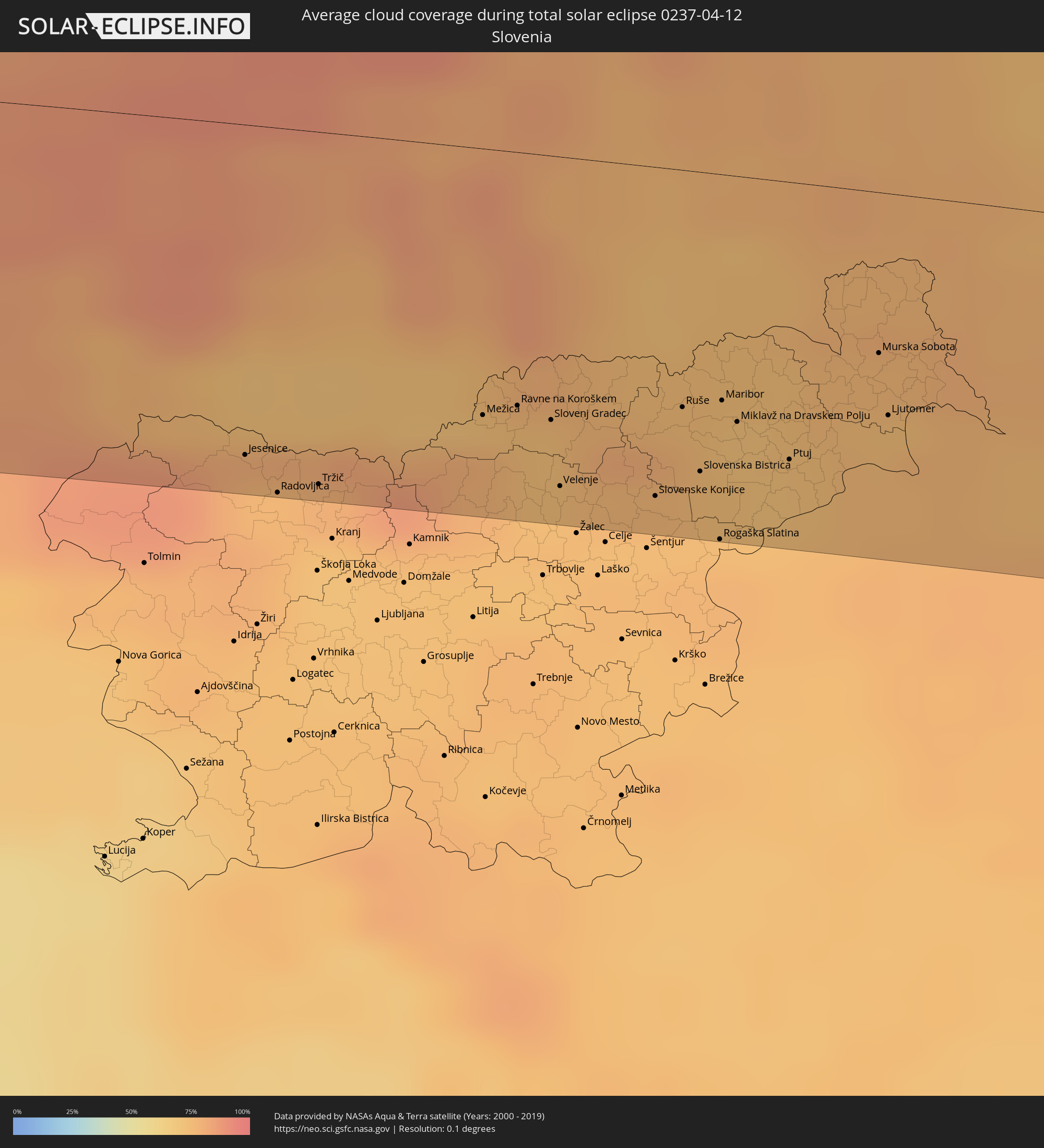 Slovenia
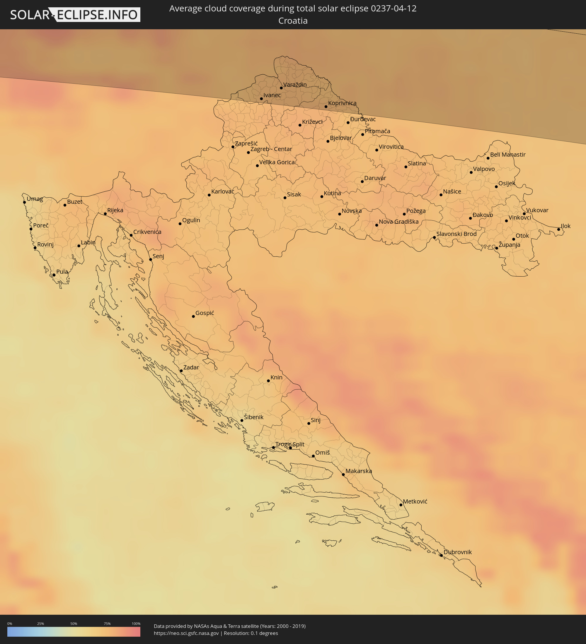 Croatia
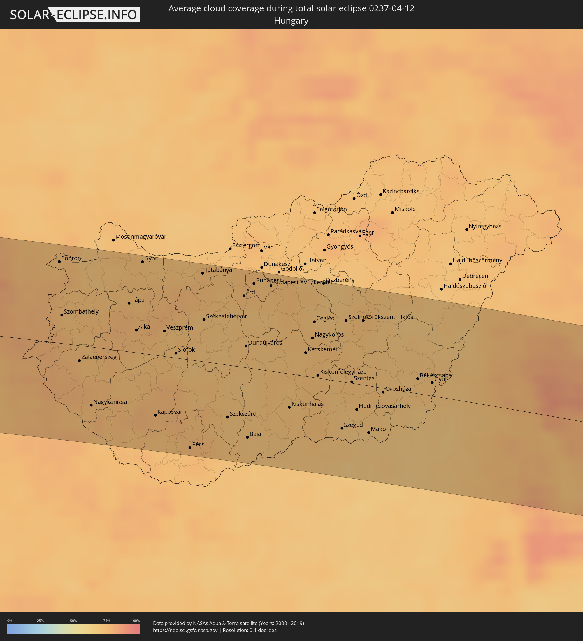 Hungary
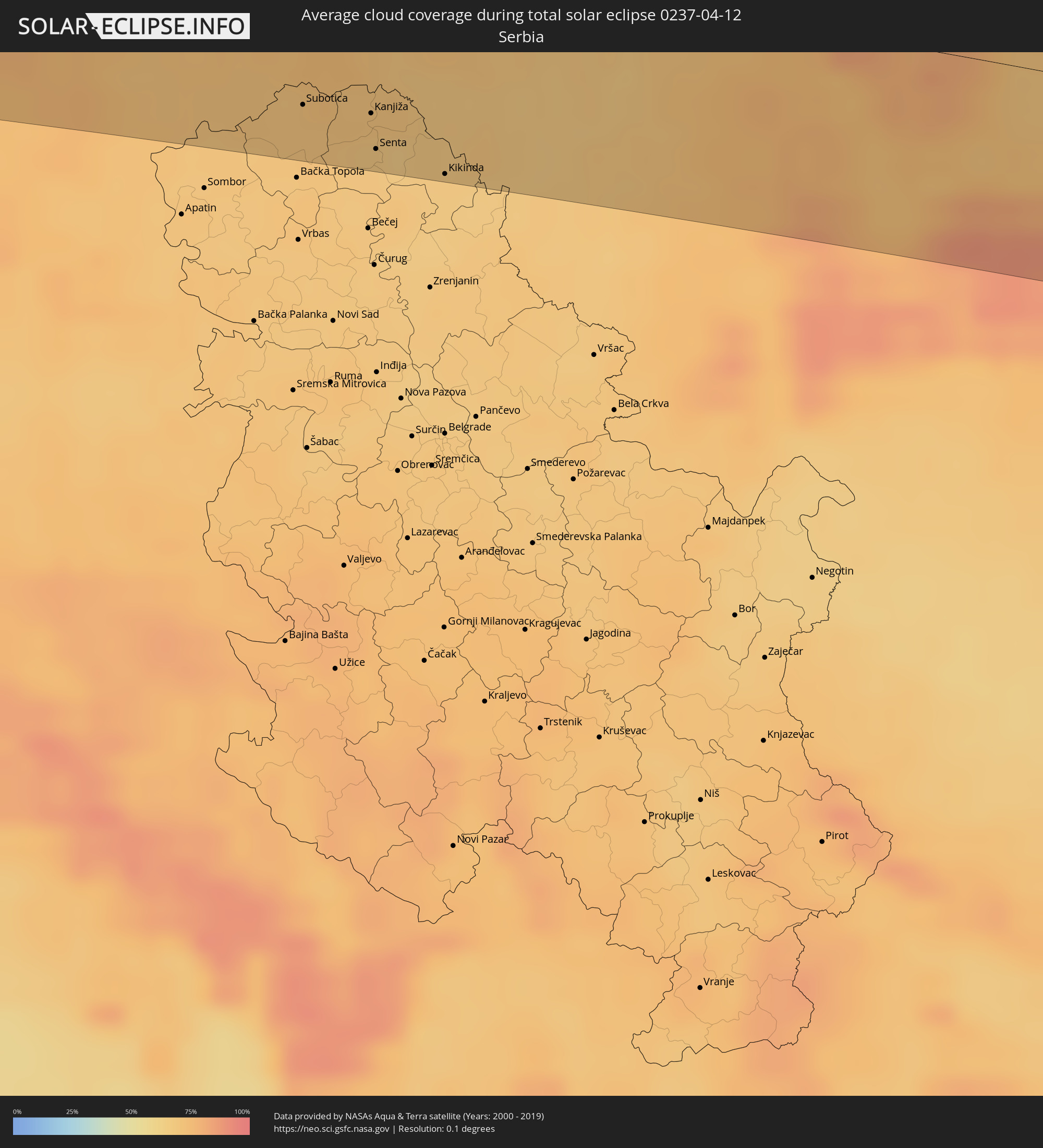 Serbia
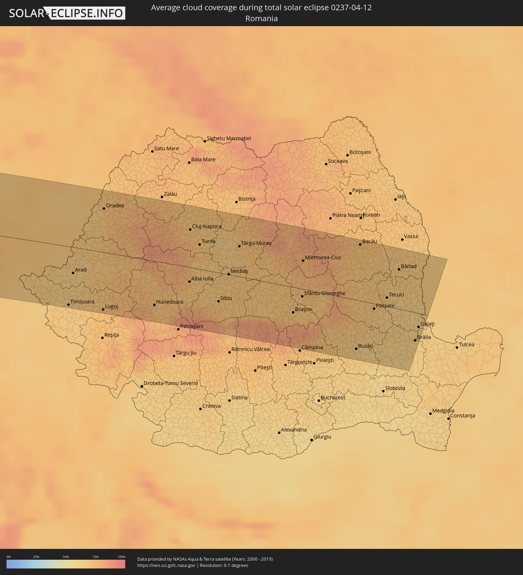 Romania
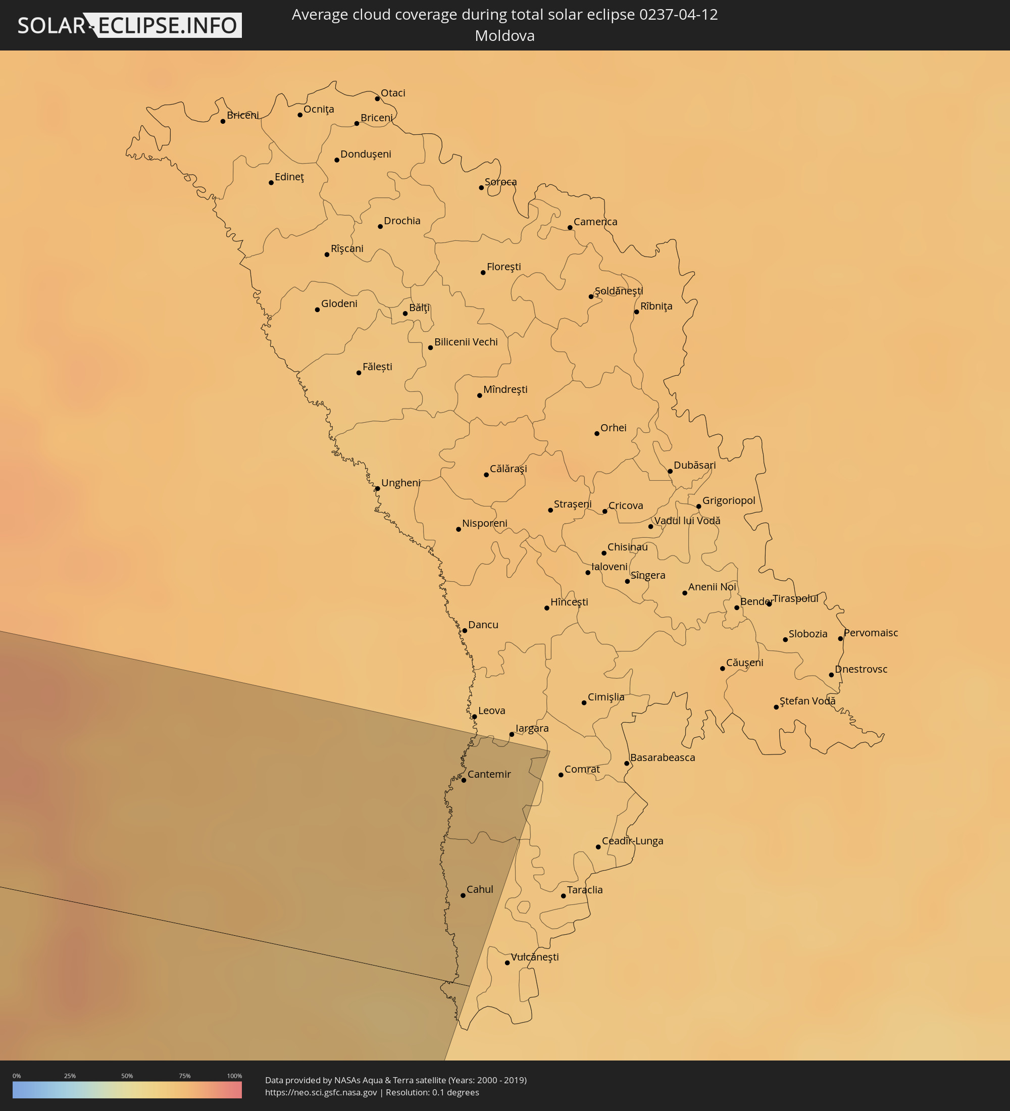 Moldova
Cities inside the path of the eclipse
The following table shows all locations with a population of more than 5,000 inside the eclipse path. Cities which have more than 100,000 inhabitants are marked bold. A click at the locations opens a detailed map.
| City | Type | Eclipse duration | Local time of max. eclipse | Distance to central line | Ø Cloud coverage |
|
Muisne, Esmeraldas
|
total | - | 08:33:14 UTC-05:14 | 78 km | 78% |
|
Esmeraldas, Esmeraldas
|
total | - | 08:34:03 UTC-05:14 | 68 km | 78% |
|
Valdez, Esmeraldas
|
total | - | 08:35:04 UTC-05:14 | 82 km | 80% |
|
San Lorenzo de Esmeraldas, Esmeraldas
|
total | - | 08:35:15 UTC-05:14 | 88 km | 87% |
|
Cali, Valle del Cauca
|
total | - | 08:58:28 UTC-04:56 | 41 km | 86% |
|
Pereira, Risaralda
|
total | - | 09:01:32 UTC-04:56 | 25 km | 91% |
|
Armenia, Quindío
|
total | - | 09:01:05 UTC-04:56 | 1 km | 93% |
|
Manizales, Caldas
|
total | - | 09:02:08 UTC-04:56 | 35 km | 92% |
|
Ibagué, Tolima
|
total | - | 09:01:24 UTC-04:56 | 40 km | 93% |
|
Soacha, Cundinamarca
|
total | - | 09:02:42 UTC-04:56 | 98 km | 93% |
|
Bogotá, Bogota D.C.
|
total | - | 09:02:54 UTC-04:56 | 104 km | 94% |
|
Bucaramanga, Santander
|
total | - | 09:08:17 UTC-04:56 | 42 km | 91% |
|
Cúcuta, Norte de Santander
|
total | - | 09:10:21 UTC-04:56 | 62 km | 90% |
|
San Cristóbal, Táchira
|
total | - | 09:39:03 UTC-04:27 | 30 km | 93% |
|
Mérida, Mérida
|
total | - | 09:41:49 UTC-04:27 | 19 km | 85% |
|
Mucumpiz, Mérida
|
total | - | 09:41:32 UTC-04:27 | 3 km | 95% |
|
Barinas, Barinas
|
total | - | 09:43:02 UTC-04:27 | 50 km | 95% |
|
Barquisimeto, Lara
|
total | - | 09:46:48 UTC-04:27 | 2 km | 78% |
 Kralendijk, Bonaire
|
total | - | 09:44:05 UTC-04:35 | 81 km | 81% |
|
Puerto Cabello, Carabobo
|
total | - | 09:49:17 UTC-04:27 | 69 km | 85% |
|
Valencia, Carabobo
|
total | - | 09:48:44 UTC-04:27 | 95 km | 77% |
|
Guacara, Carabobo
|
total | - | 09:49:01 UTC-04:27 | 100 km | 68% |
|
El Limón, Aragua
|
total | - | 09:49:30 UTC-04:27 | 112 km | 65% |
|
The Bottom, Saba
|
total | - | 10:02:05 UTC-04:35 | 93 km | 49% |
|
Marigot
|
total | - | 10:32:56 UTC-04:06 | 112 km | 61% |
 Cul de Sac
|
total | - | 10:03:11 UTC-04:35 | 109 km | 52% |
|
Philipsburg
|
total | - | 10:03:11 UTC-04:35 | 106 km | 50% |
|
Farrington, The Farrington
|
total | - | 10:33:19 UTC-04:06 | 118 km | 52% |
|
Sandy Hill, Sandy Hill
|
total | - | 10:33:21 UTC-04:06 | 118 km | 52% |
|
East End Village, East End
|
total | - | 10:33:24 UTC-04:06 | 118 km | 52% |
|
Oranjestad, Sint Eustatius
|
total | - | 10:02:11 UTC-04:35 | 62 km | 55% |
|
Gustavia
|
total | - | 10:32:56 UTC-04:06 | 81 km | 45% |
|
Sandy Point Town, Saint Anne Sandy Point
|
total | - | 10:31:51 UTC-04:06 | 42 km | 62% |
|
Saint Paul’s, Saint Paul Capesterre
|
total | - | 10:31:59 UTC-04:06 | 42 km | 62% |
|
Dieppe Bay Town, Saint John Capesterre
|
total | - | 10:32:01 UTC-04:06 | 43 km | 62% |
|
Trinity, Trinity Palmetto Point
|
total | - | 10:31:52 UTC-04:06 | 31 km | 53% |
|
Cayon, Saint Mary Cayon
|
total | - | 10:32:01 UTC-04:06 | 32 km | 54% |
|
Basseterre, Saint George Basseterre
|
total | - | 10:31:55 UTC-04:06 | 27 km | 60% |
|
Monkey Hill, Saint Peter Basseterre
|
total | - | 10:31:58 UTC-04:06 | 28 km | 60% |
|
Charlestown, Saint Paul Charlestown
|
total | - | 10:31:45 UTC-04:06 | 7 km | 51% |
|
Fig Tree, Saint John Figtree
|
total | - | 10:31:44 UTC-04:06 | 4 km | 51% |
|
Saint Peters, Saint Peter
|
total | - | 10:31:37 UTC-04:06 | 52 km | 62% |
|
Plymouth, Saint Anthony
|
total | - | 10:31:30 UTC-04:06 | 57 km | 54% |
|
Brades, Saint Peter
|
total | - | 10:31:40 UTC-04:06 | 51 km | 62% |
|
Bolands, Saint Mary
|
total | - | 10:32:44 UTC-04:06 | 58 km | 65% |
|
Saint John’s, Saint John
|
total | - | 10:32:53 UTC-04:06 | 56 km | 64% |
|
Codrington, Barbuda
|
total | - | 10:33:57 UTC-04:06 | 19 km | 58% |
|
Piggotts, Saint George
|
total | - | 10:32:57 UTC-04:06 | 60 km | 64% |
|
Falmouth, Saint Paul
|
total | - | 10:32:48 UTC-04:06 | 68 km | 53% |
|
Parham, Saint Peter
|
total | - | 10:32:58 UTC-04:06 | 64 km | 64% |
|
Rennes, Brittany
|
total | - | 16:43:34 UTC+00:09 | 85 km | 77% |
|
Nantes, Pays de la Loire
|
total | - | 16:44:06 UTC+00:09 | 15 km | 75% |
|
Angers, Pays de la Loire
|
total | - | 16:44:32 UTC+00:09 | 8 km | 74% |
|
Le Mans, Pays de la Loire
|
total | - | 16:44:38 UTC+00:09 | 64 km | 74% |
|
Tours, Centre
|
total | - | 16:45:14 UTC+00:09 | 6 km | 71% |
|
Orléans, Centre
|
total | - | 16:45:32 UTC+00:09 | 48 km | 72% |
|
Dijon, Bourgogne-Franche-Comté
|
total | - | 16:47:16 UTC+00:09 | 20 km | 70% |
|
Besançon, Bourgogne-Franche-Comté
|
total | - | 16:47:42 UTC+00:09 | 27 km | 67% |
|
La Chaux-de-Fonds, Neuchâtel
|
total | - | 17:38:45 UTC+01:00 | 42 km | 79% |
|
Biel/Bienne, Bern
|
total | - | 17:38:53 UTC+01:00 | 37 km | 66% |
|
Mulhouse, Grand-Est
|
total | - | 16:47:53 UTC+00:09 | 31 km | 71% |
|
Bern, Bern
|
total | - | 17:39:04 UTC+01:00 | 58 km | 72% |
|
Basel, Basel-City
|
total | - | 17:38:44 UTC+01:00 | 11 km | 70% |
|
Thun, Bern
|
total | - | 17:39:15 UTC+01:00 | 79 km | 74% |
|
Lörrach, Baden-Württemberg
|
total | - | 17:38:44 UTC+01:00 | 17 km | 70% |
|
Freiburg, Baden-Württemberg
|
total | - | 17:38:33 UTC+01:00 | 60 km | 75% |
|
Luzern, Lucerne
|
total | - | 17:39:18 UTC+01:00 | 44 km | 70% |
|
Villingen-Schwenningen, Baden-Württemberg
|
total | - | 17:38:43 UTC+01:00 | 69 km | 76% |
|
Zürich, Zurich
|
total | - | 17:39:11 UTC+01:00 | 8 km | 68% |
|
Winterthur, Zurich
|
total | - | 17:39:09 UTC+01:00 | 8 km | 72% |
|
Konstanz, Baden-Württemberg
|
total | - | 17:39:12 UTC+01:00 | 27 km | 69% |
|
Sankt Gallen, Saint Gallen
|
total | - | 17:39:25 UTC+01:00 | 1 km | 76% |
|
Friedrichshafen, Baden-Württemberg
|
total | - | 17:39:17 UTC+01:00 | 27 km | 70% |
|
Balzers, Balzers
|
total | - | 17:39:41 UTC+01:00 | 38 km | 78% |
|
Schaan, Schaan
|
total | - | 17:39:37 UTC+01:00 | 27 km | 77% |
|
Gamprin, Gamprin
|
total | - | 17:39:35 UTC+01:00 | 21 km | 77% |
|
Eschen, Eschen
|
total | - | 17:39:35 UTC+01:00 | 22 km | 77% |
|
Ruggell, Ruggell
|
total | - | 17:39:34 UTC+01:00 | 19 km | 77% |
|
Triesenberg, Triesenberg
|
total | - | 17:39:39 UTC+01:00 | 32 km | 78% |
|
Mauren, Mauren
|
total | - | 17:39:36 UTC+01:00 | 21 km | 77% |
|
Planken, Planken
|
total | - | 17:39:37 UTC+01:00 | 25 km | 77% |
|
Schellenberg, Schellenberg
|
total | - | 17:39:35 UTC+01:00 | 20 km | 77% |
|
Feldkirch, Vorarlberg
|
total | - | 17:39:36 UTC+01:00 | 19 km | 80% |
|
Ravensburg, Baden-Württemberg
|
total | - | 17:39:15 UTC+01:00 | 42 km | 75% |
|
Dornbirn, Vorarlberg
|
total | - | 17:39:32 UTC+01:00 | 1 km | 78% |
|
Kempten (Allgäu), Bavaria
|
total | - | 17:39:29 UTC+01:00 | 39 km | 74% |
|
Lana, Trentino-Alto Adige
|
total | - | 17:40:27 UTC+01:00 | 81 km | 67% |
|
Merano, Trentino-Alto Adige
|
total | - | 17:40:25 UTC+01:00 | 75 km | 72% |
|
Bolzano, Trentino-Alto Adige
|
total | - | 17:40:34 UTC+01:00 | 94 km | 64% |
|
Innsbruck, Tyrol
|
total | - | 17:40:05 UTC+01:00 | 8 km | 76% |
|
Vipiteno, Trentino-Alto Adige
|
total | - | 17:40:20 UTC+01:00 | 48 km | 85% |
|
Renon - Ritten, Trentino-Alto Adige
|
total | - | 17:40:34 UTC+01:00 | 87 km | 72% |
|
Munich, Bavaria
|
total | - | 17:39:33 UTC+01:00 | 90 km | 75% |
|
Bressanone, Trentino-Alto Adige
|
total | - | 17:40:31 UTC+01:00 | 67 km | 80% |
|
Brunico, Trentino-Alto Adige
|
total | - | 17:40:32 UTC+01:00 | 56 km | 76% |
|
Valle Aurina - Ahrntal, Trentino-Alto Adige
|
total | - | 17:40:25 UTC+01:00 | 34 km | 85% |
|
Rosenheim, Bavaria
|
total | - | 17:39:52 UTC+01:00 | 62 km | 74% |
|
Cortina d'Ampezzo, Veneto
|
total | - | 17:40:45 UTC+01:00 | 84 km | 85% |
|
Salzburg, Salzburg
|
total | - | 17:40:07 UTC+01:00 | 62 km | 78% |
|
Villach, Carinthia
|
total | - | 17:41:05 UTC+01:00 | 65 km | 75% |
|
Jesenice, Jesenice
|
total | - | 17:41:15 UTC+01:00 | 83 km | 76% |
|
Klagenfurt am Wörthersee, Carinthia
|
total | - | 17:41:10 UTC+01:00 | 60 km | 72% |
|
Tržič, Tržič
|
total | - | 17:41:20 UTC+01:00 | 89 km | 78% |
|
Wolfsberg, Carinthia
|
total | - | 17:41:08 UTC+01:00 | 32 km | 76% |
|
Slovenj Gradec, Slovenj Gradec
|
total | - | 17:41:23 UTC+01:00 | 66 km | 73% |
|
Velenje, Velenje
|
total | - | 17:41:30 UTC+01:00 | 83 km | 74% |
|
Graz, Styria
|
total | - | 17:41:05 UTC+01:00 | 2 km | 75% |
|
Slovenska Bistrica, Slovenska Bistrica
|
total | - | 17:41:33 UTC+01:00 | 75 km | 74% |
|
Rogaška Slatina, Rogaška Slatina
|
total | - | 17:41:40 UTC+01:00 | 92 km | 76% |
|
Maribor, Maribor
|
total | - | 17:41:28 UTC+01:00 | 57 km | 74% |
|
Ptuj, Ptuj
|
total | - | 17:41:35 UTC+01:00 | 70 km | 72% |
|
Ivanec, Varaždinska
|
total | - | 17:41:45 UTC+01:00 | 89 km | 77% |
|
Murska Sobota, Murska Sobota
|
total | - | 17:41:28 UTC+01:00 | 40 km | 76% |
|
Wiener Neustadt, Lower Austria
|
total | - | 17:40:43 UTC+01:00 | 86 km | 75% |
|
Varaždin, Varaždinska
|
total | - | 17:41:44 UTC+01:00 | 78 km | 77% |
|
Čakovec, Međimurska
|
total | - | 17:41:42 UTC+01:00 | 69 km | 76% |
|
Szombathely, Vas
|
total | - | 17:41:09 UTC+01:00 | 27 km | 76% |
|
Koprivnica, Koprivničko-Križevačka
|
total | - | 17:41:54 UTC+01:00 | 90 km | 78% |
|
Győr, Győr-Moson-Sopron
|
total | - | 17:40:59 UTC+01:00 | 86 km | 72% |
|
Pécs, Baranya
|
total | - | 17:42:08 UTC+01:00 | 84 km | 73% |
|
Székesfehérvár, Fejér
|
total | - | 17:41:24 UTC+01:00 | 39 km | 72% |
|
Budapest, Budapest
|
total | - | 17:41:15 UTC+01:00 | 80 km | 74% |
|
Stanišić
|
total | - | 17:42:19 UTC+01:00 | 90 km | 70% |
|
Budapest XVII. kerület, Budapest
|
total | - | 17:41:17 UTC+01:00 | 80 km | 73% |
|
Subotica, Vojvodina
|
total | - | 17:42:15 UTC+01:00 | 67 km | 70% |
|
Kecskemét, Bács-Kiskun
|
total | - | 17:41:43 UTC+01:00 | 22 km | 72% |
|
Kanjiža, Vojvodina
|
total | - | 17:42:18 UTC+01:00 | 66 km | 70% |
|
Senta, Vojvodina
|
total | - | 17:42:24 UTC+01:00 | 81 km | 67% |
|
Novi Kneževac, Vojvodina
|
total | - | 17:42:19 UTC+01:00 | 68 km | 70% |
|
Čoka, Vojvodina
|
total | - | 17:42:23 UTC+01:00 | 79 km | 67% |
|
Szeged, Csongrád
|
total | - | 17:42:11 UTC+01:00 | 45 km | 70% |
|
Szolnok, Jász-Nagykun-Szolnok
|
total | - | 17:41:34 UTC+01:00 | 58 km | 72% |
|
Mokrin
|
total | - | 17:42:25 UTC+01:00 | 77 km | 67% |
|
Kikinda, Vojvodina
|
total | - | 17:42:29 UTC+01:00 | 88 km | 66% |
|
Timişoara, Timiş
|
total | - | 18:26:59 UTC+01:44 | 87 km | 67% |
|
Arad, Arad
|
total | - | 18:26:42 UTC+01:44 | 38 km | 68% |
|
Oradea, Bihor
|
total | - | 18:26:08 UTC+01:44 | 64 km | 72% |
|
Cluj-Napoca, Cluj
|
total | - | 18:26:21 UTC+01:44 | 55 km | 73% |
|
Sibiu, Sibiu
|
total | - | 18:26:59 UTC+01:44 | 43 km | 72% |
|
Braşov, Braşov
|
total | - | 18:27:02 UTC+01:44 | 38 km | 81% |
|
Bacău, Bacău
|
total | - | 18:26:21 UTC+01:44 | 83 km | 72% |
|
Brăila, Brăila
|
total | - | 18:27:07 UTC+01:44 | 42 km | 64% |
|
Galaţi, Galaţi
|
total | - | 18:26:59 UTC+01:44 | 20 km | 64% |
|
Cahul, Cahul
|
total | - | 18:37:17 UTC+01:55 | 31 km | 66% |
|
Cantemir, Cantemir
|
total | - | 18:37:02 UTC+01:55 | 72 km | 69% |