Total solar eclipse of 12/28/1209
| Day of week: | Monday |
| Maximum duration of eclipse: | 01m50s |
| Maximum width of eclipse path: | 65 km |
| Saros cycle: | 109 |
| Coverage: | 100% |
| Magnitude: | 1.019 |
| Gamma: | -0.0018 |
Wo kann man die Sonnenfinsternis vom 12/28/1209 sehen?
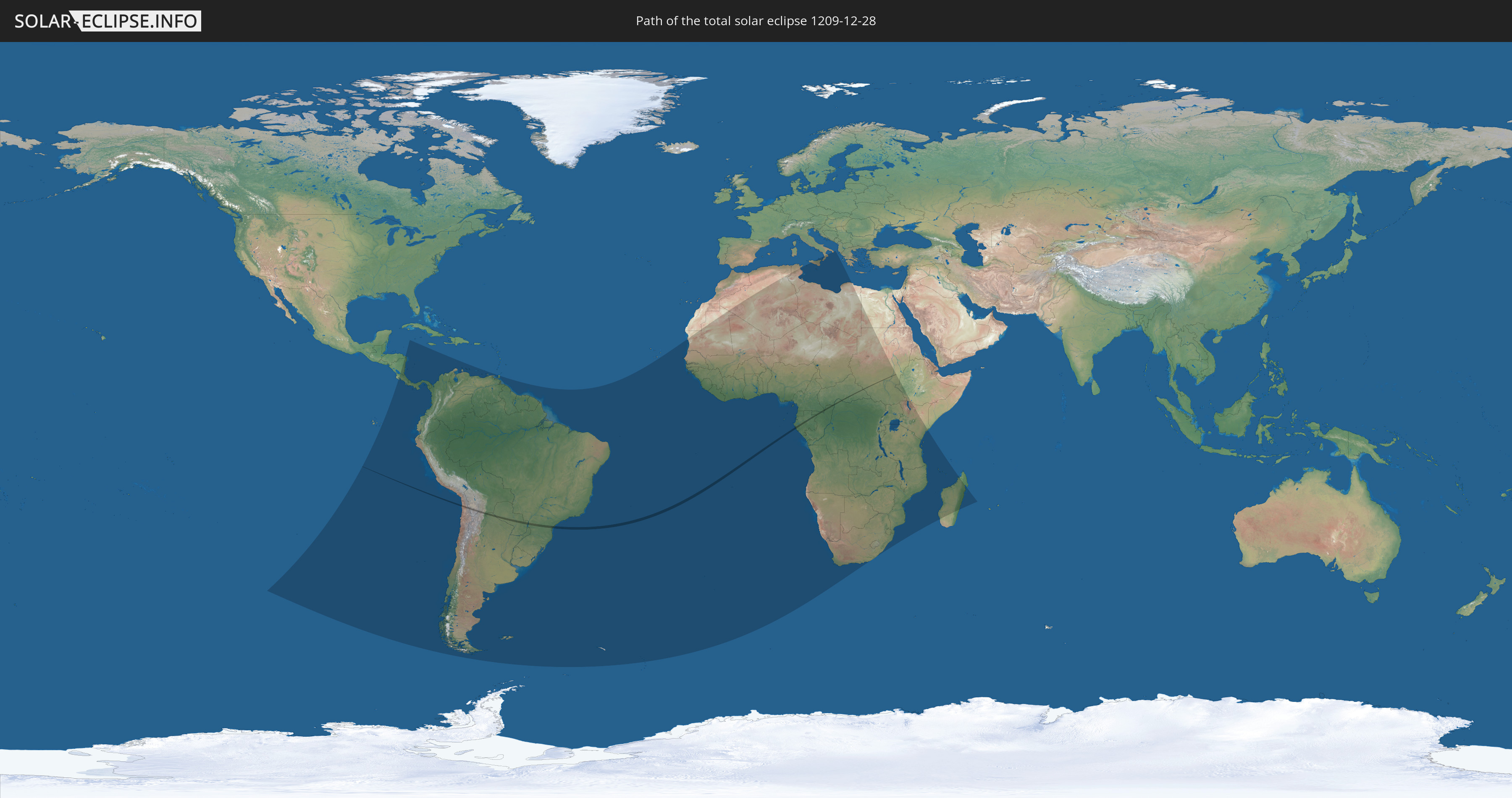
Die Sonnenfinsternis am 12/28/1209 kann man in 73 Ländern als partielle Sonnenfinsternis beobachten.
Der Finsternispfad verläuft durch 12 Länder. Nur in diesen Ländern ist sie als total Sonnenfinsternis zu sehen.
In den folgenden Ländern ist die Sonnenfinsternis total zu sehen
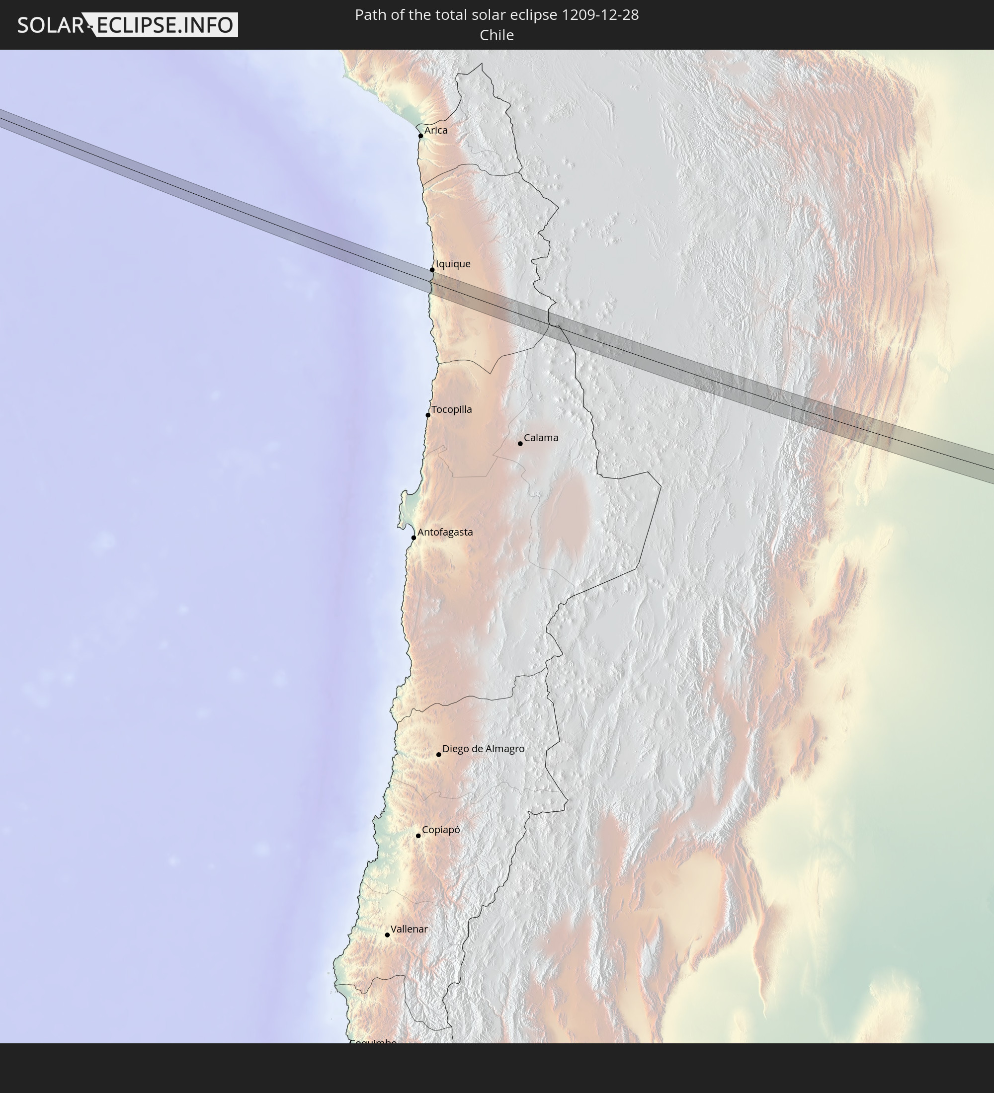 Chile
Chile
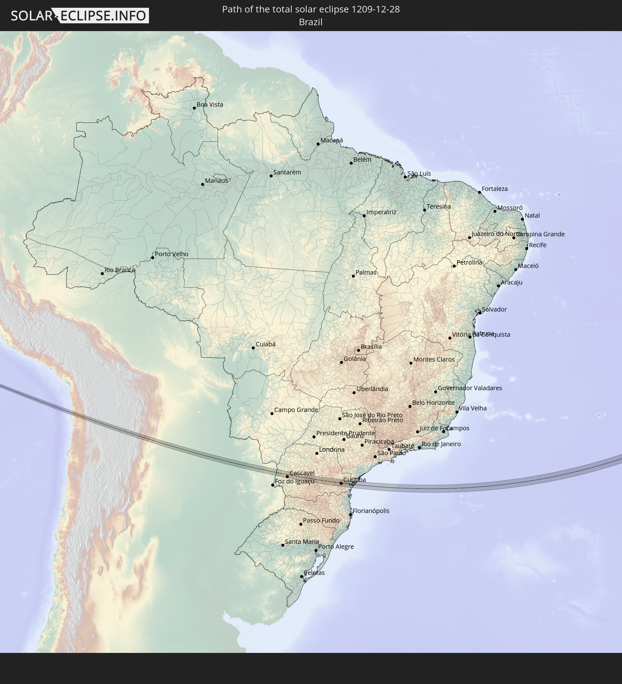 Brazil
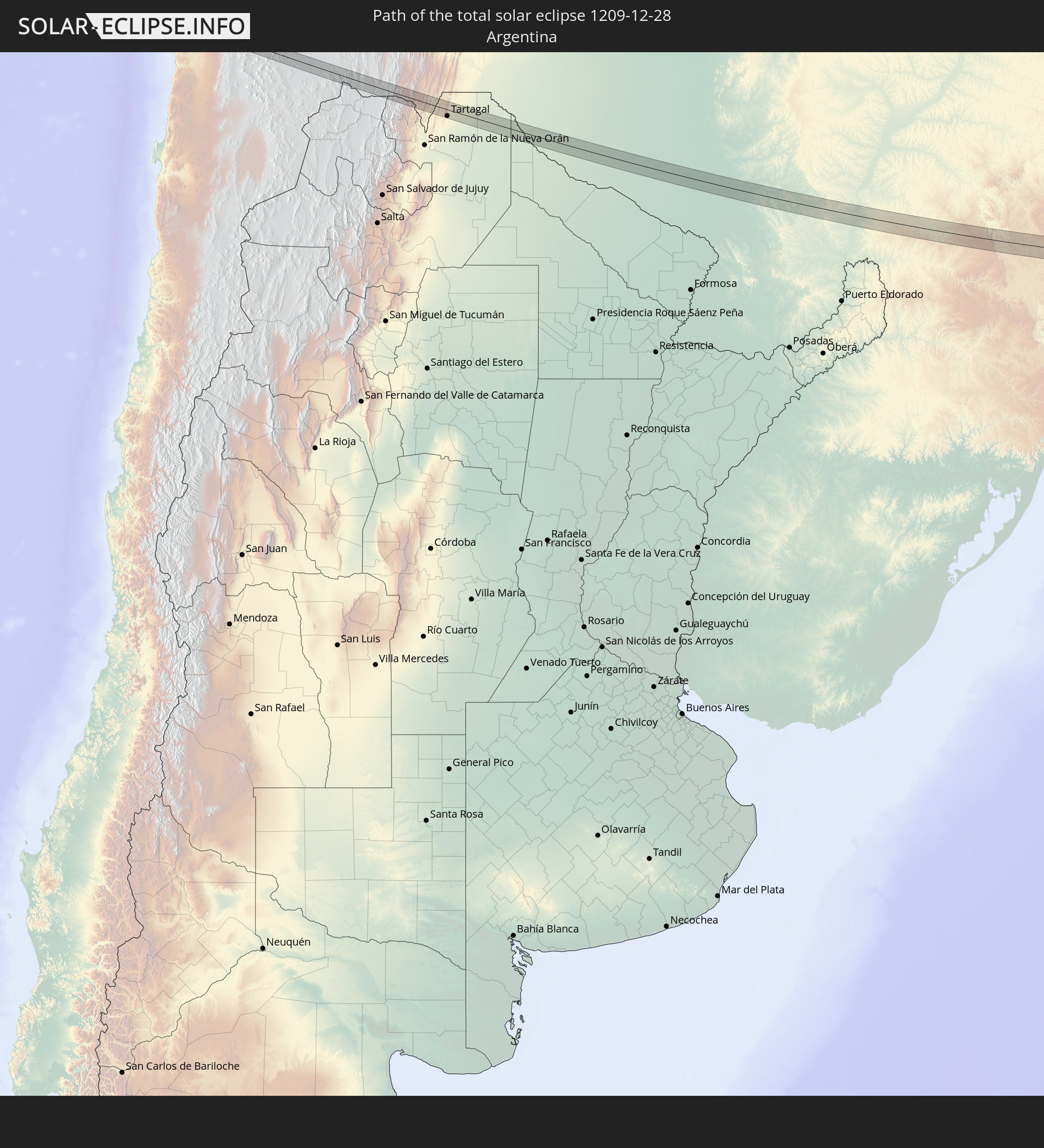 Argentina
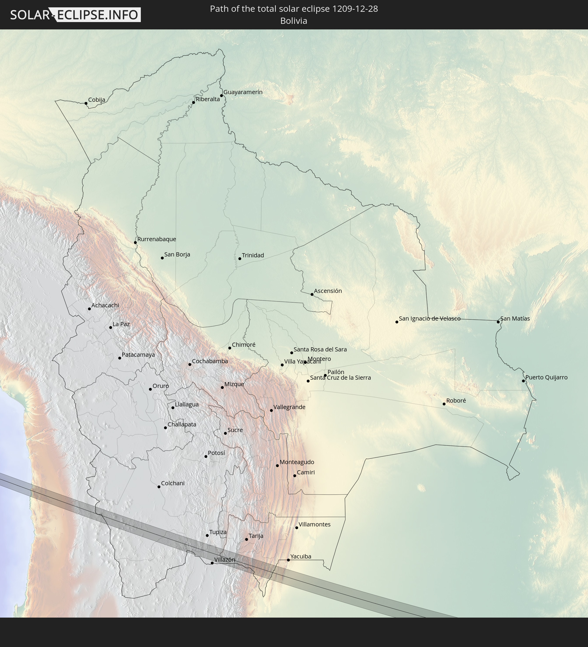 Bolivia
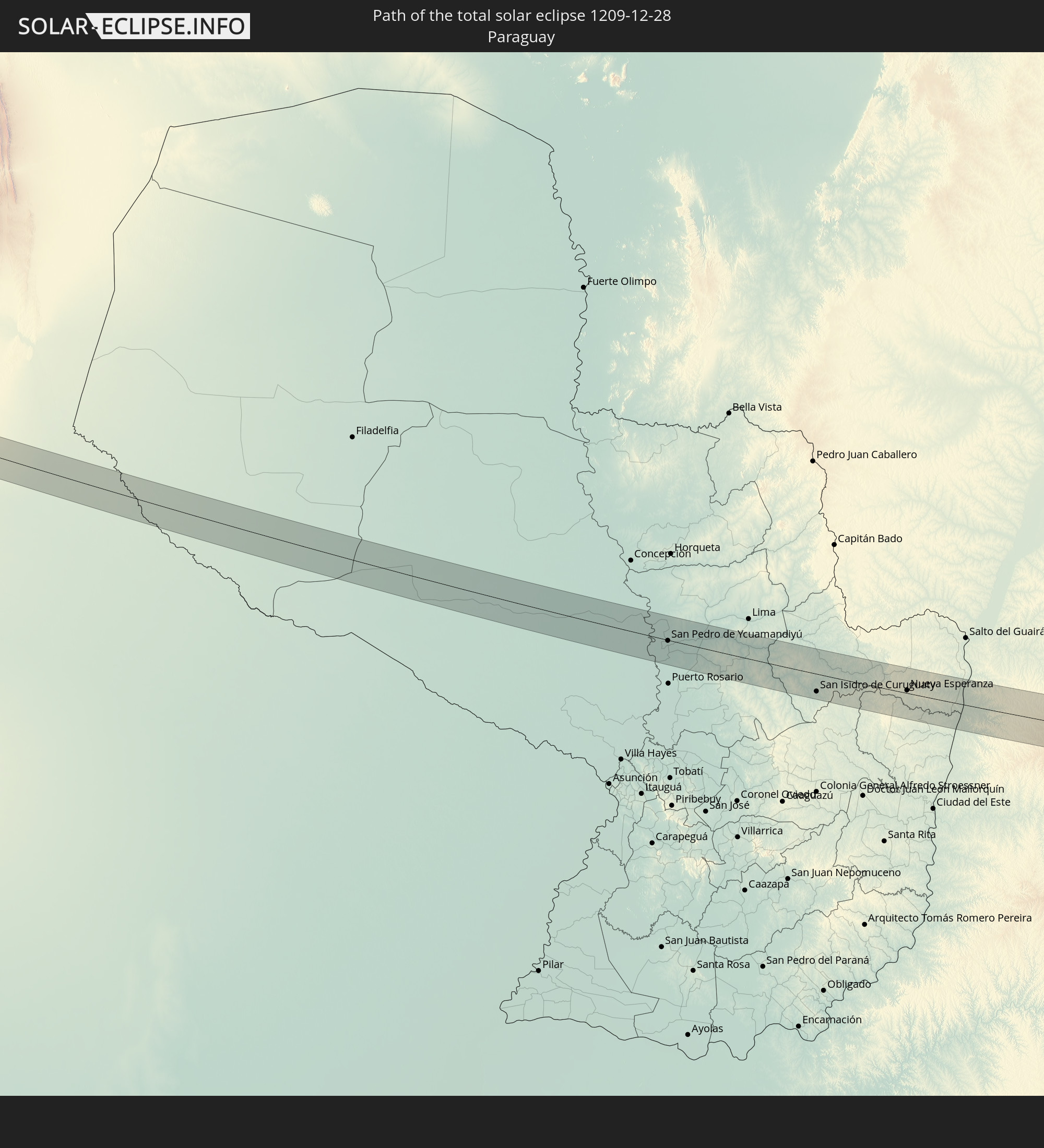 Paraguay
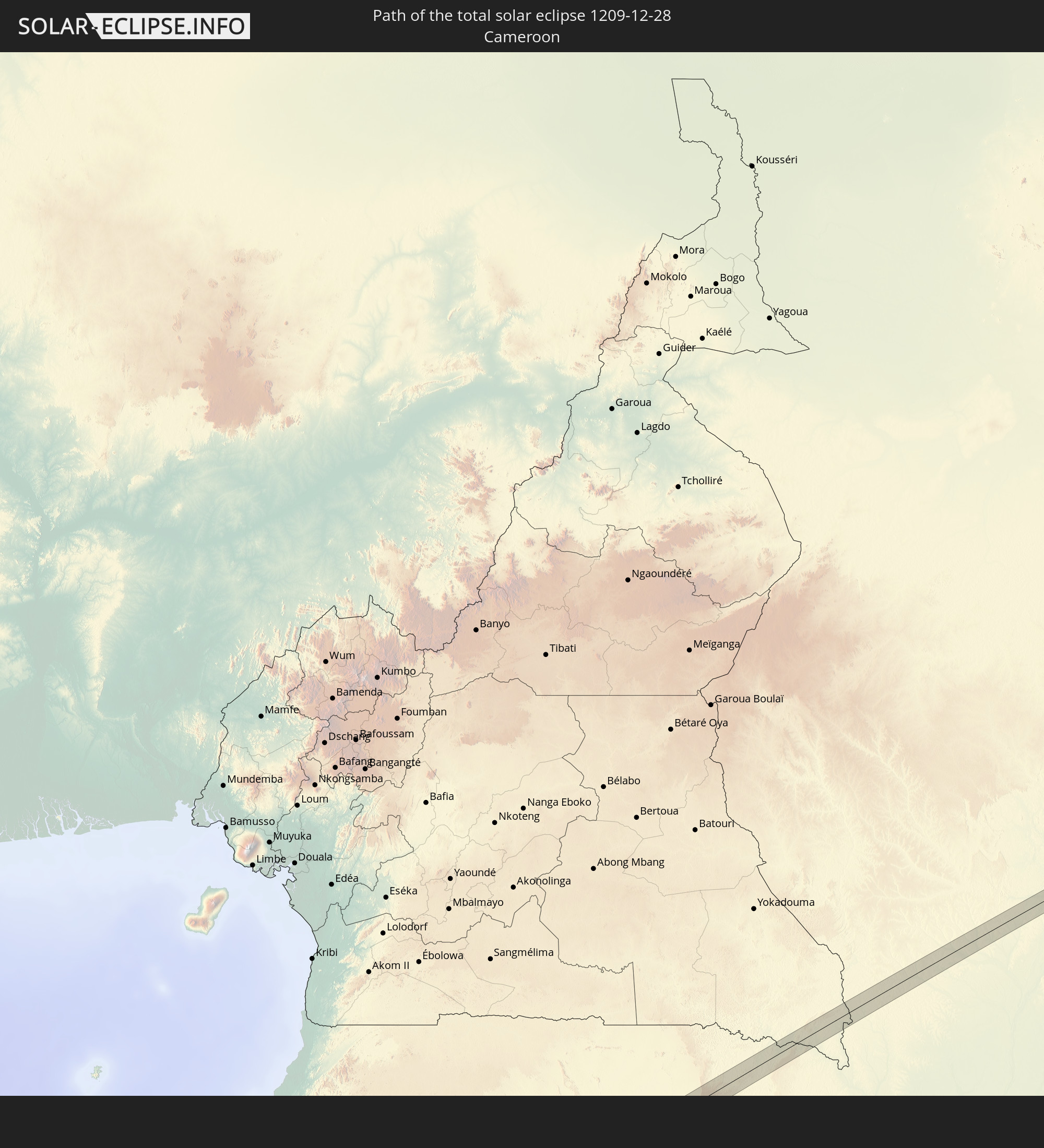 Cameroon
 Gabon
Gabon
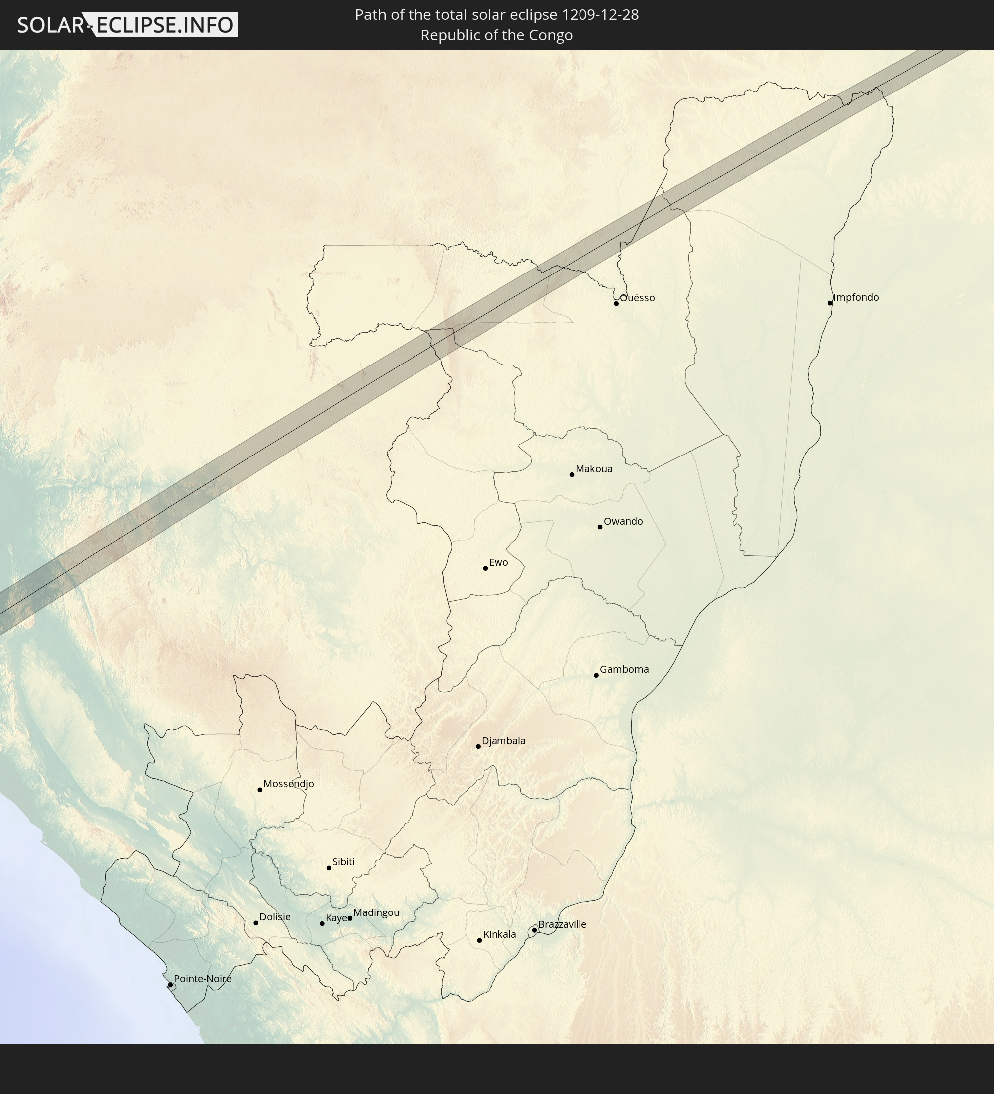 Republic of the Congo
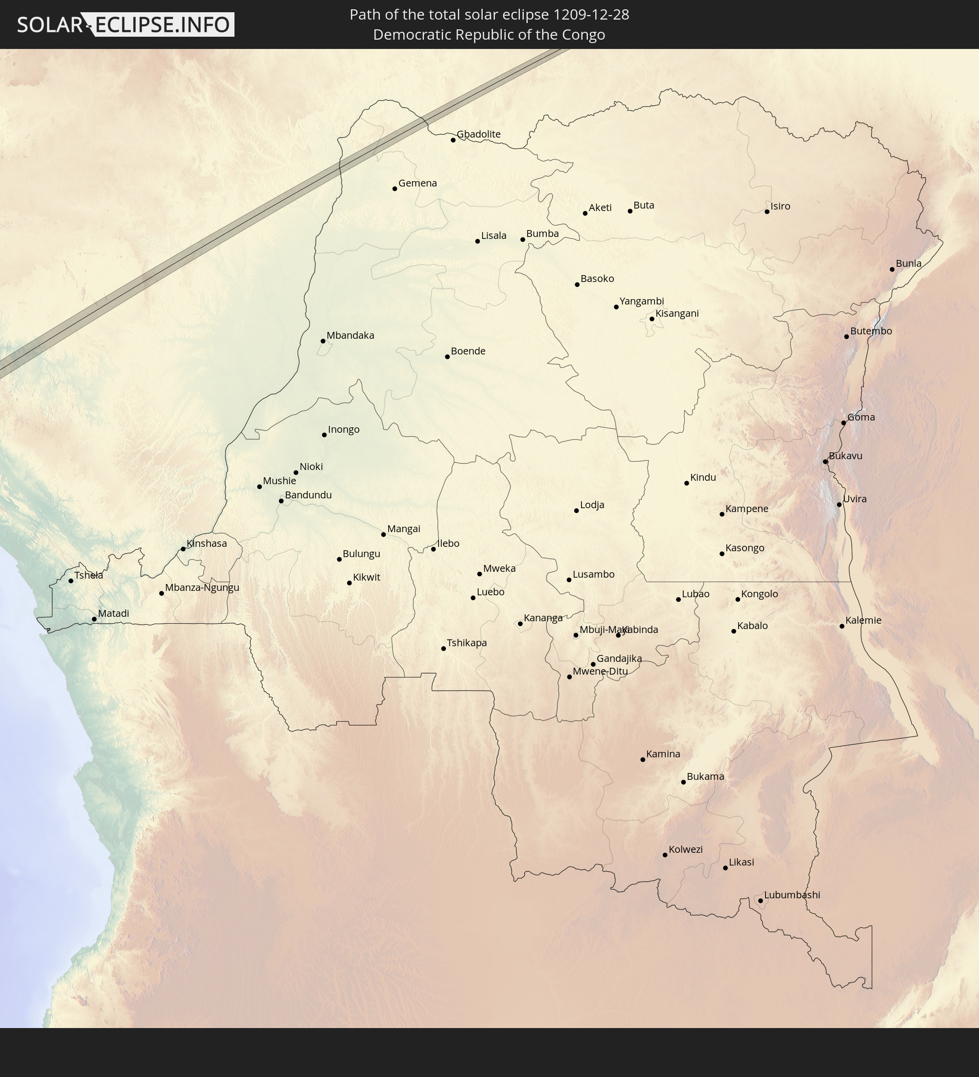 Democratic Republic of the Congo
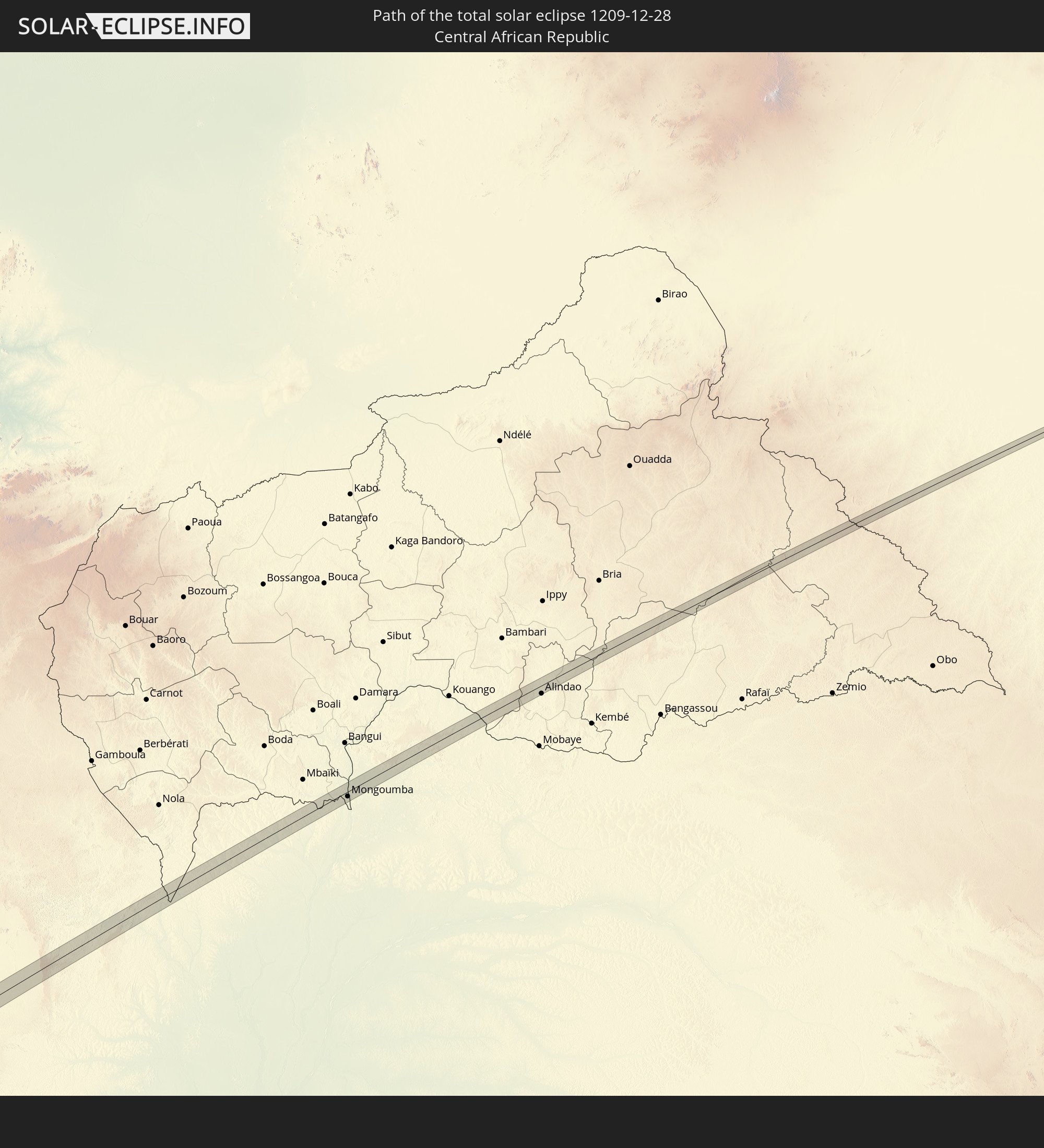 Central African Republic
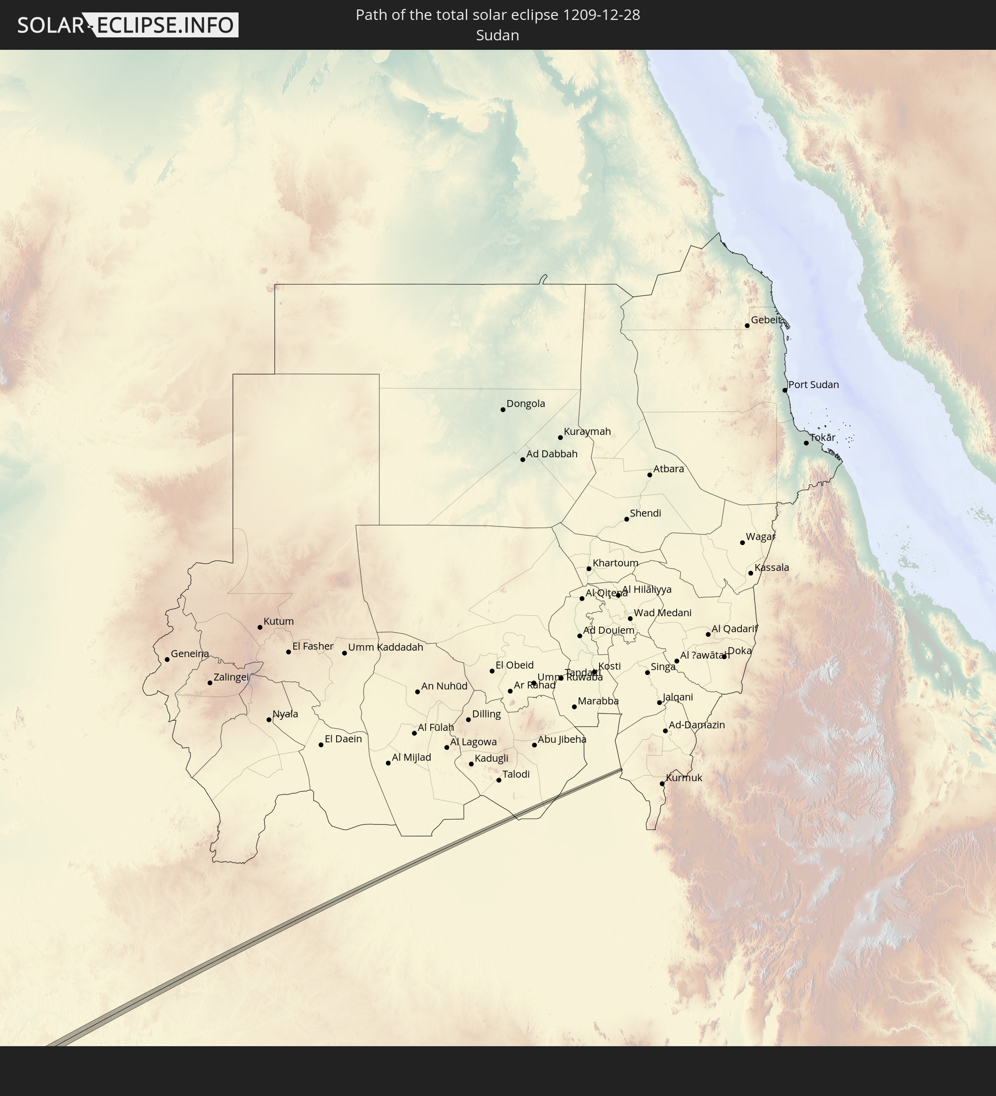 Sudan
Sudan
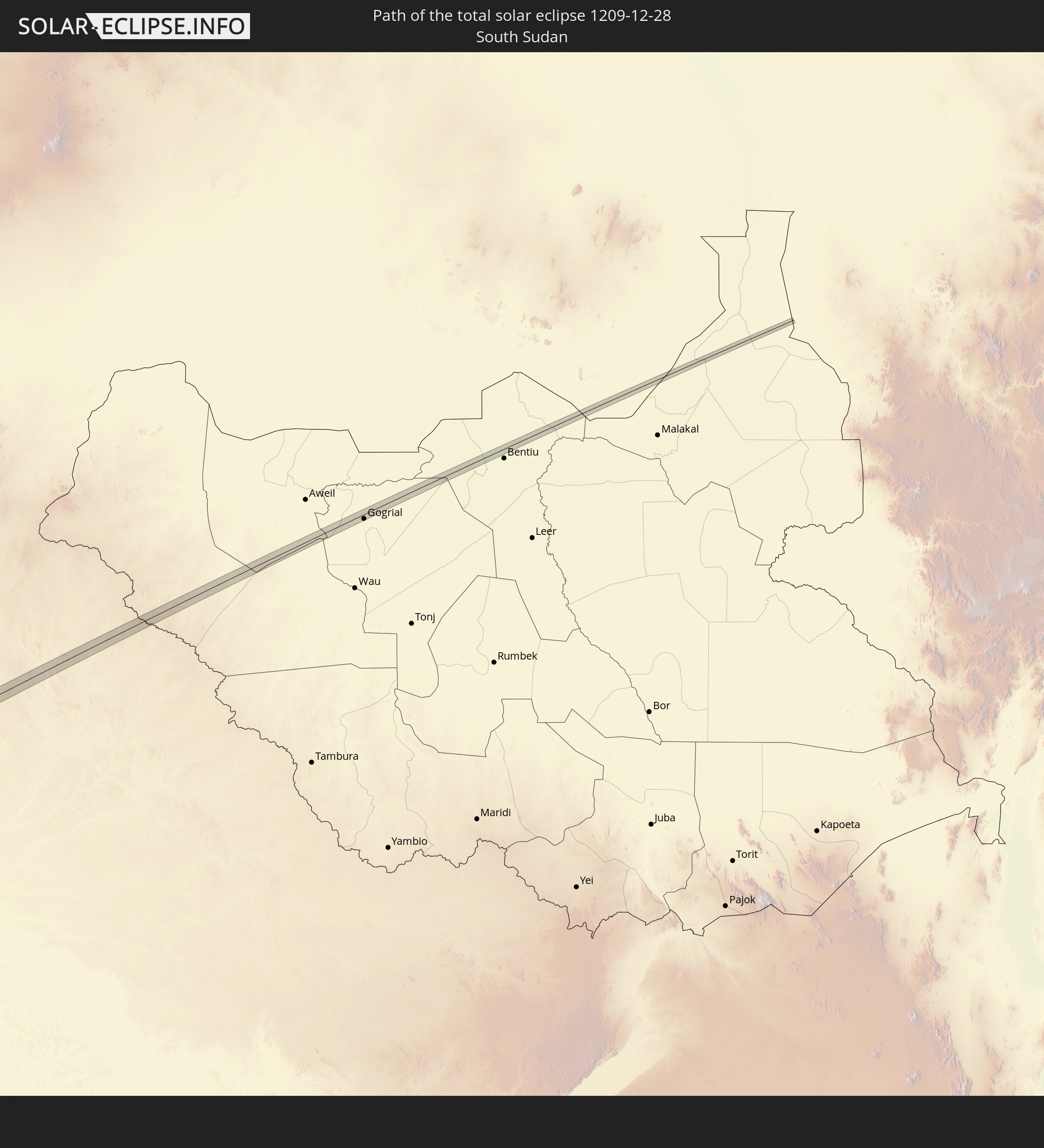 South Sudan
In den folgenden Ländern ist die Sonnenfinsternis partiell zu sehen
 Chile
Chile
 Ecuador
 Honduras
 Nicaragua
 Costa Rica
 Panama
 Colombia
 Peru
Peru
 Jamaica
 Brazil
 Argentina
 Venezuela
 Aruba
Aruba
 Bolivia
 Paraguay
 Trinidad and Tobago
 Falkland Islands
 Guyana
 Uruguay
 Suriname
 French Guiana
 South Georgia and the South Sandwich Islands
 Senegal
 Mauritania
 The Gambia
 Guinea-Bissau
 Guinea
 Saint Helena, Ascension and Tristan da Cunha
 Sierra Leone
 Mali
Mali
 Liberia
 Algeria
 Ivory Coast
 Burkina Faso
 Ghana
Ghana
 Togo
Togo
 Niger
Niger
 Benin
Benin
 Nigeria
 Equatorial Guinea
 São Tomé and Príncipe
 Italy
Italy
 Tunisia
 Cameroon
 Gabon
Gabon
 Libya
Libya
 Republic of the Congo
 Angola
 Namibia
 Democratic Republic of the Congo
 Chad
Chad
 Malta
Malta
 Central African Republic
 South Africa
 Botswana
 Sudan
Sudan
 Zambia
 Egypt
Egypt
 Zimbabwe
 Lesotho
 Rwanda
 Burundi
 Tanzania
 Uganda
 Mozambique
 Swaziland
 Malawi
 Ethiopia
 Kenya
Kenya
 French Southern and Antarctic Lands
 Madagascar
 Comoros
 Mayotte
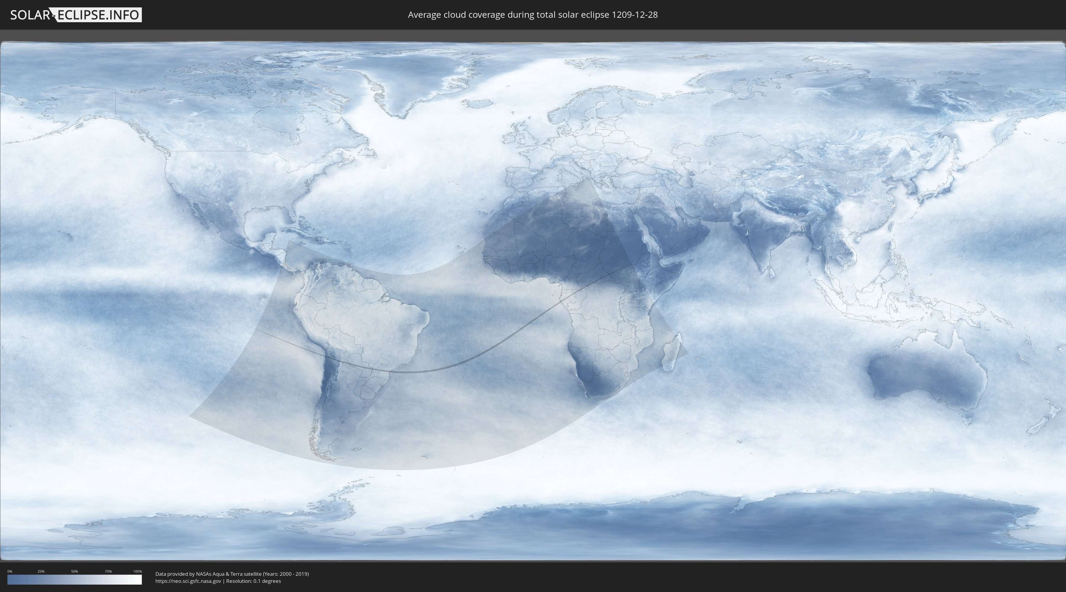
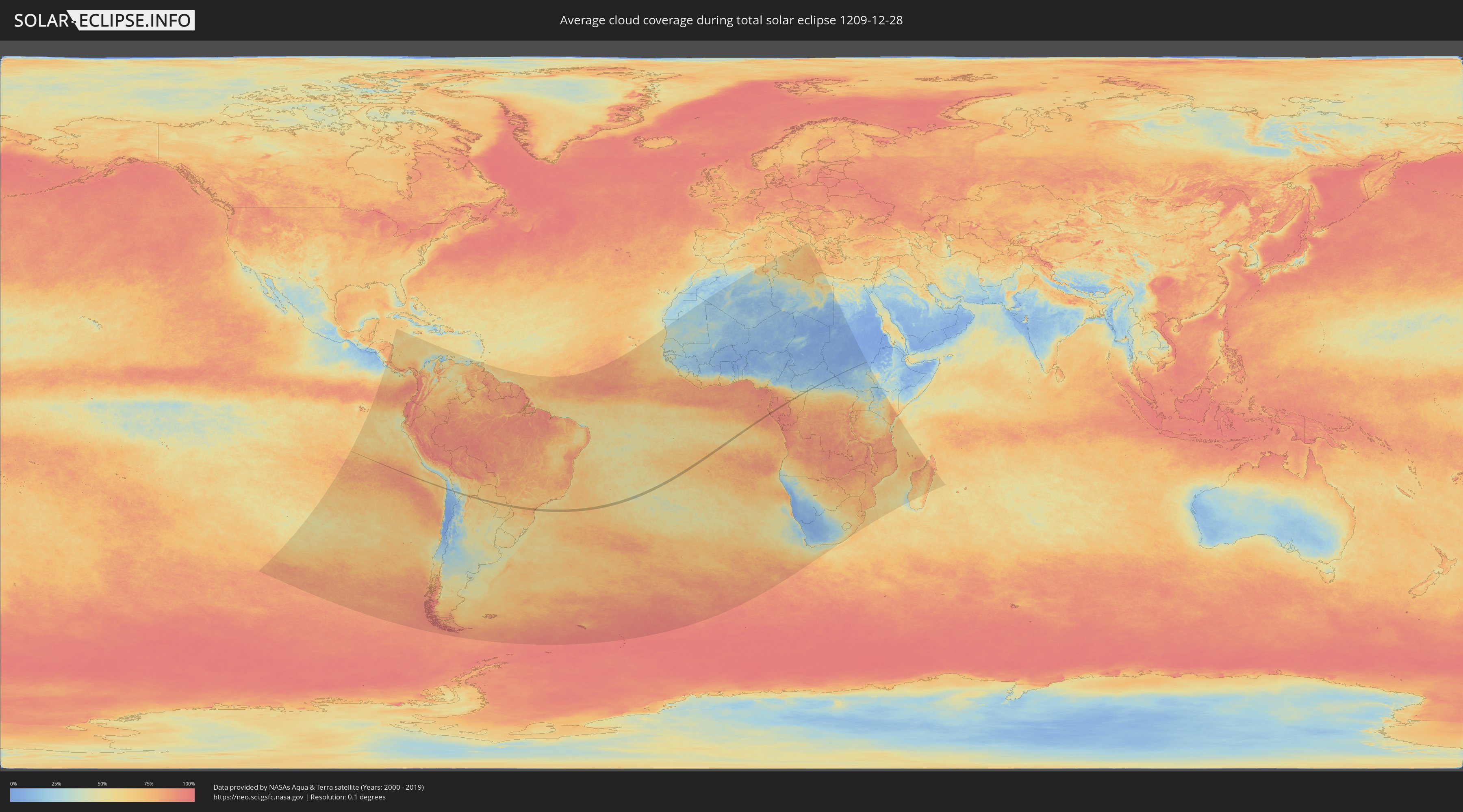
How will be the weather during the total solar eclipse on 12/28/1209?
Where is the best place to see the total solar eclipse of 12/28/1209?
The following maps show the average cloud coverage for the day of the total solar eclipse.
With the help of these maps, it is possible to find the place along the eclipse path, which has the best
chance of a cloudless sky.
Nevertheless, you should consider local circumstances and inform about the weather of your chosen
observation site.
The data is provided by NASAs satellites
AQUA and TERRA.
The cloud maps are averaged over a period of 19 years (2000 - 2019).
Detailed country maps
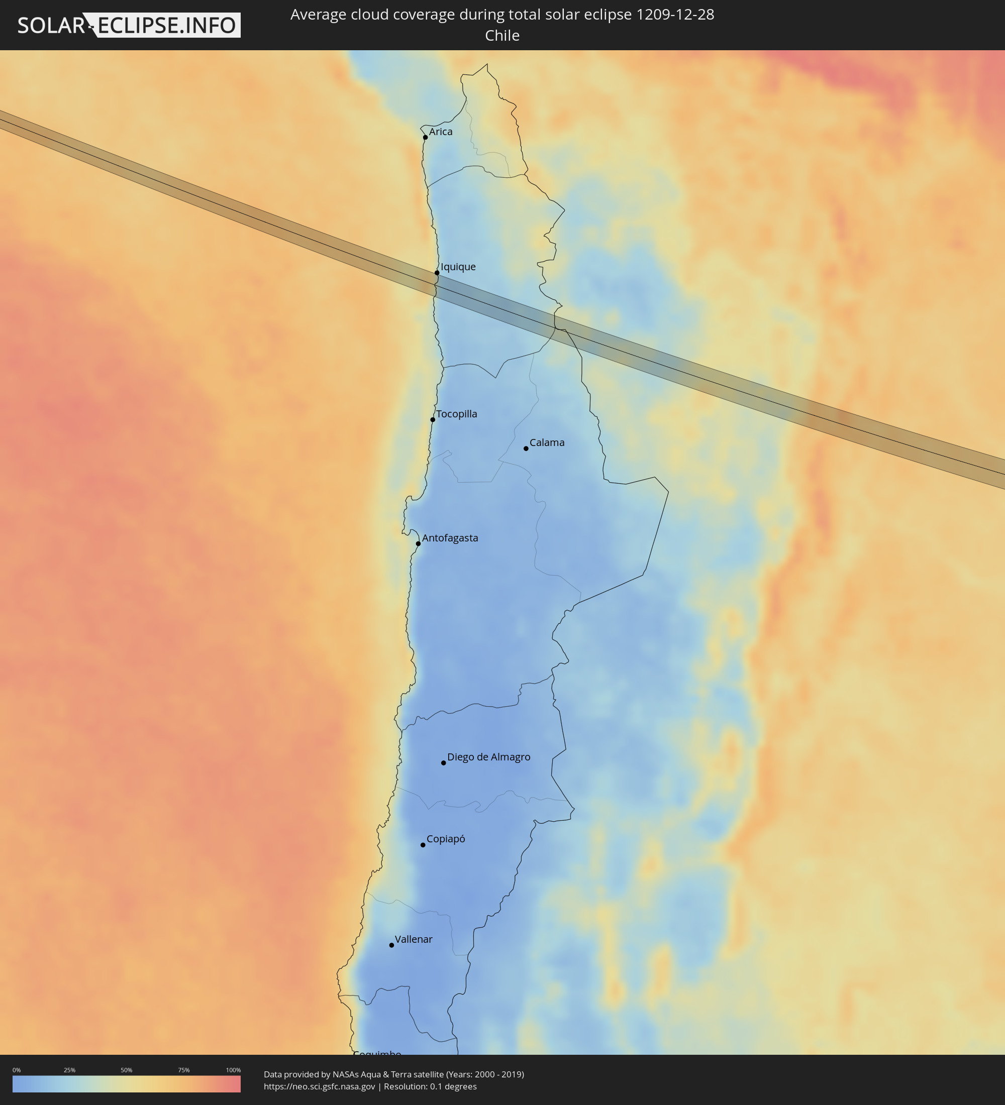 Chile
Chile
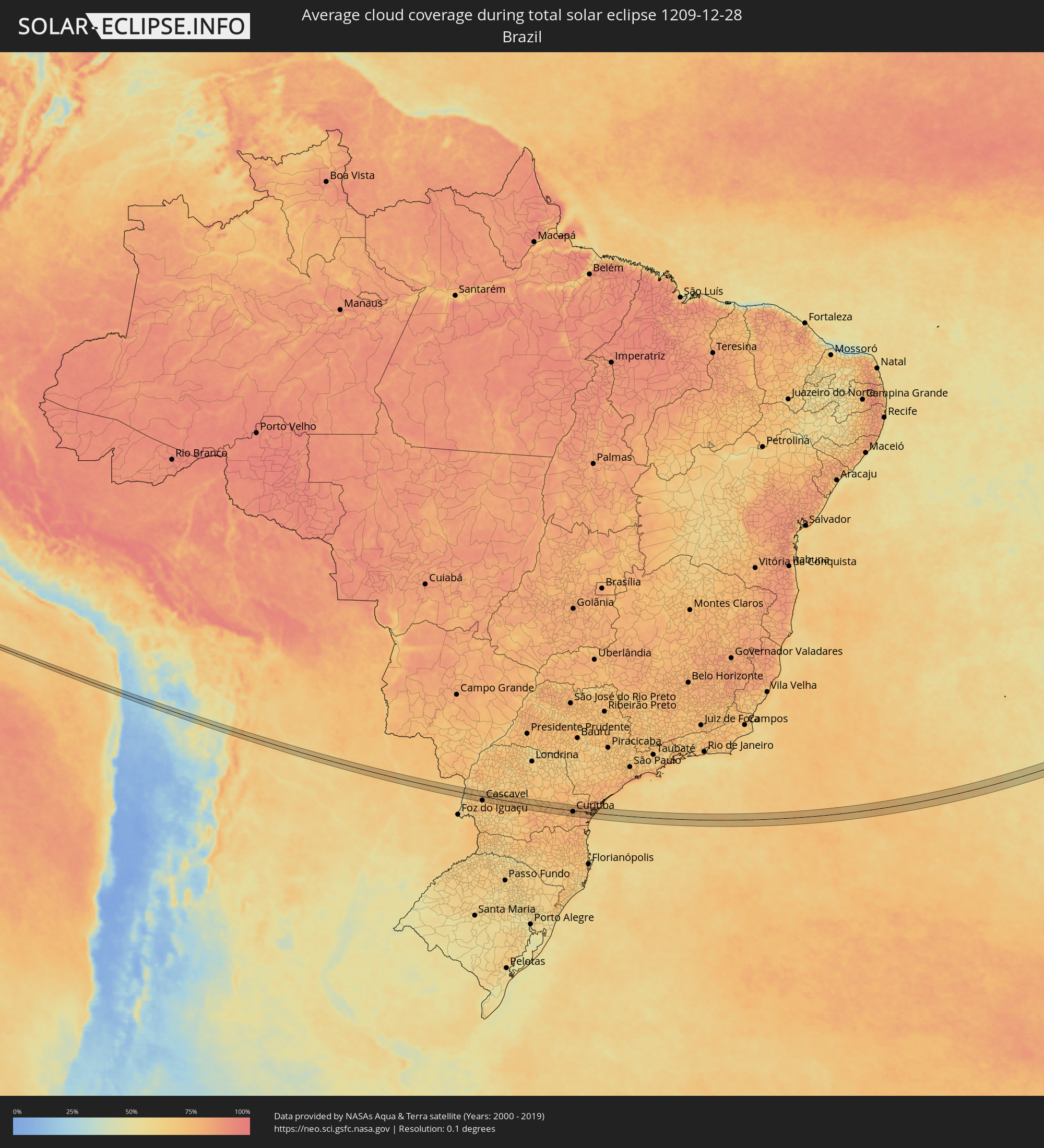 Brazil
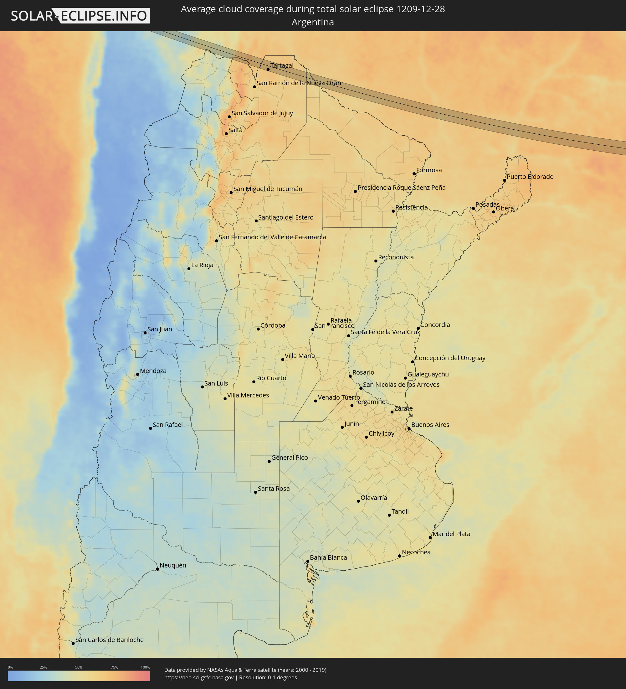 Argentina
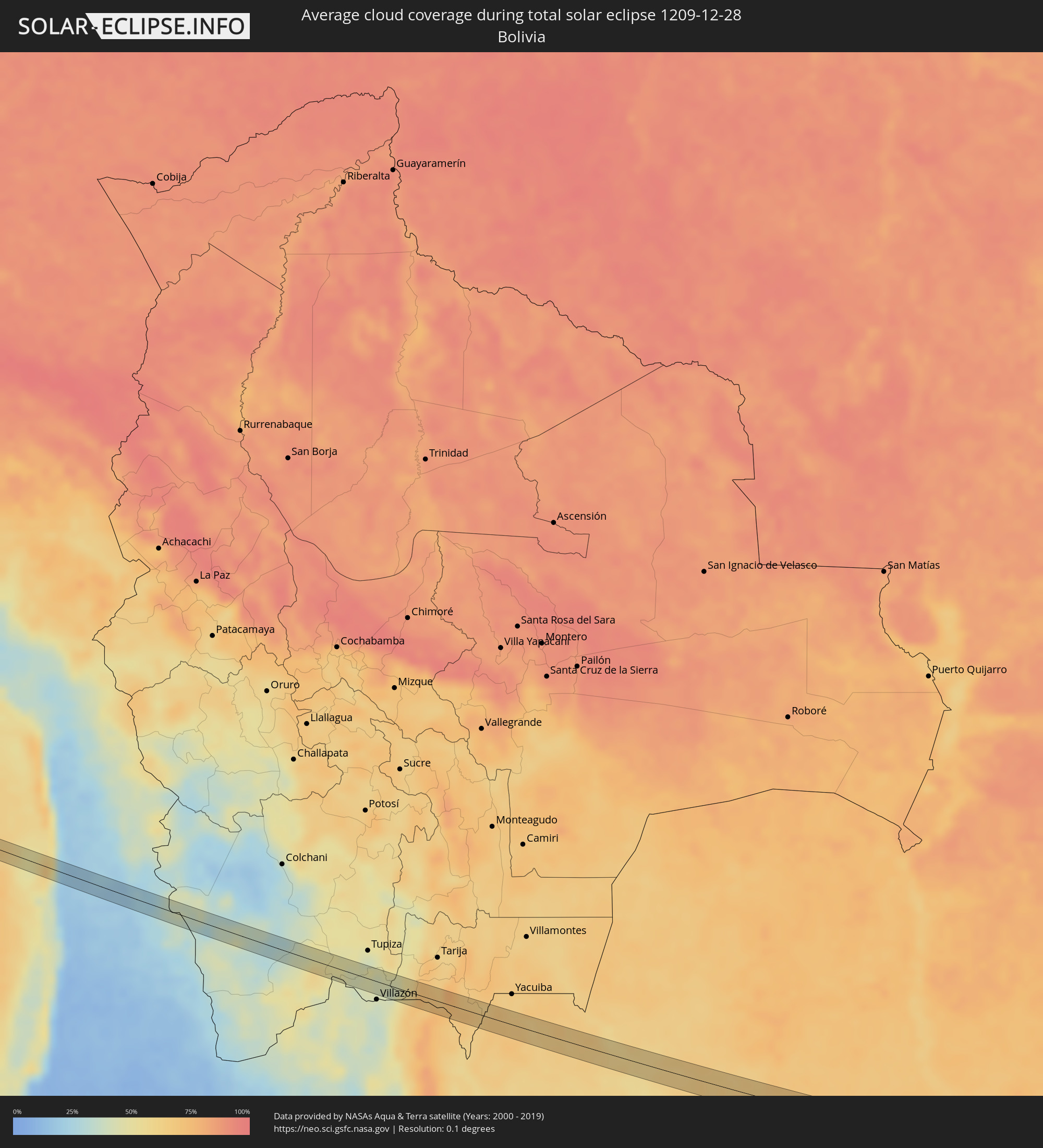 Bolivia
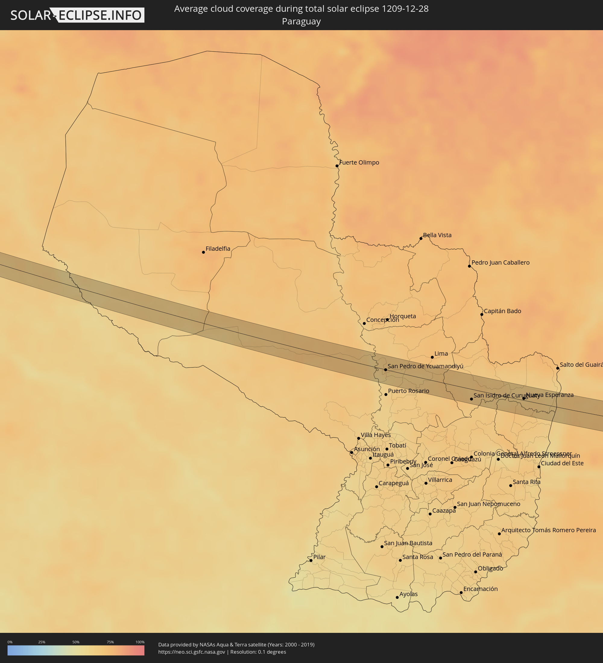 Paraguay
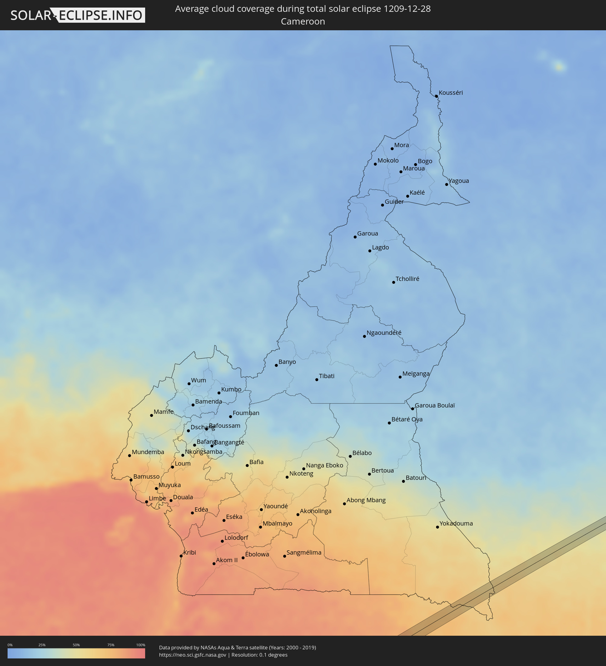 Cameroon
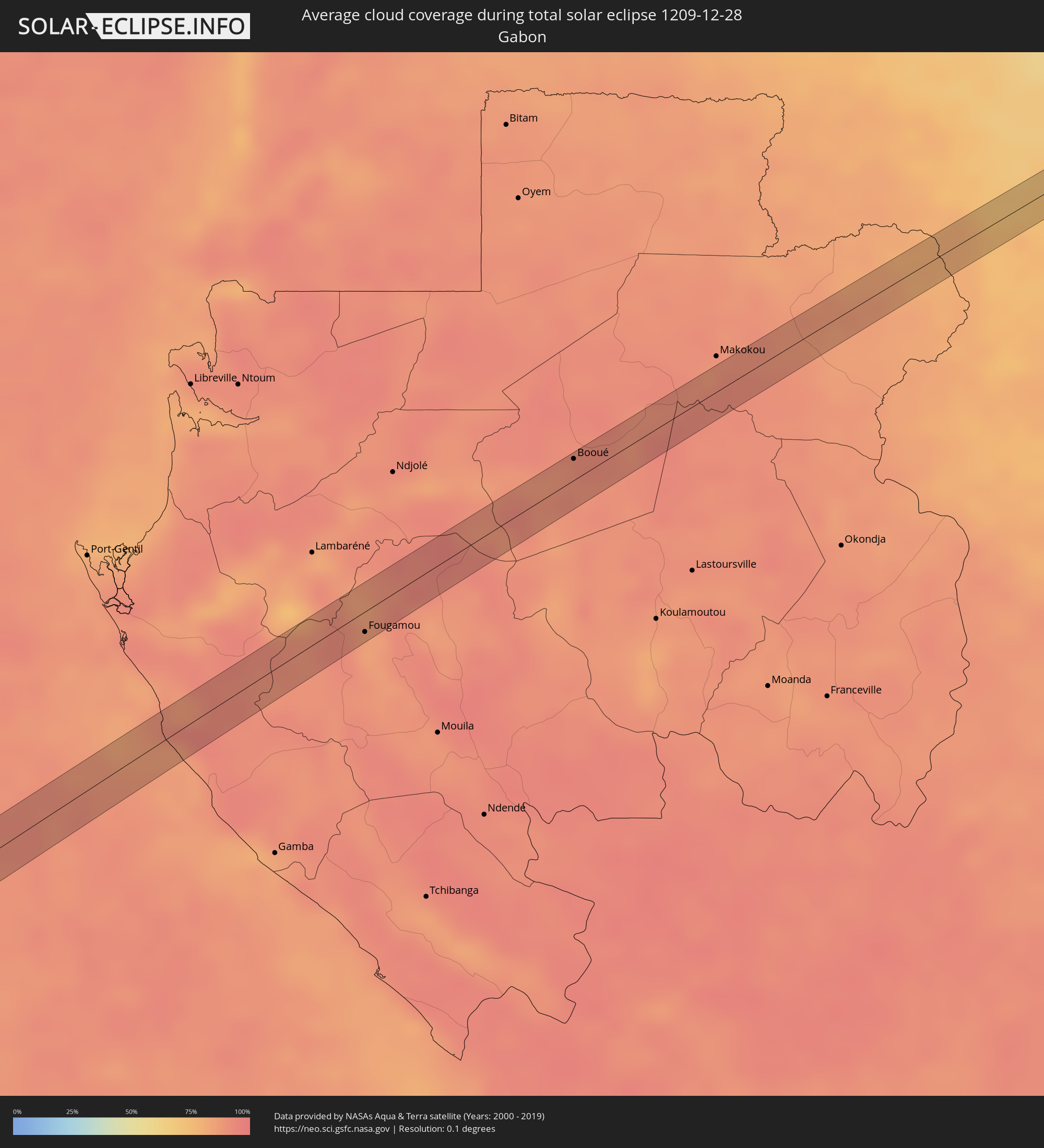 Gabon
Gabon
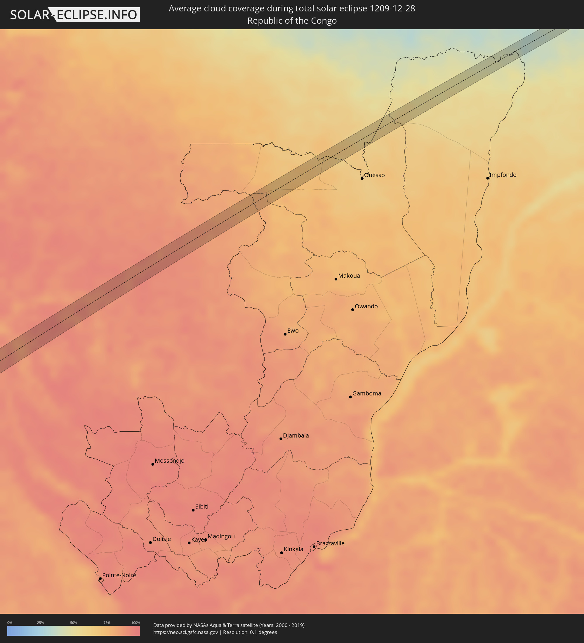 Republic of the Congo
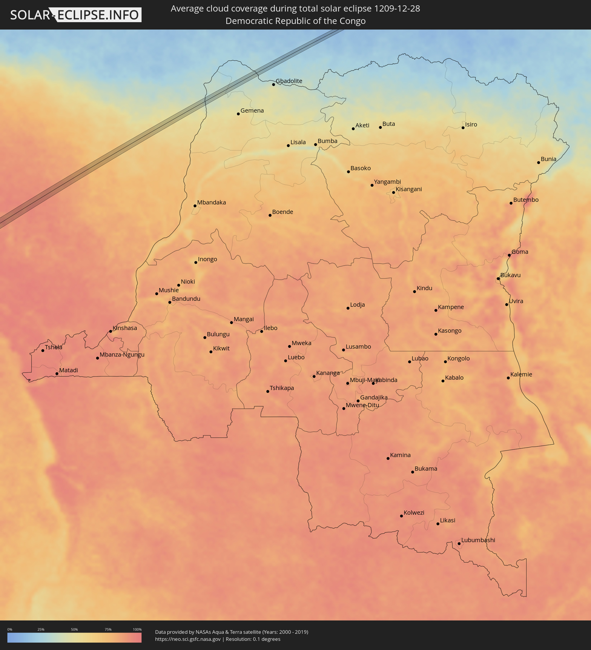 Democratic Republic of the Congo
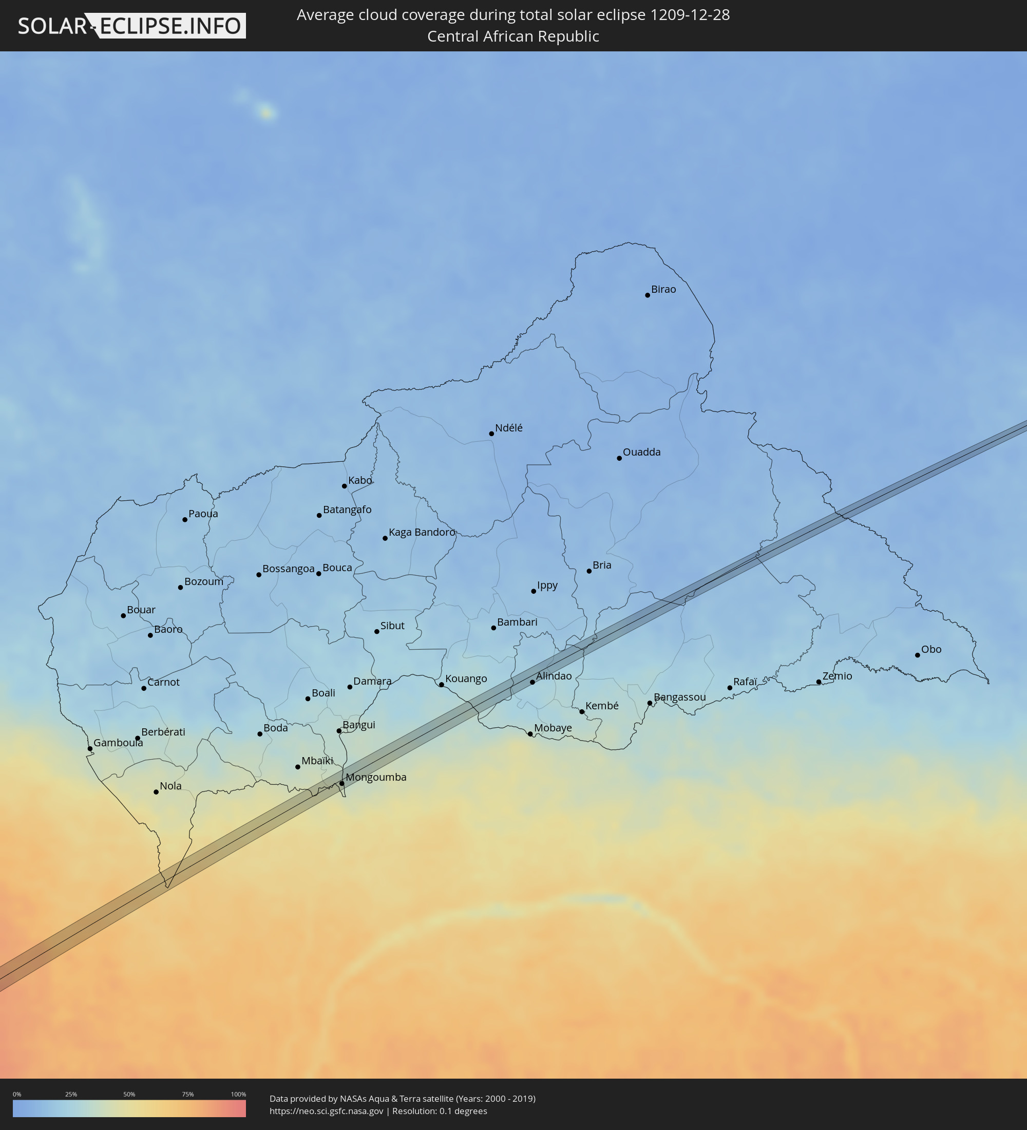 Central African Republic
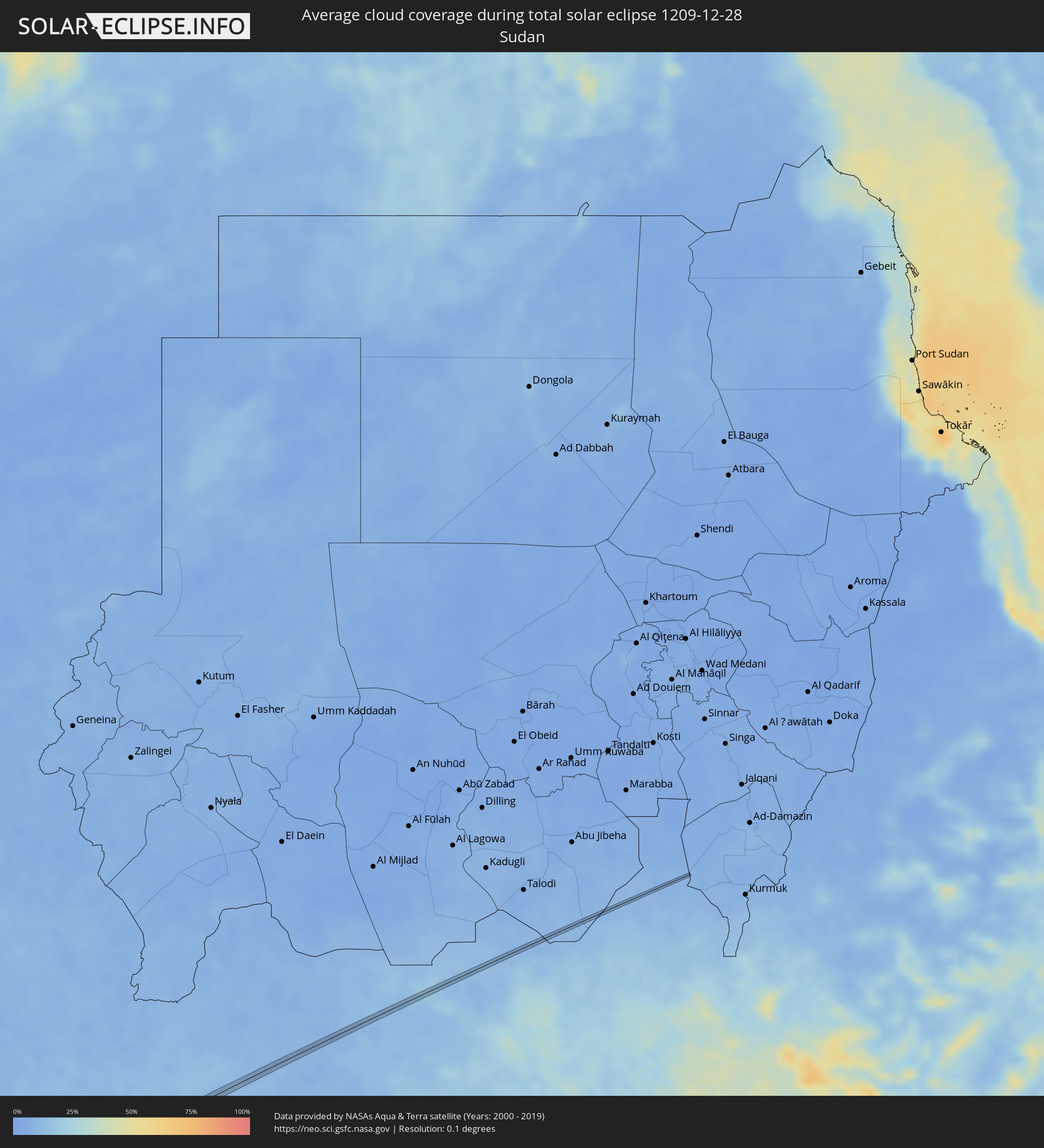 Sudan
Sudan
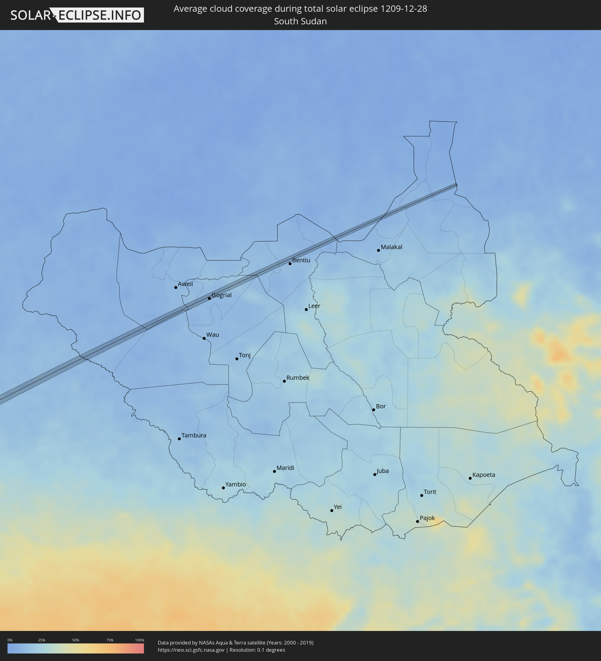 South Sudan
Cities inside the path of the eclipse
The following table shows all locations with a population of more than 5,000 inside the eclipse path. Cities which have more than 100,000 inhabitants are marked bold. A click at the locations opens a detailed map.
| City | Type | Eclipse duration | Local time of max. eclipse | Distance to central line | Ø Cloud coverage |
|
Tartagal, Salta Province
|
total | - | 08:05:43 UTC-04:16 | 15 km | 69% |
|
San Pedro de Ycuamandiyú, San Pedro
|
total | - | 08:41:57 UTC-03:50 | 1 km | 61% |
|
San Isidro de Curuguaty, Canindeyú
|
total | - | 08:44:25 UTC-03:50 | 16 km | 67% |
|
Nueva Esperanza, Canindeyú
|
total | - | 08:45:49 UTC-03:50 | 3 km | 66% |
|
Marechal Cândido Rondon, Paraná
|
total | - | 09:31:25 UTC-03:06 | 13 km | 67% |
|
Toledo, Paraná
|
total | - | 09:32:03 UTC-03:06 | 2 km | 71% |
|
Cascavel, Paraná
|
total | - | 09:32:40 UTC-03:06 | 19 km | 72% |
|
Corbélia, Paraná
|
total | - | 09:32:52 UTC-03:06 | 1 km | 70% |
|
Guaraniaçu, Paraná
|
total | - | 09:33:46 UTC-03:06 | 24 km | 75% |
|
Prudentópolis, Paraná
|
total | - | 09:37:22 UTC-03:06 | 6 km | 73% |
|
Imbituva, Paraná
|
total | - | 09:38:06 UTC-03:06 | 2 km | 75% |
|
Ponta Grossa, Paraná
|
total | - | 09:38:56 UTC-03:06 | 19 km | 73% |
|
Palmeira, Paraná
|
total | - | 09:39:21 UTC-03:06 | 16 km | 75% |
|
Campo Largo, Paraná
|
total | - | 09:40:19 UTC-03:06 | 13 km | 76% |
|
Araucária, Paraná
|
total | - | 09:40:36 UTC-03:06 | 26 km | 77% |
|
Itaperuçu, Paraná
|
total | - | 09:40:36 UTC-03:06 | 16 km | 75% |
|
Rio Branco do Sul, Paraná
|
total | - | 09:40:40 UTC-03:06 | 20 km | 75% |
|
Almirante Tamandaré, Paraná
|
total | - | 09:40:43 UTC-03:06 | 5 km | 77% |
|
Curitiba, Paraná
|
total | - | 09:40:49 UTC-03:06 | 6 km | 79% |
|
Colombo, Paraná
|
total | - | 09:40:53 UTC-03:06 | 10 km | 78% |
|
São José dos Pinhais, Paraná
|
total | - | 09:40:59 UTC-03:06 | 17 km | 76% |
|
Pinhais, Paraná
|
total | - | 09:41:00 UTC-03:06 | 7 km | 78% |
|
Quatro Barras, Paraná
|
total | - | 09:41:12 UTC-03:06 | 3 km | 75% |
|
Piraquara, Paraná
|
total | - | 09:41:15 UTC-03:06 | 5 km | 75% |
|
Campina Grande do Sul, Paraná
|
total | - | 09:41:14 UTC-03:06 | 10 km | 77% |
|
Antonina, Paraná
|
total | - | 09:41:58 UTC-03:06 | 1 km | 75% |
|
Paranaguá, Paraná
|
total | - | 09:42:23 UTC-03:06 | 7 km | 73% |
|
Pontal do Paraná, Paraná
|
total | - | 09:42:28 UTC-03:06 | 24 km | 70% |
|
Fougamou, Ngouni
|
total | - | 15:35:56 UTC+00:13 | 12 km | 84% |
|
Booué, Ogooué-Ivindo
|
total | - | 15:37:51 UTC+00:13 | 13 km | 90% |
|
Mongoumba, Lobaye
|
total | - | 15:43:57 UTC+00:13 | 6 km | 38% |
|
Libenge, Équateur
|
total | - | 15:43:59 UTC+00:13 | 8 km | 36% |
|
Alindao, Basse-Kotto
|
total | - | 15:45:36 UTC+00:13 | 11 km | 24% |
 Gogrial, Warrap
|
total | - | 17:41:09 UTC+02:06 | 6 km | 11% |