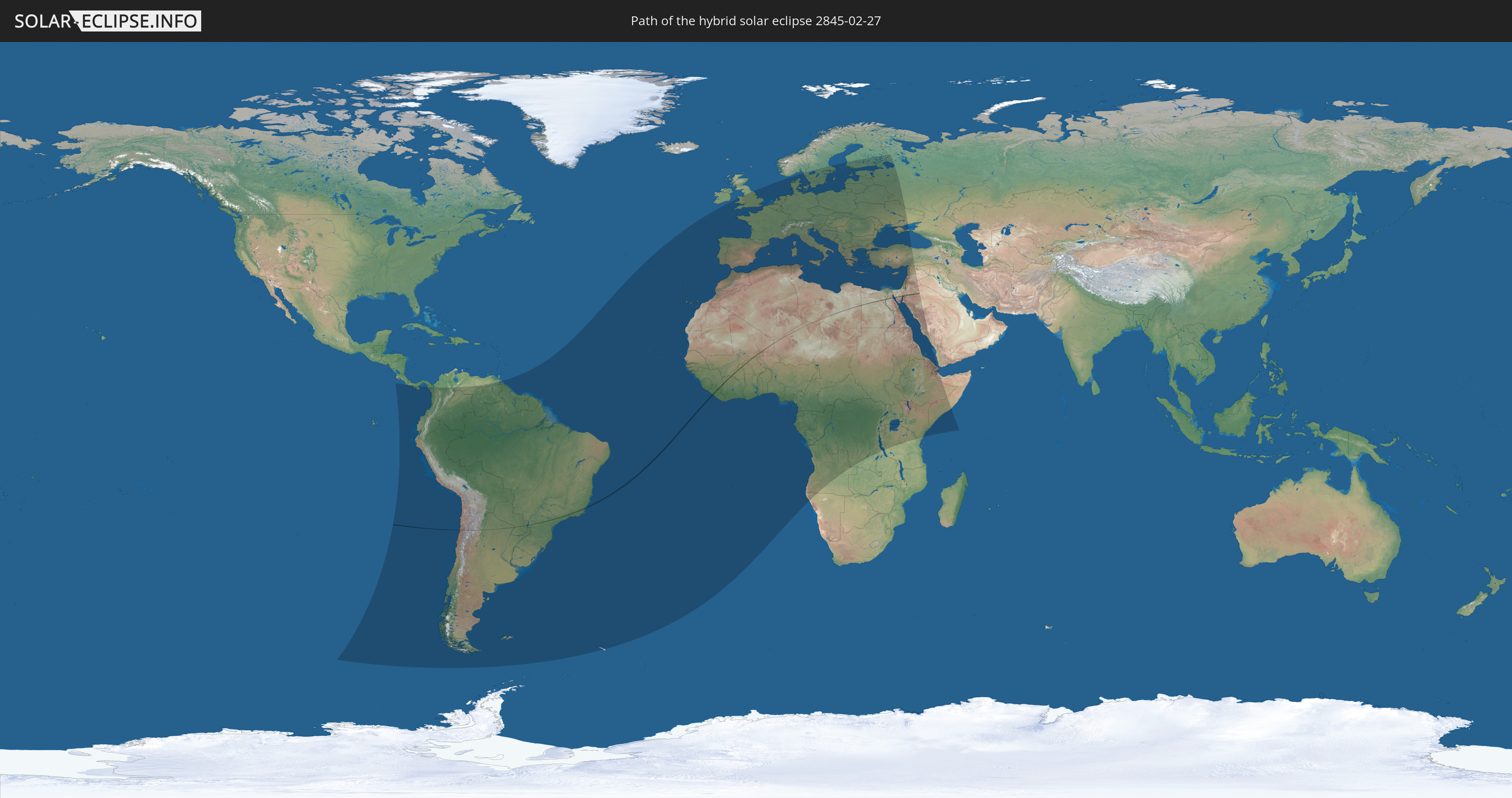
Hybrid solar eclipse of 02/27/2845
| Day of week: | Monday |
| Maximum duration of eclipse: | 00m55s |
| Maximum width of eclipse path: | 34 km |
| Saros cycle: | 163 |
| Coverage: | 100% |
| Magnitude: | 1.0098 |
| Gamma: | 0.0467 |
Wo kann man die Sonnenfinsternis vom 02/27/2845 sehen?
Die Sonnenfinsternis am 02/27/2845 kann man in 113 Ländern als partielle Sonnenfinsternis beobachten.
Der Finsternispfad verläuft durch 15 Länder. Nur in diesen Ländern ist sie als hybrid Sonnenfinsternis zu sehen.
In den folgenden Ländern ist die Sonnenfinsternis hybrid zu sehen
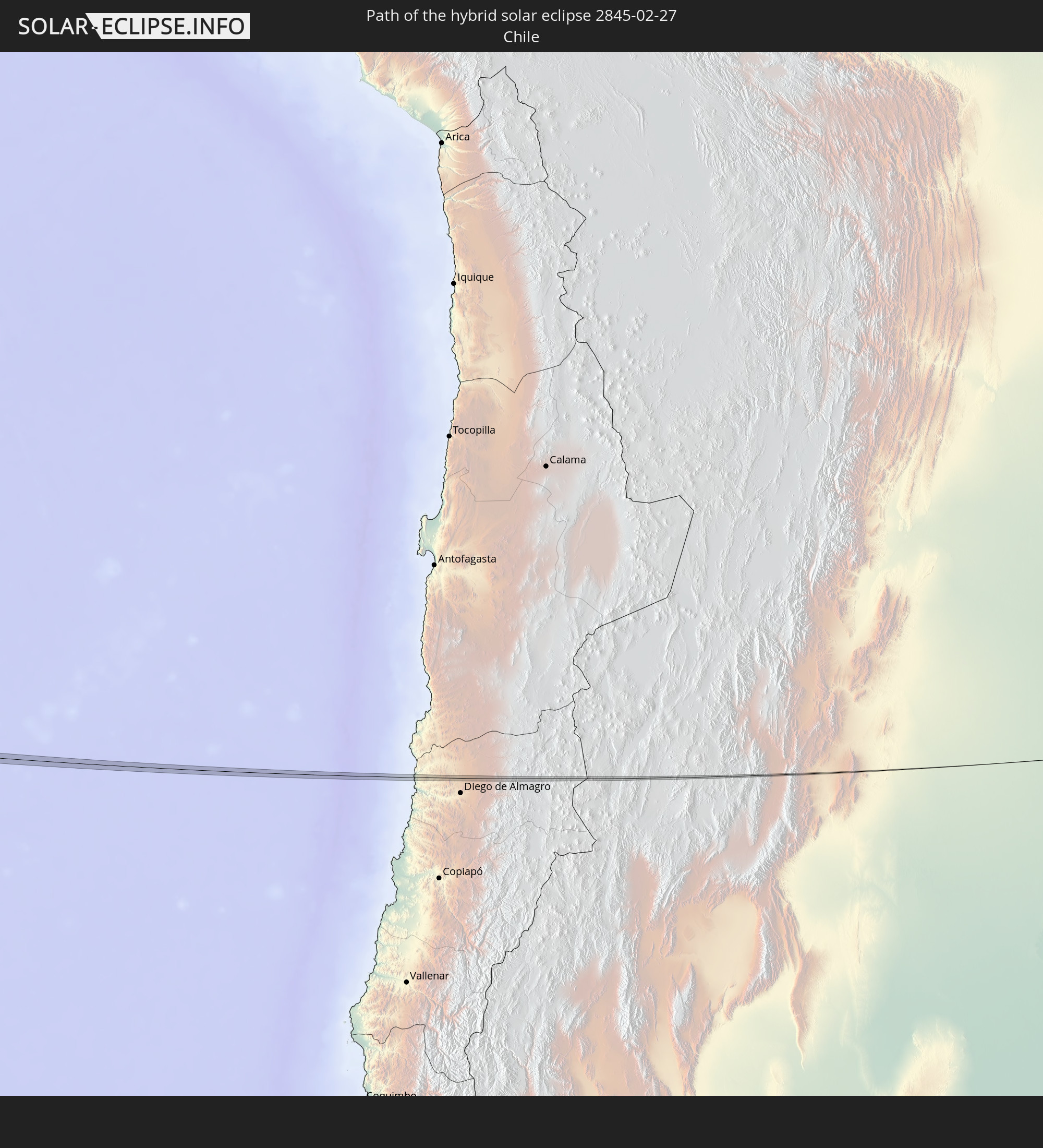 Chile
Chile
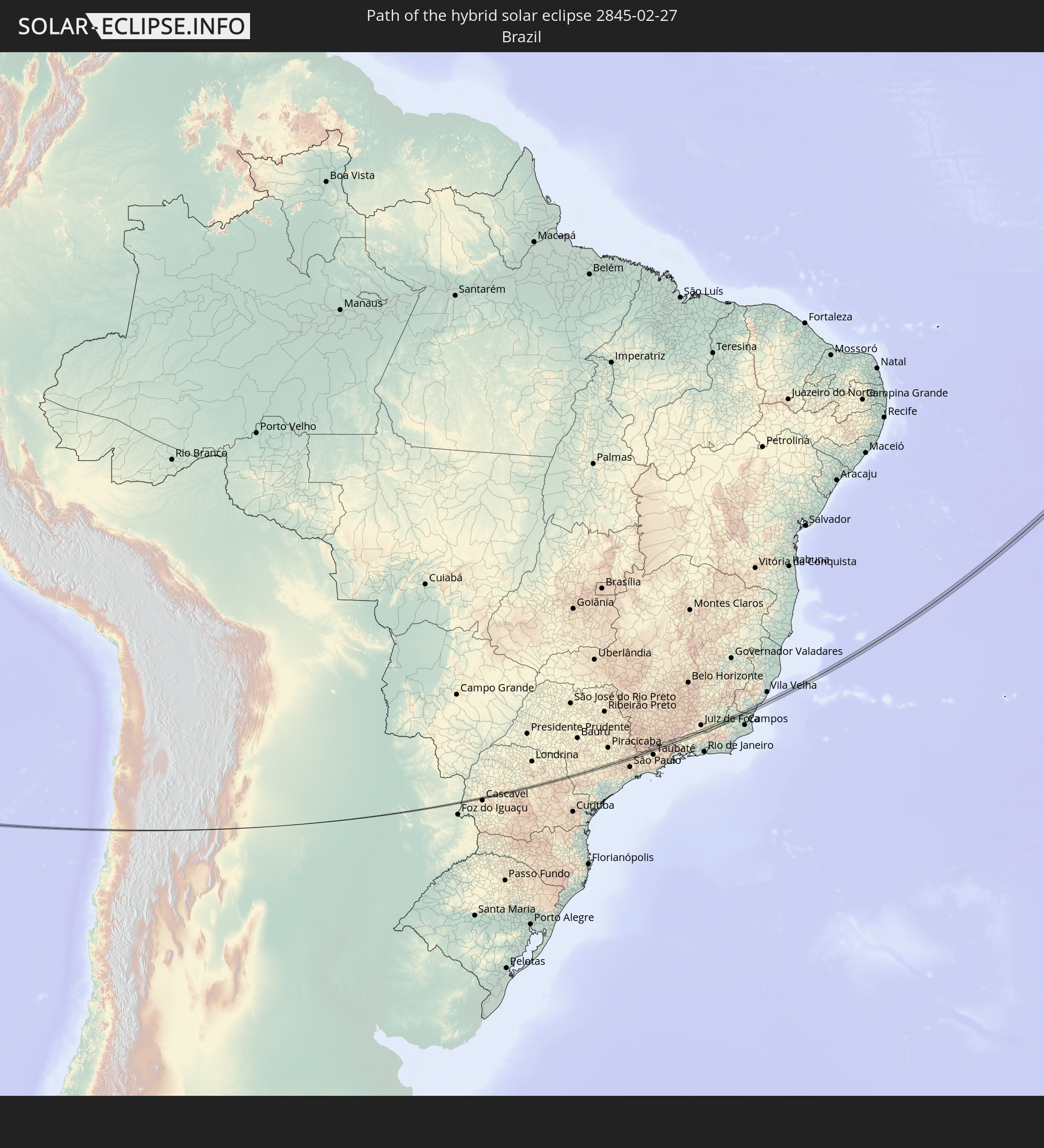 Brazil
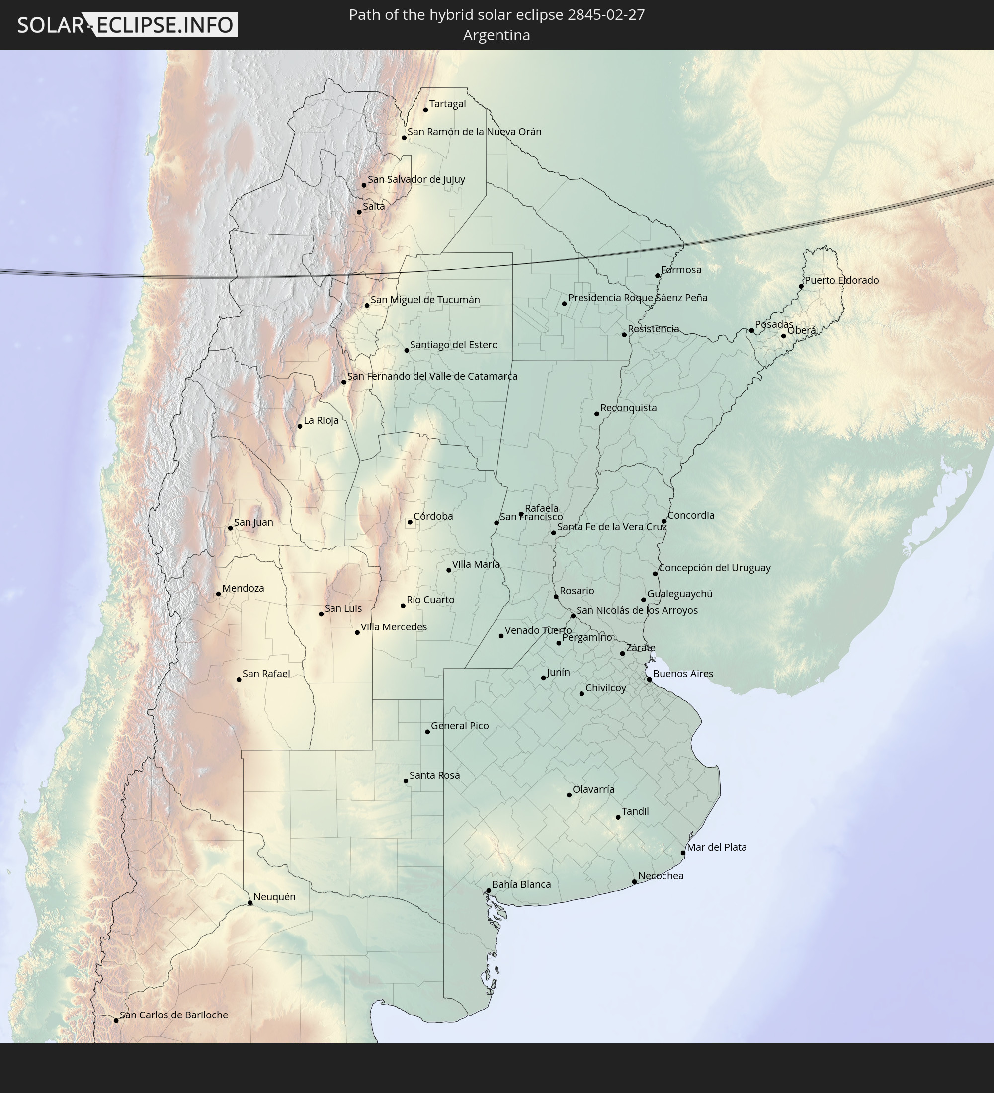 Argentina
 Paraguay
 Guinea
 Mali
Mali
 Liberia
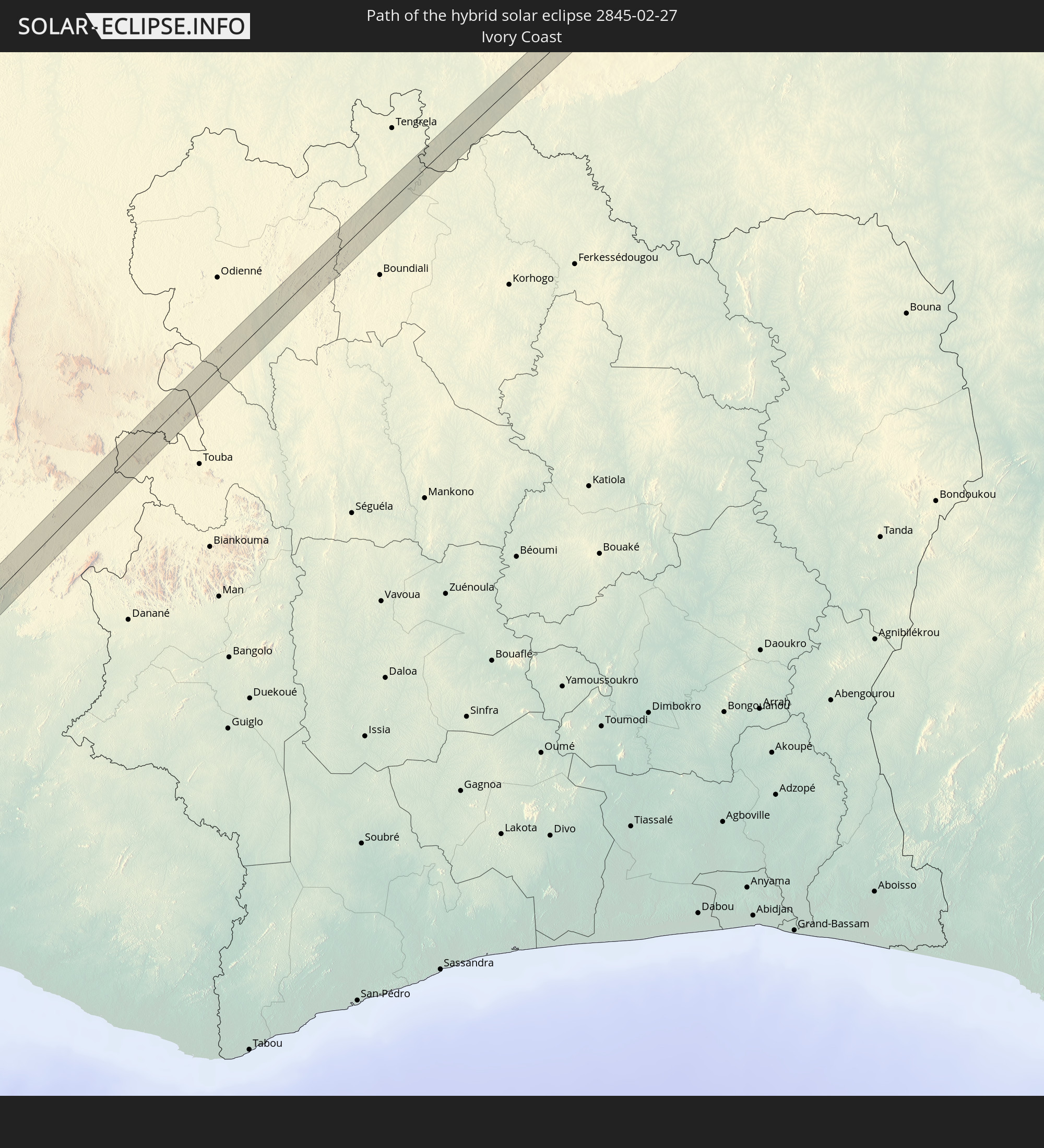 Ivory Coast
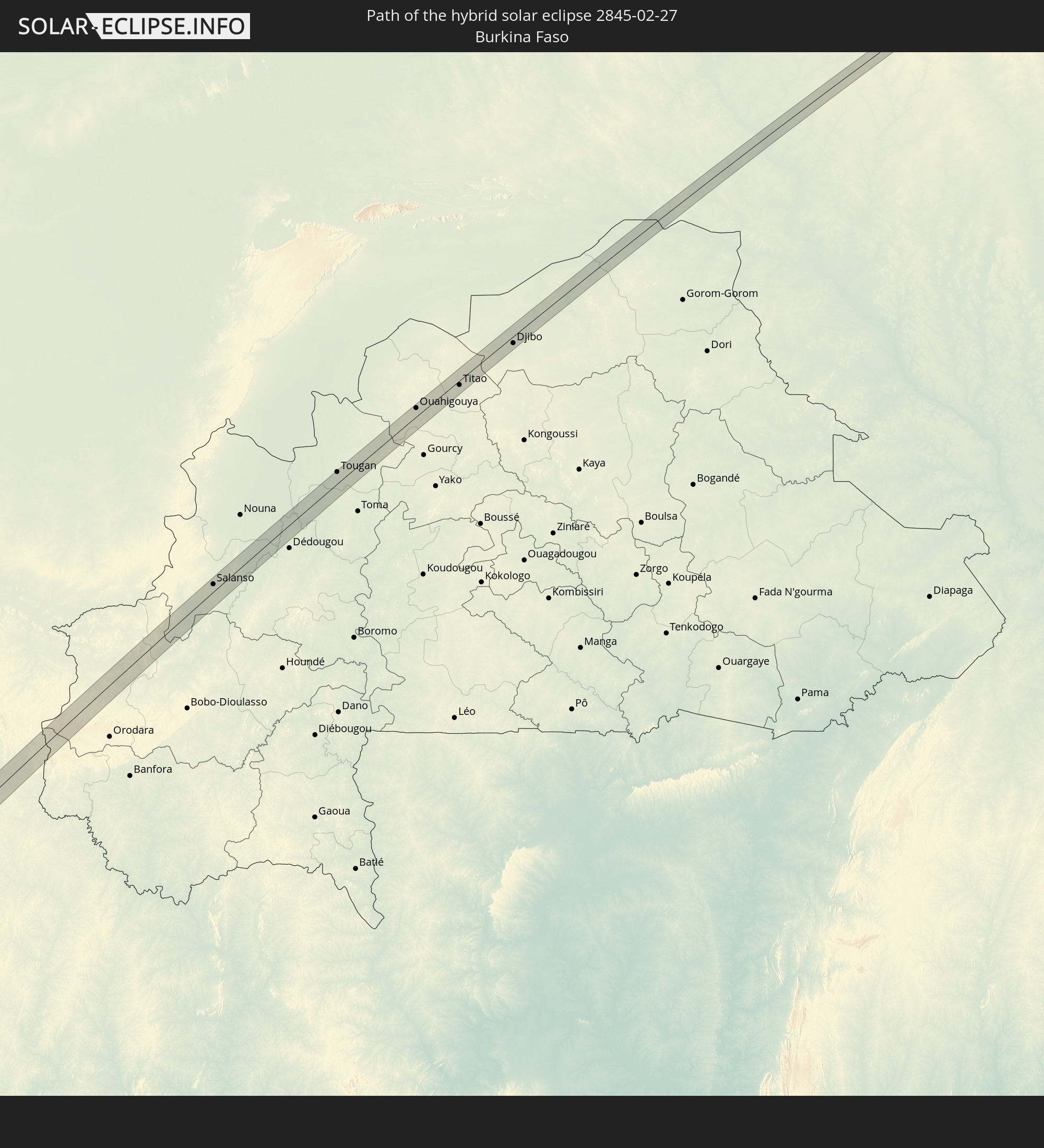 Burkina Faso
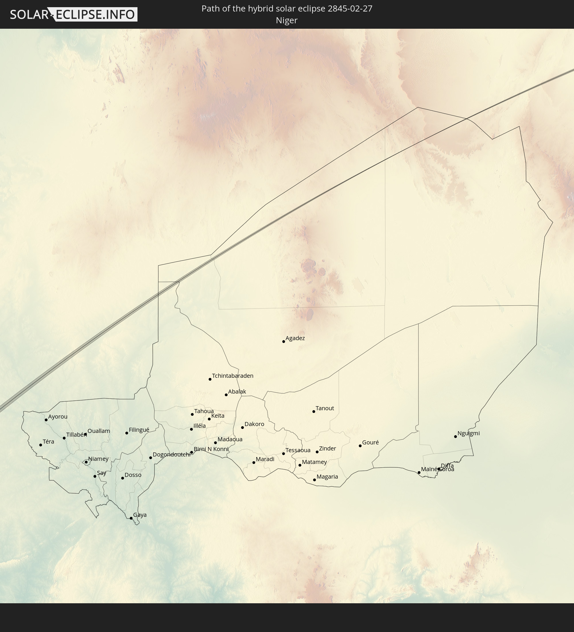 Niger
Niger
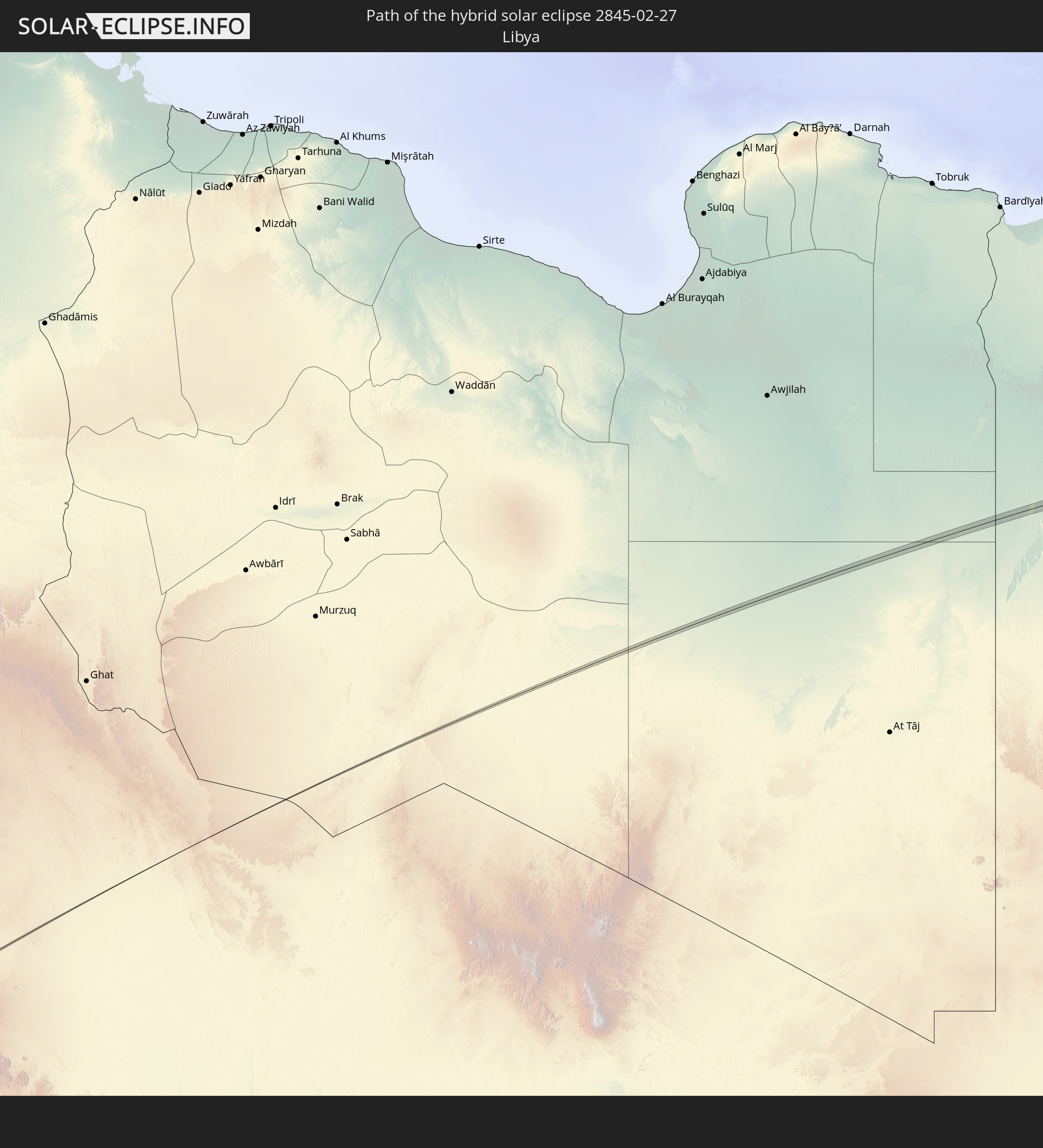 Libya
Libya
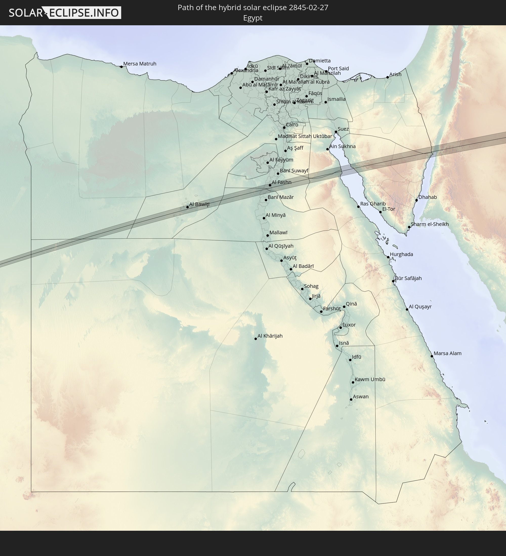 Egypt
Egypt
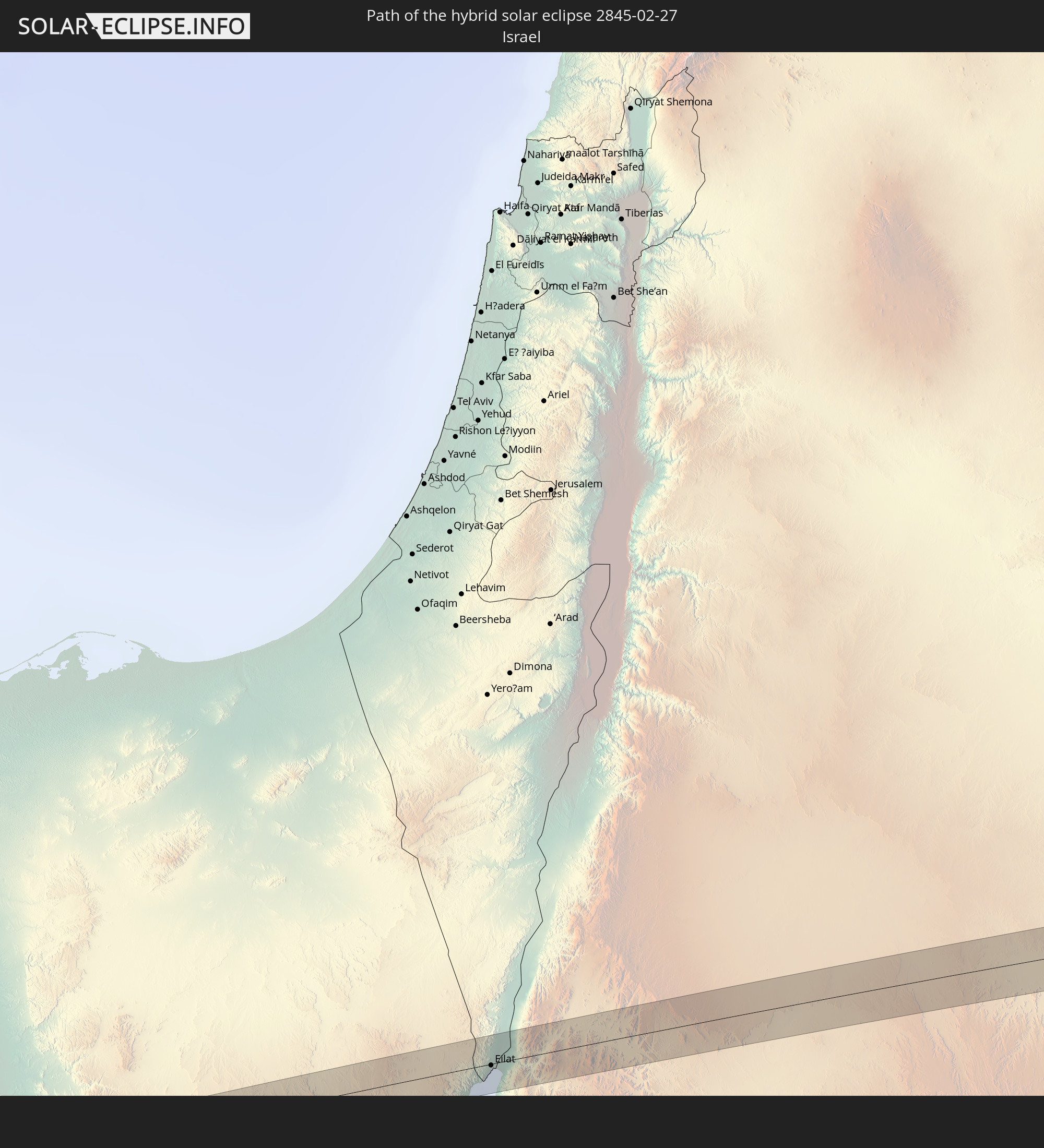 Israel
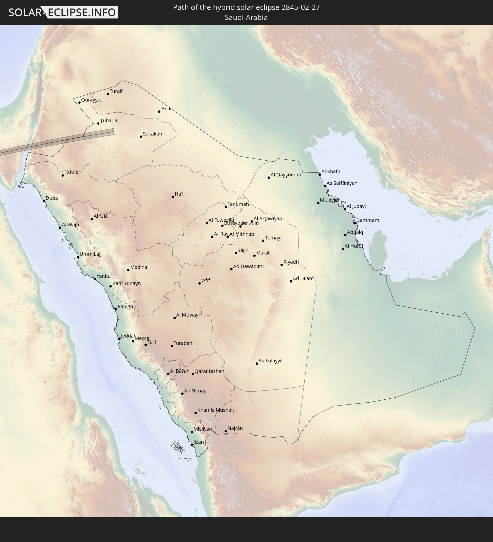 Saudi Arabia
 Jordan
In den folgenden Ländern ist die Sonnenfinsternis partiell zu sehen
 Russia
 Chile
Chile
 Ecuador
 Costa Rica
 Panama
 Colombia
 Peru
Peru
 Brazil
 Argentina
 Venezuela
 Bolivia
 Paraguay
 Falkland Islands
 Guyana
 Uruguay
 Suriname
 French Guiana
 South Georgia and the South Sandwich Islands
 Portugal
 Cabo Verde
 Spain
Spain
 Senegal
 Mauritania
 The Gambia
 Guinea-Bissau
 Guinea
 Saint Helena, Ascension and Tristan da Cunha
 Sierra Leone
 Morocco
 Mali
Mali
 Liberia
 Algeria
 United Kingdom
 Ivory Coast
 Burkina Faso
 Gibraltar
 France
 Ghana
Ghana
 Guernsey
 Jersey
 Togo
Togo
 Niger
Niger
 Benin
Benin
 Andorra
 Belgium
 Nigeria
 Netherlands
 Equatorial Guinea
 Luxembourg
 Germany
 Switzerland
 São Tomé and Príncipe
 Italy
Italy
 Monaco
 Tunisia
 Denmark
 Cameroon
 Gabon
Gabon
 Libya
Libya
 Liechtenstein
 Austria
 Sweden
 Republic of the Congo
 Angola
 Namibia
 Czechia
 Democratic Republic of the Congo
 San Marino
 Vatican City
 Slovenia
 Chad
Chad
 Croatia
 Poland
 Malta
Malta
 Central African Republic
 Bosnia and Herzegovina
 Hungary
 Slovakia
 Montenegro
 Serbia
 Albania
 Åland Islands
 Greece
 Romania
 Republic of Macedonia
 Finland
 Lithuania
 Latvia
 Estonia
 Sudan
Sudan
 Ukraine
 Bulgaria
 Belarus
 Egypt
Egypt
 Turkey
 Moldova
 Rwanda
 Burundi
 Tanzania
 Uganda
 Cyprus
 Ethiopia
 Kenya
Kenya
 State of Palestine
 Israel
 Saudi Arabia
 Jordan
 Lebanon
 Syria
Syria
 Eritrea
 Somalia
 Djibouti
 Yemen
Yemen
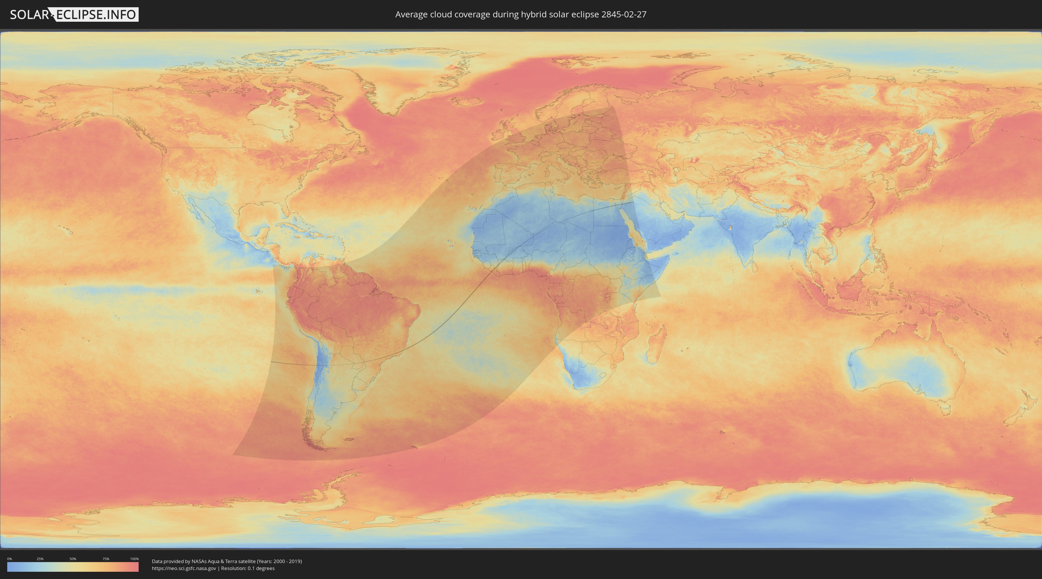
How will be the weather during the hybrid solar eclipse on 02/27/2845?
Where is the best place to see the hybrid solar eclipse of 02/27/2845?
The following maps show the average cloud coverage for the day of the hybrid solar eclipse.
With the help of these maps, it is possible to find the place along the eclipse path, which has the best
chance of a cloudless sky.
Nevertheless, you should consider local circumstances and inform about the weather of your chosen
observation site.
The data is provided by NASAs satellites
AQUA and TERRA.
The cloud maps are averaged over a period of 19 years (2000 - 2019).

Detailed country maps
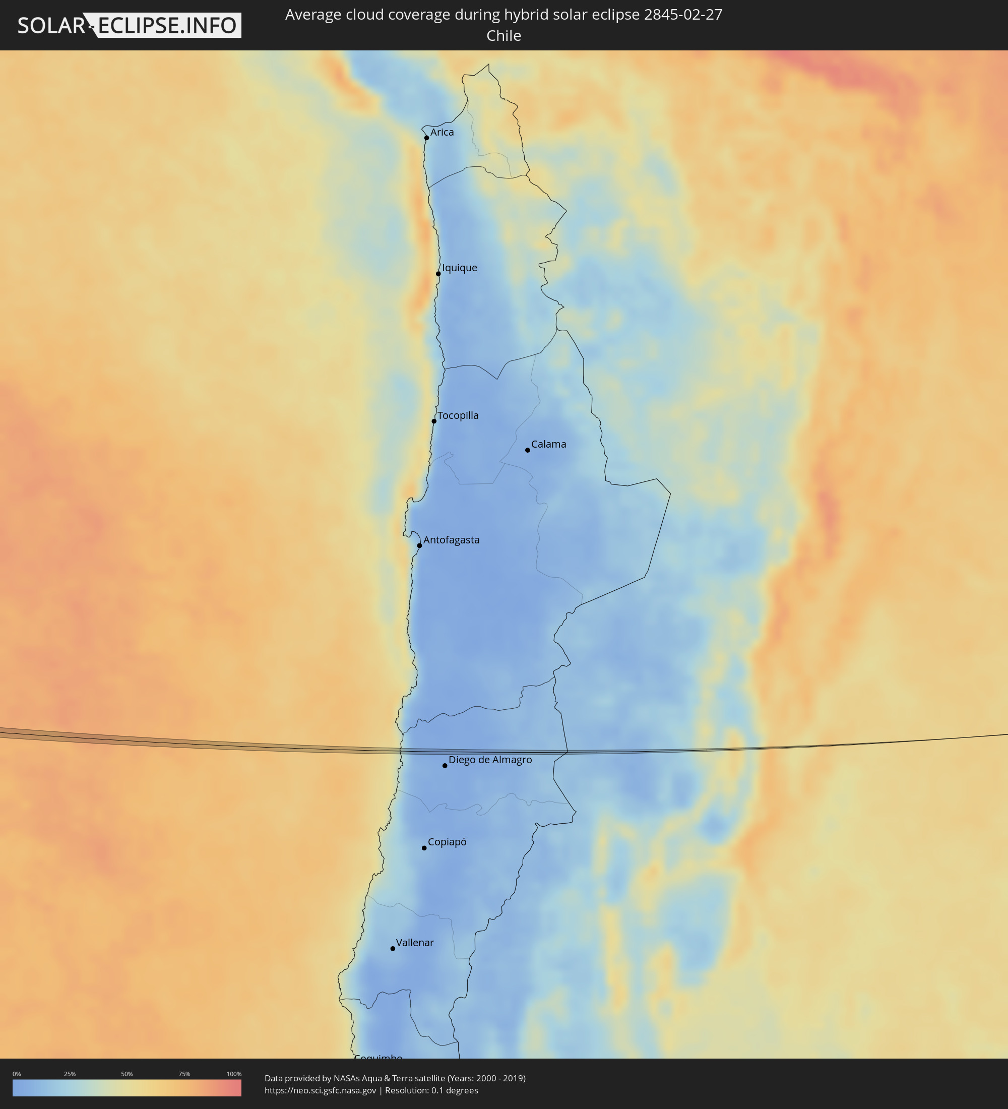 Chile
Chile
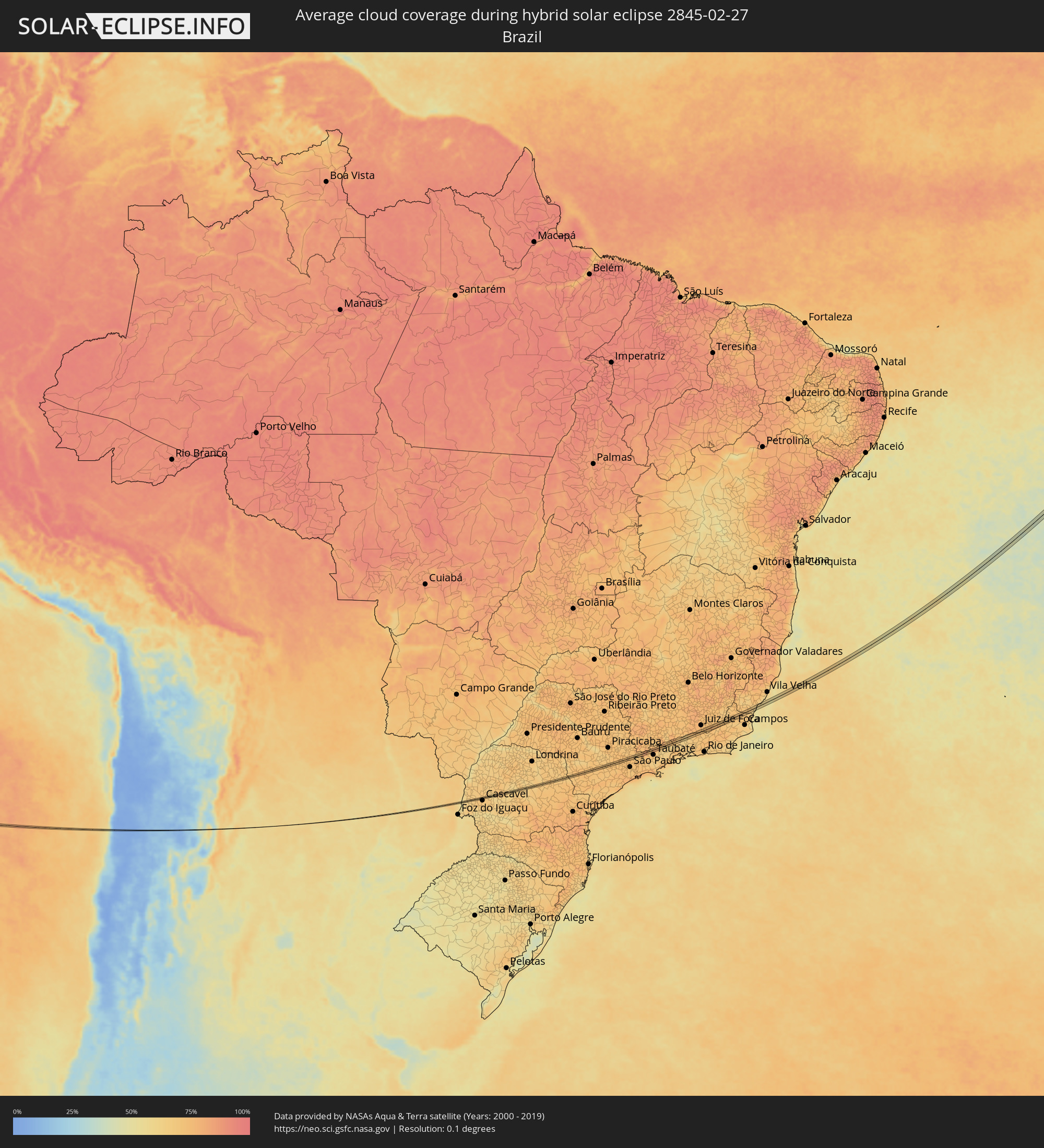 Brazil
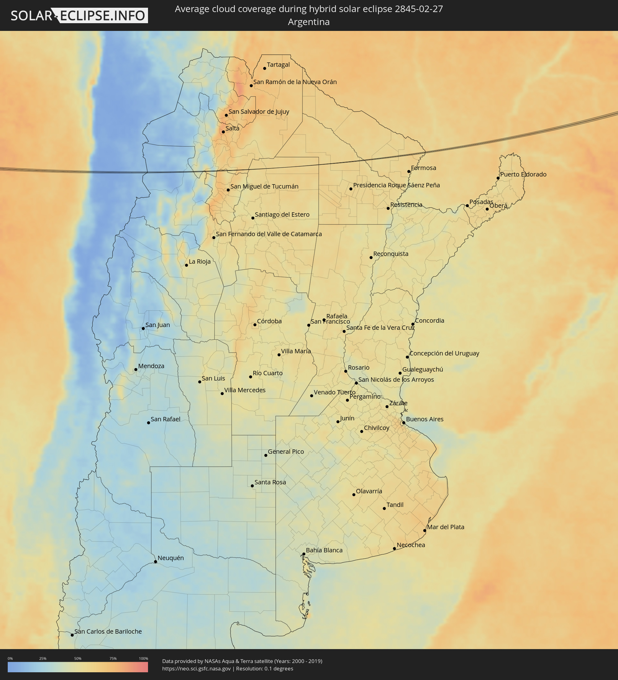 Argentina
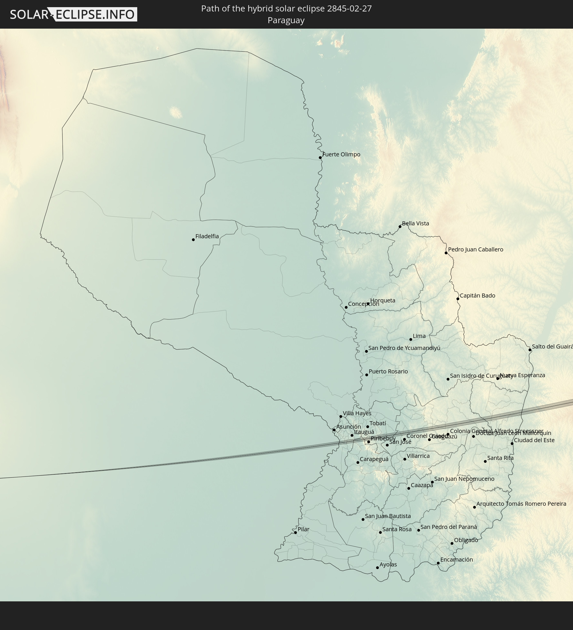
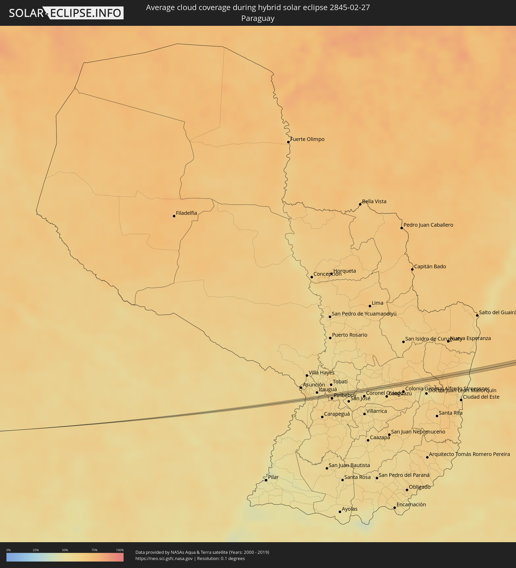 Paraguay
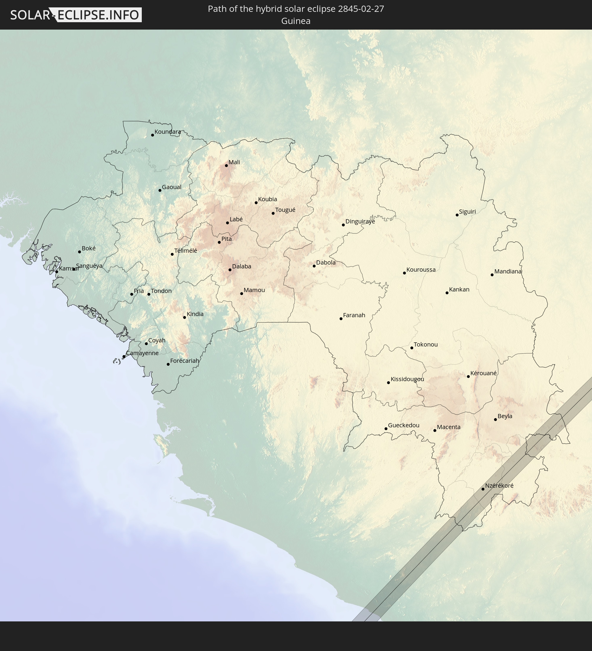
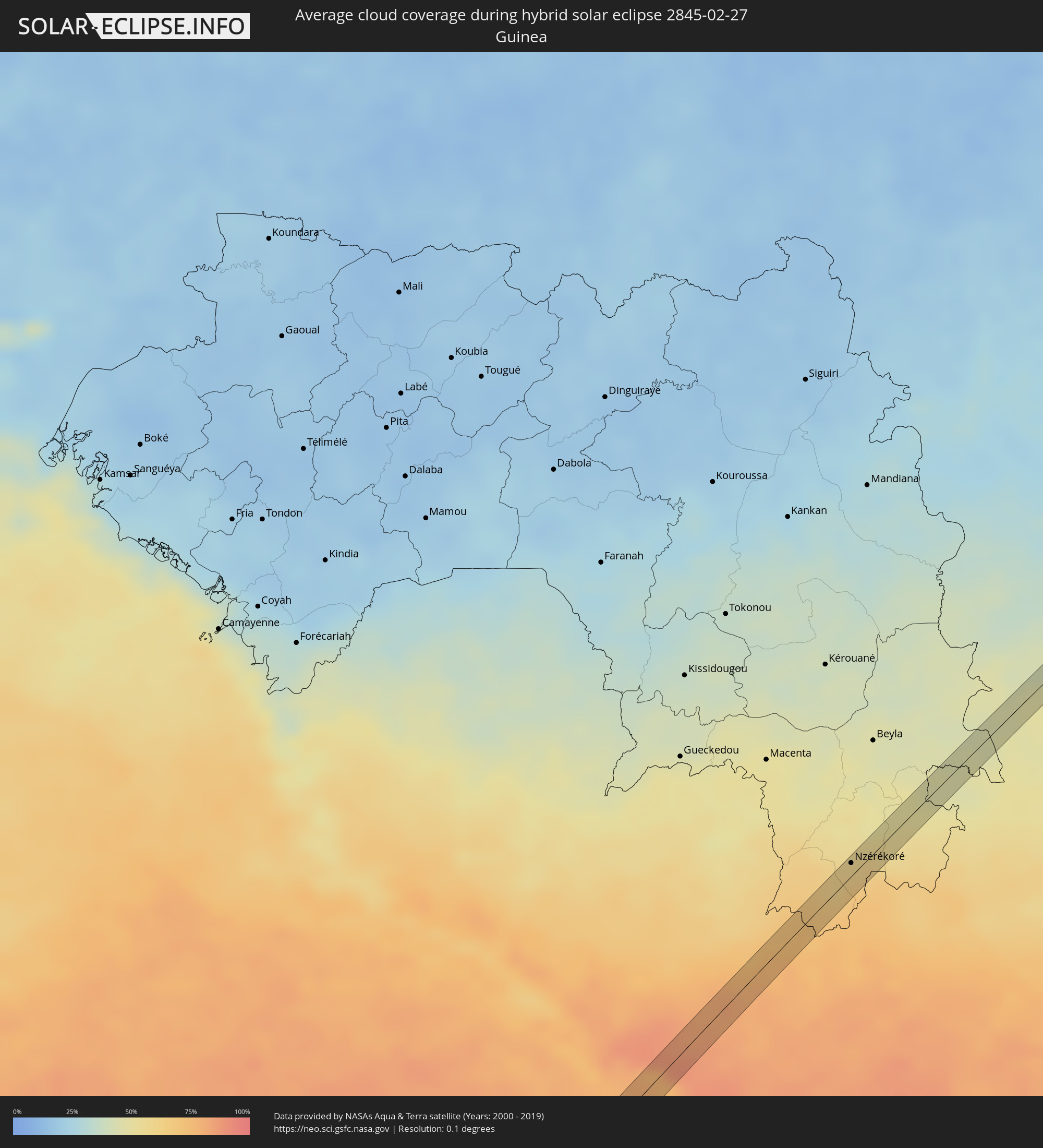 Guinea
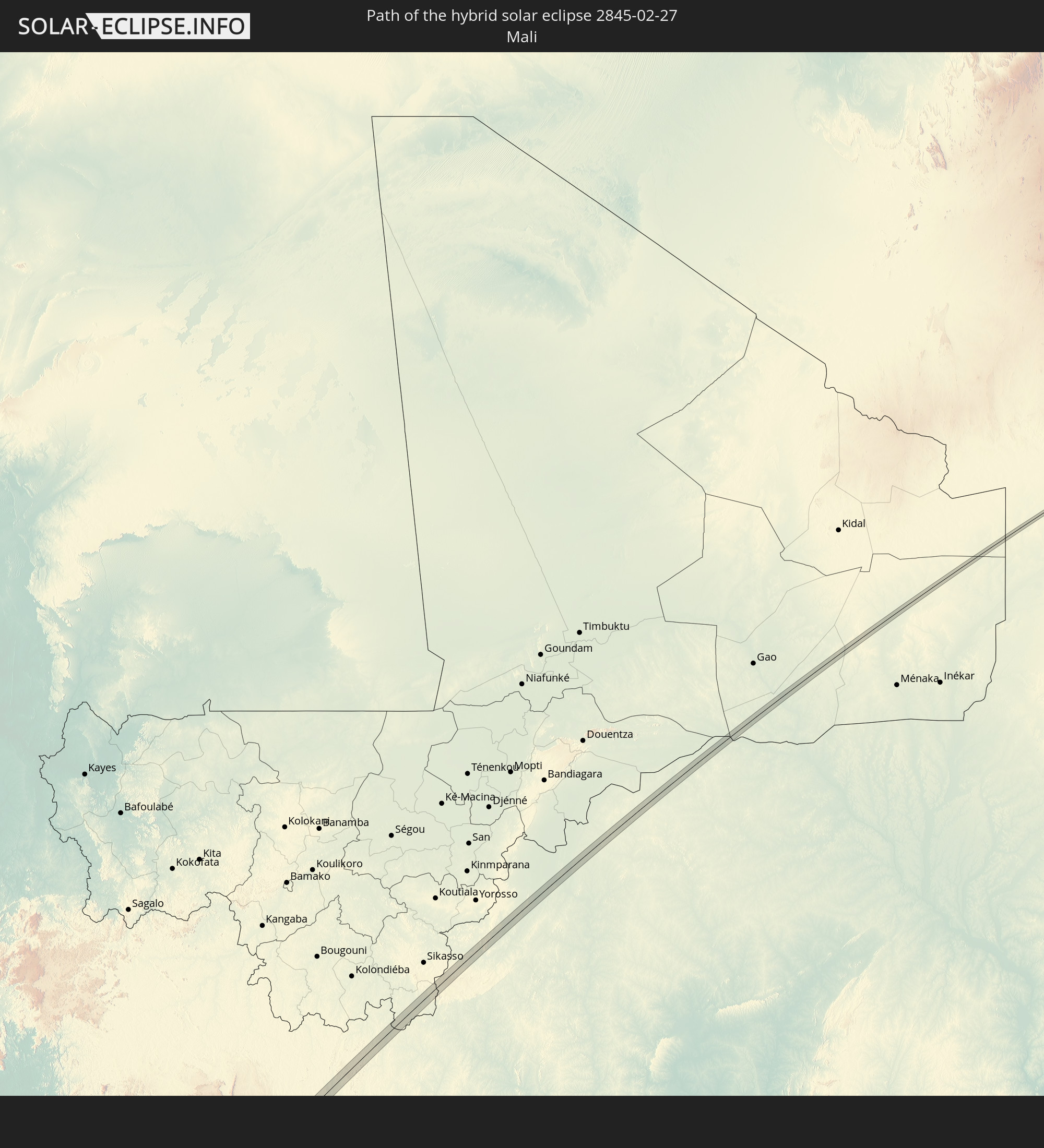
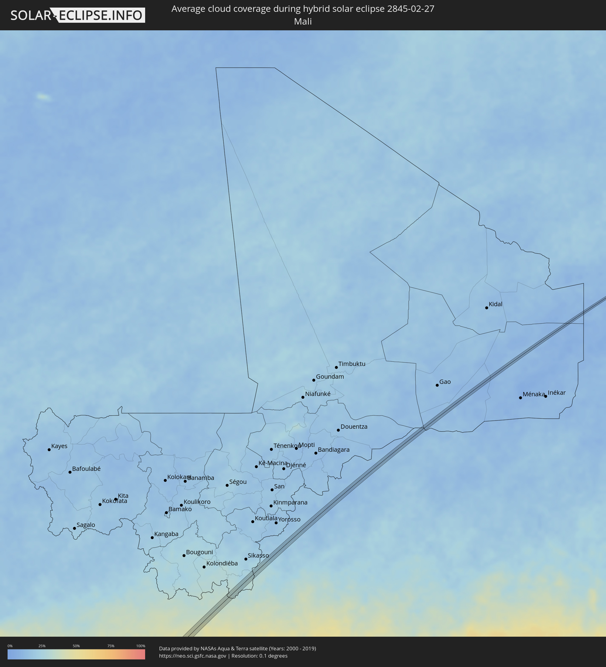 Mali
Mali
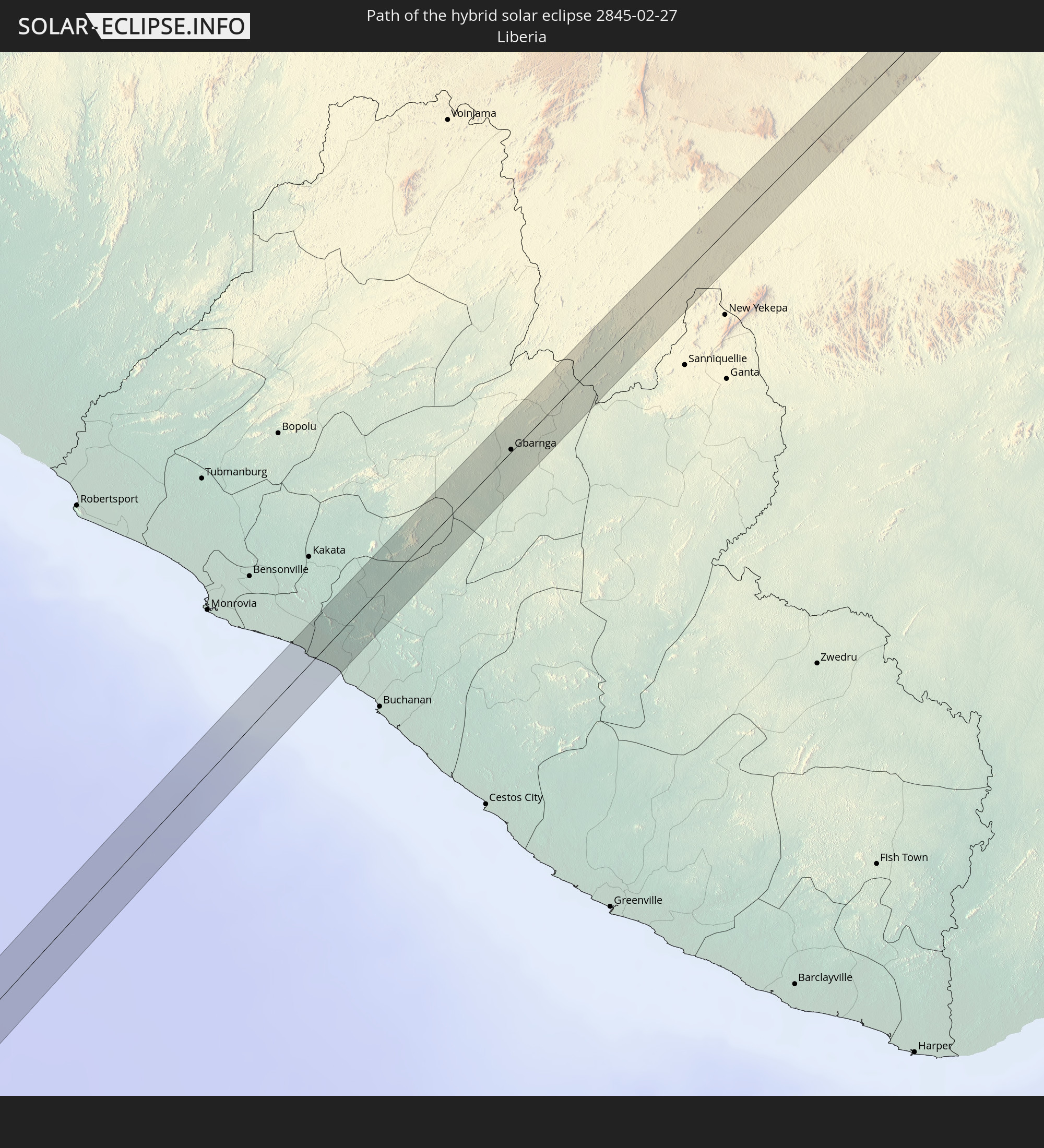
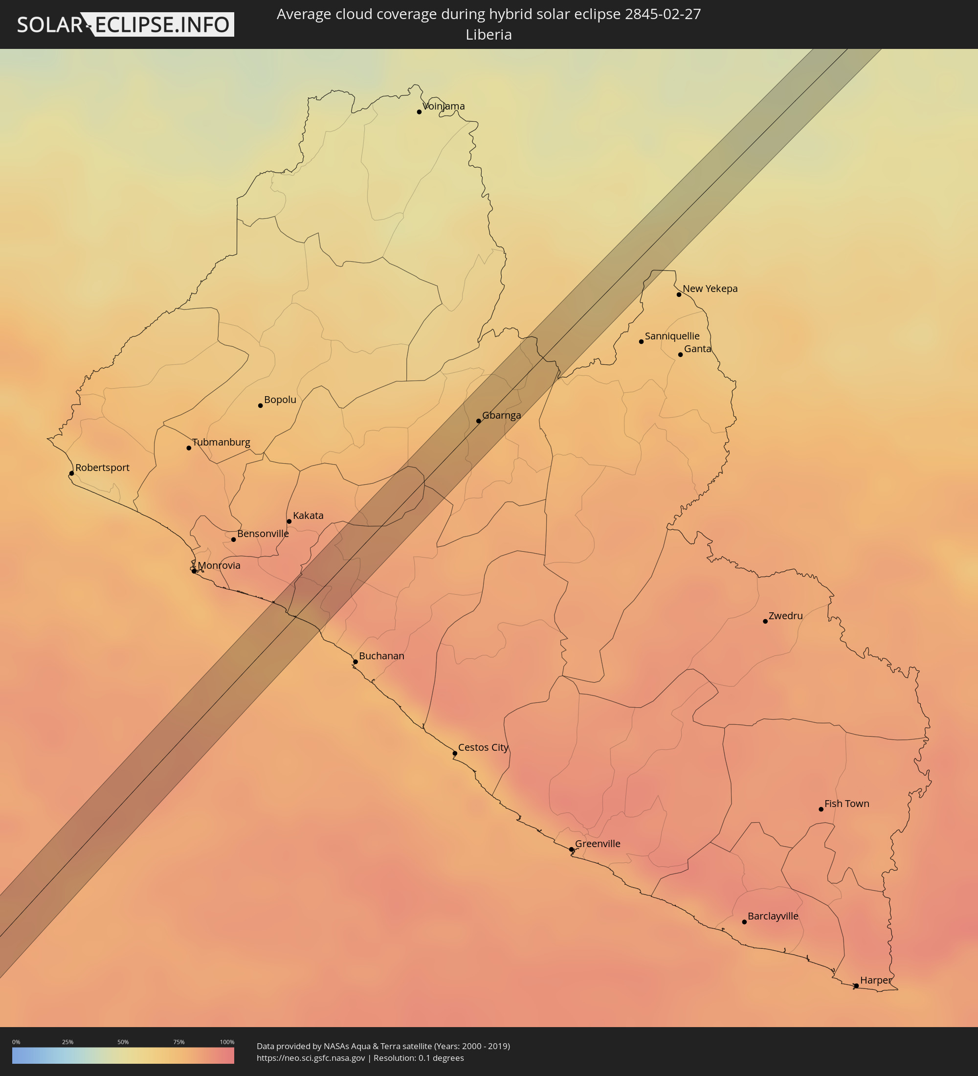 Liberia
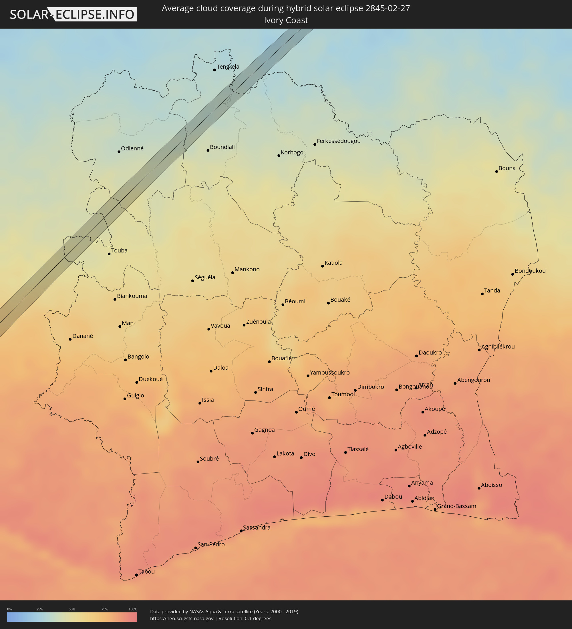 Ivory Coast
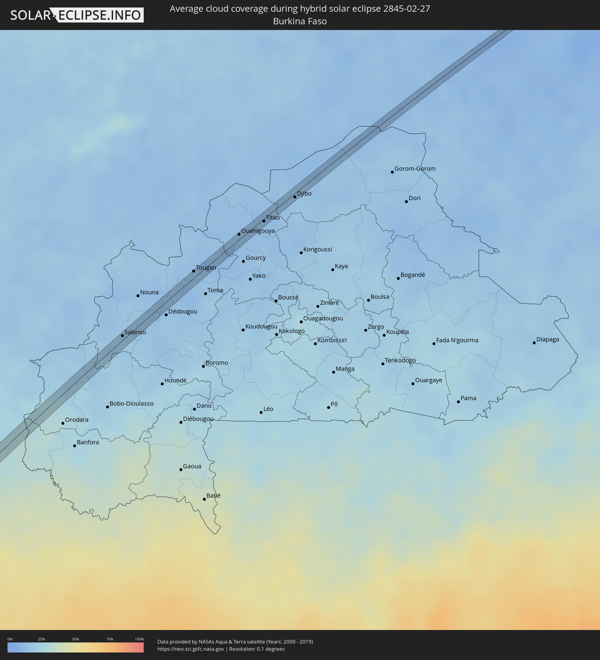 Burkina Faso
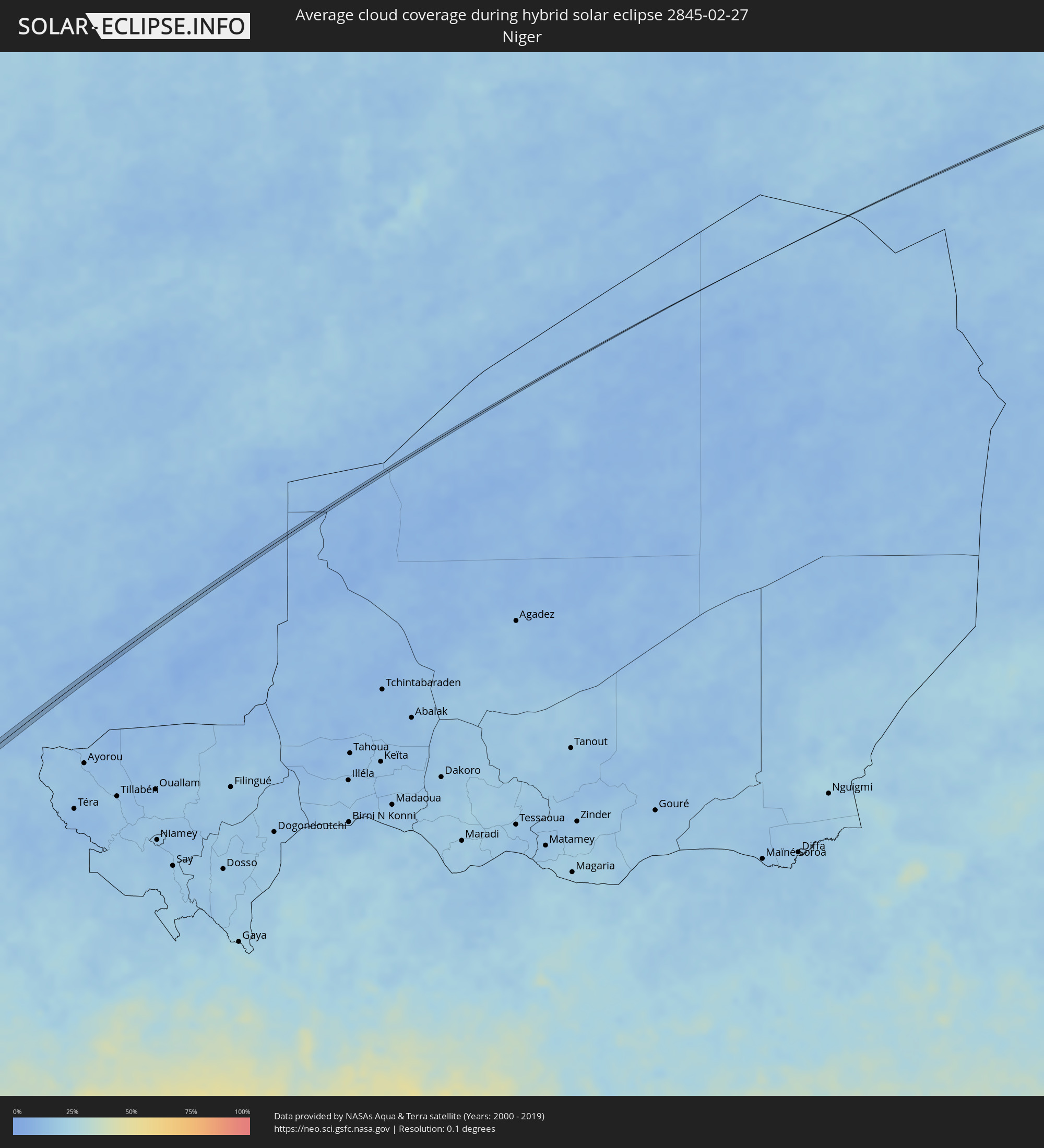 Niger
Niger
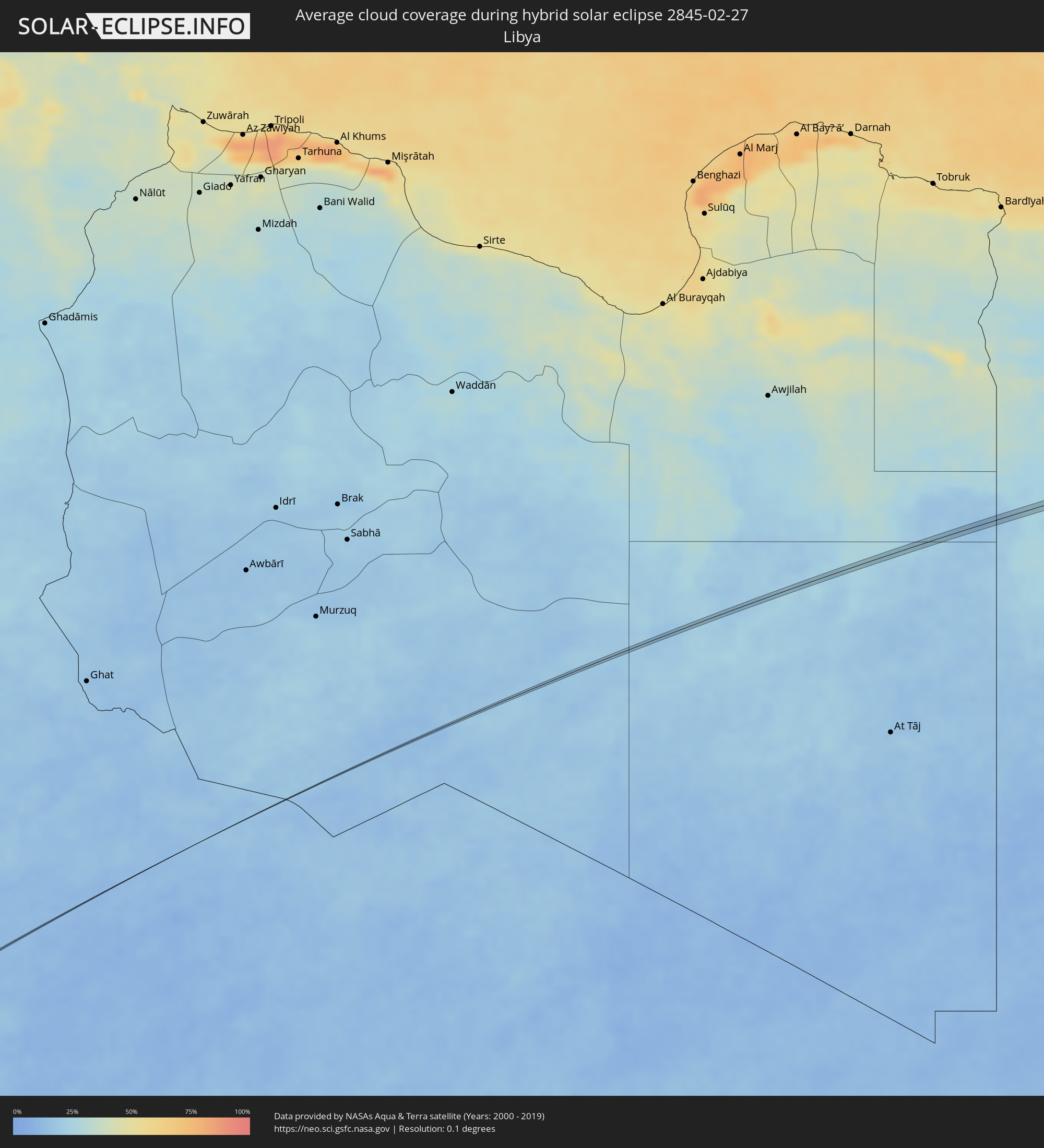 Libya
Libya
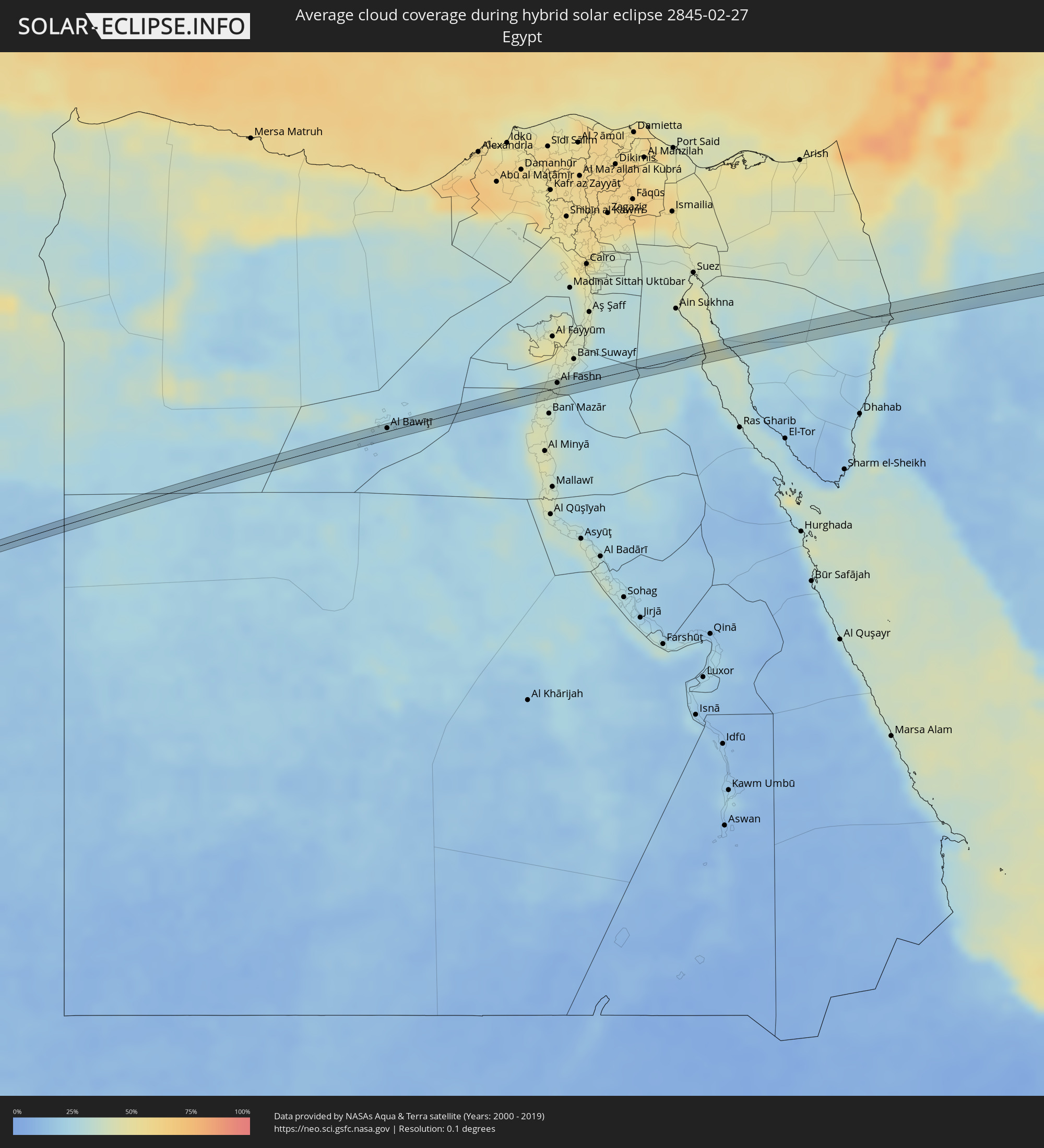 Egypt
Egypt
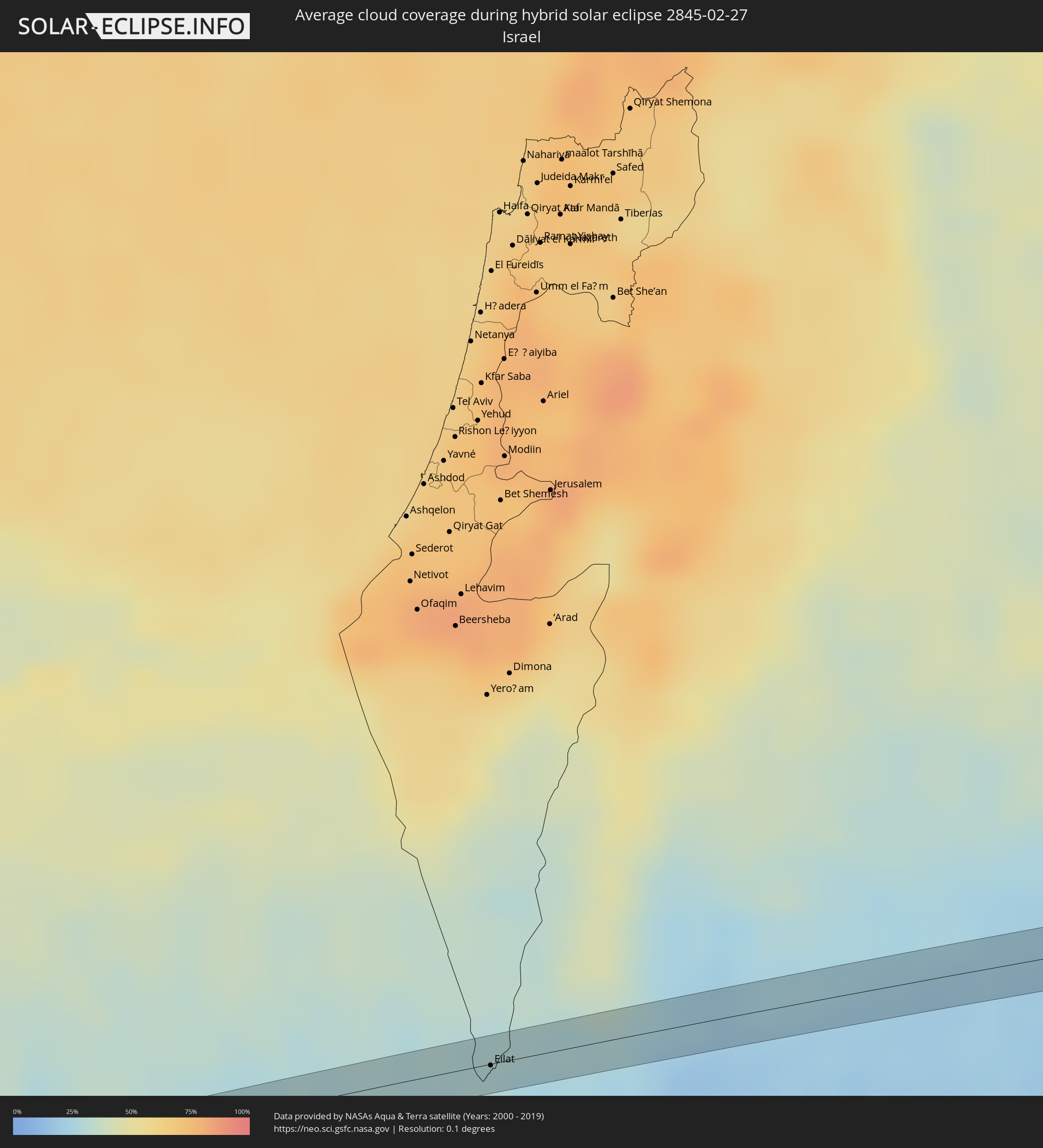 Israel
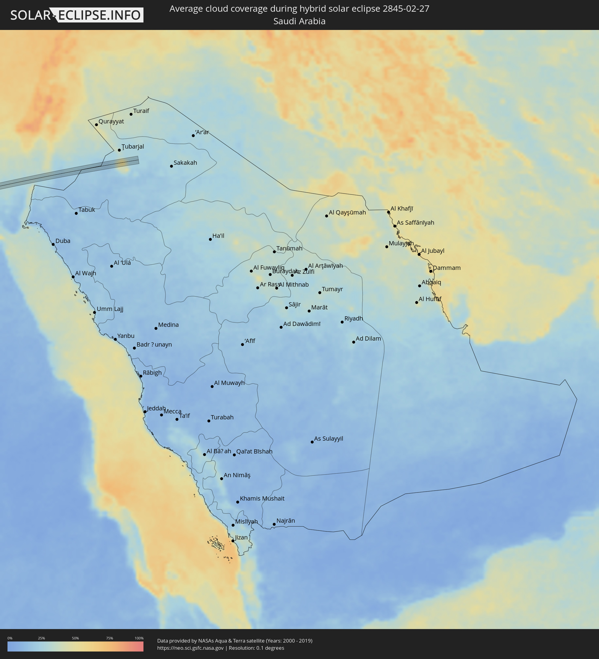 Saudi Arabia
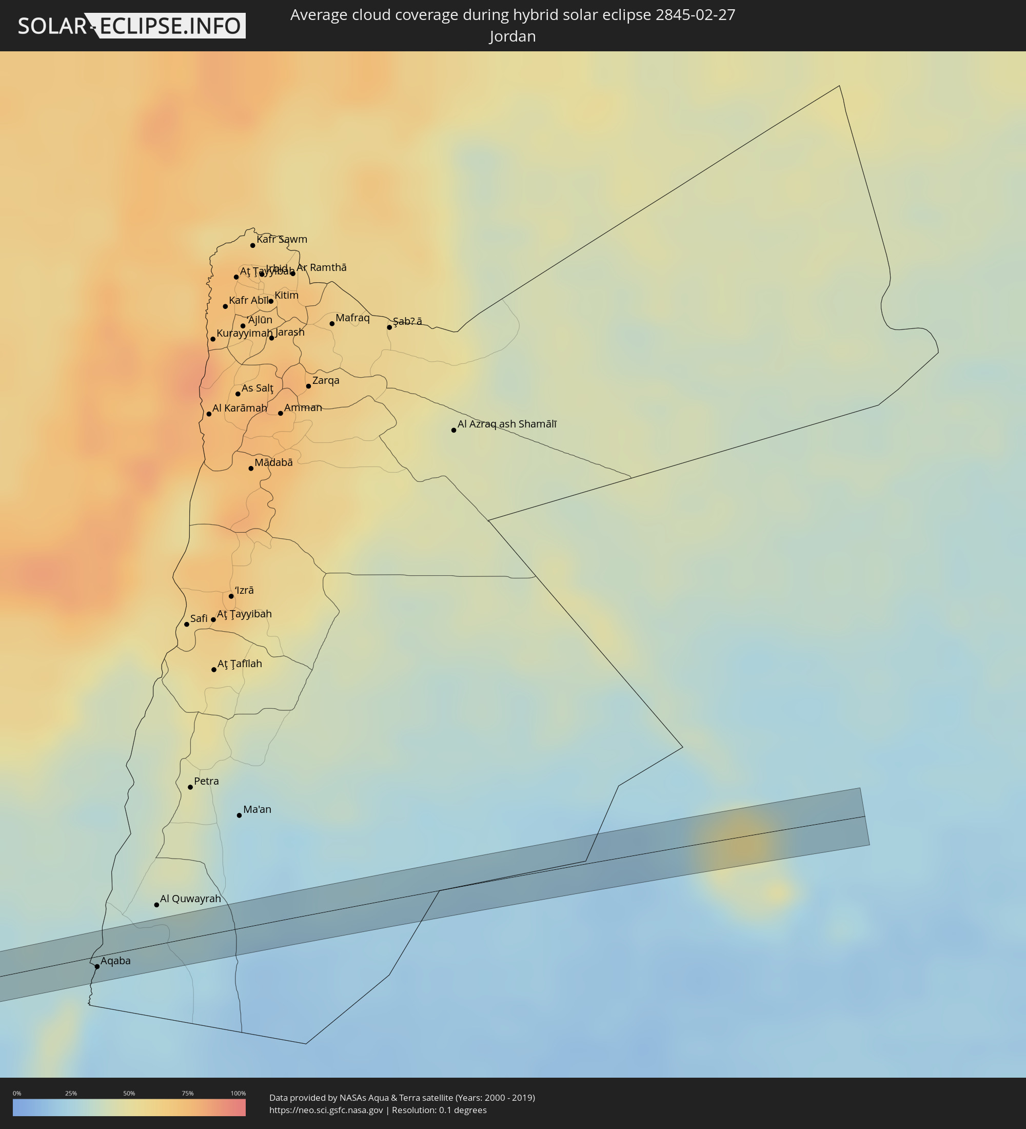 Jordan
Cities inside the path of the eclipse
The following table shows all locations with a population of more than 5,000 inside the eclipse path. Cities which have more than 100,000 inhabitants are marked bold. A click at the locations opens a detailed map.
| City | Type | Eclipse duration | Local time of max. eclipse | Distance to central line | Ø Cloud coverage |
|
Guarambaré, Central
|
total | - | 08:55:56 UTC-03:00 | 0 km | 57% |
|
Eusebio Ayala, Cordillera
|
total | - | 08:56:28 UTC-03:00 | 2 km | 61% |
|
Corbélia, Paraná
|
total | - | 09:00:47 UTC-03:00 | 1 km | 69% |
|
Itaberá, São Paulo
|
total | - | 09:06:40 UTC-03:00 | 1 km | 71% |
|
Itapetininga, São Paulo
|
total | - | 09:08:22 UTC-03:00 | 2 km | 72% |
|
Capela do Alto, São Paulo
|
total | - | 09:08:54 UTC-03:00 | 1 km | 70% |
|
Araçoiaba da Serra, São Paulo
|
total | - | 09:09:03 UTC-03:00 | 6 km | 73% |
|
Cabreúva, São Paulo
|
total | - | 09:09:54 UTC-03:00 | 0 km | 72% |
|
Jundiaí, São Paulo
|
total | - | 09:10:21 UTC-03:00 | 5 km | 72% |
|
Várzea Paulista, São Paulo
|
total | - | 09:10:25 UTC-03:00 | 0 km | 74% |
|
Atibaia, São Paulo
|
total | - | 09:10:54 UTC-03:00 | 1 km | 73% |
|
Bom Jesus dos Perdões, São Paulo
|
total | - | 09:11:00 UTC-03:00 | 4 km | 72% |
|
Piracaia, São Paulo
|
total | - | 09:11:14 UTC-03:00 | 1 km | 69% |
|
Campos do Jordão, São Paulo
|
total | - | 09:12:39 UTC-03:00 | 8 km | 78% |
|
Piquete, São Paulo
|
total | - | 09:13:24 UTC-03:00 | 7 km | 67% |
|
Lorena, São Paulo
|
total | - | 09:13:22 UTC-03:00 | 7 km | 63% |
|
Cruzeiro, São Paulo
|
total | - | 09:13:45 UTC-03:00 | 4 km | 63% |
|
Itatiaia, Rio de Janeiro
|
total | - | 09:14:27 UTC-03:00 | 3 km | 61% |
|
Resende, Rio de Janeiro
|
total | - | 09:14:39 UTC-03:00 | 4 km | 64% |
|
Porto Real, Rio de Janeiro
|
total | - | 09:14:57 UTC-03:00 | 5 km | 62% |
|
Quatis, Rio de Janeiro
|
total | - | 09:15:01 UTC-03:00 | 5 km | 62% |
|
Valença, Rio de Janeiro
|
total | - | 09:16:03 UTC-03:00 | 9 km | 70% |
|
Mar de Espanha, Minas Gerais
|
total | - | 09:17:32 UTC-03:00 | 3 km | 71% |
|
Santo Antônio de Pádua, Rio de Janeiro
|
total | - | 09:19:14 UTC-03:00 | 3 km | 70% |
|
Itapemirim, Espírito Santo
|
total | - | 09:22:05 UTC-03:00 | 2 km | 51% |
|
Marataizes, Espírito Santo
|
total | - | 09:22:03 UTC-03:00 | 5 km | 51% |
|
Piúma, Espírito Santo
|
total | - | 09:22:28 UTC-03:00 | 11 km | 57% |
|
Gbarnga, Bong
|
total | - | 14:17:21 UTC+00:00 | 1 km | 76% |
|
Nzérékoré, Nzerekore
|
total | - | 14:19:51 UTC+00:00 | 8 km | 58% |
|
Salanso, Boucle du Mouhoun
|
total | - | 14:34:39 UTC+00:00 | 5 km | 19% |
|
Tougan, Boucle du Mouhoun
|
total | - | 14:37:28 UTC+00:00 | 8 km | 14% |
|
Ouahigouya, Nord
|
total | - | 14:39:06 UTC+00:00 | 6 km | 14% |
|
Titao, Nord
|
total | - | 14:39:51 UTC+00:00 | 3 km | 12% |
|
Djibo, Sahel
|
total | - | 14:40:55 UTC+00:00 | 5 km | 16% |
|
Al Bawīţī, Giza
|
annular | - | 17:15:24 UTC+02:00 | 4 km | 20% |
|
Al Fashn, Beni Suweif
|
annular | - | 17:15:56 UTC+02:00 | 5 km | 34% |
|
Eilat, Southern District
|
annular | - | 17:16:36 UTC+02:00 | 1 km | 29% |
|
Aqaba, Aqaba
|
annular | - | 17:16:36 UTC+02:00 | 5 km | 29% |